Play audio — original link
Play audio
Play audio

REGULAR MEETING OF THE PLANNING COMMISSION TUESDAY, DECEMBER 16, 2025, AT 5 P.M. AUSTIN CITY HALL, COUNCIL CHAMBERS, ROOM 1001 301 WEST 2ND STREET AUSTIN, TEXAS Some members of the Planning Commission may be participating by videoconference. The meeting may be viewed online at: http://www.austintexas.gov/page/watch-atxn-live Public comment will be allowed in-person or remotely via telephone. Speakers may only register to speak on an item once either in-person or remotely and will be allowed up to three minutes to provide their comments. Registration no later than 2 p.m. on the day of the meeting is required for remote participation by telephone. To register to speak remotely, contact Ella Garcia, Staff Liaison, for questions regarding speaker registration at LandUseLiaison@austintexas.gov or by phone at 512- 978-0821. CURRENT COMMISSIONERS: Alice Woods, Chair (District 2) Casey Haney, Vice Chair (Mayor’s Representative) Felicity Maxwell, Secretary (District 5) Imad Ahmed, Parliamentarian (District 6) Anna Lan (Mayor’s Representative) Vacant (Mayor’s Representative) Patrick Howard (District 1) EX-OFFICIO MEMBERS: Nadia Barrera-Ramirez (District 3) Brian Bedrosian (District 4) Adam Powell (District 7) Peter Breton (District 8) Danielle Skidmore (District 9) Joshua Hiller (District 10) Jessica Cohen, Chair of Board of Adjustment TC Broadnax, City Manager EXECUTIVE SESSION (No public discussion) Candace Hunter, A.I.S.D. Board of Trustees Richard Mendoza, Director of Transportation and Public Works The Planning Commission will announce it will go into Executive Session, if necessary, according to Chapter 551 of the Texas Government Code, to receive advice from Legal Counsel on matters specifically listed on the agenda. The Commission may not conduct a closed meeting without the approval of the city attorney. Private Consultation with Attorney – Section 551.071. Staff Liaison: Ella Garcia, 512-978-0821 Attorney: AJ Urteaga, 512-974-2386 Page 1 of 6 AGENDA CALL TO ORDER PUBLIC COMMUNICATION: GENERAL The first four speakers signed up prior to the meeting being called to order will each be allowed a three-minute allotment to address their concerns regarding items not posted on the agenda. APPROVAL OF MINUTES 1. Approve the minutes of the Planning Commission regular meeting on Tuesday, December 9, 2025. PUBLIC HEARINGS 2. Plan Amendment: East 11th & 12th Street Urban Renewal Area Modification #14 - East 11th and 12th Street Urban Renewal Plan Amendment#14; District 1 N/A-Urban Renewal Plan, Waller Creek Watershed; Central East Austin (OCEAN) Neighborhood Planning Area Location: Owner/Applicant: City of Austin Agent: Request: Staff Rec.: Staff: City of Austin (Hunter Maples) Amend the Urban Renewal Plan …
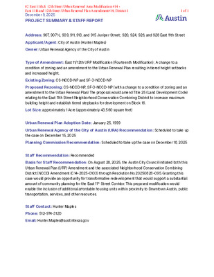
December 9, 2025 PROJECT SUMMARY & STAFF REPORT Address: 907, 907 ½, 909, 911, 913, and 915 Juniper Street; 920, 924, 926, and 928 East 11th Street Applicant/Agent: City of Austin (Hunter Maples) Owner: Urban Renewal Agency of the City of Austin Type of Amendment: East 11/12th URP Modification (Fourteenth Modification); A change to a condition of zoning and an amendment to the Urban Renewal Plan resulting in tiered height setbacks and increased height. Existing Zoning: CS-NCCD-NP and SF-3-NCCD-NP Proposed Rezoning: CS-NCCD-NP, SF-3-NCCD-NP (with a change to a condition of zoning and an amendment to the Urban Renewal Plan) The proposal would amend Title 25 (Land Development Code) relating to the East 11th Street Neighborhood Conservation Combining District to increase maximum building height and establish tiered stepbacks for development on Block 16. Lot Size: approximately 1 Acre (approximately 43,560 square feet) Urban Renewal Plan Adoption Date: January 25, 1999 Urban Renewal Agency of the City of Austin (URA) Recommendation: Scheduled to take up the case on December 15, 2025 Planning Commission Recommendation: Scheduled to take up the case on December 16, 2025 Staff Recommendation: Recommended Basis for Staff Recommendation: On August 28, 2025, the Austin City Council initiated both this Urban Renewal Plan (URP) Amendment and the associated Neighborhood Conservation Combining District (NCCD) Amendment (C14-2025-0103) through Resolution No.20250828-095. Granting this case would provide an opportunity for transformative redevelopment that would support a substantial amount of community planning for the East 11th Street Corridor. This proposed modification would enable the inclusion of additional affordable housing units within proximity to Downtown Austin, public transportation, services, and other resources. Staff Contact: Hunter Maples Phone: 512-974-3120 Email: Hunter.Maples@austintexas.gov 02 East 11th & 12th Street Urban Renewal Area Modification #14 - East 11th and 12th Street Urban Renewal Plan Amendment#14; District 11 of 1
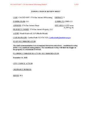
ZONING CHANGE REVIEW SHEET CASE: C14-2025-0097- 1716 San Antonio St Rezoning DISTRICT: 9 ZONING FROM: GO ZONING TO: DMU-CO ADDRESS: 1716 San Antonio Street SITE AREA: 0.1352 acres (5, 889 sq. ft.) PROPERTY OWNER: 1716 San Antonio Property, LLC AGENT: Husch Blackwell, LLP (Nikelle Meade) CASE MANAGER: Cynthia Hadri 512-974-7620, Cynthia.hadri@austintexas.gov STAFF RECOMMENDATION: The staff recommendation is to recommend downtown mixed use – conditional overlay (DMU-CO) combined zoning district. The conditional overlay will limit the height on the property to a maximum of 60 feet. PLANNING COMMISSION ACTION / RECOMMENDATION: December 16, 2025: CITY COUNCIL ACTION: ORDINANCE NUMBER: ISSUES: N/A 04 C14-2025-0097 - 1716 San Antonio St Rezoning; District 91 of 19 C14-2025-0097 2 CASE MANAGER COMMENTS: The property in question is approximately 0.13 acres, is developed with one building, has access to West 18th Street (level 1) and San Antonio Street (level 1), and is currently zoned general office (GO) zoning district. This site is in the Northwest District of the Downtown Area Plan. The area is characterized as mixed use with residential, offices, personal services and restaurants (DMU; DMU-CO; CS; CS-1; GO; CS; ). The Travis County Courthouse is to the east and is zoned public (P). Please refer to Exhibits A (Zoning Map) and B (Aerial View). The staff is recommending the downtown mixed use – conditional overlay (DMU-CO) combined zoning district as requested by the applicant. The proposed zoning is compatible and consistent with surrounding land uses and zoning patterns in this area as there is existing DMU zonings to the south, east and west. The Downtown Austin Plan is supportive of both retail and office uses. Based on the information above, staff believe that the proposed zoning change is supported by the Downtown Austin Plan. The Downtown Area Plan calls for DMU 60 for this tract (please see attached Exhibit D- Downtown Austin Plan Exhibits). BASIS OF RECOMMENDATION: 1. The proposed zoning should be consistent with the purpose statement of the district sought. The downtown mixed use district is intended for areas on the periphery of CBD classifications in the central core area, permitting a variety of uses compatible with downtown Austin and allowing intermediate densities as a transition from the commercial core to surrounding districts. Site development regulations are intended to permit combinations of office, retail, commercial, and residential uses within a single development. The conditional overlay combining district may be applied in combination …
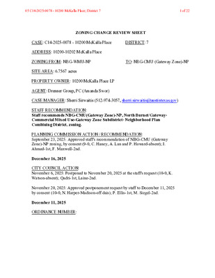
ZONING CHANGE REVIEW SHEET CASE: C14-2025-0078 - 10200 McKalla Place DISTRICT: 7 ADDRESS: 10200-10202 McKalla Place ZONING FROM: NBG-WMU-NP TO: NBG-CMU (Gateway Zone)-NP SITE AREA: 6.7567 acres PROPERTY OWNER: 10200 McKalla Place LP AGENT: Drenner Group, PC (Amanda Swor) CASE MANAGER: Sherri Sirwaitis (512-974-3057, sherri.sirwaitis@austintexas.gov) STAFF RECOMMENDATION: Staff recommends NBG-CMU(Gateway Zone)-NP, North Burnet/Gateway- Commercial Mixed Use-Gateway Zone Subdistrict- Neighborhood Plan Combining District, zoning. PLANNING COMMISSION ACTION / RECOMMENDATION: September 23, 2025: Approved staff's recommendation of NBG-CMU (Gateway Zone)-NP zoning, by consent (9-0, C. Haney, A. Lan and P. Howard-absent); I. Ahmed-1st, F. Maxwell-2nd. December 16, 2025 CITY COUNCIL ACTION: November 6, 2025: Postponed to November 20, 2025 at the staff's request (10-0, K. Watson-absent); Qadri-1st, Laine-2nd. November 20, 2025: Approved postponement request by staff to December 11, 2025 by consent (10-0, N. Harper-Madison-off dais); P. Ellis-1st, M. Siegel-2nd. December 11, 2025 ORDINANCE NUMBER: 05 C14-2025-0078 - 10200 McKalla Place; District 71 of 22 ISSUES: Upon drafting the ordinance for this case, the staff and the applicant realized that a portion of the property along the rail line was not included on the zoning case map. Therefore, the staff updated the staff map to include the rail spur 0.306-acre portion of the property that is also being rezoned and the case will be re-notified for the December 16, 2025 Planning Commission meeting and the January 22, 2026 City Council meeting (Please see Updated Zoning Case Map - Exhibit A-1). CASE MANAGER COMMENTS: The property in question is a 6.76 acre lot that is developed with a 135,000 sq. ft. one-story warehouse structure containing office and manufacturing uses that fronts onto McKalla Place. It is one block to the east of the Rutland Drive and Burnet Road intersection and is within walking distance of the Austin FC Q2 Stadium, which is located directly to the north. The property is within the North Burnet Gateway Neighborhood Planning area and is zoned NBG-WMU- NP, North Burnet Gateway-Warehouse Mixed Use-Neighborhood Plan Combining District. The lots directly to the south, east and west of this site have office/warehouse buildings, with multiple tenants, and are also zoned NBG-WMU-NP. The applicant is requesting to rezone the property from NBG-NP (WMU Subdistrict) to NBG-NP (CMU-Gateway Zone Subdistrict) to allow for the development of a residential project with associated ground floor uses (please see Applicant’s Request Letter-Exhibit C). The CMU-Gateway Zone subdistrict allows for an FAR of 12:1 and a …
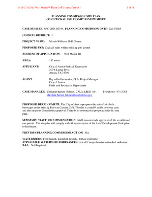
PLANNING COMMISSION SITE PLAN CONDITIONAL USE PERMIT REVIEW SHEET CASE NUMBER: SPC-2025-0279A PLANNING COMMISSION DATE: 12/16/2025 COUNCIL DISTRICT: 1 PROJECT NAME: Morris Williams Golf Course PROPOSED USE: Cocktail sales within existing golf course ADDRESS OF APPLICATION: 3851 Manor Rd AREA: 117 acres APPLICANT: AGENT: City of Austin Parks & Recreation 200 S Lamar Blvd Austin, TX 78704 Reynaldo Hernandez, PLA, Project Manager City of Austin Parks and Recreation Department CASE MANAGER: Christine Barton-Holmes, CNUa, LEED AP Telephone: 974-2788 christine.barton-holmes@austintexas.gov PROPOSED DEVELOPMENT: The City of Austin proposes the sale of alcoholic beverages at the existing Fairway Cantina Café. The site is zoned P and is over one acre, and thus requires Commission approval. There is no construction proposed with this site plan. SUMMARY STAFF RECOMMENDATION: Staff recommends approval of the conditional use permit. The site plan will comply with all requirements of the Land Development Code prior to its release. PREVIOUS PLANNING COMMISSION ACTION: NA WATERSHEDS: Fort Branch, Tannehill Branch - Urban watershed APPLICABLE WATERSHED ORDINANCE: Current/ Comprehensive watershed ordinance T.I.A.: Not Required 06 SPC-2025-0279A - Morris Williams Golf Course; District 11 of 11 PROJECT INFORMATION: ZONING: P MAX. BLDG. COVERAGE: * MAX. IMPERV. CVRG.: * MAX HEIGHT: * REQUIRED PARKING: NA EXIST. USE: Community recreation *P zoning development standards to be determined by approval of a conditional use site plan [25-2-625(D)(2)] LIMITS OF CONSTRUCTION:NA PROPOSED BLDG. CVRG: NA PROPOSED IMP. CVRG: NA PROPOSED HEIGHT: NA PROVIDED PARKING:158 PROPOSED USE: Community recreation SUMMARY COMMENTS ON SITE PLAN: Land Use: The applicant is proposing to sell alcoholic beverages within the existing facility, to be consumed within the boundaries of the golf course. There is no construction proposed. The site plan will comply with all requirements of the Land Development Code prior to its release. Staff recommends approval of the requested revision. Environmental: The site is in the Tannehill Branch watershed, which is an Urban Watershed Zones. Transportation: Access is available from Manor Road. SURROUNDING CONDITIONS: Zoning/ Land use North: PUD (Mueller) East: SF-3-NP, GR-NP (single-family residential, religious facility, medical offices) South: E Martin Luther King Jr Blvd, then SF-3-NP (single-family residential) West: LR-MU-CO-NP (medical and professional office buildings, religious facility) Street Manor Rd R.O.W. 65’ Surfacing 35’ Classification Corridor Mobility NEIGHBORHOOD ORGANIZATIONS: Austin Independent School District Austin Neighborhoods Council Del Valle Community Coalition East Austin Conservancy East MLK Combined Neighborhood Plan Contact Team Friends of Austin Neighborhoods Homeless Neighborhood Association JJ Seabrook …
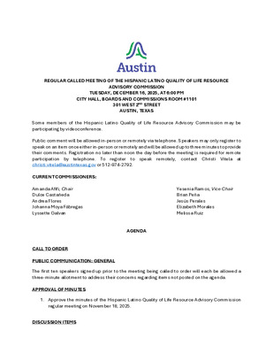
REGULAR CALLED MEETING OF THE HISPANIC LATINO QUALITY OF LIFE RESOURCE ADVISORY COMMISSION TUESDAY, DECEMBER 16, 2025, AT 6:00 PM CITY HALL, BOARDS AND COMMISSIONS ROOM #1101 301 WEST 2ND STREET AUSTIN, TEXAS Some members of the Hispanic Latino Quality of Life Resource Advisory Commission may be participating by videoconference. Public comment will be allowed in-person or remotely via telephone. Speakers may only register to speak on an item once either in-person or remotely and will be allowed up to three minutes to provide their comments. Registration no later than noon the day before the meeting is required for remote participation by remotely, contact Christi Vitela at christi.vitela@austintexas.gov or 512-974-2792. telephone. To to speak register CURRENT COMMISSIONERS: Amanda Afifi, Chair Dulce Castañeda Andrea Flores Johanna Moya Fábregas Lyssette Galvan AGENDA CALL TO ORDER PUBLIC COMMUNICATION: GENERAL Yesenia Ramos, Vice Chair Brian Peña Jesús Perales Elizabeth Morales Melissa Ruiz The first ten speakers signed up prior to the meeting being called to order will each be allowed a three-minute allotment to address their concerns regarding items not posted on the agenda. APPROVAL OF MINUTES 1. Approve the minutes of the Hispanic Latino Quality of Life Resource Advisory Commission regular meeting on November 18, 2025. DISCUSSION ITEMS 2. Presentation regarding the development of a report by Austin Equity and Inclusion to understand and address disparities in community conditions across neighborhoods. Presentation by Shivani Datar, Business Process Specialist, Austin Equity and Inclusion. 3. Presentation regarding Universal Tech Movement’s updated mission, digital inclusion efforts and ways in which the commission can support UTM's pathways into technology. Presentation by Michael Ward Jr., President and CEO, Universal Tech Movement. 4. Discussion of the Public Spaces Task Force. DISCUSSION AND ACTION ITEMS 5. Approve the creation of an Arts and Culture Working Group. FUTURE AGENDA ITEMS ADJOURNMENT The City of Austin is committed to compliance with the Americans with Disabilities Act. Reasonable modifications and equal access to communications will be provided upon request. For assistance, please contact the Liaison or TTY users’ route through 711. A person may request language access accommodations no later than 48 hours before the scheduled meeting. Please call or email Christi Vitela at the Austin City Clerk’s Office, at 512-974-2792 or christi.vitela@austintexas.gov, to request service or for additional information. For more information on the Hispanic Latino Quality of Life Resource Advisory Commission, please contact Christi Vitela at 512-974-2792 or christi.vitela@austintexas.gov.
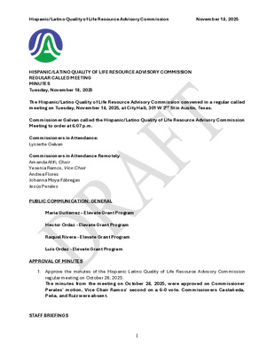
Hispanic/Latino Quality of Life Resource Advisory Commission November 18, 2025 HISPANIC/LATINO QUALITY OF LIFE RESOURCE ADVISORY COMMISSION REGULAR CALLED MEETING MINUTES Tuesday, November 18, 2025 The Hispanic/Latino Quality of Life Resource Advisory Commission convened in a regular called meeting on Tuesday, November 18, 2025, at City Hall, 301 W 2nd St in Austin, Texas. Commissioner Galvan called the Hispanic/Latino Quality of Life Resource Advisory Commission Meeting to order at 6:07 p.m. Commissioners in Attendance: Lyssette Galvan Commissioners in Attendance Remotely: Amanda Afifi, Chair Yesenia Ramos, Vice Chair Andrea Flores Johanna Moya Fábregas Jesús Perales PUBLIC COMMUNICATION: GENERAL Maria Gutierrez – Elevate Grant Program Hector Ordaz - Elevate Grant Program Raquel Rivera - Elevate Grant Program Luis Ordaz - Elevate Grant Program APPROVAL OF MINUTES 1. Approve the minutes of the Hispanic Latino Quality of Life Resource Advisory Commission regular meeting on October 28, 2025. The minutes from the meeting on October 28, 2025, were approved on Commissioner Perales’ motion, Vice Chair Ramos’ second on a 6-0 vote. Commissioners Castañeda, Peña, and Ruiz were absent. STAFF BRIEFINGS 1 Hispanic/Latino Quality of Life Resource Advisory Commission November 18, 2025 2. Introduction of the Austin Arts, Culture, Music, and Entertainment office (AACME). Briefing by Angela Means, Director, Austin Arts, Culture, Music, and Entertainment. The presentation was made by Candice Cooper, Interim Chief Administrative Officer, Austin Arts, Culture, Music, and Entertainment. DISCUSSION ITEMS 3. Presentation by Michael Ward Jr., President and CEO, Universal Tech Movement, regarding an updated mission, digital inclusion efforts and ways in which the commission can support UTM's pathways into technology. Withdrawn. DISCUSSION AND ACTION ITEMS 4. Approve an alternate representative to the Joint Inclusion Committee. The motion to approve Dulce Castañeda as the alternate representative to the Joint Inclusion Committee was approved on Commissioner Moya Fábregas’ motion, Chair Afifi’s second, on a 6-0 vote. Commissioners Castañeda, Peña, and Ruiz were absent. FUTURE AGENDA ITEMS Discussion of an Arts & Culture Working Group Discussion of Public Spaces Task Force ADJOURNMENT Commissioner Galvan adjourned the meeting at 7:02 p.m. without objection. 2

Mapping Opportunity Gary Aaron | Business Process Consultant Sr. Shivani Datar | Business Process Specialist City of Austin's Commitment In every community, there are conditions—some visible, others deeply embedded—that shape how people live, work, and move through the city. Austin is committed to becoming the most livable city for all identities… Mobility Index The City is developing an index to better align department priorities with community priorities. This index will help: Identify neighborhood- level conditions that affect people’s daily lives Identify where barriers to opportunity persist Guide service delivery and decision-making with data and community insight Purposeful Design Neighborhood-level conditions are grouped into themes Reflect core dimensions of community life Organize conditions into actionable categories Identify shared needs and track progress ex. Limited English Proficiency ex. Median Household Income Belonging & Mobility Livelihood & Work Health & Well Being ex. Access to Health Insurance Indicators Health & Wellbeing ⚬ ⚬ Access to Health Resources ■ Percent uninsured ■ Percent of children in poverty Functional and Physical Health Context ■ Residents with a disability ■ Estimated Annual Loss Due to Environmental Hazard & Weather ⚬ Livelihood & Work Economic Stability Indicators ■ Median household income ■ Is this tract in concentrated poverty? ■ Underemployment rate Housing Stability and Cost Burdens ■ Eviction Rate ■ Percent living in poverty ■ Percent of income spent on utilities ⚬ ⚬ Belonging & Mobility Social Inclusion and Access ■ Percent of households that speak limited English ■ Percent of households with no internet access ■ Percent of population aged 65+ with an ambulatory difficulty ⚬ Education, Environment, and Household Supports ■ Percent of people with less than a high school diploma ■ Percent of people with low physical activity ■ Household Support Risk Score Building Together | Listening to What Matters Most to Our Community What do you see as the most important issues or opportunities in your community today? In your view, what are the key drivers of success or opportunity in your community? What changes would have the greatest impact on mobility and opportunity in your community? Thank You!
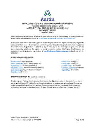
REGULAR MEETING OF THE ZONING AND PLATTING COMMISSION TUESDAY, DECEMBER 16, 2025, AT 6 P.M. AUSTIN CITY HALL, COUNCIL CHAMBERS, ROOM 1001 301 WEST 2ND STREET AUSTIN, TEXAS Some members of the Zoning and Platting Commission may be participating by videoconference. The meeting may be viewed online at: http://www.austintexas.gov/page/watch-atxn-live Public comment will be allowed in-person or remotely via telephone. Speakers may only register to speak on an item once either in-person or remotely and will be allowed up to three minutes to provide their comments. Registration no later than 2 p.m. the day of the meeting is required for remote participation by telephone. To register to speak remotely, contact Ella Garcia, Staff Liaison, for questions regarding speaker registration at LandUseLiaison@austintexas.gov or by phone at 512- 978-0821. CURRENT COMMISSIONERS: Hank Smith, Chair (District 8) Betsy Greenberg, Vice Chair (District 10) Ryan Puzycki, Secretary (District 7) Alejandra Flores, Parliamentarian (District 5) Luis Osta Lugo (Mayor’s Representative) Scott Boone (District 1) EXECUTIVE SESSION (No public discussion) David Fouts (District 2) Lonny Stern (District 3) Andrew Cortes (District 4) Christian Tschoepe (District 6) Taylor Major (District 9) The Zoning and Platting Commission will announce it will go into Executive Session, if necessary, pursuant to Chapter 551 of the Texas Government Code, to receive advice from Legal Counsel on matters specifically listed on this agenda. The commission may not conduct a closed meeting without the approval of the city attorney. Private Consultation with Attorney – Section 551.071 Staff Liaison: Ella Garcia, 512-978-0821 Attorney: Jenna Schwartz, 512-978-0871 Page 1 of 5 AGENDA CALL TO ORDER PUBLIC COMMUNICATION: GENERAL The first four speakers signed up prior to the meeting being called to order will each be allowed a three-minute allotment to address their concerns regarding items not posted on the agenda. APPROVAL OF MINUTES 1. Approve the minutes of the Zoning and Platting Commission regular meeting on Tuesday, December 2, 2025. PUBLIC HEARINGS 2. Rezoning: Location: C14-2024-0092 - Allred, Riddle, and W. Slaughter; District 5 2205, 2207, 2209 & 2200 Riddle Road; 2200, 2202, 2206, 2208, 2300, 2102, 2104, 2106, 2108, 2014 & 2014 ½ Allred Drive; 2105, 2107, 2109, 2111 & 2113 West Slaughter Lane, Slaughter Creek Watershed Owner/Applicant: 2106 Allred LLC; 2206 Allred LLC; 2200 Allred Dr LLC; 2205 Riddle Agent: Request: Staff Rec.: Staff: Road LLC; 2105 Slaughter Lane LLC; Ruff Gibson; Steve Carpenter; Getalong Productions LLC; Scioneaux Scott; Eugene Robertson; Michael Scott Eppes; …
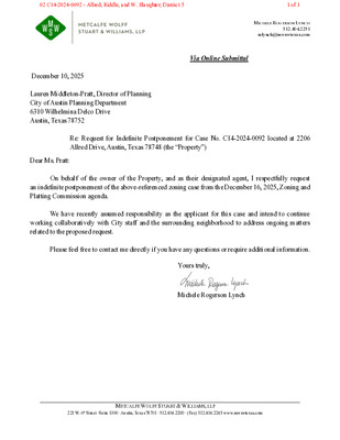
MICHELE ROGERSON LYNCH 512.404.2251 mlynch@mwswtexas.com Via Online Submittal December 10, 2025 Lauren Middleton-Pratt, Director of Planning City of Austin Planning Department 6310 Wilhelmina Delco Drive Austin, Texas 78752 Re: Request for Indefinite Postponement for Case No. C14-2024-0092 located at 2206 Allred Drive, Austin, Texas 78748 (the “Property”) Dear Ms. Pratt: On behalf of the owner of the Property, and as their designated agent, I respectfully request an indefinite postponement of the above-referenced zoning case from the December 16, 2025, Zoning and Platting Commission agenda. We have recently assumed responsibility as the applicant for this case and intend to continue working collaboratively with City staff and the surrounding neighborhood to address ongoing matters related to the proposed request. Please feel free to contact me directly if you have any questions or require additional information. Yours truly, Michele Rogerson Lynch METCALFE WOLFF STUART & WILLIAMS, LLP 221 W. 6th Street ·Suite 1300 ·Austin, Texas 78701 ·512.404.2200 · (Fax) 512.404.2245 www.mwswtexas.com 02 C14-2024-0092 - Allred, Riddle, and W. Slaughter; District 51 of 1
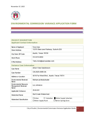
November 17, 2025 ENVIRONMENTAL COMMISSION VARIANCE APPLICATION FORM PROJECT DESCRIPTION Applicant Contact Information Name of Applicant Street Address City State ZIP Code Work Phone E-Mail Address Terry Irion 13215 Bee cave Parkway, Suite A-230 Austin, Texas 78738 512-615-6653 Terry.irion@sprouselaw.com Variance Case Information Case Name Case Number Address or Location Environmental Reviewer Name Environmental Resource Management Reviewer Name Applicable Ordinance Watershed Name Watershed Classification Arbor View Subdivision C8-2025-0085.0A 4316 Far West Blvd., Austin, Texas 78731 Mohamad Abdulkader Liz Johnston 25-8-301 Bull Creek Watershed ☐Urban ☐Water Supply Rural ☐ Suburban █ Water Supply Suburban ☐ Barton Springs Zone City of Austin | Environmental Commission Variance Application Guide 1 November 17, 2025 Edwards Aquifer Recharge Zone ☐ Barton Springs Segment ☐ Northern Edwards Segment █ Not in Edwards Aquifer Zones Edwards Aquifer Contributing Zone Distance to Nearest Classified Waterway ☐ Yes █ No 1,300 lineal feet Water and Waste Water service to be provided by City of Austin Request The variance request is as follows (Cite code references: Variance 25-8- 301 Impervious cover square footage: acreage: percentage: Existing 0 0 0 Proposed 3,900 0.09 15.98 % Provide general description of the property (slope range, elevation range, summary of vegetation / trees, summary of the geology, CWQZ, WQTZ, CEFs, floodplain, heritage trees, any other notable or outstanding characteristics of the property) The parcel is a 0.56-acre parcel that fronts on a curbed and guttered public street. All utilities necessary to serve the tract are already built underground in public right-of -way or PUE. There is a storm sewer inlet on the western end of the parcel that discharges storm water from Far West Blvd onto the parcel. The ERI identifies a potential seep in the NW corner of the parcel that will be isolated in a Lot 2 “no build” conservation and drainage easement lot and further protected by a 75’ CEF buffer zone. There is no classified waterway or floodplain on the parcel. The nearest classified waterway and FEMA floodplain is Bull Creek, which is 1,300 lineal feet from the subject Property, as depicted in Exhibit 9. No water quality is proposed for this one lot single family residence because there will be less than 5,000 sqft of proposed impervious cover. The parcel has steep slopes which fall somewhere over 50’ from the front of the parcel to the rear of the parcel. Accordingly, net site area as calculated in Section 25-8-62 is …
November 17, 2025 ENVIRONMENTAL COMMISSION VARIANCE APPLICATION FORM PROJECT DESCRIPTION Applicant Contact Information Name of Applicant Street Address City State ZIP Code Work Phone E-Mail Address Terry Irion 13215 Bee Cave Parkway, Suite A-2320 Austin, Texas 78738 512-615-6653 Terry.irion@sprouselaw.com Variance Case Information Case Name Case Number Address or Location Environmental Reviewer Name Environmental Resource Management Reviewer Name Applicable Ordinance Watershed Name Watershed Classification Arbor View Subdivision C8-2025-0085.0A 4316 Far West Blvd., Austin, Texas 78731 Mohamad Abdulkader Liz Johnston 25-8-302 Bull Creek Watershed ☐Urban ☐Water Supply Rural ☐ Suburban █ Water Supply Suburban ☐ Barton Springs Zone City of Austin | Environmental Commission Variance Application Guide 1 November 17, 2025 Edwards Aquifer Recharge Zone ☐ Barton Springs Segment ☐ Northern Edwards Segment █ Not in Edwards Aquifer Zones Edwards Aquifer Contributing Zone Distance to Nearest Classified Waterway ☐ Yes █ No 1,300 lineal feet Water and Waste Water service to be provided by City of Austin Request The variance request is as follows (Cite code references: Variance 25-8- 302 Impervious cover square footage: acreage: percentage: Existing 0 0 0 Proposed 3,900 0.09 15.89 % Provide general description of the property (slope range, elevation range, summary of vegetation / trees, summary of the geology, CWQZ, WQTZ, CEFs, floodplain, heritage trees, any other notable or outstanding characteristics of the property) The parcel is a 0.56-acre parcel that fronts on a curbed and guttered public street. All utilities necessary to serve the tract are already built underground in public right-of -way or PUE. There is a storm sewer inlet on the western end of the parcel that discharges storm water from Far West Blvd onto the parcel. The ERI identifies a potential seep in the NW corner of the parcel that will be isolated in a Lot 2 “no build” conservation and drainage easement lot and further protected by a 75’ CEF buffer zone. There is no classified waterway or floodplain on the parcel. The nearest classified waterway and FEMA floodplain is Bull Creek, which is 1,300 lineal feet from the subject Property, as depicted in Exhibit 7. No water quality is proposed for this one lot single family residence because there will be less than 5,000 sqft of proposed impervious cover. The parcel has steep slopes which fall somewhere over 50’ from the front of the parcel to the rear of the parcel. Accordingly, net site area as calculated in Section 25-8-62 is …
November 17, 2025 ENVIRONMENTAL COMMISSION VARIANCE APPLICATION FORM PROJECT DESCRIPTION Applicant Contact Information Name of Applicant Street Address City State ZIP Code Work Phone E-Mail Address Terry Irion 13215 Bee Cave Parkway, Suite A-230 Austin, Texas 78738 512-615-6653 Terry.irion@sprouselaw.com Variance Case Information Case Name Case Number Address or Location Environmental Reviewer Name Environmental Resource Management Reviewer Name Applicable Ordinance Watershed Name Watershed Classification Arbor View Subdivision C8-2025-0085.0A 4316 Far West Blvd., Austin, Texas 78731 Mohamad Abdulkader Liz Johnston 25-8-423 Bull Creek Watershed ☐Urban ☐Water Supply Rural ☐ Suburban █ Water Supply Suburban ☐ Barton Springs Zone City of Austin | Environmental Commission Variance Application Guide 1 November 17, 2025 Edwards Aquifer Recharge Zone ☐ Barton Springs Segment ☐ Northern Edwards Segment █ Not in Edwards Aquifer Zones Edwards Aquifer Contributing Zone Distance to Nearest Classified Waterway ☐ Yes █ No 1,300 lineal feet Water and Waste Water service to be provided by City of Austin Request The variance request is as follows (Cite code references: Variance 25-8- 423 Impervious cover square footage: acreage: percentage: Provide general description of the property (slope range, elevation range, summary of vegetation / trees, summary of the geology, CWQZ, WQTZ, CEFs, floodplain, heritage trees, any other notable or outstanding characteristics of the property) Existing 0 0 0 Proposed 3,900 0.09 15.98 % The parcel is a 0.56-acre parcel that fronts on a curbed and guttered public street. All utilities necessary to serve the tract are already built underground in public right-of -way or PUE. There is a storm sewer inlet on the western end of the parcel that discharges storm water from Far West Blvd onto the parcel. The ERI identifies a potential seep in the NW corner of the parcel that will be isolated in a Lot 2 “no build” conservation and drainage easement lot and further protected by a 75’ CEF buffer zone. There is no classified waterway or floodplain on the parcel. The nearest classified waterway and FEMA floodplain is Bull Creek, which is 1,300 lineal feet from the subject Property, as depicted in Exhibit 9. No water quality is proposed for this one lot single family residence because there will be less than 5,000 sqft of proposed impervious cover. The parcel has steep slopes which fall somewhere over 50’ from the front of the parcel to the rear of the parcel. Accordingly, net site area as calculated in Section 25-8-62 is …
ARBOR VIEW SUBDIVISION 4316 FAR WEST BLVD C8-2025-0085.0A Mike McDougal Environmental Policy Program Manager Austin Development Services OUTLINE 2 Vicinity Map Variance Recommendation Property Data Additional Considerations Synopsis Variance Conditions Site Constraints Variance Requests EV Commission Recommendation VICINITY MAP North of the river Located between Loop 360 and Mopac 3 North NTS 4 North NTS PROPERTY DATA Bull Creek Watershed Water Supply Suburban Watershed Classification Drinking Water Protection Zone Located over Edwards Aquifer Recharge Zone 5 PROPERTY DATA Council District 10 Steep topography Predominantly slopes over 25% Currently undeveloped PROPERTY DATA 6 SYNOPSIS 7 0.56-acre subdivision located approximately 0.4 miles west of the Far West Blvd and Mesa Dr The property is unplatted North NTS SYNOPSIS 8 The applicant proposes to plat a two lot subdivision One lot will be a Critical Environmental Feature lot and will not be developed The other lot will be a single family lot North NTS Critical Environmental Feature Lot Single Family Lot SITE CONSTRAINTS The property slopes to the north (away from the Right of Way) The majority of the slopes are greater than 25% (50% to 80%) 9 North NTS Drainage Drainage SITE CONSTRAINTS LDC 25-8-301 limits the construction of driveways on slopes over 15% The applicant proposes to construct a driveway on slopes over 15% 10 North NTS Drainage Drainage SITE CONSTRAINTS LDC 25-8-302 limits the construction of buildings on slopes over 15% The applicant proposes to construct a building on slopes over 15% 11 North NTS Drainage Drainage SITE CONSTRAINTS LDC 25-8-423 limits watershed impervious cover to 30% of net site area Net site area = ~775 sq ft 30% x 775 sq ft = ~232 sq ft 12 North NTS The watershed impervious cover limit is ~232 sq ft Drainage Drainage The applicant proposes 3900 sq ft of impervious cover VARIANCE REQUESTS Variance requests are as follows: 13 1. Request to vary from LDC 25-8-301 to allow the construction of a driveway on slopes over 15% 2. Request to vary from LDC 25-8-302 to allow the construction of buildings on slopes over 15% 3. Request to vary from LDC 25-8-423 to exceed the 30% net site area watershed impervious cover limit and to allow 3900 …
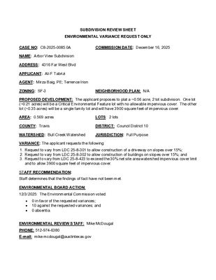
SUBDIVISION REVIEW SHEET ENVIRONMENTAL VARIANCE REQUEST ONLY CASE NO: C8-2025-0085.0A COMMISSION DATE: December 16, 2025 NAME: Arbor View Subdivision ADDRESS: 4316 Far West Blvd APPLICANT: Ali F Tabrizi AGENT: Mirza Baig, PE; Terrence Irion ZONING: SF-3 NEIGHBORHOOD PLAN: N/A PROPOSED DEVELOPMENT: The applicant proposes to plat a ~0.56 acre, 2 lot subdivision. One lot (~0.21 acres) will be a Critical Environmental Feature lot with no allowable impervious cover. The other lot (~0.35 acres) will be a single family lot and will have 3900 square feet of impervious cover. AREA: 0.569 acres LOTS: 2 lots COUNTY: Travis DISTRICT: Council District 10 WATERSHED: Bull Creek Watershed JURISDICTION: Full Purpose VARIANCE: The applicant requests the following: 1. Request to vary from LDC 25-8-301 to allow construction of a driveway on slopes over 15%; 2. Request to vary from LDC 25-8-302 to allow construction of buildings on slopes over 15%; and 3. Request to vary from LDC 25-8-423 to exceed the 30% net site area watershed impervious cover limit and to allow 3900 square feet of impervious cover. STAFF RECOMMENDATION: Staff determines that the findings of fact have not been met. ENVIRONMENTAL BOARD ACTION: 12/3/2025: The Environmental Commission voted: 0 in favor of the requested variances; 10 against the requested variances; and 0 absentia. ENVIRONMENTAL REVIEW STAFF: Mike McDougal PHONE: 512-974-6380 E-mail: mike.mcdougal@austintexas.gov CASE MANAGER: Angela Gallegos PHONE: 512-974-3437 E-mail: angela.gallegos@austintexas.gov ATTACHMENTS Environmental Commission Recommendation Environmental Commission Backup . RECOMMENDATION TO LAND USE COMMISSION Environmental Commission Recommendation Number: 20251203-002: Arbor View Subdivision; C8-2025-0085.0A WHEREAS, the Environmental Commission recognizes the applicant is seeking variance requests from LDC 25-8-301 to allow construction of a driveway on slopes over 15%, LDC 25-8-302 to allow construction of buildings on slopes over 15%, and LDC 25-8-423 to exceed the 30% net site area watershed impervious cover limit and to allow 3900 square feet of impervious cover; and WHEREAS, the property is located in the Bull Creek Watershed, in the Drinking Water Protection Zone, and the Edwards Aquifer Recharge Zone; and WHEREAS, the Environmental Commission recognizes that Staff does not recommend this variance, having determined that the findings of fact have not been met; and WHEREAS, the Environmental Commission recognizes that approval of these variances could set a precedent on how slopes and other environmental features can be built upon in the future. NOW, THEREFORE, BE IT RESOLVED the Environmental Commission recommends denial of the requested variance. …
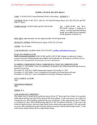
ZONING CHANGE REVIEW SHEET CASE: C14-2025-0103 (Council Initiated: Block 16 Rezoning) DISTRICT: 1 ADDRESS: Block 16: 907, 907 ½, 909, 911, 913 and 915 Juniper Street; 916, 920, 924, 926, and 928 East 11th Street ZONING FROM: CS-NCCD-NP and SF-3-NCCD-NP TO: CS-NCCD-NP and SF-3- NCCD-NP (change a condition of zoning – increase maximum building height and establish tiered stepbacks for development on Block 16) SITE AREA: approximately one acre (approximately 43,560 square feet) PROPERTY OWNER: Urban Renewal Agency of the City of Austin AGENT: City of Austin CASE MANAGER: Jonathan Tomko (512) 974-1057, jonathan.tomko@austintexas.gov STAFF RECOMMEDATION: Staff recommends granting CS-NCCD-NP and SF-3-NCCD-NP (change a condition of zoning – increase maximum building height and establish tiered stepbacks for development on Block 16). See the basis of recommendation section below for more information. PLANNING COMMISSION OTHER COMMISSION ACTION / RECOMMENDATION: November 17, 2025 (URB): Case was scheduled to be heard by the Urban Renewal Board; however, quorum was not met. November 18, 2025 (PC): Staff postponement request to December 16, 2025. December 15, 2025 (URB): Case is scheduled to be heard by the Urban Renewal Board December 16, 2025 (PC): Case is scheduled to be heard by Planning Commission CITY COUNCIL ACTION: TBD ORDINANCE NUMBER: TBD ISSUES: N/A CASE MANAGER COMMENTS: The subject tract is located at the northwest corner of East 11th Street and Curve Street. It is currently undeveloped and has been utilized for unpaved off-street parking. To the east (across Curve Street) is a large four-story office building, and three four-story townhomes. To the south (across East 11th Street) is a medium two-story office building being utilized as The Texas Music Museum. To the west is the Dedrick Hamilton House, a historic single-family home constructed in approximately 1892, and a small two-story office building being utilized as the African American Cultural and Heritage Facility. To the north (across Juniper Street) are five single family homes. 03 C14-2025-0103 - Council Initiated: Block 16 Rezone; District 11 of 18 The subject tract is located along CapMetro Route 2 and 485, but is also proximate to route 4, and 5. East 11th Street is an Imagine Austin Activity Corridor, and the site is located less 1,500 feet from two additional Imagine Austin Activity Corridors: East 12th Street and East 7th Street. The site is less than 1,000 feet from two Imagine Austin Activity Centers: Plaza Saltillo and Downtown. BASIS OF RECOMMENDATION: The …
ZONING AND PLATTING COMMISSION MEETING MINUTES Tuesday, December 2, 2025 ZONING AND PLATTING COMMISSION REGULAR MEETING TUESDAY, DECEMBER 2, 2025 MEETING MINUTES The Zoning and Platting Commission convened in a regular meeting on Tuesday, December 2, 2025, at Austin City Hall, Council Chambers, Room 1001, 301 W. Second Street, in Austin, Texas. Chair Smith called the Zoning and Platting Meeting to order at 6 p.m. Commissioners in Attendance: Hank Smith Betsy Greenberg Andrew Cortes Ryan Puzycki Lonny Stern Commissioners in Attendance Remotely: Scott Boone David Fouts Taylor Major Luis Osta Lugo Christian Tschoepe Commissioners Absent: Alejandra Flores PUBLIC COMMUNICATION: GENERAL None present. APPROVAL OF MINUTES 1. Approve the minutes of the Zoning and Platting Commission regular meeting on Tuesday, November 18, 2025. The minutes from the meeting of Tuesday, November 18, 2025, were approved on the consent agenda on Vice Chair Greenberg’s motion, Commissioner Osta Lugo’s second, on a 10-0 vote 1 ZONING AND PLATTING COMMISSION MEETING MINUTES Tuesday, December 2, 2025 PUBLIC HEARINGS 2. Rezoning: Location: Owner/Applicant: Agent: Request: Staff Rec.: Staff: C14-2025-0091 - Covington Medical; District 7 703 E. Covington Drive, Walnut Creek Watershed LX Enterprises LLC Thrower Design (Victoria Haase) LR-CO to GO Recommended Sherri Sirwaitis, 512-974-3057, sherri.sirwaitis@austintexas.gov Austin Planning The motion to approve Staff’s recommendation of GO for C14-2025-0091 - Covington Medical; District 7, located at 703 E. Covington Drive, was approved on the consent agenda on Vice Chair Greenberg’s motion, Commissioner Osta Lugo’s second, on a 10-0 vote. C14-2025-0100 - 16231 N IH 35; District 7 16231 N IH-35 Service Road North Bound, Gilleland Creek Watershed 3. Rezoning: Location: Owner/Applicant: Austins FEC RE LLC Agent: Request: Staff Rec.: Staff: Metcalfe Wolff Stuart & Williams, LLP (Michele Rogerson Lynch) SF-2, GR to LI-PDA Recommended Sherri Sirwaitis, 512-974-3057, sherri.sirwaitis@austintexas.gov Austin Planning The motion to approve Staff’s recommendation of LI-PDA for C14-2025-0100 - 16231 N IH 35; District 7, located at 16231 N IH-35 Service Road North Bound, was approved on the consent agenda on Vice Chair Greenberg’s motion, Commissioner Osta Lugo’s second, on a 10-0 vote. 4. Partial Plat C8-2025-0091(VAC) - Colony Park Sustainable Community Initiative PUD Phase 1 Right-of-Way 7900 Loyola Lane, Walnut Creek Vacation: Location: Owner/Applicant: Michael Gates (City of Austin) Agent: Request: Gerardo Martinez (Civilitude LLC) The request is for the approval of a partial plat vacation to release the ROW shown on the existing plat. The ROW subject for release is Mathews Prairie …
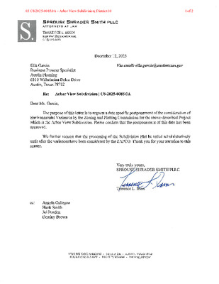
03 C8-2025-0085.0A - Arbor View Subdivision; District 101 of 2 03 C8-2025-0085.0A - Arbor View Subdivision; District 102 of 2
PLANNING COMMISSION MEETING MINUTES Tuesday, December 9, 2025 PLANNING COMMISSION MEETING MINUTES REGULAR MEETING TUESDAY, DECEMBER 9, 2025 The Planning Commission convened in a regular on Tuesday, December 9, 2025, at Austin City Hall, Council Chambers, Room 1001, 301 W. Second Street, in Austin, Texas. Chair Haney called the Planning Commission Meeting to order at 6:00 p.m. Commissioners in Attendance: Felicity Maxwell Casey Haney Nadia Barrera-Ramirez Anna Lan Joshua Hiller Peter Breton Adam Powell Danielle Skidmore Brian Bedrosian Imad Ahmed Commissioners Absent: Alice Woods Patrick Howard Ex-Officio Members in Absent: TC Broadnax Jessica Cohen Candace Hunter Richard Mendoza 1 Vacancy on the Dais PUBLIC COMMUNICATION: GENERAL None present. 1 PLANNING COMMISSION MEETING MINUTES Tuesday, December 9, 2025 APPROVAL OF MINUTES 1. Approve the minutes of the Planning Commission regular meeting on Tuesday, April 11, 2024, the minutes of the Planning Commission regular meeting on February 4, 2025, and the Planning Commission regular meeting on November 18, 2025. The minutes from the meeting of April 11, 2024, February 4, 2025, and November 18, 2025, were approved on the consent agenda on Secretary Maxwell’s motion, Commissioner Hiller’s second, on a 10-0 vote. Chair Woods and Commissioner Howard were absent. 1 vacancy on the dais. PUBLIC HEARINGS 2. Plan Amendment: NPA-2024-0018.01 - 7003, 7005, 7007 Guadalupe Street Rezone; Location: District 4 7003, 7005, 7007 Guadalupe Street, Waller Creek Watershed; Brentwood/Highland Combined (Highland) Neighborhood Planning Area Owner/Applicant: Purple Square One Limited Liability (Lan Chen) Agent: Request: Bowman (Jerome Perales, P.E.) High Density Single Family and Multifamily Residential to Mixed Use land use Applicant postponement request to January 27, 2026 Maureen Meredith, 512-974-2695, maureen.meredith@austintexas.gov Austin Planning Staff Rec.: Staff: The motion to approve the Applicant’s postponement request to January 27, 2026, was approved on the consent agenda on Secretary Maxwell’s motion, Commissioner Hiller’s second, on a 10-0 vote. Chair Woods and Commissioner Howard were absent. 1 vacancy on the dais. 3. Rezoning: Location: C14-2024-0036 - 7003, 7005, 7007 Guadalupe Street Rezone; District 4 7003, 7005, 7007 Guadalupe Street, Waller Creek Watershed; Brentwood/Highland Combined (Highland) Neighborhood Planning Area Owner/Applicant: Purple Square One Limited Liability (Lan Chen) Agent: Request: Bowman (Jerome Perales, P.E.) MF-1-CO-ETOD-DBETOD-NP (Subdistrict 2), SF-6-NP and MF-2-ETOD- DBETOD-NP (Subdistrict 2) to GR-ETOD-DBETOD-NP (Subdistrict 1), increasing the maximum building height from 90 feet to 120 feet through participation in a density bonus program. Applicant postponement request to January 27, 2026 Jonathan Tomko, 512-974-1057, jonathan.tomko@austintexas.gov Austin Planning …