ZONING CHANGE REVIEW SHEET DISTRICT: 3 ZONING TO: CS-MU-V-CO-NP CASE: C14-2022-0054 830 Airport ZONING FROM: SF-3-NP and CS-CO-NP ADDRESS: 830 and 838 Airport Boulevard, 917 and 923 Shady Lane SITE AREA: 1.74 acres PROPERTY OWNERS: Sam’s Radiator, Inc. and 838 Airport 2017 LP CASE MANAGER: Heather Chaffin (512-974-2122, heather.chaffin@austintexas.gov) STAFF RECOMMENDATION: Staff supports the Applicant’s request of CS-MU-V-CO-NP. The CO prohibits Vehicular storage and makes the following land uses conditional: Agricultural sales and services, Construction sales and services, Limited warehousing and distribution, Building maintenance services, Laundry services, Equipment sales, and Equipment repair services. AGENT: Clinton Sayers For a summary of the basis of staff’s recommendation, see case manager comments on page 2. PLANNING COMMISSION ACTION / RECOMMENDATION: July 26, 2022: July 12, 2022: To grant postponement to July 26, 2022 as recommended by staff, on consent. CITY COUNCIL ACTION: July 28, 2022: ORDINANCE NUMBER: 1 of 6B-8 C14-2022-0054 2 ISSUES: No issues at this time. CASE MANAGER COMMENTS: The subject property is located south of the intersection of Shady Lane and Airport Boulevard with frontage on both streets. The property is comprised of SF-3-NP and CS-CO-NP lots that are developed with single family residences and automotive repair land uses. The conditional overlays (COs) limit some of commercial land uses permitted under CS zoning. The applicant has stated that two single family residences are proposed to be demolished if the site is rezoned and redeveloped. Immediately south are properties zoned SF-3-NP, CS-CO-NP and LO-MU-NP that are developed with a mix of land uses, including Single family residential, Equipment sales, Indoor entertainment and other uses. The property is bounded on the north by Boggy Creek and the site includes floodplain and water quality zones that will affect redevelopment. Across Boggy Creek to the north are properties zoned CS-CO-NP, GR-MU-NP and GR-NP that are developed with Restaurant-limited, Automotive repair services and Convenience storage land uses. Across Shady Lane to the west are properties zoned SF-3-NP, LR-MU- CO-NP and P-NP that include Single family residential land use, Undeveloped property, Plant nursery and the Anita Ferrales Coy Facility (formerly Allen Elementary) which is home to several public services. Across Airport Boulevard to the east are properties zoned MH-NP and P-NP that are developed with a mobile home community and a fire station. Please see Exhibits A and B- Zoning Map and Aerial Exhibit. The Applicant is requesting CS-MU-V-CO-NP zoning and has stated their intent to …
DISTRICT: Contiguous to District 2 TO: PUD ZONING CHANGE REVIEW SHEET CASE: C814-2012-0152.04 – Pilot Knob PUD ZONING FROM: Unzoned ADDRESS: 9211, 9501, and 9715 Thaxton Road SITE AREA: Three tracts totaling 50.908 acres PROPERTY OWNER: Carma Easton, LLC (Chad Matheson) AGENT: Armbrust & Brown, PLLC (Richard T. Suttle, Jr.) CASE MANAGER: Wendy Rhoades (512-974-7719, wendy.rhoades@austintexas.gov) STAFF RECOMMENDATION: The Staff recommendation is to grant planned unit development (PUD) district zoning for the three tracts as outlined in the redlined draft PUD amendment ordinance, and as shown in Exhibit C – the revised Land Use Plan and Density Table, and supporting Exhibits D, J, L, M, O, P, P-1, R, and U. For a summary of the basis of Staff’s recommendation, see pages 2 and 3. PLANNING COMMISSION ACTION: July 26, 2022: CITY COUNCIL ACTION: September 1, 2022: ORDINANCE NUMBERS: ISSUES: The subject three tracts proposed to be added to the PUD will also be annexed for limited purpose jurisdiction, with Council consideration scheduled for September 1, 2022 (C7L- 2022-0001). The total area of the tracts is 50.908 acres and revises the Pilot Knob PUD to 2,676.179 acres. EXHIBITS AND ATTACHMENTS TO THE STAFF REPORT: Exhibits A and A-1: Zoning Map and Aerial Exhibit B: Memo from Watershed Protection Department – Environmental Officer Applicant’s Summary Letter and Redlined, draft PUD Amendment Ordinance 1 of 58B-9 C814-2012-0152.04 Page 2 Revised Exhibits to the PUD: Exhibit C: Land Use Plan and Density Table Exhibit D: Conceptual Parks and Open Space Plan Exhibit J: Critical Water Quality Zone Transfers Exhibit L: Proposed Waterway Crossings Exhibit M: Wetland Transfer Exhibit Exhibit O: Cut / Fill Exhibit Exhibit P: Impervious Cover Map Exhibit P-1: Impervious Cover Table Exhibit R: Conceptual Public Art Master Plan Exhibit U: Project Area CASE MANAGER COMMENTS: The proposed amendment to the Pilot Knob Planned Unit Development (PUD) consists of three undeveloped, unzoned and non-contiguous tracts that are adjacent to the PUD and have access to Thaxton Road. These three parcels are currently within unincorporated Travis County and proposed for annexation and establishment of initial permanent zoning, thus bringing them into the PUD. Please refer to Exhibits A (Zoning Map), and A-1 (Aerial View). The proposed amendment would add approximately 51 acres to the Mixed Residential area of the PUD for a revised total of 2,676.179 acres. The 65% average impervious cover in the PUD will not change. As information, the Mixed …
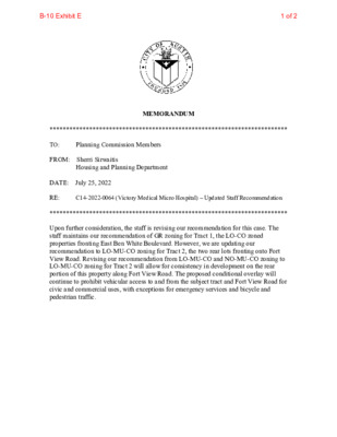
ZONING CHANGE REVIEW SHEET CASE: C14-2022-0064 (Victory Medical Micro Hospital) DISTRICT: 5 ZONING FROM: LO-MU-CO, NO-MU-CO, LO-CO TO: GR ADDRESS: 4303 Victory Drive, 2109 and 2111 Fort View Road and 2106, 2108 & 2110 W. Ben White Boulevard Service Road West Bound SITE AREA: 1.1217 acres PROPERTY OWNER: Eveann Investments, L.P. (William G. Franklin) AGENT: Husch Blackwell, LLP (Nikelle Meade) CASE MANAGER: Sherri Sirwaitis (512-974-3057, sherri.sirwaitis@austintexas.gov) STAFF RECOMMENDATION: Staff recommends GR, Community Commercial District, zoning for the LO-CO zoned properties fronting East Ben White Boulevard (proposed Tract 1). The staff recommends that the lots fronting Fort View Road (proposed Tract 2) shall remain zoned LO-MU-CO, Limited Office-Mixed Use-Conditional Overlay Combining District, zoning and NO-MU-CO, Neighborhood Office-Mixed Use-Conditional Overlay Combining District, zoning. PLANNING COMMISSION ACTION / RECOMMENDATION: July 26, 2022 CITY COUNCIL ACTION: ORDINANCE NUMBER: 1 of 14B-10 C14-2022-0064 ISSUES: N/A CASE MANAGER COMMENTS: 2 The property in question consists of six lots that have been re-subdivided and are currently developed with medical, administrative office and personal services uses located between Fort View Road and West Ben White Boulevard. Fort View Road is designated as a residential collector street that dead ends into the GR zoned tract along Victory Drive. The lots to the north, across Fort View Road, are developed with single-family residences. To the east, there are single-family residences fronting Fort View Road and an office and a personal services use fronting W. Ben White Boulevard. The property to the west is developed with a medical office (original Victory Medical Facility). The applicant is requesting GR, Community Commercial District, zoning for these lots to redevelop this property as a Ho spita l Ser vic e s use in- patient the adjacent Victory Medical overnight beds as part of Center facility t o the west (please see the Applicant’s Request Letter – Exhibit D). the e xpa nsion of to a dd f our The staff is recommending GR zoning on Tract 1, the front portion of Lot 1 currently zoned LO-CO that fronts onto/accesses the frontage road for West Ben White Boulevard (please see Staff's Proposed Tract Map - Exhibit C). However, the staff does not support a zoning change for Tract 2, the rear two lots zoned LO-MU-CO and NO-MU-CO that front onto Fort View Road. Fort View Road is a residential collector street, near its terminus. The majority of the properties along this stretch of Fort View …
PLANNING COMMISSION SITE PLAN CONDITIONAL USE PERMIT REVIEW SHEET PC DATE: 07/26/22 SPC-2021-0340C CASE NUMBER: PROJECT NAME: Dove Springs Public Health Facility ADDRESS: APPLICANT: 5811 Palo Blanco Ln City of Austin PO Box 1088 AUSTIN, Texas, 78767 Garza EMC (Alexandra Boone) 7708 Rialto Austin, Texas, 78735 (512) 298-3284 AGENT: Williamson Creek CASE MANAGER: Renee Johns, (512) 974-2711 or renee.johns@austintexas.gov WATERSHED: NEIGHBORHOOD PLAN: McKinney PROJECT DESCRIPTION: The applicant proposes a new public health facility. The lot is currently a community recreation (public) use that will continue and the proposed new uses are Day Care Services (Commercial) and Administrative Services. No medical procedures or equipment are proposed within the new facility. The scope of work for Dove Springs Public Health Facility includes childcare facilities to be leased to a tenant and four Austin Public Health (APH) departments, including Women-Infants-Children (WIC), Neighborhood Services, Immunizations, and Community Youth Development (CYD). WIC will provide one-on-one office consultations on benefits and for services like Nutrition Education and Breastfeeding; they will also provide community healthy cooking classes. Neighborhood Services provides office consultations for assistance with rent, utilities, and food for low to moderate income families; this location includes a small food pantry storage area. Immunizations provides immunizations and consultations regarding them for children who are uninsured or Medicaid recipients as well as some qualifying adults. Community Youth Development at this location is comprised of staff offices/desking and equipment storage only; the space is not intended to receive regular visitors. SUMMARY STAFF RECOMMENDATION: Staff recommends approval of the Conditional Use Permit. The proposed public health facility will offer needed services and support the surrounding community. The site plan will comply with all requirements of the Land Development Code prior to its release. SUMMARY STAFF COMMENT ON SITE PLAN: The applicant proposes a public health facility. Sites zoned Public (P) greater than one acre in size are a Conditional Use that require Land Use Commission approval according to Land Development Code section 25-2-625. PROJECT INFORMATION: SITE AREA ZONING EXISTING / REMAINING USE PROPOSED NEW USES CVC PROPOSED IMPERVIOUS COVER 13.599 Acres (592,372 Square feet) P-NP (Public) Community Recreation (Public) Day Care Services (Commercial) / Administrative Services NA 63,772 square feet 10.76% 1 of 8B-11 Page 2 Current WATERSHED ORDINANCE PROPOSED BUILDING COVERAGE 2.69% PROPOSED ACCESS TIA PROPOSED HEIGHT PARKING REQURIED PARKING PROPOSED EXISTING ZONING AND LAND USES Site ZONING P North South East West SF-3-NP P-NP P-NP SF-6-NP NEIGHBORHOOD …
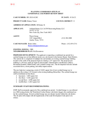
PLANNING COMMISSION SITE PLAN CONDITIONAL USE PERMIT REVIEW SHEET CASE NUMBER: SPC-2021-0129C PC DATE: 07/26/22 (512) 394-1900 COUNCIL DISTRICT: 9 Wuest Group 5207 Airport Blvd Austin, Texas, 78751 Ashland Rainey LLC & EW Renovating Rainey LLC 165 W 73rd St, New York City, New York 10023 PROJECT NAME: Rainey Tower ADDRESS OF APPLICATION: 80 Rainey St APPLICANT: AGENT: CASE MANAGER: Renee Johns EXISTING ZONING: CBD NEIGHBORHOOD PLAN: NA/Downtown PROPOSED DEVELOPMENT: The applicant is requesting a conditional use permit for a cocktail lounge use on four different stories on a site located in the historic Rainey Street District. The current site is comprised of multiple lots and includes an existing cocktail lounge building located to the south of the proposed high rise totaling 1,287 square feet. The proposed new building is a 49 story multi use high rise that includes Administrative and Business Offices, Restaurant (limited), Multi-Family, and Cocktail Lounge uses. The development will also include associated drives, onsite parking, and utility improvements. The new high rise is proposing a total of 22,985 square feet of new cocktail lounge use in addition to the exiting 1,287 located in the existing building (Reina Bar). The cocktail lounge use will be distributed on four floors: Renee.Johns@austintexas.gov Phone: (512) 974-2711 basement – 7,698 square feet first floor – 7,430 square feet second floor – 2,989 square feet twelfth floor – 4,868 square feet SUMMARY STAFF RECOMMENDATIONS: CUP: Staff recommends approval of the conditional use permit. Cocktail lounge is a use allowed in a CBD zoning district, the Waterfront Overlay Rainey sub district triggers the conditional use for the cocktail lounge. Several cocktail lounge uses are already located within this sub district. The site plan will comply with all requirements of the Land Development Code prior to its release. 1 of 11B-12 PROJECT INFORMATION Area of proposed CUP Area of existing cocktail lounge Existing Zoning Watershed Watershed Ordinance Traffic Impact Analysis Capitol View Corridor Proposed Access Proposed Impervious Cover Height Parking required: None, CBD zoning Total New Cocktail Lounge: 22,985 square feet basement – 7,698 square feet first floor – 7,430 square feet second floor – 2,989 square feet twelfth floor – 4,868 square feet 1,287 square feet on the first floor CBD Waller Creek / Lady Bird Lake Current Code None, however, cocktail use was evaluated under the TIA for the broader project. Not applicable Pedestrian …
SUBDIVISION REVIEW SHEET CASE NO.: C8-2019-0147 COMMISSION DATE: July 26, 2022 SUBDIVISION NAME: Bradsher Tract 3 ADDRESS: U.S Highway 183 & McKinney Falls Parkway APPLICANT: CCI – McKinney Falls I, L.P. AGENT: Land Strategies Inc. (Paul W. Linehan) ZONING: CS-CO-NP (commercial) NEIGHBORHOOD PLAN: Southeast AREA: 124.85 acre (5,438,466 sf) LOTS: 27 COUNTY: Travis DISTRICT: 2 WATERSHED: Onion Creek JURISDICTION: Full Purpose SIDEWALKS: Sidewalks will be constructed along streets. VARIANCE: None DEPARTMENT COMMENTS: The request is for the approval of Bradsher Tract 3 preliminary plan comprised of 27 lots on 124.85 acres (5,438,466 sf). The preliminary plan complies with the criteria for approval and staff recommends approval. STAFF RECOMMENDATION: Staff recommends approval of the preliminary plan. This plan meets applicable State and City of Austin land development code requirements. CASE MANAGER: Cesar Zavala PHONE: 512-974-3404 E-mail: cesar.zavala@austintexas.gov ATTACHMENTS Exhibit A: Vicinity map Exhibit B: Proposed preliminary plan 1 of 7B-14 EXHIBIT A ` 2 of 7B-14 3 of 7B-14 FDFP GAS GAS Existing Gas LEGEND: FDFP CWQZ CWQZ Critical Water Quality Zone Wetlands buffer 100 yr Floodplain by CLOMR under review Fully Developed Floodplain Existing Electric Overhead Existing Electric Overhead Setback Existing Gas Setback Zoning boundary Proposed Lot Line Proposed Access Easement Proposed Sidewalk Proposed seedling planted strip Proposed Biofiltration Tree preserved Tree removed LAND STRATEGIES INC. 1983 - 2022 39 YEARS OF EXCELLENCE 1411 W 5th Street SUITE 100 AUSTIN,TX. 78703 PH: (512) 328-6050 FAX: (512) 328-6172 EMAIL: LSI@LSIaustin.COM DRE STE EG I A P R EP CAA NDS L U L W . LIN E A R C H H I T A N E C T S T A T E 6.9.2022 917 O F SA X E T NOTES: 1. W W W W W W W W GAS GAS CITGO GAS LINE GAS GAS GAS GAS CITGO GAS LINE GAS GAS GAS (CS-CO-NP) GAS GAS GAS PROPOSED 50 ' ACCESS EASEMENT GAS CITGO GAS LINE GAS G A S CITGO GAS LINE GAS GAS GAS GAS 200 FT GAS LINE SETBACK 200 FT GAS LINE SETBACK ZONING BOUNDARY Block B Lot 1 2.60 Ac. Block B Lot 2 4.64 Ac. Block B F D F P WATER QUALITY AND DETENTION FACILITY 2 P F D F GAS C W Q Z Block B Lot 4 14.84 Ac. F D F P (CS-CO-NP) 200 FT GAS LINE SETBACK ZONING BOUNDARY y 0 0 1 d o f …
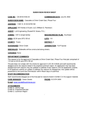
SUBDIVISION REVIEW SHEET CASE NO.: C8-2018-0165.4A COMMISSION DATE: July 26, 2022 SUBDIVISION NAME: Cascades at Onion Creek East, Phase Four ADDRESS: 11601 S. IH 35 SVRD NB APPLICANT: M/I Homes of Austin, LLC (William G. Peckman) AGENT: LJA Engineering (Russell W. Kotara, P.E.) ZONING: I-SF-2 (single family) NEIGHBORHOOD PLAN: Southeast AREA: 22.34 acre (973,130 sf) LOTS: 110 COUNTY: Travis DISTRICT: 5 WATERSHED: Onion Creek JURISDICTION: Full Purpose SIDEWALKS: Sidewalks will be constructed along streets. VARIANCE: None DEPARTMENT COMMENTS: The request is for the approval of Cascades at Onion Creek East, Phase Four final plat comprised of 110 lots on 22.34 acre (973,130 sf). The final plat complies with the criteria for approval and staff recommends approval. STAFF RECOMMENDATION: Staff recommends approval of the final plat. This plat meets applicable State and City of Austin land development code requirements. CASE MANAGER: Cesar Zavala PHONE: 512-974-3404 E-mail: cesar.zavala@austintexas.gov ATTACHMENTS Exhibit A: Vicinity map Exhibit B: Proposed final plat Exhibit C: Comment Report ` 1 of 14B-16 2 of 14B-16 4/22/20224/22/20223 of 14B-16 4 of 14B-16 5 of 14B-16 CITY OF AUSTIN –DEVELOPMENT SERVICES DEPARTMENT SUBDIVISION APPLICATION – MASTER COMMENT REPORT 11601 S IH 35 SVRD NB U0 512-974-3404 C8-2018-0165.4A CASE NUMBER: REVISION #: UPDATE: 00 CASE MANAGER: Cesar Zavala PHONE #: PROJECT NAME: Cascades at Onion Creek East, Phase Four Final Plat LOCATION: SUBMITTAL DATE: June 27, 2022 REPORT DUE DATE: July 21, 2022 FINAL REPORT DATE: July 20, 2022 STAFF REPORT: This report includes all staff comments received to date concerning your most recent subdivision application submittal. The comments may include requirements, recommendations, or information. The requirements in this report must be addressed by an updated submittal. The subdivision application will be approved when all requirements from each review discipline have been addressed. If you have any questions, concerns or if you require additional information about this report, please contact your case manager at the phone number listed above or by using the contact information listed for each reviewer in this report. Any change to the plan/plat shall not cause noncompliance with any applicable code or criteria. In addition, any change to the plat may trigger new comments. UPDATE DEADLINE INFORMATION (LDC 25-4-56; 25-4-82): All comments must be addressed by filing an updated submittal prior to the update deadline of September 26, 2022 . Otherwise, the application will expire. If this date falls on a weekend or City of Austin holiday, …
PLANNING COMMISSION AGENDA Tuesday, July 26, 2022 The Planning Commission will convene at 6:00 PM on Tuesday, July 26, 2022 at Austin City Hall, Council Chambers, Room 1001 301 W. Second Street, Austin, TX. Some members of the Planning Commission may be participating by videoconference. The meeting may be viewed online at: http://www.austintexas.gov/page/watch-atxn-live Greg Anderson Awais Azhar Grayson Cox Yvette Flores – Secretary Claire Hempel – Vice-Chair Patrick Howard Jennifer Mushtaler Solveij Rosa Praxis Carmen Llanes Pulido Robert Schneider Todd Shaw – Chair James Shieh – Parliamentarian Jeffrey Thompson Ex-Officio Members Arati Singh – AISD Board of Trustees Jessica Cohen – Chair of Board of Adjustment Spencer Cronk - City Manager Richard Mendoza - Director of Public Works EXECUTIVE SESSION (No public discussion) The Planning Commission will announce it will go into Executive Session, if necessary, pursuant to Chapter 551 of the Texas Government Code, to receive advice from Legal Counsel on matters specifically listed on this agenda. The Commission may not conduct a closed meeting without the approval of the city attorney. Private Consultation with Attorney – Section 551.071 Attorney: Steven Maddoux, 512-974-6080 Commission Liaison: Andrew Rivera, 512-974-6508 PUBLIC COMMUNICATION The first four (4) speakers signed up prior to the commencement of the meeting will each be allowed a three-minute allotment to address their concerns regarding items not posted on the agenda. A. APPROVAL OF MINUTES 1. Approve the minutes of July 12, 2022. B. PUBLIC HEARINGS 1. Plan Amendment: Location: Owner/Applicant: Agent: Request: Staff Rec.: Staff: NPA-2022-0014.01 - 3111 and 3112 Caseybridge Court; District 2 3111 and 3112 Caseybridge Court, Carson Creek Watershed; Southeast Combined (Southeast) NP Area Lichter Equities, LP (Robert J. Lichter) Drenner Group, PC (Leah M. Bojo) From Mixed Use, Major Planned Development and Industry to Mixed Use Recommended Maureen Meredith, 512-974-2695, maureen.meredith@austintexas.gov Housing and Planning Department 2. Rezoning: Location: Owner/Applicant: Agent: Request: Staff Rec.: Staff: C14-2022-0060 - 3111 Caseybridge Court; District 2 3111 Caseybridge Court, Carson Creek Watershed; Southeast Combined (Southeast) NP Area Lichter Equities, LP (Robert J. Lichter) Drenner Group, PC (Leah M. Bojo) CS-MU-CO-NP to CS-MU-V-CO-NP Recommended, with conditions Sherri Sirwaitis, 512-974-3057, sherri.sirwaitis@austintexas.gov Housing and Planning Department 3. Rezoning: Location: Owner/Applicant: Agent: Request: Staff Rec.: Staff: C14-2022-0059 - 3112 Caseybridge Court; District 2 3112 Caseybridge Court, Carson Creek Watershed; Southeast Combined (Southeast) NP Area Lichter Equities, LP (Robert J. Lichter) Drenner Group, PC (Leah M. Bojo) CS-MU-CO-NP and LI-CO-NP to CS-MU-V-CO-NP Recommended, …
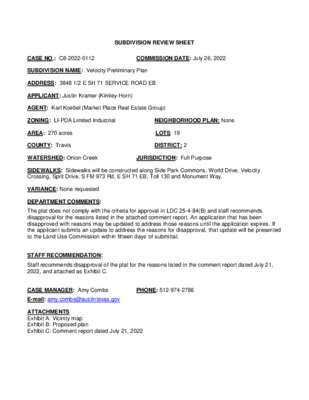
SUBDIVISION REVIEW SHEET CASE NO.: C8-2022-0112 COMMISSION DATE: July 26, 2022 SUBDIVISION NAME: Velocity Preliminary Plan ADDRESS: 3848 1/2 E SH 71 SERVICE ROAD EB APPLICANT: Justin Kramer (Kimley-Horn) AGENT: Karl Koebel (Market Place Real Estate Group) ZONING: LI-PDA Limited Industrial NEIGHBORHOOD PLAN: None AREA: 270 acres LOTS: 19 COUNTY: Travis DISTRICT: 2 WATERSHED: Onion Creek JURISDICTION: Full Purpose SIDEWALKS: Sidewalks will be constructed along Side Park Commons, World Drive, Velocity Crossing, Sprit Drive, S FM 973 Rd, E SH 71 EB, Toll 130 and Monument Way. VARIANCE: None requested DEPARTMENT COMMENTS: The plat does not comply with the criteria for approval in LDC 25-4-84(B) and staff recommends disapproval for the reasons listed in the attached comment report. An application that has been disapproved with reasons may be updated to address those reasons until the application expires. If the applicant submits an update to address the reasons for disapproval, that update will be presented to the Land Use Commission within fifteen days of submittal. STAFF RECOMMENDATION: Staff recommends disapproval of the plat for the reasons listed in the comment report dated July 21, 2022, and attached as Exhibit C. CASE MANAGER: Amy Combs PHONE: 512-974-2786 E-mail: amy.combs@austintexas.gov ATTACHMENTS Exhibit A: Vicinity map Exhibit B: Proposed plan Exhibit C: Comment report dated July 21, 2022 Exhibit A: Vicinity Map VELOCITY PRELIMINARY PLAN SOUTHWEST CORNER OF SH-71 AND SH-130 AUSTIN, TEXAS C8-2020-0141 VELOCITY PRELIMINARY PLAN SHEET INDEX SHEET NO. DESCRIPTION 1 2 3 4 5 6 7 8 9 10 COVER SHEET GENERAL NOTES OVERALL PRELIMINARY PLAN PRELIMINARY PLAN (SHEET 1 OF 6) PRELIMINARY PLAN (SHEET 2 OF 6) PRELIMINARY PLAN (SHEET 3 OF 6) PRELIMINARY PLAN (SHEET 4 OF 6) PRELIMINARY PLAN (SHEET 5 OF 6) PRELIMINARY PLAN (SHEET 6 OF 6) STREET CROSS-SECTIONS H W Y-71 F M-973 PROJECT LOCATION 0 3 X-1 T VICINITY MAP SCALE: 1" = 2,000' NORTH COA GRID: P15, P16 JUNE 2022 LEGAL DESCRIPTION: BEING 270.93 ACRES OF LAND, LOCATED IN THE SANTIAGO DEL VALLE LEAGUE ABSTRACT NUMBER 24, TRAVIS COUNTY, TEXAS, AND BEING A PORTION OF THAT CERTAIN 385.684 ACRE TRACT, CONVEYED TO SH 71-130 HOLDINGS, LP., IN DOCUMENT NUMBER 2014189945 OFFICIAL PUBLIC RECORDS OF TRAVIS COUNTY, TEXAS., AND ALL OF THAT CERTAIN 4.886 ACRE TRACT, CONVEYED TO SH 71-30 HOLDINGS, LP, IN DOCUMENT NUMBER 2014189949, OFFICIAL PUBLIC RECORDS OF TRAVIS COUNTY, TEXAS. OWNER/DEVELOPER MARK BULMASH VC HOLDINGS QOZ, LP 1601 RIO GRANDE, SUITE …
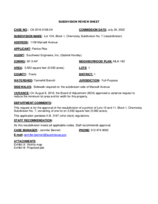
SUBDIVISION REVIEW SHEET CASE NO.: C8-2016-0168.0A COMMISSION DATE: July 26, 2022 SUBDIVISION NAME: Lot 10A, Block 1, Chernosky Subdivision No. 7 (resubdivision) ADDRESS: 1106 Mansell Avenue APPLICANT: Patrice Rios AGENT: Southwest Engineers, Inc. (Gabriel Hovdey) ZONING: SF-3-NP NEIGHBORHOOD PLAN: MLK-183 AREA: 3,582 square feet (0.082 acres) LOTS: 1 COUNTY: Travis DISTRICT: 1 WATERSHED: Tannehill Branch JURISDICTION: Full-Purpose SIDEWALKS: Sidewalk required on the subdivision side of Mansell Avenue VARIANCE: On August 8, 2016, the Board of Adjustment (BOA) approved a variance request to reduce the minimum lot area and lot width for this property. DEPARTMENT COMMENTS: This request is for the approval of the resubdivision of a portion of Lots 10 and 11, Block 1, Chernosky Subdivision No. 7, consisting of one lot on 3,582 square feet (0.082 acres). This application predates H.B. 3167 (shot clock) regulations. STAFF RECOMMENDATION: As this resubdivision meets all applicable codes, Staff recommends approval. CASE MANAGER: Jennifer Bennett PHONE: 512-974-9002 E-mail: jennifer.bennett@austintexas.gov ATTACHMENTS Exhibit A: Vicinity map Exhibit B: Proposed plat SouthwestEngineers Inc. Civil Environmental Planning TBPENo.:1909 www.swengineers.com 142CimarronParkLp Buda,Texas78610 (512)312-4336 LOCATIONMAP 1106MANSELLAVE LOT10A,BLOCK1,CHERNOSKY SUBDIVIDIONNO.7 Date: File: Scale: Tech: ProjectNo.: 08152016 LocationExhibit N.T.S. MI 0662-001-16 LOT 10A, BLOCK 1, CHERNOSKY SUBDIVISION NO. 7 A S62° 21' 51"E 198.77' A RESUBDIVISION OF A PORTION OF LOTS 10 & 11, BLOCK 1, CHERNOSKY SUBDIVISION NO. 7 N W E S GRAPHIC SCALE 1" = 30' 30 0 15 30 60 REFERENCE LEGEND: R1 = DOC. NO. 2016038100, O.P.R.T.C.TX. R2 = CHERNOSKY SUBDIVISION NO. 7, VOL. 4, PG. 179, P.R.T.C.TX. R3 = CHERNOSKY SUBDIVISION NO. 8, VOL. 4, PG. 183, P.R.T.C.TX. R4 = CHERNOSKY #7, RESUBDIVISION OF BLOCK 1, LOTS 8, 9, 10 & 11, VOL. 55, PG. 51, P.R.T.C.TX. R5 = VOL. 4295, PG. 1396, D.R.T.C.TX. D.R.T.C.TX. = DEED RECORDS, TRAVIS COUNTY, TEXAS O.P.R.T.C.TX. = OFFICIAL PUBLIC RECORDS, TRAVIS COUNTY, TEXAS LINE TYPE LEGEND: 2, B T 1 O L B 4' 7.9 3 ADJOINING LOT LINE BOUNDARY RIGHT OF WAY EASEMENT SIDEWALK N=10073314.37 E=3131337.82 ELEV=507.65 A 1277.04' AREA: TOTAL AREA = 3,581.94 SQ. FT. - 0.082 ACRES S46° 59' 02" W F 5' 3.8 9 1 N=10072443.17 E=3130404.10 2"E 1' 1 6° 4 2 N A A 93.39' REYES STREET 50' RIGHT OF WAY 93.39'(R5) 292.16' 9' 0.9 2 3 5) 0'(R 9.2 8 1) K 1, (R C O L ( R 2 ) 0' 9.2 8 B L O C K 1 , V E …
************************************************************************ MEMORANDUM TO: Planning Commission Members FROM: Sherri Sirwaitis Housing and Planning Department DATE: July 25, 2022 RE: C14-2022-0064 (Victory Medical Micro Hospital) – Updated Staff Recommendation ************************************************************************ Upon further consideration, the staff is revising our recommendation for this case. The staff maintains our recommendation of GR zoning for Tract 1, the LO-CO zoned properties fronting East Ben White Boulevard. However, we are updating our recommendation to LO-MU-CO zoning for Tract 2, the two rear lots fronting onto Fort View Road. Revising our recommendation from LO-MU-CO and NO-MU-CO zoning to LO-MU-CO zoning for Tract 2 will allow for consistency in development on the rear portion of this property along Fort View Road. The proposed conditional overlay will continue to prohibit vehicular access to and from the subject tract and Fort View Road for civic and commercial uses, with exceptions for emergency services and bicycle and pedestrian traffic. B-10 Exhibit E1 of 2 ! ! ! ! ! ! ! ! ! ! ! ! ! ! ! ! ! ! ! ! ! ! ! ! ! ! ! ! ! ! ! ! ! ! ! ! ! ! ! ! ! ! ! ! ! ! ! ! ! ! ! ! ! ! ! ! ! ! ! ! ! ! ! ! ! ! ! ! ! ! ! ! ! ! ! ! ! ! ! ! ! ! ! ! ! ! ! ! ! ! ! ! ! ! ! ! ! ! ! ! ! ! ! ! ! ! ! ! ! ! ! ! ! ! ! ! ! ! ! ! ! ! ! ! ! ! ! ! ! ! ! ! ! ! ! ! ! ! ! ! ! ! ! ! ! ! ! ! ! ! ! ! ! ! ! ! ! ! ! ! ! ! ! ! ! ! ! ! ! ! ! ! ! ! ! ! ! ! ! ! ! ! ! ! SHOPPING CENTER CS-1 CS GR C14-2008-0043 ! ! ! ! ! ! ! ! ! ! ! ! GR ! ! ! ! ! ! ! ! ! ! B D N R B L V A M S L A B A N K D R I V E - T H R U RESTAURANT 79-217 GR-V 77-060 SP88-0152C SP97-0061CS SF-3 70-88 YOUNG …
SUBDIVISION REVIEW SHEET CASE NO.: C8-2018-0165.4A COMMISSION DATE: July 26, 2022 SUBDIVISION NAME: Cascades at Onion Creek East, Phase Four ADDRESS: 11601 S. IH 35 SVRD NB APPLICANT: M/I Homes of Austin, LLC (William G. Peckman) AGENT: LJA Engineering (Russell W. Kotara, P.E.) ZONING: I-SF-2 (single family) NEIGHBORHOOD PLAN: Southeast AREA: 22.34 acre (973,130 sf) LOTS: 110 COUNTY: Travis DISTRICT: 5 WATERSHED: Onion Creek JURISDICTION: Full Purpose SIDEWALKS: Sidewalks will be constructed along streets. VARIANCE: None DEPARTMENT COMMENTS: The request is for the approval of Cascades at Onion Creek East, Phase Four final plat comprised of 110 lots on 22.34 acre (973,130 sf). The plat does not comply with the criteria for approval in LDC 25-4-84(B) and staff recommends disapproval for the reasons listed in the attached comment report. An application that has been disapproved with reasons may be updated to address those reasons until the application expires. If the applicant submits an update to address the reasons for disapproval, that update will be presented to the Land Use Commission within fifteen days of submittal. STAFF RECOMMENDATION: Staff recommends disapproval of the final plat for reasons listed in Exhibit C in the support material. CASE MANAGER: Cesar Zavala PHONE: 512-974-3404 E-mail: cesar.zavala@austintexas.gov ATTACHMENTS Exhibit A: Vicinity map Exhibit B: Proposed final plat Exhibit C: Comment Report ` 2 of 14B-16 4/22/20224/22/20223 of 14B-16 4 of 14B-16 5 of 14B-16 CITY OF AUSTIN –DEVELOPMENT SERVICES DEPARTMENT SUBDIVISION APPLICATION – MASTER COMMENT REPORT 11601 S IH 35 SVRD NB U0 512-974-3404 C8-2018-0165.4A CASE NUMBER: REVISION #: UPDATE: 00 CASE MANAGER: Cesar Zavala PHONE #: PROJECT NAME: Cascades at Onion Creek East, Phase Four Final Plat LOCATION: SUBMITTAL DATE: June 27, 2022 REPORT DUE DATE: July 21, 2022 FINAL REPORT DATE: July 20, 2022 STAFF REPORT: This report includes all staff comments received to date concerning your most recent subdivision application submittal. The comments may include requirements, recommendations, or information. The requirements in this report must be addressed by an updated submittal. The subdivision application will be approved when all requirements from each review discipline have been addressed. If you have any questions, concerns or if you require additional information about this report, please contact your case manager at the phone number listed above or by using the contact information listed for each reviewer in this report. Any change to the plan/plat shall not cause noncompliance with any applicable code or criteria. In …
REGULAR MEETING OF THE HISPANIC/LATINO QUALITY OF LIFE RESOURCE ADVISORY COMMISSION TUESDAY, JULY 26, 2022 AT 5:30 PM AUSTIN CITY HALL – BOARDS AND COMMISSIONS ROOM 1101 301 W 2ND St, AUSTIN, TX 78701 Some members of the Commission may be participating by videoconference Public comment will be allowed in-person or remotely by telephone. Speakers may only register to speak on an item once either in-person or remotely and will be allowed up to three minutes to provide their comments. Registration no later than noon the day before the meeting is required for remote participation by telephone. To register to speak remotely: Call or email the board liaison at Amanda.Jasso@austintexas.gov or 512-974-9107. The information required is the speaker name, item number(s) they wish to speak on if applicable, email address and telephone number (must be the same number that will be used to call into the meeting). CURRENT BOARD MEMBERS: Amanda Afifi, District 2, Chair Sharon Vigil, District 7, Vice-Chair Ricardo Garay, District 3 Jesus Perales, District 8 Daniela Silva, District 1 Dulce Castañeda, District 10 AGENDA Maria C. Solis, District 5 Felicia Peña, Mayor Sandy Ramirez, District 6 Ivanna Neri, District 4 District 9 - Vacant CALL TO ORDER PUBLIC COMMUNICATION: GENERAL Each speaker will have three minutes to address their concerns regarding items not posted on the agenda. Speakers wishing to address an agenda item will have the chance to do so when the agenda item is called. APPROVAL OF MEETING MINUTES 1. Approve the minutes of the Hispanic/Latino Quality of Life Commission regular meeting held on June 28, 2022. STAFF BRIEFINGS 2. Staff briefing regarding key findings and recommendations from Small and Minority Business Resources’ Disparity Report. Presented by Edward Campos, Director. DISCUSSION AND ACTION ITEMS 3. Presentation by representatives from Tesla and discussion and possible action regarding workforce equity, infrastructure needs, community partnerships, and environmental justice. Presenters include Walt Gonzalez, Brooke Kintz, Teresa Grant, and Logan Grant. WORKING GROUP UPDATES, DISCUSSION, AND ACTION ITEMS 4. Health Work Group (Commissioner Garay) – related to COVID-19 5. Representatives to Joint Inclusion Committee (Chair Afifi and Vice-Chair Vigil) - related to latest JIC discussion and activity 6. Representatives to Commission on Seniors (Commissioner Solis) – related to issues relevant to older adults in the Hispanic/Latino community 7. Budget and Policy Priorities Work Group (Chair Afifi, Vice-Chair Vigil, & Commissioners Peña, Silva, and Perales) – related to the City Manager’s …
REGULAR MEETING OF THE HISPANIC/LATINO QUALITY OF LIFE RESOURCE ADVISORY COMMISSION TUESDAY, JULY 26, 2022 AT 5:30 PM AUSTIN CITY HALL – BOARDS AND COMMISSIONS ROOM 1101 301 W 2ND St, AUSTIN, TX 78701 Some members of the Commission may be participating by videoconference Public comment will be allowed in-person or remotely by telephone. Speakers may only register to speak on an item once either in-person or remotely and will be allowed up to three minutes to provide their comments. Registration no later than noon the day before the meeting is required for remote participation by telephone. To register to speak remotely: Call or email the board liaison at Amanda.Jasso@austintexas.gov or 512-974-9107. The information required is the speaker name, item number(s) they wish to speak on if applicable, email address and telephone number (must be the same number that will be used to call into the meeting). CURRENT BOARD MEMBERS: Amanda Afifi, District 2, Chair Sharon Vigil, District 7, Vice-Chair Ricardo Garay, District 3 Jesus Perales, District 8 Daniela Silva, District 1 Dulce Castañeda, District 10 AGENDA ADDENDUM Maria C. Solis, District 5 Felicia Peña, Mayor Sandy Ramirez, District 6 Ivanna Neri, District 4 District 9 - Vacant DISCUSSION AND ACTION ITEMS 4. Presentation by representatives from Tesla Outreach Community Alliance (TOCA) and discussion and possible action regarding community asks and concerns. The City of Austin is committed to compliance with the American with Disabilities Act. Reasonable modifications and equal access to communications will be provided upon request. Meeting locations are planned with wheelchair access. If requiring Sign Language Interpreters or alternative formats, please give notice at least 2 days (48 hours) before the meeting date. Please call Amanda Jasso at City of Austin Equity Office at 512-974-9107 for additional information; TTY users route through Relay Texas at 711. For more information on the Hispanic/Latino Quality of Life Resource Advisory Commission please contact Amanda Jasso at Amanda.Jasso@austintexas.gov
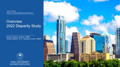
City of Austin Small and Minority Business Resources Overview 2022 Disparity Study Edward Campos, Director, SMBR Tamela Saldana, Ph.D., Assistant Director, SMBR Objectives Background Disparity Study Purpose and Objectives Quantitative & Qualitative Analysis Key Findings Study Recommendations Next Steps City of Austin | SMBR 2 Background • Jan. 2020 – Colette Holt & Associates (CHA) was contracted to conduct the 2022 Disparity Study • April 2020 – Two virtual Public Kick-off webinars were held • 2020 – Launched disparity study website and e-mail account City of Austin | SMBR 3 Disparity Study Purpose and Objectives • Complies with constitutional mandate to regularly review evidence supporting race- and gender-based programs • Provides a legal defense if the programs are challenged • Develops accurate data for annual and contract goal setting • Gathers feedback for program improvements City of Austin | SMBR 4 Quantitative Analysis CHA analyzed the following information: FY 2013 – FY 2018 contract data files 4,741 contract records -1,069 contracts were analyzed for the sample file -*96 % Prime and Subcontractor validation of contract files SMBR’s MBE/WBE Program; and Financial Services Departments’ (Purchasing, Capital Contracting), Public Works’ and Economic Development’s processes and procedures More than 75 documents and information resources City of Austin | SMBR 5 Study Contract Data Contract Type Total Contracts Prime Contracts Subcontracts TOTAL 1,002 842 1,844 Share of Total Contracts 54.3% 45.7% 100.0% Final Contract Data File Net Dollar Value Business Type Total Contract Dollars Prime Contracts $826,453,073.73 $249,783,337.28 Subcontracts Share of Total Contract Dollars 76.8% 23.2% Source: CHA analysis of City of Austin data City of Austin | SMBR 6 Distribution of Contract Dollars Distribution of Contract Dollars by Race and Gender (total dollars) MBE Asian Native American NAICS Black Hispanic White Women M/WBE Total Non- M/WBE TOTAL $15,368,481 $51,392,913 $17,411,303 $754,775 $84,927,473 $60,325,355 $145,252,828 $747,078,317 $892,331,145 Distribution of Contract Dollars by Race and Gender (share of total dollars) Native American White Women MBE Asian NAICS Black Hispanic M/WBE Total Non- M/WBE TOTAL 1.7% 5.8% 2.0% 0.1% 9.5% 6.8% 16.3% 83.7% 100.% Source: CHA analysis of City of Austin data City of Austin | SMBR 7 Weighted Availability Aggregated Weighted Availability for City Contracts Black Hispanic 1.5% 4.7% Asian 1.4% Native American 0.4% MBE 8.0% White Women 6.5% MBE/WBE 14.4% Non- MBE/WBE 85.6% Total 100.0% Source: CHA analysis of City of Austin data City of Austin | SMBR 8 Disparity Ratios Black 118.0% Disparity …
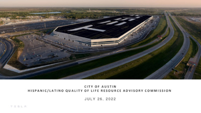
C I T Y O F A U S T I N H I S P A N I C / L A T I N O Q U A L I T Y O F L I F E R E S O U R C E A D V I S O R Y C O M M I S S I O N J U L Y 2 6 , 2 0 2 2 O U R M I S S I O N Accelerate the world’s transition to sustainable energy G I G A F A C T O R Y T E X A S F O O T P R I N T October 2020 January 2021 July 2022 G I G A F A C T O R Y T E X A S C O M M U N I T Y I N V E S T M E N T $2.7 Billion of Real and Business Property 3,500+ Employees (82% Travis County Residents) $50.6 Million paid to HUBs G I G A F A C T O R Y T E X A S C O M M U N I T Y I N V E S T M E N T / O U T R E A C H AISD Eastside Vertical Team American Youth Works Austin Area Urban League Austin Community Foundation Austin Partners in Education Austin Voices for Education and Youth Austin’s Colony HOA Black Leaders Collective Boys and Girls Club Breakthrough Central Texas Central Texas Food Bank Community Advancement Network Communities in Schools E4 Youth EcoRise Girlstart Goodwill Latinitas Latinas in Tech PODER Prado HOA TAAP TOCA Workforce Solutions Capital Area G I G A F A C T O R Y T E X A S C O M M U N I T Y I N V E S T M E N T Financial investment in Del Valle ISD to support: • Deputy Chief Educational Workforce Development • Program Manager of Workforce Readiness • High School Robotics Instructor G I G A F A C T O R Y T E X A S C O M M U N I T Y I N V E S T M E N T Tesla Signing Day 2022 Tesla Sponsored Austin Community College Partnership 72 High School Graduates Entered Manufacturing Development Program …
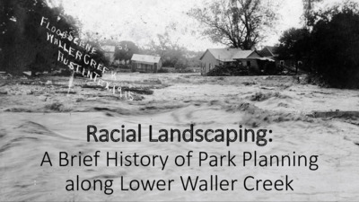
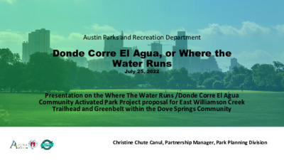
REGULAR MEETING OF THE PARKS AND RECREATION BOARD JULY 25, 2022 – 6:00 PM CITY HALL CHAMBERS, ROOM 1001 301 W. 2ND STREET AUSTIN, TEXAS 78701 Some members of the Parks and Recreation Board may be participating by videoconference. The meeting may be viewed online at: http://www.austintexas.gov/page/watch-atxn-live Public comment will be allowed in-person or remotely via telephone. Speakers may only register to speak on an item once either in-person or remotely and will be allowed up to three minutes to provide their comments. Registration no later than noon the day before the meeting is required for remote participation by telephone. To register to speak remotely, call or email Tim Dombeck, (512) 974-6716, Tim.Dombeck@austintexas.gov. CURRENT BOARD MEMBERS/COMMISSIONERS: Laura Cottam Sajbel (D-9), Chair Sarah Faust (D-5), Vice-Chair Nina Rinaldi (D-1) Anna Di Carlo (D-2) Patrick Moore (D-3) Kathryn Flowers (D-4) Lisa Hugman (D-6) Nancy Barnard (D-7) Kim Taylor (D-8) Dawn Lewis (D-10) Richard DePalma (Mayor) AGENDA CALL TO ORDER PUBLIC COMMUNICATION: GENERAL The first ten speakers signed up prior to the meeting being called to order will each be allowed a three-minute allotment to address their concerns regarding items not posted on the agenda. APPROVAL OF MINUTES Approve the minutes of the Parks and Recreation Board regular meeting of June 27, 2022. DISCUSSION AND ACTION ITEMS Presentation, discussion and possible action on the history of Waller Creek as it pertains to upcoming naming opportunities. (Cottam Sajbel) Presenter(s): Dr. Katherine Pace, Urban Environmental Historian and Dr. Ted Gordon, Founding Chair Department of African and African Diaspora Studies, University of Texas at Austin. Page 1 of 3 1. 2. Presentation, discussion and possible action regarding the Where The Water Runs/Donde Corre El Agua community activated park project proposal for East Williamson Creek trailhead and greenbelt with the Dove Spring Community. (SD23 Strategies: Health & Environment, Culture & Lifelong Learning, Govt that Works for All; PARD Long Range Strategies: Relief from Urban Life, Urban Public Spaces, Park access for All). Presenter(s): Christine Chute Canul, Partnership Manager, Parks and Recreation, Frances Acuña, Go Austin Vamos Austin, Blanca Ortiz, Elena Rodriguez and Enedina Sánchez, E. Williamson Creek Adopters, Bjørn Sletto, School of Architecture at the university of Texas at Austin. Discussion and possible action regarding a recommendation to Austin City Council on guidelines for making decisions about conditional use permits to allow for the sale of alcohol in Parks. (Cottam Sajbel, Di Carlo) Discussion and possible action …
Annual Internal Review 2022 Page 1 of 8 DRAFT Annual Internal Review This report covers the time period of 7/1/2021 to 6/30/2022 ______________________Parks and Recreation Board______________ The Board/Commission mission statement (per the City Code) is: (A) The Parks and Recreation Board membership should include citizens of the city who are interested in public parks and public recreation and persons who are knowledgeable in recreation matters. The director of the Parks and Recreation Department, the city manager or designee, the director of the Financial and Administrative Services Department, and the city attorney are ex officio members of the board. (B) The board shall advise the city council and the city manager regarding: (1) the acquisition, development, improvement, equipment, programming, and maintenance of all land and facilities managed by the Parks and Recreation Department of the City of Austin; (2) the purchase of additional land to be managed by the Parks and Recreation Department of the City of Austin. (C)The board shall outline a general plan of development for land, facilities, and programs. The board may submit the plan to the Planning Commission and the city manager for detail development, and the city manager may then submit the plan to the city council for approval as may be required by the City Code. (D) The board shall promote close cooperation between the City and all private citizens, institutions, and agencies interested in or conducting recreational activities, so that all recreational resources within the City may be coordinated to secure the greatest public welfare. (E) The board shall perform other duties as prescribed by the City Code or as directed by the city council. Annual Internal Review 2022 Page 2 of 8 1. Describe the board’s actions supporting their mission during the previous calendar year. Address all elements of the board’s mission statement as provided in the relevant sections of the City Code. The City of Austin Parks and Recreation Board has three areas of responsibility in its advisory function to the City Council. The activities this board took for fiscal year 2021- 2022 are listed by area below. A. Take action to recommend to City Council and/or Director enhancements, additions, and deletions to Parks and Recreation Department programs and planning. August 24, 2021 1. Recommended to the City Council the negotiation and execution of a partnership agreement with The Trail Foundation for the operations, maintenance, and programming for the Ann and Roy …
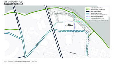
305 S. CONGRESS PUD Proposed Bike Network 1 S T S T R E E T Lady Bird Lake BIKE / PEDESTRIAN TRAIL PROPOSED TRAIL CONNECTION HIGH COMFORT ROAD MEDIUM COMFORT ROAD PROPOSED MEDIUM COMFORT ROAD PROPOSED SHARED ROAD PROPOSED SHARED PATHWAY LANEWAY B Road classifications per Austin bike network C O N G R E S S A V E N U E A Y A W E N A L 305 S. Congress C Y A W E N A L BARTON SPRINGS ROAD EXTENSION B A RT O N S P RIN G S R O A D RIVERSIDE DRIVE 305 S. CONGRESS I CASE NUMBER: C814-89-0003.02 I JUNE 2021 305 S. CONGRESS PUD Proposed Pedestrian Network BIKE / PEDESTRIAN TRAIL LAKEFRONT PEDESTRIAN WALKS SIDEWALK ADJACENT TO ROADWAY PATHWAY / PLAZA C O N G R E S S A V E N U E DRIVEWAY B A Y A W E V R D I C Y A W E V R D I BARTON SPRINGS ROAD EXTENSION 305 S. CONGRESS I CASE NUMBER: C814-89-0003.02 I JUNE 2021
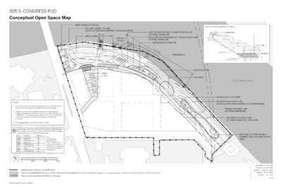
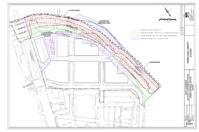
WATER QUALITY FEATURE 25 YEAR FLOODPLAIN LINE 432.57’ ELEVATION ACCORDING TO COA RAS MODEL GREAT LAWN PIER . X A M " 0 - ' 0 7 35''-0" MAX. WATER STEPS 30'-0" MAX. 40'-0" MAX. CRITICAL WATER QUALITY ZONE SETBACK LINE 100’ FROM SHORELINE HALF CRITICAL WATER QUALITY ZONE SETBACK LINE 50’ FROM SHORELINE WATER QUALITY FEATURE 6 75'-0" M A X. 70'-0" X. A M BOARDWALK WATER STEPS CONCEPTUAL DETAIL GREAT STEPS MULTI-USE TRAIL PLAY AREA LADY BIRD LAKE WATER QUALITY FEATURE 100 YEAR FLOODPLAIN LINE 440.88’ ELEVATION ACCORDING TO COA RAS MODEL PRIMARY SETBACK LINE 150’ FROM SHORELINE SECONDARY SETBACK LINE 50’ FROM PRIMARY SETBACK LINE PROPOSED FUTURE PROJECT CONNECT RAIL LINE AND/OR STA- TION Conceptual Open Space Map S O U T H C O N G R E S S A V E N U E NOTES: 1. The location and size of all improvements shown on this Exhibit are approximate and subject to change based upon final design. 2. Location and size of improvements shown on the plan may be modified and approved administratively by city staff, so long as such modification is in accordance with Section 3.1.3. Such modification must be approved by the Parks Department and Watershed Protection. 3. The average width of the trail will be up to 15 feet. In conjunction with the Environmental Protection and Restoration Plan, shoreline improvements include the removal of all non-native, invasive species and the following native trees: Tag # Species DBH (in.) 1086 1087 1396 1397 1402 1414 1450 Sycamore American Elm Sycamore American Elm American Elm Pecan American Elm 16 10 10 11 8 19 14 Note: This table does not represent a comprehensive list of trees located within the PUD that will be affected by the redevelopment of the Property. B A RT O N S P RIN G S R O A D 0 100’ 200’ 300’ Site Boundary (821,517 sf/18.86 acre) Plaza/Landscape Area (69,478 sf/1.59 acre) Park Land (284,418sf/6.53 acre, which includes the inundated land.) *PARKLAND AREA IS SUBJECT TO CHANGE BASED ON FINAL LOCATION AND DESIGN OF CAPMETRO STATION 6 / 8 Submitted: July 24, 2019Updated: June 26, 2020Updated: July 9, 2021Updated: April 14, 2021305 S. CONGRESS PUDCASE NUMBER: C814-89-0003.02Updated: October 12, 2020
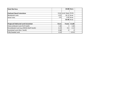
Total Site Area Parkland Owed Calculation Residential units Hotel Units Proposed Dedicated Land Calculation Unencumbered Land (Full Credit) Encumbered Land (e.g CWQZ) (Half Credit) Inundated Land (Zero Credit) Fully Deeded Land 18.86 Acres Units Land Owed (PUD) 24.31 Acres 1375 275 2.09 Acres 26.40 Acres Acres 1.44 4.23 0.86 6.53 Factor Credit 1.44 2.12 0 3.555 1 0.5 0
Racial Landscaping: A Brief History of Park Planning along Lower Waller Creek Austin, 1880 A Social Survey of Austin, 1913 …people are crowded together in small huts, one and two families in a one-room shanty, and little children are forced to play out in the dusty street on the filthy, dirty creek or river bank where their homes are located. A City Plan for Austin, 1928 …we are recommending the ultimate establishment of a neighborhood park in the vicinity of Eleventh and Twelfth Streets just east of the I& G N Railroad…The topography is very rough and is at present occupied by the cheapest type of negro shacks, whereas the property immediately adjoining is more valuable and can eventually be residential property of the highest order. The acquisition of this property for park purposes, and the removal of the present type of development, will increase the value of the surrounding property many times the cost of the acquisition thereof. A City Plan for Austin, 1928 The property immediately north of Palm School, on account of being isolated and cut up by Waller Creek, is very cheap property, and in a neglected state … The block to the west of Palm School … is also very cheap property and will remain so as long as Waller Creek is permitted to continue in its present condition. It is our recommendation that these tracts of land be acquired by the city, and that the course of Waller Creek be straightened … Second Street from Red River to East Avenue and Sabine Street from First to Third could be vacated and this entire tract converted into a very desirable neighborhood play ground. A City Plan for Austin, 1928 [The] Shoal Creek Valley … is flanked on either side by high bluffs, and very desirable residential property. Between the bluffs ... are considerable lowlands which are not particularly desirable for residential use. We are recommending that the lowlands of this valley be acquired for a large park ... to control the nature of developments of the bluff front properties. The completion of this drive will entail the acquisition of certain cheap property along the banks of Waller Creek from Eighth Street to Nineteenth Street. Most of the property which will be needed is at present occupied by very unsightly and unsanitary shacks inhabited by negroes. With these buildings removed...remaining property will be of a substantial …
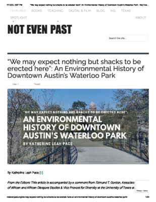
Forgetting Waller Creek: An Environmental History of Race, Parks, and Planning in Downtown Austin, Texas Katherine Leah Pace Journal of Southern History, Volume 87, Number 4, November 2021, pp. 603-644 (Article) Published by The Southern Historical Association For additional information about this article https://muse.jhu.edu/article/840045 Access provided at 5 Dec 2021 03:27 GMT from The University Of Texas at Austin, General Libraries Forgetting Waller Creek: An Environmental History of Race, Parks, and Planning in Downtown Austin, Texas By Katherine Leah Pace Waller Creek is a flood-prone stream that runs through the center of Austin, Texas. To quote Joseph Jones, an English professor who published a 1982 treatise on the waterway, Waller Creek flows “quite literally” through “the inner heart of Austin.” It originates in the city’s north-central suburbs and flows generally south through the University of Texas (UT) flagship campus, past the historic Brackenridge Hospital, around the east side of Capitol Square, which sits on a hill, and down the eastern edge of down- town, where it empties into Town Lake, an impounded stretch of the Colorado River. It is Austin’s most urbanized, polluted, and degraded creek; yet, as ecologists insist, it continues to provide habitat for a host of animal and plant species.1 A “flash flood alley,” central Texas is a convergence zone for divergent weather systems, including massive, humid tropical fronts that roll off the Gulf of Mexico and cold dry fronts that move into Texas from the north and west. When these systems collide, they produce intense storms. Central Texas soils are relatively thin and rocky or heavy in clay, while the region’s terrain is hilly, limiting the soil’s capacity to absorb rainfall. As such, during intense storms, runoff flows rapidly into nearby streams, trig- gering sudden, high-velocity, and enormously destructive flash floods.2 1 Joseph Jones, Life on Waller Creek: A Palaver about History as Pure and Applied Education (Austin, 1982), 8–9 (quotation on 9). In 2007 Town Lake was renamed Lady Bird Lake. I would like to acknowledge the invaluable assistance provided to me by archivists at the Austin History Center and to thank Dr. Sarah Dooling for her encouragement and edits. 2 Texas Department of Insurance, Division of Workers’ Compensation, “Flash Flood Safety,” Take 5 for Safety, no. HS99-501E (05-21), https://www.tdi.texas.gov/pubs/videoresource/t5flood .pdf (quotation); William Keith Guthrie, “Flood Alley: An Environmental History of Flooding in Texas” (Ph.D. dissertation, University of Kansas, 2006), 1–9; Victor R. Baker, Flood …
7/12/22, 4:18 PM Edmund T. Gordon's Bio - Office of the Executive Vice President and Provost Home ▸ The Office ▸ Edmund T. Gordon’s Bio Edmund T. Gordon’s Bio fmiller@austin.utexas.edu C U R R I C U L U M V I TA E Edmund T. Gordon's V I E W / D O W N L O A D Dr. Edmund T. Gordon is an anthropologist whose work focuses on power and social transformation in the Black Diaspora. He is founding C O N TA C T U S Dr. Gordon’s publications have appeared nationally and internationally, CV chair of the Department of African and African Diaspora Studies (2010- 2017), is an associate professor of African and African Diaspora Studies and Anthropology, and is the executive director of the Contextualization and Commemoration Initiative at The University of Texas at Austin. His teaching and research interests include: power and identity in the African Diaspora, critical race and gender theory, and the racial economy of space and resources. and his book Disparate Diasporas: Identity and Politics in an African- Nicaraguan Community (UT Press, 1998), a historical ethnography of Black Nicaraguans’ politics and identity, is currently being translated into Spanish. In an e�ort to bring his scholarship into public engagement, Dr. Gordon has conducted collaborative research projects with communities in Central America funded by Ford Foundation and World Bank. He also received a major grant from the Rockefeller Foundation, which supported his development of the African Diaspora Program in the Department of Anthropology at UT Austin and the expansion of the Center for African and African American Studies, as its director. Under Dr. Gordon’s leadership, the Department of African Diaspora Studies was founded in 2010. He was an elected member of the Austin Independent School District’s Board of Trustees (2015-2018). He continues his service work through the creation of a Racial Geography Tour of UT Austin’s campus. In 2014, Dr. Gordon received UT’s highest honors, a Presidential Citation and the Pro Bene Meritis award in 2016 from the College of Liberal Arts. C O N TA C T U S R E L AT E D Q U I C K L I N K S Phone 512-471-4363 110 Inner Campus Dr. Public Access Fax 512-475-7385 STOP G1000 to Course Email Austin, TX 78712-1701 Information Diversity, Equity & Inclusion provost.o�ce@utexas.edu The O�ce Initiatives News (HB2504) Faculty & Academic Resources UT Austin Home …
Austin Parks and Recreation Department Donde Corre El Agua, or Where the Water Runs July 25, 2022 Presentation on the Where The Water Runs /Donde Corre El Agua Community Activated Park Project proposal for East Williamson Creek Trailhead and Greenbelt within the Dove Springs Community Christine Chute Canul, Partnership Manager, Park Planning Division • Frances Acuña Go Austin Vamos Austin • Blanca Ortíz, Elena Rodríguez and Enedina Sánchez E. Williamson Creek Adopters • Bjørn Sletto School of Architecture at the University of Texas at Austin Agenda • Partners: • Site History • Community Engagement • Community Priorities • Proposed Site Improvements • Next Steps E. Williamson Creek Greenbelt | Dove Springs Partnership We worked in collaboration with: ● Urban Roots youth interns ● UT Professor Bjørn Sletto with School of Architecture and his graduate Community & Regional Planning class ● The community residents of E. Williamson Creek ● Park Ranger Cadets Overview of Community Engagement Creek adopters, students and Urban Roots worked actively through the pandemic speaking individually with neighbors, hosting group discussions, knocking on doors, receiving feedback and designing the project. They also walked the proposed trail. Donde Corre El Agua | Where the Water Runs Donde Corre El Agua | Where the Water Runs • High level priorities that came out of the Community Engagement were: • Culture • Signs designed with community input • History of culture and recipes along the trail signs • Preservation flood mitigation • Conservation • Land preservation for air quality, wildlife and • Neighborhood conservation of culture, values and beliefs are displayed along the flood wall Donde Corre El Agua | Where the Water Runs • Continued priorities of the engagement: • Area must be safe to walk, play and de-stress • Swings, volleyball and basketball • The park should welcome people of all ages to relax and play. • Benches along the trail and tables in open spaces for gathering • Changes should be made in a way that does not hurt the natural environment. • Any changes to the park should be easy-to- maintain and contribute to visitors’ safety and comfort. Next Steps ✔Community Activated Park Project Proposal| Complete (2022) • Neighborhood Partnering Program (NPP) Application • Project Scope and Project Budget Estimate • NPP Board Approval • Design & Permitting • NPP & PARD - Implementation of Identified Priorities • Trailhead, nature trails and placemaking • Partnership - Ongoing …
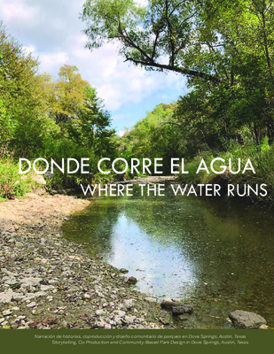
DONDE CORRE EL AGUA WHERE THE WATER RUNS Narración de historias, coproducción y diseño comunitario de parques en Dove Springs, Austin, Texas Storytelling, Co-Production and Community-Based Park Design in Dove Springs, Austin, Texas DONDE CORRE EL AGUA Narración de historias, coproducción y diseño comunitario de parques en Dove Springs, Austin, Texas WHERE THE WATER RUNS Storytelling, Co-Production and Community-Based Park Design in Dove Springs, Austin, Texas August 2021 DONDE CORRE EL AGUA WHERE THE WATER RUNS Autores Authors Samira Bashar Alaina Bompiedi Caitin Hartnett Jongmoon Lee Jorge Losoya Raviya Mysorewala Michelle Parke Veronica Romero Editor Editor Bjørn Sletto Community and Regional Planning School of Architecture The University of Texas at Austin Project Website: https://sites.utexas.edu/environmentaljustice-austin/ Story Map: https://arcg.is/1eOC5j The University of Texas at Austin School of Architecture 310 Inner Campus Drive B7500 Austin, TX 78712-1009 www.soa.utexas.edu/programs/commu- nity-and-regional-planning Go Austin/Vamos Austin 3710 Cedar Street Suite #230 Austin, TX 78705 www.goaustinvamosaustin.org/ Urban Roots 4900 Gonzales St. Austin, TX 78702 www.urbanrootsatx.org/ Este proyecto fue fondeado por la Fundación Hogg a través de la Escuela de Arquitectura de La Universidad de Texas en Austin. Fue definido como un Proyecto Académico solo con propósitos educativos por la Oficina de Apoyo y Cumplimiento de la Investigación (RSC) de La Universidad de Texas. Este trabajo fue facilitado y supervisado por GAVA, Urban Roots y los Creek Adopters. This project was supported with funding from the Hogg Foundation through the School of Architecture, The University of Texas at Austin. Defined as a Class Project for educational use only by the Office of Research Support and Compliance (RSC), The University of Texas, the work was facilitated and supervised by GAVA, Urban Roots, and the Creek Adopters. AGRADECIMIENTOS ACKNOWLEDGEMENTS Este proyecto comunitario se originó con el liderazgo de Blanca Ortiz, Elena Rodríguez y Enedina Sánchez, residentes de mucho tiempo de Dove Springs quienes adoptaron esta porción del Cinturón verde Williamson Creek a través de Keep Austin Beatiful. Nuestro grupo de estudiantes y profesores de la UT estamos profundamente agradecidos con Blanca, Elena y Enedina sus invitarnos a participar en por incansables esfuerzos de mejorar el parque de su vecindario. Nos gustaría agradecer también a Carmen Llanes Pulido y Frances Acuña de GAVA y Ana Aguirre con el equipo Southeast Neighborhood Contact por habernos dado la bienvenida como socios, además de facilitar el involucramiento con los residentes. Nuestro más profundo agradecimiento para Sydney Corbin con Urban Roots, sin cuyo comprometido liderazgo, atento …
Republic Square Conditional Use Permit Parks Board Meeting May 23, 2022 City of Austin Parks and Recreation Department: Reynaldo Hernandez, PLA Project Manager Downtown Austin Alliance Foundation: Molly Alexander, Executive Director Angela Navarro, Community Outreach Coordinator WHO, WHAT AND WHY WHO is involved: City of Austin Parks and Recreation Department and the Downtown Austin Alliance Foundation WHAT is the purpose: Permit the consumption of alcohol at the designated areas in Republic Square WHY are we here: To align current permit with City of Austin Land Development Code Republic Square Conditional Use Permit (CUP) OVERVIEW AND BACKGROUND Republic Square park renovation completed in Fall 2017 Salt & Time Café received a TABC permit and began the sale of alcohol from vendor on park premises in 2020 CONDITIONAL USE PERMIT CUP required for sale of alcohol on public property CUP changes the zoning of the property from ‘PUBLIC’ to PARK AND RECREATION SERVICES (SPECIAL)’ which will permit the sale of alcohol on the grounds The CUP does not apply to special events. Events at Republic Square will continue to need a separate agreement for alcohol sales. Republic Square Conditional Use Permit (CUP) CUP PROCESS SUBMITTAL TO DEVELOPMENT SERVICES START JANUARY 2022 COMMUNITY ENGAGEMENT Open House APRIL 13, 2022 PARKS AND RECREATION BOARD PLANNING COMMISSION MAY 2022 COMPLETE AUG./SEPT. 2022 The CUP does not apply to special events Events at Republic Square have a separate agreement for alcohol sale and area. Republic Square Conditional Use Permit (CUP) Republic Square Park Context TEXAS ALCOHOL BEVERAGE COMMISION • The license allows for the sale of alcohol on-premises and in designated areas. • Permit issued for a 2-year duration and is renewable. • Austin Police Department can issue citations for consumption of alcohol outside • No one under the age of 18 can sell alcohol. No one under the age of 21 can of defined boundaries. consume alcohol. Republic Square Conditional Use Permit (CUP) OPERATIONAL PLAN • Downtown Austin Alliance Park Ambassadors are present to ensure compliance with CUP from 6 am to 10 pm daily. • Downtown Austin Alliance Foundation agreement with the vendor to adhere to TABC guidelines. Republic Square Conditional Use Permit (CUP) EXAMPLES OF URBAN PARKS WHERE ALCOHOL SALE IS ALLOWED DALLAS • Klyde Warren Park • Tietze Park • Crowley Park HOUSTON • Discovery Green • Market Square Park San Antonio • Hemis Fair • Tower of the Americas • La …
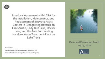
Presented by: Gabrielle Restivo, Contract Management Specialist IV, and Amanda Ross, Division Manager, Natural Resources Programs Parks and Recreation Board July 25, 2022 1 AGREEMENT HISTORY • The City entered into an agreement with the Lower Colorado River Authority (LCRA) on July 26, 2007, for buoy installation and maintenance to alert boaters to the hazards associated with the floodgates and spillway of the then recently renovated Tom Miller Dam. • In July 2013, this agreement was amended to include the City’s water treatment plants and other improvements abutting or adjacent to Lake Austin, Lady Bird Lake, Decker Lake, and the area surrounding Handcox Water Treatment Plant on Lake Travis. • This agreement expires on December 30, 2022, and will be replaced by the proposed agreement. 2 3 SERVICES AND DELIVERABLES City and LCRA will together: LCRA will: City will: • Determine the location, type, number, and anchoring of the buoys. • Provide all labor and equipment for buoy installation. • Establish processes and • Maintain, repair, or • Pay for the cost of buoys and installation ($5,000- 10,000 annually). • Assist if requested as mutually agreed. procedures for the purchase and installation of buoys. • Mutually loan equipment for the purposes of the agreement. replace damaged buoys subject to staffing, funding, and water and weather conditions. 4 AGREEMENT TERM APPROVALS REQUIRED • Five years with two additional five- year terms upon written agreement • Austin City Council • LCRA Board of Directors 5 ACTION REQUESTED Recommend that the City Council authorize the negotiation and execution of an interlocal agreement with LCRA for the installation, maintenance, and replacement of buoys to assist boaters in recognizing hazards on Lake Austin, Lady Bird Lake, Decker Lake, and the area surrounding Handcox Water Treatment Plant on Lake Travis. 6
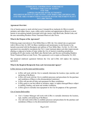
INTERLOCAL COOPERATION AGREEMENT BETWEEN THE CITY OF AUSTIN AND THE LOWER COLORADO RIVER AUTHORITY REGARDING BUOYS AT LAKE AUSTIN, LADY BIRD LAKE, DECKER LAKE, AND THE AREA SURROUNDING HANDCOX WATER TREATMENT PLANT ON LAKE TRAVIS Agreement Overview: City of Austin agrees to work with the Lower Colorado River Authority (LCRA) to install, maintain, and replace buoys, signs, cables and/or markers and appurtenances (Buoys) to assist boaters in recognizing hazards associated with Lake Austin, Lady Bird Lake, Decker Lake, and the area surrounding Handcox Water Treatment Plant on Lake Travis. What is the Purpose of the Agreement? Following major renovations to Tom Miller Dam in 2005, the City entered into an agreement with LCRA on July 26, 2007, for Buoy installation and maintenance to alert boaters to the hazards associated with the floodgates and spillway of Tom Miller Dam. On July 16, 2013, this agreement was amended to incorporate the City’s water treatment plants and other improvements abutting or adjacent to bodies of water within the City of Austin's controlling jurisdiction, including all of Lake Austin, Lady Bird Lake, Decker Lake, and the area surrounding Handcox Water Treatment Plant on Lake Travis. This agreement is set to expire on December 30, 2022. The proposed interlocal agreement between the City and LCRA will replace the expiring agreement. What is the Required Reciprocity from each Governmental Agency? LCRA Services to be Provided and Deliverables • LCRA will work with the City to mutually determine the location, type, number, and anchoring of the Buoys. • LCRA will work with the City to establish processes and procedures for the purchase and installation of Buoys in the aforementioned waterways. • LCRA will provide all labor and equipment for Buoy installation. • LCRA agrees to use best efforts to maintain, repair, or replace damaged Buoys subject to staffing, funding, and water and weather conditions. • LCRA agrees to mutually loan equipment to the City for purposes of the agreement. City of Austin Deliverables • City’s Contract Manager will work with LCRA to mutually determine the location, type, number, and anchoring of the Buoys. • City will work with LCRA to establish processes and procedures for the purchase and installation of Buoys in the aforementioned waterways. Page 1 of 2 INTERLOCAL COOPERATION AGREEMENT BETWEEN THE CITY OF AUSTIN AND THE LOWER COLORADO RIVER AUTHORITY REGARDING BUOYS AT LAKE AUSTIN, LADY BIRD LAKE, DECKER LAKE, AND THE AREA SURROUNDING …
CEMETERY OPERATIONS Perpetual Care Fund Parks and Recreation Board Presentation July 2022 MISSION STATEMENT | Cemetery Operations strives to honor the past, present, and future of Austin’s sacred municipal burial grounds with integrity, empathy, and respect. VISION STATEMENT | Cemetery Operations utilizes available resources to provide the best quality of service and care to our diverse community and historic cemeteries. The Founding of Historic Cemeteries 1839 • Oakwood Cemetery 1872 • Stanley- Nolen 1878 • Cemetery at Longview Park 1898 • Plummers Cemetery 1915 • Oakwood Cemetery Annex 1926 • Evergreen Cemetery 1927 • Austin Memorial Cemetery • 24 FTE’s, 6 administrative, 18 grounds • 200+ acres • 400+ burials/year • 80,000 burials total • Spaces sold in two • Approximately 30 acres of undeveloped land at Austin Memorial Park for future burials 2 What Is The Perpetual Care Fund(PCF)?: The Perpetual Care Trust Fund ("PCF“) was created by City Council in 1983 pursuant to the statutory predecessor of: Texas Health and Safety Code Chap. 713, Subchap. A. The PCF is currently codified in City Code Chap. 10-1. The purpose of the Fund is to assure the perpetual maintenance of the cemetery lots and graves in the City cemeteries; invest and reinvest money in trust accounts in the Trust Fund; and apply the income earned by the Trust Fund that is in excess of the amount necessary to maintain the individual cemetery lots or graves to the beautification of the city cemeteries generally. 3 Perpetual Care Fund History: • Council established PCF, directing that 25% of the sale of each cemetery plot be deposited in the Fund. This practice was discontinued in 1982. 1959 • Council transferred PCF funds into Cemetery Endowment 1982 Fund(established in 1982. 1985 • City became the trustee for ten small, individual trusts transferred from Texas Commerce Bank and Bank One into the PCF. Based on existing records, it is unclear whether these are the only individual trusts – i.e., trusts established for the maintenance of a specific lot or gravesite -- that were ever created pursuant to Chap. 10-1. 1990 • Council merged Cemetery Endowment Fund into PCF. 4 What Is The Current Balance of The PCF: $1 million (Current Principle) $10,000 ( Interested Yielded and Deposited In GF) $3.3 million (Current Budget Funded by GF) $330 million (Amount needed in PCF to be solvent) Meanwhile, deferred maintenance at the cemeteries remains a significant issue. …
PERPETUAL CARE FUND - FAQ The City of Austin Parks and Recreation Department (PARD) assumed management of the City's five historic cemeteries on November 1, 1986. Until March 2013, PARD used a contractor, InterCare Corporation, exclusively for cemetery sales, operations, maintenance and management. In assuming direct management of the five City cemeteries, PARD staff uncovered a number of operational and administrative challenges that not only required thorough research, but also required the development and implementation of new processes and procedures in accordance with established State and City laws and industry best practices. Systematically, PARD addressed a number of issues and recently uncovered an additional challenge related to the Perpetual Care Fund (PCF). Unfortunately, other immediate challenges associated with direct cemetery management prevented PARD from addressing this issue until this time. What is the purpose of the Perpetual Care Fund The Perpetual Care Trust Fund ("PCTF" or "Fund") was created by City Council in 1983 pursuant to the statutory predecessor of Texas Health and Safety Code Chap. 713, Subchap. A. The PCTF is currently codified in City Code Chap. 10-1, Art. 2. See Attachment 1. The purpose of the Fund is to assure the perpetual maintenance of the cemetery lots and graves in the city cemeteries; invest and reinvest money in trust accounts in the Trust Fund; and apply the income earned by the Trust Fund that is in excess of the amount necessary to maintain the individual cemetery lots or graves to the beautification of the city cemeteries generally. When was the last contribution made to the PCF The Cemetery Perpetual Care Interest Fund was utilized for expenditures to operate and maintain the City of Austin’s cemetery until FY 2013-14, when all costs associated with cemetery operations were moved to the General Fund. The remaining balance of the fund was transferred to a separate account in FY 2013-14. The Cemetery Perpetual Care Principal Fund has a current balance of approximately $1 million. Annual interest earnings on this principal are approximately $10,000 and the interest is recorded as revenue that goes back into the General Fund. The balance must remain in the fund due to legal requirements (City Code: Article 2. Section 10‐1‐11). What is the current balance of the PCF Councilman Bechtol moved to increase cemetery lot charges and set up a special fund for perpetual care to receive 25% of each lot sale. Minutes of the City Council …
M E M O R A N D U M Parks and Recreation Board Kimberly A. McNeeley, M. Ed., CPRP, Director Austin Parks and Recreation Department July 20, 2022 TO: FROM: DATE: SUBJECT: Dissolving the Perpetual Care Trust Fund The purpose of this memorandum is to provide information related to the origin and purpose of the Perpetual Care Trust Fund (PCF), as well as provide justification for why it should be dissolved. The PCF was created by City Council in 1983 pursuant to the statutory predecessor of Texas Health and Safety Code Chap. 713, Subchapter A. The PCF is currently codified in City Code Chap. 10-1, Art. 2. The purpose of the fund is to assure the perpetual maintenance of the cemetery lots and graves in the City cemeteries; invest and reinvest money in trust accounts; and apply the income earned by the PCF, that is in excess of the amount necessary to maintain the individual cemetery lots or graves, to the beautification of City cemeteries generally. The Parks and Recreation Department’s (Department) objective, since it assumed direct responsibility for cemetery maintenance in 2013, has been to provide the same level of care to all graves, lots and public areas in the five City-owned cemeteries. The amount of income generated from the PCF principal is a small fraction of the Department’s cemeteries budget. Meanwhile, deferred maintenance at the cemeteries remains a significant issue, and its cost alone exceeds the cemeteries budget. The Department would prefer the PCF principal be moved into a Capital Improvement Project account or a Special Revenue account that is specifically for cemetery maintenance and operations. This would allow the funds to roll over each fiscal year as needed to cover differed maintenance. Before the PCF can be dissolved, the Texas State Legislature must pass an amendment to Health and Safety Code Chapter 713 that gives Austin City Council permission to do so. The Parks and Recreation Board can aid this process by recommending that Austin City Council support an amendment to State Law to allow the City to dissolve the Perpetual Care Trust Fund and use the principal for general cemetery maintenance and capital improvements. cc: Jodi Jay, M.B.A., CPRP, Assistant Director Liana Kallivoka, PhD, PE, LEED Fellow, Assistant Director Lucas Massie, M.Ed., CPRP, Assistant Director Suzanne Piper, DBA, Chief Administrative Officer Page 1 of 1
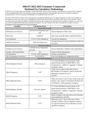
Austin Parks and Recreation Department Presentation on: Parkland Dedication Requirements for Commercial Developments Paul Books, Planner III; Robynne Heymans, Planner Senior; Thomas Rowlinson, Principal Planner; Randy Scott, Program Manager - Parks and Recreation Department July 25th, 2022 1 Proposed Formula Required Parkland = 9.4 acres X Functional Population 1,000 people • 9.4 acres per 1,000 people equals the established parks level of service • Functional Population • The estimated commuter workforce of a new development discounted by their relative opportunity to access parkland, representing the full-time equivalent population of new development • Functional Population = Employee Density X Occupancy Rate X Operation Time X Percent Commuter from Outside City Limits Employee Density (SF Per Employee) Occupancy Rate Operational Hours Percent Commuter Industrial Retail Office Hotel 2,500 SF 550 SF 300 SF 1,500 SF 94% 95% 92% - 70.8% 37.5% 23.8% 70.8% 58% 58% 58% 58% 2 2 Proposed Requirements Land Dedication – 9.4 Acres per 1,000 functional population Fee-in-Lieu – $3,781.32 per functional population Development Fee – $351.85 per functional population Per SF by Use Category: Fee-in-Lieu Development Fee Office $1.6007/SF $0.1489/SF Total: $1.7497/SF Retail $1.4206/SF $0.1322/SF $1.5528/SF Industrial $0.5838/SF $0.0543/SF $0.6382/SF Hotel $1.0352/SF $0.0963/SF $1.1315/SF Figures are preliminary and subject to change 3 3 Example of Application - Mixed Use Commercial Step 1: Calculate Estimated Employees in Commercial Space Total SF SF/Employee Total Employees 136,000 300 453 Commercial Step 2: Derive Functional Population of Commercial Space Employees Occupancy Operation Hours Percent Commuter Functional Population 92% B 23.8% 58% 57.57 C D Formula = A * B * C * D Total 453 A Commercial Step 3: Calculate Requirements of Commercial Space Commercial Land Owed 0.54 acres Formula = (Functional Population/1000) x 9.4 acres Commercial Fee-In-Lieu $217,695 Commercial Development Fee $20,250 Formula = SF of Development x $1.6007 Formula = SF of Development x $0.1489 Total Requirement: Land Owed 5.48 acres Fee-In-Lieu $1,117,376 Development Fee $182,935 Residential Step 1: Calculate Residential Population Residential Step 2: Calculate Residential Requirements Total Units SMART Units Resident Population 309 0 525 Residential Land Owed 4.94 acres Residential Fee-In-Lieu $899,681 Residential Development Fee $162,685 4 Figures are approximate Formula = (Total Units x 1.7 / 1,000)*9.4 Formula = People x $2,912.17 Formula = People x $526.49 Example of Application - Office Urban Office Hypothetical Step 1: Calculate Estimated Employees Total SF SF/Employee Total Employees 325,000 300 1,083 Step 2: Derive Functional Population Operation Hours Total …
PROPOSED CHANGES TO ARTICLE 14 (PARKLAND DEDICATION) ADDING COMMERCIAL PARKLAND DEDICATION REQUIREMENTS DRAFT SUBJECT TO ADDITIONAL CHANGES VERSION TWO ARTICLE 14. PARKLAND DEDICATION.1 § 25-1-601 GENERAL PROVISIONS. (A) The City of Austin has determined that recreational areas in the form of public parks are necessary for the well-being of residents and employees. The City has further determined that the approval of new residential and commercial development is reasonably related to the need for additional parkland and park amenities to serve new development. This article establishes a fair method for determining parkland dedication, or the payment of a fee in-lieu of dedication, to be required as a condition to the approval of new development in an amount proportionate to the impact of development on existing parks and established levels of service. (B) Except as otherwise provided in this section, the parkland dedication requirements of this article apply to: (1) a residential and commercial subdivision within the planning jurisdiction; a site plan within the zoning jurisdiction that includes residential units or commercial square footage [a hotel-motel use]; and a [residential]building permit for residential and commercial development, as provided under Section 25-1-608 (Dedication of Land or Payment In-Lieu at Building Permit). (C) The following are exempt from the requirements of this article: a subdivision or site plan for which parkland was previously dedicated or payment made under this title, except for the dwelling units or commercial square footage [lots] that exceed the number for which dedication or payment was made; (2) development within the City's extraterritorial jurisdiction that is within Travis County and governed by Title 30 (Austin/Travis County Subdivision Regulations); and (3) affordable dwelling units that are certified under the S.M.A.R.T. Housing Policy approved by the city council. (2) (3) (1) (D) The following definitions apply throughout this article: (1) ANNUAL OCCUPANCY RATE means the hotel-motel occupancy rate for the City of Austin, as reported annually by the Texas Economic Development & Tourism Office. (2) COMMERCIAL OCCUPANCY RATE means the City of Austin’s current commercial occupancy rate as determined annually by the director annually using the most recent data from the Austin Chamber of Commerce or a comparable source if deemed appropriate by the director. (3) COMMUTER POPULATION PERCENTAGE means the percentage of employees who live outside the City of Austin’s corporate limits, as determined by the most recent United States Census. 1Editor's note(s)—Ord. No. 20160128-086, Pt. 2, adopted February 8, 2016 …
Updated : 6/27/22 --Draft: Study of Parkland Dedication Requirements for Commercial Uses-- This study provides an overview of parkland dedication as it pertains to retail, industrial, and office uses, as directed by City Council in Resolution No. 20220407-042, passed April 7th, 2022. This Study, produced by the Parks and Recreation Department, outlines the applicability of creating a new ordinance to require parkland dedication for commuters of commercial developments and outlines the methodology behind said ordinance. This Study may be used as the basis for creating a parkland dedication commuter commercial ordinance, for review and approval by City Council after a public and stakeholder engagement period. Purpose Parkland is an essential city service that affords well documented economic, recreational, physical, and mental health benefits to its users (see research conducted by RigolonError! Hyperlink reference not valid. 2022, who cite CromptonError! Hyperlink reference not valid. 2019, and Markevych, et al. 2017). The current parkland dedication ordinance is a critical tool that allows the Parks and Recreation Department (PARD) to mitigate the impact of new users on the park level of service for the people of Austin in accordance with goals and mandates set forth in the City Charter, City Council Resolution 20091119-068, Imagine Austin Comprehensive Plan, and the PARD Long Range Plan. Parks provide recreational opportunities, create community, preserve the city’s character and natural resources, contribute to economic growth and tourism, increase transportation opportunities, and keep Austin beautiful. Parkland dedication requires new developments to account for their direct impact on the existing park system, thereby addressing several of the Imagine Austin Comprehensive Plan’s key goals including : “Expanding Transportation Choices” in Austin. “Tackling the Ethnic Divide”, “Prosperity for All”, “Protecting Our Natural Resources” and “Preserving Livability” by providing consistent parkland under rapidly changing development conditions. On February 25, 2020, the Parks and Recreation Board passed Recommendation 20200225-B3, which included the provision that commercial developments be subject to parkland dedication requirements. On March 28, 2022, the Parks and Recreation Board reaffirmed its support to require parkland dedication for office, retail, and industrial developments in Recommendation 20220328-B5. Enacting this provision would better provide parkland to Austin’s growing workforce; currently, 58% of the workforce commute from outside the city limits, and as such are not served by the existing parkland dedication ordinance, which only addresses the impact of full-time residential and hotel developments. Research shows that access to parkland is directly connected to an individual’s …
PLD Commercial Development Input SURVEY RESPONSE REPORT 09 May 2022 - 11 July 2022 PROJECT NAME: Parkland Dedication for Commercial Development PLD Commercial Development Input : Survey Report for 09 May 2022 to 11 July 2022 SURVEY QUESTIONS Page 1 of 57 PLD Commercial Development Input : Survey Report for 09 May 2022 to 11 July 2022 Q1 Approximately how far is your place of work from a public park? 16 (5.0%) 16 (5.0%) 109 (33.7%) 109 (33.7%) 72 (22.3%) 72 (22.3%) 58 (18.0%) 58 (18.0%) 68 (21.1%) 68 (21.1%) Question options Less than 1/4 mile 1/4 to 1/2 mile 1/2 to 1 mile More than 1 mile I do not know where the closest park or natural space is Optional question (321 response(s), 8 skipped) Question type: Radio Button Question Page 2 of 57 PLD Commercial Development Input : Survey Report for 09 May 2022 to 11 July 2022 Q2 How often do you access public parks before, during, or after work? 25 (7.7%) 25 (7.7%) 47 (14.5%) 47 (14.5%) 30 (9.3%) 30 (9.3%) 37 (11.4%) 37 (11.4%) 185 (57.1%) 185 (57.1%) Question options Never Rarely (fewer than 5 times a year) Occasionally (5 to 10 times a year) Sometimes (10 to 20 times a year) Often (more than twice a month) Optional question (322 response(s), 7 skipped) Question type: Radio Button Question Page 3 of 57 PLD Commercial Development Input : Survey Report for 09 May 2022 to 11 July 2022 Q3 If you visit park space before, during, or after the work day, please share how you use the park (choose all that apply). 250 190 275 250 225 200 175 150 125 100 75 50 25 145 109 50 34 Question options Other (please specify) Exercise (walking, running, biking, workout equipment, etc.) Relaxation, meditation, mental breaks Eating or picnicking Part of your commute to or from work Connecting with friends or family Optional question (304 response(s), 25 skipped) Question type: Checkbox Question Page 4 of 57 PLD Commercial Development Input : Survey Report for 09 May 2022 to 11 July 2022 Q4 What park amenities would encourage you to visit a nearby public park before, during, or after the work day? (choose all that apply) 251 203 184 115 91 79 71 95 59 275 250 225 200 175 150 125 100 75 50 25 Question options Multipurpose field or lawn Exercise or workout equipment Trails …
DRAFT 2022-2023 Commuter Commercial Parkland Fee Calculation Methodology In 2022 the City Council approved Ordinance XXXXXXXXXX which created a formula to determine the commercial fees required in-lieu of parkland dedication. The Ordinance requires an annual adoption of the parkland dedication fees during the annual fee schedule process. The fee calculation methodologies are established in § 25-X-XXX The below 2022-2023 fees reflect the Council approved calculation methodology to be adopted annually. Several of the variables in the formula are static from year to year, including the square feet per person and the operations hours. Some of the variables will be reevaluated each year based on publicly available data, such as the occupancy rate and the percent commuter workforce, as well as the fees-in-lieu of parkland land dedication and park development. The only variable in the above formula that is unique to the new development is the total square feet of the development. Variables Calculation Factor Description Parkland Level of Service Service Population / Park Acres Fee In-Lieu of Land 96.70 Service Population per 1 acre Park Acres City Population 10,086.32 Park Acres (excludes Metro and District Parks) Parkland Cost Factor $365,653.44 per acre 975,321 (2021 Population) Current City Population Average land cost of acres purchased over the last five years Park Development 4,046.98 Service Population per park Facilities Level of Service Service Population / Number of Developed Parks Number of Developed Parks City Population Park Development Cost Factor 241 975,321 (2021 Population) $1,423,928.42 Count of all developed parks Current city population Cost of developing one Neighborhood Park Functional Population Office Employee Density 300 sq ft /person Office Occupancy 0.92 Office Operation Hours 0.238 Retail Employee Density 550 sq ft / person Retail Occupancy Retail Operation Hours 0.95 0.375 U.S. Green Building Council estimate of the square feet per person in LEED BD+C: New Constructionv4 - LEED v4. Appendix 2. Default occupancy counts Austin area occupancy rates derived from the Chamber of Commerce 'Austin Area Profile' reflecting occupancy by use in Q2 2021 Office use occurs 5 out of 7 days of the week, and 8 hours a day, equal to 23.8 percent (40 hours out of 168 hours a week) operation occupancy. U.S. Green Building Council estimate of the square feet per person in LEED BD+C: New Constructionv4 - LEED v4. Appendix 2. Default occupancy counts Retail occupancy rates derived from NAI Partners report published in Q2 2021 Retail use occurs …