3-2: Where the Water Runs Final Report — original pdf
Backup
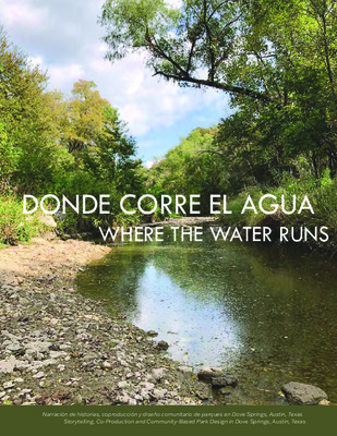
DONDE CORRE EL AGUA WHERE THE WATER RUNS Narración de historias, coproducción y diseño comunitario de parques en Dove Springs, Austin, Texas Storytelling, Co-Production and Community-Based Park Design in Dove Springs, Austin, Texas DONDE CORRE EL AGUA Narración de historias, coproducción y diseño comunitario de parques en Dove Springs, Austin, Texas WHERE THE WATER RUNS Storytelling, Co-Production and Community-Based Park Design in Dove Springs, Austin, Texas August 2021 DONDE CORRE EL AGUA WHERE THE WATER RUNS Autores Authors Samira Bashar Alaina Bompiedi Caitin Hartnett Jongmoon Lee Jorge Losoya Raviya Mysorewala Michelle Parke Veronica Romero Editor Editor Bjørn Sletto Community and Regional Planning School of Architecture The University of Texas at Austin Project Website: https://sites.utexas.edu/environmentaljustice-austin/ Story Map: https://arcg.is/1eOC5j The University of Texas at Austin School of Architecture 310 Inner Campus Drive B7500 Austin, TX 78712-1009 www.soa.utexas.edu/programs/commu- nity-and-regional-planning Go Austin/Vamos Austin 3710 Cedar Street Suite #230 Austin, TX 78705 www.goaustinvamosaustin.org/ Urban Roots 4900 Gonzales St. Austin, TX 78702 www.urbanrootsatx.org/ Este proyecto fue fondeado por la Fundación Hogg a través de la Escuela de Arquitectura de La Universidad de Texas en Austin. Fue definido como un Proyecto Académico solo con propósitos educativos por la Oficina de Apoyo y Cumplimiento de la Investigación (RSC) de La Universidad de Texas. Este trabajo fue facilitado y supervisado por GAVA, Urban Roots y los Creek Adopters. This project was supported with funding from the Hogg Foundation through the School of Architecture, The University of Texas at Austin. Defined as a Class Project for educational use only by the Office of Research Support and Compliance (RSC), The University of Texas, the work was facilitated and supervised by GAVA, Urban Roots, and the Creek Adopters. AGRADECIMIENTOS ACKNOWLEDGEMENTS Este proyecto comunitario se originó con el liderazgo de Blanca Ortiz, Elena Rodríguez y Enedina Sánchez, residentes de mucho tiempo de Dove Springs quienes adoptaron esta porción del Cinturón verde Williamson Creek a través de Keep Austin Beatiful. Nuestro grupo de estudiantes y profesores de la UT estamos profundamente agradecidos con Blanca, Elena y Enedina sus invitarnos a participar en por incansables esfuerzos de mejorar el parque de su vecindario. Nos gustaría agradecer también a Carmen Llanes Pulido y Frances Acuña de GAVA y Ana Aguirre con el equipo Southeast Neighborhood Contact por habernos dado la bienvenida como socios, además de facilitar el involucramiento con los residentes. Nuestro más profundo agradecimiento para Sydney Corbin con Urban Roots, sin cuyo comprometido liderazgo, atento consejo y generosidad, este proyecto no hubiera sido posible. A los jóvenes practicantes de Urban Roots, quienes trabajaron con nosotros los últimos ochos meses, muchas gracias por sus ideas y creatividad: Gerardo, Ulises, Angelica, Melanie, Audrey, Nick, Emilio, Stefany, Briana, Eloy, Rodolfo, Javier and Nashley. Tenemos una enorme gratitud a Kerstin Johansson con el programa Park Ranger Education & Outreach del Departamento de Parques y Recreaciones de la ciudad de Austin por presentarnos al Cadete de Parques Uriel Martínez, quien se convirtió en un socio invaluable de nuestro trabajo. Todos apreciamos enormemente el apoyo continuo y el atento consejo de Preston Stewart y Peter Babrow del Programa Team This community-based project originated with the leadership of Blanca Ortiz, Elena Rodriguez and Enedina Sánchez, long-time residents of Dove Springs who adopted this portion of the Williamson Creek Greenbelt through Keep Austin Beautiful. Our group of UT students and faculty are deeply grateful to Blanca, Elena and Enedina for inviting us to participate in their tireless efforts to improve their neighborhood park. We would also like to thank Carmen Llanes Pulido and Frances Acuña with GAVA and Ana Aguirre with the Southeast Neighborhood Contact for welcoming us as partners and facilitating our engagement with residents. Our deepest appreciation goes to Sydney Corbin with Urban Roots, without whose committed leadership, thoughtful advice and generosity this project would not have been possible. To the youth interns of Urban Roots who worked with us over the past eight months: thank you so much for your insights and creativity: Gerardo, Ulises, Angelica, Melanie, Audrey, Nick, Emilio, Stefany, Briana, Eloy, Rodolfo, Javier and Nashley. We owe a debt of gratitude to Kerstin Johansson with the Park Ranger Education & Outreach program of the City of Austin Parks & Recreation Department for introducing us to Park Cadet Uriel Martinez, who became an invaluable partner in our work. All of us greatly appreciate the continuous support and thoughtful counsel of Preston Stewart and Peter Babrow of the City of Austin Neighborhood Partnering Program. We also benefited tremendously from the generous assistance of Matt Hollon, Erin Wood, Katina Bohrer, Roxanne Jackson, and Scott Avery with the City of Austin Watershed Protection Department in determining structural and regulatory opportunities and limitations of the project site. Susan Garnett and Andrea Bates provided us with a deeper understanding of long-range planning and community engagement efforts underway in the Watershed Protection Department and helped shape our own work in the community. We also want to thank Christine Chute Canul, Partnership & Development Administrator with the City of Austin Parks & Recreation Department, for laying the foundation for this initial community-based study and design project, and Community Art Advocates Monica Maldonado and Filiberto Medieta for helping us conceptualize the community mural and bringing it closer to reality. de Asociación Vecinal de la ciudad de Austin. También nos beneficiamos ampliamente de la generosa cooperación de Matt Hollon, Erin Wood, Katina Bohrer, Roxanne Jackson, y Scott Avery del Departamento de Protección de Cuencas Hidrográficas de la ciudad de Austin, en la determinación de oportunidades, limitaciones estructurales y regulatorias del sitio del proyecto. Susan Garnett y Andrea Bates nos brindaron un panorama profundo de la planificación a largo plazo y los esfuerzos de participación comunitaria en curso del Departamento de Protección de Cuencas Hidrológicas, además de ayudarnos a conformar nuestro comunidad. También queremos agradecer a Christine Chute Canul, Partnership & Development Administrator con el Departamento de Parques y Recreaciones de la ciudad de Austin por sentar las bases de este incipiente proyecto de estudio y diseño basado en la comunidad y a los Defensores de Arte Comunitario, Mónica Maldonado y Filiberto Medieta, por ayudarnos a conceptualizar el mural comunitario y estar más cerca de volverlo una realidad. trabajo en la Blanca Ortiz, Elena Rodriguez, Enedina Sánchez Creek Adopters Frances Acuña GAVA Bjørn Sletto UT Austin ÍNDICE DE CONTENIDOS TABLE OF CONTENTS 01 09 19 23 35 49 55 63 87 97 Capítulo 1: Introducción Chapter 1: Introduction Capítulo 2: El Sitio Chapter 2: Site Context Capítulo 3: Marco Teórico Chapter 3: Theoretical Approach Capítulo 4: Narración de Historias Chapter 4: Storytelling Capítulo 5: Diseño Chapter 5: Design Capítulo 6: Lenguaje Chapter 6: Language Capítulo 7: Hallazgos Chapter 7: Findings Capítulo 8: Recomendaciones Chapter 8: Recommendations Capítulo 9: Discusión Chapter 9: Discussion Referencias References INTRODUCCIÓN INTRODUCTION Este proyecto creció por la iniciativa de tres residentes de Austin, Blanca Ortíz, Elena Rodríguez y Enedina Sánchez, de transformar una sección al este del cinturón verde del Williamson Creek en un parque seguro y acogedor para los vecinos. El enfoque del proyecto es una sección de área de parque dentro del Cinturón verde que se extiende desde Pleasant Valley Road Bridge hasta la intersección de Creek Bend Drive y Brassiewood Drive en el vecindario de Dove Springs. three Austin This project grew from the initiative of residents, Blanca Ortíz, Elena Rodríguez, and Enedina Sánchez, to transform a section of the East Williamson Creek Greenbelt into a safe and welcoming park for their neighbors. The focus of the project is a section of parkland within the Greenbelt extending from Pleasant Valley Road Bridge to the intersection of Creek Bend Drive and Brassiewood Drive in the Dove Springs neighborhood. residentes fuera del área Algunos inmediata están familiarizados con el parque, que está bajo la jurisdicción de ambos, el Departamento de Protección de Cuencas Hidrográficas y el Departamento de Parques y Recreación de la Ciudad de Austin (PARD). La entrada sobre Creek Bend Drive no tiene señalamiento y la extensión norte está casi cerrada por un muro anti- inundaciones de 3 metros de altura. A lo largo de los años, el sendero del parque está lleno de maleza y la ribera del río continúa erosionándose. En algunas Few residents outside the immediate area are familiar with the park, which is under the jurisdiction of both the City of Austin Watershed Protection Department and the City of Austin Parks and Recreation Department (PARD). The entrance on Creek Bend Drive is unmarked, and its northern extent is almost fully enclosed by a ten-foot-high floodwall. Over the years, the park trail has become overgrown and the riverbanks continue to erode. In some areas, steep drop-offs to the creek pose a risk to hikers. While the park’s 1 WHERE THE WATER RUNS: ST ORYTELLI NG, CO-PRODUCTI ON & COMMUNITY-BASED PAR K D ES IG N 2 ruggedness deters some residents from visiting it, others embrace its natural beauty and primitive trails and serve as its voluntary stewards. The space holds deep meaning for many residents as a site for solitude and exploration, and elders fondly recall a time when the park was actively maintained by the neighbors. Ortíz, Rodríguez, and Sánchez have followed this tradition of care by becoming “Adopters” of the park through the Austin-based non- profit Keep Austin Beautiful. áreas, las pendientes pronunciadas del arroyo representan un riesgo para los senderistas. Si bien, las condiciones actuales del parque disuaden a algunos residentes de visitarlo, otros gustan de su belleza natural y senderos primitivos sus vigilantes voluntarios. El siendo espacio mantiene un significado profundo para muchos residentes como un sitio para la soledad y exploración. Los adultos mayores recuerdan con cariño cuando el parque era mantenido activamente por los vecinos. Ortíz, Rodríguez y Sánchez han seguido esta tradición de cuidado al convertirse en “Adoptadores” del parque a través de la organización sin fines de lucro Keep Austin Beautiful, con sede en Austin. Figura 1: El parque por la mañana. Figure 1: The park in the morning. 3 DO NDE CORR E EL AGUA: NARRAC IÓN DE HIST ORIAS, C OP RO DUC CIÓN Y DISEÑO COMUNITARIO DE PARQUES PARD, In spring 2020, the Creek Adopters (Figure 2) initiated a collaboration with community organizer Frances Acuña of Go! Austin/¡Vamos! Austin (GAVA) and a group of graduate students from the University of Texas at Austin to lead a community-centered project to reimagine the park space. As the project got underway, a number of organizations joined to provide logistical assistance, technical and the Watershed including Protection Department, and the Neighborhood Partnering Program (NPP) of the City of Austin Public Works Department (PWD). Youth interns from the PARD Park Ranger Cadet Program and Urban Roots helped shape initial designs for the park and the Community Art Advocates Monica Maldonado and Filiberto Medieta joined to collaborate on a mural design for the floodwall. The primary goal of the collaboration was to document past and current uses of the park as well as residents’ perspectives and priorities for the future park space. Conducted by UT students under the direction of the Creek Adopters, this study would also include workshops with residents to develop a participatory design for the area that incorporated residents’ priorities for flood mitigation, beautification improvement, and quality of and the to Greenbelt. increased accessibility life el (NPP) (Figura 2) con En la primavera del 2020, los Creek iniciaron una Adopters organizador colaboración comunitario Frances Acuña de Go! Austin/¡Vamos! Austin (GAVA) y un grupo de estudiantes de posgrado de la Universidad de Texas en Austin para liderar un proyecto centrado en la comunidad para re-imaginar el espacio del parque. A medida que el proyecto se puso en marcha, varias organizaciones se unieron para proveer asistencia técnica y logística, incluyendo a PARD, el Departamento de Protección de Cuencas Hidrológicas y el Programa de Asistencia Vecinas del Departamento de Obras Públicas de la ciudad de Austin (PWD). Practicantes jóvenes del programa de Guardabosques de PARD y de Urban Roots, ayudaron a darle forma los diseños iniciales del parque y los Defensores de Arte Comunitario, Mónica Maldonado y Filiberto Medieta, se unieron para colaborar en el diseño de un mural para el muro anti-inundaciones. El objetivo principal de la colaboración fue documentar los usos históricos y actuales del parque, así como las perspectivas y prioridades de los residentes para el futuro del espacio del parque. Dirigido por los estudiantes de la UT bajo la dirección de los Creek Adopters, este estudio también incluiría talleres con residentes para desarrollar un los diseño participativo para el área con el fin de incorporar las prioridades de los residentes sobre mitigación de inundaciones, embellecimiento y mejora de la calidad de vida, así como el mejoramiento de la accesibilidad al Cinturón verde. Buscamos un enfoque profundamente Figura 2: Los adoptantes del arroyo: Blanca Ortíz, Elena Rodríguez y Enedina Sánchez. Figure 2: The creek adopters: Blanca Ortíz, Elena Rodríguez and Enedina Sánchez. Figura 3: Foto del grupo después de un taller comunitario. Figure 3: Group photo after a community workshop. inclusivos, planeación colaborativo para desarrollar nuestra investigación y métodos de diseño. Nuestro objetivo era coproducir procesos de atentos al conocimiento de la comunidad y sus prioridades, y que fomenten el intercambio abierto y reflexivo de los sentimientos, perspectivas e ideas de los participantes. Realizamos varios talleres para ayudar a diseñar las herramientas de relacionamiento público desarrolladas por los estudiantes de posgrado de la UT, además de ganar retroalimentación los socios de jóvenes del proyecto. Todos los socios colaboraron con la investigación inicial y nuestro análisis y representaciones – mapas, diseños y nuestra página de internet, mapas de historias y videos– se sometieron a numerosas presentaciones y revisiones basadas en las observaciones de cada socio. Nuestro relacionamiento con la comunidad ideas generadas por We pursued a deeply collaborative approach to develop our research and design methods. Our goal was to co- produce a planning process that would be inclusive, attentive to community knowledge and priorities, and foster sharing of thoughtful open and participants’ sentiments, perspectives, and ideas. We held repeated workshops to help design the public engagement tools developed by the UT graduate students, and gain feedback on ideas generated by the project’s youth partners. All partners collaborated on the initial research, and our analysis and representations—maps, designs, and our website, StoryMaps and videos—underwent numerous reviews and revisions based on each partner’s observations. WHERE THE WATER RUNS: ST ORYTELLI NG, CO-PRODUCTI ON & COMMUNITY-BASED PAR K D ES IG N 4 WHERE THE WATER RUNS: ST ORYTELLI NG, CO-PRODUCTI ON & COMMUNITY-BASED PAR K D ES IG N 6 nos hizo adaptarnos a las restricciones por la COVID-19, que requirió que trabajáramos al aire libre, con distancia social en pequeños grupos, usando mascarillas. Mientras que esto fue pesado al principio, estos protocolos se volvieron fáciles y no nos impidieron nuestra capacidad de conducir investigación de manera profunda y productiva con nuestros socios. Es importante destacar que no obstaculizaron nuestra capacidad para mantener conversaciones entre los residentes y el personal de planificación para abordar las tensiones en torno a la percepción de falta de comprensión de la ciudad sobre las las perspectivas, el conocimiento y prioridades de la comunidad. Abordar la desconfianza y la falta de comunicación entre los residentes y los planificadores se convirtió en un objetivo importante para este proyecto, esto nos obligó a continuar con nuestro trabajo de investigación y diseño en el contexto de inundaciones traumáticas y una historia de desigualdades en la gestión de parques. El proyecto fue completado en dos fases de acuerdo con el calendario académico: los semestres de otoño y primavera. De julio a noviembre del 2020, llevamos a cabo una investigación basada en la comunidad, usando métodos para alcanzar la máxima participación posible de la comunidad en el contexto de las restricciones por la COVID-19. Desarrollamos una variedad de herramientas de investigación en inglés y español que facilitaron las interacciones con individuos y grupos pequeños y además le dieron la oportunidad a los residentes de compartir su conocimiento y perspectivas de varias maneras. Nuestra investigación y métodos de diseño incluyeron entrevistas, (tomar fotografías del parque foto-voz y discutir las imágenes), actividades de dibujo (para visualizar elementos de letreros interpretativos y murales futuros), las caminatas Pit-stop (para registrar los usos, sentimientos y perspectivas de los residentes en diferentes puntos) y diseño participativo (para bocetar las amenidades deseadas en el sitio). Our community engagement required us to adapt to COVID-19 restrictions, which necessitated working outside in small, socially-distanced groups and wearing masks. While burdensome at first, these protocols later became impede effortless and did not our ability to conduct deep and productive research with our partners. they did not hamper Importantly, to hold conversations our ability between residents and planning staff to address tensions around the city’s perceived lack of understanding of community perspectives, knowledge, and priorities. Addressing mistrust and miscommunication between residents and planners became an important goal for this project, which required us to pursue our research and design work in the context of traumatic flood events and a history of inequities in parks management. in accordance with The project was completed in two the phases academic calendar: fall and spring semester. From July 2020 to November 2020, we community- conducted based research, using methods that would achieve the greatest possible community participation in light of COVID-19 restrictions. We developed a variety of research tools in both English and Spanish that facilitated interactions with individuals or small groups and provided residents with the opportunity to share their knowledge and perspectives in a variety of ways. Our research and design methods included interviews, Photovoice (taking photographs of the park and discussing the pictures), drawing activities (to envision elements of future interpretive signs and murals), pit-stop walks (to register residents’ uses, sentiments, and perspectives at different locations), and participatory design (to sketch desired amenities in the site). Figura 4 (arriba) y 5 (debajo): Ejemplos de distanciamiento social en talleres comunitarios. Debido a la pandemia COVID-19, se establecieron protocolos de seguridad para llevar a cabo este trabajo en persona. Figure 4 (above) and 5 (below): Examples of social distancing at community workshops. Because of the COVID-19 pandemic, safety protocols were put in place to conduct this work in person. 7 DO NDE CORR E EL AGUA: NARRAC IÓN DE HIST ORIAS, C OP RO DUC CIÓN Y DISEÑO COMUNITARIO DE PARQUES nuestros De enero y hasta principios de mayo, investigación completamos nuestra y presentamos hallazgos, propuestas de diseño y recomendaciones para los letreros interpretativos, así como el mural comunitario. Encontramos que los residentes tenían recuerdos complejos y vívidos de los usos pasados del parque, incluyendo nostalgia por el tiempo en que el parque estaba mantenido de mejor manera. Muchos residentes jóvenes percibieron el sitio como un espacio natural único en Dove Springs y deseaban mantener su calidad silvestre y relativamente tranquila, refiriéndose a él como un “bosque” y un “arroyo” en lugar de un “parque”. Los residentes mayores, por otro lado, tendieron a preferir un espacio más controlado y con mayor manejo. Sin embargo, todos los participantes estuvieron de acuerdo en que el parque debía proveer diversidad de pequeños espacios para diferentes usos y que necesitaban más senderos accesibles y visibles para atraer visitantes. La profundidad de las respuestas de los residentes sobre el proyecto, generó una idea para recuperar el muro anti-inundación señalamientos From January through early May, we completed our research and presented our findings, design proposals, and recommendations for interpretive signs and a community mural. We found that residents had complex and vivid memories of past uses of the park, including nostalgia for a time when the park was better maintained. Many youth residents perceived the site as a uniquely natural space in Dove Springs and wished to maintain its rugged and relatively undisturbed quality, referring to it as a “forest” and “arroyo” rather than a “park”. Resident elders, on the other hand, tended to prefer a more controlled and heavily managed space. However, all participants agreed that the park ought to provide a diversity of smaller spaces for different uses and that it needed more accessible pathways and visible signage to attract visitors. The depth of residents’ responses to the project engendered an idea to reclaim the floodwall by installing a mural that would reflect the community’s values, diversity, and history. Figura 6: Mapa del sitio. Figure 6: Site map. 0 0.005 0.01 0.025 Miles WHERE THE WATER RUNS: ST ORYTELLI NG, CO-PRODUCTI ON & COMMUNITY-BASED PAR K D ES IG N 8 We decided to present the results of this work through ESRI StoryMaps, which allow users to “walk” through the park space to see videos, pictures and quotes reflecting the variety of landscapes within the park and the diversity of residents’ perspectives and feelings towards it. To complement the interactive maps, we also designed physical maps and posters that facilitated design discussions with residents and our partners, and filmed video interviews with our partners where they reflected on the research and design process. All of these materials, including this report intended for community activists, city officials, and educators, are available to view and download on a website developed for this project. mediante la instalación de un mural que reflejara los valores, la diversidad y la historia de la comunidad. Decidimos presentar los resultados de este trabajo a través de ESRI Mapas de Historias, que permitió a los usuarios el “caminar” a través del espacio del parque para ver videos, fotos y frases reflexionando acerca de la variedad de paisajes dentro del parque y la diversidad de las perspectivas y sentimientos de los residentes sobre el parque. Para complementar los mapas interactivos, también diseñamos mapas y posters físicos que facilitaran las discusiones de diseño con los residentes y nuestros socios. Además mostramos entrevistas en video con nuestros socios donde reflexionaban sobre la investigación y proceso de diseño. Todo este material, incluyendo este informe destinado a activistas comunitarios, funcionarios de la ciudad y educadores, están disponibles para ver y descargar en un sitio de internet desarrollado para este proyecto. 0 0.005 0.01 0.025 Miles EL SITIO SITE CONTEXT Sobre Dove Springs About Dove Springs Hasta la década de 1970, Dove Springs era en gran parte tierra rural con poco desarrollo. Con la construcción de la Base de la Fuerza Aérea de Bergstrom, se construyeron nuevas subdivisiones para atraer veteranos y familias militares jóvenes quienes fueron propietarios de casas por primera vez y necesitaban vivienda asequible (Castillo, 2012). Sin embargo, para la mitad de la década de 1980, se incrementaron los crímenes violentos, las actividades de pandillas y la pobreza (Barnes, 2016). Cuando la Base de la Fuerza Aérea de Bergstrom –que luego se convirtió en el Aeropuerto Internacional Austin-Bergstrom– cerró en 1993, el número de familias militares descendió y la economía local empezó a sufrir las consecuencias. De acuerdo a los datos del Censo de Estados Unidos del 2019, Dove Springs tiene una población de 16,000 personas aproximadamente, de los cuales el 75% son de origen Hispano y Latino. Aunque la actividad de las pandillas y crímenes violentos Until the 1970s, Dove Springs was largely rural land and saw little development. With the construction of the Bergstrom Air Force Base, new subdivisions were built to attract veterans and young military families who were first-time homeowners and needed affordable housing (Castillo 2012). By the mid-1980s, however, violent crime, gang activity and poverty had increased (Barnes 2016). When Bergstrom Air Force base - later to become the Austin-Bergstrom International Airport – closed in 1993, the number of military families declined and the local economy began to suffer. According to 2019 US Census data, Dove Springs has a population of approximately 16,000 people of whom over 75% are of Hispanic/Latino origin. Although gang activity and violent crime has decreased in the last decade, poverty remains an issue as 17 to 34% of families 2 WHERE THE WATER RUNS: ST ORYTELLI NG, CO-PRODUCTI ON & COMMUNITY-BASED PAR K D ES IG N 10 han descendido en la última década, la pobreza continua siendo un tema, ya que del 17 al 34% de las familias continúan viviendo por debajo de la línea de pobreza. En ingreso medio por familia es de $47,345 (+/- $11,164) y los residentes de Dove Springs trabajan principalmente en la construcción, aunque también tienen presencia en educación, cuidado de la salud, venta minorista, administración y entretenimiento o servicios alimentarios. La mayoría de las viviendas son unifamiliares. El tramo censal 24.12, que comprende el sitio del proyecto, tiene un estimado de viviendas ocupadas por el propietario de 61.5% de acuerdo a datos del Censo de 2019. La alta tasa de propietarios de vivienda se debe a un mercado de viviendas asequibles. Sin embargo, debido a su asequibilidad y al rápido crecimiento de Austin, Dove Springs se ha vuelto susceptible a la especulación inmobiliaria y gentrificación. Para complicar aún más las cosas, las adquisiciones y desplazamiento de personas, debido a los daños y riesgos por inundaciones han reducido en gran medida la oferta de viviendas en el área. Estas adquisiciones, aunque necesarias, han tensado el tejido social de Dove Springs al desplazar a residentes con antigüedad quienes probablemente no regresarán. Sin embargo, a pesar de estas dificultades, la comunidad de Dove Springs encuentra fuerza en su capital social y espíritu de emprendimiento. Entre los adultos mayores y jóvenes de Dove Springs, han surgido líderes que están dispuestos a ayudar a su comunidad a abordar frontalmente los problemas ambientales, de equidad y socioeconómicos. remain below the poverty line. The median household income is $47,345 (+/- $11,164) and residents of Dove Springs primarily work in construction but are also represented in education, healthcare, retail, administration, and entertainment or food services. 61.5% The majority of housing is single-family residential. Census tract 24.12, which encompasses the project site, has an estimated owner-occupied housing units according to 2019 Census data. The high homeownership rate is due to an affordable housing market. However, due to its affordability and Austin’s rapid growth, Dove Springs has become susceptible to real estate speculation and gentrification. Further complicating matters, acqui- sitions and removals due to flood damage and risks have greatly reduced the housing stock in the area. These acquisitions, though necessary, have stressed the social fabric of Dove Springs by displacing many longtime residents who are unlikely to return. However, despite these hardships, the Dove Springs community finds strength in its social capital and entrepreneurial spirit. Among Dove Springs’ elders and youth, leaders have emerged who are willing to help their community take environmental, equity, socio-economic issues head on. Figura 7: Dove Springs, Austin, código postal 78744. Figure 7: Dove Springs, Austin, zip code 78744. 11 DO NDE CORR E EL AGUA: NARRAC IÓN DE HIST ORIAS, C OP RO DUC CIÓN Y DISEÑO COMUNITARIO DE PARQUES Espacios Verdes Green Spaces En un radio de 1 milla del sitio del proyecto, los residentes disfrutan de tres parques en el vecindario (Houston School Park, Parque Poinciana Neighborhood y Pastor Edward Clarence Craig, Jr.), áreas recreativas más grandes (Parque recreativo Springs, distrital Dove Complejo de fútbol Onion Creek y el Cinturón Verde Onion Creek) y un parque estatal de 641 acres (Paque Estatal McKinney Falls). Sin embargo, la mayoría de estos espacios verdes no están a una distancia caminable del sitio del proyecto. El sitio del proyecto está ubicado dentro de Williamson Creek East Greenbelt, cuyo sendero comienza en Creek Bend Dr. entre dos casas (4907 y 5001 Creek Bend Dr.). El cinturón verde de Williamson Within a 1-mile radius of the project site, residents enjoy three neighborhood parks (Houston School Park, Poinciana Neighborhood Park, and Pastor Edward Clarence Craig, Jr.), larger recreational areas (Dove Springs Recreation and District Park, Onion Creek Soccer Complex, and Onion Creek Greenbelt) and a 641-acre state park (McKinney Falls State Park). However, the majority of these green spaces are not within walking distance of the project site. The project site is located within the Williamson Creek East Greenbelt whose trail head starts on Creek Bend Dr. between two homes (4907 and 5001 Creek Bend Dr.). The Williamson Creek Greenbelt stretches from the Oak Hill 18 17 16 15 19 20 21 22 23 24 14 13 12 11 25 26 Figura 8: Mapa del área de impacto, Neighborhood Partnering Program. Figure 8: Map of the Neighborhood Partnering Program project impact area. 10 9 8 7 6 5 27 28 29 30 31 4 3 2 32 33 34 35 D 1 NT VALLEY R S PLEASA Stakeholder Signature Area Figura 9: Vista del arroyo. Figure 9: View of the creek. Creek se extiende desde el vecindario de Oak Hill en el suroeste de Austin hasta el parque estatal McKinney Falls. Williamson Creek está seco la mayor parte del año, pero es propenso a inundaciones. La ciudad de Austin ha comprado algunas tierras a lo largo del cinturón verde y las ha reservado como espacio abierto. Sin embargo, a pesar del establecimiento de Williamson Creek East Greenbelt, los senderos para caminatas y bicicletas no han aumentado o están deteriorados. Los esfuerzos de la comunidad local para hacer senderos accesibles a lo largo del arroyo están en curso y el Plan de Visión Central Williamson Creek Greenway es un inicio prometedor. Nuestro proyecto es un esfuerzo paralelo centrado en reinventar una parte no desarrollada del cinturón verde de la parte Este de Williamson Creek. neighborhood in southwest Austin to McKinney Falls State Park. Williamson Creek is dry for most of the year but is notoriously prone to flooding. Some land along the greenbelt has been bought by the City of Austin and set aside as open space. Despite the establishment of the Williamson Creek East Greenbelt, however, hike and bike trails have not been developed or are neglected. Local community efforts to make accessible trails along the creek are ongoing and the Central Williamson Creek Greenway - Vision Plan is a promising start. Our project is a parallel effort focused on reimagining an undeveloped portion of the Williamson Creek East Greenbelt. WHERE THE WATER RUNS: ST ORYTELLI NG, CO-PRODUCTI ON & COMMUNITY-BASED PAR K D ES IG N 12 13 DO NDE CORR E EL AGUA: NARRAC IÓN DE HIST ORIAS, C OP RO DUC CIÓN Y DISEÑO COMUNITARIO DE PARQUES Brassiewood Dr Creek Bend Dr East Williamson Creek E William Cannon Dr Creek Centerline A line drawn in the middle of the creek Línea Central del Arroyo Una línea trazada en el medio del arroyo. Erosion Hazard Zone (EHZ) An area where erosion is probable, making it a risky area to build or have structures on. Erosion occurs when soils are displaced by wind or water. The reason it is dangerous to build in erosion hazard zones is because the moving soils can threaten the founda�ons of buildings and destabilize them. Area lying within 100� from the creek centerline is designated as EHZ here where no development is allowed without contrac�ng engineer. In Aus�n, the EHZ is managed by the City’s Watershed Department. Zona con Riesgo de Erosión (EHZ) Un área donde puede haber erosión, haciéndola un área riesgosa para construir o tener estructuras encima. La erosión ocurre cuando se desplaza por viento o agua. La razón por la que es peligroso construir en zonas con riesgo de erosión es porque los suelos que se desplazan pueden amenazar las cimentaciones y desestabilizarlas. El área que se encuentra a 100 pies (30 metros) de la línea central del arroyo se designa como ‘zona de riesgo de erosión’ (EHZ por sus siglas en inglés), en esta área no se permite ningún desarrollo sin contractar a un ingeniero. En Aus�n, las zonas de riesgo de erosión (EHZ) es manejada por el Departamento de Cuencas Hidrográficas (City of Aus�n Watershed Department). Inner Half of Cri�cal Water Quality Zone (CWQZ) The CWQZ is a protected area around streams and rivers that protects the nearby ecosystem: the water, soils, and vegeta�on. These areas help control flooding impacts, reduce erosion, and preserve water quality. The protected areas can be anywhere from 50 to 400 feet away from the creek centerline, depending on the size of the waterway.Area lying within 150� from the creek centerline is designated as inner half of CWQZ here. In Aus�n, the City’s Watershed department manages the CWQZ. Mitad Interior de la Zona Crí�ca de Calidad del Agua (CWQZ) La Zona Crí�ca de Calidad del Agua (CWQZ por sus siglas en inglés) es un área protegida alrededor de arroyos y ríos que protege el ecosistema cercano: el agua, suelos y la vegetación. Estas áreas ayudan a controlar el impacto de inundaciones, reducen la erosión y preservan la calidad del agua. Las áreas protegidas pueden estar de 50 a 400 pies (15 a 120 metros) de la línea central del arroyo, dependiendo del ancho del río. El área que se encuentra a 150 pies (46 metros) de la línea central del arroyo es designada como ‘mitad interior’ de la Zona Crí�ca de Calidad de Agua (CWQZ). En Aus�n, el Departamento de Cuencas Hidrográficas (City of Aus�n Watershed Department) maneja el CWQZ. Outer line of Cri� cal Water Quality Zone (CWQZ) The outer line of CWQZ lies 300� from creek centerline here. Límite Exterior de la Zona Crí�ca de Calidad del Agua (CWQZ) El límite exterior de la zona crí�ca de calidad del agua (CWQZ) se encuentra a 300 pies (91 metros) de la línea central del arroyo. 500-year floodplains Áreas de inundación de 500 años The 500-year floodplain is the land that is predicted to flood during a 500-year storm, which has a 0.2% (or 1 in a 500) chance of Las áreas de inundación de 500 años es el área que se predice se inundará durante una tormenta cada 500 años, que � ene un 0.2% (o 1 en 500) de posibilidades de occurring in any given year. ocurrir en un año determinado. 100-year floodplains Áreas de inundación de 100 años The 100-year floodplain is the land that is predicted to flood during a 100-year storm, which has a 1% (or 1 in a 100) chance of occurring Las áreas de inundación de 100 años es el área que se predice se inundará durante una tormenta cada 100 años, que � ene un 1% (o 1 en 100) de posibilidades de in any given year. Right of Way ocurrir en un año determinado Derecho de Paso Right of Ways are publicly-owned areas that serve as access points. Common examples include streets, sidewalks, and strips between private property. In Aus�n, the City Transporta�on Department El derecho de paso son áreas públicas que sirven como puntos de acceso. Los ejemplos más comunes incluyen las calles, las aceras o banquetas y las franjas entre propiedades privadas. En Aus�n, el Departamento de Transportación (City of Aus�n manages these areas. Transporta�on Department) maneja estas áreas. Williamson Creek Greenway A greenway is a strip of undeveloped land that is meant to be a recrea�onal space and/or serve as environmental protec�on. Typically, they are close to urban areas and are great parks to visit. But they also provide a natural habitat for wildlife, giving them con�nuous routes through the city. In Aus�n, the City’s Parks and Recrea�on Department manages greenways. La Vía Verde del Arroyo Williamson La vía verde es una franja de suelo sin desarrollar que está des�nado a ser un espacio de recreo y/o servir como protección ambiental. Típicamente, están cerca de áreas urbanas y son parques grandes para visitar. Pero también proveen de un hábitat natural para la vida salvaje, dándoles rutas con�nuas a través de la ciudad. En Aus�n, el Departamento de Parques y Recreaciones (City of Aus�n Parks and Recrea�on Department) maneja estas vías verdes. d S Pleasant Valley R ° Map design: Samira Binte Bashar Map Design: Samira Binte Bashar, Spanish translation: León Staines Díaz Spanish Translation: León Staines Díaz Data Source: ArcGIS base map, City of Austin GIS data Data Source: ArcGIS Base Maps, City of Austin GIS Data Link to data sources: https://austintexas.gov/department/gis-data Link to Data Sources: http://austintexas.gov/department/gis-data Date: October 09, 2020 Date: October 9, 2020 0 0.05 0.1 0.15 Miles S ource: E s ri, Maxar, G eoE ye, E arths tar G eographics, C NE S /Airbus DS , US DA, US G S , AeroG R ID, IG N, and the G IS Us er C ommunity WHERE THE WATER RUNS: ST ORYTELLI NG, CO-PRODUCTI ON & COMMUNITY-BASED PAR K D ES IG N 14 Línea Central del Arroyo Creek Centerline Una línea trazada en el medio del arroyo. A line drawn in the middle of the creek Creek Centerline Línea Central del Arroyo A line drawn in the middle of the creek Una línea trazada en el medio del arroyo. Zona con Riesgo de Erosión (EHZ) Erosion Hazard Zone (EHZ) Un área donde puede haber erosión, haciéndola un área riesgosa para An area where erosion is probable, making it a risky area to build or construir o tener estructuras encima. La erosión ocurre cuando se desplaza have structures on. Erosion occurs when soils are displaced by wind por viento o agua. La razón por la que es peligroso construir en zonas con or water. The reason it is dangerous to build in erosion hazard zones riesgo de erosión es porque los suelos que se desplazan pueden amenazar is because the moving soils can threaten the founda�ons of las cimentaciones y desestabilizarlas. El área que se encuentra a 100 pies buildings and destabilize them. Area lying within 100� from the (30 metros) de la línea central del arroyo se designa como ‘zona de riesgo creek centerline is designated as EHZ here where no development de erosión’ (EHZ por sus siglas en inglés), en esta área no se permite ningún is allowed without contrac�ng engineer. In Aus�n, the EHZ is desarrollo sin contractar a un ingeniero. En Austin, las zonas de riesgo de managed by the City’s Watershed Department. erosión (EHZ) es manejada por el Departamento de Cuencas Hidrográficas (City of Austin Watershed Department). Mitad Interior de la Zona Crítica de Calidad del Agua Inner Half of Cri�cal Water Quality Zone (CWQZ) La Zona Crítica de Calidad del Agua (CWQZ por sus siglas en inglés) es The CWQZ is a protected area around streams and rivers that un área protegida alrededor de arroyos y ríos que protege el ecosistema protects the nearby ecosystem: the water, soils, and vegeta�on. cercano: el agua, suelos y la vegetación. Estas áreas ayudan a controlar These areas help control flooding impacts, reduce erosion, and el impacto de inundaciones, reducen la erosión y preservan la calidad del preserve water quality. The protected areas can be anywhere from agua. Las áreas protegidas pueden estar de 50 a 400 pies (15 a 120 50 to 400 feet away from the creek centerline, depending on the metros) de la línea central del arroyo, dependiendo del ancho del río. El size of the waterway.Area lying within 150� from the creek área que se encuentra a 150 pies (46 metros) de la línea central del arroyo centerline is designated as inner half of CWQZ here. In Aus�n, the es designada como ‘mitad interior’ de la Zona Crítica de Calidad de Agua City’s Watershed department manages the CWQZ. (CWQZ). En Austin, el Departamento de Cuencas Hidrográficas (City of Austin Watershed Department) maneja el CWQZ. Outer line of Cri� cal Water Quality Zone (CWQZ) Límite Exterior de la Zona Crítica de Calidad del Agua The outer line of CWQZ lies 300� from creek centerline here. El límite exterior de la zona crítica de calidad del agua (CWQZ) se encuentra a 300 pies (91 metros) de la línea central del arroyo. (CWQZ) Erosion Hazard Zone (EHZ) Zona con Riesgo de Erosión (EHZ) An area where erosion is probable, making it a risky area to build Un área donde puede haber erosión, haciéndola un área riesgosa para construir o or have structures on. Erosion occurs when soils are displaced by tener estructuras encima. La erosión ocurre cuando se desplaza por viento o agua. wind or water. The reason it is dangerous to build in erosion hazard La razón por la que es peligroso construir en zonas con riesgo de erosión es porque zones is because the moving soils can threaten the foundations of los suelos que se desplazan pueden amenazar las cimentaciones y desestabilizarlas. buildings and destabilize them. Area lying within 100ft from the El área que se encuentra a 100 pies (30 metros) de la línea central del arroyo se creek centerline is designated as EHZ here where no development designa como ‘zona de riesgo de erosión’ (EHZ por sus siglas en inglés), en esta área is allowed without contracting engineer. In Austin, the EHZ is no se permite ningún desarrollo sin contractar a un ingeniero. En Aus�n, las zonas managed by the City’s Watershed Department. de riesgo de erosión (EHZ) es manejada por el Departamento de Cuencas Hidrográficas (City of Aus�n Watershed Department). Inner Half of Critical Water Quality Zone (CWQZ) Mitad Interior de la Zona Crí�ca de Calidad del Agua (CWQZ) The CWQZ is a protected area around streams and rivers that La Zona Crí�ca de Calidad del Agua (CWQZ por sus siglas en inglés) es un área protects the nearby ecosystem: the water, soils, and vegetation. protegida alrededor de arroyos y ríos que protege el ecosistema cercano: el agua, These areas help control flooding impacts, reduce erosion, and suelos y la vegetación. Estas áreas ayudan a controlar el impacto de inundaciones, preserve water quality. The protected areas can be anywhere reducen la erosión y preservan la calidad del agua. Las áreas protegidas pueden from 50 to 400 feet away from the creek centerline, depending on estar de 50 a 400 pies (15 a 120 metros) de la línea central del arroyo, dependiendo del ancho del río. El área que se encuentra a 150 pies (46 metros) de la línea central the size of the waterway.Area lying within 150ft from the creek del arroyo es designada como ‘mitad interior’ de la Zona Crí�ca de Calidad de Agua centerline is designated as inner half of CWQZ here. In Austin, the (CWQZ). En Aus�n, el Departamento de Cuencas Hidrográficas (City of Aus�n City’s Watershed department manages the CWQZ. Watershed Department) maneja el CWQZ. (CWQZ) Límite Exterior de la Zona Crí�ca de Calidad del Agua (CWQZ) Outer Line of Critical Water Quality Zone (CWQZ) El límite exterior de la zona crí�ca de calidad del agua (CWQZ) se encuentra a 300 The outer line of CWQZ lies 300ft from creek centerline. pies (91 metros) de la línea central del arroyo. Áreas de inundación de 500 años 500-year floodplains Las áreas de inundación de 500 años es el área que se predice se inundará The 500-year floodplain is the land that is predicted to flood during durante una tormenta cada 500 años, que tiene un 0.2% (o 1 en 500) de a 500-year storm, which has a 0.2% (or 1 in a 500) chance of posibilidades de ocurrir en un año determinado. occurring in any given year. 500-Year Floodplain The 500-year floodplain is the land that is predicted to flood during a 500-year storm, which has a 0.2% (or 1 in a 500) chance of occurring in any given year. Áreas de inundación de 500 años Las áreas de inundación de 500 años es el área que se predice se inundará durante una tormenta cada 500 años, que � ene un 0.2% (o 1 en 500) de posibilidades de ocurrir en un año determinado. Áreas de inundación de 100 años 100-year floodplains Las áreas de inundación de 100 años es el área que se predice se inundará The 100-year floodplain is the land that is predicted to flood during durante una tormenta cada 100 años, que tiene un 1% (o 1 en 100) de a 100-year storm, which has a 1% (or 1 in a 100) chance of occurring posibilidades de ocurrir en un año determinado. in any given year. Áreas de inundación de 100 años Las áreas de inundación de 100 años es el área que se predice se inundará durante una tormenta cada 100 años, que � ene un 1% (o 1 en 100) de posibilidades de ocurrir en un año determinado 100-Year Floodplain The 100-year floodplain is the land that is predicted to flood during a 100-year storm, which has a 1% (or 1 in a 100) chance of occurring in any given year. Derecho de Paso Right of Way El derecho de paso son áreas públicas que sirven como puntos de acceso. Right of Ways are publicly-owned areas that serve as access points. Los ejemplos más comunes incluyen las calles, las aceras o banquetas y Common examples include streets, sidewalks, and strips between las franjas entre propiedades privadas. En Austin, el Departamento de private property. In Aus�n, the City Transporta�on Department Transportación (City of Austin Transportation Department) maneja estas manages these areas. áreas. Right of Way Derecho de Paso Right of Ways are publicly-owned areas that serve as access El derecho de paso son áreas públicas que sirven como puntos de acceso. Los points. Common examples include streets, sidewalks, and strips ejemplos más comunes incluyen las calles, las aceras o banquetas y las franjas entre between private property. In Austin, the City Transportation propiedades privadas. En Aus�n, el Departamento de Transportación (City of Aus�n Department manages these areas. Transporta�on Department) maneja estas áreas. La Vía Verde del Arroyo Williamson Williamson Creek Greenway La vía verde es una franja de suelo sin desarrollar que está destinado a ser A greenway is a strip of undeveloped land that is meant to be a un espacio de recreo y/o servir como protección ambiental. Típicamente, recrea�onal space and/or serve as environmental protec�on. están cerca de áreas urbanas y son parques grandes para visitar. Pero Typically, they are close to urban areas and are great parks to visit. también proveen de un hábitat natural para la vida salvaje, dándoles rutas But they also provide a natural habitat for wildlife, giving them continuas a través de la ciudad. En Austin, el Departamento de Parques y con�nuous routes through the city. In Aus�n, the City’s Parks and Recreaciones (City of Austin Parks and Recreation Department) maneja estas Recrea�on Department manages greenways. vías verdes. Williamson Creek Greenway La Vía Verde del Arroyo Williamson La vía verde es una franja de suelo sin desarrollar que está des�nado a ser un A greenway is a strip of undeveloped land that is meant to be a espacio de recreo y/o servir como protección ambiental. Típicamente, están cerca recreational space and/or serve as environmental protection. de áreas urbanas y son parques grandes para visitar. Pero también proveen de un Typically, they are close to urban areas and are great parks to hábitat natural para la vida salvaje, dándoles rutas con�nuas a través de la ciudad. visit. But they also provide a natural habitat for wildlife, giving En Aus�n, el Departamento de Parques y Recreaciones (City of Aus�n Parks and them continuous routes through the city. In Austin, the City’s Parks Recrea�on Department) maneja estas vías verdes. and Recreation Department manages greenways. Figura 10: Mapa de regulaciónes que denotan los límites y restricciones del uso de la tierra dentro del sitio del parque. Figure 10: Policy Map denoting land use boundaries and restrictions within the park site. d S Pleasant Valley R ° Brassiewood Dr Creek Bend Dr East Williamson Creek E William Cannon Dr Map design: Samira Binte Bashar Spanish translation: León Staines Díaz Data Source: ArcGIS base map, City of Austin GIS data Link to data sources: https://austintexas.gov/department/gis-data Date: October 09, 2020 0 0.05 0.1 0.15 Miles S ource: E s ri, Maxar, G eoE ye, E arths tar G eographics, C NE S /Airbus DS , US DA, US G S , AeroG R ID, IG N, and the G IS Us er C ommunity 15 DO NDE CORR E EL AGUA: NARRAC IÓN DE HIST ORIAS, C OP RO DUC CIÓN Y DISEÑO COMUNITARIO DE PARQUES El Sitio The Site El sitio del proyecto de 7.61 acres está localizado en la parte Norte del Williamson Creek, extendiéndose hacia el Este desde la curva de Creek Bend Drive en Teewood Drive hasta Pleasant Valley Road (Fig. #). Después de las grandes inundaciones en 1998 y 2001 que devastaron casas en Teewood Drive, el sitio fue adquirido por la Ciudad de Austin que compró las casas ubicadas en la zona de inundación. Con la ayuda del Cuerpo de Ingenieros del Ejército de Estados Unidos, se instaló el muro contra inundaciones actual para proteger las casas restantes en Creek Bend Dr. de los riesgos de inundación. Teewood Drive ahora está truncado inmediatamente al Sur de Creek Bend Drive y no queda nada de las casas y departamentos que alguna vez estuvieron en el sitio. Aunque el sitio ha tenido un mantenimiento limitado, los residentes han realizado sus propios senderos en el área. Los voluntarios de la comunidad han colocado mantillo para distinguir y mantener los caminos, y los miembros del Cuerpo de Conservación Civil han creado bancos de árboles caídos que sirven como asientos en las paradas de descanso. Los Creek Adopters también limpian periódicamente los terrenos durante todo el año en un esfuerzo por mantener el sitio libre de basura. El sitio tiene limitaciones significativas para el desarrollo y uso humano (Figura 12). Las más grandes son las áreas de inundación de 100 y 500 años. El ochenta por ciento del sitio está cubierto por el área de inundación de 100 años y el resto del sitio por área de inundación de 500 años. Además, el sitio está aún más limitado por peligros de erosión, zonas críticas de protección de la calid. The 7.61-acre project site is located on the north side of Williamson Creek, stretching east from the curve of Creek Bend Drive at Teewood Drive to Pleasant Valley Road (Fig. #). After extensive flooding in 1998 and 2001 devastated homes on Teewood Drive, the site was acquired by the City of Austin in order to buy out the homes located in the flood zone. With the assistance of the U.S. Army Corps of Engineers, the current floodwall was installed to protect the remaining homes on Creek Bend Dr. from flood risks. Teewood Drive is now truncated immediately south of Creek Bend Drive and nothing remains of the homes and apartments once located on the site. Although limited the site has seen maintenance, residents have developed their own trails in the area. Mulch has been placed by community volunteers to distinguish and maintain pathways and members of the Civilian Conservation Corps have created simple benches from fallen trees to serve as seating for ad hoc rest stops. The Creek Adopters also periodically clean the grounds throughout the year in an effort to keep the site clear of litter. The site has significant constraints to development and human use (Figure 12), the biggest of which are the 100- and 500-year floodplains. Eighty percent of the site is covered by the 100-year floodplain and the remainder of the site by the 500-year floodplain. Moreover, the site is further constrained by erosion hazards, critical water quality protection zones, and a right-of-way at the trailhead entrance maintained by the City of Austin Public Works Department and used by city personnel and maintenance crews. Figura 9: El muro de anti- inundación en el parque. Figure 9: The floodwall at the park site. Figura 11: Bancos hechos por el Civilian Conservation Corps. Figure 11: Benches made by the Civilian Conservation Corps. 17 DO NDE CORR E EL AGUA: NARRAC IÓN DE HIST ORIAS, C OP RO DUC CIÓN Y DISEÑO COMUNITARIO DE PARQUES Creek Centerline Línea Central del Arroyo Erosion Hazard Zone (EHZ) Zona con Riesgo de Erosión (EHZ) Flood wall Muro de retención del agua Creek Bend Dr Inner Half of Cri�cal Water Quality Zone (CWQZ) Mitad Interior de la Zona Cri�ca de Calidad del Agua (CWQZ) B B A Creek Centerline Línea Central del Arroyo A Section BB Erosion Hazard Zone (EHZ) Zona con Riesgo de Erosión (EHZ) Inner Half of Cri�cal Water Quality Zone (CWQZ) Mitad Interior de la Zona Cri�ca de Calidad del Agua (CWQZ) Flood wall Muro de retención del agua Creek Bend Dr Figura 12: Secciones topográficas del sitio. Figure 12: Topographic sections of the project site. Design: Samira Binte Bashar Spanish transla�on: León Staines Díaz Data Source: Google map, Google Stock Photos Link to data sources: h�p://bit.ly/Creekbenddrive Date: May 03, 2021 Section AA Topographic Sec�ons (Exis�ng) Creek Centerline Línea Central del Arroyo Erosion Hazard Zone (EHZ) Zona con Riesgo de Erosión (EHZ) Flood wall Muro de retención del agua Creek Bend Dr Inner Half of Cri�cal Water Quality Zone (CWQZ) Mitad Interior de la Zona Cri�ca de Calidad del Agua (CWQZ) WHERE THE WATER RUNS: ST ORYTELLI NG, CO-PRODUCTI ON & COMMUNITY-BASED PAR K D ES IG N 18 B B A Creek Centerline Línea Central del Arroyo A Section BB Erosion Hazard Zone (EHZ) Zona con Riesgo de Erosión (EHZ) Inner Half of Cri�cal Water Quality Zone (CWQZ) Mitad Interior de la Zona Cri�ca de Calidad del Agua (CWQZ) Flood wall Muro de retención del agua Creek Bend Dr Design: Samira Binte Bashar Spanish transla�on: León Staines Díaz Data Source: Google map, Google Stock Photos Link to data sources: h�p://bit.ly/Creekbenddrive Date: May 03, 2021 Section AA Topographic Sec�ons (Exis�ng) MARCO TEÓRICO THEORETICAL APPROACH Al participar en y con ... lugares, los investigadores aprenden lo que significa ser parte de la comunidad con la que están colaborando. By engaging in and with…places, researchers learn what it means to be a part of the community with whom they are collaborating. “ -Johnson and Larsen, 2013, p.10 ” Abordamos nuestro proyecto con el espíritu de coproducción, a medida que descubríamos historias y significados, compartimos conocimientos e ideas y desarrollamos opciones de diseño del parque. La coproducción de conocimiento puede ayudar a identificar las voces que quedan al margen para empoderar a la comunidad hacia un objetivo de autodeterminación (Larsen & Johnson, 2013). Este enfoque nos permitió brindar un “tercer espacio” a las personas que normalmente no tienen la oportunidad de expresar sus inquietudes en los procesos de planificación. De esta manera, los miembros de la comunidad con una diversidad de experiencias pudieron brindar múltiples perspectivas sobre el sitio (Umemoto, 2001). We approached our project in the spirit of co-production as we uncovered stories and meanings, shared knowledge and ideas, and developed park design options. Co-production of knowledge can help identify voices that are sidelined in order to empower the community towards a goal of self- determination (Larsen & Johnson, 2013). This approach allowed us to provide a ‘third-space’ to individuals who typically do not have the opportunity to voice their concerns in planning processes. This way, community members with a diversity of experiences were able to provide multiple perspectives on the site (Umemoto, 2001). 3 WHERE THE WATER RUNS: ST ORYTELLI NG, CO-PRODUCTI ON & COMMUNITY-BASED PAR K D ES IG N 20 La coproducción de conocimiento permite a su los grupos comunitarios cambiar posición de consumidores de conocimiento a productores de conocimiento. Es una forma de conectar el conocimiento académico con el conocimiento de la comunidad y descubrir ideas políticas y técnicas cruciales que los profesionales podrían potencialmente pasar por alto (Corburn, 2003). Por lo tanto, como profesionales reflexivos, nos enfocamos en la importancia de las relaciones, la reciprocidad y la confianza en la investigación, al mismo tiempo que aceptamos la falta de estructura al comienzo del proceso. No comenzamos a desarrollar un plan antes de visitar el sitio y reunirnos con nuestros socios comunitarios. Nuestro grupo de estudiantes también tenía expectativas diferentes y no inició el proyecto con una perspectiva predeterminada y única. Esto nos permitió reflexionar continuamente y responder de manera creativa a los desafíos y oportunidades (Rios et al, 2012). It Co-production of knowledge enables community groups to shift their position from knowledge consumers to knowledge producers. to connect is a way academic knowledge with community- based knowledge and uncover crucial political and technical insights that could potentially be overlooked by professionals (Corburn, 2003). Therefore, as reflective practitioners, we focused on the importance of relationships, reciprocity, and trust in research while accepting the lack of structure at the beginning of the process. We did not start developing a plan before visiting the site and meeting with our community partners. Our group of students also had different expectations and did not start the project with a pre-formed and singular perspective. This allowed us to continuously reflect and respond creatively to challenges and opportunities (Rios et al, 2012). La reflexión constante nos ayudó a entender como los lugares no son estáticos y siempre están en un estado de transformación. La idea de que los lugares y los espacios son estáticos puede tener implicaciones en la manera en que la gente se relaciona con sus entornos. Al enfocarse solamente en el aspecto físico y tangible de un lugar, los urbanistas pueden crear lugares con efectos alienantes y marginalizadores. En lugar de estudiar el sitio por nosotros mismos y usando formulas prescritas para conceptualizarlo, queríamos estudiar como los lugares son inventados y negociados por los residentes (Rios et al, 2012). Métodos como entrevistas mientras se camina y de foto-voz nos permitieron observar las actividades e interacciones de la comunidad en el espacio y entender los procesos sociales que le dan forma al parque. Estos métodos también permitieron a todos los grupos y a los tomadores de decisión aprender lecciones importantes de unos a otros sin importar su entrenamiento formal (Marti, F. et. al, 2012), por lo tanto, se proveyó de un entendimiento holístico de las posibilidades del sitio. helped reflection also Constant us understand how places are not static and are always in a state of becoming. The idea that places and spaces are static can have implications on the way people relate to their environments. By focusing solely on the physical and tangible aspects of a place, planners can create places that have an alienating and marginalizing effect. Instead of studying the site on our own and using prescriptive formulas to conceptualize it, we wanted to study how places are invented and negotiated by residents (Rios et al, 2012). Methods such as walking interviews and photovoice allowed us to observe the community’s activities and interactions in the space and understand the social processes that shaped the park. These methods also allow all groups and stakeholders to learn important lessons from each other regardless of their formal training (Marti, F. et. al, 2012), thus providing a holistic understanding of the possibilities for the site. 21 DO NDE CORR E EL AGUA: NARRAC IÓN DE HIST ORIAS, C OP RO DUC CIÓN Y DISEÑO COMUNITARIO DE PARQUES Dichos métodos co-productivos sirven para resaltar las experiencias vividas de los miembros de la comunidad, informando y profundizando así la comprensión proporcionada por las herramientas de planificación tradicionales como encuestas, mapeo GIS y análisis cuantitativo. A los profesionales les ayuda vivir experiencias con colaboradores para comprender los diferentes retos que enfrentan (Larsen and Johnson, 2013). Aún más importante, tal acercamiento ayuda a los profesionales a observar y a entender las pequeñas experiencias diarias que podrían haberse perdido con investigaciones convencionales, incluyendo las historias que los residentes cuentan para dar sentido a su paisaje y el contexto en el que viven. Para Sandercock (2003), las historias son una manera de trasladar las experiencias vividas y maneras de conocer la ciudad en un formato legible que puede ser entendido en diferentes comunidades. Además, sostiene que los urbanistas pueden utilizar la narración de historias para comprender y representar mejor a las comunidades en su práctica e investigación (2011). De manera similar, Beebeejaun (2014) implora a los investigadores reconocer el “poder, privilegio, exclusividad y exclusión” incrustado en la investigación textual. Ella anima a los investigadores a usar métodos como la narración de historias y prácticas basadas en artes visuales para integrar a los participantes en la investigación, en lugares donde las representaciones textuales puedan ser una barrera. Si bien las herramientas tradicionales son útiles, es posible que no revelen historias ocultas que incluyan emociones, valores, aspiraciones y recuerdos. Debido a esto, decidimos utilizar el dibujo, la fotografía y el diseño para identificar información e historias que no se representan fácilmente a través del texto, lo que brinda oportunidades para que personas con diferentes antecedentes participen en el proceso de planificación. highlight serve Such co-productive methods community members’ to lived experiences, thus informing and deepening the understanding provided by traditional planning tools such as surveys, GIS mapping, and quantitative analysis. Living through experiences with their collaborators helps practitioners understand struggles the different they face (Larsen and Johnson, 2013). Most importantly, such an approach helps the practitioner observe and understand small everyday experiences which might be missed in mainstream approaches, including stories residents tell to make sense of their landscape and the context in which they live. different For Sandercock (2003), stories are a way to translate the lived experiences and ways of knowing the city into a legible format that can be understood across communities. she argues planners Furthermore, to better storytelling can utilize understand and represent communities in their practice and research (2011). Similarly, Beebeejaun (2014) implores researchers to recognize the “power, privilege, exclusivity and exclusion” embedded in textual research. She encourages to pursue researchers storytelling and methods visual arts-based practices to bring participants research where textual representations may pose a barrier. While traditional tools are useful, they may not reveal concealed stories that take the form of emotions, values, aspirations and memories. Because of this, we decided to use drawing, photography and designing to identify information and stories that are not easily represented through text, thus providing opportunities for individuals with differing backgrounds to participate in the planning process. such as into WHERE THE WATER RUNS: ST ORYTELLI NG, CO-PRODUCTI ON & COMMUNITY-BASED PAR K D ES IG N 22 “ La creación de lugares ocurre con o sin planificadores y diseñadores profesionales. Placemaking happens with or without professional planners and designers. ”- Rios et al., 2012, p. 15 Methods that go beyond text are also useful for representation of alternative visions that are often marginalized. Sieber (2012) argues that murals can serve as powerful and affordable means of grassroots representation to confront the hegemonic narratives that are prevalent in print and electronic media. Community murals in Latino communities in California appeared in neighborhoods that had no control over traditional media outlets and where negative media coverage only emphasized problems such as crime, drugs and violence. Similarly, traditional media such as newspapers (McGee and Diaz, 2014) have characterized Dove Springs as a neighborhood with a history of gang violence and drug abuse. In our conversations with our partners, we came to understand the value residents attached to the community’s persistent struggle to revitalize Dove Springs and that they wanted this image to be promoted. A mural at the project site can work as a counterhegemonic tool to paint a positive image of the neighborhood that highlights residents’ agency and place-making efforts. Los métodos que pueden ir más allá de los textos son también son útiles para la representación de visiones alternativas que son usualmente marginalizadas. Sieber (2012) argumenta que los murales pueden servir como medios poderosos y asequibles de la representación de bases sociales para confrontar las narrativas hegemónicas que prevalecen en los medios impresos y electrónicos. Los murales comunitarios en las comunidades latinas de California aparecieron en vecindarios que no tenían control sobre los medios de comunicación tradicionales y donde la cobertura negativa de los medios solo enfatizaba los problemas como el crimen, las drogas y la violencia. De manera similar, los medios tradicionales como los periódicos (McGee y Díaz, 2014) han caracterizado a Dove Springs como un vecindario con un historial de violencia de pandillas y abuso de drogas. En nuestras conversaciones con nuestros socios, llegamos a comprender el valor que los residentes atribuían a la persistente lucha de la comunidad para revitalizar Dove Springs y que esta es la imagen que quieren que se promueva. Un mural en el sitio del proyecto puede funcionar como una herramienta contra-hegemónica para pintar una imagen positiva del vecindario que resalte la agencia de los residentes y los esfuerzos de la creación de lugares. NARRACIÓN DE HISTORIAS STORYTELLING Introducción Introduction Usamos la narración de historias para entender como los miembros de una comunidad ven los espacios verdes y los significados que se adhieren a ellos. Este trabajo fue crucial para asegurar que las experiencias de la comunidad, memorias e historias asociadas con espacios verdes, incluidos el sitio del proyecto, fueran incorporadas en el diseño del parque. to storytelling methods We used to understand how community members view greenspaces and the meanings attached them. This work was crucial to ensuring that the community’s experiences, memories and stories associated with greenspaces, including the project site, were incorporated into the park design. Mientas que la teoría enfatizó principios importantes a seguir en nuestra investigación, nosotros pudimos concretar ideas abstractas con la ayuda de nuestros socios comunitarios. Estuvimos en constante comunicación con nuestros socios para asegurarnos de que estábamos haciendo las preguntas correctas, comprensible utilizando y desarrollando métodos que fueran atractivos e inclusivos. También compartíamos constantemente y nuestros análisis con nuestros socios y miembros de la comunidad para evitar tergiversaciones de sus historias e ideas. resultados lenguaje un in theory highlighted important While principles to follow in our research, we were able to make abstract ideas concrete with the help of our community constant partners. We were communication with our partners to make sure we were asking the right comprehensible questions, language and developing methods that were engaging and inclusive. We also regularly shared our results and analysis with our partners and community members to avoid misrepresentation of their stories and ideas. using 4 WHERE THE WATER RUNS: ST ORYTELLI NG, CO-PRODUCTI ON & COMMUNITY-BASED PAR K D ES IG N 24 “ Los vecinos estacionan sus carros, así que bloquean la entrada y no ves que es un parque para ir. Pero si lo eliminas y pones un letrero aquí y unbote de basura y el reciclaje... entonces será diferente. Neighbors park their cars so they block the entrance and you don’t see it’s a park for you to go. But if you remove it and then have the sign here and a trashcan and the recycle...then it’s gonna look different. - Gloria Creek Adopter, 2020 ” Figura 13: Jorge entrevistando a Gloria. Figure 13: Jorge interviewing Gloria. 25 DO NDE CORR E EL AGUA: NARRAC IÓN DE HIST ORIAS, C OP RO DUC CIÓN Y DISEÑO COMUNITARIO DE PARQUES Métodos Usados Methods Used tradicionales Usamos una combinación de métodos como participativos entrevistas con métodos basados en el uso de arte, incluyendo foto-voz, dibujo de murales y diseño de carteles interpretativos. Realizamos entrevistas con los residentes para obtener información empírica sobre el uso del parque y comprender mejor los valores y perspectivas sobre la naturaleza y los espacios verdes de los residentes. Nuestros socios de la comunidad nos ayudaron a reclutar entrevistadores y a diseñar los cuestionarios. Las entrevistas comenzaron con preguntas orientadas al diseño y eso llevó a otras preguntas más generales y basadas en valores, que últimamente se integraron a nuestro mapa de historias, así como a nuestros principios de diseño. La actividad de foto-voz involucró a los jóvenes de la comunidad para reunir sus perspectivas del sitio, así como de los espacios públicos en general. Esta actividad nos ayudó a entender como los jóvenes se imaginan el parque, que aspectos quieren conservar o cambiar, y que elementos les gustaría incorporar de otros espacios públicos que frecuentan. En la primer parte de la actividad, los jóvenes caminaron a través del parque para tomar fotos de las such We used a combination of traditional as participatory methods, interviews, with arts-based methods including photovoice, mural drawing, and interpretive sign design. We conducted interviews with residents to gain empirical information on park use and to better understand the values and perspectives on nature and green spaces of the residents. Our community partners helped us recruit interviewees and draft questionnaires. Interviews began with design-oriented questions and led into more general and value- based questions, which ultimately informed our story map as well as our design principles. The photovoice activity involved local youth to gather their perspectives on the site as well as public spaces in general. This activity helped us understand how the youth envisioned the park, what aspects they wanted to keep or change, and what elements they wanted to incorporate from other public spaces they frequent. In the first part of the activity, the youth walked through the park to take pictures of what they liked and did not like followed by a brief group discussion. The second part of the Figura 14: Gráfico de nuestro enfoque de investigación. Figure 14: Chart of our research approach. Site Analysis Identify site constraints and opportunities. Methods Testing Test methods and integrate feedback. Checking Theories Understand sentiments, uses, and perspectives. Prototyping Iterative Design Process Analyzing VISIONING Generate visions via participatory methods. Refining Testing DELIVERY Figura 15: Jovenes de Urban Roots participando en la actividad de photovoice. Figure 15: Urban Roots youth participating in a photovoice activity. cosas que les gustaban y disgustaban, seguido de una breve discusión grupal. En la segunda parte de la actividad, se utilizó un enfoque comparativo en el que los jóvenes trajeron fotos de su espacio al aire libre favorito en Austin y explicaron lo que les gusta de él y por qué querrían que se incluyera en el diseño del parque. Los resultados informaron nuestro mapa de historias, pero también proporcionaron ideas para el equipo de diseño. activity used a comparative approach where the youth brought pictures of their favorite outdoor space in Austin and explained what they liked about it and why they would want it to be included in the park design. The results informed our story map but also provided ideas for the design team. WHERE THE WATER RUNS: ST ORYTELLI NG, CO-PRODUCTI ON & COMMUNITY-BASED PAR K D ES IG N 26 27 DO NDE CORR E EL AGUA: NARRAC IÓN DE HIST ORIAS, C OP RO DUC CIÓN Y DISEÑO COMUNITARIO DE PARQUES El muro a lo largo del parque recibió mucha jóvenes atención. Algunos indicaron que era aburrido. Algunos adultos mayores dijeron que era un recordatorio de que la ciudad se había olvidado del área después de levantar el muro. Eso llevó a la idea de que un mural podría ayudar a embellecer la entrada al parque y representar la identidad del lugar. Se pidió a los jóvenes discutir la historia del vecindario con los adultos mayores y pensaran acerca de lo que ellos valoraban en su comunidad, además de brindar ejemplos de murales que les gustaran. Después se les pidió que pintaran un mural en papel y que discutieran las ideas. Después de estas actividades de dibujo, compartieron el trabajo artístico del taller. Se llevó a cabo en la entrada del parque, donde se invitó a todos los miembros de la comunidad que viven The wall along the park received a lot of attention, with some youth pointing out that it was boring. Some elders said it was a reminder that the city had forgotten about the area after putting up the wall. This led to the idea that a mural could help beautify the entrance to the park and represent place-based identity. The youth were asked to discuss the neighborhood’s history with their elders, think about what they valued in their community and bring examples of murals they liked. They were then asked to paint a mural design on paper and discuss their ideas. Following these drawing activities, we shared the artwork in a workshop, held at the entrance to the park, where all community members living around the creek were invited. The community voted for the best design and discussed the elements they liked the most. In a second Figura 16: Imagenes tomados por Urban Roots durante la actividad de photovoice. Figure 16: Images taken by Urban Roots youth during photovoice activities. WHERE THE WATER RUNS: ST ORYTELLI NG, CO-PRODUCTI ON & COMMUNITY-BASED PAR K D ES IG N 28 alrededor del arroyo. La comunidad votó por el mejor diseño y discutió los elementos que más les gustaron. En un segundo taller realizado en el Centro Recreativo de Dove Springs, facilitamos una reunión entre muralistas reclutados por nuestro socio del proyecto GAVA, los jóvenes de Urban Roots y los Creek adopters. Les compartimos nuestros hallazgos de los talleres previos y los jóvenes explicaron sus dibujos, lo que motivó una discusión entre los diferentes actores sobre los elementos importantes a ser incluidos en el mural. Este taller fomentó conexión entre las múltiples partes interesadas, dio visibilidad a los jóvenes en el proceso de planificación, nos ayudó a concretar el concepto del mural y nos permitió incorporar comentarios e ideas de los miembros más viejos de la comunidad en el diseño del mural. workshop held at the Dove Springs Recreation Center, we facilitated a meeting between muralists recruited by our project partner GAVA, Urban Roots youth, and the creek adopters. We shared the findings from our previous workshop and the youth explained their drawings, which prompted a discussion between the different stakeholders on important elements to be included in the mural. This workshop fostered connection between multiple stakeholders, gave youth visibility in the planning process, helped us concretize the mural concept, and allowed us to incorporate feedback and ideas from the older members of the community into the mural design. Figura 17: Jóvenes de Urban Roots participando en una actividad de dibujo para el letrero de la entrada. Figure 17: Urban Roots youth participating in an entrance sign drawing activity. 29 DO NDE CORR E EL AGUA: NARRAC IÓN DE HIST ORIAS, C OP RO DUC CIÓN Y DISEÑO COMUNITARIO DE PARQUES Figura 18: Dibujo juvenil que muestra elementos naturales por Rodolfo. Figure 18: Youth drawing showing natural elements by Rodolfo. Figura 19: Diseño de mural por Ulises. Figure 19: Mural Drawing by Ulises. WHERE THE WATER RUNS: ST ORYTELLI NG, CO-PRODUCTI ON & COMMUNITY-BASED PAR K D ES IG N 30 Figura 21: Diseño del mural por Angelica. Figure 21: Mural Drawing by Angelica. Figura 20: Diseño del mural por Javier. Figure 20: Mural Drawing by Javier. Figura 22: Miembros de la comunidad votando sobre los diseños del mural. Figure 22: Community members voting on the mural designs. También realizamos una actividad de letreros en la que les pedimos a los jóvenes que dibujaran un diseño para la entrada al parque. Luego compartimos los dibujos con otros miembros de la comunidad en el primer taller, les pedimos que votaran sobre los mejores conceptos y anotamos sugerencias para posibles modificaciones. En el taller, los miembros de la comunidad también votaron ideas para colocar letreros interpretativos alrededor del parque. La mayoría de los residentes estaban interesados en ver carteles sobre elementos culturales, recuerdos individuales y cosas que los jóvenes deberían aprender. En el segundo taller, los Creek Adopters expresaron una gran preferencia por los letreros que se relacionan con las historias de la comunidad, particularmente las formas en que los residentes han transformado el vecindario a través de sus propios esfuerzos, así como elementos importantes de la cultura alimenticia local y tradiciones asociadas con feriados importantes. We also conducted a sign activity where we asked the youth to draw a concept of the park entrance design. We then shared the drawings with other community members in the first workshop, asked them to vote on the best concepts, and noted suggestions for possible modifications. At the workshop, community members also voted on ideas for interpretive signs to be placed around the park. Most residents were interested in seeing signs about cultural elements, individual memories and things young people should learn. In the second workshop, the Creek Adopters voiced a strong preference for signs that relate histories of the community, particularly the ways in which residents have transformed the neighborhood through their own efforts, as well as important elements of the local food culture and traditions associated with important holidays. 31 DO ND E CORRE EL AGUA: NARRAC IÓN DE HIST ORIAS, COPRODUCCIÓN Y DISEÑO COMUNITARIO DE PARQUES WHERE THE WATER RUNS: ST ORYTELLI NG, CO-PRODUCTI ON & COMMUNITY-BASED PAR K D ES IG N 32 “ Letreros más grandes más cercanas a la acera que son visibles. We need bigger signs closer to the sidewalk that are visible. - Urban Roots Youth 2021 ” Figura 23: Dibujo del letrero de la entrada por Emilio. Figure 23: Entrance sign drawing by Emilio. WHERE THE WATER RUNS: ST ORYTELLI NG, CO-PRODUCTI ON & COMMUNITY-BASED PAR K D ES IG N 34 Reflexiones Reflections relacionarse Las actividades de foto-voz, el mural y los letreros se alejan de las típicas actividades para con actores en urbanismo, ya que permiten que las voces de los jóvenes, sus valores y perspectivas sean escuchadas, y por lo tanto, sirvan como una buena práctica para la planificación y diseño basados en la comunidad. Dado que las perspectivas y voces de los jóvenes generalmente se pasan por alto, las metodologías inclusivas como estas, proporcionaron una manera de inclusión de forma atractiva. También descubrimos que muchos de los jóvenes que participaron eran tímidos o reacios a hablar. Las prácticas basadas en las artes visuales les permitieron expresar sus pensamientos y, después de cada sesión, mejoramos los métodos de facilitación, las preguntas y las actividades para que fuera más cómodo y conveniente para los miembros de la comunidad comprender, participar y hablar. The photovoice, mural and sign activities broke away from the typical engagement activities of planning by enabling youth’s voices, values, and perspectives to be heard, and thus served as a good practice for community-based planning and design. Since youth’s perspectives and voices are typically overlooked, inclusive methodologies such as these provided an outlet for their inclusion in an engaging way. We also found that many of the youth who participated were shy or reluctant to speak up. The visual arts-based practices allowed them to express their thoughts, and after each improved facilitation methods, questions and activities to make it more comfortable and convenient for community members to understand, participate and speak up. session, we Figura 24: Diseño de mural por Priscilla C. Figure 24: Mural drawing by Priscilla C. “ Elena y Blanca nos hablaron de la importancia de contar historias para ellos. Al instante me conecté con sus historias mientras discutimos la importancia de la familia y la importancia de recordar a sus hijos sobre de dónde provienen. Elena and Blanca told us about the importance of storytelling for them. I instantly connected to their stories as they discussed the importance of family and the importance of reminding their children about where they are from. - Jorge Losoya UT Student, 2020 ” DISEÑO DESIGN Introducción Introduction trabajábamos en un El diseño de nuestra investigación buscaba coproducir conocimiento sobre el sitio y generar opciones de diseño con residentes y los socios de la comunidad. Nuestros métodos se basan en el conocimiento y las prácticas de diseño participativo, la creación de lugares creativos y enfoques reflexivos para la planificación y la participación comunitaria. Como contexto sociocultural e histórico caracterizado por el trauma ambiental, el desplazamiento, el aumento de los costos de la vivienda, las presiones del desarrollo, la falta de inversión municipal y las realidades de las comunidades de inmigrantes, era importante implementar métodos participativos que respetaran las necesidades y prioridades de nuestros socios. Este entendimiento informó nuestro enfoque, métodos de investigación, actividades de participación y los productos de entrega, y lo que es más importante, contribuyó a nuestra creciente relación con nuestros socios comunitarios y los residentes de Dove Springs. Our design research aimed to co- produce knowledge about the site and generate design options with residents and community partners. Our methods were rooted in scholarship and practices in participatory design, creative placemaking, and reflexive approaches to planning and community engagement. As we were working in a sociocultural and historical context characterized environmental by trauma, displacement, rising housing costs, development pressures, lack of municipal investment, and the realities of it was to deploy participatory important methods that respected our partners’ needs and priorities. This understanding research informed our approach, methods, engagement activities, and deliverables, and, more importantly, nurtured our growing relationship with our community partners and the residents of Dove Springs. immigrant communities, 5 WHERE THE WATER RUNS: ST ORYTELLI NG, CO-PRODUCTI ON & COMMUNITY-BASED PAR K D ES IG N 36 Facilitar procesos participativos signifi- cativos requiere enfoques de investigación comprometidos con la coproducción e iguales intercambios de conocimiento. Como profesionistas preocupados con los aspectos de diseño del sitio, era crítico para nosotros el documentar la realidad material y física del sitio así como los usos, perspectivas y sentimientos intangibles asociados con el espacio. Nuestra caminata ‘Pit-stop’, los talleres de diseño participativo, encuestas de preferencias y pruebas iterativas así como sesiones de retroalimentación con los socios de la comunidad y residentes, nos ayudaron a llegar a principios de guía en conjunto, conceptos de diseño, y opciones de diseño que reflejaban genuinamente un puente entre lo material y lo relacionado a las experiencias, deseos, necesidades, así como el pasado y futuro del sitio. Facilitating a meaningful participatory process requires research approaches that are committed to co-production and equal exchanges of knowledge. As practitioners concerned with the design aspects of this site, it was critical for us to document the material and physical realities of the site as well as the uses, perspectives and intangible sentiments associated with the space. Our ‘Pit-stop Walk’, participatory design workshops, preference surveys, and iterative testing and feedback sessions with community partners and residents helped us jointly arrive at guiding principles, design concepts, and design options that genuinely reflect a bridge between the material and the experiential, desires and needs, and the past and future of this site. Figura 25: Foto de reunión con socios. Figure 25: Picture of a meeting with partners. WHERE THE WATER RUNS: ST ORYTELLI NG, CO-PRODUCTI ON & COMMUNITY-BASED PAR K D ES IG N 38 Métodos Usados Methods Used Después de documentar las limitantes naturales y regulatorias del sitio a través de la revisión de documentos y diálogo profundo con los funcionarios del Departamento de Parques y Cuencas Hidrológicas, desarrollamos dos métodos participativos para documentar los usos, sentimientos y perspectivas de los residentes en el sitio: entrevistas mientras caminábamos y actividades de diseño participativo. Los métodos dónde se camina sirven como fundamento para actividades de diseño participativo al documentar las interconexiones entre la gente y el espacio en sus propias palabras. Estos métodos atraen memorias e ideas, animando a los participantes a reflexionar acerca de sus experiencias en el lugar. Kanstrup et al. (2014) sugiere que los métodos dónde se camina son particularmente útiles para entender las conexiones de los residentes in-situ con el espacio y para revelar las “historias ocultas” de las comunidades (Bell, 2019). Nuestros métodos de caminatas ‘Pit-stop’ fueron desarrolladas en conjunto con los Creek adopters. Cada uno de los Creek adopters le dio a nuestro un equipo un tour por el trayecto que realizan regularmente, parando en las áreas del sitio que les interesaban, les causaban preocupación, o en los que disfrutaban. Estas caminatas nos ayudaron a entender los elementos del paisaje cuál de generaban los sentimientos más fuertes y de más debate, lo que nos permitió desarrollar preguntas para participantes en el futuro (Fig. 26). After documenting the natural and regulatory constraints of the site through document review and in-depth dialogue with Parks and Watershed Department staff, we developed two participatory methods to document resident uses, sentiments, and perspectives on the site: walking interviews and participatory design activities. Walking methods serve as a foundation for participatory design activities by documenting the interconnections between people and space in their own words. Walking methods stir up memories and ideas, encouraging their to participants experiences of places. Kanstrup et al. (2014) suggest that walking methods are particularly useful to understand residents’ ‘in-situ’ connections with a space and reveal “concealed stories” of communities (Bell, 2019). reflect on Our ‘Pit-stop Walk’ method was developed together with the Creek Adopters. Each Creek Adopter gave our team a tour of her usual walking path, stopping at areas in the site that piqued her interest, caused her concern, or delighted her. These walks helped us understand which landscape features generate the strongest feelings and most debate and allowed us to develop questions for future participants (Fig. 26). Figura 26: Foto de las caminatas 'Pit-Stop.' Figure 26: Photo from the Pit-Stop Walks. 39 DO NDE CORR E EL AGUA: NARRAC IÓN DE HIST ORIAS, C OP RO DUC CIÓN Y DISEÑO COMUNITARIO DE PARQUES Luego mapeamos un recorrido circular de 45 minutos con nueve ‘Pit-stops’ que cubrían casi todo el perímetro del sitio, asegurando que los elementos significativos del paisaje estuvieran representados en por lo menos uno de estos ‘Pit-stops’. Comenzando en la entrada del sendero en Creek Bend Drive, le preguntamos a los participantes que respondieran a las preguntas cuando se les solicitara, pero también que compartieran pensamientos espontáneos a lo largo del recorrido. En todos los ‘Pit-stops’, se les pidió a los participantes que describieran los alrededores, expresando sus sentimientos o nivel de confort en ese punto en específico, también que explicaran como usan ese punto en ese momento o como les gustaría usarlo, así como los cambios que les gustaría ver ahí (Fig. 27). Cada ‘Pit-stop’ tuvo preguntas de seguimiento específicas sobre elementos particulares en el entorno natural y construido (por ejemplo, preguntas sobre el letrero de entrada, vegetación alta, desniveles empinados hacia el arroyo, etc.). Estas preguntas de seguimiento ayudaron a identificar las fuentes de incomodidad o confusión que podría experimentar un usuario de ese espacio (Fig. 28). that significant We then mapped out a 45-minute loop trail with nine “pit stops” that covered nearly the entire perimeter of the site, ensuring landscape features were represented in at least one stop. Starting at the trailhead entrance at Creek Bend Drive, we asked participants to respond to questions when prompted but also to share spontaneous thoughts as they walked the trail. At all pit stops, participants were asked to describe their surroundings, express their feelings or comfort level at that specific point, explain how they currently use that point or how they would like to use it, and what changes they would like to see here (Fig. 27). Each pit stop also had specific follow- up questions about particular elements in the natural and built environment (e.g., questions about the entrance sign, tall vegetation, steep drop-offs to the creek, etc.). These follow-up questions helped identify sources of discomfort or confusion a user of the space might experience (Fig. 28). Figura 27: Formas del Pit-Stop por Blanca. Figure 27: Pit - Stop Forms from Blanca. WHERE THE WATER RUNS: ST ORYTELLI NG, CO-PRODUCTI ON & COMMUNITY-BASED PAR K D ES IG N 40 41 DO NDE CORR E EL AGUA: NARRAC IÓN DE HIST ORIAS, C OP RO DUC CIÓN Y DISEÑO COMUNITARIO DE PARQUES ANÁLISIS DE PARADAS PEATONALES Inseguro. Desordenado. Falta de privacidad. Abandonado. No se usa – Riesgo de inundación. Mantenimiento. Seguridad. Privacidad. “Se siente como meterse sin permiso.” - Ulises Hermoso. Relajante. Accesible. Abierto. Senderos. Señalización. Bancas naturales. Mantenimiento. Seguridad. “Se siente como si estuviera explorando el bosque.” - Gerardo Inseguro. Desordenado. Falta de privacidad. Aversión al riesgo. Señalización. Senderos. Ningún otro uso. Preservación de la naturaleza. Mantenimiento. Seguridad. Privacidad. “Mucha historia se está muriendo aquí porque no podemos mantenerlos.” - Frances 4 8 3 9 2 1 7 5 6 Entrada desagradable. Desordenado. Falta de visibilidad. Señalización. Jardines comunitarios/espacio verde. Entrada grandiosa. Marca del lugar (Hito). Mantenimiento. “Cuando la ciudad puso el muro, se olvidaron de este lugar.” - Arminda Áreas de descanso en ‘entornos naturales.’ Áreas de juegos. Señalización. Abierto. Relajante. Hermoso. Encantador. Preservación natural. Espacio para actvidad. Privacidad. Balance entre humanos, vida salvaje y naturaleza. “Aquí hay un sentido natural - no se debe de quitar.” - Audrey Natural. Agradable. Relajante. Plantas coloridas. Amenidades. Preservación natural. Un lugar para celebrar. Marca del lugar (Hito). Mantenimiento. Nostálgico. Abierto. Seguro Áreas de descanso. Señalización Preservación natural. Espacio para actvidad. Mantenimiento. Privacidad. “Podría ser como una plaza.” - Gabriella 0 0.025 Miles Map Design: Samira Binte Bashar Spanish translaton: León Staines Díaz Data Source: Google map Link to data sources: http://bit.ly/Creekbenddrive Date: November 13, 2020 Áreas de oportunidadÁreas de preocupaciónSentimientosUsosPerspectivasLEYENDA ANÁLISIS DE PARADAS PEATONALES WHERE THE WATER RUNS: ST ORYTELLI NG, CO-PRODUCTI ON & COMMUNITY-BASED PAR K D ES IG N 42 Hermoso. Relajante. Accesible. Abierto. Senderos. Señalización. Bancas naturales. Mantenimiento. Seguridad. “Se siente como si estuviera explorando el bosque.” - Gerardo Inseguro. Desordenado. Falta de privacidad. Abandonado. No se usa – Riesgo de inundación. Mantenimiento. Seguridad. Privacidad. “Se siente como meterse sin permiso.” - Ulises Inseguro. Desordenado. Falta de privacidad. Aversión al riesgo. Señalización. Senderos. Ningún otro uso. Preservación de la naturaleza. Mantenimiento. Seguridad. Privacidad. “Mucha historia se está muriendo aquí porque no podemos mantenerlos.” - Frances Signage Map i 8 i i i i 3 9 2 1 i Entrada desagradable. Desordenado. Falta de visibilidad. Señalización. Jardines comunitarios/espacio verde. Entrada grandiosa. Marca del lugar (Hito). Mantenimiento. “Cuando la ciudad puso el muro, se olvidaron de este lugar.” - Arminda i 7 i i i 4 i i i i 5 6 i Abierto. Relajante. Hermoso. Encantador. Áreas de descanso en ‘entornos naturales.’ Áreas de juegos. Señalización. Preservación natural. Espacio para actvidad. Privacidad. Balance entre humanos, vida salvaje y naturaleza. “Aquí hay un sentido natural - no se debe de quitar.” - Audrey i i i i Community culture/ Cultura comunitaria Community history/ Historia comunitaria Tradi�onal recipes/ Recetas tradicionales i i Park history/ Historia del parque Na�ve plants/ Plantas na�vas i i Wildlife/ Natural. Agradable. Relajante. Plantas coloridas. Amenidades. Animales silvestres Preservación natural. Nature conserva�on/ Un lugar para celebrar. Marca del lugar (Hito). Mantenimiento. Protección de naturaleza Protección i i Creek history/ Historia del arroyo History of flooding/ Historia de inundación i Park maintenance/ Mantenimiento del parque Nostálgico. Abierto. Seguro Áreas de descanso. Señalización Preservación natural. Espacio para actvidad. Mantenimiento. Privacidad. Safety measures/ Avisos de seguridad i “Podría ser como una plaza.” - Gabriella Figura 28: Análisis de paradas peatonales. Figure 28: Pitstop Walk Analysis Map. 0 0.005 0.01 0 0.025 Miles 0.025 Miles Design: Samira Binte Bashar, Jorge Losoya Spanish transla�on: Creek adopters Data Source: Google map, Google Stock Photos Link to data sources: h�p://bit.ly/Creekbenddrive Date: April 29, 2021 Map Design: Samira Binte Bashar Spanish translaton: León Staines Díaz Data Source: Google map Link to data sources: http://bit.ly/Creekbenddrive Date: November 13, 2020 Áreas de oportunidadÁreas de preocupaciónSentimientosUsosPerspectivasLEYENDA 43 DO NDE CORR E EL AGUA: NARRAC IÓN DE HIST ORIAS, C OP RO DUC CIÓN Y DISEÑO COMUNITARIO DE PARQUES PITSTOP WALK ANALYSIS MAP Beautiful. Relaxing. Accessible. Open. Trails. Sigange. Natural benches. Maintenance. Safety. “Feels like I am exploring a forest.” - Gerardo Unsafe. Disordered. Lack of Privacy. Disabandonment No use - flood hazard. Maintenance. Safety. Privacy “Feels like trespassing.” - Ulises Unsafe. Disordered. Risk aversion. Signage. Trails. No other use. Nature Preservation. Maintenance. Safety. Privacy. “A lot of history is dying here because we cannot preserve it.” - Frances 4 8 3 9 2 1 7 5 6 Unwelcoming entrance. Disordered. Lack of visibility. Signage. Community gardens/green space. Grand entrance. Placebranding. Maintenance. “Once the city put up the wall, they forgot about this place.” - Arminda Open. Relaxing. Beautiful. Delightful. Rest stops with ‘natural settings’. Playspaces. Signage. Nature preservation. Activity space. Privacy. Balance between human space, wildlife, and nature. “Aquí hay un sentido natural - no se debe de quitar.” - Audrey Natural. Pleasant. Relaxing. Colorful plants. Amenities. Nature preservation. A place for celebration. Placebranding. Maintenance. Nostalgic. Open. Safe. Rest stops. Signage. Nature preservation. Activity space. Privacy. “Could be like a patio.” - Gabriella 0 0.025 Miles Map Design: Samira Binte Bashar Spanish translaton: León Staines Díaz Data Source: Google map Link to data sources: http://bit.ly/Creekbenddrive Date: November 13, 2020 Areas ofopportunityAreas ofconcernSentimentsUsesPerspectivesLEGEND PITSTOP WALK ANALYSIS MAP WHERE THE WATER RUNS: ST ORYTELLI NG, CO-PRODUCTI ON & COMMUNITY-BASED PAR K D ES IG N 44 Beautiful. Relaxing. Accessible. Open. Trails. Sigange. Natural benches. Maintenance. Safety. “Feels like I am exploring a forest.” - Gerardo Unsafe. Disordered. Lack of Privacy. Disabandonment No use - flood hazard. Maintenance. Safety. Privacy “Feels like trespassing.” - Ulises Unsafe. Disordered. Risk aversion. Signage. Trails. No other use. Nature Preservation. Maintenance. Safety. Privacy. “A lot of history is dying here because we cannot preserve it.” - Frances Signage Map i 8 i i i i 3 9 2 1 i Unwelcoming entrance. Disordered. Lack of visibility. Signage. Community gardens/green space. Grand entrance. Placebranding. Maintenance. “Once the city put up the wall, they forgot about this place.” - Arminda i 7 i i i 4 i i i i 5 6 Protección “Aquí hay un sentido natural - no se debe de quitar.” - Audrey i Open. Relaxing. Beautiful. Delightful. i Rest stops with ‘natural settings’. Playspaces. Signage. Nature preservation. Activity space. Privacy. Balance between human space, wildlife, and nature. i i i Community culture/ Cultura comunitaria Community history/ Historia comunitaria Tradi�onal recipes/ Recetas tradicionales i i Park history/ Historia del parque Na�ve plants/ Plantas na�vas i i Wildlife/ Natural. Pleasant. Relaxing. Animales silvestres Colorful plants. Amenities. Nature preservation. Nature conserva�on/ A place for celebration. Placebranding. Maintenance. Protección de naturaleza i i Creek history/ Historia del arroyo History of flooding/ Historia de inundación i Park maintenance/ Mantenimiento del parque Nostalgic. Open. Safe. Rest stops. Signage. Nature preservation. Activity space. Privacy. i Safety measures/ Avisos de seguridad “Could be like a patio.” - Gabriella Figura 28: Análisis de paradas peatonales. Figure 28: Pitstop Walk Analysis Map. 0 0.005 0.01 0 0.025 Miles 0.025 Miles Design: Samira Binte Bashar, Jorge Losoya Map Design: Samira Binte Bashar Spanish transla�on: Creek adopters Spanish translaton: León Staines Díaz Data Source: Google map, Google Stock Photos Data Source: Google map Link to data sources: h�p://bit.ly/Creekbenddrive Link to data sources: http://bit.ly/Creekbenddrive Date: April 29, 2021 Date: November 13, 2020 Areas ofopportunityAreas ofconcernSentimentsUsesPerspectivesLEGEND 45 DO NDE CORR E EL AGUA: NARRAC IÓN DE HIST ORIAS, C OP RO DUC CIÓN Y DISEÑO COMUNITARIO DE PARQUES Dibujos de Diseño Design Drawings Los talleres de diseño participativo se basaron en los sentimientos, usos y perspectivas documentados durante la caminata ‘Pit-stop’. Les dimos a los participantes dos mapas aéreos del sitio: uno con la longitud total del sitio y el otro enfocando la entrada al sitio por Creek Ben Drive. El facilitador del taller colocó papel calca sobre los mapas base y le pidió a los participantes que dibujaran los usos y elementos de diseño que querían ver en el sitio. A través de preguntas guía, les pedimos a los participantes que pensaran en el sitio de manera holística y que consideraran cómo un posible usuario del sitio de movería por el espacio (Figs. 29-31). The participatory design workshops built upon the sentiments, uses and perspectives documented during the Pit-stop Walk. We gave workshop participants two aerial base maps of the site: one of the entire length of the site and the other a close-up of the entrance to the site off Creek Bend Drive. The workshop facilitator placed tracing paper over the base maps and prompted the participants to draw uses and design elements they wanted to see on the site. Through guiding questions, we asked the participants to think about the site holistically and consider how a prospective user of the site would move through the space (Figs. 29-31). Figura 29: Taller de diseño participativo con jóvenes de Urban Roots. Figure 29: Participatory design workshop with Urban Roots youth. WHERE THE WATER RUNS: ST ORYTELLI NG, CO-PRODUCTI ON & COMMUNITY-BASED PAR K D ES IG N 46 Estos talleres ayudaron a los miembros de la comunidad a percibir el significado de los espacios comunes desde un ángulo diferente, lo que les permitió desenterrar las fortalezas ocultas del sitio (lo que luego llamamos ‘áreas de oportunidad’), así como identificar los riesgos que debían mitigarse (‘áreas de preocupación’). El taller también nos permitió presentar restricciones y limitaciones a medida que se propusieron posibles soluciones y abordarlas de forma espontánea y colaborativa. These workshops helped community members perceive the meaning of common spaces from a different angle, allowing them to unearth hidden assets of the site (what we later called ‘areas of opportunity’) as well as identify risks that needed to be mitigated (‘areas of concern’). The workshop also allowed us to present constraints and limitations as potential solutions were proposed and to troubleshoot them spontaneously and collaboratively. Figura 30: Resultados del taller de diseño participativo. Figure 30: Participatory design workshop results. Figura 31: Taller de diseño participativo. Figure 31: Design workshop. Reflexiones Reflections los resultados Después de analizar tanto de las caminatas en boxes como de los talleres de diseño participativo, consideramos necesario el desarrollar encuestas de preferencia para acotar los usos potenciales para el sitio y para determinar dónde, a la mayoría le gustaría ver de la comunidad, las encuestas cambio. Desarrollamos de preferencias junto con los socios de la comunidad para que los residentes pudieran votar en sus visiones preferidas para el sitio, soluciones potenciales de diseño, usos y amenidades. A diferencia de las caminatas ‘Pit-stops’ y los talleres de diseño participativo, las encuestas de preferencias reunían información de manera cuantitativa, lo que nos ayudó a entender mejor las prioridades de los residentes. After analyzing the outcomes of both the pitstop walks and the participatory design workshops, we found it necessary to develop a preference survey to narrow down potential uses for the site and to clarify where the majority of the community wanted to see change. We developed the preference survey together with community partners so residents could vote on their preferred vision for the site, potential design solutions, uses, and amenities. Unlike the pit-stop walk and the participatory design workshop, the preference survey gathered data quantitatively which helped us gain a better understanding of the priorities of residents. 47 DO NDE CORR E EL AGUA: NARRAC IÓN DE HIST ORIAS, C OP RO DUC CIÓN Y DISEÑO COMUNITARIO DE PARQUES WHERE THE WATER RUNS: ST ORYTELLI NG, CO-PRODUCTI ON & COMMUNITY-BASED PAR K D ES IG N 48 La encuesta de preferencias fue realizada durante el primer taller en la entrada del parque, incluyó seis preguntas de opción múltiple y una pregunta final abierta sobre temas que iban desde amenidades hasta actividades, así como su visión del parque. los participantes que Les pedimos a respondieran a cada pregunta colocando una calcomanía en la respuesta que más reflejaba su postura. En última instancia, la encuesta de preferencias informó las opciones de diseño presentadas en el capítulo “Recomendaciones”. in the park entrance, Conducted during the first workshop held the preference survey featured six multiple choice questions and one final open- ended question on topics ranging from amenities to activities and their vision for the park. We asked participants to respond to each question by placing a sticker on the answer that most reflected their position. Ultimately, the preference survey informed the design options presented in the “Recommendations” chapter. El éxito de nuestra investigación se debió al co-aprendizaje y la lluvia de ideas con otros equipos. El equipo de narración de historias ayudó a profundizar nuestro conocimiento de los valores estéticos de los residentes e informó sobre el deseo de un mural y de letreros interpretativos en las opciones de diseño. La presencia del equipo de ‘lenguaje de planeación’ en nuestras actividades de participación, nos ayudó a obtener claridad sobre las barreras del idioma entre los investigadores y los miembros de la comunidad. Los comentarios de las sesiones de seguimiento y evaluación realizadas por el equipo de ‘lenguaje de planeación’ brindaron información sobre las preguntas que hicimos en las caminatas ‘Pit-stop’, taller de diseño participativo y encuesta de preferencias. La pandemia de la COVID-19 impuso limitaciones notables y barreras para la participación. La distancia social y uso de mascarillas hizo más difícil la comunicación durante las caminatas ‘Pit-stop’ y las actividades de diseño participativo. En cambio, las actividades de participación involucraron de 1 a 2 personas a la vez, lo que hizo imposible llegar a un gran número de residentes. Aunque es incierto hasta qué punto la COVID-19 afectó la participación, creemos que los niveles de participación entre los residentes podrían haber sido más altos si la transmisión o enfermedad potencial no hubiera sido una preocupación. The success of our research was due to co-learning and brainstorming with other teams. The Storytelling team helped deepen our knowledge of the aesthetic values of residents and informed the integration of a mural and interpretive signs into the design options. The Planning Language team’s presence in our engagement activities helped us gain clarity on barriers to language between researchers and community members. Feedback from monitoring and evaluation sessions conducted by the Planning Language team informed the questions we asked in the Pit-stop Walk, participatory design workshop, and preference survey. The COVID-19 pandemic imposed notable limitations and barriers to participation. Distancing and masking requirements made it more difficult to communicate during the Pit-stop Walks and participatory design activities. Instead, engagement activities involved 1-2 people at a time, making it impossible to reach large numbers of residents. Although the extent to which COVID-19 participation affected is uncertain, we believe that levels residents of participation among could have been higher if potential transmission or illness had not been a concern. LENGUAJE LANGUAGE Introducción Introduction El número de actores involucrados en este proyecto, incluyendo residentes, organizaciones sin fines de lucro, y los departamentos de la Ciudad de Austin, brindó la oportunidad de estudiar la comunicación entre nuestros socios e identificar cualquier brecha o barrera de comunicación. Esta idea se inspiró en las primeras conversaciones con nuestros colaboradores de GAVA, quienes compartieron experiencias en las que los departamentos de la ciudad de Austin no lograron comunicarse de manera efectiva con los residentes sobre sus actividades de gestión de cuencas hidrográficas y los riesgos de inundación en Dove Springs. Para nuestros socios, las repetidas fallas en la comunicación llevaron a muchos residentes a sentirse desconectados de los procesos de planificación o excluidos de los ambientes donde la participación las incentivada, pública es reuniones del concejo de la ciudad. como to effectively The number of stakeholders engaged in this project, including residents, non- profit organizations, and City of Austin departments, provided an opportunity to study communication among our partners and identify any communication gaps or barriers. This idea was inspired by early conversations with our GAVA collaborators, who shared experiences where City of Austin departments failed communicate with residents around its watershed management activities and flood risks in Dove Springs. It seemed to our partners that repeated lapses in communication led many residents to feel disengaged from planning processes or excluded from settings where public participation is encouraged, such as city council meetings. Our partners at the Austin Watershed Protection Department agreed that communication with Dove somewhat residents was Springs 6 WHERE THE WATER RUNS: ST ORYTELLI NG, CO-PRODUCTI ON & COMMUNITY-BASED PAR K D ES IG N 50 strained, in part because community outreach had not been their priority up until recently. Our team sought to gain a holistic picture of the communication among our partners by observing and documenting the tone and content of all language exchanges throughout the project. This included making observations about dialogue between our project partners and residents, noting differences in the language used by elders and youth, terms residents the and observing used to illustrate their knowledge of the park and surrounding community. Similar to the Storytelling and Design teams, our plan also sought to include participatory methods that involved our partners as collaborators. We held debrief sessions with our partners and workshop participants to review and discuss our observations, and worked with our partners to develop a video archive of their reflections on the project and its meaning to them. Nuestros socios en el Departamento de Protección de Cuencas Hidrográficas de Austin estuvieron de acuerdo en que la comunicación con los residentes de Dove Springs era algo tensa, en parte porque el alcance comunitario no había sido su prioridad hasta hace poco. Nuestro equipo buscó obtener una imagen holística de la comunicación entre nuestros socios al observar y documentar el tono y el contenido de todos los intercambios de lenguajes a lo largo del proyecto. Esto incluyó hacer observaciones sobre el diálogo entre nuestros socios del proyecto y los residentes, así como notar las diferencias en el lenguaje usado por los adultos mayores y los jóvenes, además de observar los términos que los residentes usaban para mostrar su conocimiento del parque y la comunidad circundante. Al igual que los equipos de narración de historias y diseño, nuestro plan incluir métodos participativos que involucraran a nuestros socios como colaboradores. Organizamos sesiones informativas con nuestros socios y participantes del taller para revisar y discutir nuestras observaciones, además trabajamos con nuestros socios para desarrollar un archivo de video de sus reflexiones sobre el proyecto y su significado para ellos. también buscó “ Primero, estaba molesto con mi desempeño como facilitador. Sin embargo, al reflexionar sobre ello durante un día, veo las respuestas a nuestras preguntas en las anécdotas personales que compartimos. At first, I was disappointed with my performance as a facilitator. However, in reflecting on it for a day now, I’m seeing the answers to our questions in the personal anecdotes that were shared. - Caitin Hartnett UT Student, 2020 ” 51 DO NDE CORR E EL AGUA: NARRAC IÓN DE HIST ORIAS, C OP RO DUC CIÓN Y DISEÑO COMUNITARIO DE PARQUES Métodos Usados Methods Used La investigación sugiere que los problemas de comunicación entre los ciudadanos y los planificadores profesionales pueden surgir de las barreras del idioma o de la dependencia de la terminología técnica (Umemoto, 2011). Nuestro objetivo era aminorar esas tensiones trabajando con nuestros socios de la comunidad para darles confianza en los contextos de planificación, además de trabajar con nuestros socios de planificación para reconocer y respetar la profundidad del conocimiento local de nuestros socios de la comunidad de Dove Springs. Es importante destacar que hicimos un esfuerzo consciente para garantizar que todos nuestros entregables finales fueran coproducidos con nuestros socios de la comunidad, lo que significa que nuestros socios desarrollarían conjuntamente y aprobarían todos los productos del proyecto. asesorarían, Research suggests that communication problems between citizens and prof- essional planners can arise from language barriers or reliance on tech- nical terminology (Umemoto 2011). We aimed to alleviate those strains by working with our resident partners to give them confidence in planning contexts, and by working with our planning partners to recognize and respect the depth of our resident partners’ local knowledge of the Dove Springs community. Importantly, we made a conscious effort to ensure that all of our final deliverables would be co-produced with our resident partners, meaning that our partners would advise on, co-develop, and approve the project’s end products. Figura 32: Socios comunitarios discutiendo iniciativas de planificación. Figure 32: Community partners discussing planning initiatives. WHERE THE WATER RUNS: ST ORYTELLI NG, CO-PRODUCTI ON & COMMUNITY-BASED PAR K D ES IG N 52 Desarrollamos métodos que nos permiti- eran entender el conocimiento de los residentes sobre su comunidad y que ilustrara cualquier impedimento de comuni- cación entre los residentes y los servidores públicos. La manera principal en que hicimos esto fue a través de observar y documentar palabras frases y conceptos importantes que surgieran en nuestros talleres y reuniones con los vecinos. Usando una plantilla para tomar notas que nosotros diseñamos, anotamos los momentos en que los participantes pidieron aclaraciones sobre una palabra, frase o concepto y registramos nuestras observaciones sobre cómo los facilitadores del taller resolvieron esas brechas en la comprensión. Un método relacionado fue sostener reuniones estructuradas con los participantes acerca de palabras, frases y conceptos que taller. Esto capturamos durante cada los participantes implicó preguntar a qué tan seguros se sentían durante cada taller y si había conceptos poco claros que debían aclararse. Por último, nuestra lista inicial de métodos de observación incluyó la revisión de grabaciones de las reuniones del concejo de la ciudad relacionadas con temas de cuencas hidrográficas para observar cómo los planificadores recibieron los comentarios del público. Sin embargo, decidimos dejar este método con el fin de poder enfocar nuestros esfuerzos en observar la comunicación entre nuestros socios y participantes. Las entrevistas semiestructuradas comple- mentaron estos métodos de observación al permitirnos hacer preguntas específicas sobre la comunicación, el conocimiento y la comprensión a nuestros socios en la Ciudad de Austin, y brindarles a nuestros socios la oportunidad de dirigir esta investigación en formas que consideren valiosas. Al limitar nuestras entrevistas a las partes claves interesadas, pudimos abordar temas más delicados sobre la comprensión de los residentes y la naturaleza de la relación entre los residentes y los planificadores. how workshop We developed methods that allowed us to gain an understanding of residents’ knowledge of their community and illuminate any impediments to commun- ication between residents and city officials. The primary way we did this was by observing and documenting important words, phrases, and concepts that came up in our workshops and meetings with residents. Using a note- taking template that we designed, we noted moments when participants asked for clarification about a word, phrase, or concept and recorded our observations about facilitators resolved those gaps in understanding. A related method was holding structured debriefs with participants about the words, phrases, and concepts that we captured during each workshop. This involved asking participants about how confident they felt during each workshop, and if there were any unclear concepts that needed to be elucidated. Last, our initial slate of observational methods included reviewing recordings of city council meetings pertaining to watershed issues to observe how public comments were received by planners. However, we decided to drop this method so we could focus our efforts on observing communication among our partners and participants. interviews Semi-structured comple- mented these observational methods by allowing us to ask specific questions about communication, knowledge, and understanding to our partners in the City of Austin, and to provide our partners an opportunity to direct this inquiry in ways they found valuable. By limiting our interviews to key stakeholders, we could broach sensitive topics about residents’ understanding and the nature of the relationship between residents and planners. 53 DO NDE CORR E EL AGUA: NARRAC IÓN DE HIST ORIAS, C OP RO DUC CIÓN Y DISEÑO COMUNITARIO DE PARQUES Reflexiones Reflections A medida que el proyecto evolucionó, también lo hicieron nuestros puntos de vista acerca de cómo mostraríamos nuestros hallazgos. Inicialmente, imaginamos que usaríamos nuestros hallazgos sobre los desafíos de la comunicación, para desarrollar una guía para los miembros de la comunidad que desean emprender proyectos similares con el programa de Parques Activados por la Comunidad del Departamento de Parques de Austin. Sin embargo, después de llevar esta idea a nuestros socios Creek adopters, descubrimos que estaban más entusiasmados a utilizar nuestros hallazgos para inspirar y motivar a los futuros líderes. Los Creek adopters sugirieron seguir el enfoque de narración de historias para mostrar el conocimiento de nuestros socios y residentes, además de relacionar nuestros esfuerzos para hacer posible este proyecto. El objetivo del video sería ilustrar el liderazgo, el conocimiento y las soluciones creativas de los residentes que desarrollaron, a pesar de las diferencias epistemológicas, lingüísticas y culturales. otoño, Después de esta discusión a fines del comenzamos a semestre de enfocarnos en usar videos para documentar nuestros talleres y grabar entrevistas con los participantes del proyecto. En estas entrevistas, los Creek adopters y otros miembros de la comunidad relataron sus impresiones sobre el proyecto, las lecciones aprendidas y sus recomendaciones para los activistas comunitarios en otros lugares. Estas entrevistas, además de una serie de videos cortos que ilustran diferentes aspectos de nuestro proceso de co-producción, se hicieron públicos en un sitio web desarrollado para el proyecto, que también retrata a cada individuo y organización participante y proporciona enlaces a recursos relacionados con el tema. Al estar en sintonía con las necesidades de nuestros socios y reflexionar Park As the project evolved, so did our views about how we would showcase our findings. Initially, we imagined that we would use our findings about communication challenges to develop a resource guide for community members who want to undertake similar projects with the Austin Parks Department’s Community-Activated program. However, after bringing this idea to our Creek adopter partners, we found that they were keener to use our findings to inspire and motivate future leaders. The Creek adopters suggested pursuing a storytelling approach to put our partners’ and residents’ knowledge on display, and to relate our efforts to make this project possible. The goal of the video would be to illustrate the residents’ leadership, knowledge, and creative solutions they developed in spite of epistemological, linguistic, and cultural differences. Following this discussion in the late fall semester, we began to focus on using video to document our workshops and record interviews with the project participants. In these interviews, the Creek adopters and other community members related their impressions about the project, the lessons learned, and their recommendations for community activists elsewhere. These interviews and a series of short video clips illustrating different aspects of our co-productive process were made public on a website developed for the project, which also portrays each participating individual and organization, and provides links to related resources. By staying attuned to the needs of our partners and reflecting critically on our potential contributions, we were able to adjust our approach and develop virtual, beyond- text representations that may serve to address the communication barriers we set out to document. Figura 33: Frances, Alaina, y Enedina discuten cómo documentar el proyecto. Figure 33: Frances, Alaina, and Enedina discuss how to document the project. Conceptually, our partners’ interest in the documentary helped us see how language barriers can contribute to feelings of exclusion from planning contexts. Whereas initially our interest in language came from a concern about access (i.e. Can folks who want to participate in planning contexts do so?) this revelation allowed us to see how language barriers may inhibit feelings of belonging or entitlement to planning decision-making individuals feel like they have a place in planning discussions?). Our partners clearly recognized this distinction and wanted to create content that would illustrate to future leaders that they belonged in planning spaces. (i.e. Do críticamente sobre nuestras potenciales contribuciones, pudimos ajustar nuestro enfoque y desarrollar representaciones virtuales, más allá del texto escrito, que pueden servir para superar las barreras de comunicación que nos propusimos documentar. El interés conceptual de nuestros socios sobre el documental, nos ayudó a ver cómo las barreras del idioma pueden contribuir a sentimientos de exclusión en los contextos de planificación. Mientras que inicialmente nuestro interés en el lenguaje surgió de una preocupación por el acceso (por ejemplo: ¿las personas que quieren participar en contextos de planificación pueden hacerlo?), esta revelación nos permitió ver cómo las barreras del lenguaje pueden inhibir los sentimientos de pertenencia o el derecho a participar en la toma de decisiones de planificación (por ejemplo: ¿Las personas sienten que tienen un lugar las discusiones de planificación?). en Nuestros socios reconocieron claramente esta distinción y querían crear contenido que ilustrara a los futuros líderes que pertenecían a los espacios de planificación. WHERE THE WATER RUNS: ST ORYTELLI NG, CO-PRODUCTI ON & COMMUNITY-BASED PAR K D ES IG N 54 HALLAZGOS FINDINGS Usos Uses En la actualidad, el sitio es utilizado por los residentes principalmente para caminar, hacer ejercicio y para apreciar el entorno natural. Algunos residentes nos informaron haber caminado por Williamson Creek East Greenbelt hasta el aeropuerto Austin-Bergstrom. Sin embargo, las caminatas cortas por la mañana y por la tarde son más comunes. Los usuarios principales son las madres del vecindario que llevan a sus hijos a pasear o jugar en el sitio. Un asentamiento para personas en situación de calle se encuentra actualmente en el lado sur de Williamson Creek a la vista del sitio del proyecto. Partes del sitio han sido ocupadas temporalmente por residentes sin vivienda, pero no se han encontrado tiendas de campaña At present, the site is used primarily by residents for walking, exercising and for appreciating the natural environment. A few residents reported hiking the Williamson Creek East Greenbelt to the Austin-Bergstrom Airport. However, short morning and afternoon walks are more common. The primary users are neighborhood mothers who bring their children for a walk or play on the site. A homeless camp is currently located on the south side of Williamson Creek within view of the site. Portions of the site have been temporarily occupied by unhoused residents, but no tents have been found on the site. Residents concerns about expressed the homeless camp, both in terms of potential harm to their families but also safety 7 WHERE THE WATER RUNS: ST ORYTELLI NG, CO-PRODUCTI ON & COMMUNITY-BASED PAR K D ES IG N 56 to the risk of injury or death to homeless people due to flash flooding. The site is also used by wildlife and is home to a small but notable deer population. en el sitio. Los residentes expresaron preocupaciones de seguridad sobre el campamento para personas en situación de calle, tanto en términos de daño potencial a sus familias, como también del riesgo de lesiones o muerte de personas sin hogar debido a inundaciones repentinas. El sitio también es utilizado por la vida silvestre y es el hogar de una pequeña pero notable población de ciervos. Figura 34: El sendero cerca del muro de anti-inundación. Figure 34: The walking path near the flood wall. 57 DO NDE CORR E EL AGUA: NARRAC IÓN DE HIST ORIAS, C OP RO DUC CIÓN Y DISEÑO COMUNITARIO DE PARQUES Sentimientos Sentiments Incluso antes de ingresar al sitio, muchos residentes dijeron que el acceso no era acogedor, sino que parecía emitir una advertencia de que el parque estaba fuera de los límites. Otros dijeron que la entrada se siente abandonada y les hizo sentir que la Ciudad de Austin se había olvidado del lugar (Fig. 35). Even before entering the site, many residents said the entrance was not welcoming but instead gave off a warning that the park was off limits. Others said the entrance felt abandoned and made them feel the city had forgotten about the place (Fig. 35). Los elementos dentro del parque también desencadenaron emociones conflictivas. Algunos participantes se sintieron seguros y cálidos debido a la vegetación alta, pero otros sintieron que los pastos altos eran peligrosos y que potencialmente podrían ser un escondite para delincuentes o animales peligrosos. Mientras tanto, el muro alto contra inundaciones dio a muchos participantes una sensación de seguridad, pero también les recordó cómo la Ciudad de Austin se había olvidado del espacio después de levantar el muro. Tales reacciones nos mostraron que los elementos de los parques no solo se ajustan a las necesidades funcionales y estéticas, sino que también dan forma a cómo se sienten las personas y, por lo tanto, la manera en la que interactúan con el espacio. las ‘Pit-stop’ y caminatas Durante otras actividades de la investigación, los residentes y los jóvenes a menudo mencionaban recuerdos individuales, que evidenciaban cómo los significados se asocian con el lugar y además fomentan sentimientos de pertenencia y nostalgia. Uno de los miembros de la comunidad compartió cómo limpiaba el lugar con los vecinos después de mudarse cerca del arroyo. También recordó que su hijo solía tener una casa del árbol y pescaba en el arroyo cuando recuerdos de sus Elements within the park also triggered conflicting emotions. Some participants felt safe and warm because of the high vegetation, but others felt the tall grasses were dangerous and could potentially be a hiding place for offenders or dangerous animals. The high floodwall, meanwhile, gave many participants a feeling of safety but also reminded them how the city had forgotten about the space after putting up the wall. Such reactions showed us that elements in parks do not merely fit functional and aesthetic needs but also shape how people feel about and thus interact with the space. During Pit-stop Walks and other research activities, residents and youth often recalled individual memories, which showed us how meanings become associated with place and then nurture feelings of belonging and nostalgia. One of the community members shared her individual memories of how she would clean the place with neighbors after moving near the creek. She also recalled that her son used to have a treehouse and would fish at the creek when the area was more maintained and accessible. Others built associations with their time in Mexico, explaining that the creek brought them close to the feeling of living near a river in Mexico. Figura 35: Entrada del parque Figure 35: The park entrance. “ Es como una advertencia ... no es amable ... abandonado. The gate is like a warning. It's not friendly, it's deserted. - Melanie Urban Roots Youth, 2020 ” 58 WHERE THE WATER RUNS: ST ORYTELLI NG, CO-PRODUCTI ON & COMMUNITY-BASED PAR K D ES IG N WHERE THE WATER RUNS: ST ORYTELLI NG, CO-PRODUCTI ON & COMMUNITY-BASED PAR K D ES IG N 60 Some envisioned a piece of their home in the form of community gardens where they wanted to grow medicinal plants or native Mexican plants like they did in their own yards. Many also recalled activities that they used to do with their family in the past, such as processing pecans into candy. These memories show us how places are not static but constantly reproduced through different meanings and associations. Preserving these memories in park design can help instill a sense of belonging in community members and motivate them to take ownership of the public space. el área estaba mejor mantenida y era más accesible. Otros hicieron asociaciones con su vida en México, explicando que el arroyo los hizo tener la sensación de vivir cerca de un río en México. Algunos se imaginaron una parte de sus casas en forma de jardines comunitarios donde querrían cultivar plantas medicinales o plantas nativas mexicanas como lo hacían en sus propios jardines. Muchos también recordaron actividades que solían hacer con su familia en el pasado, como procesar dulces de nuez. Estos recuerdos nos muestran cómo los lugares no son estáticos, sino que se constituyen constantemente a través de diferentes significados y asociaciones. Preservar estos recuerdos en el diseño del parque puede ayudar a inculcar un sentido de pertenencia en los miembros de la comunidad y motivarlos a apropiarse del espacio público. Figura 38: Dibujo de diseño del parque. Figur8 38: Park design drawing. Figura 36 (arriba): El sendero en el área de investigación en agosto de 2020. Figure 36 (top): The trail at the research site in August 2020. Figura 37 (abajo): Jóvenes de Urban Roots realizando la actividad de fotovoces en el otoño de 2020. Figure 37 (bottom): Urban Roots youth conducting the photovoice activity in fall 2020. Figura 39: Conversación entre jóvenes y ancianos. Figure 39: Conversation between youth and elders. Perspectivas Perspectives La mayoría de los participantes vieron el sitio como un lugar para las familias del vecindario y sus invitados en lugar de un sitio para todas las personas de Austin. Enfatizando la cercanía a sus hogares, los residentes esperaban tener un espacio de parque seguro y acogedor a una distancia caminable. Sin embargo, la falta de visibilidad y accesibilidad fueron grandes preocupaciones que surgieron durante las caminatas ‘Pit-stop’. En la entrada del sendero, autos estacionados y otros a exceso de velocidad, además de la falta de un camino transitable al sitio, fueron las principales preocupaciones expresadas por los residentes. Dentro del sitio, la mayoría de los participantes pidieron mejorar el mantenimiento de los senderos, aunque The majority of participants saw the site as a place for neighborhood families and their guests rather than a place for all Austinites. Emphasizing the proximity to their homes, residents looked forward to having a safe and welcoming park space within walking distance. However, lack of visibility and accessibility were big concerns that emerged during pit- stop walks. At the trailhead entrance, parked and speeding cars and the lack of a walkable path to the site were principal concerns expressed by residents. Within the site, most participants called for improved maintenance of the trails, although to varying degrees. Elders in the community were adamant that the space had not been taken care of in 61 DO ND E CORRE EL A GUA: NARRAC IÓN DE HIST ORIAS, COPRODUCCIÓN Y DISEÑO COMUNITARIO DE PARQUES WHERE THE WATER RUNS: ST ORYTELLI NG, CO-PRODUCTI ON & COMMUNITY-BASED PAR K D ES IG N 62 en diversos grados de necesidad. Los adultos mayores de la comunidad insistieron en que el espacio no se había cuidado en años y que los senderos parecían descuidados. Aduciendo los peligros de encontrar animales salvajes y posibles agresores, los adultos mayores querían que se cortara la vegetación alta por debajo del nivel de los ojos y que se ensancharan los senderos. Sin embargo, los jóvenes prefirieron la vegetación crecida, ya que vieron el sitio como un “bosque” que necesitaba preservación en lugar de intervención. Los jóvenes vieron el sitio como una oportunidad para que Dove Springs tuviera un “tipo de parque distinto” a otras áreas recreativas cercanas. En particular, vieron que las enredaderas y las raíces de los árboles eran estéticamente agradables y estaban encantados de encontrar grupos de ciervos. Los ancianos, al contrario, querían ver un lugar para la actividad humana dentro de un entorno natural, prefiriendo espacios despejados y abiertos para el juego y la recreación con familiares y amigos. para mantenimiento A pesar de estas diferencias generacionales, tanto los adultos mayores como los jóvenes, expresaron lo valioso de tener un espacio natural cerca. Ambos grupos expresaron la necesidad de más paradas de descanso con bancos a lo largo del sitio, así como equipamiento y seguridad, como botes de basura y señales de senderos direccionales, además de bancos y otras comodidades que se integraran en el entorno natural. Los residentes también querían más infraestructura para caminar y andar en bicicleta, incluyendo bebederos, estaciones para bicicletas y senderos para bicicletas. Los adultos mayores también buscaron programas para que los jóvenes y los niños aprendan sobre la comunidad y el entorno natural y para pasar tiempo al aire libre, incluyendo carteles interpretativos para relacionar la historia de la comunidad y los elementos culturales. Por último, todos los participantes expresaron la necesidad de que la entrada al comienzo del sendero sea más prominente y acogedora para los usuarios, especialmente si son nuevos en el sitio. years and that trails appeared unkempt. Citing the dangers of encountering wild animals and potential assailants, elders wanted tall vegetation to be cut down below eye level and for trails to be widened. Youth, however, preferred the overgrowth of vegetation and instead viewed the site as a “forest” needing preservation rather than intervention. Youth saw the site as an opportunity for Dove Springs to have a “different kind of park” unlike other nearby recreation areas. They particularly saw the vines and roots of trees to be aesthetically pleasing and were delighted to encounter deer populations. Elders, on the other hand, wanted to see a place for human activity within the natural environment, preferring cleared and open spaces for play and recreation with family and friends. Despite these generational differences, both elders and youth expressed value in having a natural space nearby. Both elders and youth expressed the need for more rest stops with benches throughout the site as well as amenities for upkeep and safety, such as trash cans and directional trail signs, and all wanted benches and other amenities to blend into the natural environment. Residents also wanted more infrastructure for walking and biking, including water fountains, bicycle stations, and trails that supported bicycles. Elders also sought programming for youth and children to learn about the community and the natural environment and to spend time outdoors, including interpretive signs to relate information about community history and cultural elements. Lastly, all participants expressed a need for the trailhead entrance to be more prominent and welcoming to users, especially if new to the site. RECOMENDACIONES RECOMMENDATIONS los Mientras tres que equipos se comunicaron el trabajo de los demás, las recomendaciones de murales y letreros interpretativos se derivan principalmente de los procesos de narración de historias y tienen como objetivo compartir las perspectivas y narrativas de los residentes sobre el vecindario y de Dove Springs de manera más amplia. La segunda parte de este capítulo presenta las opciones del diseño físico del parque, que se derivaron principalmente del proceso de diseño participativo pero también incorporaron ideas de los elementos etnográficos del proyecto to the stem three While teams informed each other’s work, the mural and interpretive recommendations sign mainly the from storytelling processes and residents’ share aim perspectives and narratives about the neighborhood and Dove Springs more broadly. this The second part of chapter present the physical design options for the park, which were mainly derived participatory from design process but also incorporated insights from the ethnographic elements of the project. the Figura 40: Dibujos que representan la historia de la comunidad. Figure 40: Mural drawings representing community history. 8 Figura 41: Jóvenes de Urban Roots dibujando diseños del parque. Figure 41: Urban Roots youth drawing park designs. Mural Mural Basados en los dibujos hechos por los jóvenes de Urban Roots, encontramos que la naturaleza, la comunidad y la defensoría, fueron los temas más comunes para el mural. En el segundo taller, realizado en el semestre de primavera, los Creek Adopters, los Defensores del Arte Comunitario, Mónica Maldonado y Filiberto Medieta, así como los jóvenes, se unieron en torno a los siguientes temas para ser reflejados en el mural: Based on the drawings completed by Urban Roots youth, we found that nature, community and advocacy were the most common themes desired for the mural. In the second workshop conducted in spring semester, the Creek Adopters, the Community Art Advocates Monica Maldonado and Filberto Medieta, and the youth coalesced around the following themes to be illustrated in the mural: • • línea de Historia: Una tiempo mostrando como Dove Springs se formó como vecindario, la gente que solía vivir ahí y como el vecindario y la comunidad evolucionaron. History: a timeline showing how Dove Springs formed as a neighborhood, people who used to live there, and how the neighborhood and community evolved. Defensoría, justicia y la organización de base comunitaria: dado que la reputación de Dove Springs como un área con problemas de violencia, los miembros de la comunidad quisieron demostrar sus esfuerzos sirvieron para revivir el barrio y cambiar su imagen. cómo violence, Advocacy, justice and grass-root organizing: given Dove Springs’ reputation as an area troubled by community members wanted to demonstrate how their efforts served to revive the neighborhood and change its image. the • • WHE RE THE WATER RUNS: ST ORYTELL ING, C O- PR OD UCTION & COMM UNI TY- BAS ED PA RK D ES IG N 64 65 DO NDE CORR E EL AGUA: NARRAC IÓN DE HIST ORIAS, C OP RO DUC CIÓN Y DISEÑO COMUNITARIO DE PARQUES • • • • Comunidad, familia y unidad: los residentes enfatizaron que la unidad del vecindario jugó un papel en su renacimiento y que la forma en que los residentes se ayudan entre sí es única en la comunidad. Community, family and unity: residents emphasized that the unity of the neighborhood played a part in its revival and that the way residents help each other is unique to the community. se Diversidad y cultura: los residentes también enorgullecen de la diversidad del vecindario, enfatizando la presencia de personas de diferentes orígenes que hablan diferentes idiomas. Diversity and culture: residents also take pride in the diversity of the neighborhood, emphasizing the presence of people from different backgrounds who speak different languages. Figura 42: Dibujos que representan justicia y la organización de base comunitaria. Figure 42: Mural drawings that represent justice and grassroots organizing. WHERE THE WATER RUNS: ST ORYTELLI NG, CO-PRODUCTI ON & COMMUNITY-BASED PAR K D ES IG N 66 • • y la vida Naturaleza silvestre: los pasantes de Urban Roots enfatizaron necesidad de preservar el estado natural del parque para su vida silvestre, como los ciervos que vieron en el lugar. Quisieron incluir este aspecto en el mural porque destacaba como una característica única del parque. Memoria: los muralistas sugirieron que una sección del muro podría estar dedicada a personas importantes de la comunidad, como aquellos que perdieron la vida en las inundaciones. • • Nature and wildlife: the Urban Roots’ interns emphasized the need to preserve the natural state of the park for its wildlife, such as the deer which they witnessed there. They wanted to include this aspect in the mural because it stood out as a unique feature of the park. Memorialization: the muralists suggested that a section of the wall could be dedicated to important people in the community, such as those who lost their lives in the floods. Figura 43: Dibujo que representan familia y la unidad del vecindario. Figure 43: Mural drawing that represent community and family. 67 DO NDE CORR E EL AGUA: NARRAC IÓN DE HIST ORIAS, C OP RO DUC CIÓN Y DISEÑO COMUNITARIO DE PARQUES WHERE THE WATER RUNS: ST ORYTELLI NG, CO-PRODUCTI ON & COMMUNITY-BASED PAR K D ES IG N 68 Siguientes Pasos Next Steps 1.) 1.) Los muralistas, los Creek Adopters y los practicantes de Urban Roots, necesitan discutir la longitud del mural en el muro anti-inundación. También deben discutir cómo se pueden incorporar los diferentes temas: por ejemplo, una sección del muro podría estar dedicada a cada tema, o los diferentes temas podrían extenderse simultáneamente a lo largo de una sección más amplia del muro. Finalmente, es necesario reflexionar sobre los elementos específicos que se incluirán en el mural. Los muralistas, los Creek Adopters y los funcionarios públicos necesitan coordinarse e iniciar el proceso de permisos, así como discutir las opciones de financiamiento y cualquier solicitud de fondeo adicional. Finalmente, los muralistas, Urban Roots, los miembros de la comunidad y los Creek Adopters, necesitan discutir un calendario y la logística para realmente pintar el mural. Se sugirió durante el segundo taller que los miembros de la comunidad pudieran ser incluidos en el proceso de pintar el mural. 2.) 3.) The muralists, the creek adopters and the Urban Roots’ interns need to discuss the length of the flood wall that should be dedicated to the mural. They should also discuss the different how themes may be incorporated: for example, one section of the wall could be theme, or to each dedicated the different themes could run concurrently along a longer section of the wall. Finally, it is necessary to reflect on the specific elements to be included in the mural. 2.) 3.) Muralists, creek adopters and city officials need to coordinate and initiate the permitting process as well as discuss funding options and any additional grant applications. Finally, the muralists, Urban Roots, community members and creek adopters need to discuss a schedule and the logistics of painting the actual mural. It was suggested in the second workshop that community members could be included in the mural painting process. Figura 44: Dibujos que representan la diversidad y la cultura (arriba) y la naturaleza y la vida silvestre (abajo). Figure 44: Mural drawings that represent diversity and culture (above) and nature and wildlife (below). 69 DO NDE CORR E EL AGUA: NARRAC IÓN DE HIST ORIAS, C OP RO DUC CIÓN Y DISEÑO COMUNITARIO DE PARQUES Letreros Interpretativos Interpretive Sign las Durante ‘Pit-stop’ y caminatas entrevistas realizadas en otoño del 2020, los residentes sugirieron colocar letreros interpretativos a lo largo del parque. En el primer taller en la primavera 2021, los residentes votaron sobre los temas a incluir en los letreros interpretativos, acordando que los letreros deberían enfocarse en las memorias colecticas, elementos culturalmente significativos y en la educación de los jóvenes. En el segundo taller, los Creek Adopters concretizaron estos conceptos y temas al conversarlo con los jóvenes de Urban Roots. Basados en esta discusión. Lo siguiente es un contenido posible para ilustrar estos tres temas (Fig. 45): Memorias colectivas Historia de Dove Springs y cómo cambió y evolucionó. Los miembros de la comunidad se enorgullecen de cómo sus esfuerzos colectivos revitalizaron el vecindario y quieren que esto se ilustre. Todo el proceso de diseño del parque métodos utilizando participativos. Elementos culturalmente significativos sobre plantas Información cultivadas en jardines comunitarios personales. Los Creek Adopters y otros residentes cultivan plantas nativas mexicanas, muchas de las cuales tienen beneficios medicinales y, por lo tanto, son significativas para ellos. Maneras de convertir nueces en dulces. Uno de los practicantes recolectar mencionó que nueces en los parques con su padre y luego las convertían en dulces. solía • • • • During the pit stop walks and interviews conducted in fall 2020, the residents suggested placing interpretive signs throughout the park. In the first workshop in spring 2021, residents voted on themes to include on interpretive signs, agreeing that signs should focus on collective memories, culturally significant elements, and youth education. In the second workshop, the Creek Adopters concretized these concepts and themes in conversation with the Urban Roots youth. Based on this discussion, the following is possible content to illustrate these three themes (Fig. 45): Collective memories • History of Dove Springs and how it changed and evolved. Community members take pride in how their collective efforts revitalized the neighborhood and wanted this to be illustrated. • The whole process of how the park was designed using participatory methods. Culturally significant elements • • Information on plants grown in personal community gardens. The Creek Adopters and other residents grow Mexican native plants, many of which have medicinal benefits and hence are meaningful to them. Ways to turn pecans into candy. One of the interns mentioned that he used to collect pecans in parks with his father and would then process them into candy later. WHERE THE WATER RUNS: ST ORYTELLI NG, CO-PRODUCTI ON & COMMUNITY-BASED PAR K D ES IG N 70 Educación de los jóvenes Youth education El proceso de compostaje. The process of composting. Maneras de mantener en parque. Ways to maintain the park. Información sobre el arroyo y las inundaciones. Information about the creek and flooding. Información sobre la vida silvestre presente en el parque y maneras para preservarla. Information on wildlife present in the park and how it could be preserved. Siguientes Pasos Next Steps Los Creek Adopters y sus socios deben realizar talleres con los residentes para desarrollar temas y elaborar el contenido específico de los letreros interpretativos. The Creek Adopters and their partners should hold workshops with residents to develop themes and elaborate the specific content of the interpretive signs. Los Creek Adopters necesitan buscar fondos y otro tipo de apoyos para los letreros interpretativos, aprovechando la ayuda de UT Austin y otros socios. The Creek Adopters need to seek funds and other support for interpretive signs, drawing on the assistance of UT Austin and other partners. Después, el contenido de los letreros, incluidos el texto y las imágenes, debe recopilarse utilizando fuentes de internet y las entrevistas con los residentes. Following this, the content for the signs, including text and images, must be gathered using online sources and and interviews with residents. interviews diseñar los Con el apoyo de los socios del los Creek Adopters proyecto, múltiples deberían opciones para letreros y presentarlos a la comunidad, PARD y otros departamentos relevantes de la ciudad para comentarios y aprobaciones. With the support of project partners, Creek Adopters should then design multiple options for the signs and present to the community, PARD and other relevant city departments for comment and approvals. • • • • 1.) 2.) 3.) 4.) • • • • 1.) 2.) 3.) 4.) 71 DO NDE CORR E EL AGUA: NARRAC IÓN DE HIST ORIAS, C OP RO DUC CIÓN Y DISEÑO COMUNITARIO DE PARQUES Signage Map SIGNAGE MAP Signage Map i i i i i i i i i i i i i i i i i i i i i Protección Protección i i i i i i i i i i i i i i Community culture/ Cultura comunitaria i Community culture/ Cultura comunitaria Community culture Cultura comunitaria Community history/ Historia comunitaria Community history/ i Historia comunitaria Community history Historia comunitaria Tradi�onal recipes/ Recetas tradicionales Tradi�onal recipes/ i Traditional recipes Recetas tradicionales Recetas tradicionales i i i i Park history/ Historia del parque Park history/ Historia del parque Park history Historia del parque Na�ve plants/ Plantas nativas Na�ve plants/ Plantas na�vas Native plants Plantas na�vas i i Wildlife/ i Animales silvestres Wildlife/ Animales silvestres Wildlife Animales silvestres i Protección de naturaleza Nature conserva�on/ Nature conservation Protección de naturaleza Nature conserva�on/ Protección de naturaleza i i i Creek history/ Creek history/ Historia del arroyo Historia del arroyo Park maintenance/ Park maintenance/ Mantenimiento del parque Mantenimiento del parque History of flooding/ History of flooding/ i Historia de inundación Historia de inundación Safety measures/ Safety measures/ Avisos de seguridad Avisos de seguridad i i i i 0 0.005 0.01 0 0.005 0.01 0.025 Miles 0.025 Miles Design: Samira Binte Bashar, Jorge Losoya Design: Samira Binte Bashar, Jorge Losoya Spanish transla�on: Creek adopters Data Source: Google map, Google Stock Photos Link to data sources: h�p://bit.ly/Creekbenddrive Data Source: Google map, Google Stock Photos Spanish transla�on: Creek adopters Link to data sources: h�p://bit.ly/Creekbenddrive Date: April 29, 2021 Date: April 29, 2021 Figura 45: Mapa que ilustra las ubicaciones propuestas de señales interpretativas. Figure 45: Map illustrating proposed locations of interpretive signs. WHERE THE WATER RUNS: ST ORYTELLI NG, CO-PRODUCTI ON & COMMUNITY-BASED PAR K D ES IG N 72 Signage Map Signage Map i i i i i i i i i i i i i i i i i i i i i i i i i i i i i i i i Community culture/ i Community culture/ i Park history/ i Park history/ Cultura comunitaria Cultura comunitaria Historia del parque Historia del parque i Wildlife/ i Wildlife/ Animales silvestres Animales silvestres i Creek history/ i Historia del arroyo Creek history/ Historia del arroyo Creek history Historia del arroyo i Park maintenance/ Mantenimiento del parque Park maintenance/ Manteinmiento del parque Park maintenance Mantenimiento del parque Community history/ Community history/ i i Na�ve plants/ i Na�ve plants/ i Historia comunitaria Historia comunitaria Plantas na�vas Plantas na�vas Nature conserva�on/ Protección de naturaleza Nature conserva�on/ i Protección de naturaleza i i History of flooding/ Historia de inundación History of flooding/ Historia de inundación History of flooding Historia de inundación i Safety measures/ Avisos de seguridad Safety measures/ Avisos de seguridad Safety measures Avisos de seguridad i i Protección Protección i i i Tradi�onal recipes/ i Tradi�onal recipes/ Recetas tradicionales Recetas tradicionales 0 0 0.005 0.005 0.01 0.01 0.025 Miles 0.025 Miles 0.025 Miles Design: Samira Binte Bashar, Jorge Losoya Map Design: Samira Binte Bashar, Jorge Losoya Design: Samira Binte Bashar, Jorge Losoya Spanish Translation: Creek Adopters Spanish transla�on: Creek adopters Spanish transla�on: Creek adopters Data Source: GoogleMaps, Google Stock Photos Data Source: Google map, Google Stock Photos Data Source: Google map, Google Stock Photos Link to Data Sources: http://bit.ly/Creekbenddrive Link to data sources: h�p://bit.ly/Creekbenddrive Date: April 29, 2021 Link to data sources: h�p://bit.ly/Creekbenddrive Date: April 29, 2021 Date: April 29, 2021 73 DO NDE CORR E EL AGUA: NARRAC IÓN DE HIST ORIAS, C OP RO DUC CIÓN Y DISEÑO COMUNITARIO DE PARQUES Opciones del Diseño Físico Physical Design Options Basados en las caminatas Pit-stop y en los talleres de diseño participativo, identificamos áreas de oportunidad y de preocupación dónde los residentes quieren ver mejoras o dónde creen que se tienen que aplicar medidas de mitigación. Las áreas de oportunidad eran espacios dentro del sitio dónde los residentes quisieran pasar más tiempo, mientras que las áreas de preocupación eran barreras para poder usar el espacio o lugares que los residentes querían evitar. Estas áreas de preocupación incluyen la erosión y la empinada orilla del río cerca del puente de Pleasant Valley, cuya responsabilidad recae en el Departamento de Protección de Cuencas Hidrográficas y que, por lo tanto, no se incluye en las siguientes opciones de diseño de amenidades del parque. las tal, proporcionamos a Al proponer posibles soluciones de diseño, equilibramos el deseo de la comunidad de mantener el sitio natural pero lo suficientemente mantenido para la actividad humana. Las siguientes opciones de diseño se desarrollaron teniendo en cuenta limitaciones reglamentarias y naturales del sitio. Como la comunidad opciones de diseño “Básico” y “Avanzado” para espacios dentro del sitio con limitaciones que teníamos que solucionar. Como actores externos apoyando a los participantes, nuestro objetivo no era elegir un diseño final, sino ayudar a la comunidad a discutir e imaginar una nueva identidad para el sitio a través de opciones de diseño. Drawing on the pit-stop walks and participatory design workshops, we identified areas of opportunity and areas of concern where residents wanted to see improvements, or where they believed mitigation measures should take place. Areas of opportunity were spaces within the site where residents wanted to spend more time, while areas of concern were barriers to use or spaces that residents wanted to avoid. These areas of concern include the eroding and steep riverbank near the Pleasant Valley bridge, which is a continuing responsibility of the Watershed Protection Department and which therefore is not included in the following park amenity design options. the site’s In proposing possible design solutions, we balanced the community’s desire to keep the site natural yet maintained enough for human activity. The following options were developed design regulatory considering and natural constraints. As such, we provided the community with ‘Basic’ and ‘Advanced’ design options for spaces within the site that presented limitations we needed to work around. As third- party supporting participants, our goal was not to choose a final design, but to aid the community in discussing and imagining a new identity for the site through design options. Figura 46: Vista del parque a primera hora de la mañana, primavera de 2021. Figure 46: View of the park in the early morning, spring 2021. 75 DO NDE CORR E EL AGUA: NARRAC IÓN DE HIST ORIAS, C OP RO DUC CIÓN Y DISEÑO COMUNITARIO DE PARQUES Áreas de Intervención Este mapa inicial identifica áreas de oportunidad, incluyendo nuevas paradas de descanso, espacios de reunión y un jardín comunitario. Las áreas de preocupación han sido marcadas con la leyenda: “sin actividad,” pero es necesario erigir vallas de seguridad y letreros que adviertan a los visitantes evitar el área debido a corrientes de inundación peligrosas o riesgo de caídas. Proposed Design Interven�ons PROPOSED DESIGN INTERVENTIONS Proposed Design Interven�ons Rest stops/Área de descanso Área de descanso / Rest stops Rest stops/Área de descanso Área de picnic / Picnic area Picnic area/ Área de picnic Picnic area/ Área de picnic Play area/ Área de juego Play area/ Área de juego Flower garden/ Jardín de flores Flower garden/ Jardín de flores Jardín de flores / Flower garden Huerta comunitaria / Community garden Community garden/ Huerta comunitaria Community garden/ Huerta comunitaria Walk and bike trail/ Sendero Walk and bike trail/ Sendero No interven�on/ No intervención No intervención / No intervention No interven�on/ No intervención 0 0 0.005 0.005 0.01 0.01 0.025 Miles 0.025 Miles Design: Samira Binte Bashar Design: Samira Binte Bashar Spanish transla�on: Creek adopters Spanish transla�on: Creek adopters Data Source: Google map, Google Stock Photos Data Source: Google map, Google Stock Photos Link to data sources: h�p://bit.ly/Creekbenddrive Link to data sources: h�p://bit.ly/Creekbenddrive Date: May 03, 2021 Date: May 03, 2021 WHERE THE WATER RUNS: ST ORYTELLI NG, CO-PRODUCTI ON & COMMUNITY-BASED PAR K D ES IG N 76 Areas of Intervention This initial map identifies areas of opportunity, including new rest stops, gathering spaces and a community garden. Areas of concerns have been marked for “no activity,” but it is necessary to erect security fencing and signs warning visitors to avoid the area due to dangerous flood currents or fall risk. Proposed Design Interven�ons Proposed Design Interven�ons Proposed Design Interven�ons Rest stops/Área de descanso Rest stops/Área de descanso Picnic area/ Área de picnic Picnic area/ Área de picnic Play area/ Área de juego Área de juego / Play area Play area/ Área de juego 0 0.005 0 0.01 0.005 0.01 0.025 Miles 0.025 Miles Rest stops/Área de descanso Flower garden/ Jardín de flores Flower garden/ Jardín de flores Picnic area/ Área de picnic Community garden/ Huerta comunitaria Community garden/ Huerta comunitaria Play area/ Área de juego Walk and bike trail/ Sendero Sendero / Walk and bike trail Walk and bike trail/ Sendero Flower garden/ Jardín de flores No interven�on/ No intervención No interven�on/ No intervención Community garden/ Huerta comunitaria Walk and bike trail/ Sendero No interven�on/ No intervención 0 0.01 0.005 0.025 Miles Design: Samira Binte Bashar Design: Samira Binte Bashar Spanish transla�on: Creek adopters Spanish transla�on: Creek adopters Data Source: Google map, Google Stock Photos Data Source: Google map, Google Stock Photos Map Design: Samira Binte Bashar Link to data sources: h�p://bit.ly/Creekbenddrive Link to data sources: h�p://bit.ly/Creekbenddrive Design: Samira Binte Bashar Spanish Translation: Creek Adopters Date: May 03, 2021 Date: May 03, 2021 Spanish transla�on: Creek adopters Data Source: GoogleMaps, Google Stock Photos Data Source: Google map, Google Stock Photos Link to Data Sources: http://bit.ly/Creekbenddrive Date: May 3, 2021 Link to data sources: h�p://bit.ly/Creekbenddrive Date: May 03, 2021 Diseño de la Entrada Los residentes quieren ver una entrada reconocible y que de la bienvenida al sendero del parque. En el primer taller en la primavera, los residentes votaron por su dibujo favorito en el letrero de entrada del parque y otras puertas dibujadas por los jóvenes de Urban Roots. Los elementos de los dibujos ganadores se incorporarán en el diseño final. Ambas opciones incluyen un letrero de entrada, dos puertas de entrada a la altura de la cintura para evitar el tráfico de vehículos y un gran letrero en arco sostenido por dos pilares. La opción "Avanzada" tiene una puerta más prominente con madera más pesada de mayor calidad e incluye jardineras para desincentivar estacionarse. Se quitó el pavimento de concreto y se reemplazó con pasto y granito triturado para indicar el comienzo del sendero. La opción "Básica" tiene una estructura de puerta menos prominente y utiliza madera cortada sin acabados. El pavimento de hormigón se mantiene intacto. Entrance Design Residents want to see a welcoming, recognizable entrance to the trail. In the first workshop in the spring, residents voted on their favorite drawing of the entrance sign and gates sketched by Urban Roots youth, and elements of the winning drawings are incorporated in this design. Both options include an entrance sign, two waist-high gate doors to prevent vehicular traffic and a large arching sign held by two pillars. The ‘Advanced’ option has a more prominent gate with heavier and higher quality wood and include planters to discourage parking. The concrete pavement has been removed and replaced with grass and decomposed granite to indicate the start of the trailhead. The ‘Basic’ option has a less prominent gate structure and uses roughly cut lumber. The concrete pavement has been kept intact. 77 DO ND E CORRE EL A GUA: NARRAC IÓN DE HIST ORIAS, COPRODUCCIÓN Y DISEÑO COMUNITARIO DE PARQUES Short floodwall area near entrance Design: Samira Binte Bashar Data Source: Photo from the class archive, Google stock photos, Urban Roots youth Date: April 23, 2021 El Muro Anti-inundaciones Cerca de la Entrada Esta imagen muestra el área de entrada inmediatamente dentro de la puerta al comienzo del muro de contención. Los residentes expresaron interés en tener murales en este muro, incluso en la entrada, como una forma de representar la identidad de la comunidad. Un letrero interpretativo describirá con más detalle el carácter de la comunidad (Los diseños de murales y letreros son solo para fines ilustrativos. Consulte los temas del mural y los letreros interpretativos al comienzo de este capítulo.) Esta parte del área de entrada también se embellecerá con flores silvestres e incluirá un sendero con superficie de granito triturado o césped bordeado con mantillo a lo largo de los bordes. 79 DO NDE CORR E EL AGUA: NARRACIÓN DE HIST ORIAS, COPRODUC CI ÓN Y DI SE ÑO CO MUN ITA RI O D E PAR QUES Short floodwall area near entrance Design: Samira Binte Bashar Data Source: Photo from the class archive, Google stock photos, Urban Roots youth Date: April 23, 2021 Floodwall Near Entrance This figure shows the entrance area immediately inside the gate at the beginning of the floodwall. Residents expressed interest in having murals painted on the wall, including here in the entrance, as a way to represent community identity. An interpretive sign will further describe the character of the community. (The mural and sign designs are for illustrative purposes only. Please refer to the mural and interpretive sign themes at the beginning of this chapter.) This part of the entrance area will also be beautified with wildflowers and include a trail surfaced by decomposed granite or grass cover bordered with mulch along the edges. WHERE THE WATER RUNS: ST ORYTELLI NG, CO-PRODUCTI ON & COMMUNITY-BASED PAR K D ES IG N 80 El Jardín Comunitario cerca del Muro anti-inundaciones Este punto es un pequeño y acogedor espacio cerca del muro anti-inundaciones donde ya se ha rebajado la maleza. Los residentes quieren ver una parada de descanso y un jardín comunitario instalado en este lugar con letreros interpretativos y un diseño mural en el muro anti-inundaciones (el diseño del mural y los letreros interpretativos son solo para fines ilustrativos. Consultar los temas del mural y los letreros interpretativos al principio de este capítulo). La opción 'Avanzada' incluye un bote de basura con bolsas para perros para sus dueños, una luz que funciona con energía solar, un bebedero y un sendero de granito triturado. La opción "Básica" solo incluye un bote de basura y un sendero de césped bordeado con mantillo para evitar que entre la maleza. Community Garden near Floodwall This is a small, cozy space near the flood wall where the brush has already been cleared. Residents want to see a rest stop and community garden space installed here with interpretive signs and a mural design on the floodwall. (The mural design and interpretive signs are for illustrative purposes only. Please refer to mural and interpretive sign themes at the beginning of this chapter.) The ‘Advanced’ option includes a trash receptacle with doggy bags for dog owners, a solar-powered light, a water fountain, and a decomposed granite trail. The ‘Basic’ option only includes a trash bin and a grass-covered trail bordered with mulch to prevent grass and weeds from entering. 81 DO ND E CORRE EL A GUA: NARRAC IÓN DE HIST ORIAS, COPRODUCCIÓN Y DISEÑO COMUNITARIO DE PARQUES Area near floodwall; Op�on 1: Advanced/Avanzado Design: Samira Binte Bashar Spanish transla�on: Creek adopters Date: April 23, 2021 Data Source: Photo from the class archive, Google stock photos, Resident of Dove Spring Creek edge Design: Samira Binte Bashar Data Source: Photo from the class archive, Google stock photos Date: April 23, 2021 83 DO ND E CORRE EL A GUA: NARRAC IÓN DE HIST ORIAS, COPRODUCCIÓN Y DISEÑO COMUNITARIO DE PARQUES Creek edge Design: Samira Binte Bashar Date: April 23, 2021 Data Source: Photo from the class archive, Google stock photos Los Cruces del Arroyo Cuando el arroyo está seco, un cruce de aguas bajas proporciona acceso informal y temporal a senderos adicionales en el Cinturón verde Williamson Creek. Un sendero que lleva al cruce estará claramente definido y embellecido con flores silvestres, además, un muro bajo construido con troncos alejará a los excursionistas del borde más alto del arroyo. Los visitantes verán dos letreros: uno de advertencia sobre los riesgos de cruzar cuando el arroyo esté lleno y otro que explique la historia del arroyo y proporcione un mapa de la red de senderos en el Cinturón verde de Williamson Creek. Este letrero también lustrará el deseo de los residentes adultos mayores de mantener el césped corto a lo largo de los bordes de las rutas para senderismo. Creek Crossing When the creek is dry, a low-water crossing provides informal and temporary access to additional trails in the Williamson Creek Greenbelt. A trail leading to the crossing will be clearly delineated and beautified with wildflowers, and a low wall constructed from logs will steer hikers away from the higher edge of the creek. Visitors will see two signs: one a cautionary sign about risks of crossing when the creek is full and another explaining the history of the creek and providing a map of the trail network in the Williamson Creek Greenbelt. This figure also illustrates the desire of older residents to keep the grass short along the edge of hiking trails. WHERE THE WATER RUNS: ST ORYTELLI NG, CO-PRODUCTI ON & COMMUNITY-BASED PAR K D ES IG N 84 Campo Abierto El Pit-stop #6 (‘Campo Abierto’) es el espacio más grande del sitio, lo que provee de oportunidades para actividades grupales. Los residentes quieren tener actividades deportivas de bajo impacto, como fútbol o voleibol y muchos también quieren incluir mesas de picnic y bancas. La opción "Avanzada" incluye mesas de picnic, equipo de juegos, una cancha de voleibol y baloncesto con base de granito triturado y un sendero de granito triturado. La opción "Básica" incluye estructuras de materiales naturales que pueden resistir inundaciones sin causar daños. Incluye una red de voleibol atada entre árboles, un aro de baloncesto sin el pavimento de la cancha, bancos hechos a base de troncos y espacio para mantas de picnic y fútbol. Ambas opciones ilustran el deseo de los residentes mayores de mantener la hierba corta a lo largo de los senderos y áreas de descanso. Open Field Pit-stop #6 (‘Open Field’) is the largest space in the site providing opportunity for group activities. Residents want to see low-impact sporting activities, such as soccer or volleyball, and many also want to include picnic tables and benches. The ‘Advanced’ option includes picnic tables, playground equipment, a volleyball and basketball court with a base of decomposed granite, and a decomposed granite trail. The ‘Basic’ option includes structures of natural materials that can wash away in floods without causing damage, including a volleyball net tied between trees, a basketball hoop without the court pavement, log benches, and space for picnic blankets and soccer. These options both illustrate the desire of older residents to maintain the grasses short along trails and rest areas. 85 DO ND E CORRE EL A GUA: NARRAC IÓN DE HIST ORIAS, COPRODUCCIÓN Y DISEÑO COMUNITARIO DE PARQUES DISCUSIÓN DISCUSSION para lecciones Este proyecto proporcionó importantes trabajos guiar futuros en East Williamson Creek y la planificación comunitaria de manera más amplia. Esto incluye lecciones sobre enfoques de investigación que fomentan la coproducción, lecciones sobre métodos de investigación y diseño que son inclusivos y apropiados para el contexto local y lecciones para la planificación crítica en comunidades marginadas. This project provided important lessons to inform future work in East Williamson Creek and community-based planning more broadly. These include lessons about research approaches that foster co-production, lessons about research and design methods that are inclusive and appropriate for the local context, and lessons for critical planning in marginalized communities. Figura 47: El sendero del parque. Figure 47: The park trail. 9 DISCUSIÓN WHERE THE WATER RUNS: ST ORYTELLI NG, CO-PRODUCTI ON & COMMUNITY-BASED PAR K D ES IG N 88 Lecciones sobre este enfoque Lessons about Approach Primero, usamos un enfoque basado en el sitio para guiar este proyecto. Situar nuestras intervenciones de investigación y diseño en un paisaje específico hizo que el proyecto fuera más tangible para los residentes, lo que a su vez aumentó la relevancia de nuestro trabajo para nuestros socios y miembros de la comunidad. Los residentes tienen fuertes conexiones con el parque y están muy familiarizados con el sitio y nuestro enfoque basado en el lugar fomentó el diálogo y el compromiso con los residentes. Este enfoque basado en el lugar puede aumentarse mediante una serie de talleres comunitarios y otras actividades a fin de incrementar la relevancia de una planificación más amplia de cuencas hidrográficas para vecindarios en lugares distintos. First, we used a place-based approach to guide this project. Situating our research and design interventions in a specific landscape made the project more tangible to residents, which in turn increased the relevance of our work for our partners and community members. Residents have strong connections to the park and are very familiar with the site, and our place-based approach fostered dialogue and engagement with residents. Such a place-based approach can be scaled up through series of community-based workshops and other activities in order to increase the relevance of broader watershed planning situated for differently neighborhoods. integramos (no enfoques tradicionales) tanto También cualitativos como cuantitativos (planificación urbana técnica/ tradicional). En lugar de utilizar solo métodos de planificación tradicionales, como encuestas o mapeo con GIS, o métodos de diseño que se enfocan únicamente en los aspectos físicos y tangibles de un lugar, usamos métodos como caminar y narración de historias que evocaban conexiones emocionales y personales con el sitio. Esta combinación de enfoques cualitativos y cuantitativos ayudó a todos los socios a comprender el sentido de lugar de los residentes, así como las realidades y limitaciones ambientales y regulatorias. Tal integración de factores emocionales, culturales y empíricos, proporcionan una comprensión más profunda de las complejas relaciones socio-ambientales que definen los espacios del parque, lo que a su vez facilita diseños y propuestas de planificación situadas en el contexto local y, al mismo tiempo, sirve para lograr objetivos más amplios de gestión de cuencas hidrográficas. We also integrated both qualitative quantitative and (non-traditional) traditional (technical other and planning) approaches. Instead of traditional planning utilizing only methods such as surveys or mapping with GIS, or design methods that focus solely on the physical and tangible aspects of a place, we used methods such as walking and storytelling that evoked emotional and personal connections with the site. This mix of qualitative and quantitative approaches helped all partners understand residents’ sense of place as well as the environmental and regulatory realities and constraints. Such an integration of emotional, cultural, and empirical factors provide a deeper understanding of the complex socio- environmental relationships that define park spaces, in turn facilitating designs and planning proposals situated in local context while still serving broader watershed management goals. 89 DO NDE CORR E EL AGUA: NARRAC IÓN DE HIST ORIAS, C OP RO DUC CIÓN Y DISEÑO COMUNITARIO DE PARQUES Intencionalmente buscamos integrar a una gran variedad de grupos dentro de la comunidad. Reconociendo las limitaciones por el tiempo y la pandemia de 2020-21, trabajamos directamente con diferentes socios que estaban dispuestos a ser parte del proceso, incluyendo organizaciones jóvenes y residentes, comunitarias, personal de la ciudad de Austin. Trabajar con estos socios nos permitió tener acceso a sus integrantes y llegar a un grupo más amplio de participantes. Tratando de ser conscientes de la carga de trabajo y, a veces, la carga indebida que pesa sobre ciertos líderes comunitarios o individuos, consideramos estas asociaciones como una oportunidad para atender las necesidades de los líderes comunitarios al ayudar a reclutar nuevos líderes y ampliar su alcance con otros actores. We were intentional about reaching out to a variety of groups within the community. Recognizing that we were constrained by time and the pandemic of 2020-21, we worked directly with different partners who were willing and able to be a part of the process community organizations, including residents, youth, and City of Austin staff. Working with these partners allowed us to gain access to their constituents and reach a broader group of participants. Trying to be cognizant of the workload and sometimes undue burden placed on certain community leaders or individuals, we viewed these partnerships as an opportunity to assist and serve the needs of community leaders by helping to recruit new leaders and broadening engagement. Desde el principio, abordamos el proyecto con actitudes flexibles y estuvimos preparados para esperar lo inesperado. Dos conceptos clave guiaron nuestro trabajo: adaptar y ajustar. Usamos el término "adaptación" para referirnos a la importancia de permanecer flexible durante el transcurso del proyecto. Esto incluye estar dispuesto a responder a las necesidades o expectativas que surjan y a modificar el proyecto en una dirección diferente según sea necesario. "Adaptarse", por otro lado, se refiere a ser flexible cuando se enfrenta a giros sorprendentes de los acontecimientos en el momento. Estas son habilidades que rara vez se enseñan en los programas de posgrado, pero que son esenciales para impulsar proyectos de participación comunitaria que sean respetuosos y productivos. trabajo a La importancia de adaptar y ajustar las circunstancias nuestro cambiantes se hizo evidente a medida que negociamos las distintas necesidades e intereses de nuestros socios. Esto implicó establecer y reconfirmar continuamente las expectativas de nuestros socios sobre las nuestras, así como también indagar From the outset, we approached the project with flexible attitudes and were prepared to expect the unexpected. Two key concepts guided our work: adapt and adjust. We use the term “adapting” to refer to the importance of remaining flexible over the course of the project. This includes being willing to respond to needs or expectations that arise and to move the project in a different direction as needed. “Adjusting,” meanwhile, refers to being flexible when faced with surprising turns of events in the moment. These are skills that are rarely taught in graduate programs but that are essential in order to foster respectful and productive community engagement projects. to The importance of adapting and changing adjusting our work circumstances became apparent as we negotiated the varying needs and interests of our partners. This involved establishing and continuously reconfirming our partners’ expectations of us as well as directly inquiring about the needs of different actors involved in the process. For example, we needed to respect the needs of community WHERE THE WATER RUNS: ST ORYTELLI NG, CO-PRODUCTI ON & COMMUNITY-BASED PAR K D ES IG N 90 directamente sobre las necesidades de los diferentes actores involucrados en el proceso. Por ejemplo, necesitábamos respetar las necesidades de los miembros de la comunidad y al mismo tiempo considerar las restricciones reglamentarias impuestas por el Departamento de Protección de Cuencas Hidrográficas, así como las limitaciones del Programa de Asociación de Vecindarios. Debido a que este proyecto estaba en constante evolución, necesitábamos asegurarnos de consultar constantemente a nuestros socios y compartirles la información que obtuvimos. con constante comunicación La los socios del proyecto se tradujo en un enfoque iterativo de nuestros métodos de investigación y análisis de datos. Al diseñar y ejecutar nuestros métodos de investigación, utilizamos un proceso de cinco pasos: 1) Entablamos un diálogo con nuestros socios para comprender sus necesidades, 2) Escuchamos a nuestros socios para comprender el tipo investigación que necesitábamos de hacer para abordar sus necesidades, 3) Desarrollamos métodos tentativos de manera co-productiva, incluyendo compartir ideas y editar herramientas de investigación juntos, 4) Probamos los métodos junto con nuestros socios, y 5) Ejecutamos los métodos con nuestros socios. Nuestro enfoque iterativo para el análisis de datos implicó compartir nuestros hallazgos y conclusiones preliminares con nuestros socios y luego ajustar nuestro trabajo en respuesta a ese diálogo. personal de la ciudad de Austin. Trabajar con estos socios nos permitió tener acceso a sus integrantes y llegar a un grupo más amplio de participantes. Tratando de ser conscientes de la carga de trabajo y, a veces, la carga indebida que pesa sobre ciertos líderes comunitarios o individuos, consideramos estas asociaciones como una oportunidad para atender las necesidades de los líderes comunitarios al ayudar a reclutar nuevos líderes y ampliar su alcance con otros actores. members while also considering the regulatory restrictions imposed by the Watershed Protection Department and the limitations of the Neighborhood Partnering Program. Because this project was constantly evolving, we needed to make sure that we were constantly conferring with our partners and sharing information we obtained. This constant communication with project partners translated into an iterative approach to our research methods and data analysis. When designing and executing our research methods, we used a five-step process: 1) we engaged in dialogue with our partners in order to understand their needs, 2) we listened to our partners to understand what research needed to be done to address those needs, 3) we developed tentative methods in a co-productive manner, including sharing ideas and editing research tools together, 4) we tested the methods together with our partners, and 5) we executed the methods with our partners. Our iterative approach to data analysis involved sharing our findings and preliminary take-aways with our partners and then adjusting our work in response to that dialogue. out to a variety of groups within the community. Recognizing that we were constrained by time and the pandemic of 2020-21, we worked directly with different partners who were willing and able to be a part of the process community organizations, including residents, youth, and City of Austin staff. Working with these partners allowed us to gain access to their constituents and reach a broader group of participants. Trying to be cognizant of the workload and sometimes undue burden placed on certain community leaders or individuals, we viewed these partnerships as an opportunity to assist and serve the needs of community leaders by helping to recruit new leaders and broadening engagement. 91 DO NDE CORR E EL AGUA: NARRAC IÓN DE HIST ORIAS, CO PR OD UCCIÓN Y DISEÑO COMUNITARIO DE PARQUES Lecciones sobre los Métodos Lessons about Methods Nuestro enfoque de investigación basado en el lugar, iterativo y adaptativo, nos permitió llegar a grupos diversos dentro de la comunidad. El usar una mezcla de métodos creó una variedad de espacios para que personas con diferentes necesidades respondieran en formas con las que se sintieran cómodas. Al recolectar información de distintas maneras a través de diferentes métodos, pudimos ganar un entendimiento más amplio de las diversas perspectivas y deseos de los miembros de la comunidad, que a su vez probó ser útil también para nuestros socios. iterative, and Our place-based, adaptive research approach allowed us to reach a variety of groups within the community. Using a mix of methods created a variety of spaces for people with different needs to respond in ways that were more comfortable for them. By collecting information in different ways through different methods, we were able to gain a broader understanding of community members’ diverse perspectives and desires, which in turn proved useful to our project partners as well. Enfocamos nuestra investigación en gran medida en los métodos "más allá del texto" (Beebeejaun, 2014), ya que permiten una variedad de representaciones que pueden llegar a diferentes audiencias. Las representaciones textuales pueden ser excluyentes y pueden plantear barreras a la participación. Los métodos más allá del texto rebasan los límites de los métodos de investigación tradicionales al destacar la experiencia vivida y las diferentes formas de conocimiento. Crean diferentes puntos de entrada a un problema y pueden ayudar a poner en la superficie el conocimiento y representaciones de la comunidad marginada. Gracias a que los métodos de investigación tradicionales pueden ser excluyentes debido a un lenguaje inaccesible, nos aseguramos de desarrollar herramientas de diseño que fueran intuitivas y comprensibles para los residentes. Por ejemplo, nos aseguramos de que el mapa base utilizado para nuestro diseño participativo fuera fácil de leer y que nuestros formularios de parada en Pit-box utilizaran un lenguaje apropiado en el contexto local. of reach We focused our research heavily on “beyond-text” methods (Beebeejaun, they allow for a 2014) because representations that variety audiences. different can Textual can be representations exclusionary and may pose barriers to participation. Beyond-text methods push the boundaries of traditional research methods by highlighting lived experience and different ways of knowing. They create different points of entry to a problem and can help bring marginalized community knowledge and representations to the surface. Because traditional research methods can be exclusionary due to unapproachable language, we made sure to develop design tools that intuitive and understandable were by residents. For example, we made sure that the base map used for our to participatory design was easy read and that our pit-stop forms used language that was appropriate for the local context. Figura 48: Doug y Uriel dibujando diseños del parque. Figure 48: Doug and Uriel drawing park designs WHERE THE WATER RUNS: ST ORYTELLI NG, CO-PRODUCTI ON & COMMUNITY-BASED PAR K D ES IG N 94 When it came time to meeting with our partners or conducting field research with community members, we were both creative and adaptive in terms of fostering productive research spaces. A variety of constraints including time, pandemic restrictions, and unpredictable weather forced us to be ready for co- production in unusual spaces at all times. Considering the role that spaces play in power relations, we made it a point to meet people where they felt comfortable, such as in their homes and in outdoor spaces. Conducting research while walking was key to connecting with residents and facilitating dialogue, demonstrating the importance of an immersive, place-based approach to community-based research. Together with our project partners we decided to document the research process, which is a valuable research method in its own right. Documenting the process allows planning practitioners to and other external researchers reflect on the process and consider challenges and successes. It also helps to improve replicability of the research for other interested groups that may want to conduct similar work. Beyond- text documentation of the research and design process, such as in the form of the short videos available on our project website, can serve as inspiration and foster connection and learning between grassroots groups. Cuando llegó el momento de reunirnos con nuestros socios o de realizar la investigación de campo con los miembros de la comunidad, fuimos tanto creativos como adaptativos en términos de fomentar espacios de investigación productivos. Una variedad de limitaciones, como el tiempo, las restricciones pandémicas y el clima impredecible, nos obligaron a estar listos para la coproducción en espacios inusuales en todo momento. Teniendo en cuenta el papel que juegan los espacios en las relaciones de poder, nos propusimos encontrar a las personas donde se sintieran cómodas, como en sus hogares y en los espacios al aire libre. Realizar se camina fue clave para conectarse con los residentes y facilitar el diálogo, lo que demuestra la importancia de un enfoque inmersivo basado en el lugar para la investigación basada en la comunidad. investigaciones mientras Con nuestros socios del proyecto, tomamos la decisión de documentar el proceso de investigación, que es un método de investigación valioso por derecho propio. La documentación del proceso permite a los profesionistas de la planificación y a otros investigadores externos, a reflexionar sobre el proceso y considerar los desafíos y éxitos. También la replicabilidad ayuda a mejorar de la investigación para otros grupos interesados que deseen realizar un trabajo similar. La documentación más allá del texto del proceso de investigación y diseño, como los videos cortos disponibles en el sitio web de nuestro proyecto, puede servir de inspiración, además de fomentar la conexión y el aprendizaje entre los grupos de base. Figura 49: Elena revisando un borrador del StoryMap con Jorge.Jorge. Figure 49: Elena reviewing a draft of the StoryMap with Jorge. 95 DO NDE CORR E EL AGUA: NARRAC IÓN DE HIST ORIAS, C OP RO DUC CIÓN Y DISEÑO COMUNITARIO DE PARQUES Lecciones más amplias Broader Lessons La planificación urbana efectiva basada en la comunidad, requiere asociaciones productivas y equitativas con una variedad de actores, incluyendo comunitarias, organizaciones líderes, miembros comunitarios, organizaciones sin fines de lucro y funcionarios públicos. Construir confianza y relaciones productivas con los socios, requiere tiempo, comunicación constante, reflexividad crítica y voluntad de escuchar y aprender. También requiere flexibilidad y adaptabilidad para poder responder a las necesidades y expectativas de los socios en un proceso en continua evolución. Los principios de coproducción pueden facilitar tal planeación comunitaria. La coproducción se basa en métodos que son inclusivos, que están diseñados para llegar a una diversidad de personas y buscan obtener y centrar el conocimiento de la comunidad y las perspectivas marginadas. En nuestro caso, nos basamos en una combinación de métodos basados en el lugar y en el arte para involucrar a miembros de la comunidad de diferentes edades para compartir sus sentimientos y perspectivas en el sitio del parque. La coproducción es un proceso iterativo que requiere una comunicación constante entre los socios, que exige la autocrítica y la observación cuidadosa y continua, además de la evaluación colectiva del proceso de investigación y planificación. Debido a que dichos procesos de planeación comunitaria para la coproducción se basan en la asociación, adaptabilidad, inclusión, reflexividad, comunitario y conocimiento ellos ayudan a romper las barreras comunes en la práctica de la planeación tradicional tales como relaciones de poder inequitativas y desconfianza. Dichos enfoques son parte integral del trabajo por la justicia ambiental y social en comunidades que durante mucho tiempo han estado excluidas de los procesos formales de planificación. planning Effective community-based equitable requires productive and variety of partnerships among a community stakeholders, including organizations and leaders, community members, non-profit organizations, and public officials. Building trust and productive relationships with partners requires time, constant communication, critical reflexivity, and a willingness to listen and to learn. It also requires flexibility and adaptability to be able to respond to partners’ needs and expectations in a continually evolving process. The principles of co-production can facilitate such community-based planning. Co-production is premised on methods that are inclusive, are designed to reach a diversity of people, and seek to elicit and center community knowledge and marginalized perspectives. In our case, we drew on a mix of place-based and arts-based methods to involve community members of different ages to share their sentiments and perspectives on the park site. Co-production is an iterative process that communication constant between partners, calling for self-critique and careful, continuous observation and collective evaluation of the research and planning process. requires Because such co-productive, community- focus on based planning processes inclusion, adaptability, partnership, community knowledge, and reflexivity, they help to break down common barriers in traditional planning practice such as unequal power relations and distrust. Such approaches are integral to working toward environmental and social justice in communities that have long been excluded from formal planning processes. Figura 50: Samira Bashar presenta la actividad de diseño participativo en el Dove Springs Recreational Center. Figure 50: Samira Bashar introduces the participatory design activity at the Dove Springs Recreational Center. 97 DO NDE CORR E EL AGUA: NARRAC IÓN DE HIST ORIAS, C OP RO DUC CIÓN Y DISEÑO COMUNITARIO DE PARQUES REFERENCIAS REFERENCES Barnes, Michael. 2016. Austin’s Dove Springs Neighborhood Looks toward Making Welcome Changes. The Austin-American Statesman. Retrieved from https://www.statesman.com/; Aug 16; Updated 2018, Sep 25. Bell, Lee Ann. 2019. Storytelling for Social Justice: Connecting Narrative and the Arts in Antiracist Teaching. New York: Routledge. Childs, Mark C. 2008. Storytelling and Urban Design. Journal of Urbanism 1 (2): 173-186. Beebeejaun, Yasminah, Catherine Durose, James Rees, Joanna Richardson and Liz Richardson. 2014. ‘Beyond Text’: Exploring Ethos and Method in Co-producing Research with Communities. Community Development Journal 49(1): 37–53. Castillo, Juan. 2012. Dove Springs Facing Crossroads. The Statesman. Retrieved from https://www.statesman.com; Sep 23; Updated 2018, Sep 27. Corburn, Jason. 2003. Bringing Local Knowledge into Environmental Decision Making: Improving Urban Planning for Communities at Risk. Journal of Planning Education and Research 22: 420-433. Creagh, Robyn. 2018. Design Tactics for Urban Places: Fragmentation and Malleability in Attachment to Contested and Changing Cities. Home Cultures 15(1): 53-71. Derr, Victoria. 2015. Integrating Community Engagement and Children’s Voices into Design and Planning Education. CoDesign 11 (2: 119–133. Johnson, Jay. and Soren Larsen (eds.). 2013. Deeper Sense Of Place: Stories And Journeys Of Indigenous-Academic Collaboration. Corvallis: Oregon State University Press. Lung-Amam, Willow S. and Casey Dawkins. 2020. The Power of Participatory Story Mapping: Advancing Equitable Development in Disadvantaged Neighbourhoods. Community Development Journal 55(3): 473–495. Marti, Fernando Martí, Christine Selig, Lupe Arreola, Antonio Díaz, Amie Fishman, and Nick Pagoulatos. 2012. “Planning against Displacement: a Decade of Progressive Community-based Planning in San Francisco’s Mission District.” In Rios and Vazquez, eds. Dialogos: Placemaking in Latino Communities, pp. 126-140. London: Routledge. McGee, Kate and Diaz, Joy. 2014. Dove Springs: Turning the Corner in Southeast Austin. KUT. Retrieved: https://www.kut.org/ post/dove-springs-turning-corner-southeast-austin. Rios, Michael and Leonardo Vazquez, eds. 2012. Dialogos: Placemaking in Latino Communities. London: Routledge. Sandercock, Leonie. 2003. Out of the Closet: The Importance of Stories and Storytelling in Planning Practice. Planning Theory & Practice 4(1): 11-28. Santo, Charles, Nathan Ferguson, and Andrew Trippel. 2010. Engaging Urban Youth through Technology: The Youth Neighborhood Mapping Initiative. Journal of Planning Education and Research 30(1): 52–65. Sieber, Tim, Graca Indias Cordeiro and Ligia Ferro. 2012. The Neighborhood Strikes Back: Community Murals by Youth in Boston’s Communities of Color. City & Society 24 (3):263–280. Umemoto, Karen. 2001. Walking in Another’s Shoes: Epistemological Challenges in Participatory Planning. Journal of Planning Education and Research 21:17-31.