REGULAR MEETING OF THE ZONING AND PLATTING COMMISSION TUESDAY, APRIL 21, 2026, AT 6 P.M. AUSTIN CITY HALL, COUNCIL CHAMBERS, ROOM 1001 301 WEST 2ND STREET AUSTIN, TEXAS Some members of the Zoning and Platting Commission may be participating by videoconference. The meeting may be viewed online at: http://www.austintexas.gov/page/watch-atxn-live Public comment will be allowed in-person or remotely via telephone. Speakers may only register to speak on an item once either in-person or remotely and will be allowed up to three minutes to provide their comments. Registration no later than 2 p.m. on the day of the meeting is required for remote participation by telephone. To register to speak remotely, please use the QR code or link at the end of this document. If you have questions regarding speaker registration, please contact Ella Garcia, Staff Liaison, at LandUseLiaison@austintexas.gov or by phone at 512-978-0821. CURRENT COMMISSIONERS: Hank Smith, Chair (District 8) Betsy Greenberg, Vice Chair (District 10) Ryan Puzycki, Secretary (District 7) Alejandra Flores, Parliamentarian (District 5) Luis Osta Lugo (Mayor’s Representative) Scott Boone (District 1) David Fouts (District 2) Lonny Stern (District 3) Andrew Cortes (District 4) Christian Tschoepe (District 6) Taylor Major (District 9) Staff Liaison: Ella Garcia, 512-978-0821 Attorney: AJ Urteaga, 512-974-2386 Page 1 of 7 AGENDA CALL TO ORDER PUBLIC COMMUNICATION: GENERAL The first four speakers signed up prior to the meeting being called to order will each be allowed a three-minute allotment to address their concerns regarding items not posted on the agenda. APPROVAL OF MINUTES 1. Approve the minutes of the Zoning and Platting Commission regular meeting on Tuesday, April 7, 2026. PUBLIC HEARINGS C14-2025-0113 - 500 East FM 1626 Road; District 5 500 East FM 1626 Road, Onion Creek Watershed 2. Rezoning: Location: Owner/Applicant: Forest Creek Investments LLC SiteATX LLC (Jennifer Hanlen) Agent: CS-MU-CO to CS-1 Request: Staff recommends CS-1-CO Staff Rec.: Nancy Estrada, 512-974-7617, nancy.estrada@austintexas.gov Staff: Austin Planning C14-2025-0064- Circle C Tract 110; District 5 11010 ½ South Mopac Expressway, Slaughter Creek Watershed 3. Rezoning: Location: Owner/Applicant: Circle C Land, LP (Erin D. Pickens) Drenner Group PC (Amanda Swor) Agent: CS-MU-CO to CS-MU-CO, to change conditions of zoning Request: Recommended Staff Rec.: Nancy Estrada, 512-974-7617, nancy.estrada@austintexas.gov Staff: Austin Planning C14-2026-0012 - 8011 Brodie Lane; District 8 8011 Brodie Lane, Williamson Creek Watershed 4. Rezoning: Location: Owner/Applicant: Cool Breeze Residential Properties, LLC Agent: Request: Staff Rec.: Staff: Eustace Isidore NO-MU-CO to LO-MU-CO Staff recommends LO-MU …
ZONING CHANGE REVIEW SHEET CASE: C14-2025-0113 – 500 E FM 1626 DISTRICT: 5 ADDRESS: 500 East FM 1626 Road ZONING FROM: CS-MU-CO TO: CS-1 SITE AREA: 2,060 square feet out of 1.55 acres PROPERTY OWNER: Forest Creek Investments LLC AGENT: SiteATX, LLC (Jennifer Hanlen) CASE MANAGER: Nancy Estrada (512-974-7617, nancy.estrada@austintexas.gov) STAFF RECOMMEDATION: The Staff recommendation is to grant commercial – liquor sales – conditional overlay (CS-1-CO) combining district zoning. The Conditional Overlay would prohibit the following use permitted in CS-1 base district zoning: Adult-Oriented Businesses. ZONING & PLATTING COMMISSION ACTION / RECOMMENDATION: April 21, 2026: CITY COUNCIL ACTION: ORDINANCE NUMBER: ISSUES: None at this time CASE MANAGER COMMENTS: The subject rezoning area consists of approximately 2,060 square feet (or 0.047 acres) located at the northeast corner of East Farm to Market Road 1626 and Old San Antonio Road and is currently zoned general commercial services – mixed use – conditional overlay (CS-MU- CO). The site is developed with approximately 7,000 square feet of new construction, including a convenience store and two future tenant lease spaces. South 1st Street, an Imagine 02 C14-2025-0113 - 500 East FM 1626 Road; District 51 of 10 C14-2025-0113 Page 2 Austin Corridor, is located less than a quarter mile to the west, while IH-35 is less than one- half mile to the east. East Farm to Market Road 1626 is classified as a Level 3 suburban arterial and functions as a major roadway, while Old San Antonio Road functions as a Level 2 collector roadway. Adjacent land uses include multifamily residences to the north and east, and commercial uses to the east along the South IH-35 frontage road (CS-MU-CO; GR-CO). To the west across Old San Antonio Road are the Austin Fire and Austin-Travis County EMS Station, as well as multifamily residences (P; MF-3-CO). South of the site, across East Farm to Market Road 1626, is a congregate living residential use (MF-2). Properties to the southwest are located outside of the City of Austin’s municipal boundaries and within the City’s two-mile extraterritorial jurisdiction (ETJ). Please refer to Exhibits A (Zoning Map) and A-1 (Aerial View). The Applicant is requesting a footprint rezoning of 2,060 square feet within the commercial/retail center to commercial-liquor sales (CS-1) district zoning. The new development fronts East Farm to Market Road 1626, with vehicular access provided from Old San Antonio Road. Staff is recommending commercial-liquor sales – conditional overlay (CS-1-CO) combining …
ZONING CHANGE REVIEW SHEET CASE: C14-2026-0012 – 8011 Brodie Ln DISTRICT: 8 ADDRESS: 8011 Brodie Lane ZONING FROM: NO-MU-CO TO: LO-MU-CO SITE AREA: 0.41 acres PROPERTY OWNER: Cool Breeze Residential Properties, LLC AGENT: The Isidore Law Group (Eustace Isidore) CASE MANAGER: Reese McMichael (512-974-7633, reese.mcmichael@austintexas.gov) STAFF RECOMMEDATION: The staff recommendation is to grant limited office – mixed use (LO-MU) district zoning. ZONING & PLATTING COMMISSION ACTION / RECOMMENDATION: April 21, 2026: CITY COUNCIL ACTION: To be scheduled. ORDINANCE NUMBER: ISSUES: None at this time CASE MANAGER COMMENTS: The subject rezoning area consists of approximately 0.41 acres located at the northeast corner of the intersection of Brodie Lane and Thomas Kincheon Street. Situated on the site is a small office building that formerly housed a local branch of Farmers Insurance. Furthermore, this property features a parking lot with 13 parking spaces, including one handicap-accessible space. Vehicle access is taken from Thomas Kincheon Street. The current zoning district of this property, established in 2004 by Ordinance No. 040617- Z-3, is Neighborhood Office, Mixed Use – Conditional Overlay (NO-MU-CO); the conditional overlay in effect for this property limits vehicle trips generated by use of this property to 300 trips per day. 04 C14-2026-0012 - 8011 Brodie Lane; District 81 of 9 C14-2025-0002 Page 2 Adjacent land uses consists of single family residences to the east, commercial services and retail to the south and west, and commercial offices to the north. Please refer to Exhibits A (Zoning Map) and B (Aerial View). As for the transportation context of the larger vicinity surrounding this property, the Austin Strategic Mobility Plan (ASMP) identifies Thomas Kincheon Street as a level 1 street and Brodie Lane as a level 3 street, and MoPac Expressway is within 1.5 miles of this property. Immediately across Brodie Lane from this property is a Capitol Metro Bus station, at which the 333 bus arrives approximately every 30 to 40 minutes, between 5:30 AM and 11:20 PM every day of the week. The applicant is requesting limited office – mixed use – conditional overlay (LO-MU-CO) combined district zoning for a proposed medical office use (not exceeding a gross floor area of 5,000 square feet). Currently, there is no proposed construction to augment the existing building, nor site. Staff is recommending limited office – mixed use (LO-MU) district zoning. The conditional overlay will be removed. The Austin Transportation Department and Public Works (ATPW) no …
ZONING CHANGE REVIEW SHEET CASE: C14-2025-0114 – ICU Medical DISTRICT: 7 ADDRESS: 3900 W Howard Lane ZONING FROM: LI TO: LI-PDA SITE AREA: 170.144 acres PROPERTY OWNER: ICU Medical Pearl LLC APPLICANT/AGENT: Drenner Group, P.C. (Leah M. Bojo) CASE MANAGER: Sherri Sirwaitis (512-974-3057, sherri.sirwaitis@austintexas.gov) STAFF RECOMMEDATION: Staff recommends LI-PDA, Limited Industrial-Planned Development Area Combining District, zoning. ZONING AND PLATTING COMMISSION ACTION / RECOMMENDATION: April 21, 2026 CITY COUNCIL ACTION: ORDINANCE NUMBER: 05 C14-2025-0114 - ICU Medical; District 71 of 16 C14-2025-0114 ISSUES: N/A CASE MANAGER COMMENTS: 2 The property in question is a 170+ acre industrial park that is located at the northwest intersection of West Howard Lane and the North MoPac Expressway South Bound Service Road. The property to the north and south of this site is part of the Robinson Ranch PUD. The applicant is requesting LI-PDA, Limited Industrial-Planned Development Area District, zoning with additional permitted uses, prohibited uses and a maximum height of 140 feet (please see Applicant’s Request Letter-Exhibit C). The proposed PDA conditions are as follows: The applicant is requesting the following changes to the LI base district through the PDA overlay: 1) Additional Permitted Uses by right: Research Assembly Services Research Warehousing Services Research Testing Services 2) Prohibited Uses as principal uses on the property: General Warehousing and Distribution Recycling Center Funeral Services Pedicab Storage and Dispatch Monument Retail Sales Scrap and Salvage Railroad Facilities 4) The following modifications to the LI base district site development regulations: Maximum Height: 140 feet The staff recommends LI-PDA, Limited Industrial-Planned Development Area Combining District, zoning. The proposed PDA overlay will permit additional commercial uses on the property, prohibit more intensive commercial and industrial uses and allow for an increase the maximum height from 60 feet to 140 feet. The requested zoning meets the intent of the district sought as the property is a large site that is located at the southwest intersection of a highway and a major arterial roadway. LI-PDA zoning is compatible with the surrounding industrial (LI, LI-CO) zoning and commercial-mixed use designation in PUD zoning. The tract under consideration is located within a neighborhood center (Howard Station Neighborhood Center) as designated by the Imagine Austin Comprehensive Plan and is adjacent to Howard Station Capital Metro rail station. The applicant agrees with the staff’s recommendation. 05 C14-2025-0114 - ICU Medical; District 72 of 16 C14-2025-0114 3 BASIS OF RECOMMENDATION: 1. The proposed zoning should be …
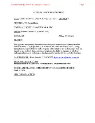
ZONING CHANGE REVIEW SHEET CASE: C14-81-037(RCT) – 3900 W. Howard Lane RCT DISTRICT: 7 ADDRESS: 3900 Howard Lane OWNER/APPLICANT: Otsuka ICU Medical, LLC AGENT: Drenner Group, P.C. (Leah M. Bojo) ZONING: LI REQUEST: AREA: 206.30 acres The applicant is requesting the termination of the public restrictive covenant recorded in 1981 in Volume 7430, Pages 513 - 528 of the Official Public Records of Travis County, Texas, that imposes restrictions on the property for the attached site and landscape plan; on permitted and prohibited uses; on site development standards; on signage; on off street parking regulations; on performance standards and for streets, utilities and other facilities. CASE MANAGER: Sherri Sirwaitis (512-974-3057, sherri.sirwaitis@austintexas.gov) STAFF RECOMMENDATION: Staff recommends the proposed public restrictive covenant termination. ZONING AND PLATTING COMMISSION ACTION / RECOMMENDATION: April 21, 2026 CITY COUNCIL ACTION: 1 06 C14-81-037(RCT) - 3900 W. Howard Lane RCT; District 71 of 27 DEPARTMENT COMMENTS: In this case, the applicant is requesting to terminate a public restrictive covenant that was recorded in 1981 in association with zoning case C14-81-037. The applicant is asking to delete this restrictive covenant to remove restrictions on the property that include conditions on the attached site and landscape plan; permitted and prohibited uses; site development standards; signs; off street parking; performance standards for noise, vibration, glare, smoke and particulate matter, toxic and noxious matter, fire and explosive hazards and liquid or solid wastes and stipulations for streets, utilities and other facilities. Please see Applicant’s Request Letter - Exhibit C and Original Restrictive Covenant – Exhibit D. The staff recommends the applicant’s request to remove the conditions of this public restrictive covenant because the property in question is currently developed with an industrial park that is located at the northwest intersection of West Howard Lane and the North MoPac Expressway South Bound Service Road. New development on the property will be subject to current Code regulations and building requirements. The applicant agrees with the staff’s recommendation. EXISTING ZONING AND LAND USES: Site North South East West ZONING LI PUD, LI PUD ROW, County LI-CO AREA STUDY: N/A WATERSHED: Walnut Creek LAND USES Office/Industrial Robinson Ranch PUD (MXD or TOD Designation) Robinson Ranch PUD (MXD or TOD Designation) North MoPac Frontage Road South Bound Office/Warehouse (Wells Branch Technology Park) CAPITOL VIEW CORRIDOR: N/A HILL COUNTRY ROADWAY: N/A NEIGHBORHOOD ORGANIZATIONS: Friends of Austin Neighborhoods, Homeless Neighborhood Association, Red Line Parkway Initiative AREA CASE HISTORIES: …
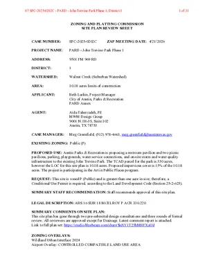
ZONING AND PLATTING COMMISSION SITE PLAN REVIEW SHEET CASE NUMBER: SPC-2025-0202C ZAP MEETING DATE: 4/21/2026 PROJECT NAME: PARD - John Trevino Park Phase 1 ADDRESS: 9501 FM 969 RD DISTRICT: 1 WATERSHED: Walnut Creek (Suburban Watershed) AREA: 10.18 acres limits of construction APPLICANT: Beth Larkin, Project Manager City of Austin, Parks & Recreation PARD Annex AGENT: Aida Taherzadeh, PE MWM Design Group 9001 N. IH-35, Suite 102 Austin, TX 78753 CASE MANAGER: Meg Greenfield, (512) 978-4663, meg.greenfield@austintexas.gov EXISTING ZONING: Public (P) PROPOSED USE: Austin Parks & Recreation is proposing a restroom pavilion and two picnic pavilions, parking, playgrounds, water service connections, and on-site storm and water quality infrastructure to the existing John Trevino Park. The TCAD parcel for the park is 330 acres, however the LOC for this site plan is 10.18 acres. Proposed impervious cover is 15% of the 10.18 acres. The project is participating in the Art in Public Places program. REQUEST: This site is zoned P (Public) and is greater than one acre in size; therefore, a Conditional Use Permit is required, according to the Land Development Code (Section 25-2-625). SUMMARY STAFF RECOMMENDATION: Staff recommends approval of this site plan. LEGAL DESCRIPTION: ABS 16 SUR 18 MCELROY P ACR 330.220 SUMMARY COMMENTS ON SITE PLAN: This site plan has gone through two pre-submittal design consultations and three rounds of formal review. All reviewers are approved except for Drainage. Latest comment report is attached. Link to full plan set: https://studio.bluebeam.com/share/$aXY1T25hMHFXaUd ZONING OVERLAYS: Wildland Urban Interface 2024 Airport Overlay: CONTROLLED COMPATIBLE LAND USE AREA 07 SPC-2025-0202C - PARD - John Trevino Park Phase 1; District 11 of 31 SURROUNDING CONDITIONS: North: Vacant, Commercial, Single Family (ETJ) East: Commercial, Single Family (SF3) West: Commercial, Single Family (ETJ) South: Walnut Creek (DR) NEIGHBORHOOD ORGANIZATION: Austin Independent School District Austin Neighborhoods Council Del Valle Community Coalition Del Valle Independent School District Dog’s Head Neighborhood Association E.A.C.H. (East Austin Community Hills) Friends of Austin Neighborhoods Friends of Northeast Austin Homeless Neighborhood Association Imperial Neighborhood Association Overton Family Committee 07 SPC-2025-0202C - PARD - John Trevino Park Phase 1; District 12 of 31 John Treviño Jr. Metropolitan Park at Morrison Ranch - Phase 1 9501 FM 969 Austin, Texas 78724 SUBMITTAL DATE DATE: FEBRUARY 18, 2025 CIVIL ENGINEER: DAVID HILDEBRANDT, P.E. DAVID.HILDEBRANDT@MWMDG.COM (512) 453-0767 MWM DESIGN GROUP, INC. 9001 N. IH-35, STE #102 AUSTIN, TEXAS 78753 CONTACT: MEL FUECHEC MEL.FUECHEC@AUSTINTEXAS.GOV (512) 974-5635 OWNER: COA …
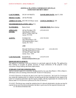
ZONING & PLATTING COMMISSION SITE PLAN EXTENSION REVIEW SHEET CASE NUMBER: SP-2017-0478D(XT3) ZAP HEARING DATE: April 21, 2026 PROJECT NAME: All Stor Westlake ADDRESS OF SITE: 9021 FM 2244 Road, Austin COUNCIL DISTRICT: ETJ NEIGHBORHOOD PLANNING AREA: N/A WATERSHED: Barton Creek JURISDICTION: Barton Springs APPLICANT/ OWNER: AGENTS: (512) 682-5552 (512) 761-6161 All Stor Westlake, LTD Attn: Brendan Callahan 500 W 5th Street, Suite 700 Austin, TX 78701 Civilitude LLC Attn: Mickael Reyes, P.E. 503 Kenniston Drive, Unit 5 Austin, TX 78752 AND Metcalfe Wolff Stuart & Williams, LLP Attn: Michele Rogerson Lynch 221 West 6th Street, Suite 1300 Austin, Texas 78701 (512) 404-2251 CASE MANAGER: Randall Rouda (512) 974-3338 Randall.rouda@austintexas.gov PROPOSED DEVELOPMENT: The applicant is requesting a two-year extension to a previously approved site plan. The applicant has been working to re-instate all permits necessary to begin construction of the proposed 3-story convenience storage building and related improvements. SUMMARY STAFF RECOMMENDATION: Staff recommends approval to extend this site plan permit by two years from March 1, 2026 to March 1, 2008 based on the case meeting criteria from LDC Section 25-5-62(C)(1)(a). 25-5-63(C) Extension of released site plan by the Land Use Commission: “the Land Use Commission may extend the expiration date of a released site plan beyond the date established by this chapter if the Land Use Commission determines that the request complies with the requirements for extension by the director under 25-5-62 (Extension of Released Site Plan by Director).” 25-5-62(C) The director may extend the expiration date of a released administrative site plan one time for a period of one year if the director determines that there is good cause for the requested extension; and (1) the director determines that: 08 SP-2017-0478D(XT3) - All Stor Westlake; ETJ1 of 7 SP-2017-0478D(XT2) All Stor Westlake a) the site plan substantially complies with the requirements that apply to a new application for site plan approval; b) the applicant filed the original application for site plan approval with the good faith expectation that the site plan would be constructed; c) the applicant constructed at least one structure shown on the original site plan that is suitable for permanent occupancy; or d) the applicant has constructed a significant portion of the infrastructure required for development of the original site plan; and SUMMARY OF SITE PLAN: LAND USE: The site is in the Extra-Territorial Jurisdiction (ETJ). All applicable development standards have been met. ENVIRONMENTAL: All …
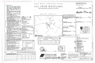
1C 1C 1C 1C N SLOPE 0 - 15% SLOPE 15 - 25% SLOPE 25 - 35% SLOPE 35% + SLOPE TOTAL AREA ENTIRE PROPERTY AREA [SF] AREA [AC] 164,953 97,171 49,084 18,279 329,488 3.79 2.23 1.13 0.42 7.564 1C 01.07.2019 1C 1C ONLY10/28/202508 SP-2017-0478D(XT3) - All Stor Westlake; ETJ5 of 7 Impervious Cover Table Use: Convenience Storage Existing Proposed Removal Proposed Addition Building Parking/Driveway - - 24,700 - - 13,560 Sidewalk & Others - - 132 Total (Area) Gross Site Area Total (Percent) - - 38,392 329,499 SF 7.564 Acre 0.00% 0.00% 11.65% 1C 1C APPENDIX Q-1: NET SITE AREA Net Site Area is Only Applicable To Watersheds Classified As Barton Springs Contributing Zone Gross Site Area (GSA) Site Deductions Critical Water Quality Zone (CWQZ) Water Quality Transition Zone (WQTZ) Wastewater Irrigation Areas Upland Area (Gross Site Minus Total Deduction) Deduction Subtotal 7.564 Acres 0.000 0.000 0.055 0.055 7.509 Acres Acres Acres Acres Acres Net Site Area Calculation Area of Upland with Slope 0 - 15% Area of Upland with Slope 15 - 25% Area of Upland with Slope 25 - 35% Area of Upland with Slope Over 35% 3.735 2.230 1.130 X 100 % = X 40 % = X 20 % = 0.420 X 0 % = Net Site Area Total 3.735 0.892 0.226 0.000 Acres Acres Acres Acres 4.853 Acres N 1C 01.07.2019 1C 1C ONLY10/28/202508 SP-2017-0478D(XT3) - All Stor Westlake; ETJ6 of 7 221C231C ONLY10/28/202508 SP-2017-0478D(XT3) - All Stor Westlake; ETJ7 of 7
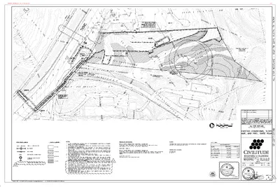
ZONING & PLATTING COMMISSION SITE PLAN EXTENSION REVIEW SHEET CASE NUMBER: SP-2017.0130C.SH (XT3) ZAP HEARING DATE:April 21, 2026 PROJECT NAME: The Grove at Shoal Creek Residential Phase 1 ADDRESS OF SITE: 4215 Bull Creek Rd COUNCIL DISTRICT: 10 WATERSHED: Shoal Creek JURISDICTION: Austin Full Purpose APPLICANT/ OWNER: AGENT: Grove Residential Development 2100 Northland Dr Austin, Tx 78756 A Ron Thrower (Thrower Design) P.O. Box 41957 Austin, TX 78704 (512) 686-4986 (512) 476-4456 CASE MANAGER: Chris Sapuppo (512) 978-4556 chris.sapuppo@austintexas.gov PROPOSED DEVELOPMENT: The applicant is requesting a five (5) year extension to a previously approved site plan. The construction of a 410-unit condominium development for residential use on a 75.79 acre site with associated parking, driveways, storm sewers, rain gardens, and water quality and utility improvements for a total of 986,198 sqft of impervious cover (32.3%). The project is located within the Shoal Creek Watershed and is subject to all watershed protection regulations as set forth in Chapter 25 of the City of Austin Code of Ordinances. This project participates in the Affordable Housing program. SUMMARY STAFF RECOMMENDATION: Staff recommends approval to extend this site plan permit by five (5) years, from March 01, 2026 to March 01, 2031 based on the case meeting criteria from LDC Section 25-5-62(C). The applicant has included a justification letter explaining details of this site (see attached). 25-5-63(C) Extension of released site plan by the Land Use Commission: “the Land Use Commission may extend the expiration date of a released site plan beyond the date established by this chapter if the Land Use Commission determines that the request complies with the requirements for extension by the director under 25-5-62 (Extension of Released Site Plan by Director).” 25-5-62(C) The director may extend the expiration date of a released administrative site plan one time for a period of one year if the director determines that there is good cause for the requested extension; and “ (1) the director determines that: the site plan substantially complies with the requirements that apply to a new (a) application for site plan approval; (b) expectation that the site plan would be constructed; the applicant filed the original application for site plan approval with the good faith 09 SP-2017-0130C.SH(XT3) - The Grove at Shoal Creek Residential Phase PH 1 Site Plan Extension; District 101 of 8 SP-2017.0130C.SH(XT2)The Grove at Shoal Creek Residential Phase 1 (c) the applicant constructed at least one structure …
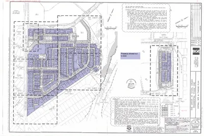
ZONING CHANGE REVIEW SHEET CASE: C14-2025-0064 – Circle C Tract 110 DISTRICT: 8 ADDRESS: 11010-1/2 South Mopac Expressway Southbound ZONING FROM: CS-MU-CO TO: CS-MU-CO, to change conditions of zoning, including modification of the conditional overlay to remove prohibited uses and remove the provision which prohibits vehicular access to Dahlgreen Avenue in Ordinance No. 020801-31. SITE AREA: 67.138 acres PROPERTY OWNER: Circle C Land, LP (Erin D. Pickens) AGENT: Drenner Group PC (Amanda Swor) CASE MANAGER: Nancy Estrada (512-974-7617, nancy.estrada@austintexas.gov) STAFF RECOMMENDATION: The Staff recommendation is to grant general commercial services – mixed use – conditional overlay (CS-MU-CO) combining district zoning, to change conditions of zoning. The Conditional Overlay will be modified to remove the following prohibited uses on Tract B: Multifamily residential, General retail sales (convenience), General retail sales (general), Financial services, Personal improvement services, Restaurant (general) and Medical offices (over 5,000 square feet). The provision which prohibits vehicular access to Dahlgreen Avenue will be removed. All other portions of the Conditional Overlay that apply to Tract B (the subject property) will remain unchanged. ZONING AND PLATTING COMMISSION ACTION / RECOMMENDATION: April 21, 2026: CITY COUNCIL ACTION: ORDINANCE NUMBER: 03 C14-2025-0064- Circle C Tract 110; District 51 of 22 C14-2025-0064 ISSUES: Page 2 The Circle C Board of Directors and Homeowners Association has provided a letter of support for the proposed modification to the Conditional Overlay. CASE MANAGER COMMENTS: The subject undeveloped property is described as Tract B and is a part of Tract 110 of the Stratus Property at Circle C. It consists of approximately 67 acres located along the west side of South Mopac Expressway (Loop 1), just north of State Highway 45. Zoning for this tract as well as several other Stratus properties in the vicinity was established in August 2002. Tract B is currently zoned general commercial services – mixed use – conditional overlay (CS-MU-CO) combining district zoning with the conditional overlay establishing prohibited uses, square footage restrictions for a single occupant leasable space and development standards. Vehicular access from the property to Dahlgreen Avenue is prohibited and all access to the property is required to be from other adjacent public streets or through adjacent property. To the north is a university, an AISD elementary school, single family residences and undeveloped property (GR-MU-CO ; I-SF-2); undeveloped property and a charter school is to the south (GO-MU-CO; CS-MU-CO); and single family residences are to the west (I-RR; …
ZONING AND PLATTING COMMISSION MEETING MINUTES Tuesday, April 7, 2026 ZONING AND PLATTING COMMISSION REGULAR MEETING TUESDAY, April 7, 2026 MEETING MINUTES The Zoning and Platting Commission convened in a regular meeting on Tuesday, April 7, 2026, at Austin City Hall, Council Chambers, Room 1001, 301 W. Second Street, in Austin, Texas. Chair Smith called the Zoning and Platting Meeting to order at 6:01 p.m. Commissioners in Attendance: Hank Smith Betsy Greenberg Ryan Puzycki Luis Osta Lugo Commissioners in Attendance Remotely: Alejandra Flores Scott Boone Andrew Cortes David Fouts Taylor Major Lonny Stern Christian Tschoepe Commissioners Absent: None PUBLIC COMMUNICATION: GENERAL None present. APPROVAL OF MINUTES 1. Approve the minutes of the Zoning and Platting Commission regular meeting on Tuesday, March 17, 2026. The minutes from the meeting of Tuesday, March 17, 2026, were approved on the consent agenda on Secretary Puzycki’s motion, Parliamentarian Flores’ second, on a 10-0 vote. Commissioner Osta Lugo was absent. 1 ZONING AND PLATTING COMMISSION MEETING MINUTES Tuesday, April 7, 2026 PUBLIC HEARINGS 2. Rezoning: Location: C14-2025-0089 - 1120 and 1122 S Capital of Texas Highway; District 8 1120 ½ South Capital of Texas Hwy SB, 1120 South Capital of Texas Hwy SB, 1122 South Capital of Texas HWY SB, 1220 South Capital of Texas Hwy SB, Eanes Creek Watershed Owner/Applicant: AREIT City View LLC Agent: Request: Staff Rec.: Staff: Drenner Group, P.C. (Leah M. Bojo) LO and LR to LO-V-DB90 Recommended Beverly Villela, 512-978-0740, beverly.villela@austintexas.gov Austin Planning The public hearing was closed on Commissioner Fouts’ motion, Secretary Puzycki’s second, on a 10-0 vote. Commissioner Osta Lugo was absent. The motion to deny Staff’s recommendation of LO-V-DB90 failed on Commissioner Stern’s motion, Vice Chair Greenberg’s second, on a 4-6 vote. Those voting aye were Vice Chair Greenberg, and Commissioners Fouts, Stern, and Tschoepe. Those voting nay were Chair Smith, Secretary Puzycki, Parliamentarian Flores, and Commissioners Boone, Cortes, and Major. Commissioner Osta Lugo was absent. The motion to approve Staff’s recommendation of LO-V-DB90 for C14-2025-0089 - 1120 and 1122 S Capital of Texas Highway, located at 1120 ½ South Capital of Texas Highway South Bound, 1120 South Capital of Texas Highway South Bound, 1122 South Capital of Texas Highway South Bound, 1220 South Capital of Texas Highway South Bound, was approved on Secretary Puzycki’s motion, Commissioner Major’s second, on a 6-4 vote. Those voting aye were Chair Smith, Secretary Puzycki, Parliamentarian Flores, and Commissioners Boone, Cortes, …
ZONING AND PLATTING COMMISSION MEETING MINUTES Tuesday, April 7, 2026 ZONING AND PLATTING COMMISSION REGULAR MEETING TUESDAY, APRIL 7, 2026 MEETING MINUTES The Zoning and Platting Commission convened in a regular meeting on Tuesday, April 7, 2026, at Austin City Hall, Council Chambers, Room 1001, 301 W. Second Street, in Austin, Texas. Chair Smith called the Zoning and Platting Meeting to order at 6:01 p.m. Commissioners in Attendance: Hank Smith Betsy Greenberg Ryan Puzycki Alejandra Flores David Fouts Christian Tschoepe Commissioners in Attendance Remotely: Scott Boone Andrew Cortes Taylor Major Lonny Stern Commissioners Absent: Luis Osta Lugo PUBLIC COMMUNICATION: GENERAL None present. APPROVAL OF MINUTES 1. Approve the minutes of the Zoning and Platting Commission regular meeting on Tuesday, March 17, 2026. The minutes from the meeting of Tuesday, March 17, 2026, were approved on the consent agenda on Secretary Puzycki’s motion, Parliamentarian Flores’ second, on a 10-0 vote. Commissioner Osta Lugo was absent. 1 ZONING AND PLATTING COMMISSION MEETING MINUTES Tuesday, April 7, 2026 PUBLIC HEARINGS 2. Rezoning: Location: C14-2025-0089 - 1120 and 1122 S Capital of Texas Highway; District 8 1120 ½ South Capital of Texas Hwy SB, 1120 South Capital of Texas Hwy SB, 1122 South Capital of Texas HWY SB, 1220 South Capital of Texas Hwy SB, Eanes Creek Watershed Owner/Applicant: AREIT City View LLC Agent: Request: Staff Rec.: Staff: Drenner Group, P.C. (Leah M. Bojo) LO and LR to LO-V-DB90 Recommended Beverly Villela, 512-978-0740, beverly.villela@austintexas.gov Austin Planning The public hearing was closed on Commissioner Fouts’ motion, Secretary Puzycki’s second, on a 10-0 vote. Commissioner Osta Lugo was absent. The motion to deny Staff’s recommendation of LO-V-DB90 failed on Commissioner Stern’s motion, Vice Chair Greenberg’s second, on a 4-6 vote. Those voting aye were Vice Chair Greenberg, and Commissioners Fouts, Stern, and Tschoepe. Those voting nay were Chair Smith, Secretary Puzycki, Parliamentarian Flores, and Commissioners Boone, Cortes, and Major. Commissioner Osta Lugo was absent. The motion to approve Staff’s recommendation of LO-V-DB90 for C14-2025-0089 - 1120 and 1122 S Capital of Texas Highway, located at 1120 ½ South Capital of Texas Highway South Bound, 1120 South Capital of Texas Highway South Bound, 1122 South Capital of Texas Highway South Bound, 1220 South Capital of Texas Highway South Bound, was approved on Secretary Puzycki’s motion, Commissioner Major’s second, on a 6-4 vote. Those voting aye were Chair Smith, Secretary Puzycki, Parliamentarian Flores, and Commissioners Boone, Cortes, and …
-----Original Message----- From: Amanda Swor Sent: Monday, April 20, 2026 3:39 PM To: Amy Rupp Cc: Estrada, Nancy <Nancy.Estrada@austintexas.gov> Subject: Re: Request for postponement on C14-2025-0064 (Circle C Tract 110) External Email - Exercise Caution Good afternoon, As the applicant, we will not object to this request for postponement. Have a great day. Amanda Swor > On Apr 20, 2026, at 1:31 PM, Amy Rupp wrote: > > > Hello Ms Estrada and Ms Soar: > > I am requesting a postponement on this zoning case to May 5, 2026 so that I and other residents of Circle C can look at the traffic study and get clarification on ingress/egress points. > > Best regards, > Amy Rupp > Circle C Neighborhood Association CAUTION: This is an EXTERNAL email. Please use caution when clicking links or opening attachments. If you believe this to be a malicious or phishing email, please report it using the "Report Message" button in Outlook. For any additional questions or concerns, contact CSIRT at "cybersecurity@austintexas.gov". 03 C14-2025-0064- Circle C Tract 110; District 51 of 1
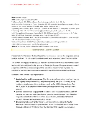
From: Jennifer Leeper Sent: Sunday, April 19, 2026 10:36 PM To: Boone, Scott - BC <BC-Scott.Boone@austintexas.gov>; Smith, Hank - BC <bc- Hank.Smith@austintexas.gov>; Flores, Alejandra - BC <BC-Alejandra.Flores@austintexas.gov>; Stern, Lonny - BC <BC-Lonny.Stern@austintexas.gov>; Major, Taylor - BC <BC- Taylor.Major@austintexas.gov>; Tschoepe, Christian - BC <BC-Christian.Tschoepe@austintexas.gov>; Greenberg, Betsy - BC <bc-Betsy.Greenberg@austintexas.gov>; Osta Lugo, Luis - BC <BC- Luis.OstaLugo@austintexas.gov>; Fouts, David - BC <BC-David.Fouts@austintexas.gov>; De Portu, Felix - BC <BC-Felix.Deportu@austintexas.gov>; Puzycki, Ryan - BC <BC- Ryan.Puzycki@austintexas.gov>; Estrada, Nancy <Nancy.Estrada@austintexas.gov>; Cortes, Andrew - BC <BC-Andrew.Cortes@austintexas.gov> Cc: Karen Hibpshman; Bill SOS Alliance; Constituents@traviscountytx.gov; District 8 <District8@austintexas.gov>; sosinfo@sosalliance.org Subject: Re: Oppose Zoning Change for Stratus Property along Mopac External Email - Exercise Caution Please note for the record that our household continues to oppose the proposed zoning change for Tract 110 in Circle C (near Dahlgreen and La Crosse), case C14-2025-0064. The current zoning (approved in 2002) includes a Conditional Overlay that restricts uses and explicitly prohibits vehicular access to Dahlgreen Avenue. Homeowners purchased properties with the understanding that this restriction would remain in place. The proposal to remove this prohibition represents a significant and concerning change. Residents have several ongoing concerns: Lack of notice and transparency: After the proposal was put on hold last year, no new signage was posted along Dahlgreen regarding the April 21 hearing. Many residents only learned of this update through an April 16 HOA newsletter. Per HB24, signs must be posted within 14 days of application filing. No signs were posted. Limited homeowner engagement: Residents raised objections at the last HOA meeting but have not been given further opportunities to provide input. We also request access to the referenced HOA support letter, as the Board has not recently engaged homeowners on this matter. Environmental constraints: This property lies within the Edwards Aquifer Recharge Zone, Barton Springs watershed, and a Drinking Water Protection Zone. It is subject to strict TCEQ and Save Our Springs (SOS) regulations, including 03 C14-2025-0064- Circle C Tract 110; District 51 of 5 impervious cover limits. It is unclear how the proposed changes can meet these requirements. Traffic and safety impacts: Any access to Dahlgreen Avenue—even limited to emergency vehicles—would increase traffic near Kiker Elementary and pose safety concerns. Property values: These changes will negatively affect nearby home values, which were purchased based on the 2002 zoning conditions. Our concerns remain unresolved. We respectfully request that this opposition be formally recorded and the hearing postponed because proper notice …
MANIFEST LANEPhase(s) closed outto date09 SP-2017-0130C.SH(XT3) - The Grove at Shoal Creek Residential Phase PH 1 Site Plan Extension; District 101 of 1
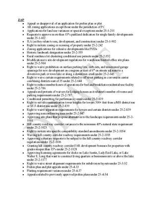
ZAP • Appeal or disapproval of an application for prelim plan or plat • All zoning applications except those under the jurisdiction of PC • Applications for land use variances or special exceptions under 25-1-211 • Requests to approve more than 15% parkland dedication for single family developments under 25-1-602 ILA (as they relate to use, development, and construction) under 25-1-902 • • Right to initiate zoning or rezoning of property under 25-2-242 • Zoning applications for cohesive developments like PUDs • Historic landmark designation under 25-2-355 • Rural residence lot clustering conditional use permits under 25-2-552 • Modifications to site development regulations for warehouse/limited office site plans under 25-2-584 • Right to waive prohibition on surface parking lots, curb cuts, and unscreened garage openings for new development on congress or east of 6th on streets adjacent to a downtown park or town lake or along a downtown creek under 25-2-643 • Right to waive certain requirements related to off street parking in convention center combining districts east of 35 under 25-2-644 • Right to reduce number hours of operations for bed and breakfasts residential use facility under 25-2-786 • Appeals and protests of waivers for lodging houses as it relates to number of rooms and parking requirements under 25-2-787 • Conditional permitting for performance venues under 25-2-819 • Right to set telecommunication tower heights for towers 300+ feet from a MH district/use or SF-5 district/use under 25-2-839 • Right to waive separation requirements for towers and certain districts under 25-2-839 • Approving nonconforming uses under 25-2-947 • Approving site plans that propose alternatives to the landscape requirements under 25-2- 1001 • Hill country road way corridor variances to the minimum 40% natural state requirement under 25-2-1025 • Right to initiate site specific compatibility standard amendments under 25-2-1054 • Waiving hill country corridor roadway requirements under 25-2-1105 • Approving voluntary requests to be subject to the hill country roadway corridor regulations under 25-2-1106 • Granting hill country roadway corridor FAR development bonuses for properties with grades steeper than 15% under 25-2-1128 • Approving licensing agreements for docks on Lake Austin, Lady Bird Lake, or Lake Walter E. Long that want to construct living quarters or businesses into or above the lake under 25-2-1177 • Right to waive street alignment requirements for subdivision layouts under 25-3-52 • Prelim plan and plat appeals under 25-4-33 • Platting requirement variances under 25-4-37 • …
ZONING AND PLATTING COMMISSION MEETING MINUTES Tuesday, April 21, 2026 ZONING AND PLATTING COMMISSION REGULAR MEETING TUESDAY, APRIL 21, 2026 MEETING MINUTES The Zoning and Platting Commission convened in a regular meeting on Tuesday, April 21, 2026, at Austin City Hall, Council Chambers, Room 1001, 301 W. Second Street, in Austin, Texas. Chair 6:04 p.m. called the Zoning and Platting Meeting to order at 6:46 p.m. Commissioners in Attendance: Hank Smith Betsy Greenberg Ryan Puzycki David Fouts Luis Osta Lugo Commissioners in Attendance Remotely: Scott Boone Andrew Cortes Lonny Stern Commissioners Absent: Alejandra Flores Taylor Major Christian Tschoepe PUBLIC COMMUNICATION: GENERAL None present. APPROVAL OF MINUTES 1. Approve the minutes of the Zoning and Platting Commission regular meeting on Tuesday, April 7, 2026. The minutes from the meeting of Tuesday, April 7, 2026, were approved on the consent agenda, as amended, on Chair Smith’s motion, Vice Chair Greenberg’s second, on an 8-0 vote. Parliamentarian Flores and Commissioners Major and Tschoepe were absent. 1 ZONING AND PLATTING COMMISSION MEETING MINUTES Tuesday, April 21, 2026 PUBLIC HEARINGS 2. Rezoning: Location: Owner/Applicant: Agent: Request: Staff Rec.: Staff: C14-2025-0113 - 500 East FM 1626 Road; District 5 500 East FM 1626 Road, Onion Creek Watershed Forest Creek Investments LLC SiteATX LLC (Jennifer Hanlen) CS-MU-CO to CS-1 Staff recommends CS-1-CO Nancy Estrada, 512-974-7617, nancy.estrada@austintexas.gov Austin Planning The motion to approve Staff’s recommendation of CS-1-CO for C14-2025-0113 - 500 East FM 1626 Road; District 5, located at 500 East FM 1626 Road, was approved on the consent agenda on Chair Smith’s motion, Vice Chair Greenberg’s second, on an 8-0. Parliamentarian Flores and Commissioners Major and Tschoepe were absent. C14-2025-0064- Circle C Tract 110; District 5 11010 ½ South Mopac Expressway, Slaughter Creek Watershed 3. Rezoning: Location: Owner/Applicant: Circle C Land, LP (Erin D. Pickens) Drenner Group PC (Amanda Swor) Agent: CS-MU-CO to CS-MU-CO, to change conditions of zoning Request: Recommended Staff Rec.: Nancy Estrada, 512-974-7617, nancy.estrada@austintexas.gov Staff: Austin Planning The motion to approve the Neighborhood’s postponed request to May 5, 2026, was approved on Chair Smith’s motion, Vice Chair Greenberg’s second, on an 8-0. Parliamentarian Flores and Commissioners Major and Tschoepe were absent. C14-2026-0012 - 8011 Brodie Lane; District 8 8011 Brodie Lane, Williamson Creek Watershed 4. Rezoning: Location: Owner/Applicant: Cool Breeze Residential Properties, LLC Agent: Request: Staff Rec.: Staff: Eustace Isidore NO-MU-CO to LO-MU-CO Staff recommends LO-MU Reese McMichael, 512-974-7633, reese.mcmichael@austintexas.gov Austin Planning The motion …
ZONING AND PLATTING COMMISSION MEETING MINUTES Tuesday, April 21, 2026 ZONING AND PLATTING COMMISSION REGULAR MEETING TUESDAY, APRIL 21, 2026 MEETING MINUTES The Zoning and Platting Commission convened in a regular meeting on Tuesday, April 21, 2026, at Austin City Hall, Council Chambers, Room 1001, 301 W. Second Street, in Austin, Texas. Chair Smith called the Zoning and Platting Meeting to order at 6:04 p.m. Commissioners in Attendance: Hank Smith Betsy Greenberg Ryan Puzycki David Fouts Luis Osta Lugo Commissioners in Attendance Remotely: Scott Boone Andrew Cortes Lonny Stern Commissioners Absent: Alejandra Flores Taylor Major Christian Tschoepe PUBLIC COMMUNICATION: GENERAL None present. APPROVAL OF MINUTES 1. Approve the minutes of the Zoning and Platting Commission regular meeting on Tuesday, April 7, 2026. The minutes from the meeting of Tuesday, April 7, 2026, were approved on the consent agenda, as amended, on Chair Smith’s motion, Vice Chair Greenberg’s second, on an 8-0 vote. Parliamentarian Flores and Commissioners Major and Tschoepe were absent. 1 ZONING AND PLATTING COMMISSION MEETING MINUTES Tuesday, April 21, 2026 PUBLIC HEARINGS 2. Rezoning: Location: Owner/Applicant: Agent: Request: Staff Rec.: Staff: C14-2025-0113 - 500 East FM 1626 Road; District 5 500 East FM 1626 Road, Onion Creek Watershed Forest Creek Investments LLC SiteATX LLC (Jennifer Hanlen) CS-MU-CO to CS-1 Staff recommends CS-1-CO Nancy Estrada, 512-974-7617, nancy.estrada@austintexas.gov Austin Planning The motion to approve Staff’s recommendation of CS-1-CO for C14-2025-0113 - 500 East FM 1626 Road; District 5, located at 500 East FM 1626 Road, was approved on the consent agenda on Chair Smith’s motion, Vice Chair Greenberg’s second, on an 8-0. Parliamentarian Flores and Commissioners Major and Tschoepe were absent. C14-2025-0064- Circle C Tract 110; District 5 11010 ½ South Mopac Expressway, Slaughter Creek Watershed 3. Rezoning: Location: Owner/Applicant: Circle C Land, LP (Erin D. Pickens) Drenner Group PC (Amanda Swor) Agent: CS-MU-CO to CS-MU-CO, to change conditions of zoning Request: Recommended Staff Rec.: Nancy Estrada, 512-974-7617, nancy.estrada@austintexas.gov Staff: Austin Planning The motion to approve the Neighborhood’s postponed request to May 5, 2026, was approved on Chair Smith’s motion, Vice Chair Greenberg’s second, on an 8-0. Parliamentarian Flores and Commissioners Major and Tschoepe were absent. C14-2026-0012 - 8011 Brodie Lane; District 8 8011 Brodie Lane, Williamson Creek Watershed 4. Rezoning: Location: Owner/Applicant: Cool Breeze Residential Properties, LLC Agent: Request: Staff Rec.: Staff: Eustace Isidore NO-MU-CO to LO-MU-CO Staff recommends LO-MU Reese McMichael, 512-974-7633, reese.mcmichael@austintexas.gov Austin Planning The motion to …