Play audio — original link
Play audio
Play audio
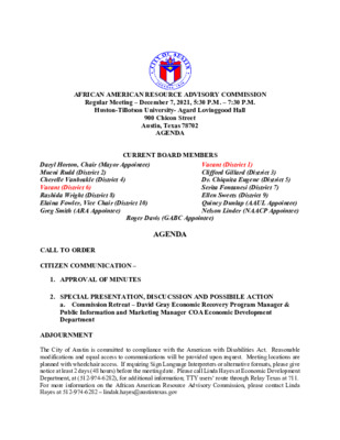
AFRICAN AMERICAN RESOURCE ADVISORY COMMISSION Regular Meeting – December 7, 2021, 5:30 P.M. – 7:30 P.M. Huston-Tillotson University- Agard Lovinggood Hall 900 Chicon Street Austin, Texas 78702 AGENDA CURRENT BOARD MEMBERS Daryl Horton, Chair (Mayor Appointee) Mueni Rudd (District 2) Cherelle Vanbrakle (District 4) Vacant (District 6) Rashida Wright (District 8) Elaina Fowler, Vice Chair (District 10) Greg Smith (ARA Appointee) Roger Davis (GABC Appointee) AGENDA Vacant (District 1) Clifford Gillard (District 3) Dr. Chiquita Eugene (District 5) Serita Fontanesi (District 7) Ellen Sweets (District 9) Quincy Dunlap (AAUL Appointee) Nelson Linder (NAACP Appointee) CALL TO ORDER CITIZEN COMMUNICATION – 1. APPROVAL OF MINUTES 2. SPECIAL PRESENTATION, DISCUCSSION AND POSSIBILE ACTION a. Commission Retreat – David Gray Economic Recovery Program Manager & Public Information and Marketing Manager COA Economic Development Department ADJOURNMENT The City of Austin is committed to compliance with the American with Disabilities Act. Reasonable modifications and equal access to communications will be provided upon request. Meeting locations are planned with wheelchair access. If requiring Sign Language Interpreters or alternative formats, please give notice at least 2 days (48 hours) before the meeting date. Please call Linda Hayes at Economic Development Department, at (512-974-6282), for additional information; TTY users’ route through Relay Texas at 711. For more information on the African American Resource Advisory Commission, please contact Linda Hayes at 512-974-6282 – lindak.hayes@austintexas.gov
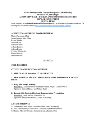
Urban Transportation Commission Special Called Meeting December 7th, 2021 at 5pm AUSTIN CITY HALL – BOARDS AND COMMISSIONS ROOM 1101 301 W. SECOND STREET AUSTIN, TEXAS Some members of the Urban Transportation Commission may be participating by videoconference. The meeting may be viewed online at: http://www.austintexas.gov/page/watch-atxn-live AUSTIN, TEXAS CURRENT BOARD MEMBERS: Mario Champion, Chair Susan Somers, Vice Chair Ruven Brooks Nathan Ryan Samuel Franco Athena Leyton Allison Runas Cynthia Weatherby Diana Wheeler James Driscoll AGENDA CALL TO ORDER CITIZEN COMMUNICATION: GENERAL 1. APPROVAL OF November 2nd, 2021 MINUTES 2. NEW BUSINESS: PRESENTATION, DISCUSSION AND POSSIBLE ACTION ITEMS A. Lady Bird Bridge Briefing Presenters: Annick Beaudet and Peter Mullan, Project Connect Office Sponsors: Samuel Franco and Nathan Ryan B. Farm & City Projected Regional Transportation Presentation Presenters: Jay Crossley, Farm and City Sponsors: Ruven Brooks and Cynthia Weatherby 3. STAFF BRIEFINGS A. Downtown Commission: Commissioner Cynthia Weatherby B. Joint Sustainability Commission: Commissioner Diana Wheeler C. Bicycle Advisory Council: Commissioner Athena Leyton D. Pedestrian Advisory Council: Commissioner Allie Runas E. City Council Mobility Committee: Commissioner Mario Champion F. Community Advisory Committee for Austin Transit Partnership Board: Susan Sommers 4. Future Agenda Items • Highway Funding ( TDB; Brooks) • TDM Update ( TBD; Somers • ASMP Update ( TBD; Brooks) • Project Connect Racial Equity Anti-Displacement Tool ( TBD; Somers) • Red River Extension ( TBD; Champion) ADJOURNMENT The City of Austin is committed to compliance with the American with Disabilities Act. Reasonable modifications and equal access to communications will be provided upon request. Meeting locations are planned with wheelchair access. If requiring Sign Language Interpreters or alternative formats, please give notice at least 2 days (48 hours) before the meeting date. Please call Christopher Parks, at (512)-978-1568, for additional information; TTY users route through Relay Texas at 711. For more information on the Urban Transportation Department, please contact Christopher Parks at christopher.parks@austintexas.gov.
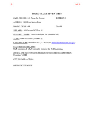
ZONING CHANGE REVIEW SHEET TO: GR DISTRICT: 6 CASE: C14-2021-0168 (Texas Cat Doctor) ADDRESS: 13264 Pond Springs Road ZONING FROM: I-RR SITE AREA: 0.912 acres (39,727 sq. ft.) PROPERTY OWNER: Texas Cat Hospital, Inc. (Kim Percival) AGENT: HB Construction (Josh McKay) CASE MANAGER: Sherri Sirwaitis (512-974-3057, sherri.sirwaitis@austintexas.gov) STAFF RECOMMEDATION: Staff recommends GR, Community Commercial District, zoning. ZONING AND PLATTING COMMISSION ACTION / RECOMMENDATION: December 7, 2021 CITY COUNCIL ACTION: ORDINANCE NUMBER: 1 of 16B-1 C14-2021-0168 2 ISSUES: N/A CASE MANAGER COMMENTS: The property in question is a 0.912 acre lot located at the southwest corner of Roxie Drive and Pond Springs Road that contains a one-story veterinary clinic. The lots to the north, across Pond Springs Road, contain a cemetery and duplex residences. To the south, there is an industrial park along Roxie Drive and Boardwalk Drive. The properties to the east are developed with industrial office and warehouse uses. To the west, there is an office use and equipment rental business. The applicant is asking to establish permanent zoning on this lot to bring the existing Pet Services use into conformance with requirements of the Land Development Code. The staff recommends GR, Community Commercial District, zoning because the site under consideration meets the intent of the requested district. The property is located at the entrance to an industrial park. The proposed zoning is consistent with surrounding land use and zoning patterns as there are office, commercial and industrial uses located to the south, east and west. GR zoning will permit the applicant to bring the veterinary clinic into conformance with land use regulations specified in the Code. The applicant agrees with the staff’s recommendation. BASIS OF RECOMMENDATION: 1. The proposed zoning is consistent with the purpose statement of the district sought. The Community commercial (GR) district is the designation for an office or other commercial use that serves neighborhood and community needs and that generally is accessible from major traffic ways. The property is located on Pond Springs Road, a minor arterial roadway. There is a public transit stop is located 0.20 linear miles from the subject property. 2. The proposed zoning promotes consistency and orderly planning. The proposed zoning is consistent with surrounding land use patterns as there is an industrial park with commercial and industrial uses to the south and east and office and commercial uses along the south side of Pond Springs Road to the west. …
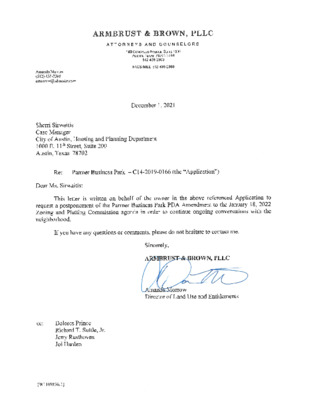
MEMORANDUM ************************************************************************ TO: FROM: Sherri Sirwaitis Zoning and Platting Commission Members Housing and Planning Department DATE: December 1, 2021 RE: C14-2019-0166 (Parmer Business Park) Postponement Request ************************************************************************ The staff supports the applicant’s request for a postponement of the above mentioned case to January 18, 2022. The postponement will provide the staff with additional time to complete our review of this amended rezoning request. The postponement request was made in a timely manner and meets the Zoning and Platting Commission’s policy. ! ! ! ! ! ! ! ! ! ! ! ! ! ! ! ! ! ! ! ! ! ! ! ! ! ! ! ! ! ! ! ! ! ! ! ! ! ! ! ! ! ! ! ! ! ! ! ! ! ! ! ! ! ! ! ! ! ! ! ! ! ! ! ! ! ! ! ! ! ! ! ! ! ! ! ! ! ! ! ! ! ! ! ! ! ! ! ! ! ! ! ! ! ! ! ! ! ! ! ! ! ! ! ! ! ! ! ! ! ! ! ! ! ! ! ! ! ! ! ! ! ! ! ! ! ! ! ! ! ! ! ! ! ! ! ! ! ! ! ! ! ! ! ! ! ! ! ! ! ! ! ! ! ! ! ! ! ! ! ! ! ! ! ! ! ! ! ! ! ! ! ! ! ! ! ! ! ! ! ! ! ! ! ! ! ! ! ! ! ! ! ! ! ! ! ! ! ! ! ! ! ! ! ! ! ! ! ! ! ! ! ! ! ! ! ! ! ! ! ! ! ! ! ! ! ! ! ! ! ! ! ! ! ! ! ! ! ! ! ! ! ! ! ! ! ! ! ! ! ! ! ! ! ! ! ! ! ! ! ! ! ! ! ! ! ! ! ! ! ! ! ! ! ! ! ! ! ! ! ! ! ! ! ! ! ! ! ! ! ! ! ! ! ! ! ! ! ! ! ! ! ! ! ! ! ! ! ! ! ! ! ! ! ! ! ! ! ! ! !! …
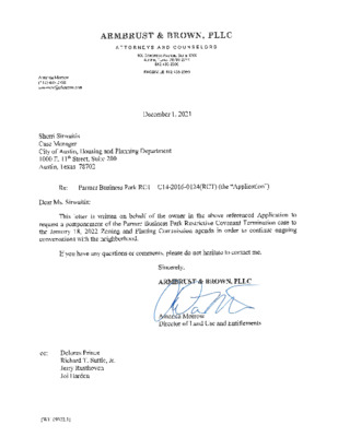
MEMORANDUM ************************************************************************ TO: FROM: Sherri Sirwaitis Zoning and Platting Commission Members Housing and Planning Department DATE: December 1, 2021 RE: C14-2016-0124(RCT) (Parmer Business Park RCT) Postponement Request ************************************************************************ The staff supports the applicant’s request for a postponement of the above mentioned case to January 18, 2022. The postponement will permit the staff to complete our review of this restrictive termination request. The postponement request was made in a timely manner and meets the Zoning and Platting Commission’s policy. ! ! ! ! ! ! ! ! ! ! ! ! ! ! ! ! ! ! ! ! ! ! ! ! ! ! ! ! ! ! ! ! ! ! ! ! ! ! ! ! ! ! ! ! ! !! ! ! ! ! ! ! ! ! ! ! ! ! ! ! ! ! ! ! ! ! ! ! ! ! ! ! ! ! ! ! ! ! ! ! ! ! ! ! ! ! ! ! ! ! ! ! ! ! ! ! ! ! ! ! ! ! ! ! ! ! ! ! ! ! ! ! ! ! ! ! ! ! ! ! ! ! ! ! ! ! ! ! ! ! ! ! ! ! ! ! ! ! ! ! ! ! ! ! ! ! ! ! ! ! ! ! ! ! ! ! ! ! ! ! ! ! ! ! ! ! ! ! ! ! ! ! ! ! ! ! ! ! ! ! ! ! ! ! ! ! ! ! ! ! ! ! ! ! ! ! ! ! ! ! ! ! ! ! ! ! ! ! ! ! ! ! ! ! ! ! ! ! ! ! ! ! ! ! ! ! ! ! ! ! ! ! ! ! ! ! ! ! ! ! ! ! ! ! ! ! ! ! ! ! ! ! ! ! ! ! ! ! ! ! ! ! ! ! ! ! ! ! ! ! ! ! ! ! ! ! ! ! ! ! ! ! ! ! ! ! ! ! ! ! ! ! ! ! ! ! ! ! ! ! ! ! ! ! ! ! ! ! ! ! ! ! ! ! ! ! ! ! ! ! ! ! …
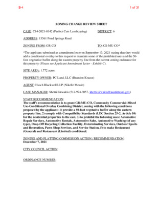
ZONING CHANGE REVIEW SHEET CASE: C14-2021-0142 (Perfect Cuts Landscaping) DISTRICT: 6 ADDRESS: 13561 Pond Springs Road ZONING FROM: GR-CO TO: CS-MU-CO* *The applicant submitted an amendment letter on September 13, 2021 stating that they would add a conditional overlay to this request to maintain some of the prohibited uses and the 50- foot vegetative buffer along the eastern property line from the current zoning ordinance for this property (Please see Applicant Amendment Letter - Exhibit C). SITE AREA: 1.772 acres PROPERTY OWNER: PC Land, LLC (Brandon Krause) AGENT: Husch Blackwell LLP (Nikelle Meade) CASE MANAGER: Sherri Sirwaitis (512-974-3057, sherri.sirwaitis@austintexas.gov) STAFF RECOMMENDATION: The staff’s recommendation is to grant GR-MU-CO, Community Commercial-Mixed Use-Conditional Overlay Combining District, zoning with the following conditions proposed by the applicant: 1) provide a 50-foot vegetative buffer along the eastern property line, 2) comply with Compatibility Standards (LDC Section 25-2, Article 10) for the residential properties to the east, 3) to prohibit the following uses: Automotive Repair Services, Automotive Rentals, Automotive Sales, Automotive Washing (of any type), Drop-Off Recycling Collection Facility, Exterminating Services, Outdoor Sports and Recreation, Pawn Shop Services, and Service Station, 5) to make Restaurant (General) and Restaurant (Limited) conditional. ZONING AND PLATTING COMMISSION ACTION / RECOMMENDATION: December 7, 2021 CITY COUNCIL ACTION: ORDINANCE NUMBER: 1 of 31B-4 C14-2021-0142 ISSUES: 2 This property was owned by Velda B. Wyche in 2014 when the previous zoning case for the plant nursery uses was conducted. PC Land, LLC purchased this property in 2016 and moved to this location from West Anderson Lane. It appears that the ownership and the use have changed and the property is no longer in conformance. According to the Austin Code Department, the applicant was originally cited on April 9, 2019 because a two-story building was being constructed on the property without a permit (Please see Notices of Code Violations – Exhibit E). CASE MANAGER COMMENTS: The property in question is currently utilized as a landscaping company (Construction Sales and Services use). This site was developed with a plant nursery use (Hill Country Garden Center) that was in existence when this tract of land was annexed by the City of Austin in 1998 (Ordinance No.19981210-L). The applicant is requesting CS-MU-CO, General Commercial Services-Mixed Use-Combining District, zoning to bring the current use on the property into conformance with land use regulations in the City of Austin Land Development Code. The staff is recommending GR-MU-CO, Community …
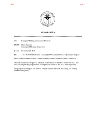
MEMORANDUM ************************************************************************ TO: Zoning and Platting Commission Members FROM: Sherri Sirwaitis Housing and Planning Department DATE: November 29, 2021 RE: ************************************************************************ The staff would like to request an indefinite postponement of the above mentioned case. The staff is asking for this postponement to complete our review of this PUD rezoning request. The postponement request was made in a timely manner and meets the Zoning and Platting Commission’s policy. C814-96-0003.18 (Pioneer Crossing PUD Amendment #18) Postponement Request 1 of 1B-5
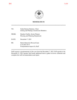
MEMORANDUM ************************************************************************ TO: Nadia Barrera-Ramirez, Chair Zoning and Platting Commission Members December 7, 2021 Heather Chaffin, Senior Planner Housing and Planning Department FROM: DATE: RE: ************************************************************************ Staff requests a postponement of this case from the December 7, 2021 ZAP agenda to the December 21, 2021 agenda. Staff needs additional time to gather reviewer comments and complete the staff recommendation and report. Harris Branch & Howard Lane C14-2021-0171 Postponement request by Staff 1 of 4B-6 From: Mike Simpson Sent: Friday, May 28, 2021 2:31 PM To: 'Glenn Weichert' ; Chaffin, Heather <Heather.Chaffin@austintexas.gov>; 'Tiffany Conner' ; 'Ron Lussier' Subject: RE: Zoning Hearing for Nearby Multi-Family Apts. Near SoWC Entrance on Bowery Trail Heather / Glenn: Yes, we will agree to just this one postponement. Thanks. ~Mike **************************** Mike Simpson 11801 Bowery Place Austin, TX 78753-7111 Phone: (512) 284-9907 From: Glenn Weichert Sent: Friday, May 28, 2021 2:01 PM To: Chaffin, Heather <Heather.Chaffin@austintexas.gov> Cc: Mike Simpson Subject: RE: Zoning Hearing for Nearby Multi-Family Apts. Near SoWC Entrance on Bowery Trail Okay with me, we need the postponement. Mike? Glenn K. Weichert The Weichert Law Firm 3821 Juniper Trace, Suite 106 Austin, Texas 78738 (512) 263-2666 ext. 101 Fax: (512) 263-2698 http://weichertlaw.com CONFIDENTIALITY NOTICE: The information in this email may be confidential and/or privileged. This email is intended to be reviewed by only the individual or organization named above. If you are not the intended recipient, you are hereby notified that any review, dissemination or copying of this email and its attachments, if any, or the information contained herein is prohibited. If you have received this email in error, please immediately notify the sender by return email and delete this email from your system. Thank you. From: Chaffin, Heather <Heather.Chaffin@austintexas.gov> Sent: Friday, May 28, 2021 12:16 PM To: Mike Simpson ; Glenn Weichert 2 of 4B-6 Subject: RE: Zoning Hearing for Nearby Multi-Family Apts. Near SoWC Entrance on Bowery Trail Thank you! I spoke to the applicant and they say they are fine with that date with the agreement that additional postponements will not be requested. From: Mike Simpson Sent: Friday, May 28, 2021 12:02 PM To: Chaffin, Heather <Heather.Chaffin@austintexas.gov>; Glenn Weichert Subject: Re: Zoning Hearing for Nearby Multi-Family Apts. Near SoWC Entrance on Bowery Trail Heather Let's shoot for July 6th. Mike From: Chaffin, Heather Sent: Friday, May 28, 2021 11:29 AM To: Glenn Weichert Cc: Mike Simpson Subject: RE: Zoning Hearing for …
1 ZONING CHANGE REVIEW SHEET DISTRICT: 1 CASE: C14-2020-0145 -- Rogers ADU ZONING FROM: SF-2 TO: SF-3 ADDRESS: 5210 Rogers Lane SITE AREA: 0.338 Acres PROPERTY OWNER/APPLICANT: Capital River Group, LLC - Series 24 (Stuart Carr) CASE MANAGER: Heather Chaffin (512-974-2122, heather.chaffin@austintexas.gov) STAFF RECOMMENDATION: Staff supports the Applicant’s request to rezone the property to SF-3. For a summary of the basis of staff’s recommendation, see case manager comments on page 2. ZONING AND PLATTING COMMISSION ACTION/ RECOMMENDATION: December 7, 2021: CITY COUNCIL ACTION: TBD ORDINANCE NUMBER: 1 of 7B-7 C14-2021-0145 2 ISSUES: Under the current zoning, one single family residence can be constructed on the lot. If rezoned to SF-3, a maximum of two dwelling units would be permitted on the lot. The Applicant has stated their intent to retain the existing single family residence and add an accessory dwelling unit (ADU). CASE MANAGER COMMENTS: The proposed rezoning is for a 0.33 acre property located on the west side of Roger Lane approximately 240 feet north of the FM 969 right-of-way. The property is zoned SF-2 and developed with one house. Surrounding properties are also zoned SF-2 and primarily developed with single family residences and related structures. At the intersection of Rogers Lane and FM 969 is an art studio/indoor entertainment property zoned SF-2 (nonconforming land uses). West of the property is LR-MU and SF-6-CO zoned property that is currently undeveloped. Further to the east is Oak Meadows Elementary School, zoned SF-2. Please see Exhibits A and B—Zoning Map and Aerial Exhibit. The proposed rezoning is located on Rogers Lane, a Level 1 that primarily serves large-lot residential properties. The road right-of-way (ROW) is approximately 52 feet wide and the pavement is 18 feet wide. The Austin Strategic Mobility Plan (ASMP) does not identify any immediate or long terms plans for improvements to the roadway. The proposed rezoning does not generate enough vehicular trips to trigger the requirement for a Neighborhood Traffic Analysis (NTA). In addition to this rezoning request, two other rezoning requests are currently under Staff review that propose access to Rogers Lane. One of these cases, C14-2021-0141 (Agave Annex), is required to submit a NTA which will provide more information about the characteristics and capacity of the street. Mitigations, including potential street widening, may be recommended out of that NTA. The NTA for C14-2021-0141 has not yet been submitted for Staff review. Staff supports the SF-3 rezoning …
MEMORANDUM ************************************************************************ TO: Nadia Barrera-Ramirez, Chair Zoning and Platting Commission Members December 7, 2021 Heather Chaffin, Senior Planner Housing and Planning Department FROM: DATE: RE: ************************************************************************ Staff requests a postponement of this case from the December 7, 2021 ZAP agenda to the January 4, 2022 agenda. Staff needs additional time to gather reviewer comments and complete the staff recommendation and report. Vaught Ranch Rezoning C14-2021-0159 Postponement request by Staff 1 of 4B-8 From: Mike Simpson Sent: Friday, May 28, 2021 2:31 PM To: 'Glenn Weichert' ; Chaffin, Heather <Heather.Chaffin@austintexas.gov>; 'Tiffany Conner' ; 'Ron Lussier' Subject: RE: Zoning Hearing for Nearby Multi-Family Apts. Near SoWC Entrance on Bowery Trail Heather / Glenn: Yes, we will agree to just this one postponement. Thanks. ~Mike **************************** Mike Simpson 11801 Bowery Place Austin, TX 78753-7111 Phone: (512) 284-9907 From: Glenn Weichert Sent: Friday, May 28, 2021 2:01 PM To: Chaffin, Heather <Heather.Chaffin@austintexas.gov> Cc: Mike Simpson Subject: RE: Zoning Hearing for Nearby Multi-Family Apts. Near SoWC Entrance on Bowery Trail Okay with me, we need the postponement. Mike? Glenn K. Weichert The Weichert Law Firm 3821 Juniper Trace, Suite 106 Austin, Texas 78738 (512) 263-2666 ext. 101 Fax: (512) 263-2698 http://weichertlaw.com CONFIDENTIALITY NOTICE: The information in this email may be confidential and/or privileged. This email is intended to be reviewed by only the individual or organization named above. If you are not the intended recipient, you are hereby notified that any review, dissemination or copying of this email and its attachments, if any, or the information contained herein is prohibited. If you have received this email in error, please immediately notify the sender by return email and delete this email from your system. Thank you. From: Chaffin, Heather <Heather.Chaffin@austintexas.gov> Sent: Friday, May 28, 2021 12:16 PM To: Mike Simpson ; Glenn Weichert 2 of 4B-8 Subject: RE: Zoning Hearing for Nearby Multi-Family Apts. Near SoWC Entrance on Bowery Trail Thank you! I spoke to the applicant and they say they are fine with that date with the agreement that additional postponements will not be requested. From: Mike Simpson Sent: Friday, May 28, 2021 12:02 PM To: Chaffin, Heather <Heather.Chaffin@austintexas.gov>; Glenn Weichert Subject: Re: Zoning Hearing for Nearby Multi-Family Apts. Near SoWC Entrance on Bowery Trail Heather Let's shoot for July 6th. Mike From: Chaffin, Heather Sent: Friday, May 28, 2021 11:29 AM To: Glenn Weichert Cc: Mike Simpson Subject: RE: Zoning Hearing for Nearby Multi-Family …
1 ZONING CHANGE REVIEW SHEET DISTRICT: 1 CASE: C14-90-0003.21 -- Harris Branch PUD Amendment 21 ZONING FROM: PUD TO: PUD, to change a condition of zoning ADDRESS: US Highway 290 and Harris Branch Parkway SITE AREA: +/-2,100 Acres PROPERTY OWNER/APPLICANT: Austin HB Residential Properties, Ltd. AGENT: Coats Rose PC (John M. Joseph) CASE MANAGER: Heather Chaffin (512-974-2122, heather.chaffin@austintexas.gov) STAFF RECOMMENDATION: Staff supports the Applicant’s request to modify the PUD to allow building height to be measured in feet (40’ maximum) instead of feet and stories (40’ and 3 stories maximum). The amendment only applies to parcels in the PUD that are designated as LO, LR, MF-2 and MF-3. For a summary of the basis of staff’s recommendation, see case manager comments on page 2. ZONING AND PLATTING COMMISSION ACTION/ RECOMMENDATION: December 7, 2021: CITY COUNCIL ACTION: January 27, 2022: ORDINANCE NUMBER: 1 of 26B-9 C14-90-0003.21 2 ISSUES: Under the current PUD zoning, building height is measured in feet and stories—40’ and 3 stories. The request would allow buildings to be measured in feet only (remaining 40’) but eliminating the story requirement. The amendment only applies to parcels in the PUD that are designated as LO, LR, MF-2 and MF-3. The amendment is based in part on construction differences and market demands that have changed since the original ordinance in 1990. The rezoning request was initially determined by Staff to be an administrative amendment which does not require Commission or Council review. After additional review, it was determined that the amendment would need to be approved by City Council because the amendment affects items that are located in the ordinance and not on the PUD land use plan. No other changes to the PUD are requested with this amendment. CASE MANAGER COMMENTS: Harris Branch Planned Unit Development (PUD) was created in 1990 in northeast Austin. The PUD is generally located northwest of the intersection of US Highway 290 and State Highway 130. Harris Branch includes over 2,000 acres and includes parcels with a wide range of zoning designations. Zoning designations range from SF-2 to LI and include most other residential, office, and commercial designations, as well as P zoned tracts for parkland and infrastructure. More than half of the original 2,000 acres has already been developed. Please see Exhibit A— Zoning Map. As stated in the Issues section, the PUD measures building height in feet and stories—40’ and 3 stories. The …
ZONING CHANGE REVIEW SHEET SITE AREA: 0.85 acres (37,026 square feet) DISTRICT: 5 ZONING TO: CS CASE: C14-2021-0151 – AR - JR .85 ZONING FROM: I-SF-2 ADDRESS: 11501 Menchaca Road PROPERTY OWNER: AR & JR Real Estate Holdings (Charles Norris) AGENT: Bennett Consulting (Rodney Bennett) CASE MANAGER: Wendy Rhoades (512-974-7719, wendy.rhoades@austintexas.gov) STAFF RECOMMENDATION: The Staff recommendation is to grant community commercial – conditional overlay (GR-CO) combining district zoning. The Conditional Overlay prohibits the following uses: automotive washing (of any type), bail bond services, commercial off-street parking, drop-off recycling collection facility, exterminating services, funeral services, outdoor entertainment, outdoor sports and recreation, pawn shop services, and service station. For a summary of the basis of Staff’s recommendation, see pages 2-3. ZONING AND PLATTING COMMISSION ACTION / RECOMMENDATION: December 7, 2021: CITY COUNCIL ACTION: January 27, 2022: ORDINANCE NUMBER: ISSUES: The Applicant is in agreement with the Staff recommendation of GR-CO district zoning. CASE MANAGER COMMENTS: The subject four platted lots are located at the southeast corner of Menchaca Road and Chappell Lane, and also have frontage on Easy Street. The property is accessed via one driveway to Menchaca Road, and there is fencing along the east half of Chappell and the entire Easy Street frontage. The lots contain a vacant equipment rental use that occupied an office / warehouse building and a second warehouse structure, both one-story. The property and adjacent commercial properties on Menchaca Road to the south were annexed into the City limits on November 20, 2017 and assigned interim – single family residence - standard lot (I-SF-2) zoning at that time. In May 2008, prior to annexation, a “D” (non-land use) site plan was approved for the equipment rental business (SP-2007-0653D). 1 of 14B-10 C14-2021-0151 Page 2 There is a walking trail, condominiums and a single family residential subdivision to the north (SF-6-CO; I-SF-2); single family residences, manufactured homes and undeveloped land to the east (County); automotive sales and a commercial building containing a tattoo business, barber shop, and retail sales uses on Menchaca Road to the south (I-SF-2), and commercial uses across Menchaca to the west (GR-CO; CS-1-CO; CS-CO). Please refer to Exhibits A (Zoning Map) and A-1 (Aerial View). The Applicant proposes to zone the property to the general commercial services (CS) district so that the existing buildings can be converted to an automotive repair business. As information, an auto repair use is first allowed in the …
ZONING CHANGE REVIEW SHEET SITE AREA: 8.977 acres ZONING TO: MF-4 CASE: C14-2021-0161 – West William Cannon Housing DISTRICT: 5 ZONING FROM: LO-CO ADDRESS: 3101 West William Cannon Drive PROPERTY OWNER: Jubilee Christian Center (Jimmy R. Seal) AGENT: Armbrust & Brown, PLLC (Michael J. Whellan) CASE MANAGER: Wendy Rhoades (512-974-7719, wendy.rhoades@austintexas.gov) STAFF RECOMMENDATION: The Staff recommendation is to grant multifamily residence – moderate-high density (MF-4) district zoning. For a summary of the basis of Staff’s recommendation, see page 2. ZONING AND PLATTING COMMISSION ACTION / RECOMMENDATION: December 7, 2021: CITY COUNCIL ACTION: January 27, 2022: ORDINANCE NUMBER: ISSUES: The Applicant has met with representatives of the Condo Association at Persimmon Hollow on William Cannon, the adjacent community to the west. Correspondence received from adjacent residents is attached at the back of the Staff report. CASE MANAGER COMMENTS: The subject undeveloped property consists of seven platted lots and a vacated right-of-way with approximately 1,450 linear feet of frontage on West William Cannon Drive. The westernmost lot has frontage on Stage Coach Trail, a 200-foot long street that provides vehicular access to the Persimmon Hollow Condominiums to the west. Two 1995-1996 rezoning cases (which occurred prior to the right-of-way vacation) covered the west and east portions of the property and Council approved the limited office – conditional overlay (LO- CO) district for each case. The Conditional Overlay limits the number of vehicle trips to 2,000 per day on each case, and prohibits vehicular access to Stage Coach Trail on the western case. 1 of 20B-11 C14-2021-0161 Page 2 City maps show a creek buffer area running in a northerly to southerly direction through the western portion of the site and continuing to the 147 acre Stephenson Preserve to the south. Creek Buffers are unbuildable areas. There are single family residences in the Western Hills at Cherry Creek subdivision and apartments across William Cannon to the north (SF-3; SF-2; MF-2-CO), undeveloped land and a church to the east (LO-CO; LO); the Stephenson Preserve to the south (PUD), and attached condominiums across Stage Coach Trail to the west that also have frontage on William Cannon (SF-3). The Imagine Austin Growth Concept Map identifies West William Cannon Drive as an Activity Corridor which is a reflection of both land uses along a roadway and the available transportation options. Please refer to Exhibits A and A-1 – Zoning Map and Aerial Exhibit. The Applicant’s request is …
ZONING CHANGE REVIEW SHEET HLC DATE: ZAP DATE: October 25, 2021 December 7, 2021 CASE NUMBER: C14H-2021-0165 APPLICANTS: Lamont and Alta Alexander, owners HISTORIC NAME: Dr. Sidney, Jr. and Helen White House WATERSHED: Shoal Creek ADDRESS OF PROPOSED ZONING CHANGE: 8601 Azalea Trail COUNCIL DISTRICT: 10 ZONING FROM: SF-3 to SF-3-H SUMMARY STAFF RECOMMENDATION: Staff recommends the proposed zoning change from single family residence (SF-3) district to single family residence – Historic Landmark (SF-3-H) combining district zoning for its significance in the areas of architecture, historical associations, and community value. QUALIFICATIONS FOR LANDMARK DESIGNATION: Architecture, Historical Associations, and Community Value: HISTORIC LANDMARK COMMISSION ACTION: October 25, 2021: Recommended historic zoning for the house’s significance under the criteria for architecture, historical associations, and community value. ZONING and PLATTING COMMISSION ACTION: DEPARTMENT COMMENTS: The house is beyond the bounds of the Comprehensive Cultural Resources Survey (1984) and has never been included in a city survey. ACTION: PHONE: 974-6454 ORDINANCE NUMBER: CITY COUNCIL DATE: January 27, 2022 ORDINANCE READINGS: 1ST 2ND 3RD CASE MANAGER: Steve Sadowsky NEIGHBORHOOD ORGANIZATION: Austin Independent School District, Austin Lost and Found Pets, Austin Neighborhoods Council, Friends of Austin Neighborhoods, NW Austin Neighbors, Neighborhood Empowerment Foundation, Northwest Austin Civic Association, SELTexas, Sierra Club, Austin Regional Group, TNR BCP - Travis County Natural Resources BASIS FOR RECOMMENDATION: Architecture: The house was built by local builder Walter Carrington for African-American dentist Dr. Sidney White, Jr. and his wife, Helen, in 1968. The house is a wing-and-gable plan ranch-style house with features of mid-century Modern design. It has a brick veneer exterior with weeping mortar, a relatively rare architectural feature in Austin. The original door and windows have been replaced. The house now has casement windows which fit into the original window openings and do not materially alter the feeling of the original construction. 1 of 28B-12 The house was built by Walter Carrington, a prolific homebuilder in central Texas, who began his career in Austin in the early 1950s. Carrington waw born in San Angelo, Texas in 1924 and passed away in Austin in 2007. He was a graduate of the University of Texas and first went to work with Nelson Puett, a local real estate agent and developer, before starting his own home building company. Many of his homes, such as this one, are located in the Northwest Hills neighborhoods of Austin, but he was also responsible for most of …
ZONING CHANGE REVIEW SHEET August 23, 2021 HLC DATE: July 26, 2021 ZAP DATE: November 2, 2021 December 7, 2021 CASE NUMBER: C14H-2021-0164 APPLICANT: Historic Landmark Commission HISTORIC NAME: Chrysler Air-Temp House COUNCIL DISTRICT: 7 WATERSHED: Shoal Creek ADDRESS OF PROPOSED ZONING CHANGE: 2502 Park View Drive ZONING FROM: SF-2 to SF-2-H SUMMARY STAFF RECOMMENDATION: Staff recommends the proposed zoning change from single family residence – standard lot (SF-2) district to single family residence – standard lot – Historic Landmark (SF-2-H) combining district zoning if the Commission believes that this house qualifies as a historic landmark and represents the entire proposed historic district. QUALIFICATIONS FOR LANDMARK DESIGNATION: Architecture, historical significance, community value. HISTORIC LANDMARK COMMISSION ACTION: July 26, 2021: Initiated historic zoning. August 23, 2021: Recommended historic zoning. Vote: 9-0 (Larosche and Tollett absent). ZONING and PLATTING COMMISSION ACTION: November 2, 2021: Postponed to December 7, 2921 at applicant’s request. DEPARTMENT COMMENTS: The house is beyond the bounds of the Comprehensive Cultural Resources Survey (1984) but is contributing to the identified Air Conditioned Village National Register Historic District, which was unfortunately not recommended by the State Board of Review. This case came before the Commission in June, 2020 for a full demolition. The applicant in the 2020 case reconsidered their application for full demolition and submitted plans for a partial demolition and retention of the character-defining features of this house; those plans were reviewed and approved by the Commission. The prior proposal would have preserved much of the street façade of the house, replacing deteriorated materials in kind or with a visually-compatible modern material, and an addition to the back in what promised to be a sensitive rehabilitation and adaptive reuse of the house. The Commission initiated historic zoning on the house during the pendency of the preparation of those plans, and satisfied that the plans would preserve the character of the house, dropped the historic zoning case. Since that time, the original applicants sold the house to the current applicant, who is seeking a permit to demolish the house and build a new house in its place. This house, being remarkably intact from the time of its construction, would have been contributing to the Air-Conditioned Village National Register Historic District, presented to 1 of 8B-13 2 the State Board of Renew earlier this month. There was owner opposition to the creation of the district and the nomination failed to …
ENVIRONMENTAL COMMISSION MOTION 20211103 002a Date: November 3, 2021 Seconded by: Perry Bedford Subject: Park 183 Buildings 6 & 7 (SP-2021-0072C) Motion by: Kevin Ramberg RATIONALE: WHEREAS, the Environmental Commission recognizes the applicant is requesting a variance from 25-8-342 to allow fill over four feet to seventeen feet, and WHEREAS, the Environmental Commission recognizes that staff recommends these variances (with one condition) having determined the required Findings of Fact have been met. THEREFORE, the Environmental Commission recommends the variance request with the following Staff Conditions: 1. Applicant will provide structural containment of fill with retaining walls. For: Bedford, Qureshi, Scott, Barrett Bixler, Bristol, Ramberg, Guerrero, and Brimer Against: None Abstain: None Recuse: None Absent: Thompson VOTE 8-0 Approved By: Linda Guerrero, Environmental Commission Chair 1 1 of 44B-14 ITEM FOR ENVIRONMENTAL COMMISSION AGENDA COMMISSION MEETING DATE: 11/03/2021 Park 183 Buildings 6 & 7 (SP-2021-0072C) Nick Brown, P.E., LDC COUNCIL DISTRICT: 4800 Distribution Drive & 7900 Industry Way NAME & NUMBER OF PROJECT: NAME OF APPLICANT OR ORGANIZATION: LOCATION: ENVIRONMENTAL REVIEW STAFF: WATERSHED: REQUEST: STAFF RECOMMENDATION: District 2 Tunde Daramola, Environmental Review Specialist Senior, DSD, 512-974-6316, Babatunde.Daramola@austintexas.gov Onion Creek Watershed, Suburban, Desired Development Zone Variance request is as follows: Request to vary from LDC 25-8-342 to allow fill over 4 feet up to 17 feet Staff recommends this variance, having determined the findings of fact to have been met. STAFF CONDITION: Provide structural containment of fill with retaining walls. 2 of 44B-14 Development Services Department Staff Recommendations Concerning Required Findings Project Name: Ordinance Standard: Watershed Protection Ordinance / Comprehensive Watershed Park 183 Buildings 6 & 7 Variance Request: Ordinance / Other To allow for fill exceeding 4ft for building construction Include an explanation with each applicable finding of fact. A. Land Use Commission variance determinations from Chapter 25-8-41 of the City Code: 1. 2. The requirement will deprive the applicant of a privilege available to owners of similarly situated property with approximately contemporaneous development subject to similar code requirements. Yes. The variance will not be providing a special privilege to the applicant. The proposed buildings are similar in size to similarly situated property. The style of the building proposes a single finished floor building with a 4 -foot loading dock and flat truck court. In order to facilitate this type of development, significant levelling is required to enhance maneuverability into the loading docks, allowing trucks to operate safely on site. The …
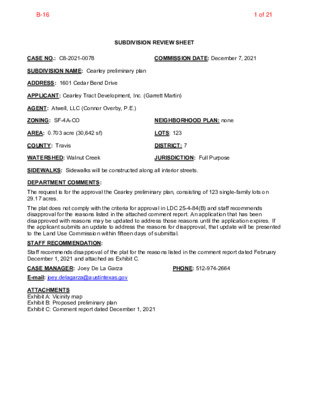
SUBDIVISION REVIEW SHEET CASE NO.: C8-2021-0078 COMMISSION DATE: December 7, 2021 SUBDIVISION NAME: Cearley preliminary plan ADDRESS: 1601 Cedar Bend Drive APPLICANT: Cearley Tract Development, Inc. (Garrett Martin) AGENT: Atwell, LLC (Connor Overby, P.E.) ZONING: SF-4A-CO NEIGHBORHOOD PLAN: none AREA: 0.703 acre (30,642 sf) COUNTY: Travis LOTS: 123 DISTRICT: 7 WATERSHED: Walnut Creek JURISDICTION: Full Purpose SIDEWALKS: Sidewalks will be constructed along all interior streets. DEPARTMENT COMMENTS: The request is for the approval the Cearley preliminary plan, consisting of 123 single-family lots on 29.17 acres. The plat does not comply with the criteria for approval in LDC 25-4-84(B) and staff recommends disapproval for the reasons listed in the attached comment report. An application that has been disapproved with reasons may be updated to address those reasons until the application expires. If the applicant submits an update to address the reasons for disapproval, that update will be presented to the Land Use Commission within fifteen days of submittal. STAFF RECOMMENDATION: Staff recommends disapproval of the plat for the reasons listed in the comment report dated February December 1, 2021 and attached as Exhibit C. CASE MANAGER: Joey De La Garza PHONE: 512-974-2664 E-mail: joey.delagarza@austintexas.gov ATTACHMENTS Exhibit A: Vicinity map Exhibit B: Proposed preliminary plan Exhibit C: Comment report dated December 1, 2021 1 of 21B-16 2 of 21B-16 UTILITIES WATER & WASTEWATER AUSTIN WATER UTILITY AVANTE PLAZA, SUITE 300 625 EAST 10TH STREET AUSTIN, TEXAS 78734 CONTACT: ALFREDO TORRES PHONE: 512.972.0238 ELECTRIC CITY OF AUSTIN 1800 LAVACA ST. AUSTIN, TX 78701 512.494.9400 GAS TXU ENERGY 1005 CONGRESS AVENUE #750 AUSTIN, TX 78701 1.800.818.6132 ONE-CALL UTILITY LOCATING SERVICE CONTRACTOR TO CALL BEFORE DIGGING!!! PHONE: 1.800.245.4545 PRELIMINARY PLAN FOR CEARLEY COMMUNITY SUBDIVISION CONSULTANTS/CONTRACTORS CIVIL ENGINEER ATWELL, LLC. 805 LAS CIMAS PARKWAY, SUITE 310 AUSTIN, TX 78746 CONTACT: CONNOR J. OVERBY, P.E PHONE: 512.904.0505 SURVEYOR ATWELL, LLC. 805 LAS CIMAS PARKWAY, SUITE 310 AUSTIN, TX 78746 CONTACT: ROBERT GERTSON, R.P.L.S. PHONE: 512.904.0505 S-2007-0769 W 8 W C) 5 1 5 V 1-0 (P 9 9 W-1 E E ELECTRIC TRANSMISSION TOWERS OWNER CEARLEY TRACT DEVELOPMENT, INC. 9111 JOLLYVILLE ROAD, SUITE 111 AUSTIN, TX 78759 PH: 512-645-2145 DEVELOPER CEARLEY TRACT DEVELOPMENT, INC. 9111 JOLLYVILLE ROAD, SUITE 111 AUSTIN, TX 78759 PH: 512-645-2145 BENCHMARK INFORMATION LEGAL DESCRIPTION ABS 382 SUR 86 HARRISON W B ABS 752 SUR 290 S A & M G R R CO ACR 30.4980 NOTES 1. RELEASE OF THIS APPLICATION DOES NOT …
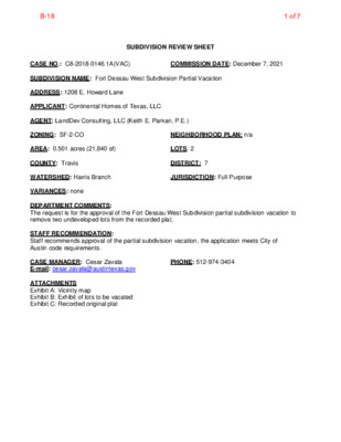
SUBDIVISION REVIEW SHEET CASE NO.: C8-2018-0146.1A(VAC) COMMISSION DATE: December 7, 2021 SUBDIVISION NAME: Fort Dessau West Subdivision Partial Vacation ADDRESS: 1208 E. Howard Lane APPLICANT: Continental Homes of Texas, LLC AGENT: LandDev Consulting, LLC (Keith E. Parkan, P.E.) ZONING: SF-2-CO NEIGHBORHOOD PLAN: n/a AREA: 0.501 acres (21,840 sf) LOTS: 2 COUNTY: Travis DISTRICT: 7 WATERSHED: Harris Branch JURISDICTION: Full Purpose VARIANCES: none DEPARTMENT COMMENTS: The request is for the approval of the Fort Dessau West Subdivision partial subdivision vacation to remove two undeveloped lots from the recorded plat. STAFF RECOMMENDATION: Staff recommends approval of the partial subdivision vacation, the application meets City of Austin code requirements. CASE MANAGER: Cesar Zavala E-mail: cesar.zavala@austintexas.gov PHONE: 512-974-3404 ATTACHMENTS Exhibit A: Vicinity map Exhibit B: Exhibit of lots to be vacated Exhibit C: Recorded original plat 1 of 7B-18 Legend Street Labels Council District Zoning Text 0.5 0 0.24 0.5 Miles NAD_1983_StatePlane_Texas_Central_FIPS_4203_Feet Date Printed: This product is for informational purposes and may not have been prepared for or be suitable for legal, engineering, or surveying purposes. It does not represent an on-the-ground survey. This product has been produced by the City of Austin for the sole purpose of geographic reference. No warranty is made by the City of Austin regarding specific accuracy or completeness. 1: 15,110 Notes Case # C8-2018-0146.1A(VAC) Address: 1208 E. Howard Lane 2 of 7B-18 L A N C O N S U N D D E V L T I N G 50' SCALE: 1" = 50' 0 100' A L C O N N D D E V GN N I S U L T A K C O 0 5 L 49 B 51 52 3 5 4 5 5 5 6 5 E RIV K D C E B U L 9 2 8 2 6 2 27 23 4 2 25 8 1 7 1 57 8 5 59 K R A A 6 1 S / P O A 5 1 14 2 3 3 3 4 3 35 K 13 2 1 0 3 K 31 C 1 1 0 1 A 0 6 61 K 2 6 C O 3 6 L 64 5 6 6 6 B 67 8 4 47 6 4 45 4 4 2 2 21 0 2 9 1 E RIV E D S U A H U Z 7 3 6 3 35 40 L 9 3 …
MBE/WBE and Small Business Enterprise Procurement Program Advisory Committee Tuesday, December 7, 2021 at 5:30 p.m. Austin Energy HQ - 4815 Mueller Blvd, Austin, TX 78723 Eliza May, Chair (Renteria) Lena Banks (Harper-Madison) Shiller Liao (Tovo) Tina Cannon (Kitchen) AGENDA Members: Reginald Worlds, Vice Chair (Pool) Erica Douglass (Kelly) Ahmed Moledina (Alter) Talan Tyminski (Fuentes) Barbra Boeta (Adler) Daniel Berner (Ellis) Terry Mitchell (Casar) CALL TO ORDER CITIZEN COMMUNICATION: GENERAL The first 10 speakers signed up prior to the meeting being called to order will each be allowed a three-minute allotment to address their concerns regarding items not posted on the agenda. 1. APPROVAL OF MINUTES 2. NEW BUSINESS For discussion and possible action on recommendations to City Council (City Code § 2-1-163(B)) regarding the following: a. Discussion and appropriate action regarding updates on the status outcomes, issues, and discussions from and for the Inclusive Procurement Working Group. b. Discussion and appropriate action regarding information on the use of a Personal Net Worth (PNW) and the Economic Disadvantage definition; and development of a proposed resolution on the issue of PNW and the Economic Disadvantage definition in the MBE/WBE Procurement Program. (45 minutes) c. Discussion and appropriate action on a resolution on the issue of PNW and the Economic Disadvantaged definition in the MBE/WBE Procurement Program. 3. OLD BUSINESS For discussion and possible action on recommendations to City Council (City Code § 2-1-163(B)) regarding the following: a. Update on the Disparity Study with discussion and appropriate action. (5 minutes) 4. FUTURE AGENDA ITEMS a. Corridor Program MBE/WBE Outreach Update (January) b. Alternative Delivery Selection Criteria (January) ADJOURNMENT The City of Austin is committed to compliance with the American with Disabilities Act. Reasonable modifications and equal access to communications will be provided upon request. Meeting locations are planned with wheelchair access. If requiring Sign Language Interpreters or alternative formats, please give notice at least 2 days (48 hours) before the meeting date. Please contact Nakia James at (512) 974-9108 or nakia.james@austintexas.gov for additional information; TTY users route through Relay Texas at 711. For more information on the MBE/WBE and Small Business Procurement Program Advisory Committee, contact Nakia James at (512) 974-9108 or nakia.james@austintexas.gov. Page 1 of 1