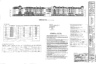
B-02 C14-2021-0184 Elevation, Notes, Calculations .pdf.pdf — original pdf
Backup

Backup
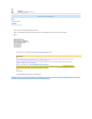
From: To: Cc: Subject: Date: Rhoades, Wendy; Re: For ZAP 2-1-2022 C14-2021-0184 - 7201 FM Road 2222 Tuesday, February 1, 2022 2:32:53 PM *** External Email - Exercise Caution *** On Feb 1, 2022, at 1:10 PM, Michele Rogerson Lynch wrote: Wendy - my understanding is that Lake Austin Collective has asked for a 2 week postponement. I just let Linda know that I will not oppose. Michele, Thank you very much, Linda Bailey Thanks, M ----------------------------- Michele Rogerson Lynch Director of Land Use & Entitlements Metcalfe Wolff Stuart & Williams, LLP 221 W. 6th Street, Suite 1300 Austin, Texas 78701 (512) 404-2251 ofc (512) 797-2129 cell (512) 404-2244 fax On Jan 28, 2022, at 11:13 AM, Rhoades, Wendy <Wendy.Rhoades@austintexas.gov> wrote: The Zoning and Platting Commission (ZAP) agenda and the updated Staff report with all correspondence received to date are provided in the link below. The 7201 FM Road 2222 zoning case (Item B-2) is slated as a discussion item. Please refer to page 6 for a link to register in advance of the meeting to address the Commission. Page 7 includes information about parking validation and Speaker testimony time allocation. Staff report (with page numbers): ZONING CHANGE REVIEW SHEET (austintexas.gov) Please note, the ZAP meeting has the option of allowing the public to participate via telephone as well as in-person. In order to address the ZAP Commission by telephone, please be sure to sign up through the Commission Liaison Andrew Rivera prior to Noon on Monday, January 31st. In- person speakers are able to sign up anytime prior to the ZAP 6 p.m. start time. [Outside Email] All, Sincerely, Wendy Rhoades <Zoning and Platting Commission February 1 2022 Agenda.pdf> CAUTION: This email was received at the City of Austin, from an EXTERNAL source. Please use caution when clicking links or opening attachments. If you believe this to be a malicious and/or phishing email, please forward this email to cybersecurity@austintexas.gov.
Play audio
Regular Meeting ZONING & PLATTING COMMISSION Tuesday, February 1, 2022 The Zoning & Platting Commission convened in a meeting on Tuesday, February 1, 2022 @ http://www.austintexas.gov/page/watch-atxn-live Chair Barrera-Ramirez called the Commission Meeting to order at 6:05 p.m. Commission Members in Attendance: Cesar Acosta Scott Boone Timothy Bray Ann Denkler – Parliamentarian Betsy Greenberg David King Jolene Kiolbassa – Vice-Chair Nadia Barrera-Ramirez – Chair Hank Smith Carrie Thompson Roy Woody EXECUTIVE SESSION (No public discussion) The Zoning & Platting Commission will announce it will go into Executive Session, if necessary, pursuant to Chapter 551 of the Texas Government Code, to receive advice from Legal Counsel on matters specifically listed on this agenda. The Commission may not conduct a closed meeting without the approval of the city attorney. Private Consultation with Attorney – Section 551.071 CITIZEN COMMUNICATION The first four (4) speakers signed up prior to the speaker registration deadline will each be allowed a three-minute allotment to address their concerns regarding items not posted on the agenda. A. APPROVAL OF MINUTES 1. Approval of minutes from January 18, 2022 Motion for approval of minutes from January 18, 2022 was approved on the consent agenda on the motion by Commissioner Smith, seconded by Commissioner Greenberg, approved on a vote of 10-0. Commissioner Bray off the dais. B. 1. Rezoning: Location: PUBLIC HEARINGS C14-2021-0161 - West William Cannon Housing; District 5 3101 West William Cannon Drive, Williamson Creek Watershed - Barton Springs Zone Jubilee Christian Center (Jimmy R. Seal) Armbrust & Brown, PLLC (Michael J. Whellan) LO-CO to MF-4 Recommended Wendy Rhoades, 512-974-7719, wendy.rhoades@austintexas.gov Housing and Planning Department Owner/Applicant: Agent: Request: Staff Rec.: Staff: Motion to grant Applicant’s request for postponement of this item to March 1, 2022 was approved on the consent agenda on the motion by Commissioner Smith, seconded by Commissioner Greenberg on a vote of 10-0. Commissioner Bray off the dais. 2. Zoning: Location: Owner/Applicant: West Lake Vistas LLC (Kimberly de la Fuente) Agent: Request: Staff Rec.: Staff: Metcalfe Wolff Stuart & Williams, LLP (Michele Rogerson Lynch) I-RR to MF-4-CO Recommended Wendy Rhoades, 512-974-7719, wendy.rhoades@austintexas.gov Housing and Planning Department C14-2021-0184 - 7201 FM Road 2222; District 10 7201 FM Road 2222, West Bull Creek Watershed Motion to grant Neighborhood’s request for postponement of this item to February 15, 2022 was approved on the consent agenda on the motion by Commissioner Smith, seconded by Commissioner Greenberg on a vote of 10-0. …
ARTS COMMISSION SPECIAL CALLED MEETING January 31, 2022 AT 6:00 PM Austin City Hall, Council Chambers, Room 1001 301 W 2nd Street, Austin, Texas 78701 Some members of the Arts Commission may be participating by videoconference. The meeting may be viewed online at: http://www.austintexas.gov/page/watch-atxn-live Public comment will be allowed in-person or remotely by telephone. Speakers may only register to speak on an item once, either in-person, or remotely and will be allowed up to three (3) minutes to provide their comments. Speakers wishing to participate remotely by telephone are required to register in advance no later than noon the day before the meeting. To register to speak remotely email or call Anne-Marie McKaskle-Davis at annemarie.mckaskle@austintexas.gov, 512-974-7854 by noon on Sunday, January 30, 2022. CURRENT BOARD MEMBERS: Michelle Polgar – Chair, Celina Zisman – Vice Chair, Brett Barnes, Jaime Castillo, Lulu Flores, Felipe Garza, Acia Gray, kYmberly Keeton, Amy Mok, Heidi Schmalbach, Rick Van Dyke CALL TO ORDER AGENDA CITIZEN COMMUNICATION: GENERAL The first 10 speakers who register to speak no later than noon the day before the meeting will be allowed a three-minute allotment to address their concerns regarding items not posted on the agenda. 1. APPROVAL OF MINUTES a. Approve the minutes for the regular Arts Commission meeting on: i. December 15, 2021 2. CHAIR’S REPORT a. Updates - Council Action on ARPA Funding; Equity WG; Reminder of Equity Resources; Communication b. Art in Public Places Liaison Report - Commissioner Barnes c. AEDC/Cultural Trust Advisory Committee Report – Carl Settles d. Downtown Commission Report – Commissioner Keeton 3. SPECIAL PRESENTATION a. Ground Floor Theatre – Lisa Scheps, Founder & Co-Artistic Director a. ARPA and Non-Profit Relief Funding Update – Laura Odegaard, Cultural Investment b. Hotel Occupancy Tax Update – Sylnovia Holt-Rabb, Acting Economic Development c. Cultural Funding Review Process Update – Meghan Wells, Cultural Arts Division 4. STAFF BRIEFINGS Program Manager Department Director Manager 5. OLD BUSINESS a. Discussion and Possible Action on Cultural Funding Review Process b. Discussion and Possible Action on Working Groups and Working Group Updates i. Equity Working Group with Community Arts leaders of the BIPOC/LGBTQIA/Disabilities Community/Women with Commissioners Keeton (chair) and commissioners Castillo, Gray, Polgar and community members ii. Joint Working Group for Joint Cultural Committee with Commission Chair Polgar, Commissioner Castillo (chair) and working group members from the Quality of Life Commissions iii. Joint Music/Arts Commission Working Group to identify additional funding resources …
American Rescue Plan Act ‐ Arts Update ARTS COMMISSION JANUARY 31, 2022 Arts & Culture Non‐Profit Relief: $3.92m o $2 million (part of City’s American Rescue Plan Act (ARPA) allocation) o 100 one‐time, flat, unrestricted grants of $20,000 o Notifications: Week of August 16th; Funding distribution: Week of August 23rd o Additional Funds added and distributed 11/23/2021 o $1 million Council Approved Budget Amendment (50 awards) o $420,000 ARPA (21 awards) o Additional Funds added and approved by council 12/9/2021 o $500,000 (25 awards) o COA executed contract 12/22/21; BBB invoiced 12/27/21 o Checks cut and mailed on 12/31/21! o CM Alter asked us to “act with expediency... ideally by December 31, 2021” = success! Arts Community Relief (ARPA): $5.32m o Council approved fund allocations ‐ November 18, 2021 o Pivot to third party announced– December 15, 2022 o Notification to cultural contractors from COA – December 17, 2022 o Award emails/ links sent from BBB* – December 22, 2022 o Purchasing finalized contract with third party – January 13, 2022 o BBB invoiced – January 18, 2022 o Funds received by BBB; 335 checks ($5m) cut & mailed – January 21, 2022 *22 contractors ($71,702.10) received funding from COA directly before we pivoted to BBB. Breakdown of Creative Sector Support Program Date Source Amount Funded # of Grants By Year Music Disaster Relief Grant 1.0 Creative Space Disaster Relief April 2020 June 2020 COA COA $1,500,000 1,497 $1,000,000 Small Business Relief Grant (Creative Industries only) July 2020 CARES $2,187,038 Non‐Profit Relief Grant (Arts & Culture only) July/Sept 2020 CARES $1,921,841 Creative Worker Relief Grant August 2020 CARES $3,500,000 1,866 Live Music Venue Preservation Relief January 2021 SAVES $1,394,700 Arts & Culture Non‐Profit Relief Grant August 2021 ARPA+ $3,920,000 Arts Community Relief January 2022 ARPA $5,318,705 Music Disaster Relief Grant 2.0 February 2022 ARPA $2,300,000 32 131 127 73 196 384 $10,108,879 $5,314,700 $7,618,705 $23,042,284 1,150 5,456
Comal Pocket Park Prospectus A U S T I N A R T S C O M M I S S I O N J A N U A R Y 3 1 , 2 0 2 2 What's happened at Comal Pocket Park? Improvements to Overall Accessibility Project scope included: • New Entry • Additional Sidewalk • • Playground Equipment • Picnic Area • Half-Court Basketball Court • Landscaping • New seating • Decking • Bocce Ball Court The park’s renovation is intended to meet the needs of the ever-changing population while maintaining a connection to its storied history. Artwork Location & Opportunity District 3 Project Goals Community feedback for the goals was provided through PARD's community engagement process for the park's renovation project and via virtual meeting on 11/30/22. Artist Budget: $43,000 Complements the entrance arch, as well as the other natural and built features of the park; Establishes the park as a destination for gathering within the neighborhood, in a fun, inviting way for kids and families; Recognizes the park’s history and celebrates the area’s diverse community and culture; Is safe, easily maintained, and vandal resistant in an exterior environment; Contributes to the depth and breadth of the City of Austin’s public art collection. Eligibility •Eligible: Professional visual artists or artist teams; at least 18 years of age; live in the 7- county Austin metropolitan area •Excludes: Full-time, permanent City of Austin employees; employees of the project consultants and sub-consultants; artists under an active AIPP contract Selection Process •RFQ open for 2 months; submissions via PublicArtist.org •3-person jury and advisors select 3-5 finalists for interviews; recommend 1 artist or artist team and 1 alternate •Approval by AIPP Panel and Arts Commission •Selected artist or artist team is engaged in a design + commission contract with AIPP Selection Criteria • Artistic merit and technical expertise; • Ability to engage the community in which the artwork is being proposed; • Demonstrated success completing works of art 3-Person Jury Suggestions Advisors A 3-member jury shall be selected that includes at least 1 visual artist. Possible jury members include: Project advisors will be invited to participate in the process to provide assistance and expertise to the selection panel. The project advisors to the panel may include: • Trenton Anthony, Visual Artist James Teasdale, HACA Staff Member • Lys Santamaria, Visual Artist • Dianne Sonnenberg, Visual Artist • Andrew Long, Visual Artist …
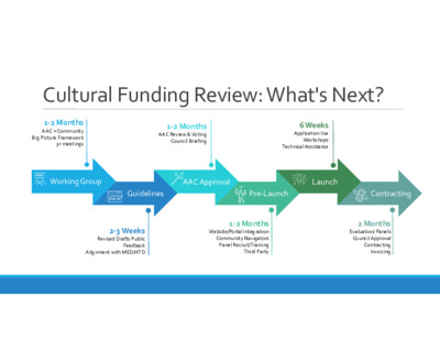
Cultural Funding Review: What's Next? 1‐2 Months AAC + Community Big Picture Framework 3+ meetings 1‐2 Months AAC Review & Voting Council Briefing 6 Weeks Application live Workshops Technical Assistance Working Group AAC Approval Launch Guidelines Pre‐Launch Contracting 2‐3 Weeks Revised Drafts Public Feedback Alignment with MED/HTD 1‐2 Months Website/Portal Integration Community Navigators Panel Recruit/Training Third Party 2 Months Evaluation/ Panels Council Approval Contracting Invoicing
Dove Springs Health Facility AIPP Project Prospectus Approval A N N A B R A D L E Y, A I P P STA F F A RT S C O M M I S S I O N JA N UA RY 3 1 , 2 0 2 2 Community Engagement: 9/21/21, 9/25/21 Public Art Intent & Goals • Creates an iconic artwork that identifies the Dove Springs area as a strong multi-generational and multi-cultural, historically-family neighborhood; • Reflects a welcoming, healing, and caring place of protection; • Visually or physically integrates educational elements that promotes early childhood development; • • Is safe, easily maintained, and vandal resistant in an exterior environment; and Enriches or adds to the depth/breadth of the City of Austin’s public art collection. Jury & Project Advisors A 3-member voting selection jury of artists and arts professionals shall be advised by members from the Dove Springs Task Force. Possible Jurors may include: Monica Maldonado, Mas Cultura Angel Garcia, Marmon Mok Architects Angel Alcala, TEMPO 2019 & AFD Phase 6 City of Austin Advisors include: Kymberley Maddox - Austin Public Health • • • Dove Springs Rec Manager • Gina Saenz – Parks and Recreation Department, City Kalpana Sutria – Project Manager, Public Works Filip Gecic – Austin Public Health of Austin SpawGlass, Design - Builder • Artist Eligibility Applicants should meet the following requirements: Professional visual artist, or artist team At least 18 years of age; and Live in the 7-county Austin metropolitan area (Williamson, Travis, Bastrop, Caldwell, Hays, Burnet, and Blanco counties). AIPP Panel and Arts Commission Project Advisors may include: • • Joel Nolan – Liaison Art in Public Places Panel Jaime Castillo – Liaison Austin Arts Commission, District 2 Pavilion shade structure: $110,000 A foundation platform will be provided at measuring at approximately 18’x 42’. The artists will design, fabricate and install a shade structures that will serve as a meeting place. Exterior wall: $64,000 The west-facing wall at the entrance to the facility will have an approximate area of 34’ tall x 23’ wide to create a wall hung 3-D artwork or a 2-D artwork to be mounted to the building. Schedule (subject to change) 2021 April - Project introduction to AIPP Panel September - Community engagement meetings 2022 January - Prospectus approval by AIPP Panel & Arts Commission February - Request for Qualifications released & Artist Information Meeting for Cycle …
Hotel Occupancy Tax Update Laura Odegaard Cultural Investment Program Manager Economic Development Department January 31, 2022 C I T Y O F A U S T I N E C O N O M I C D E V E L O P M E N T 1 Hotel Occupancy Tax – December 2021 Hotel Occupancy Tax Fund Month Ended December 31, 2021 Approved Budget Amended Budget December w/Encumb Year-to-date w/Encumb Year-End Estimate Year-End Variance Fav(Unfav) Year-End % Variance Fav(Unfav) BEGINNING BALANCE 0 0 0 0 Tfr to Cultural Arts Fund 6,660,189 6,660,189 314,150 2,374,916 6,660,189 0 0 N/A 0.0% Total HOT Dec YTD is $24,868,025 • 36% of Budget of $69,773,408 • $16M above prior year YTD of $8,867,163 C I T Y O F A U S T I N E C O N O M I C D E V E L O P M E N T 2 HOT Cultural Arts Fund – December 2021 Year End Estimate: $6,660,189 For Comparison: 36% so far C I T Y O F A U S T I N E C O N O M I C D E V E L O P M E N T 3 Questions? C I T Y O F A U S T I N E C O N O M I C D E V E L O P M E N T 4
Play video
JOINT INCLUSION COMMITTEE January 28th, 2022 at 3:00 PM City Hall Board and Commissions – Room 1101 301 W 2nd St. Austin, Texas 78701 Some members of the COMMISSION/BOARD may be participating by videoconference CURRENT BOARD MEMBERS: Hispanic Quality of Life Advisory Commission: Amanda Afifi Alternate: Sharon Vigil Alternate: Johanna Hosking Pulido Early Childhood Council: Raul Alvarez Commission for Women: Flannery Bope Alternate: Rebecca Austen Comission for Seniors: Emily Nicola Alternate: Sally VanSickle Human Rights Commission: Jamarr Brown Alternate: Idona Griffith Asian American Quality of Life Commission: Vincent Cobalis Alternate: Hanna Huang Commission on Immigrant Affairs: Karen Crawford (Vice Chair) Alternate: Krystal Gomez Alternate: Charles Curry LGBTQ Quality of Life Commission: (Chair) Mayor’s Committee for People with Disability: Robin Orlowski African American Resource Advisory Commission: Gregory Smith Alternate: Joey Gidseg Alternate: Serita Fontanesi AGENDA CALL TO ORDER CITIZEN COMMUNICATION: GENERAL The first 10 speakers signed up prior to the meeting being called to order will each be allowed a three-minute allotment to address their concerns regarding items not posted on the agenda. 1. APPROVAL OF MINUTES Minutes from December 1st 2021 2. PRESENTATIONS a. Chief Chacon 3. OLD BUSINESS a. FY21-22/FY22-23 Budget Process i. Report from individual Commission representatives on progress made in determining status of FY21-22 recommendations in the FY21-22 Adopted Budget ii. Report from individual Commission representatives on progress made in determining recommendations for the FY22-23 Proposed Budget iii. Discussion and establishing of a deadline for submission iv. Discussion and appointing budget work groups v. Discussion and planning for budget workshop 4. NEW BUSINESS FUTURE AGENDA ITEMS ADJOURNMENT The City of Austin is committed to compliance with the American with Disabilities Act. Reasonable modifications and equal access to communications will be provided upon request. Meeting locations are planned with wheelchair access. If requiring Sign Language Interpreters or alternative formats, please give notice at least 2 days (48 hours) before the meeting date. Please call Enakshi Ganguly at the Equity Office, at (512) 987 – 1569 or enakshi.ganguly@austintexas.gov for additional information; TTY users route through Relay Texas at 711. For more information on the Joint Inclusion Committee, please contact Enakshi Ganguly at (512) 987 – 1569 or enakshi.ganguly@austintexas.gov.
Play audio
JOINT INCLUSION COMMITTEE SPECIAL CALLED MEETING MINUTES ON BUDGET January 28th, 2022 JOINT INCLUSION COMMITTEE (JIC) FRIDAY, JANUARY 28, 2022 at 3:00 PM City Hall Boards and Commissions – Room 1101 301 W 2nd St Austin, TX 78701 SPECIAL CALLED MEETING MNUTES ON BUDGET Some members of the Commission may be participating by videoconference. Public comment will be allowed in person or via telephone. Remote speakers must register in advance (48 hrs). All public comment will occur at the beginning of the meeting. To speak remotely, residents must: Call or email the board liaison at Jeremy Garza at Equity Office, at (512-978-1797), no later than 48hrs before meeting. The information required is the speaker’s name, item number(s) they wish to speak on, whether they are for/against/neutral, email address and telephone number. CURRENT BOARD MEMBERS: Hispanic Quality of Life Advisory Commission: Amanda Afifi Alternate: Sharon Vigil Alternate: Johanna Hosking Pulido Early Childhood Council: Raul Alvarez Commission for Women: Flannery Bope Alternate: Rebecca Austen Commission for Seniors: Emily Nicola Alternate: Sally VanSickle Human Rights Commission: Jamarr Brown Alternate: Idona Griffith Asian American Quality of Life Commission: Vincent Cobalis Alternate: Hanna Huang Commission on Immigrant Affairs: Karen Crawford (Vice Chair) Alternate: Krystal Gomez Alternate: Charles Curry LGBTQ Quality of Life Commission: (Chair) Mayor’s Committee for People with Disability: Robin Orlowski African American Resource Advisory Commission: Gregory Smith Alternate: Joey Gidseg Alternate: Serita Fontanesi January 28th, 2022 JOINT INCLUSION COMMITTEE SPECIAL CALLED MEETING MINUTES ON BUDGET Meeting Minutes Charles Curry call to the meeting at 3:05pm CALL TO ORDER VIRTUAL ROLL CALL: Present: • Charles Curry – Chair • Karen Crawford – Vice-Chair • Amanda Afifi • Robin Orlowski • Sally Van Sickle • Greg Smith • Vince Cobalis • Raul Alvarez • Rebecca Austen Absent: • Emily Nicola • Jamarr Brown PUBLIC COMMUNICATION: GENERAL The first 10 speakers signed up prior to the meeting being called to order will each be allowed a three-minute allotment to address their concerns regarding items not posted on the agenda. Public comment will be allowed in-person or remotely by telephone. Speakers may only register to speak on an item once either in-person or remotely and will be allowed up to three minutes to provide their comments. Registration no later than noon the day before the meeting is required for remote participation. To register, please email Jeremy Garza at jeremy.garza@austintexas.gov or call at (512) 987 – 1569. 1. …
BUILDING AND STANDARDS COMMISSION MEETING Wednesday, January 26, 2022 at 6:30 p.m. Austin City Hall, Council Chambers, Room 1001 301 W. 2nd Street, Austin, Texas 78701 Some members of the Building and Standards Commission may be participating via videoconference. The meeting may be viewed online at: http://www.austintexas.gov/page/watch-atxn-live AGENDA The Building and Standards Commission (“Commission”) may go into a closed session under Chapter 551 of the Texas Government Code to receive advice from legal counsel or for other reasons permitted by law as specifically listed on this agenda. Further, if necessary, the Commission may go into a closed session as permitted by law regarding any item on this agenda. Building and Standards Commission Members Andrea Freiburger, Chair Pablo Avila, Vice Chair Wordy Thompson John Green CALL TO ORDER CITIZEN COMMUNICATION: GENERAL Timothy Stostad Elizabeth Mueller Sade Ogunbode Edgar Farerra Edward Selig Michael C. Francis Thomas Vocke, Fire Marshall (Ex Officio) The first five speakers signed up prior to the meeting being called to order will each be allowed a three- minute allotment to address their concerns regarding items not posted on the agenda. APPROVAL OF MINUTES Approve the minutes of the Building and Standards Commission’s December 8, 2021 regular meeting. PUBLIC HEARINGS New Case(s): The Commission will hear the following cases concerning alleged violations of the City’s Property Maintenance Code and may issue an order to vacate, relocate occupants, repair, demolish, or secure the premises; and may assess civil penalties: 1. Case Numbers: CL 2022-002066; CL 2022-002070; CL 2022-002076; CL 2022-002087; CL 2022-002099; CL 2022-002119; CL 2022-002132; CL 2022-002136; and CL 2022-002149 Property address: 6903 Deatonhill Drive (aka Flagstone Terrace Condominiums) - Buildings 1-8 (Exteriors) and Bldg. 9 (Pool House) / Owner(s): Flagstone Terrace Owners Association, Inc., and Individual Owners of Units 1-49 (see attached list) Page 1 Staff presenter: Dedric Knox Staff recommendation: Repair residential condominium structures and pool house 2. Case Number: CL 2022-002014 Property address: 600 Barwood Park (aka Remington House Apartments), Building 22/ Owner: Remington CF House Associates Limited Partnership Staff presenter: Alicia Tovar Staff recommendation: Repair fire-damaged multi-family structure 3. Case Number: CL 2022-002055 Property address:2006 Blue Meadow Drive / Owner: Charles Richard Vines Staff presenter: Sandy Van Cleave Staff recommendation: Demolish fire-damaged mobile home and accessory structure Returning for Commission Action: The Commission will hear the following returning cases that concern alleged violations of the City’s Property Maintenance Code and may issue orders to vacate, …
EMMA S. BARRIENTOS MEXICAN AMERICAN CULTURAL CENTER ADVISORY BOARD SPECIAL CALLED MEETING WEDNESDAY, JANUARY 26, 2022 6:00 PM City Hall – Boards and Commissions Room 301 W. Second St. Austin, TX 78701 Some members of the Emma S. Barrientos Mexican American Cultural Center Advisory Board may be participating by videoconference. The meeting may be viewed online at: http://www.austintexas.gov/page/watch-atxn-live Public comment will be allowed in-person or remotely by telephone. Speakers may only register to speak on an item once either in-person or remotely and will be allowed up to three minutes to provide their comments. Registration no later than noon the day before the meeting is required for remote participation. To register call or email the board liaison at 512-974-3771 or michelle.rojas@austintexas.gov BOARD MEMBERS David Goujon, Chair Arthur Navarro, Vice Chair Gerardo Gandy, Member Ricardo Maga Rojas, Member Tomas Salas, Member Wayne Lopes, Member Claudia Massey, Member Endi Silva, Member AGENDA Citizens wishing to speak on the agenda and non-agenda related items must sign up at least ten minutes before the meeting is called to order. Citizens may speak on non-agenda items under the Citizens Communications section of the agenda. Citizens may speak on an agenda related item after a presentation on the item has been made, except that Citizens may not speak after City staff reports. Speakers signed up at least 10 minutes prior to the meeting being called to order will each be allowed a three-minute allotment to address their concerns. Boards and Commissions follow the same rules as City Council meetings. CALL TO ORDER CITIZEN COMMUNICATION The first 10 speakers signed up prior to the meeting being called to order will each be allowed (3) three minutes to address their concerns regarding items not posted on the agenda. 1. PRESENTATIONS a. Presentation by Heidi Tse, Project Manager and the joint venture of Miro Rivera Architects and Tatiana Bilbao Studios on the Schematic Design for Phase 2. 2. NEW BUSINESS Rojas) 3. ADJOURNMENT a. Discussion and possible action on Phase 2 Schematic Design. (Goujon, Maga The City of Austin is committed to compliance with the American with Disabilities Act. Reasonable modifications and equal access to communications will be provided upon request. Meeting locations are planned with wheelchair access. If requiring Sign Language Interpreters or alternative formats, please give notice at least 2 days (48 hours) before the meeting date. Please call Michelle Rojas at the Parks and Recreation Department, …

CIP ID#5201.008 Schematic Design Presentation Miró Rivera-Tatiana Bilbao LLC January , 202220tESB-MACC Phase 2 Improvements Schematic Design Presentation CONCEPT PRINCIPLES Approach, Views, Enclosure & Security, Access, Visibility TRAIL LADY BIRD LAKE YOUTH PLAY AREA PARKING LAKE LEVEL GARDEN ZÓCALO HEALING GARDEN LOADING DOCK WELCOME GARDEN 22 CONCEPT PRINCIPLES Approach, Views, Enclosure & Security, Access, Visibility LOADING DOCK HEALING GARDEN ZÓCALO LAKE LEVEL GARDEN LADY BIRD LAKE WELCOME GARDEN PARKING YOUTH PLAY AREA TRAIL 32 LANDSCAPE Plan Level 1 HEALING GARDEN YOUTH PLAY AREA TRAIL LAKE LEVEL GARDEN 24 LANDSCAPE Lake Level TRAIL LAKE LEVEL GARDEN 25 26DRAWN BY:JOB #:DATE:SHEET:SCALE:600 RIVER STREETAUSTIN, TEXAS 78701MEXICAN AMERICANCULTURAL CENTERREVISIONISSUEDAStructuralMartinez Engineering501 Congress Ave, Ste 113Austin, TX 78701737.238.2741MWM Design Group305 E Huntland DrAustin, TX 78752512.453.0767CONSULTANTSCivil EngineerLandscape ArchitectTen Eyck Landscape Architec1214 W 6th St, #100Austin, TX 78703512.813.9999Aptus Engineering1919 S 1st St, Bldg BAustin, TX 78704512.872.5059MEPMiró Rivera Architects505 Powell StreetAustin, Texas 78703512.477.7016Copyright ©2021, Miró Rivera-Tatiana Bilbao LLCTatiana Bilbao ESTUDIPaseo de la Reforma 38CDMX, Mexico 06600+52 (55) 8589 8822NOT FOR REGULATORYAPPROVAL, PERMITTINGOR CONSTRUCTIONSCHEMATIC DESIGN11/2311/23SRLRIPARIAN W/ SLOPE STABILIZATIONRAIN GARDEN / SWALELAWN(SHRUBS, FORBS, GRASSES, GROUNDCOVERS)TREESTRANSPLANTED TREESPECIMEN TREE(QUANTITY IS APPROXIMATE)PCNATIVE PLANTING AREACACTUS GARDENLARGE TREESSMALL TREES PALMSPLANTING ZONE DIAGRAMTREE DIAGRAMUNDERSTORY / RIPARIANSLOPE / RIPARIANUNDERSTORY / RIPARIANRAIN GARDENCACTUS GARDENUNDERSTORY / RIPARIANSLOPE / RIPARIANUNDERSTORY / RIPARIANRAIN GARDENSUNNY SLOPEPLANTING PLAN &REFERENCE IMAGESLLLLLPPPPPPPPCCPSSSSSRRMACC Community Engagement PresentationLANDSCAPE Planting Zones FLOOR PLAN Level 1 W // // // KEY PLAN Existing (Non-Renovated Space) Reception / Visitor Information Youth Education Utility / Mechanical Multi-use Auditorium Auditorium Lobby Dance Class Music Room Community Gallery Permanent Gallery Teaching Kitchen 27 ZOOM PLAN Youth Education OFFICE STORAGE YOUTH CLASSROOM 4 YOUTH CLASSROOM 3 UNISEX STORAGE YOUTH CLASSROOM 2 YOUTH GALLERY YOUTH CLASSROOM 1 UNISEX STORAGE Key: Plan Level 1 8 WALKTHROUGH Youth Classrooms and Zocalo Staircase 29 ZOOM PLAN Multi-purpose Auditorium B.O.H AUDITORIUM VESTIBULE LOBBY/TICKETING UNISEX Key: Plan Level 1 THE CURRENT THEATRE HAS 135 SEATS THE RENOVATED THEATRE WILL HAVE 228 SEATS 210 ZOOM PLAN Multi-purpose Auditorium AUDITORIUM Key: Plan Level 1 THE CURRENT THEATRE HAS 135 SEATS THE RENOVATED THEATRE WILL HAVE 228 SEATS 211 ZOOM PLAN Reception BREAK ROOM OFFICE COVERED WALKWAY OFFICE OPEN OFFICE Key: Plan Level 1 212 ZOOM PLAN Gallery, Kitchen and Music Rooms MUSIC ROOM 2 MUSIC ROOM 3 MUSIC ROOM 1 UNISEX COMMUNITY GALLERY PERMANENT GALLERY UNISEX PANTRY TEACHING KITCHEN Key: Plan Level 1 213 WALKTHROUGH Aerial View of Gallery Wing and Lake Level Connection 214 FLOOR PLAN Level 2 5 8 3 7 1 …
Play video

Repeat Offender Program Audit: Building & Standards Commission Briefing Agenda 1. 2020 Audit Report Summary 2. Stakeholder Engagement Timeline 3. Concluding Statements Audit Report Summary • Responses to finding one and two in the Audit Report are complete. • Deadline for response to finding three is October 2022. Stakeholder Engagement Timeline Thank you.
Play audio