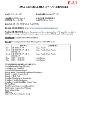
BOA GENERAL REVIEW COVERSHEET CASE: C15-2021-0097 BOA DATE: October 11th, 2021 ADDRESS: 4315 Avenue A OWNER: Gary J. Hobbs COUNCIL DISTRICT: 9 AGENT: Nathan Hobbs ZONING: SF-3-NCCD-NP (Hyde Park NCCD) LEGAL DESCRIPTION: W 76FT OF LOT 1-3 BLK 11 HYDE PARK ADDN NO 1 VARIANCE REQUEST: decrease the minimum Lot Size requirements from 5,750 square feet (required) to 5,700 square feet (requested) and increase the improvement value from 20% (allowed) to 60% (requested) SUMMARY: complete a remodel and addition ISSUES: lot configuration, location of heritage trees, unhabitable home Site North South East West ZONING SF-3-NCCD-NP SF-3-NCCD-NP; MF-3- NCCD-NP SF-3-NCCD-NP; MF-4- NCCD-NP MF-4-NCCD-NP MF-4-NCCD-NP LAND USES Single-Family Single-Family; Multi-Family Single-Family; Multi-Family Multi-Family Multi-Family NEIGHBORHOOD ORGANIZATIONS: Austin Independent School District Austin Lost and Found Pets Austin Neighborhoods Council Central Austin Community Development Corporation Friends of Austin Neighborhoods Friends of Hyde Park Homeless Neighborhood Association Hyde Park Neighborhood Assn. Hyde Park Neighborhood Plan Contact Team My Guadalupe Neighborhood Empowerment Foundation North Austin Neighborhood Alliance Preservation Austin SELTexas Sierra Club, Austin Regional Group E-3/1 ! ! ± SUBJECT TRACT PENDING CASE ! ! ZONING BOUNDARY NOTIFICATIONS CASE#: LOCATION: C15-2021-0097 4315 AVENUE A This product is for informational purposes and may not have been prepared for or be suitable for legal, engineering, or surveying purposes. It does not represent an on-the-ground survey and represents only the approximate relative location of property boundaries. 1 " = 292 ' This product has been produced by CTM for the sole purpose of geographic reference. No warranty is made by the City of Austin regarding specific accuracy or completeness. E-3/2 E-3/3 E-3/4 E-3/5 E-3/6 E-3/7 E-3/8 E-3/9 E-3/10 E-3/11 E-3/12 E-3/13 E-3/14 E-3/15 E-3/16 E-3/17 E-3/18 E-3/19 E-3/20 E-3/21 E-3/22 E-3/23 E-3/24 E-3/25 E-3/26 E-3/27 E-3/28 E-3/29 E-3/30 E-3/31 E-3/32 E-3/33 E-3/34 E-3/35 E-3/36 E-3/37
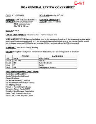
BOA GENERAL REVIEW COVERSHEET CASE: C15-2021-0098 BOA DATE: October 11th, 2021 ADDRESS: 5200 McKinney Falls Pkwy COUNCIL DISTRICT: 2 AGENT: Alecia Mosadomi OWNER: PAP Realty Partnership/ MVE Ventures, Ltd./ The WP & AP Ltd. ZONING: MF-4 LEGAL DESCRIPTION: ABS 24 DELVALLE S ACR 13.5883 (1-D-1W) VARIANCE REQUEST: increase height limit from 30 feet (minimum allowed) to 47 feet (requested), increase height limit from 40 feet (maximum allowed) to 47 feet (requested), increase height limit from 40 feet plus one foot for each 10 feet of distance in excess of 100 feet but not more than 300 feet (maximum allowed) to 47 feet (requested) SUMMARY: erect Multi-Family Housing ISSUES: floodplain which places constraints on the location, size and configuration of structures ZONING LAND USES MF-4 2 mi. ETJ Site North South RR East West P DR Multi-Family 2 mi. ETJ Rural Residential Public Development Reserve NEIGHBORHOOD ORGANIZATIONS: Austin Lost and Found Pets Austin Neighborhoods Council Caracol Southeast Del Valle Community Coalition Del Valle Independent School District Dove Springs Proud Friends of Austin Neighborhoods Go Austin Vamos Austin 78744 Homeless Neighborhood Association Onion Creek Homeowners Assoc. Sierra Club, Austin Regional Group E-4/1 M C KIN N E Y FA LLS ! ! ± SUBJECT TRACT PENDING CASE ! ! ! ! ZONING BOUNDARY NOTIFICATIONS C15-2021-0098 CASE#: LOCATION: 5200 MCKINNEY FALLS PARKWAY This product is for informational purposes and may not have been prepared for or be suitable for legal, engineering, or surveying purposes. It does not represent an on-the-ground survey and represents only the approximate relative location of property boundaries. 1 " = 417 ' This product has been produced by CTM for the sole purpose of geographic reference. No warranty is made by the City of Austin regarding specific accuracy or completeness. E-4/2 Board of Adjustment General/Parking Variance Application DevelopmentATX.com | Phone: 311 (or 512-974-2000 outside Austin) For submittal and fee information, see austintexas.gov/digitaldevelopment WARNING: Filing of this appeal stops all affected construction activity. This application is a fillable PDF that can be completed electronically. To ensure your information is saved, click here to Save the form to your computer, then open your copy and continue. The Tab key may be used to navigate to each field; Shift + Tab moves to the previous field. The Enter key activates links, emails, and buttons. Use the Up & Down Arrow keys to scroll through drop-down lists and check boxes, and hit Enter …
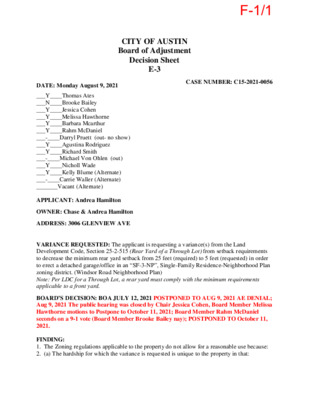
CITY OF AUSTIN Board of Adjustment Decision Sheet E-3 CASE NUMBER: C15-2021-0056 DATE: Monday August 9, 2021 ___Y____Thomas Ates ___N____Brooke Bailey ___Y____Jessica Cohen ___Y____Melissa Hawthorne ___Y____Barbara Mcarthur ___Y____Rahm McDaniel ___-____Darryl Pruett (out- no show) ___Y____Agustina Rodriguez ___Y____Richard Smith ___-____Michael Von Ohlen (out) ___Y____Nicholl Wade ___Y____Kelly Blume (Alternate) ___-____Carrie Waller (Alternate) _______Vacant (Alternate) APPLICANT: Andrea Hamilton OWNER: Chase & Andrea Hamilton ADDRESS: 3006 GLENVIEW AVE VARIANCE REQUESTED: The applicant is requesting a variance(s) from the Land Development Code, Section 25-2-515 (Rear Yard of a Through Lot) from setback requirements to decrease the minimum rear yard setback from 25 feet (required) to 5 feet (requested) in order to erect a detached garage/office in an “SF-3-NP”, Single-Family Residence-Neighborhood Plan zoning district. (Windsor Road Neighborhood Plan) Note: Per LDC for a Through Lot, a rear yard must comply with the minimum requirements applicable to a front yard. BOARD’S DECISION: BOA JULY 12, 2021 POSTPONED TO AUG 9, 2021 AE DENIAL; Aug 9, 2021 The public hearing was closed by Chair Jessica Cohen, Board Member Melissa Hawthorne motions to Postpone to October 11, 2021; Board Member Rahm McDaniel seconds on a 9-1 vote (Board Member Brooke Bailey nay); POSTPONED TO October 11, 2021. FINDING: 1. The Zoning regulations applicable to the property do not allow for a reasonable use because: 2. (a) The hardship for which the variance is requested is unique to the property in that: F-1/1 (b) The hardship is not general to the area in which the property is located because: 3. The variance will not alter the character of the area adjacent to the property, will not impair the use of adjacent conforming property, and will not impair the purpose of the regulations of the zoning district in which the property is located because: ______________________________ Elaine Ramirez Executive Liaison ____________________________ Jessica Cohen Chair forF-1/2 CITY OF AUSTIN Board of Adjustment Decision Sheet D-2 CASE NUMBER: C15-2021-0056 DATE: Monday July 12, 2021 _______Thomas Ates _______Brooke Bailey _______Jessica Cohen _______Melissa Hawthorne _______Barbara Mcarthur _______Rahm McDaniel (OUT) _______Darryl Pruett _______Agustina Rodriguez _______Richard Smith (OUT) _______Michael Von Ohlen _______Nicholl Wade _______Kelly Blume (Alternate) _______Carrie Waller (Alternate) _______Vacant (Alternate) APPLICANT: Andrea Hamilton OWNER: Chase & Andrea Hamilton ADDRESS: 3006 GLENVIEW AVE VARIANCE REQUESTED: The applicant is requesting a variance(s) from the Land Development Code, Section 25-2-515 (Rear Yard of a Through Lot) from setback requirements to decrease the minimum rear yard setback from 25 feet (required) …
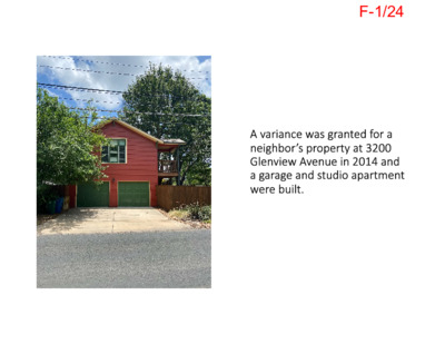
F-1/24 F-1/25 F-1/26 F-1/27 F-1/28 F-1/29 F-1/30 F-1/31 F-1/32 F-1/33 F-1/34 F-1/35 Ramirez, Elaine From: Sent: To: Subject: Attachments: Importance: High Friday, July 09, 2021 5:40 PM Ramirez, Elaine; Ramirez, Diana C15-2021-0056 3006 Glenview Avenue Agenda Item D-2 3006 Glenview 7-12-21 BOA case.pdf *** External Email - Exercise Caution *** Good afternoon Elaine and Diana, Please be sure that the Board of Adjustment members get the following position statement and attachment before the Monday, July 12, 2021 hearing. By the way, the Bryker Woods Neighborhood Association did not receive notification of this variance hearing from the City, rather we received it second hand from another neighborhood association. Thank you, Joyce Basciano Bryker Woods Neighborhood Association Dear Chair Cohen and Members of the Board of Adjustment, Re: C15‐2021‐0056 3006 Glenview Avenue Agenda Item D‐2 The Bryker Woods Neighborhood Association (BWNA) Board of Directors considered this variance request. In the case of through lots we are guided by the precedent set by the Board of Adjustment on Monday, September 8, 2014 in Case Number C15‐2014‐0115 (see attachment). That case involved another through lot on Glenview Avenue that backed up to Jefferson St. (3200 Glenview, cited in the backup for 3006 Glenview). The 2014 BOA Decision granted a variance decreasing the 25 ft setback to 10 ft from the property line, not 5 ft. A 10 ft rear lot setback is still reasonable for through lots on Glenview Avenue and is in keeping with the historic character of Jefferson St. Accordingly, we support a decrease of the 25 ft setback to 10 ft but oppose a decrease of the setback to 5 ft. Thank you for your service to the community, Joyce Basciano, for the Bryker Woods Neighborhood Association CAUTION: This email was received at the City of Austin, from an EXTERNAL source. Please use caution when clicking links or opening attachments. If you believe this to be a malicious and/or phishing email, please forward this email to cybersecurity@austintexas.gov. 1 F-1/36 F-1/37 F-1/38 From: To: Subject: Date: Kathryn Timmerman Ramirez, Elaine C15-2021-0056 Thursday, July 29, 2021 3:31:40 PM *** External Email - Exercise Caution *** C15-2021-0056 Elaine, I live at 2908 Glenview Avenue, Austin, Texas 78703 and I writing you in support of the variance from the Land Development Code requested by Andrea Hamilton. Thank you, Kathryn Timmerman 512-825-8375 CAUTION: This email was received at the City of Austin, from an EXTERNAL source. …
CITY OF AUSTIN Board of Adjustment Decision Sheet E-4 DATE: Monday August 9, 2021 CASE NUMBER: C15-2021-0062 ___Y____Thomas Ates ___Y____Brooke Bailey ___Y____Jessica Cohen ___Y____Melissa Hawthorne ___Y____Barbara Mcarthur ___Y____Rahm McDaniel ___-____Darryl Pruett (out – no show) ___Y____Agustina Rodriguez ___Y____Richard Smith ___-____Michael Von Ohlen (out) ___Y____Nicholl Wade ___Y____Kelly Blume (Alternate) ___-____Carrie Waller (Alternate) _______Vacant (Alternate) APPLICANT: David Cancialosi OWNER: Christen Steen ADDRESS: 3401 RIVERCREST DR VARIANCE REQUESTED: The applicant is requesting variance(s) from the Land Development Code, Section 25-2-551 (Lake Austin District Regulations) (C) (3) (a) increase the maximum impervious cover on a slope with a gradient of 15 percent or less from 35 percent (allowed) to 48 percent (requested), (53% existing) (b) increase the maximum impervious cover on a slope with a gradient of 15 percent and not more than 25 percent from 10 percent (allowed) to 49 percent (requested), (54.25% existing) (c) increase the maximum impervious cover on a slope with a gradient of more than 25 percent and not more than 35 percent from 5 percent (allowed) to 18 percent (requested), (4.41% existing) (d) increase maximum impervious cover on a slope gradient greater than 35 percent to 3 percent (requested), (0.83% existing) in order to erect a Single-Family + associated improvements in a “LA”, Lake Austin zoning district. Note: This section of the Land Development Code applies to lots that are included in a subdivision plat recorded before April 22, 1982 or a tract that is not required to be platted. For the above address the Subdivision Plat was recorded on January 4, 1965 F-2/1 The overall change in IC is from 21.51% to a proposed 20.89% IC, or 8,084 SF IC to 7,883 SF IC, when calculated on a gross lot area basis. BOARD’S DECISION: BOA JULY 12, 2021 POSTPONED TO AUGUST 9, 2021; Aug 9, 2021 The public hearing was closed by Chair Jessica Cohen, Board Member Melissa Hawthorne motions to Postpone to October 11, 2021; Board Member Brooke Bailey seconds on a 10-0 vote; POSTPONED TO October 11, 2021. FINDING: 1. The Zoning regulations applicable to the property do not allow for a reasonable use because: 2. (a) The hardship for which the variance is requested is unique to the property in that: (b) The hardship is not general to the area in which the property is located because: 3. The variance will not alter the character of the area adjacent to the property, will not …
CITY OF AUSTIN Board of Adjustment Decision Sheet D-2 DATE: Monday September 13, 2021 CASE NUMBER: C15-2021-0085 ___-____Thomas Ates OUT ___-____Brooke Bailey OUT ___Y____Jessica Cohen ___Y____Melissa Hawthorne ___Y____Barbara Mcarthur ___Y____Rahm McDaniel ___Y____Darryl Pruett ___Y____Agustina Rodriguez ___Y____Richard Smith ___Y____Michael Von Ohlen ___Y____Nicholl Wade ___Y____Kelly Blume (Alternate) ___Y____Carrie Waller (Alternate) ___-____Vacant (Alternate) APPLICANT: David Cancialosi OWNER: Estates at Lake Austin, LP ADDRESS: 1717 CHANNEL RD VARIANCE REQUESTED: The applicant is requesting variance(s) from the Land Development Code, Section 25-2-551 (Lake Austin District Regulations) (B) (1) (a) from shoreline setback requirements to reduce the shoreline setback from 75 feet (required) to 25 feet (requested) along a man-made inlet in order to erect a Single-Family + associated improvements in a “LA”, Lake Austin zoning district. BOARD’S DECISION: BOA MEETING SEPT 13, 2021 The public hearing was closed by Chair Jessica Cohen, Board Member Michael Von Ohlen motions to Postpone to October 11, 2021; Board Member Rahm McDaniel seconds on a 11-0 vote; POSTPONED TO OCTOBER 11, 2021. FINDING: 1. The Zoning regulations applicable to the property do not allow for a reasonable use because: 2. (a) The hardship for which the variance is requested is unique to the property in that: (b) The hardship is not general to the area in which the property is located because: F-3/1 3. The variance will not alter the character of the area adjacent to the property, will not impair the use of adjacent conforming property, and will not impair the purpose of the regulations of the zoning district in which the property is located because: ______________________________ Elaine Ramirez Executive Liaison ____________________________ Jessica Cohen Chair forF-3/2 PERMIT PARTNERS, LLC 300 E. Highland Mall Blvd Ste. 207 Austin, Texas 78752 David C. Cancialosi September 14, 2021 City of Austin 301 W. 2nd St. Austin, Texas 78701 City of Austin Board of Adjustment RE: Variance request for 1717 Channel Road to reduce 75’ Shoreline Setback to 25’ Shoreline Setback per LDC 25-2-551(B)(1)(a) – Amended cover letter for October meeting Dear Board of Adjustment Commissioners, Per your request please find a bullet point list containing reasonable use, hardship, adverse impact and other related information in a more definitive format. • The 1.7 ac tract (75,000 SF) tract was annexed into Austin jurisdiction in 1968 and zoned “A”, the equivalent of today’s “SF-2” or “SF3” zoning. This zoning was changed to “LA” in the early 1980’s by the city. The reasonable use …
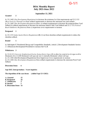
BOA Monthly Report July 2021-June 2022 September 13, 2021 Granted 2 Postponed 1 Denied 1 Withdrawn 3 1) 25-2-492 (Site Development Regulations) to decrease the minimum Lot Size requirements and 25-2-515 (Rear Yard of a Through Lot) from setback requirements to decrease the minimum rear yard setback 2) 25-2-492 (Site Development Regulations) from: a) setback requirements to decrease the minimum Rear Yard Setback b) setback requirements to decrease the minimum Interior Side Yard Setback and 25-2-735 (Festival Beach Subdistrict Regulations) from c) impervious cover requirements to increase 1) 25-2-551 (Lake Austin District Regulations) (B) (1) (a) from shoreline setback requirements to reduce the shoreline setback 1) Subchapter F: Residential Design and Compatibility Standards, Article 2, Development Standards Section 2.1 (Maximum Development Permitted) to increase the F.A.R 1) 25-10-133 (University Neighborhood Overlay Zoning District Signs) (H) to allow for a total of six (6) signs to all be illuminated, five (5) LED illuminated wall signs and one (1) internally illuminated cabinet wall sign 2) 25-2-492 (Site Development Regulations) from Impervious Cover requirements to increase 3) 25-2-492 (Site Development Regulations) from setback requirements to decrease the minimum Front Yard Setback Discussion Items 6 Sept 2021. Interpretations 0 new inquiries The deposition of the case items: (Added Sept 13 # 2021) A. Granted 12 B. Postponed 16 C. Withdrawn 5 2 D. Denied E. Discussion Items 14 G-1/1 August 9, 2021 1) 25-2-492 (Site Development Regulations) to decrease the minimum lot width 2) 25-2-492 (Site Development Regulations) from setback requirements to decrease the minimum Front Yard Setback 3) 25-2-492 (D) (Site Development Regulations) to decrease the minimum lot size requirement 4) 25-2-773 (Duplex Residential Use) (B) (5) (b) from two stories (maximum allowed) to three stories Granted 4 Postponed 8 setback requirements to decrease the minimum Interior Side Yard Setback and from 25-2-735 (Festival Beach 1) 25-10-133 (University Neighborhood Overlay Zoning District Signs) (H) to allow for a total of six (6) signs to all be illuminated, five (5) LED illuminated wall signs and one (1) internally illuminated cabinet wall sign 2) 25-10-133 (University Neighborhood Overlay Zoning District Signs), a) (F) to allow three (3) wall signs above the second floor, one on each the northern, southern and eastern sides.b) (G) (1) one projecting sign for each building façade (allowed) to two (2) projecting signs (requested) on the eastern side c) (H) to allow for all twelve (12) signs, nine (9) on the …
§ 2-1-111 - BOARD OF ADJUSTMENT. (A) The Board of Adjustment is established as provided in Local Government Code Chapter 211 (Municipal Zoning Authority). (B) The board shall be composed of 11 members. (C) Each board member shall be appointed to serve a two-year term. (D) The council may appoint alternate board members to serve in the absence of regular members. An alternate member shall be appointed to serve a two-year term. (E) A regular or alternate board member may be removed by council for cause on a written charge after a public hearing. (F) The board shall: (1) (2) (3) (4) (5) (1) (2) board. hear and decide a request for a variance from the requirements of Chapter 25-2 (Zoning), except as otherwise provided by the Code; hear and decide an appeal of an administrative action under Chapter 25-2 (Zoning); hear and decide a request for a variance from the requirements of airport zoning regulations under Section 241.034, Local Government Code; hear and decide a request for a special exception under Chapter 25-2 (Zoning); and perform other duties prescribed by ordinance or state law. (G) The board shall hold meetings at the call of the chairperson and at other times as requested by the (H) The chairperson, or the acting chairperson in the absence of the chairperson, may administer oaths and compel the attendance of witnesses. (I) Each case before the board must be heard by at least 75 percent of the board members. (J) The concurring vote of 75 percent of the board members is necessary to: reverse an order, requirement, decision, or determination of an administrative official; decide in favor of an applicant on a matter on which the board is required to pass under Chapter 25-2 (Zoning); or (3) authorize a variation from the terms of Chapter 25-2 (Zoning). (K) The board shall prepare minutes of its proceedings. The minutes shall include the vote of each member on each item before the board and shall state if a member is absent or fails to vote on an item. Source: Ord. 20071129-011; Ord. 20080110-048; Ord. 20080618-030; Ord. 20110526-098;Ord. No. 20141211-204, Pt. 14, 7-1-15. G-5/1 ARTICLE 3. - PROCEDURES FOR APPEALS Division 1. - Reserved.[2] Footnotes: --- (2) --- §§ 2-5-41—2-5-45. - RESERVED. Division 2. - Appeals. § 2-5-61 - GENERAL PROVISIONS FOR APPEALS. Editor's note— Ord. No. 20170518-014 >, Pt. 4, effective May 29, 2017, repealed §§ …
AGENDA MEETING MINUTES September 13, 2021 The Board of Adjustment meeting convened on Monday, September 13, 2021. Some members of the Board of Adjustment may be participating by videoconference. The meeting may be viewed online at: http://www.austintexas.gov/page/watch-atxn-live. Jessica Cohen (Chair) called the Board Meeting to order at 5:35 p.m. Board Members in Attendance (in person): Jessica Cohen (Chair), Rahm McDaniel, Richard Smith, Nicholl Wade, Kelly Blume (Alternate), Carrie Waller (Alternate) Board Members in Attendance (virtually via teleconference): Melissa Hawthorne (Vice Chair), Barbara Mcarthur, Darryl Pruett, Agustina Rodriguez, Michael Von Ohlen, Board Members Absent: Thomas Ates, Brooke Bailey City Staff in Attendance: Elaine Ramirez (Board Liaison) Lee Simmons (Board Attorney) City Staff Absent: Diana Ramirez (Board Secretary) EXECUTIVE SESSION (No public discussion) The Board of Adjustment will announce it will go into Executive Session, if necessary, pursuant to Chapter 551 of the Texas Government Code, to receive advice from Legal Counsel on matters specifically listed on this agenda. The Board of Adjustment may also announce it will go into Executive Session, if necessary, to receive advice from Legal Counsel regarding any other item on this agenda. Private Consultation with Attorney – Section 551.071 CITIZEN COMMUNICATION: GENERAL The first (4) four speakers who register to speak no later than noon the day before the meeting will be allowed a three-minute allotment to address their concerns regarding items not posted on the agenda.NONE A. DISCUSSION AND REQUESTED ACTION ITEM Staff requests approval August 9, 2021 draft minutes A-1 On-Line Link: Item A-1 A-1/1 Board Member Melissa Hawthorne motions to approve the minutes for August 9, 2021, Board member Richard Smith seconds on a 10-0-1 vote (Board member Melissa Hawthorne abstained for Items C-1, C-2); APPROVED MINUTES FOR August 9, 2021. B. DISCUSSION AND REQUESTED ACTION ITEM B-1 Staff and Applicant requests for postponement and withdraw of items posted on this Agenda Items C-1, E-1 and E-2 applicant requests to withdraw C. SIGNS PREVIOUS POSTPONEMENTS C-1 C16-2021-0008 Leah M. Bojo for The Standard at Austin, LLC 715 W. 23rd Street On-Line Link: Item C-1 PART1; PART2; PART3; PART4; NO PRESENTATION The applicant is requesting a sign variance(s), a total of 6 signs on the property from the Land Development Code, Section 25-10-133 (University Neighborhood Overlay Zoning District Signs) (H) to allow for a total of six (6) signs to all be illuminated, five (5) LED illuminated wall signs and one (1) internally illuminated cabinet …
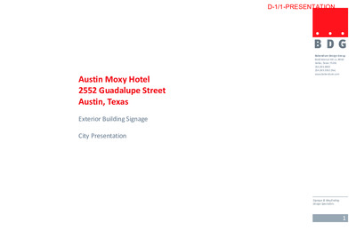
Austin Moxy Hotel 2552 Guadalupe Street Austin, Texas Exterior Building Signage City Presentation Babendure Design Group 8140 Walnut Hill Ln. #950 Dallas, Texas 75231 214.265.1960 214.265.5552 (fax) www.babendure.com Signage & Wayfinding Design Specialists 1 D-1/1-PRESENTATION F E A B C D 5 4 1 3.2 3.1 1 OVERALL SITE PLAN Scale: 1/16"=1'-0" Sign Location Plan 2 7 Existing single story building on adjacent lot (Owned by another party) Existing single story building on adjacent lot (Owned by another party) Existing single story building on adjacent lot (Owned by another party) Babendure Design Group8140 Walnut Hill Ln. #950Dallas, Texas 75231214.265.1960214.265.5552 (fax)www.babendure.comAustin Moxy HotelAustin, TexasExterior Building SignageNovember 18, 2020D-1/2-PRESENTATION 1 RESTAURANT IDENTITY Projecting Sign Box with push-through Restaurant Logo Top of Sign = 12’-8” above grade 3.1 MENU DISPLAY Located to left of windows. Top of Sign = 6’-0”above grade. 3.2 MENU DISPLAY Located to left of windows. Top of Sign = 6’-0”above grade. 4 5 PICK UP WINDOW IDENTITY Box sign with white push-through graphics. Top of Sign = 8’-0” above grade. ORDER WINDOW IDENTITY Box sign with white push-through graphics. Top of Sign = 8’-0” above grade. BILLBOARD (Owned By Another Party) 1 A B 3.1 4 3.2 5 EAST ELEVATION SCALE: 1/16” = 1’-0” 18'-3 1/2" (High Logo) 16'-3" (Low Logo) " 2 / 1 8 - ' 2 A Dimensional Letters to be Moxy pink. Top of Sign - 58’-8” above grade. " 6 - ' 1 " 2 / 1 4 - ' 2 B Dimensional Letters to be Moxy pink. Top of Sign - 14’-8” above grade. D C Dimensional Letters mounted on the canopy ledge. Color to be Moxy pink. Top of Sign - 14’-2” above grade. Projecting Sign Box with push-through graphics. Logo to be Moxy pink day. Top of Sign - 22’-8” above grade. East Elevation High and Low Level Signs 3 Babendure Design Group8140 Walnut Hill Ln. #950Dallas, Texas 75231214.265.1960214.265.5552 (fax)www.babendure.comAustin Moxy HotelAustin, TexasExterior Building SignageNovember 18, 2020D-1/3-PRESENTATION 18'-3 1/2" 16'-3 1/2" " 8 / 1 8 - ' 2 " 2 / 1 7 - ' 3 A " 8 / 5 9 " 2 / 1 2 " 1 1 - ' 1 " 4 - ' 2 LOCATION A HIGH LEVEL WALL IDENTITY FRONT ELEVATION • AREA CALCULATION: 60 SQFT Top of Sign = 58’-8” above grade. SCALE: 1/4” = 1’-0” 2 1/2" 6'-0" 5'-7" 1 3/4"Stroke Width 1" …
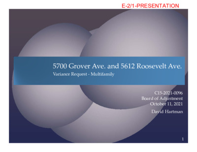
5700 Grover Ave. and 5612 Roosevelt Ave. Variance Request ‐ Multifamily C15‐2021‐0096 Board of Adjustment October 11, 2021 David Hartman 1 E-2/1-PRESENTATION Project Overview 4.135 acres, comprised of former Dart Bowl bowling alley at 5700 Grover Avenue and a vacant lot at 5612 Roosevelt Avenue. August 2021 City Council approved rezoning Ordinance No. 20210826‐099 that zoned the property MF‐6‐CO‐NP. Proposed Recreational Trail connects Woodrow Pocket Park/Recreational Trail to Roosevelt Avenue and Theckla Terrace. Voluntary 10% affordable housing, via recorded Private Restrictive Covenant with Habitat/HomeBase. Requesting following variances: • Maximum 8’ fence height along the western Property line adjacent to single family housing along Woodrow Avenue per agreement with Brentwood Neighborhood Association, and • Compatibility height standards related to adjacent McCallum High School tennis courts/running track/sports field located to the east of the Property along Grover Avenue.. 2 E-2/2-PRESENTATION Project Location 3 E-2/3-PRESENTATION Zoning Area Map MF‐3‐NP MF‐6‐CO‐NP 4 E-2/4-PRESENTATION Compatibility Constraints 5 E-2/5-PRESENTATION Compatibility Triggered by SF‐3 Zoning to East McCallum High School (Tennis Courts/Running Track/Baseball Field) 6 E-2/6-PRESENTATION Property Constraints 77 E-2/7-PRESENTATION
CITY OF AUSTIN Development Services Department Permitting & Development Center Phone: 512.978.4000 6310 Wilhelmina Delco Dr, Austin, Texas 78752 Board of Adjustment General/Parking Variance Application WARNING: Filing of this appeal stops all affected construction activity. This application is a fillable PDF that can be completed electronically. To ensure your information is saved, click here to Save the form to your computer, then open your copy and continue. The Tab key may be used to navigate to each field; Shift + Tab moves to the previous field. The Enter key activates links, emails, and buttons. Use the Up & Down Arrow keys to scroll through drop-down lists and check boxes, and hit Enter to make a selection. The application must be complete and accurate prior to submittal. If more space is required, please complete Section 6 as needed. All information is required (if applicable). For Office Use Only Case # __________________ ROW # ___________________ Tax # ____________________ Section 1: Applicant Statement Street Address: __________________________________________________________________ Subdivision Legal Description: ____________________________________________________________________________ ____________________________________________________________________________ Lot(s): _________________________________ Block(s): _____________________________ Outlot: _________________________________ Division: _____________________________ Zoning District: ___________________________________________________________________ I/We ________________________________________________ on behalf of myself/ourselves as authorized agent for ________________________________________________ affirm that on Month , Day , Year , hereby apply for a hearing before the Board of Adjustment for consideration to (select appropriate option below): Erect Attach Complete Remodel Maintain Other: ____________ Type of Structure: ______________________________________________________________ City of Austin | Board of Adjustment General/Parking Variance Application 06/24/2021 | Page 4 of 8 Portion of the City of Austin Land Development Code applicant is seeking a variance from: ____________________________________________________________________________ ____________________________________________________________________________ ____________________________________________________________________________ ____________________________________________________________________________ Section 2: Variance Findings The Board must determine the existence of, sufficiency of, and weight of evidence supporting the findings described below. Therefore, you must complete each of the applicable Findings Statements as part of your application. Failure to do so may result in your application being rejected as incomplete. Please attach any additional supporting documents. NOTE: The Board cannot grant a variance that would provide the applicant with a special privilege not enjoyed by others similarly situated or potentially similarly situated. I contend that my entitlement to the requested variance is based on the following findings: Reasonable Use The zoning regulations applicable to the property do not allow for a reasonable use because: ____________________________________________________________________________ ____________________________________________________________________________ ____________________________________________________________________________ ____________________________________________________________________________ ____________________________________________________________________________ ____________________________________________________________________________ ____________________________________________________________________________ Hardship a) The hardship for which the variance is requested is unique to the property in that: …
Item E-4 Case No. C15-2021-0098 McKinney Falls Apartments 5200 McKinney Falls Parkway Seeking variance from 25-2-1063(C) - Height Limitations and Setbacks for Large Sites October 11, 2021 E-4/1-PRESENTATION Overview To increase maximum height to 47’ when 50’ or less from triggering property (30’ required). To increase maximum height to 47’ when between 50-100’ from triggering property (40’ required). To increase maximum height to 47’ from 40’ plus one foot for each 10’ of distance in excess of 100’ from triggering property [achieves 47’ at 170’ setback] (required). 2 E-4/2-PRESENTATION Purpose: To construct 251 multifamily housing units. Zoning: MF-4 (approved September 2, 2021). Overview 3 E-4/3-PRESENTATION E-4/4-PRESENTATION Zoning Map 5 E-4/5-PRESENTATION Reasonable Use Multifamily development at this location is reasonable. No single-family uses in the vicinity. 6 E-4/6-PRESENTATION Reasonable Use Triggering property is state property that is not subject to City of Austin zoning regulation. Application of the zoning regulations significantly reduces the number of units that can be developed while not providing any protection to any single- family residential use or future use. 7 E-4/7-PRESENTATION Hardship Floodplain makes the southern end of the property less developable. The addition of the compatibility regulations reduce the buildable area by an additional 32.95%, making development infeasible. 8 E-4/8-PRESENTATION Floodplain Map 9 E-4/9-PRESENTATION E-4/10-PRESENTATION E-4/11-PRESENTATION Hardship Number of dwelling units on the tract is reduced from 251 to 188. Adjacent similarly shaped triangular tract to the southwest is distinguished from the subject tract because that tract is covered by floodplain; while the subject tract would be buildable if it were not subject to compatibility. 12 E-4/12-PRESENTATION Approval Does Not Alter Character of Neighborhood Multifamily use is a desirable and compatible use with the nearby McKinney Job Center and supported by Imagine Austin policies. Moderate density multifamily is suitable near arterial roadway (McKinney Falls Parkway). Multifamily use at this location is consistent with the purpose state of the MF-4 zoning district to provide residential units near employment opportunities. significant 13 E-4/13-PRESENTATION E-4/14-PRESENTATION 15 E-4/15-PRESENTATION
PERMIT PARTNERS, LLC 300 E. Highland Mall Blvd Ste. 207 Austin, Texas 78752 David C. Cancialosi September 1, 2021 City of Austin 301 W. 2nd St. Austin, Texas 78701 City of Austin Board of Adjustment RE: Variance request for site at 3401 Rivercrest Dr. to amend impervious cover – Amended cover letter for October meeting Dear Board of Adjustment Commissioners, Per your request please find a bullet point list containing reasonable use, hardship, adverse impact and other related information. The site is ~37,000 lot built atop a hill as part of the platted Rivercrest Section 2 subdivision approved in mid- 1960’s. It is comprised of two lots which combined and individually do not meet LA lot size requirements. The individual platted lots were legally compliant with “A” zoning in mid-1960’s; however, are sub-standard to LA zoning requirements: Individual nor combined, they do not have minimum 1 ac in size and doe not have 100’ along a public right-of-way as required by LA zoning performance standards. The site was originally zoned “A” when COA asserted control over this area. In 1984, COA changed zoning to LA, which changed “A” zoned, legally compliant lots along the lake to a legal non-compliant lot (re: size) and associated structures (re: IC). Owner wishes to exercise reasonable use as intended by both the original plat and zoning change approval asserted by local jurisdictions to allow single-family house and associated accessory improvements. Current home is in need of repair and updating. Main concern is structural integrity of retaining walls surrounding hillside. Please see attached drainage letter per your request at August hearing. Rerouting the retaining walls and placement of new walls is necessary. This request is to amend impervious coverage calculations to 1) meet the actual LA code requirements and 2) correct erroneous permit issuance and inspection passage occurring in 2006. When COA forced LA zoning on this property it made site immediately non-compliant with respect, mostly, to impervious coverage. It was unbuildable by any reasonable standards. The subsequent 2006 permit approval exacerbated this issue. In 2006 COA approved extensive plans for new construction via permit #2006-002550, albeit erroneously. This approval was issued accordingly to SF-2 zoning standards. SF-2 zoning allows one to count the gross lot area of the entire ~37,000 SF lot (which approved 16% IC of gross lot area coverage per said application); however, LA zoning requires one to delineate calculations on a …
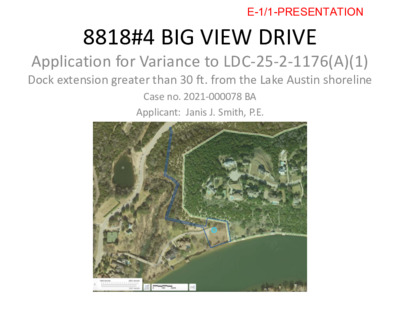
1717 CHANNEL ROAD AUSTIN, TX 78746 Case # 2021-000072 BA F-3/1-PRESENTATION VARIANCE REQUEST I. Seeking BOA Variance to reduce shoreline setback: • LDC 25-2-551(B)(1)(a) to reduce shoreline setback from 75’ to 25’ along a man-made slough that abuts the property via cut in boat slip. • Lake Austin shoreline setback is 75’ per staff’s current interpretation of where a shoreline setback is measured from as it relates to man made sloughs or inlets. • My client is seeking a 25’ Lake Austin shoreline setback from the slough. • The man-made slough has a cut-in slip created sometime between1955 and 1968 per City of Austin zoning profile aerials. • There does not appear to be any natural causation of the inlet. It appears wholly man made using various historical aerials and physical inspections. F-3/2-PRESENTATION AERIAL F-3/3-PRESENTATION MAP AERIAL F-3/4-PRESENTATION CHANNEL RD + ENTRANCE TO SITE Easement to 1717 F-3/5-PRESENTATION VARIOUS INLET ANGLES F-3/6-PRESENTATION VARIOUS INLET AND CHANNEL ANGLES F-3/7-PRESENTATION VARIOUS PROPERTY ANGLES FROM INLET F-3/8-PRESENTATION VARIOUS PROPERTY ANGLES AROUND INLET F-3/9-PRESENTATION EASEMENT THAT SPLITS PROPERTY F-3/10-PRESENTATION CHANNEL TO / FROM LAGOON – LAKE AUSTIN F-3/11-PRESENTATION REASONABLE USE The zoning regulations applicable to the property do not allow for a reasonable use because: • The zoning regulations combined with unique hardships prevent a reasonable use of this site as prescribed by the applicable zoning district. • The existing 1.72-acre tract is vacant and zoned Lake Austin, LA, as part of the City-wide effort to apply LA zoning to lake properties in 1984. The site was annexed June 15, 1968, and zoned “A” zoning which is the equivalent of today’s SF-2 zoning. The site does not front the main body of Lake Austin. It is only accessible to the water via a small inlet that connects to a lagoon. From that lagoon a straight line was dredged to the site. On the other side of the lagoon, it connects to the main body of Lake Austin via separate canal (from the lagoon). That canal travels under a bridge (Channel Road), then it connects to the main body. (please see aerial maps for quick reference). We believe the cut-in slip was created during the same time period as the actual inlet because the 1955 – 1968 aerials reflect the inlet being dredged from the lagoon during this time and not in any aerials before 1955. It shows the inlet in the same location between …
LGBTQ QUALITY OF LIFE ADVISORY COMMISSION Monday, October 11, 2021 7:00 p.m. City of Austin Permitting and Development Center, Room 1401 6310 Wilhelmina Delco Dr., Austin, Texas 78752 District Commissioner 1 2 3 4 5 6 7 8 Kannou (Kimberly) Curette VACANT Victor Martinez Holly Kirby Ruben Baeza Rebecca Dreke VACANT Saul Gonzalez CALL TO ORDER District 9 10 Mayor At-Large At-Large At-Large At-Large AGENDA Commissioner Nan Dowling Brandon Wollerson Marti Bier Grant Loveless Charles Curry Ryn Gonzales (Chair) Melissa Taylor (Vice Chair) PUBLIC COMMUNICATION – Each speaker will have 3 minutes to speak. 1. MOTION TO SUSPEND ROBERT’S RULES OF ORDER 2. APPROVAL OF MINUTES- September 13, 2021 3. REGULAR BUSINESS – The commission may act or make recommendations on the following topics: a. Presentation by Health Management Associates of a final report on the LGBTQIA+ Quality of Life Study. (Sponsor: Gonzales; Strategic Outcome: Government That Works for All) ADJOURNMENT The City of Austin is committed to compliance with the American with Disabilities Act. Reasonable modifications and equal access to communications will be provided upon request. Meeting locations are planned with wheelchair access. If requiring Sign Language Interpreters or alternative formats, please give notice at least 2 days (48 hours) before the meeting date. Please call Staff Liaison Alyssa Parra at 512-974-2834 or email Alyssa.parra@austintexas.gov, for additional information; TTY users route through Relay Texas at 711. For more information on the LGBTQ Quality of Life Commission, please contact Alyssa Parra at (512) 974-2834.
Contents Acknowledgements ................................................................................................................................... 1 Community Partners ............................................................................................................................. 1 Research Team ..................................................................................................................................... 1 City of Austin ......................................................................................................................................... 1 Executive Summary .................................................................................................................................. 3 Key Themes .......................................................................................................................................... 4 Key Recommendations ......................................................................................................................... 4 Study Framework ...................................................................................................................................... 5 Key Themes Across Data Collection Tools ............................................................................................... 6 Introduction................................................................................................................................................ 9 Purpose ................................................................................................................................................. 9 Background ........................................................................................................................................... 9 COVID-19 Pandemic and Racial Unrest ............................................................................................... 9 LGBTQIA+ Population in US, Texas, and Austin ................................................................................ 10 Austin LGBTQIA+ History ................................................................................................................... 11 Research Advisory Board ................................................................................................................... 12 Qwell Foundation Prior Surveys.......................................................................................................... 13 Methodology ........................................................................................................................................ 13 Qualitative Findings ................................................................................................................................. 14 Stakeholder Interviews ........................................................................................................................ 15 Town Halls ........................................................................................................................................... 19 Focus Groups ...................................................................................................................................... 23 Power Analysis .................................................................................................................................... 27 Quantitative Findings .............................................................................................................................. 30 Summation of Comparative Data ........................................................................................................ 30 Demographics ..................................................................................................................................... 31 Community and Social Connectedness .............................................................................................. 33 Economic Opportunity and Work ........................................................................................................ 37 Educational Opportunity and Access .................................................................................................. 41 Health .................................................................................................................................................. 43 Housing ............................................................................................................................................... 68 Personal Safety ................................................................................................................................... 70 Social and Public Services/Benefits .................................................................................................... 75 Overall Quality of Life .......................................................................................................................... 78 Disparities................................................................................................................................................ 79 Policy Priorities ........................................................................................................................................ 92 Findings Across Foundational Outcomes ............................................................................................... 93 Community and Social Connectedness .............................................................................................. 93 Economic Opportunity ......................................................................................................................... 94 Health .................................................................................................................................................. 94 Housing ............................................................................................................................................... 95 Safety .................................................................................................................................................. 96 Diversity, Equity, and Inclusion ........................................................................................................... 97 Recommendations .................................................................................................................................. 98 Key Recommendations ....................................................................................................................... 98 Conclusion............................................................................................................................................. 101 About HMA Community Strategies ....................................................................................................... 102 Appendix ................................................................................................................................................... 103 Acknowledgments A. HMA Community Strategies is deeply grateful for the support and participation of countless LGBTQIA+ and allied organizations, groups, businesses, and community members throughout this project. Community Partners Research Team HMA Community Strategies Charles Robbins, MBA – Project Director Iliana Gilman, MA – Project Manager Michelle Parra, PhD Catherine Guerrero, MPH Ryan Maganini Research Advisory Board Alexander Anderson KB Richard Bondi Sha’nyia Baltimore Sam Davis Tabitha Hamilton Lex Keaton Rocky Lane Lais Milburn Philip Schnarrs Alexander Zapata City of Austin City of Austin’s Equity Office Brion Oaks, Chief Equity Officer Kellee Coleman, Business Process Consultant, Sr. Amanda Jasso, Equity & Inclusion Program Manager Rocío Villalobos, Immigrant Affairs Program Manager Joshua Robinson, Equity & Inclusion Program Coordinator Enakshi Ganguly, Public Information Specialist, Sr. Brandon Kroos, Business Process Specialist LGBTQ Quality of Life Advisory Commission Ruben Baeza Sandra Chavez Charles Curry Kannou Curette Tarik Daniels Deirdre Doughty Nan Dowling Saul Gonzalez Christina Gorczynski Kathryn Gonzales Terrance Hines Holly Kirby Rebecca Dreke Dr. Victor Martinez Melissa Taylor Brandon Wollerson Tarik Daniels 1 2 Executive Summary This report summarizes the results of the ShoutOut Austin Lesbian, Gay, Bisexual, Transgender, Queer, Intersex, Asexual …
ANIMAL ADVISORY COMMISSION OCTOBER 11, 2021, 6 PM AUSTIN CITY HALL, Room 1101 301 W. Second St. AUSTIN, TEXAS 78702 Some members of the Commission may be participating by videoconference. The meeting may be viewed online at http://www.austintexas.gov/watch-atxn-live AGENDA CURRENT BOARD MEMBERS: Craig Nazor, Chair Nancy Nemer, Parliamentarian Palmer Neuhaus Edward Flores Monica Frenden Jo Anne Norton Lotta Smagula CALL TO ORDER CITIZEN COMMUNICATION: GENERAL The first 10 speakers signed up prior to the meeting being called to order will each be allowed a three-minute allotment to address their concerns regarding items not posted on the agenda Ryan Clinton, Vice Chair Lisa Mitchell Katie Jarl Dr. Jon Brandes Yolanda Rodriguez-Pacheco Luis Herrera a. Review and approval of minutes from the September 13, 2021, Animal Advisory 1. APPROVAL OF MINUTES Commission Meeting. 2. STAFF BRIEFINGS a. Austin Animal Center and Animal Services Reports. b. COVID Update. c. Office of the City Clerk Refresher Training: Roles and Responsibilities d. IT/Data Presentation, Austin Public Health IT e. Fire Code Requirements for Nonprofit and Commercial Animal Shelters and Boarding Facilities in Austin f. Austin Pets Alive! Quarterly Report 3. OLD BUSINESS: Update, Discussion and Possible Action a. Comparative Evaluations of Monthly Release Rates. b. Monthly Reporting of Data. c. Working Group on Off-Leash Dogs. d. Working Group on How to Increase Microchipping in the City of Austin. e. Shelter Space Issues Working Group. f. Austin Pets Alive!’s Future at the Town Lake Animal Center and the Maintenance of No Kill in Austin. g. Transferring Austin Animal Center Animals to Other Communities. 4. NEW BUSINESS: Discussion and Possible Action a. Fire Code Requirements for Nonprofit and Commercial Animal Shelters and Boarding Facilities in Austin 5. FUTURE AGENDA ITEMS 6. ADJOURNMENT The City of Austin is committed to compliance with the American with Disabilities Act. Reasonable modifications and equal access to communications will be provided upon request. Meeting locations are planned with wheelchair access. If requiring Sign Language Interpreters or alternative formats, please give notice at least 2 days (48 hours) before the meeting date. Please call Belinda Hare at the Animal Services Office, at 512-978-0565, for additional information; TTY users route through Relay Texas at 711. For more information on the Animal Advisory Commission, please contact Board Liaison. Belinda Hare, 512-978-0565 or Belinda.Hare@austintexas.gov