PLANNING COMMISSION SITE PLAN EXTENSION REVIEW SHEET CASE NUMBER: SP-2018-0181CT(XT2) PC HEARING DATE: June 10, 2025 PROJECT NAME: Highland Office Extension II ADDRESS OF SITE: 501 Clayton Lane COUNCIL DISTRICT: 4 NEIGHBORHOOD PLANNING AREA: Highland WATERSHED: Tannehill Branch JURISDICTION: Full-Purpose APPLICANT/ OWNER: HM RETAIL LLC %REDLEAF PROPERTIES LLC AGENT: Drenner Group Amanda Swor 200 Lee Barton Drive, Suite 100 Austin, TX 78704 (512) 807-2904 CASE MANAGER: Kate Castles (512) 978-4555 kate.castles@austintexas.gov PROPOSED DEVELOPMENT: The applicant is requesting a three-year extension to a previously approved site plan. The proposed development includes the construction of an office building with associated improvements. SUMMARY STAFF RECOMMENDATION: Staff recommends that the Planning Commission consider the extension of this site plan permit by three years, from September 1, 2024 to September 1, 2027, based on the criteria from LDC Section 25-5-62(C)(1). 25-5-63(C) Extension of released site plan by the Land Use Commission: “the Land Use Commission may extend the expiration date of a released site plan beyond the date established by this chapter if the Land Use Commission determines that the request complies with the requirements for extension by the director under 25-5-62 (Extension of Released Site Plan by Director).” 25-5-62(C) The director may extend the expiration date of a released administrative site plan one time for a period of one year if the director determines that there is good cause for the requested extension; and (1) the director determines that: a) the site plan substantially complies with the requirements that apply to a new application for site plan approval; b) the applicant filed the original application for site plan approval with the good faith expectation that the site plan would be constructed; c) the applicant constructed at least one structure shown on the original site plan that is suitable for permanent occupancy; or d) the applicant has constructed a significant portion of the infrastructure required for development of the original site plan; and SUMMARY OF SITE PLAN: LAND USE: The site is zoned CS-MU-V-NP. All site calculations are within the allowed amounts. 11 SP-2018-0181CT(XT2) - Highland Office-Extension II; District 41 of 6 SP-2018-0181CT(XT2) Highland Office Extension II ENVIRONMENTAL: All environmental comments have been cleared. Note, the applicant posted fiscal surety in the amount of approximately $15,787 for erosion control in May 2019 with the original site plan application. TRANSPORTATION: All transportation comments have been cleared. PREVIOUS APPROVALS 02/10/2020 09/01/2023 Site Plan administrative approval. Permit expiration: …
12 2024-128390 LM - 1114 W 5th Street; District 91 of 14 12 2024-128390 LM - 1114 W 5th Street; District 92 of 14 12 2024-128390 LM - 1114 W 5th Street; District 93 of 14 12 2024-128390 LM - 1114 W 5th Street; District 94 of 14 12 2024-128390 LM - 1114 W 5th Street; District 95 of 14 12 2024-128390 LM - 1114 W 5th Street; District 96 of 14 12 2024-128390 LM - 1114 W 5th Street; District 97 of 14 12 2024-128390 LM - 1114 W 5th Street; District 98 of 14 12 2024-128390 LM - 1114 W 5th Street; District 99 of 14 12 2024-128390 LM - 1114 W 5th Street; District 910 of 14 12 2024-128390 LM - 1114 W 5th Street; District 911 of 14 12 2024-128390 LM - 1114 W 5th Street; District 912 of 14 12 2024-128390 LM - 1114 W 5th Street; District 913 of 14 12 2024-128390 LM - 1114 W 5th Street; District 914 of 14
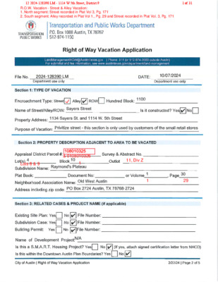
TO: Planning Commission M E M O R A N D U M FROM: Christopher Bueckert, Real Estate Services Agent Land Development Engineering, Transportation and Public Works Department DATE: June 10, 2025 SUBJECT: F# 2024-128390 LM (1114 West 5th Street) Street & Alley Right-of-Way Vacation Attached are the Application Packet and Master Comment Report regarding the right-of-way vacation application for an approximately 4,516 square foot portion of land, being the paved and developed right-of-way. The subject area is located abutting 1114 West 5th Street & 1134 Sayers Street, as shown on a map of survey prepared for G. Flury of Lot #1 & part of Lots #2 - 3 & 4 Block #10, Out Lot #11 Division Z, City of Austin, a Map of Survey recorded in Volume 3, Page 171 of the Plat Records of Travis County; being a portion of Sayers Street, a 40’ Right-of-way, the south 20’ being dedicated and shown as a 20’ Alley in Block 10, Sayers Subdivision, a subdivision recorded in Volume 1, Page 29 of the Plat Records of Travis County. The proposed vacation tract will be incorporated into the abutting parcels, which are owned by Anchor Equities Ltd, a Texas limited partnership if approved by City Council. According to the applicant’s transmittal letter dated September 21, 2024, received by the City of Austin, the applicant states, “How do you plan to develop the area to be vacated? Response: It is unknown at this time how the right of way vacation area would be developed.” All affected departments and private utility franchise stakeholders reviewed the application and recommended approval, subject to the reviewers’ conditions shown on the attached Master Comment Report. Per City Code §14-11-71 – Notice to Interested Property Owners: Public notices were sent to owners within 300’ of the area to be vacated. The Director of the Transportation and Public Works Department may approve the application after the 10th day that the notice is issued; and an affected property owner may submit comments regarding the proposed vacation. Public Notice was sent to appropriate parties on December 5, 2024. Three (3) objections were received after initial Public Notice. Upon applicant appeal and request for public hearing at City Council, twenty-seven (27) subsequent objections have been received by staff as of the date of this memorandum. This item was submitted for placement on the February 4, 2025, Urban Transportation Commission. Urban Transportation Commission …
Bueckert, Christopher From: Sent: To: Cc: Subject: Tyler Grooms <tgrooms@manifoldre.com> Sunday, December 15, 2024 3:37 PM Bueckert, Christopher Stefanie and Stephen Griffith; rsuttle@abaustin.com; Amanda Hendrix; amorrow@abaustin.com; Mila Santana Sayers Street Vacation - (2024-128390 LM) at 1114 West 5th Street You don't often get email from tgrooms@manifoldre.com. Learn why this is important External Email - Exercise Caution Christopher, I’m writing to request that the vacation of Sayer’s Street be removed from the agenda for Planning Commission on Tuesday. We were surprised to learn about this process only through the notification process to go to planning commission. Our understanding is that according to §311.008 Transportation Code, the city may vacate, abandon, or close a street by ordinance if a petition signed by all owners of real property abutting the street is submitted to the governing body. We are unaware of this petition and the owners have never signed such a petition. Per the included backup for Planning Commission, the owner’s property clearly abuts and takes access to Sayers Street (both Lot 19 and 18 abut Sayers Street). The owners of the property are copied on this email as well (Stefanie and Stephen Griffith of Griffith Properties) who object to the vacation of Sayers Street. Currently their tenants at 503 and 505 Walsh Street (tenants of their family’s partnership Walsh Street Venture 2, LLC) make regular use of Sayers Street. Marc Fray (the tenant at 503 and 505 Walsh Street) depends (and has depended for a decade) on Sayers Street to have furniture delivered to his business. Sayers Street is the only access point to this property for large trucks as access via Walsh Street is too steep and narrow for trucks. It is important to note that Sayers Street is so crucial to Mr. Fray's business that the Griffiths are in breach of contract if Sayers is vacated and Mr. Fray loses access to his business (see section 4 in below attachment). Therefore, as directly adjoining property owners having small local business tenants whose existence has depended for decades on Sayers Street, the Griffith’s object fully and strongly to vacating Sayers Street. Finally, we are working on developing the Griffith’s property. Our plans submitted to the city (SP-2024-0428) demonstrate the continued and necessary use of Sayers Street for fire access, utility access, vehicular access and loading access as a vital part of the development plan. 1 12 2024-128390 LM - 1114 W …
12 2024-128390 LM - 1114 W 5th Street; District 91 of 31 12 2024-128390 LM - 1114 W 5th Street; District 92 of 31 12 2024-128390 LM - 1114 W 5th Street; District 93 of 31 Right of Way Vacation Transmittal Letter LandManagementROW@AustinTexas.gov | Phone: 311 (or 512-974-2000 outside Austin) Forsubmittal and feeinformation, see www.austintexas.gov/department/land-management Provideareasonforthevaca�onbyansweringthefollowingques�ons:1.PropertyType:Residen�alCommercial2.Howwasheareaobevacaeddedicaed?PlaSeparaeInstrument3.DidheCiypurchaseheareaobevacaed?(i.e.,bySreeDeed)YesNo4.Arebohheareaobevacaedandyourproperyinhesame“subdivision”?(Theymusbohbeinhesamesubdivisionobeeligible.)YesNo5.Isheareaobevacaeda:Func�onalrigh-of-wayOnlydedicaedonpaper6.Arehereanyu�liylineswihinheareaobevacaed?YesNoIfyes,whaareyourplansforheu�li�es?___________________________________________________________________________________________________________________________________Applicansshouldbeadvisedhaeasemenswillbereainedoproecexis�ngu�li�es,evenifu�liyreloca�onisproposed.Alsobeadvisedhanosrucuresmaybebuilon,overorunderheeasemenswihoualicenseagreemen,insurance,andannualfee.7.Howdoyouplanodevelopheareaobevacaed?_______________________________________________________________________________________________________________________8.Hasasieplanbeensubmittedonyourprojec?YesNo9.IsyourprojecaUnifiedDevelopmen?YesNo10.IsyourprojecaS.M.A.R.T.HousingProjec?YesNo11.Whendoyouan�cipaesar�ngconsruc�onofhedevelopmen?________________________12.Whaishecurrenzoningonheadjacenproper�es?_________________________________13.Whaishecurrensausofheadjacenproper�es?__________________________________14.Whaypeofparkingfacili�escurrenlyexis?________________________________________15.Willyourparkingrequiremensincreasewihheexpansion?YesNo16.Howwillheincreasebehandled?__________________________________________________________________________________________________________________________________Utilities will stay in place. Property owner acknoweasments will be retained as partof Deed without WarrantyIt is unknown at this time how theright of way vacation area would be developedUnknownCS MU CO NP and CS MU V CO Small retail storesPaved parking lotN/A12 2024-128390 LM - 1114 W 5th Street; District 94 of 31 Right of Way Vacation Transmittal Letter LandManagementROW@AustinTexas.gov | Phone: 311 (or 512-974-2000 outside Austin) Forsubmittal and feeinformation, see www.austintexas.gov/department/land-management 17.Haveanyagreemensoreasemensbeenexecuedwihadjacenlandowner(s)orindraform?YesNoIfyes,pleaseprovideuswihacopy.18.DoesheareaobevacaedliewihinheAus�nDownownPlan(DAP)?YesNoIfyes,doesimeeDAPcrieria?YesNo19.DoesheareaobevacaedliewihinUTboundaries:EasofLamarBoulevard,wesofIH35,norhofMar�nLuherKingBoulevard,andsouhof45hSree?YesNo20.Doesheproposedvaca�onsupporhePrioriyProgramsandpolicydirec�vesseforhinheImagineAus�nComprehensivePlan?YesNoIfyes,how__________________________________________________________________________________________________________________________________________________________If you have questions; please email Land Management Department: LandManagementROW@AustinTexas.gov Continue to grow Austin's economy by investing in our workforce,education systems, entrepreneurs, and local businesses12 2024-128390 LM - 1114 W 5th Street; District 95 of 31 Right of Way Vacation Transmittal Letter LandManagementROW@AustinTexas.gov | Phone: 311 (or 512-974-2000 outside Austin) Forsubmittal and feeinformation, see www.austintexas.gov/department/land-management Provideareasonforthevaca�onbyansweringthefollowingques�ons:1.PropertyType:Residen�alCommercial2.Howwasheareaobevacaeddedicaed?PlaSeparaeInstrument3.DidheCiypurchaseheareaobevacaed?(i.e.,bySreeDeed)YesNo4.Arebohheareaobevacaedandyourproperyinhesame“subdivision”?(Theymusbohbeinhesamesubdivisionobeeligible.)YesNo5.Isheareaobevacaeda:Func�onalrigh-of-wayOnlydedicaedonpaper6.Arehereanyu�liylineswihinheareaobevacaed?YesNoIfyes,whaareyourplansforheu�li�es?___________________________________________________________________________________________________________________________________Applicansshouldbeadvisedhaeasemenswillbereainedoproecexis�ngu�li�es,evenifu�liyreloca�onisproposed.Alsobeadvisedhanosrucuresmaybebuilon,overorunderheeasemenswihoualicenseagreemen,insurance,andannualfee.7.Howdoyouplanodevelopheareaobevacaed?_______________________________________________________________________________________________________________________8.Hasasieplanbeensubmittedonyourprojec?YesNo9.IsyourprojecaUnifiedDevelopmen?YesNo10.IsyourprojecaS.M.A.R.T.HousingProjec?YesNo11.Whendoyouan�cipaesar�ngconsruc�onofhedevelopmen?________________________12.Whaishecurrenzoningonheadjacenproper�es?_________________________________13.Whaishecurrensausofheadjacenproper�es?__________________________________14.Whaypeofparkingfacili�escurrenlyexis?________________________________________15.Willyourparkingrequiremensincreasewihheexpansion?YesNo16.Howwillheincreasebehandled?__________________________________________________________________________________________________________________________________Utilities will stay in place. Property owner acknoweasments will be retained as partof Deed without WarrantyIt is unknown at this time how theright of way vacation area would be developedUnknownCS MU CO NP and CS MU V CO Small retail storesPaved parking lotN/A12 2024-128390 LM - 1114 W 5th Street; District 96 of 31 Right of Way Vacation Transmittal Letter LandManagementROW@AustinTexas.gov | Phone: 311 (or 512-974-2000 outside Austin) Forsubmittal and feeinformation, see www.austintexas.gov/department/land-management 17.Haveanyagreemensoreasemensbeenexecuedwihadjacenlandowner(s)orindraform?YesNoIfyes,pleaseprovideuswihacopy.18.DoesheareaobevacaedliewihinheAus�nDownownPlan(DAP)?YesNoIfyes,doesimeeDAPcrieria?YesNo19.DoesheareaobevacaedliewihinUTboundaries:EasofLamarBoulevard,wesofIH35,norhofMar�nLuherKingBoulevard,andsouhof45hSree?YesNo20.Doesheproposedvaca�onsupporhePrioriyProgramsandpolicydirec�vesseforhinheImagineAus�nComprehensivePlan?YesNoIfyes,how__________________________________________________________________________________________________________________________________________________________If you have questions; please email Land Management Department: LandManagementROW@AustinTexas.gov Continue to grow Austin's economy by investing in our workforce,education systems, entrepreneurs, and local businesses12 2024-128390 LM - 1114 W 5th Street; District 97 of 31 PropertyProfileROWvacationrequestSayersSt.LegendPropertyAddressesJurisdictionFULLPURPOSEJurisdictionsFillJurisdictionFULLPURPOSENotesBetween1134SayersSt.and1114W.5th0150300ftThisproductisforinformationalpurposesandmaynothavebeenpreparedfororbesuitableforlegal,engineering,orsurveyingpurposes.Itdoesnotrepresentanon-the-groundsurvey.ThisproducthasbeenproducedbytheCityofAustinforthesolepurposeofgeographicreference.NowarrantyismadebytheCityofAustinregardingspecificaccuracyorcompleteness.9/21/202412 2024-128390 LM - 1114 W 5th Street; District 98 of 31 P:\01924\Metes&Bounds&Certifications\01924_NORTH.docxPage1of19/26/24TBPLSFirm#10174300POBox90876Austin,TX78709512.537.2384www.4wardls.comEXHIBIT“______”(Right-Of-WayVacation)LegalDescriptionBEINGADESCRIPTIONOFATRACTOFLANDCONTAINING0.0517ACRE(2,253SQUAREFEET),BEINGAPORTIONOFSAYERSSTREET,A40’RIGHT-OF-WAYANDSHOWNASAPORTIONOFACALLED40’STREETINMAPOFSURVEYMADEFORG.FLURYOFLOT#1&PARTOFLOTS#2-3&4BLOCK#10,OUTLOT#11DIVISIONZ,CITYOFAUSTIN,AMAPOFSURVEYRECORDEDINVOLUME3,PAGE171OFTHEPLATRECORDSOFTRAVISCOUNTY,TEXAS(P.R.T.C.T.),SAID0.0517ACREBEINGMOREPARTICULARLYDESCRIBEDBYMETESANDBOUNDSASFOLLOWS:BEGINNING,ata1/2-inchironpipefoundintheeastlineofLot18,Block1,LauraP.Duval’sSubdivisionoftheeasthalfofLotNo.1,Division“Z”oftheOutlotsAdjoiningtheCityofAustin,asubdivisionofTravisCounty,TexasrecordedinVolume1,Page23(P.R.T.C.T.),forthesouthwestcornerofacalled0.303acretractdescribedas“Tract1”alsobeingthesouthwest120feetx100feetofLot4,Block10,Raymond’sPlateau,asubdivisionofTraviscounty,Texas,recordedinVolume1,Page30,(P.R.T.C.T.)conveyedtoAnchorEquities,LTD.InDocumentNo.2013206747oftheOfficialPublicrecordsofTravisCounty,Texas(O.P.R.T.C.T.),beingthenorthwestterminusofsaidSayersstreetandPOINTOFBEGINNINGhereof,fromwhicha1/2-inchironpipefoundinthewestlineofsaidAnchorEquities“Tract1”,forthenortheastcornerofsaidLot18bears,N21°50’59”E,adistanceof51.85feet;THENCE,withthenorthright-of-waylineofsaidSayersStreetandthesouthlineofsaidAnchorEquities“Tract1”,S67°45'43"E,adistanceof112.03feettoacalculatedpointforthenortheastcornerhereof,fromwhicha1/2-inchironrodfoundforthesoutheastcornerofsaidAnchorEquities“Tract1”andananglepointinthewestlineofLot1,ElmSquareAddition,asubdivisionofTravisCounty,Texas,recordedinVolume85,Page74C(P.R.T.C.T.)bears,S67°45'43"E,adistanceof7.30feet;THENCE,leavingthecommonlineofsaidSayersstreetandsaidAnchorEquities“Tract1”,overandacrosssaidSayersstreetthefollowingtwo(2)coursesanddistances:1)S22°16'54"W,adistanceof20.07feettoacalculatedpointforthesoutheastcornerhereof,2)N67°43'45"W,adistanceof112.90feettoacalculatedpointintheeastlineofLot19,ofsaidBlock1,LauraP.Duval’sSubdivisionandthewestright-of-waylineofsaidSayersstreetforthesouthwestcornerhereof,THENCE,inpartwiththeeastlinesofsaidLot18andsaidLot19,Block1,LauraP.Duval’sSubdivision,andthewestright-of-waylineofsaidSayersstreetN24°45'13"E,adistanceof20.02feettothePOINTOFBEGINNINGandcontaining0.0517Acre(2,253SquareFeet)ofland,moreorless.Notes:AllbearingsarebasedontheTexasStatePlaneCoordinateSystem,GridNorth,CentralZone(4203);alldistanceswereadjustedtosurfaceusingacombinedscalefactorof1.000060558237.Seeattachedsketch(referencedrawing:01924_NORTH.dwg.)_______________________________JasonWard,RPLS#58114WardLandSurveying,LLC12/09/2412 2024-128390 LM - 1114 W 5th Street; District 99 of 31 SAYERSSTREET(40'R.O.W.)W5THSTREET(R.O.W.VARIES)POBox90876,AustinTexas78709INFO@4WARDLS.COM(512)537-2384TBPELSFIRM#10174300ALimitedLiabilityCompany0.0517ACRER.O.W.VACATIONCityofAustinTravisCounty,Texas12 2024-128390 LM - 1114 W 5th Street; District 910 of 31 0.0517ACRER.O.W.VACATIONEASEMENTTravisCounty,TexasPOBox90876,AustinTexas78709INFO@4WARDLS.COM(512)537-2384TBPELSFIRM#10174300ALimitedLiabilityCompany12 2024-128390 LM - 1114 W 5th Street; District 911 of 31 P:\01924\Metes&Bounds&Certifications\01924_SOUTH.docxPage1of2TBPLSFirm#10174300POBox90876Austin,TX78709512.537.2384www.4wardls.comEXHIBIT“______”(Right-Of-WayVacation)LegalDescriptionBEINGADESCRIPTIONOFATRACTOFLANDCONTAINING0.0520ACRE(2,263SQUAREFEET),BEINGAPORTIONOFSAYERSSTREET,A40’RIGHT-OF-WAY,THESOUTH20’BEINGDEDICATEDANDSHOWNASA20’ALLEYINBLOCK10,SAYERSSUBDIVISION,ASUBDIVISIONRECORDEDINVOLUME1,PAGE29OFTHEPLATRECORDSOFTRAVISCOUNTY,TEXAS(P.R.T.C.T.),SAID0.0520ACREBEINGMOREPARTICULARLYDESCRIBEDBYMETESANDBOUNDSASFOLLOWS:COMMENCING,ata1/2-inchironpipefoundinthenorthright-of-waylineofW.5thstreet(right-of-wayvaries),forthesoutheastcornerofacalled0.174acretractdescribedas“Tract2”alsobeingthenorth66.7feetofLots8and9,Block1,SayersSubdivision,asubdivisionofTravisCounty,Texas,recordedinVolume1Page29(P.R.T.C.T.)andconveyedtoAnchorEquities,LTD.InDocumentNo.2013206747,oftheOfficialPublicRecordsofTravisCounty,Texas(O.P.R.T.C.T.),forthesouthwestcornerofacalled3,333.5squarefeettractoflandtobededicatedasSayersstreet,conveyedtotheCityofAustininVolume8271,Page812,oftheDeedRecordsofTravisCounty,Texas(D.R.T.C.T),fromwhicha1/2-inchironrodfoundforananglepointinthenorthlineofsaidW.5thstreet,alsobeingintheeastlineofLot20,Block1,LauraP.Duval’sSubdivisionoftheeasthalfofLotNo.1,Division“Z”oftheOutlotsAdjoiningtheCityofAustin,asubdivisionofTravisCounty,TexasrecordedinVolume1,Page23(P.R.T.C.T.)andbeingthesouthwestcornerofsaidAnchorEquities“Tract2”bears,N67°52’12”W,adistanceof113.94feet;THENCE,withthecommonlineofsaidAnchorEquities“Tract2”andsaidCityofAustintract,N22°14'01"E,adistanceof66.56feettoacalculatedpointforthecommonnorthcornerofsaidAnchorEquities“Tract2”andsaidCityofAustintract,forananglepointinthesouthright-of-waylineofsaidSayersstreet,forthePOINTOFBEGINNINGhereof,THENCE,withthecommonlineofsaidSayersstreetandsaidAnchorEquities“Tract2”,N67°41'49"W,adistanceof113.79feettoa1/2-inchironrodfoundintheeastlineofLot19,ofsaidBlock1,LauraP.Duval’ssubdivision,forthesouthwestterminusofsaidSayersstreetandforthenorthwestcornerofsaidAnchorEquities“Tract2”forthesouthwestcornerhereof,THENCE,withthecommonlineofsaidLot19,andsaidSayersstreet,N24°45'13"E,adistanceof19.95feettoacalculatedpointforthenorthwestcornerhereof,fromwhicha1/2-inchironpipefoundintheeastlineofLot18,ofsaidBlock1,LauraP.Duval’sSubdivision,forthesouthwestcornerofacalled0.303acretractdescribedas“Tract1”alsobeingthesouthwest120feetx100feetofLot4,Block10,Raymond’sPlateau,asubdivisionofTraviscounty,Texas,recordedinVolume1,Page30,(P.R.T.C.T.)conveyedtoAnchorEquities,LTD.InDocumentNo.2013206747(O.P.R.T.C.T.),beingthenorthwestterminusofsaidSayersstreetbears,N24°45'13"E,adistanceof20.02feet,THENCE,leavingtheeastlineofsaidLot19,overandacrosssaidSayersstreetthefollowingtwo(2)coursesanddistances:12 2024-128390 LM - 1114 W 5th Street; District 912 of 31 P:\01924\Metes&Bounds&Certifications\01924_SOUTH.docxPage2of29/26/241)S67°43'45"E,adistanceof112.90feettoacalculatedpointforthenortheastcornerhereof,2)S22°11'23"W,adistanceof20.00feettothePOINTOFBEGINNINGandcontaining0.0520Acre(2,263SquareFeet)ofland,moreorless.Notes:AllbearingsarebasedontheTexasStatePlaneCoordinateSystem,GridNorth,CentralZone(4203);alldistanceswereadjustedtosurfaceusingacombinedscalefactorof1.000060558237.Seeattachedsketch(referencedrawing:01924_SOUTH.dwg.)_______________________________JasonWard,RPLS#58114WardLandSurveying,LLC12/09/2412 2024-128390 LM - 1114 W 5th Street; District 913 of 31 W5THSTREET(R.O.W.VARIES)SAYERSSTREET(40'R.O.W.)POBox90876,AustinTexas78709INFO@4WARDLS.COM(512)537-2384TBPELSFIRM#10174300ALimitedLiabilityCompany0.0520ACRER.O.W.VACATIONCityofAustinTravisCounty,Texas12 2024-128390 LM - 1114 W 5th Street; District 914 of 31 POBox90876,AustinTexas78709INFO@4WARDLS.COM(512)537-2384TBPELSFIRM#10174300ALimitedLiabilityCompany0.0520ACRER.O.W.VACATIONCityofAustinTravisCounty,Texas12 2024-128390 LM - 1114 W 5th Street; District 915 of 31 12 2024-128390 LM - 1114 W 5th Street; District 916 of 31 …
To Whom It May Concern, I am writing to offer my wholehearted recommendation and support for The Acre as they seek to maintain their zoning rights to continue operating their exceptional daycare and boarding facility for dogs. As a longtime client of The Acre, I can confidently attest to the outstanding quality of care, professionalism, and dedication the staff shows to every animal in their care. My dog, Goose, has been attending daycare and has boarded at the facility on several occasions, and each experience has exceeded my expectations. The facility is clean, secure, and thoughtfully designed to ensure the comfort and safety of all animals, while also providing them with ample enrichment and social interaction. Not to mention the field they have for the dogs, ensure they are reaching adequate exercise time to make sure our dogs stay healthy. What truly sets The Acre apart is their deep commitment to each pet’s well-being. When Goose was recovering from surgery, the staff provided him with a safe, quiet, and closely monitored environment during the day—something that was an enormous help to me as a working pet owner. Knowing he was in capable and caring hands allowed me to focus on work without worrying about his recovery. That level of support goes above and beyond typical care and speaks volumes about the integrity and compassion of the team. The Acre provides a much-needed service to our community, supporting local pet owners who rely on quality care for their animals during workdays, travel, or emergencies. Their continued operation is not only a benefit to their clients and pets but also contributes positively to the neighborhood by promoting responsible pet ownership and providing local employment. I strongly urge the city to recognize the vital role this facility plays and support their request to maintain zoning approval. It is rare to find a business so devoted to excellence, compassion, and community. Sincerely, Troy, District 6 02 NPA-2024-0020.01 - 6201 Crow Lane; District 21 of 3 Millie thrived with the special attention and structure the Acre gave her. She was adopted as a one-year-old from the shelter and had human reactivity and resource guarding. Yet, she loved other dogs so much that we saw behavioral improvements from her learning to trust humans from them through play. We knew that play groups with other dogs where they showed her humans weren’t too bad was the key …
Drew Raffaele draffaele@drennergroup.com 512-807-2913 Ms. Lauren Middleton-Pratt Planning Department City of Austin 6310 Wilhelmina Delco Drive Austin, TX 78752 June 9, 2025 Via Electronic Delivery Re: 1305 W Oltorf Street – Zoning application for the 1.78-acre property located at 1305 W Oltorf Street, Austin, Travis County, Texas (the “Property”). Dear Ms. Middleton-Pratt: As representatives of the owner of the Property, we respectfully request a postponement of zoning case no. C14-2025-0039 on the June 10, 2025, Planning Commission agenda to the June 24, 2025, Planning Commission agenda. This postponement is intended to allow additional time to respond to the concerns from the Galindo Elementary Neighborhood Association (GENA). Please let me know if you have any questions or if we can provide any additional information. Thank you for your time and attention to this matter. Sincerely, Drew Raffaele cc: Marcelle Boudreaux, Planning Department (via electronic delivery) Joi Harden, Planning Department (via electronic delivery) 2705 Bee Cave Road, Suite 100 | Austin, Texas 78746 | 512-807-2900 | www.drennergroup.com 07 C14-2025-0039 - 1305 W Oltorf; District 31 of 1
Planning Commission Meeting of June 10, 2025 C14-2025-0039 Marcelle Boudreaux 1305 W.Oltorf Street Dear Planning Commission Members, The Galindo Elementary Neighborhood Association, GENA, voted at our general membership meeting of May 19 to oppose the rezoning request for 1305 W. Oltorf Street from CS-General Commercial Services District to CS-V, General Commercial Services District with Vertical Mixed Use Building (V) Combining District. The FEMA floodplain maps show a portion of 1305 W. Oltorf street is in the floodplain and is adjacent to a large floodplain on its back border. The west side of the property is flanked by the Union Pacific railroad tracks and the property's driveway is adjacent to the the railroad crossing on Oltorf. Attached are a video and frame grabs captured at 1305 W.Oltorf Street during the historic flood of October 2015. During this flooding event which had rainfall amounts of 10-12 inches in hours, the Travis County Constable and residents of the adjacent Woodview Mobile Home Park had to be evacuated by boat. As noted in the Notice of Public Hearing, CS-General Commercial Services District is intended predominantly for commercial and industrial activities of a service nature having operating characteristics or traffic service requirements generally incompatible with residential environments. This site is not appropriate for residential use. The railroad crossing, floodplain and the geographic features of the site make it unsuitable and unsafe for residences. All three of the Future Land Use Maps (last updated in 2006) generated by GENA and the city's planning department show this site as CS only because of the known risks. Unfortunately, the applicant was granted a waiver on the required traffic study despite known and documented traffic and flooding issues at this site; claiming traffic trips will be reduced when the project is built. Oltorf is also a major east-west route across South Austin and has frequent traffic jams extending for several blocks in both directions at the railroad crossing. Since 2015, impervious cover has greatly increased in the central city and flood mitigation efforts have been an underfunded priority until recently. With the recent flooding and deaths in central Austin, it is in the best interests of the city to put the safety and wellbeing of their residents first. GENA welcomes development that is appropriate for this site and does not put our residents and the lives of first responders in danger. We urge all of you to vote no …
Steering Committee Members: Stephen L. Amos, Chair Renae Alsobrook, Mark Ashby, Evelyn Fujimoto, Adrienne Goldsberry, Paula Hern, Nick Mehl, William Osborn, Charlie Rice, Paul Shattuck, Shawn Shillington, Erika Tatum, Meghan Yancy June 8, 2025 RE: Item 8 C14-2025-0043 - 608 Blanco Dear Chair Azhar and Members of the Planning Commission, The Old West Austin Neighborhood Association (OWANA) is writing to express our support for the proposed rezoning of 608 Blanco Street from MF4-HD-NP to LR-MU-CO-HD-NP. We believe this rezoning, with its accompanying Conditional Overlay and Restrictive Covenant, represents a thoughtful and balanced approach to land use that supports the continued vitality of our neighborhood while respecting its character and historical context. The conditions proposed—particularly the prohibited uses outlined in the Conditional Overlay and the hours of operation and other provisions included in the Restrictive Covenant—reflect meaningful community input and help ensure that any future development remains compatible with surrounding residential and historic uses. We appreciate the efforts made by Riverside Resources to reach a compromise that promotes smart, contextual development. Provided that the Conditional Overlay and Restrictive Covenant are upheld and enforced as currently outlined, OWANA believes this project will bring long-term benefit to the area and contribute positively to the broader goals of the neighborhood plan. Thank you for your time and your continued service to the community. I respectfully urge you to support this rezoning request. Sincerely, Stephen L. Amos Steering Committee Chair Old West Austin Neighborhood Association 08 C14-2025-0043 - 608 Blanco; District 91 of 1
June 5, 2025 RE: 2024-128390 LM Right-of-Way Vacation Dear Chair Hempel and Planning Commissioners, My husband and I are residents of the Old West Austin neighborhood and members of the Old West Austin Neighborhood Association (OWANA). I am writing to state OWANA’s continued opposition to the proposed closure of Sayers Street (Application No. 2024-128390 LM). As neighborhood residents we are also opposed to closure of the street, and the application also lacks support from all adjacent property owners. Sayers Street is an essential service corridor used daily by adjacent property owners and businesses for deliveries, infrastructure access, and safe traffic circulation away from pedestrian-oriented neighborhood streets like 5th, 6th, and Walsh. The claim that it is under-utilized or orphaned is simply false. For example, Walsh Ventures 2, LLC has a long-standing business that depends on Sayers for large vehicle access that will be cut off if the street is closed. Additionally, their site plan for a mixed-use development with 25 affordable housing units depends on the continued public use of Sayers for access, loading, garage entry, and utility placement. This development has broad community support and is nearing key milestones. Approving this vacation would directly undermine that progress and the City of Austin's stated housing and mobility goals. We feel that a private party should not be allowed to vacate an active public right-of-way that serves critical community functions and provides access to multiple properties. 12 2024-128390 LM - 1114 W 5th Street; District 91 of 100 It is not within a private applicant’s authority to override existing public use or force access concessions for private benefit. We urge the Commission to reject this petition and uphold the public interest in preserving access to Sayers Street. Sincerely, Kathleen Kerr & Danny Roth 1502 W 9th Street Austin, TX 78703 k.m.kerr1@gmail.com 512-797-0179 cc:christopher.bueckert@austintexas.gov ella.garcia@austintexas.gov zoning@owana.org 12 2024-128390 LM - 1114 W 5th Street; District 92 of 100 Bueckert, Christopher From: Sent: To: Cc: Subject: Butch Lawson <collectedletters57@gmail.com> Friday, June 6, 2025 8:45 AM Bueckert, Christopher; Garcia, Ella zoning@owana.org 2024-128390 LM - 1114 West 5th Street Some people who received this message don't often get email from collectedletters57@gmail.com. Learn why this is important External Email - Exercise Caution My name is Donald Lawson. I live at 1615 W. 9 1/2 St. Austin, Tx. 78703 My email is collectedletters57@gmail.com My phone number is 512.965.3084 Dear Chair Hempel and Planning Commissioners, I write to …
From the Home of Evelyn M. Fujimoto 29 April 2029 Mayor Kirk Watson and City Council Members Austin City Council City Hall, Council Chamber 301 W 2nd St. Austin, Texas 78701 United States of America Subject: Item 50: 2024-128390 LM Right-of-Way Vacation Dear Mayor Watson and City Council Members: I strongly oppose the proposed vacation of Sayers Street initiated by Anchor Equities and scheduled for the May 8th hearing. The proposal has already received unanimous opposition from the Urban Transportation Commission and was formally denied by the Transportation and Public Works Department. I live in a multi-family housing development located on a block bounded by W. 6th , W. 5th , Oakland, and Pressler Streets, in close proximity to Sayers Street. The proposed closure would adversely impact my community experience. The Old West Austin Neighborhood Association (OWANA), along with the owners of 503 and 505 Walsh Street, firmly support Sayers Street remaining open. This corridor is essential for pedestrian safety, service vehicle access, and future development viability. It provides critical infrastructure support - trash collection, deliveries, and transformer placement - while keeping such functions off pedestrian friendly streets. District 9 Council Member Qadri supports the UTC and staff recommendations to keep Walsh Street open based on the facts of this case, including that the area property owners were not in agreement. Sayers Street is also vital for businesses at 503 and 505 Walsh, whose operations had relied on large delivery vehicles that cannot access the properties from Walsh due to topography. Claims that the street is used only by retail customers are demonstrably false. Additionally, the planned “Sixth and Walsh” mixed-use development, which includes 25 affordable housing units, depends on continued public access to Sayers Street for utilities, loading, and garage access. Vacating the street would stall the project and increase traffic congestion on Walsh Street. United States of America 1501 W. 6th Street Villa West E3 Austin, Texas 78703 +1 832 648 0623 emarimoto@yahoo.com 12 2024-128390 LM - 1114 W 5th Street; District 982 of 100 City Council Page 2 Evelyn M. Fujimoto We are concerned that Anchor Equities, which owns adjacent parcels, is seeking to privatize Sayers for future development. Despite claims of no immediate redevelopment plans, such intentions seem inconsistent with ongoing development activity in the area. The petition for vacation identifies only the portion of Sayers Street that runs east and west, not the portion that …
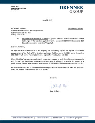
Leah M. Bojo lbojo@drennergroup.com 512-807-2918 June 10, 2025 Mr. Richard Mendoza Transportation and Public Works Department 6310 Wilhelmina Delco Drive Austin, Texas 78752 Via Electronic Delivery Re: Sayers Street Right of Way Vacation – Applicant indefinite postponement letter related to the right of Way Vacation application for the address at 1114 W. 5th Street, and 1134 Sayers Street, Austin, Texas (the “Property”). Dear Mr. Mendoza, As representatives of the owner of the Property, we respectfully request we request an indefinite postponement of the Right of Way Vacation application filed September 21, 2024, under file number 2024-128390 LM, on the Planning Commission agenda for Tuesday, June 10, 2025. While this right of way vacation application is on pause we propose to work through the necessary details with City staff and the adjacent property owner to the west. Our intent is to renotify this request for a public hearing after the adjacent owner’s site plan no. SP-2024-0428C.SH has been approved by the City. Please let me know if you or your team members require additional information or have any questions. Thank you for your time and attention to this matter. Sincerely, Leah M. Bojo 2705 Bee Cave Road, Suite 100 | Austin, Texas 78746 | 512-807-2900 | www.drennergroup.com
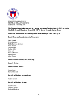
PLANNING COMMISSION REGULAR CALLED MEETING TUESDAY, JUNE 10, 2025 The Planning Commission convened in a regular meeting on Tuesday, June 10, 2025, at Austin City Hall, Council Chambers, Room 1001, 301 W. Second Street, in Austin, Texas. Vice Chair Woods called the Planning Commission Meeting to order at 6:03 p.m. Board Members/Commissioners in Attendance: Imad Ahmed Greg Anderson Nadia Barrera-Ramirez Peter Breton Casey Haney Joshua Hiller Anna Lan Felicity Maxwell Adam Powell Alice Woods Commissioners in Attendance Remotely: Danielle Skidmore Commissioners Absent: Awais Azhar Patrick Howard Ex-Officio Members in Attendance: Jessica Cohen Ex-Officio Members Absent: TC Broadnax Candace Hunter Richard Mendoza 1 APPROVAL OF MINUTES 1. Approve the minutes of the Planning Commission regular meeting Tuesday, May 27, 2025. The minutes from the meeting of May 27, 2025, were approved on the consent agenda on Commissioner Haney’s motion, Commissioner Ahmed’s second on an 11-0 vote. Chair Azhar and Commissioner Howard were absent. PUBLIC HEARINGS 2. Plan Amendment: NPA-2024-0020.01 - 6201 Crow Lane; District 2 Location: 6201 Crow Lane, Williamson Creek; South Congress Combined (Sweetbriar) Neighborhood Planning Area Owner/Applicant: Comal Bluff, LLC (Patricia Smith) Agent: Request: Staff Rec.: Staff: Metcalfe Wolff Stuart & Williams, LLC (Katherine Nicely) Mixed Use/Office to Mixed Use land use Staff Recommends Neighborhood Mixed Use Maureen Meredith, 512-974-2695, maureen.meredith@austintexas.gov Planning Department The public hearing was closed on Commissioner Maxwell’s motion, Commissioner Haney’s second, on an 11-0 vote. Chair Azhar and Commissioner Howard were absent. The motion to approve Staff’s recommendation of Neighborhood Mixed Use, but with changes to the CO to prohibit the following uses: consumer convenience services, consumer repair services, service station and custom manufacturing, was approved on Commissioner Ahmed’s motion, Commissioner Haney’s second, on a 7-4 vote. Those voting aye were Vice Chair Woods and Commissioners Ahmed, Anderson, Barrera- Ramirez, Haney, Hiller, and Maxwell. Those voting nay were Commissioners Breton, Lan, Powell, and Skidmore. Chair Azhar and Commissioner Howard were absent. 3. Rezoning: Location: C14-2024-0168 - 6201 Crow Lane; District 2 6201 Crow Lane, Williamson Creek Watershed; South Congress Combined (Sweetbriar) Neighborhood Planning Area Owner/Applicant: Comal Bluff LLC (Patricia Smith) Agent: Request: Staff Rec.: Staff: Metcalfe Wolff Stuart & Williams (Katherine Nicely) LO-MU-NP to LR-MU-CO-NP Recommended Beverly Villela, 512-978-0740, beverly.villela@austintexas.gov Planning Department The public hearing was closed on Commissioner Maxwell’s motion, Commissioner Haney’s second, on an 11-0 vote. Chair Azhar and Commissioner Howard were absent. The motion to approve Staff’s recommendation of Neighborhood Mixed Use, …
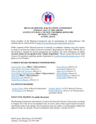
REGULAR MEETING of the PLANNING COMMISSION TUESDAY, MAY 27, 2025, 6:00 PM AUSTIN CITY HALL, COUNCIL CHAMBERS, ROOM 1001 301 WEST 2ND STREET AUSTIN, TEXAS Some members of the Planning Commission may be participating by videoconference. The meeting may be viewed online at: http://www.austintexas.gov/page/watch-atxn-live. Public comment will be allowed in-person or remotely via telephone. Speakers may only register to speak on an item once either in-person or remotely. Registration no later than 2 PM the day of the meeting is required for remote participation by telephone. For more information on public comment, please see the agenda section “Speaker Registration.” Please contact Ella Garcia, Staff Liaison, for questions regarding speaker registration at LandUseLiaison@austintexas.gov or by phone at 512-978-0821. CURRENT BOARD MEMBERS/COMMISSIONERS: Awais Azhar, Chair (Mayor’s Representative) Alice Woods, Vice Chair (District 2) Felicity Maxwell, Secretary (District 5) Casey Haney, Parliamentarian (Mayor’s Representative) Claire Hempel (District 8) Anna Lan (Mayor’s Representative) Patrick Howard (District 1) Nadia Barrera-Ramirez (District 3) Greg Anderson (District 4) Imad Ahmed (District 6) Adam Powell (District 7) Danielle Skidmore (District 9) Joshua Hiller (District 10) EX-OFFICIO MEMBERS: Jessica Cohen, Chair of Board of Adjustment Candace Hunter, A.I.S.D. Board of Trustees TC Broadnax, City Manager Richard Mendoza, Director of Transportation and Public Works EXECUTIVE SESSION (No public discussion) The Planning Commission will announce it will go into Executive Session, if necessary, according to Chapter 551 of the Texas Government Code, to receive advice from Legal Counsel on matters specifically listed on the agenda. The Commission may not conduct a closed meeting without the approval of the city attorney. Private Consultation with Attorney – Section 551.071. Staff Liaison: Ella Garcia, 512-978-0821 Attorney: AJ Urteaga, 512-974-2386 AGENDA CALL TO ORDER PUBLIC COMMUNICATION: GENERAL The first four speakers signed up prior to the meeting being called to order will each be allowed a three-minute allotment to address their concerns regarding items not posted on the agenda. APPROVAL OF MINUTES 1. Approve the minutes of the Planning Commission regular meeting on May 13, 2025, and the revised regular meeting minutes on March 25, 2025. PUBLIC HEARINGS 2. Plan Amendment: NPA-2024-0020.01 - 6201 Crow Lane; District 2 Location: 6201 Crow Lane, Williamson Creek; South Congress Combined (Sweetbriar) Neighborhood Planning Area Owner/Applicant: Comal Bluff, LLC (Patricia Smith) Agent: Request: Staff Rec.: Staff: Metcalfe Wolff Stuart & Williams, LLC (Katherine Nicely) Mixed Use/Office to Mixed Use Staff recommends Neighborhood Mixed Use Maureen Meredith, 512-974-2695, maureen.meredith@austintexas.gov Planning …
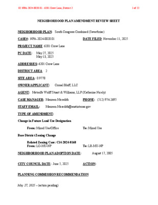
NEIGHBORHOOD PLAN AMENDMENT REVIEW SHEET NEIGHORHOOD PLAN: South Congress Combined (Sweetbriar) CASE#: NPA-2024-0020.01 DATE FILED: November 11, 2025 PROJECT NAME: 6201 Crow Lane PC DATE: May 27, 2025 May 13, 2025 ADDRESS/ES: 6201 Crow Lane DISTRICT AREA: 2 SITE AREA: 0.9778 OWNER/APPLICANT: Comal Bluff, LLC AGENT: Metcalfe Wolff Stuart & Williams, LLP (Katherine Nicely) CASE MANAGER: Maureen Meredith PHONE: (512) 974-2695 STAFF EMAIL: Maureen.Meredith@austintexas.gov TYPE OF AMENDMENT: Change in Future Land Use Designation From: Mixed Use/Office To: Mixed Use Base District Zoning Change Related Zoning Case: C14-2024-0168 From: LO-MU-NP To: LR-MU-NP NEIGHBORHOOD PLAN ADOPTION DATE: August 17, 2005 CITY COUNCIL DATE: June 5, 2025 ACTION: PLANNING COMMISSION RECOMMENDATION: May 27, 2025 – (action pending) 02 NPA-2024-0020.01 - 6201 Crow Lane; District 21 of 22 May 13, 2025 – Postponed to May 27, 2025 on the consent agenda at the request of the Applicant. [F. Maxwell – 1st; A. Woods – 2nd] Vote: 10-0 [P. Howard, C. Hempel, and D. Skidmore absent]. STAFF RECOMMENDATION: Staff recommends an alternate land use of Neighborhood Mixed Use. BASIS FOR STAFF’S RECOMMENDATION: The applicant’s request for LR-MU-NP zoning is more consistent with the Neighborhood Mixed Use land use. The property is located on a cul-de-sac, but has Commercial land use directly to the north, east, and south; Multifamily Residential land use is to the west, and Mixed Residential to the northwest. Neighborhood Mixed Use land use would be approproprite in this location. The property was a daycare center that has since closed and is now operating as a pet services/doggy daycare which is not allowed under the LO-MU-NP zoning. The request for LR- MU-NP would make the pet services use compliant with the zoning. 02 NPA-2024-0020.01 - 6201 Crow Lane; District 22 of 22 LAND USE DESCRIPTIONS: EXISTING LAND USE: Mixed Use/Office - An area that is appropriate for a mix of residential and office uses. Purpose 1. Accommodate mixed use development in areas that are not appropriate for general commercial development; and 2. Provide a transition from residential use to non residential or mixed use. Application ‐ 1. Appropriate for areas such as minor corridors or local streets adjacent to commercial areas; 2. May be used to encourage commercial uses to transition to residential use; and 3. Provide limited opportunities for live/work residential in urban areas. PROPOSED LAND USE: Mixed Use - An area that is appropriate for a mix of residential and non‐residential …
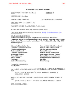
ZONING CHANGE REVIEW SHEET CASE: C14-2024-0168 (6201 Crow Lane) DISTRICT: 2 ADDRESS: 6201 Crow Lane ZONING FROM: LO-MU-NP TO: LR-MU-CO-NP (As amended) SITE AREA: .9778 acres (42,592 sq. ft.) PROPERTY OWNER: Comal Bluff LLC (Patricia Smith) AGENT: Metcalfe Wolff Stuart & Williams (Katherine Nicely) CASE MANAGER: Beverly Villela (512-978-0740, Beverly.Villela@austintexas.gov) STAFF RECOMMENDATION: Staff recommendation is to grant Neighborhood Commercial – Mixed Use – Conditional Overlay – Neighborhood Plan (LR-MU-CO-NP) combining district zoning. See the Basis of Recommendation section below. The Conditional Overlay will probibit the following uses: Alternative Financial Services Consumer Convenience Services Printing and Publishing Restaurant (General) Consumer Repair Services Restaurant (Limited) Financial Services Service Station Food Sales Custom Manufacturing PLANNING COMMISSION: May 27, 2025: General Retail Sales (Convenience) General Retail Sales (General) Off-Site Accessory Parking Personal Services Pedicab Storage and Dispatch College and University Facilities Personal Improvement Services Private Secondary Educational Facilities Plant Nursery May 13, 2025: APPROVED APPLICANT’S REQUEST FOR POSTPONEMENT TO MAY 27, 2025. [F. MAXWELL; A. WOODS – 2ND] (10-0) P. HOWARD, C. HEMPEL, D. SKIDMORE – ABSENT April 22, 2025: APPROVED STAFF’S REQUEST FOR POSTPONEMENT TO MAY 13, 2025. [F. MAXWELL; C. HANEY – 2ND] (11-0) N. BARRERA-RAMIREZ – ABSENT CITY COUNCIL ACTION: 03 C14-2024-0168 - 6201 Crow Lane; District 21 of 12 TBD ORDINANCE NUMBER: No. ISSUES: The property has an active land use code violation (CV 2024 091716) related to the operation of a pet services business, which is not permitted under the current LO-MU-NP zoning. CASE MANAGER COMMENTS: The property in question is a 0.9778-acre lot located at 6201 Crow Lane, currently developed with an existing structure that has been operating as a pet services business. The applicant is requesting to rezone the property to Neighborhood Commercial – Mixed Use – Conditional Overlay – Neighborhood Plan (LR-MU-CO-NP) combining district zoning to allow the continued use of the site for neighborhood-serving pet services under the appropriate zoning category. Crow Lane is classified as a Level 1 street. The surrounding area includes a mix of residential, hotel, and commercial uses: apartments and condominiums to the west and north, and a hotel and theater/restaurant complex in a PUD district to the east and south. A roofing business is located directly west of the site. Please refer to Exhibits A (Zoning Map) and B (Aerial View). The proposed rezoning will allow for the continued operation of a neighborhood-serving pet business while maintaining compatibility with the …
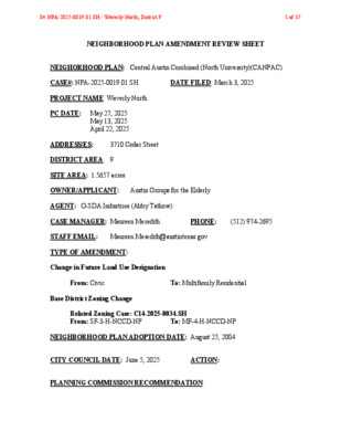
NEIGHBORHOOD PLAN AMENDMENT REVIEW SHEET NEIGHORHOOD PLAN: Central Austin Combined (North University)(CANPAC) CASE#: NPA-2025-0019.01.SH DATE FILED: March 3, 2025 PROJECT NAME: Waverly North PC DATE: May 27, 2025 May 13, 2025 April 22, 2025 ADDRESS/ES: 3710 Cedar Street DISTRICT AREA: 9 SITE AREA: 1.5657 acres OWNER/APPLICANT: Austin Groups for the Elderly AGENT: O-SDA Industries (Abby Tatkow) CASE MANAGER: Maureen Meredith PHONE: (512) 974-2695 STAFF EMAIL: Maureen.Meredith@austintexas.gov TYPE OF AMENDMENT: Change in Future Land Use Designation From: Civic To: Multifamily Residential Base District Zoning Change Related Zoning Case: C14-2025-0034.SH From: SF-3-H-NCCD-NP To: MF-4-H-NCCD-NP NEIGHBORHOOD PLAN ADOPTION DATE: August 25, 2004 CITY COUNCIL DATE: June 5, 2025 ACTION: PLANNING COMMISSION RECOMMENDATION: 04 NPA-2025-0019.01.SH - Waverly North; District 91 of 37 May 27, 2025 – (action pending) May, 13, 2025 – Postponed to May 27, 2025 on the consent agenda at the request of the Applicant. [F. Maxwell – 1st; A. Woods – 2nd] Vote: 10-0 [P. Howard, C. Hempel, and D. Skidmore absent]. April 22, 2025 - Postponed on the consent agenda to May 13, 2025 at the request of Staff. [F. Maxwell – 1st; C. Haney – 2nd] Vote: 11-0 [N. Barrera-Ramirez and C. Hempel absent]. STAFF RECOMMENDATION: To support the applicant’s request for Multifamily Residential land use. BASIS FOR STAFF’S RECOMMENDATION: Staff supports the applicant’s request for Multifamily Residential land use in this location. The property is located in an area with existing Multifamily Residential land uses. The applicant is proposing 76 affordable residential dwelling units which will provide additional housing options for the area and the city. 04 NPA-2025-0019.01.SH - Waverly North; District 92 of 37 LAND USE DESCRIPTIONS: EXISTING LAND USE: Civic - Any site for public or semi fire facilities, hospitals, and public and private schools. Includes major religious facilities and other religious activities that are of a different type and scale than surrounding uses. public facilities, including governmental offices, police, ‐ Purpose functional institutional uses that serve 1. Allow flexibility in development for major, multi the greater community; 2. Manage the expansion of major institutional uses to prevent unnecessary impacts on established neighborhood areas; 3. Preserve the availability of sites for civic facilities to ensure that facilities are adequate for population growth; 4. Promote Civic uses that are accessible and useable for the neighborhood resident and maintain stability of types of public uses in the neighborhood; ‐ 5. May include housing facilities that are accessory to …
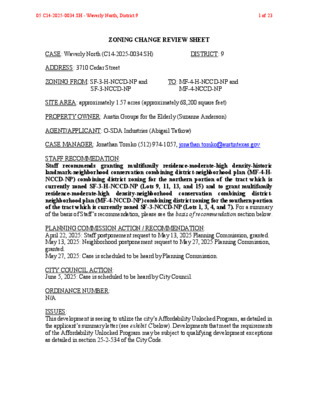
ZONING CHANGE REVIEW SHEET CASE: Waverly North (C14-2025-0034.SH) DISTRICT: 9 ADDRESS: 3710 Cedar Street ZONING FROM: SF-3-H-NCCD-NP and TO: MF-4-H-NCCD-NP and SF-3-NCCD-NP MF-4-NCCD-NP SITE AREA: approximately 1.57 acres (approximately 68,200 square feet) PROPERTY OWNER: Austin Groups for the Elderly (Suzanne Anderson) AGENT/APPLICANT: O-SDA Industries (Abigail Tatkow) CASE MANAGER: Jonathan Tomko (512) 974-1057, jonathan.tomko@austintexas.gov STAFF RECOMMEDATION: Staff recommends granting multifamily residence-moderate-high density-historic landmark-neighborhood conservation combining district-neighborhood plan (MF-4-H- NCCD-NP) combining district zoning for the northern portion of the tract which is currently zoned SF-3-H-NCCD-NP (Lots 9, 11, 13, and 15) and to grant multifamily residence-moderate-high density-neighborhood conservation combining district- neighborhood plan (MF-4-NCCD-NP) combining district zoning for the southern portion of the tract which is currently zoned SF-3-NCCD-NP (Lots 1, 3, 4, and 7). For a summary of the basis of Staff’s recommendation, please see the basis of recommendation section below. PLANNING COMMISSION ACTION / RECOMMENDATION: April 22, 2025: Staff postponement request to May 13, 2025 Planning Commission, granted. May 13, 2025: Neighborhood postponement request to May 27, 2025 Planning Commission, granted. May 27, 2025: Case is scheduled to be heard by Planning Commission. CITY COUNCIL ACTION: June 5, 2025: Case is scheduled to be heard by City Council. ORDINANCE NUMBER: N/A ISSUES: This development is seeing to utilize the city’s Affordability Unlocked Program, as detailed in the applicant’s summary letter (see exhibit C below). Developments that meet the requirements of the Affordability Unlocked Program may be subject to qualifying development exceptions as detailed in section 25-2-534 of the City Code. 05 C14-2025-0034.SH - Waverly North; District 91 of 23 C14-2025-0034.SH 2 The subject tract contains a historic landmark known as the Confederate Women’s Home on the northern portion of the site (lots 9, 11, 13, and 15). The City’s Historic Preservation Office has detailed the process for redeveloping this structure in a memo included as exhibit D. CASE MANAGER COMMENTS: The property in question is located between Home Lane and Cedar Street just south of West 28th Street. It is approximately 1,000 feet east of Guadalupe Street which is an Imagine Austin Activity Corridor and approximately 2,000 feet north of the Downtown Imagine Austin Activity Center. The site currently a two-story multifamily/office use of approximately 31,000 square feet with approximately 15,000 square feet of paved area. The northern portion of the building is historic, the southern portion was a later addition which is not. To the north, across West 38th Street …