Fayez Kazi, Chair and Planning Commission Members MEMORANDUM ************************************************************************ TO: FROM: DATE: RE: NPA-2019-0003.01– David Chapel Missionary Baptist Church 2201, 2203, 2207, 2211, 2301 E. Martin Luther King, Jr. Blvd 1805 and 1807 Ferdinand St. 1803 and 1807 Chestnut Ave. Staff Postponement Request Maureen Meredith, Senior Planner Planning and Zoning Department April 21, 2020 ************************************************************************ Staff requests a postponement of the above-referenced plan amendment case from the April 28, 2020 Planning Commission hearing to the June 23, 2020 hearing date to allow time for the submission and review of the associated zoning case. The postponement request was made in a timely manner and meets the Planning Commission’s policy. Attachment: Map of property location 1 of 2B-01 2 of 2B-01
NEIGHBORHOOD PLAN AMENDMENT REVIEW SHEET DATE FILED: November 21, 2019 NPA-2019-0015.02 3500 Pecan Springs Road March 10, 2020 April 14, 2020 April 28, 2020 NEIGHORHOOD PLAN: East MLK Combined Neighborhood Plan CASE#: PROJECT NAME: Pecan Springs Residential PC DATES: February 25, 2020 ADDRESS/ES: DISTRICT AREA: 1 SITE AREA: APPLICANT/OWNER: AGENT: TYPE OF AMENDMENT: Change in Future Land Use Designation From: Single Family To: Higher Density Single Family Related Zoning Case: C14-2019-0164 Ron Thrower; Thrower Design (512) 476-4456 WATERSHED: Fort Branch Approx. 2.4 acres Peter Gray Base District Zoning Change From: SF-3 To: SF-6 NEIGHBORHOOD PLAN ADOPTION DATE: November 7, 2002 PLANNING COMMISSION RECOMMENDATION: Pending. To be reviewed on April 28, 2020. February 25, 2020 – Item postponed at neighborhood’s request to March 10, 2020 [APPROVED BY COMMISSSIONER SCHNEIDER, SECONDED BY COMMISSIONER KENNY ON A VOTE OF 12-0; COMMISSIONER SHIEH ABSENT] March 10, 2020 – Item postponed at applicant’s request to April 14, 2020 [APPROVED BY COMMISSSIONER SHIEH, SECONDED BY COMMISSIONER SCHNEIDER ON A VOTE OF 11-0; COMMISSIONERS AZHAR AND HOWARD ABSENT] 1 B-021 of 28 April 14, 2020 – Item postponed at staff’s request to April 28, 2020 [APPROVED BY COMMISSSIONER SCHNEIDER, SECONDED BY COMMISSIONER KENNY ON A VOTE OF 12-0; COMMISSIONER LLANES PULIDO ABSENT] STAFF RECOMMENDATION: Recommended BASIS FOR STAFF’S RECOMMENDATION: The Long-Range Planning staff met on Monday, January 27, 2020 to discuss this case and the community meeting which was held on January 13, 2020. Staff voted to recommend the FLUM change from Single Family land use to Higher Density Single Family land use with a vote of 6- 0. Staff recommends the project because it will provide additional housing and density along Springdale Road which is an Imagine Austin Growth Concept Map corridor. The project will also create new opportunities for home ownership, a goal of the East MLK Neighborhood Plan. The site is within ¼ mile of the Capital Metro #300 bus line and less than a mile to the Little Walnut Creek Greenbelt. Land Use (excerpts from neighborhood plan) Goal One Preserve established residential areas and improve opportunities for home ownership by promoting the rehabilitation of existing housing and new, infill housing compatible with the existing style of this neighborhood. Goal Four Promote the development and enhancement of the neighborhood’s major corridors. Goal Nine Improve bicycle and pedestrian traffic safety on neighborhood streets. Goal Twelve Improve the quality, safety, and cleanliness of area creeks, and …
ZONING CHANGE REVIEW SHEET CASE: C14-2019-0164 Pecan Springs Residential DISTRICT: 1 ZONING FROM: SF-3-NP TO: SF-6-NP ADDRESS: 3500 Pecan Springs Road SITE AREA: 2.40 Acres PROPERTY OWNERS/APPLICANT: 9025BFD, LLC (Peter Gray) AGENT: Thrower Design (Ron Thrower) CASE MANAGER: Heather Chaffin (512-974-2122, heather.chaffin@austintexas.gov) STAFF RECOMMENDATION: Staff supports the Applicant’s request of SF-6-NP. For a summary of the basis of staff’s recommendation, see case manager comments on page 2. PLANNING COMMISSION ACTION / RECOMMENDATION: April 28, 2020: April 14, 2020: To grant postponement request by Staff to April 28, 2020, on consent. March 10, 2020: To grant postponement request by Neighborhood to April 14, 2020, on consent. February 25, 2020: To grant postponement request by Neighborhood to March 10, 2020, on consent. CITY COUNCIL ACTION: May 21, 2020: April 23, 2020: To grant postponement by Staff to May 21, 2020, on consent. March 26, 2020: To grant postponement by Council to April 23, 2020, on consent. ORDINANCE NUMBER: 1 of 16B-03 C14-2019-0164 ISSUES: No issues at this time. 2 CASE MANAGER COMMENTS: The subject property is located at the northwest corner of the intersection of Springdale Road and Pecan Springs Road. The 2.40 acre lot is zoned SF-3-NP and developed with one single family residence. The north half of the property is constrained by a tributary to Fort Branch Creek, including floodplain and creek buffers. West and Southwest of the property, along Pecan Springs Road, are additional SF-3-NP properties developed with single family residences. Northwest of the property are more SF-3-NP lots, and a SF-6-CO-NP parcel. These properties are developed with single family residences. Immediately north of the property are tracts zoned GR-MU-CO-NP that include townhouse/condominium and limited retail land uses. Across Springdale Road to the east is undeveloped land zoned SF-6-NP and land zoned GR-CO-NP that contains religious assembly land use. Please see Exhibits A, B, and C—Zoning Map, Aerial Exhibit, and Environmental Exhibit. Staff supports the Applicant’s request of SF-6-NP zoning. The environmental constraints of the property impact the option of subdividing and developing the site with single family residences. SF-6 zoning allows clustering of residential units to avoid the environmental features. SF-6 zoning has been approved for properties northwest and east; the GR-MU-CO- NP property immediately of the site is developed with townhouse/condominium land use. Staff has received correspondence in opposition to the rezoning request. Please see Exhibit D- Correspondence. BASIS OF RECOMMENDATION: 1. The rezoning should be consistent …
ZONING CHANGE / RESTRICTIVE COVENANT AMENDMENT REVIEW SHEET CASE: C14-2019-0003 / C14-85-288.8(RCA5) – ZONING FROM: GR-NP for Tract 1; CS-1-CO-NP for Tract 2 ZONING TO: GR-MU-NP for Tract 1 (35.371 acres); Lantana, Block P, Lot 3 DISTRICT: 8 CS-1-MU-CO-NP for Tract 2 (0.279 acres) ADDRESS: 7415 Southwest Parkway PROPERTY OWNER: Lantana Place, L.L.C. (Erin D. Pickens) TOTAL SITE AREA: 35.67 acres AGENT: LJA Engineering, Inc. (Paul J. Viktorin, P.E.) CASE MANAGER: Wendy Rhoades (512-974-7719, wendy.rhoades@austintexas.gov) STAFF RECOMMENDATION: The Staff recommendation is to: grant community commercial – mixed use – neighborhood plan (GR-MU-NP) combining district zoning for Tract 1 and commercial-liquor sales – mixed use – conditional overlay – neighborhood plan (CS-1-MU-CO-NP) combining district zoning for Tract 2. On Tract 2, the Conditional Overlay is to limit the maximum floor-to-area ratio is 1 : 1 and prohibit the following uses on the Property: agricultural sales & services, commercial blood plasma center, custom manufacturing, electronic prototype assembly, exterminating services, plant nursery and veterinary services, and amend the Restrictive Covenant to remove the provision establishing the maximum net leasable square feet of buildable space or maximum floor-to-area ratio (FAR) that can be developed on the Property. For a summary of the basis of Staff’s recommendation, see case manager comments on Page 2. PLANNING COMMISSION ACTION / RECOMMENDATION: April 28, 2020: April 14, 2020: APPROVED A POSTPONEMENT REQUEST BY STAFF TO APRIL 28, 2020 [R. SCHNEIDER; C. KENNY – 2ND] (12-0) C. LLANES PULIDO – ABSENT March 10, 2020: APPROVED A POSTPONEMENT REQUEST BY STAFF TO APRIL 14, 2020 [J. SHIEH; R. SCHNEIDER – 2ND] (11-0) A. AZHAR, P. HOWARD – ABSENT 1 of 23B-05 C14-2019-0003 / C14-85-288.8(RCA5) Page 2 February 25, 2020: APPROVED A POSTPONEMENT REQUEST BY STAFF TO MARCH 10, 2020 [R. SCHNEIDER; C. KENNY – 2ND] (12-0) J. SHIEH – ABSENT January 28, 2020: APPROVED A POSTPONEMENT REQUEST BY STAFF TO FEBRUARY 25, 2020 [J. THOMPSON; A. AZHAR – 2ND] (10-0) C. HEMPEL – RECUSED; C. LLANES PULIDO, P. SEEGER – ABSENT December 17, 2019: APPROVED A POSTPONEMENT REQUEST BY THE STAFF TO JANUARY 28, 2020, BY CONSENT [P. HOWARD; Y. FLORES – 2ND] (10-0) G. ANDERSON, C. LLANES PULIDO, T. SHAW – ABSENT [P. HOWARD; C. KENNY – 2ND] (11-0) P. SEEGER, J. SHIEH – ABSENT June 25, 2019: APPROVED AN INDEFINITE POSTPONEMENT REQUEST BY THE STAFF, BY CONSENT CITY COUNCIL ACTION: May 7, 2020: April 23, 2020: March 12, …
ZONING CHANGE / RESTRICTIVE COVENANT AMENDMENT REVIEW SHEET CASE: C14-2019-0003 / C14-85-288.8(RCA5) – ZONING FROM: GR-NP for Tract 1; CS-1-CO-NP for Tract 2 ZONING TO: GR-MU-NP for Tract 1 (35.371 acres); Lantana, Block P, Lot 3 DISTRICT: 8 CS-1-MU-CO-NP for Tract 2 (0.279 acres) ADDRESS: 7415 Southwest Parkway PROPERTY OWNER: Lantana Place, L.L.C. (Erin D. Pickens) TOTAL SITE AREA: 35.67 acres AGENT: LJA Engineering, Inc. (Paul J. Viktorin, P.E.) CASE MANAGER: Wendy Rhoades (512-974-7719, wendy.rhoades@austintexas.gov) STAFF RECOMMENDATION: The Staff recommendation is to: grant community commercial – mixed use – neighborhood plan (GR-MU-NP) combining district zoning for Tract 1 and commercial-liquor sales – mixed use – conditional overlay – neighborhood plan (CS-1-MU-CO-NP) combining district zoning for Tract 2. On Tract 2, the Conditional Overlay is to limit the maximum floor-to-area ratio is 1 : 1 and prohibit the following uses on the Property: agricultural sales & services, commercial blood plasma center, custom manufacturing, electronic prototype assembly, exterminating services, plant nursery and veterinary services, and amend the Restrictive Covenant to remove the provision establishing the maximum net leasable square feet of buildable space or maximum floor-to-area ratio (FAR) that can be developed on the Property. For a summary of the basis of Staff’s recommendation, see case manager comments on Page 2. PLANNING COMMISSION ACTION / RECOMMENDATION: April 28, 2020: April 14, 2020: APPROVED A POSTPONEMENT REQUEST BY STAFF TO APRIL 28, 2020 [R. SCHNEIDER; C. KENNY – 2ND] (12-0) C. LLANES PULIDO – ABSENT March 10, 2020: APPROVED A POSTPONEMENT REQUEST BY STAFF TO APRIL 14, 2020 [J. SHIEH; R. SCHNEIDER – 2ND] (11-0) A. AZHAR, P. HOWARD – ABSENT 1 of 23B-06 C14-2019-0003 / C14-85-288.8(RCA5) Page 2 February 25, 2020: APPROVED A POSTPONEMENT REQUEST BY STAFF TO MARCH 10, 2020 [R. SCHNEIDER; C. KENNY – 2ND] (12-0) J. SHIEH – ABSENT January 28, 2020: APPROVED A POSTPONEMENT REQUEST BY STAFF TO FEBRUARY 25, 2020 [J. THOMPSON; A. AZHAR – 2ND] (10-0) C. HEMPEL – RECUSED; C. LLANES PULIDO, P. SEEGER – ABSENT December 17, 2019: APPROVED A POSTPONEMENT REQUEST BY THE STAFF TO JANUARY 28, 2020, BY CONSENT [P. HOWARD; Y. FLORES – 2ND] (10-0) G. ANDERSON, C. LLANES PULIDO, T. SHAW – ABSENT [P. HOWARD; C. KENNY – 2ND] (11-0) P. SEEGER, J. SHIEH – ABSENT June 25, 2019: APPROVED AN INDEFINITE POSTPONEMENT REQUEST BY THE STAFF, BY CONSENT CITY COUNCIL ACTION: May 7, 2020: April 23, 2020: March 12, …
C14-2020-0007 1 ZONING CHANGE REVIEW SHEET CASE: C14-2020-0007– 2001 Guadalupe Street Zoning ZONING FROM: CS-NP DISTRICT: 9 TO: CS-MU-NP ADDRESS: 2001 Guadalupe Street PROPERTY OWNER: Powell-Corbett LLC (William Corbett) SITE AREA: 0.201 acres (8,755 sq. ft.) AGENT: Coats-Rose (John Joseph) CASE MANAGER: Mark Graham (512-974-3574, mark.graham@austintexas.gov ) STAFF RECOMMENDATION: The staff recommendation is to grant general commercial services – mixed use – neighborhood plan (CS-MU-NP) combining district zoning. For a summary of the basis of staff’s recommendation, see case manager comments below. PLANNING COMMISSION ACTION / RECOMMENDATION: April 28, 2020: April 14, 2020: APPROVED A POSTPONEMENT REQUEST TO APRIL 28, 2020. [R. SCHNEIDER, C. KENNY-2ND] (12-0) with C. LLANES PULIDO – ABSENT. March 10, 2020: APPROVED A POSTPONEMENT REQUEST BY APPLICANT TO [J. SHIEH, R. SCHNEIDER-2ND] (11-0) A. AZHAR, P. HOWARD - ABSENT APRIL 14, 2020. CITY COUNCIL ACTION: May 7, 2020: April 9, 2020: POSTPONED TO MAY 7, 2020 ORDINANCE NUMBER: ISSUES While there is staff support for the requested Mixed Use zoning for the property at 2001 Guadalupe Street, there are other processes available that may provide more flexible development standards such as parking, height, floor to area ratio (FAR) and in return require participation in affordable housing, streetscape investments and adherence to design standards. 1 of 28B-07 C14-2020-0007 2 CASE MANAGER COMMENTS: The subject lot is on the east side of Guadalupe Street at the south end of “The Drag,” a nickname for the portion of Guadalupe Street along the western edge of the University of Texas (UT) Austin Campus. The lot is situated between the five-story University of Texas, McCombs Business School on the south and the two story Dobie Center retail buildings to the north, in the shadow of the 27 story Dobie residential tower. This busy section of the West Campus Neighborhood has many apartments and condominiums housing UT students as well as food, clothing, school supplies and service businesses catering to students and university employees. The 0.201 acres (8,755 square foot) parcel is located on the northeast corner of Guadalupe Street and West 20th Street. On the parcel there are three retail commercial buildings, two one story buildings and a two story building. There is also outside seating between the building and Guadalupe Street for patrons of the food oriented businesses. The adjacent lot to the north is vacant. The current zoning is General Commercial Services - Neighborhood Plan (CS-NP) district. The applicant …
MEMORANDUM ************************************************************************ TO: Fayez Kazi, Chair Planning Commission Members FROM: DATE: RE: Heather Chaffin, Senior Planner Planning and Zoning Department April 28, 2020 C14-2019-0107.SH Diamond Forty-Two Postponement Request by Staff ************************************************************************ Staff requests a postponement of the above-referenced rezoning case from the April 28, 2020 Planning Commission hearing to the May 12, 2020 hearing date. The Applicant on the request has changed, and additional paperwork and processing is necessary before the case can be heard. 1 of 2B-08 From: Sally Gaskin Sent: Thursday, October 03, 2019 11:37 AM To: Chaffin, Heather <Heather.Chaffin@austintexas.gov> Cc: Megan Lasch Subject: RE: Zoning Case: C14-2019-0107.SH Jackie Robinson Street Yes, thank you for the correction. Sally 713-882-3233 From: Chaffin, Heather <Heather.Chaffin@austintexas.gov> Sent: Thursday, October 3, 2019 11:35 AM To: Sally Gaskin < Cc: Megan Lasch < Subject: RE: Zoning Case: C14-2019-0107.SH Jackie Robinson Street There is no meeting on November 5th—would you like to postpone to November 12th? From: Sally Gaskin Sent: Thursday, October 03, 2019 11:34 AM To: Chaffin, Heather <Heather.Chaffin@austintexas.gov> Cc: Megan Lasch Subject: RE: Zoning Case: C14-2019-0107.SH Jackie Robinson Street Heather, After further internal discussions, we have decided to hold off on scheduling the PC meeting for the zoning case to allow time for meetings with the neighborhood to occur without the pressure of an imminent deadline. While we are confident that the issues can be satisfactorily addressed, we want to be considerate of the neighborhood process. Our goal is to be ready for the Nov 5 meeting, but will contact you to reschedule. Also, per your suggestion, we will be present at the Oct 8 meeting in the event there are questions. Thank you, Sally 713-882-3233 2 of 2B-08
Memorandum To: Boards and Commissions From: Greg Meszaros, Director, Austin Water Date: March 25, 2020 Subject: Board and Commission and Citizen Review of new Growth-related Capital Improvement Projects in Drinking Water Protection Zone The Austin City Council approved an amendment to Austin Waters (AW) Financial Policy No. 8 to provide for enhanced Board and Commission and citizen reviews of AW’s new growth-related capital improvement projects (CIP) located in the Drinking Water Protection Zone (DWPZ). This ordinance (No. 20130117-017) took effect on January 28, 2013 and as part of the 2020 annual budget process, AW is presenting the new growth-related projects to Boards and Commissions as set forth in the ordinance. The revised 2013 Financial Policy No. 8 reads as follows: Capital improvement projects for new water and wastewater treatment plants, capital expansions, and growth-related projects that are located in the Drinking Water Protection Zone (DWPZ) will be identified and submitted, as part of the annual budget process, to the following Boards and Commissions: Water and Wastewater Commission, Resource Management Commission, Environmental Board, Planning Commission, and the Zoning and Platting Commission. These Boards and Commissions will review growth-related DWPZ capital projects spending plans, obtain Board and Commission and citizen input, review consistency with Imagine Austin Comprehensive Plan, review effect on growth within the DWPZ, and make recommendations on project approval for inclusion in Austin Water Utility’s 5-year capital spending plans. This summer, AW representatives will be distributing a brief report to the Commissions on the CIP projects located in the DWPZ related to the financial policy. Attachments: CIP Projects Summary CIP Projects Supplemental Information and Map B-091 of 5 Austin Water Infrastructure Management Financial Policy No. 8 FY21-25 CIP Plan Development Drinking Water Protection Zone Projects Summary Each year, as part of the City of Austin Budget approval process, Austin Water submits a plan for the capital improvements program (CIP) spending for the upcoming five-year period. Austin Water’s FY21- 25 CIP Plan includes projects located across the Austin metropolitan area, including the Drinking Water Protection Zone (DWPZ). In compliance with Austin Water’s Financial Policy No. 8, the capital improvement projects for new water and wastewater treatment plants, capital expansions, and growth related projects that are located in the DWPZ are presented below for consideration by City of Austin Boards and Commissions. These projects represent improvements required to meet Austin Water standards for operability and customer service. While additional capacity may be …
SUBDIVISION REVIEW SHEET CASE NO.: C8-2019-0114 PC DATE: April 28, 2020 SUBDIVISION NAME: Simon-Caskey Tract Preliminary Plan AREA: 16.664 ac. LOT(S): 26 OWNER: Ridgelea Properties, Inc. (Adams Caskey) AGENT/APPLICANT: Bill E. Couch (Carlson, Brigance & Doering) ADDRESS OF SUBDIVISION: 7715 W SH 71 COUNTY: Travis WATERSHED: Williamson Creek EXISTING ZONING: SF-1, SF-2-NP, SF-6-NP PROPOSED LAND USE: Multifamily & Commercial with ROW and Parkland DEPARTMENT COMMENTS: The request is for the approval of the Simon-Caskey Tract Preliminary Plan which will develop a 16.664 ac. previously un-platted tract creating 26 lots consisting of 2 lots for multifamily use (7.748 ac.), 21 lots for single-family use (3.810 ac.), 1 lot for parkland (1.307 ac.) and 2 lots designated for drainage & water quality easements and greenbelt (1.538 ac.) with 2.261 ac. being dedicated for streets with all associated improvements. STAFF RECOMMENDATION: Staff recommends approval of this preliminary plan as it meets all applicable State and City of Austin LDC requirements. ZONING AND PLATTING COMMISSION ACTION: CASE MANAGER: Joey de la Garza PHONE: 512-974-2664 EMAIL: joey.delagarza@austintexas.gov 1 of 12B-10 2 of 12B-10 3 of 12B-10 4 of 12B-10 5 of 12B-10 6 of 12B-10 7 of 12B-10 8 of 12B-10 9 of 12B-10 10 of 12B-10 11 of 12B-10 E MIN R E SILV N O O C C A R PAX E L F RI L I T T L E D E E R PIN T O K O O HIN C 7 1 SCENIC BROOK G R O V E C R E S T O A K M E A D O W M A R B L L A C Subject Tract ± This product is for informational purposes and may not have been prepared for or be suitable for legal, engineering, or surveying purposes. It does not CASE#: C8-2019-0114 LOCATION: 7715 W SH 71 represent an on-the-ground survey and represents only the approximate relative location of property boundaries. Base Map This product has been produced by the Development Services Department for the sole purpose of geographic reference. No warranty is made by the City of Austin regarding specific accuracy or completeness. 12 of 12B-10
SUBDIVISION REVIEW SHEET LOT(S): 20 (Jerry Perales, P.E.) P.C. DATE: April 28, 2020 (Andrey Derevianko) CASE NO.: C8-2019-0112 SUBDIVISION NAME: Twilight Gardens Preliminary Plan AREA: 17.92 acres OWNER/APPLICANT: Twilight Estates, LLC. AGENT: Perales Land Development ADDRESS OF SUBDIVISION: 8316 Twilight Terrace Dr. WATERSHED: Williamson Creek EXISTING ZONING: SF-1-CO-NP NEIGHBORHOOD PLAN: West Oak Hill PROPOSED LAND USE: Residential VARIANCES: none DEPARTMENT COMMENTS: The request is for the approval of the Twilight Gardens Preliminary Plan composed of 20 lots on 17.92 acres. The applicant is proposing to subdivide the property into a 20 lot subdivision for residential use. STAFF RECOMMENDATION: Staff recommends approval of the case, the plan meets applicable State and City of Austin LDC requirements. CASE MANAGER: Cesar Zavala Email address: cesar.zavala@austintexas.gov PHONE: 512-974-3404 JURISDICTION: Full COUNTY: Travis 1 of 3B-11 Location: 8316 Twilight Terrace Austin, Texas 78737 2 of 3B-11 SF-1-CO-NP MOBILE HOMES 9 4 0 6 0 1 L 9 3 0 505.0000 7 1 1 L SF-1-CO-NP MOBILE HOMES 2234.7500 6 1 1 L 5 1 1 L 1 LOT 3 5' P.U.E. 0.50 AC. LOT 4 0.50 AC. L155 L157 L154 9 1 0 1 1 1 L 9 2 0 4 1 1 L 2 1 1 L 2' 1.3 5 2 3 6.6"E 1 1 1 L 8' 3 d 1 8 N 2 LOT 5 0.50 AC. LOT 6 0.50 AC. LOT 7 0.50 AC. LOT 8 0.50 AC. LOT 9 0.50 AC. L158 L152 L153 955.3 4663.2500 1452.8029 9 5 0 L 1 6 0 LOT 2 0.50 AC. L133 L 1 3 2 LOT 1 DRAINAGE LOT AN DRAINAGE EASEMENT 0.10 AC. 15' D L163 SF-1-CO-NP SINGLE FAMILY 0 4 9 L159 S 5 8 d 4 2' 2 L 1 6 2 C31 W L164 2" W 6 3 8.9 C29 0' C30 0 3 9 C32 C 3 3 4 3 C R 6 0 ' W W W OP. 8" WL OP. 6" W PR WL 9 3 1 L W PR W W 8 2 C C 2 7 5 3 C C37 L151 0 5 1 L L156 W RY SKY CT. (50' R.O.W.) W W 9 4 1 L 8 3 1 L 8 4 1 L PR R W OP. 8" WL STA 7 3 1 L W W W 10.5' 50' R.O.W W W 6 3 1 L WL W OP. 6" W …
PLANNING COMMISSION SITE PLAN CONDITIONAL USE PERMIT REVIEW SHEET 76 Rainey St. 76 Rainey CUP SPC-2019-0590A PC DATE: 4/28/20 Regalado Joe Martin 7712 Kiva Dr. Austin, TX 78749 WGI (Cliff Kendall) 2021 E. 5th St. Suite 200 Austin, TX 78702 (512) 669-5560 CASE NUMBER: PROJECT NAME: ADDRESS: APPLICANT: AGENT: CASE MANAGER: Renee Johns, (512) 974-2711 or at Renee.Johns@austintexas.gov WATERSHED: Waller Creek/Lady Bird Lake PROPOSED USE: Cocktail Lounge EXISTING ZONING: CBD NEIGHBORHOOD PLAN: N/A PROPOSED DEVELOPMENT: The applicant is requesting a conditional use permit for a cocktail lounge in one existing building located in the historic Rainey Street District, totaling 2,000 sf of indoor space and 3,500 sf of outdoor covered and uncovered areas, for a grand total of 5,500 sf of CUP Cocktail Lounge space. The hours of operation will be Monday – Wednesday 5pm to 2am, Thursday 4pm to 2am, and Saturday and Sunday 11am to 2am. No construction will occur with this permit but will be permitted either as a B-plan (construction site plan) or as a site plan exemption. SUMMARY STAFF RECOMMENDATION: Staff recommends approval of the conditional use permit. Cocktail lounge is a use allowed in a CBD zoning district, the Waterfront Overlay Rainey sub district triggers the conditional use for the cocktail lounge. Several cocktail lounge uses are already located within this sub district. The site plan will comply with all requirements of the Land Development Code prior to its release. CONDITIONAL USE PERMIT REVIEW AND EVALUATION CRITERIA The following evaluation is included to provide staff evaluation on each point of the conditional use permit criteria. Section 25-5-145 of the Land Development Code states: “The Commission shall determine whether the proposed development or use of a conditional use site plan complies with the requirements of this section.” A conditional use site plan must: 1. Comply with the requirements of this title; Staff response: This application complies with the requirements of this title. 1 of 6B-12 2. Comply with the objectives and purposes of the zoning district; Staff response: This application complies with the objectives and purposes of the zoning district. The CBD zoning district allows cocktail lounge use. The Waterfront Overlay Rainey sub district triggers the conditional use for the cocktail lounge. Several cocktail lounge uses are already located within this sub district 3. Have building height, bulk, scale, setback, open space, landscaping, drainage, access, traffic circulation, and use that are compatible with the use …
P.C. DATE: 04/28/2020 LOT(S): 86 SUBDIVISION REVIEW SHEET CASE NO.: C8J-2008-0176.01.7A SUBDIVISION NAME: Sun Chase South Section Seven AREA: 25.642 acres OWNER/APPLICANT: Qualico CR, LP (Vera Massaro) AGENT: Carlson Brigance & Doering, Inc. (Charles Brigance) ADDRESS OF SUBDIVISION: Sun Chase Parkway GRIDS: N15 WATERSHED: Dry Creek East COUNTY: Travis JURISDICTION: Limited Purpose EXISTING ZONING: I-SF-4A MUD: Southeast Travis County MUD Number 1 PROPOSED LAND USE: Single Family ADMINISTRATIVE WAIVERS: Granted for cut and fill associated with water quality and detention facilities. VARIANCES: None SIDEWALKS: Sidewalks will be provided on all internal streets. DEPARTMENT COMMENTS: Approval of Sun Chase South Section Seven Final Plat, consisting of 86 lots on 25.642 acres. Water and wastewater will be provided by the City of Austin. STAFF RECOMMENDATION: The staff recommends approval of this subdivision. This plan meets all applicable County, State and City of Austin LDC requirements. ZONING AND PLATTING COMMISSION ACTION: CASE MANAGER: Sarah Sumner Email address: sarah.sumner@traviscountytx.gov PHONE: 512-854-7687 1 B-141 of 7 Sun Chase South Section 7 Location Map B-142 of 7 Carlson, Brigance & Doering, Inc. B-143 of 7 Carlson, Brigance & Doering, Inc. B-144 of 7 Carlson, Brigance & Doering, Inc. B-145 of 7 Carlson, Brigance & Doering, Inc. B-146 of 7 Carlson, Brigance & Doering, Inc. B-147 of 7
SUBDIVISION REVIEW SHEET CASE NO.: C8-2020-00038.0A COMMISSION DATE: April 28, 2020 SUBDIVISION NAME: Charro Estates ADDRESS: 694 Mesa Drive OWNER/APPLICANT: Jocelyn Fuentes AGENT: ATX Permit & Consulting, LLC (Lila Nelson) EXISTING ZONING: None JURISDICTION: 5-Mile ETJ GRIDS: S-9 COUNTY: Bastrop AREA: 5.46 acres LOT(S): 5 WATERSHED: Cedar Creek DISTRICT: N/A PROPOSED LAND USE: Single Family SIDEWALKS: Sidewalks along Mesa Drive are required to be constructed after the abutting roadway is improved and concrete curbs are in place. DEPARTMENT COMMENTS: The request is for the approval of Charro Estates, a resubdivision of Lot 15, Charro Estates, comprised of 5 lots on 5.46 acres. The plat does not comply with the criteria for approval in LDC 25-4-84(B) and staff recommends disapproval for the reasons listed in the attached comment report, EXHIBIT A. An application that has been disapproved with reasons may be updated to address those reasons until the application expires. If the applicant submits an update to address the reasons for disapproval, that update will be presented to the Land Use Commission within fifteen days of submittal. STAFF RECOMMENDATION: Staff recommends disapproval of the plat for the reasons listed in the comment report dated April 22, 2020, and attached as EXHIBIT A. CASE MANAGER: Sylvia Limon E-mail: Sylvia.Limon@austintexas.gov PHONE: 512-974-2767 ATTACHMENTS First Attachment: Vicinity map Second Attachment: Proposed plat (see sheet 2 of the plan set) Third Attachment: Comment report dated April 22, 2020 1 of 18B-15 CITY OF AUSTIN –DEVELOPMENT SERVICES DEPARTMENT SUBDIVISION APPLICATION – MASTER COMMENT REPORT 694 MESA DR March 30, 2020 UPDATE: PHONE #: U0 512-974-2767 C8-2020-0038.0A 00 CASE NUMBER: REVISION #: CASE MANAGER: Sylvia Limon PROJECT NAME: Charro Estates (W/R C8-2019-0031.0A) LOCATION: SUBMITTAL DATE: REPORT DUE DATE: April 24, 2020 FINAL REPORT DATE: April 22, 2020 STAFF REPORT: This report includes all staff comments received to date concerning your most recent subdivision application submittal. The comments may include requirements, recommendations, or information. The requirements in this report must be addressed by an updated submittal. The subdivision application will be approved when all requirements from each review discipline have been addressed. If you have any questions, concerns or if you require additional information about this report, please contact your case manager at the phone number listed above or by using the contact information listed for each reviewer in this report. Any change to the plan/plat shall not cause noncompliance with any applicable code or criteria. In addition, …
Special Meeting of the Planning Commission April 28, 2020 Planning Commission to be held April 28, 2020 with Social Distancing Modifications Public comment will be allowed via telephone; no in-person input will be allowed. All speakers, including applicants and representatives, must register in advance (Day before the scheduled meeting, April 27, 2020 by Noon). To speak remotely at the April 28, 2020 Planning Commission Meeting, residents must: •Call or email the board liaison at 512-974-6508 and andrew.rivera@austintexas.gov (the day before the meeting). The information required is the speaker name, item number(s) they wish to speak on, whether they are for/against/neutral, and address, telephone number or email address. •Once a request to speak has been called in or emailed to the board liaison, residents will receive either an email or phone call providing the telephone number to call on the day of the scheduled meeting. •Speakers must call in at least 30 minutes prior to meeting start in order to speak, late callers will not be accepted and will not be able to speak. •Speakers will be placed in a queue until their time to speak. •Handouts or other information may be emailed to andrew.rivera@austintexas.gov This information will be provided to Board and Commission members in advance of the meeting. •Residents may watch the meeting here: http://www.austintexas.gov/page/watch-atxn-live Postponement requests must be submitted to the case manager and Andrew Rivera by 5PM Monday, April 27, 2020 Order of Meeting Determination of Quorum / Meeting Called to Order Reading of Proposed Consent Agenda *Vote and Disposal of Consent Agenda **Determination of Discussion Postponement Items Public Comment on all Items (3 min. per speaker; no donation of time.) Commission Deliberation of Discussion Cases (Including staff and applicant / representative presentations) Other Business Adjournment * The consent agenda may be acted upon by one vote without separate discussion. Speakers are allowed to provide testimony on an item proposed for the consent agenda. At the discretion of the Commission the item may remain on the consent agenda. Commissioners always have the right to request an individual item be pulled from the consent agenda for debate and discussion. ** Discussion postponement consists of public comment by 2 individuals for the postponement and 2 individuals against the postponement at 2 minutes each per speaker. Testimony should not delve into the merits of the case. The granting of a postponement must be approved by affirmative vote of the Commission. …
From: Terri Knox Sent: Friday, April 24, 2020 11:51 AM To: Rivera, Andrew <Andrew.Rivera@austintexas.gov> Subject: Fwd: Simon-Caskey 2019-155557 C8 Getting Project Benefits Without Neighborhood Impacts Mr. Rivera, *** External Email - Exercise Caution *** In planning for the April 28 Planning Commission meeting, the following is a document that we would like forwarded to the Planning Commission members for review prior to the meeting: Thank you for your efforts in communicating this to the members. I am writing on behalf of my Little Deer Crossing, Oak Forest Lane, and Harvest Trail Drive neighbors in regards to the Simon Caskey Tract Development that was granted a postponement on March 10. We are set to meet again on April 28th. We ask that the Planning Commission condition approval of the Simon-Caskey preliminary plan on eliminating the connection with Little Deer Crossing. We are concerned that the Little Deer Crossing connection will open all three neighborhood streets to cut-thru traffic seeking to avoid congestion on Hwy 71 to the North and Hwy 290 via Silvermine Drive and Scenic Brook Drive. The project will still have two points of access without the potential for large volumes of cut-thru traffic that a Little Deer Crossing connection would create. We believe the Planning Commission has the authority under Land Development Code Section 25-4-57 and 25-4-151 to take this action. While we have sought to work with KB Homes to resolve our concerns, we’ve yet to reach agreement. Our goal is not to constrain the project, but solely to find ways of preserving the safety of our neighborhood streets. Further detail on the points noted above is provided in the remainder of this message. We would deeply appreciate an opportunity to speak with you prior to the next date this matter comes back before the Planning Commission. I will call shortly to confirm receipt of this message, answer any questions you have, and discuss possible dates when I and other neighborhood residents could talk with you via conference call or a video meeting. WHY WE’RE CONCERNED FOR THE SAFETY OF OUR NEIGHBORHOOOD STREETS First of all, the following brief video shows how our children regularly play on Little Deer Crossing, Harvest Trail Drive and Oak Forest Lane: https://youtu.be/ei6SJ5ivn7Q Our neighborhood lies at the intersection of two very busy highways: Hwy 71 to the North and Hwy 290 to the South. Where those highways meet is a notoriously …
B-111 of 3 B-112 of 3 From: Courtney Mogonye Sent: Friday, April 24, 2020 1:04 PM To: Rivera, Andrew <Andrew.Rivera@austintexas.gov> Cc: Zavala, Cesar <Cesar.Zavala@austintexas.gov>; Terry Irion 'tnowotny <tnowotny Subject: RE: Case No. C8-2019-0112 - Twilight Gardens (Interested Parties Objection Letter to Planning Commission) We would like a postponement to June 23, 2020. Mr. Rivera, Thanks, Courtney Courtney E. Mogonye-McWhorter T: 512.615.6652 courtney.mogonye@sprouselaw.com B-113 of 3
Davila, Jonathan From: Sent: To: Cc: Subject: Attachments: [EXTERNAL EMAIL] Good, Justin <Justin.Good@austintexas.gov> Thursday, February 20, 2020 10:02 AM Reese Hurley Mitchell, Amber SPC-2014-0442C(XT2) Sunset Ridge Mitigation Memo - DRAFT DRAFT SPC-2014-0442C(XT2) Sunset Ridge Mitigation Memo.pdf Good morning Reese, Please find attached for your review the draft mitigation memo for Sunset Ridge. Let me know if you have any questions. Thanks, Justin Good, P.E. Transportation Development Engineer – Lead: South (Consultant) Transportation Development Services Division Austin Transportation Department 901 S. MoPac Expressway, Building 5, Suite 300 Austin, TX 78746 (512) 974-1449 justin.good@austintexas.gov Transportation Development Services Division Website [EXTERNAL EMAIL] Exercise caution. Do not open attachments or click links from unknown senders or unexpected email 1 Davila, Jonathan From: Sent: To: Cc: Subject: Attachments: [EXTERNAL EMAIL] Tim Jamail <tim@ultrainvestmentsinc.com> Friday, March 6, 2020 2:06 PM 'Mitchell, Amber' 'Galati, Donna'; Jerry Rusthoven; Richard Suttle RE: Sunset Ridge (SPC-2014-0442C(XT2) Sunset Ridge - Staff Report - ! Year Extension Request.pdf; Sunset Ridge - Zoning Ordinance.pdf; Sunset Ridge - SDP - Consolidated Site Plan Application - Traffic Impact Analysis Worksheet.pdf; RE: Sunset Ridge; Sunset Ridge; FW: Meeting Request for Sunset Ridge - SPC-2014-0442C; FW: Comments & Responses regarding City requested Sidewalk along Southwest Parkway Thanks for the reply Amber. I would like to address the justifications contained in your email for the application of the Mitigation Ordinance to the above referenced property in connection with the pending SDP permit extension request for the project. 1) Extension Criteria - The code you cited below (LDC 25-5-62 Extension of Released Site Plan by Director) and related link refer to a 1-year administrative extension by the Director, which we have already previously received. Interestingly enough, there was not a single comment from the Transportation Department in connection with this 1- year extension (see attached staff report), even though the extension was granted well after the March, 2017 adoption date of Ordinance No. 20170302-077, which is now being applied to the property in connection with this second extension request. I believe the section of the code that would apply in this instance is § 25-5-63 - EXTENSION OF RELEASED SITE PLAN BY THE LAND USE COMMISSION.; however, this section does refer back to the section which you cited. 2) Site exceeds 2000 Vehicle Trips Per Day – As part of the negotiations with the City whereby I agreed to down zone the property for LI to GO, reduce the …
PLANNING COMMISSION SITE PLAN CONDITIONAL USE PERMIT REVIEW SHEET CASE NUMBER: SPC-2019-0358AX PC DATE: 4/28/2020 PROJECT NAME: Brentwood Elementary School ADDRESS: 6703 Yates Avenue, Austin, TX 78757 APPLICANT: AGENT: Austin Independent School District (Zach Pearce) 1111 W 6th Street Austin, TX 78703 (512) 745-2566 MWM Design Group (Shari Pape) 305 E Huntland Drive, Suite 200 Austin, TX 78752 (512) 689-3289 CASE MANAGER: Anaiah Johnson, (512) 974-2932 or anaiah.johnson@austintexas.gov WATERSHED: Shoal Creek (Urban) NEIGHBORHOOD PLAN: Brentwood NPA PROJECT DESCRIPTION: The applicant proposes to demolish a portion of an existing one-story public elementary school building and rebuild as a 2-story structure with associated water quality, utility, sidewalk, parking, playground, and landscape improvements. SUMMARY STAFF RECOMMENDATION: Staff recommends approval of the Conditional Use Permit. The site plan will comply with all requirements of the Land Development Code prior to its release. SUMMARY STAFF COMMENT ON SITE PLAN: The applicant proposes to replace a school building, reconfigure parking and loading areas, and redevelop the playground area on a 7.848 acre elementary school campus at 6703 Yates Avenue. The proposed project would remove existing building portions from the 100-year floodplain and improve site circulation during pickup and drop-off times. Sites zoned Public (P) greater than one acre in size are a Conditional Use that require Land Use Commission approval according to Land Development Code section 25-2-625. As this is an A-plan (land use only), no construction will be permitted with this plan. Construction will be permitted with the approval of the associated B-plan (construction), which will finalize the engineering details for the site. PROJECT INFORMATION: 341,857 SF, 7.848 acres SITE AREA P-NP (Public) ZONING Public Primary Educational Facilities PROPOSED USE 226,490 SF, 66.3% PROPOSED IMPERVIOUS COVER PROPOSED BUILDING COVERAGE 99,070 SF, 28.98% PROPOSED BUILDING HEIGHT PROPOSED F.A.R PROPOSED ACCESS PROPOSED PARKING 2 stories, 35 feet 0.29:1 Brentwood Street, Yates Avenue 69 automobile, 77 bicycle B-161 of 6 SPC-2019-0358AX NEIGHBORHOOD ORGANIZATIONS: Austin Independent School District Austin Lost and Found Pets Austin Neighborhoods Council Bike Austin Brentwood Neighborhood Association Brentwood Neighborhood Plan Contact Team Friends of Austin Neighborhoods Brentwood Elementary School Page 2 Homeless Neighborhood Association Neighborhood Empowerment Foundation North Austin Neighborhood Alliance SELTexas Shoal Creek Conservancy Sierra Club, Austin Regional Group CONDITIONAL USE PERMIT REVIEW AND EVALUATION CRITERIA The following evaluation is included to provide staff position on each point of the conditional use permit criteria. Section 25-5-145 of the Land Development Code states: “The Commission …
April 24, 2020 Memorandum for Planning Commission thru Andrew Rivera, Staff Liaison (andrew.rivera@austintexas.gov) Subject: April 28, 2020 Public Comment Sign-up (Pecans Springs, East Village), Transit, and Transparency Recommendations Disparate Impacts acknowledged by Chair/lawyer Wade Cooper January 28, 2019 “It is also undeniable that individuals may have seen, in particular areas, changes that did not help those individuals and maybe disadvantaged those individuals. . . . We hear the pain and challenge, particularly, with respect to the Eastside community.” Title VI Violation: Before and after Cap Remap, Chair Cooper refused to analyze minority routes “and then implement the least discriminatory alternative” (FTA C 4702.1B, 2012, Ch. IV-16). Now, more Northeast Austin minorities walk on high-speed roadways exceeding 20,000 vehicles per day. 1. Cap Remap Background: "We begin with the local bus service. This is the fundamental glue to the entire system," transit consultant Meg Merritt told Austin City Council/Capital Metropolitan Transportation Authority (Capital Metro) Members during the October 30, 2019 Joint Project Connect Work Session.1 Project Connect high-capacity transit (light rail, pending November 2020 referendum) is the overlay for Capital Metro’s June 3, 2018 “Cap Remap” 52 bus routes changes, now providing 15-minute frequent service in South/West and Central Austin (6-7 minutes North/West to The University of Texas at Austin) while North/East Black riders in Craigwood wait 60 minutes on FM 969 for “New” Route 339-Tuscany. Before Cap Remap, the same bus was 35 minutes Peak to UPS-Tuscany. Now, the bus stops too early for second shift (2.6 mile walk to Cameron Rd). It’s 45 minutes on Route 392-Braker with 30-minute transfer to The Arboretum. Before Cap Remap, minorities and low-income riders had a one-seat ride. Now, it’s a 30-minute transfer to the West side— diminished quality of life. Project Connect Locally-Preferred Alternative Study (2014) noted North Austin job growth through 2035. Concealed Tradeoff: Capital Metro eliminated Northeast-west connectivity ($0) to jobs but created Southeast-west connectivity ($9.9M). Zoning and Platting (ZAP) Commission passed a 2018 Title VI of the Civil Rights Act of 1964 Transit Resolution noting inequities. Capital Metro Chair Wade Cooper has since acknowledged disparate impacts in 2019 but refused to improve the system for Blacks or Northeast minorities. Instead, actors transferred $6M contingency funds to Project Connect for white choice riders. February 25, 2019 Capital Metro’s Boardroom was symbolically named Rosa Parks; FY 2019-20 Budget took credit.2 Seek transit equity during planning. 2. CASE: C14-2019-0164 Pecan Springs Residential …
@gmail.com>; Ron Thrower Subject: RE: 3500 Pecan Springs Road - FLUM Amendment and Rezoning Please see responses below in red. We hope that all are adjusting as best as can be expected We are all working from home and remain available by email or phone (cell). Please reach out if during this challenging time. needed. Victoria Haase Thrower Design www.throwerdesign.com 510 South Congress Avenue, Suite 207 Mail: P.O. Box 41957 Austin, Texas 78704 512-998-5900 Cell 512-476-4456 Office From: PSS NA < Sent: Sunday, March 22, 2020 10:42 PM To: Victoria < Cc: Jon Hagar <jo>; PSS NA < >; Nat Bradford < >; Jessica Mansfield < >; Ron Thrower <r> Subject: Re: 3500 Pecan Springs Road - FLUM Amendment and Rezoning Hi Victoria, The PSSNA voted on 3/14 to delay our formal vote regarding the property until our April 11 meeting so we had the chance to send additional questions to you (Thrower Designs). Questions: 1. Why should the neighborhood plan be changed? It was decided in our neighborhood plan nearly 20 years ago that SF6 was placed on east side of Springdale, and the west side of Springdale is SF3. Why change existing single-family neighborhood plan, when there is adequate space for SF6 on the other side of the street? It is expected that many residents are going to be protective of the work that was done on their neighborhood plan, regardless of how many years have gone by. Having been a Neighborhood Planner for the City of Austin, I remember how much work, effort and in some instances, sacrifice – that went into the creation of neighborhood plans. I can also tell you, first hand, that City Council never intended for the Neighborhood Plans to be static documents that would live in perpetuity, without change or amending. In fact, rules were put into place to allow for the plan to be amended as the neighborhood evolves over time. The East MLK Combined Neighborhood Plan was adopted by City Council in 2002. That was 18 years ago! So much has changed in our City and likely in this neighborhood since that time. Circumstances drive need for change. Look at where we are today…drastically different from 1 month ago. The Neighborhood Plan should be changed to allow for the request because doing so will produce a housing product that is more responsible and sustainable for this individual property by allowing …
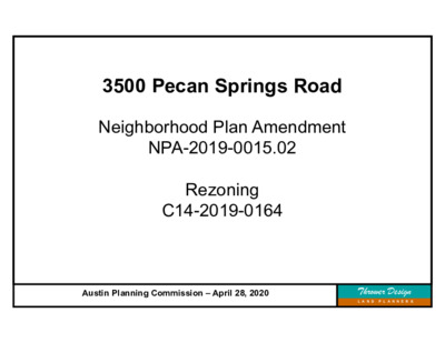
3500 Pecan Springs Road Neighborhood Plan Amendment NPA-2019-0015.02 Rezoning C14-2019-0164 Austin Planning Commission – April 28, 2020 Thrower Design L A N D P L A N N E R S Mueller Development 3500 Pecan Springs NPA-2019-0015.02 & Rezoning - C14-2019-0164 Austin Planning Commission – April 28, 2020 Thrower Design L A N D P L A N N E R S 2.4 acres 1 – 1950’s Single-Family residence 3500 Pecan Springs NPA-2019-0015.02 & Rezoning - C14-2019-0164 Austin Planning Commission – April 28, 2020 Thrower Design L A N D P L A N N E R S Intersection of Pecan Springs and Springdale Road 3500 Pecan Springs NPA-2019-0015.02 & Rezoning - C14-2019-0164 Austin Planning Commission – April 28, 2020 Thrower Design L A N D P L A N N E R S Looking west, on Pecan Springs Road 3500 Pecan Springs NPA-2019-0015.02 & Rezoning - C14-2019-0164 Austin Planning Commission – April 28, 2020 Thrower Design L A N D P L A N N E R S Looking north, on Springdale Road 3500 Pecan Springs NPA-2019-0015.02 & Rezoning - C14-2019-0164 Austin Planning Commission – April 28, 2020 Thrower Design L A N D P L A N N E R S Looking south, on Springdale Road 3500 Pecan Springs NPA-2019-0015.02 & Rezoning - C14-2019-0164 Austin Planning Commission – April 28, 2020 Thrower Design L A N D P L A N N E R S Future Land Use Map 3500 Pecan Springs NPA-2019-0015.02 & Rezoning - C14-2019-0164 Austin Planning Commission – April 28, 2020 Thrower Design L A N D P L A N N E R S FLUM Amendment Request From: Single-Family To: Higher-Density Single-Family 3500 Pecan Springs NPA-2019-0015.02 & Rezoning - C14-2019-0164 Austin Planning Commission – April 28, 2020 Thrower Design L A N D P L A N N E R S Zoning Map 3500 Pecan Springs NPA-2019-0015.02 & Rezoning - C14-2019-0164 Austin Planning Commission – April 28, 2020 Thrower Design L A N D P L A N N E R S Zoning Request From: SF-3-NP To: SF-6-NP 3500 Pecan Springs NPA-2019-0015.02 & Rezoning - C14-2019-0164 Austin Planning Commission – April 28, 2020 Thrower Design L A N D P L A N N E R S Transit & Connectivity 3500 Pecan Springs NPA-2019-0015.02 & Rezoning - C14-2019-0164 Austin Planning Commission – April 28, 2020 Thrower Design L A N D P L A …
From: LEIGH ZIEGLER < Sent: Monday, April 27, 2020 8:30 AM To: Rivera, Andrew <Andrew.Rivera@austintexas.gov> Subject: RE: 04-28-2020 Planning Commission B-04 (C14-2019-0003 - Lantana Block P, Lot 3; District 8) (1.3MB) B-05 (C14-85-288.8(RCA5) - Lantana Block P, Lot 3; District 8) *** External Email - Exercise Caution *** RE: Agenda Item 4 & 5 on 04/28/2020 SP-2014-0262C(XT2).PCA, C14-85-288.8(RCA5) 7415 SW PKWY , Lantana Block P, Lot3 Zoning Change/ Restrictive Covenant Amendment Planning Commissioners and Mr. Rivera: I am writing out of concern for the listed zoning change which does not appear to include in back-up the associated conditions set forth by Environmental Commission on March 4th which stated: • “Applicant will provide additional acreage of 3.098 acres to meet the Hill Country Roadway requirement of 40% undisturbed natural area per 25-2-1025 and development on this lot will be restricted to only allow trails. • Impervious cover for the project will be capped at 17.5 acres (49% of current site plan SP-2014-0262C(XT2)).” Oddly, the Planning Commission Agenda/ B/U did not include any parameters of the PCA for discussion with the notification of the coming “Not Public” Planning Commission Meeting on 04/28/20. Since Stratus appeared to agree during Environmental Review, I hope this was a mere oversight. There is no objection to the zoning change; however, the requested change in FAR (required for increased density) does not go without significant deleterious impact. Drainage from this lot quickly enters the Aquifer as well as Barton Creek. The lot lies above 2 disjointed fault lines and one must consider the fact that surface floodwaters from build out of adjacent areas of Lantana Phase 1 Section 2 resulted in more recent buy out of homes below Oak Park /Oak Acres. Additionally, the applicable Drainage Criterion Manual ( from letter of 2001) does not require lined retention/ detention ponds nor pollution controls over most if not the entire Lantana Phase 1 Section 2 acreage. Increasing the FAR fivefold (from .2 to 1) potentially increases the erosion, pollution and non- dispersed sheet flow on- site capture coming from suddenly taller buildings which is not addressed adequately for site plan stage. Consequently, it seems important that the additional donation of land and restatement of IC should accompany any change in the existing Restrictive Covenant for this site. Thank you, Leigh Ziegler/ 4815 Trail Crest Circle / District 8 Resident/ OHNPCTMember
COATS ROSE A PROFESSIONAL CORPORATION April 24, 2020 JMJOSEPH@COATSROSE.COM DIRECT: (512) 541-3593 FAX: (512) 469-9408 JOHN M. JOSEPH DIRECTOR Planning Commission City of Austin P.O. Box 1088 Austin, TX 78767 Re: 2001 Guadalupe Street, Austin, TX 78705 (the “Property) (Case No. C14-2020- 0007) Chair & Planning Commission Members: Thank you for your consideration of this zoning request and the application submitted on behalf of our client Powell Corbett, LLC (“Applicant”) for the property located at 2001 Guadalupe (“Property”). I have been in communication with Mr. McHone and understand the objection that he has made to this application on behalf of University Area Partners. Although, the objections are quite lengthy, the approval of the proposed application comes down to two issues. The first is that by opting into the University Neighborhood Overlay (“UNO”) the Property can increase density to a height of 65 feet. The second is by opting into UNO an applicant agrees to comply with the design standards. I proposed to Mr. McHone that if the mixed-use zoning (“MU”) if obtained, the Property will be impressed with a restrictive covenant requiring compliance with the UNO design standards per the Applicant’s agreement. The fundamental reason the Applicant is requesting MU zoning is because under UNO, the Applicant will be limited to a height of 65 feet. The City of Austin Land Development Code allows applicant 90 feet of height. This 25 foot difference translates to approximately 24, 938 square feet of density. Specifically, under UNO, developments with 65-foot height limitations typically allow a developer to achieve 5 full stories of building (95% of 8750 = 8312.5 square feet of land X 5 stories = 41,562 square feet of building). TERRACE 2, 2700 VIA FORTUNA, SUITE 350, AUSTIN, TEXAS 78746 PHONE: (512) 469-7987 FAX: (512) 469-9408 coatsrose.com 016299.000001\4815-7812-8315.v1 HOUSTON | AUSTIN | DALLAS | SAN ANTONIO | NEW ORLEANS | CINCINNATI Memo Powell – Corbett LLC To: From: Hutson Land Planners; Charles Dunn Date: April 17, 2020 Re: Corbett Property; 2001 Guadalupe Street As requested, Hutson Land Planners & Development Consultants, LLC has reviewed the University Area Partners (UAP) letter dated April 9, 2020. This memorandum is intended to provide information helpful in the evaluation University Neighborhood Overlay requirements and the Affordability Unlocked Bonus Program (AUBP). The portions of the letter provided by Michael McHone for the UAP are reviewed below. UAP Letter “Although your letter indicates that your client has …
Mr. Kazi, Chair and Planning Commission Members. My name is John Joseph, I am an attorney representing KB Home Lone Star, the owner and developer of the Simon-Caskey Property which is before you tonight, having been thoroughly reviewed by Development Review Staff and recommended to you meeting all applicable zoning, development codes and regulations for preliminary plan approval. I begin with a bit of history. On January 28, 1988 in File C14-85-288.23 by Ordinance No. 88-0128-C the City Council of the City of Austin changed the zoning map of the City with respect to two parcels of property one from Interim RR Rural Residential to “LO” Limited Office on a 13.46 acre tract and to “SF-6” Townhome and Condominium Residence on a 10.16 acre tract. A copy of this ordinance is attached as Exhibit “A”. On December 15, 1988 in by Ordinance No. 881215-L the City Council of the City of Austin changed the zoning map of the City with respect to 4 parcels of property totaling 14.14 acres, as follows; Tract 1 from Interim “RR” Rural Residential District to “SF-1” Single Family Residential (Large Lot) Tract 2 from Interim “RR” Rural Residential District to “SF-2” Single Family Residential (Standard Lot) Tract 3 from Interim “RR” Rural Residential District to “SF-6” Townhouse and Condominium Residence District, and Tract 4 from Interim “RR” Rural Residential District to “CS” Commercial Services District. Tract 4 is not a part of this preliminary plan. A copy of this ordinance is attached as Exhibit “B”. I have overlaid these zoning changes over the recommended preliminary plan, attached as Exhibit “C”. Tracts 1, 2 and 3 of Ordinance No. 881215-L are colored yellow on Exhibit “C”. The property covered by Ordinance No. 88-0128-C is colored blue on Exhibit “C”. There is no complaint as to any aspect of the preliminary plan other than the connection of the existing Little Deer Crossing to the existing neighborhood street at Oak Forest Lane. Considering the challenges with COVID 19, our client has not been able to meet face to face, but has in fact corresponded with the postponement. During this time the only objection presented was that the preliminary plan connects to the existing Little Deer Crossing and that those that live in the immediate area may experience additional traffic. through Mr. Danny Anderson, during the neighborhood, These zoning tracts, and the tracts described in the applicable restrictive covenants, …
PLANNING COMMISSION SITE PLAN EXTENSION REVIEW SHEET CASE NUMBER: SPC-2014-0442C(XT2) PC MEETING DATE: April 28, 2019 PROJECT NAME: Sunset Ridge Commission Extension ADDRESS: 8401 Southwest Pkwy AREA: 9.606 acres WATERSHED: Williamson Creek, Barton Creek (Barton Springs Zone) COUNCIL DISTRICT: 8 JURISDICTION: Full Purpose APPLICANT: AGENT: Tim Jamail Los Indios Ventures 1006 Mopac Circle, Ste 101 Austin, Texas 78746 LJA Engineering Inc. Reese Hurley, P.E. 5316 Hwy 290 W., Suite 150 Austin, Texas 78735 EXISTING ZONING: GO-CO-NP PROPOSED DEVELOPMENT: The applicant requests a three-year extension for a previously approved site plan. The approved site plan includes a 4-story office building with a total floor area of 197,300 sq. ft., with associated garage and surface parking, and other improvements. The site was originally approved with SPC-2014-0442C. STAFF RECOMMENDATION: Staff recommends the requested three-year extension to January 27, 2023 with the condition that a correction be made per request from ATD. Staff previously granted a one-year administratively approved extension from January 27, 2019 to January 27, 2020. PLANNING COMMISSION ACTION: N/A CASE MANAGER: Jonathan Davila Telephone: 974-2414 jonathan.davila@austintexas.gov PREVIOUS APPROVALS: The site plan was granted a one year administratively approved extension from January 27, 2019 to January 27, 2020. PROJECT INFORMATION: 9.606 acres EXIST. ZONING: GO-CO-NP MAX. BLDG. COVERAGE: N/A MAX. IMPERV. CVRG: 55% PROP. BLDG CVRG: 2.447 ac. (25.5%) PROP. IMP. CVRG: 4.108 acres (42.8%) B-131 of 18REVISED ROW, then LR (Southwest Pkwy and undeveloped) SF-2-CO-NP (Undeveloped) ROW, then SF-2-CO-NP (Big Timber Dr., then SF residential) GO-MU-CO-NP (undeveloped and SF residential) A COMPARISON OF THE APPROVED PROJECT WITH CURRENT REGULATIONS WATERSHED ORDINANCE: This project complies with applicable watershed regulations. LAND USE: The site plan complies with all applicable zoning regulations. ENVIRONMENTAL: All environmental comments have been cleared. TRANSPORTATION: All transportation comments have been cleared. SURROUNDING CONDITIONS: Zoning/ Land Use Northeast: Southeast: Southwest: Northwest: STREET: Southwest Pkwy NEIGHBORHOOD ORGANIZATION: Austin Independent School District Aviara HOA Bike Austin City of Rollingwood Covered Bridge Property Owners Association, Inc. East Oak Hill Neighborhood Association Escondera Condominium Owner Association Friends of Austin Neighborhoods Neighborhood Empowerment Foundation Oak Hill Association of Neighborhoods (OHAN) Oak Hill Neighborhood Plan – COA Liaison Oak Hill Neighborhood Plan Contact Team Oak Hill Trails Association Save Our Springs Alliance SELTexas Sierra Club, Austin Regional Group TNR BCP – Travis County Natural Resources Travis Country West Owners Association varies (+/- 165’) SURFACING varies (+/- 112’) CLASSIFICATION Hill Country Roadway R.O.W. B-132 of 18REVISED B-133 …
ENVIRONMENTAL COMMISSION MOTION 20200304 006a Date: March 4, 2020 Subject: Lantana Project Consent Agreement Motion by: Kevin Ramberg Seconded by: Peggy Maceo RATIONALE: WHEREAS, the Environmental Commission recognizes the applicant is requesting the Commission consider a Project Consent Agreement waiving provisions of City Code Chapters 25-7 (Drainage) and 25-8 (Environment), including Chapter 25-8, Article 13 (Save Our Springs Initiative), to allow construction of a mixed-use residential project at located at 7415 Southwest Parkway in the East Oak Hill Neighborhood Planning Area; WHEREAS, the Environmental Commission recognizes this action concerns land located in the Barton Springs Zone; and WHEREAS, the Environmental Commission recognizes that City of Austin staff recommend approval of the variance requests with conditions. Therefore, the Environmental Commission recommends approval of the requested project consent agreement (PCA) to allow for the construction of a mixed-use development with a residential component with the following; Staff Conditions: 1. applicant shall provide additional acreage of 3.098 acres to meet the Hill Country Roadway requirement of 40% undisturbed natural area per 25-2-1025 and development on this lot will be restricted to only allow trails; 2. impervious cover for the project will be capped at 17.5 acres (49% of current site plan SP-2014- 0262C(XT2)); and the following Environmental Commission Conditions: 1. Phase 5 will develop within 25% impervious cover on a net site area; 2. dedicate 6.32-acre Tract 1 as additional lands to meet impervious cover needs; 3. dedicate necessary acreage of Tract 2 as additional lands for the Phase 5 development to not exceed 25% impervious cover Net Site Area on; and 4. pursue use of rain garden in Phase 5 as allowable under TCEQ Edwards Rules. 1 VOTE 6-0 Approved By: For: Bedford, Thompson, Ramberg, Guerrero, Coyne, and Maceo Against: None Abstain: None Recuse: None Absent: Creel, Smith, Nill, Neely, Gordon Linda Guerrero, Environmental Commission Chair 2 ITEM FOR ENVIRONMENTAL COMMISSION AGENDA COMMISSION MEETING DATE: NAME & NUMBER OF PROJECT: February 19, 2020 Lantana PCA NAME OF APPLICANT OR ORGANIZATION: Michael Whellan Armbrust & Brown, PLLC LOCATION: 7415 Southwest Parkway COUNCIL DISTRICT: 8 ENVIRONMENTAL REVIEW STAFF Atha Phillips, Environmental Officer’s Office (512)974-2132, atha.phillips@austintexas.gov WATERSHED: REQUEST: STAFF RECOMMENDATION: RECOMMENDED CONDITIONS: Williamson Creek Watershed, Barton Springs Zone, Drinking Water Protection Zone Consider a Project Consent Agreement waiving provisions of City Code Chapters 25-7 (Drainage) and 25-8 (Environment), including Chapter 25-8, Article 13 (Save Our Springs Initiative), to allow construction of a mixed-use residential project …
February 18, 2020 Melissa Neslund Development Manager Stratus Properties 212 Lavaca St, Ste. 300 Austin, TX 78701 Re: Project Consent Agreement & SOS Amendment for 7415 Southwest Parkway Ms. Neslund, Thank you very much for continuing to speak with us regarding your proposed project at 7415 Southwest Parkway, which is part of the overall development otherwise known as “Lantana.” As I’m sure you can imagine, given the history of this site and the request for an amendment to the Save Our Springs Initiative Ordinance (“SOS Ordinance”), it has generated quite a bit of conversation at the Save Our Springs (“SOS”). We appreciate that Stratus has continually demonstrated a willingness to engage in dialogue surrounding their projects and their willingness to incorporate community benefits into their projects. This letter is intended to continue that dialogue so that we can help reach a reasonable resolution to allow the project to occur, while still furthering the City of Austin’s and SOS’s missions to improve the overall water quality of the Barton Springs Zone and the Edwards Aquifer. History and Dialogue re: Lantana Project To help explain how we got to our current position, we thought it would be helpful to provide some context with a brief description of key facts. As you are aware, the Lantana Letter Agreement arose out of a dispute over vested rights alleged to be applicable to a 1986 preliminary plan. This Letter Agreement (which was never approved by the City Council) has been interpreted by the City to grandfather projects in the area to pre-SOS Ordinance regulations, which has enabled Stratus (and other landowners to which Stratus sold land) to develop much of the land without SOS-water quality ponds and well over the impervious cover limits established to protect water quality. SOS has continually questioned the validity of the Letter Agreement and has advocated for projects within the area to be developed under current environmental regulations. Last summer, the site plan approved for 7415 Southwest Parkway was set to expire by its own terms. As a result, Stratus requested an extension from the Planning Commission. SOS raised objections to this site plan extension, because we received notice that Stratus intended to change the proposed use of Phase 5 of the site plan from “office” to “multi-family”. A “change of use” such as the one envisioned would typically be an indication that there is a new project under normal …
M E M O R A N D U M Fayez Kazi, Chair and Members of the Planning Commission TO: FROM: Andrew Linseisen, Assistant Director Development Services Department DATE: April 27, 2020 SUBJECT: Project Consent Agreement Lantana Block P, Lot 3 (SP-2014-0262C) Backup and Staff Recommendation As provided in Section 25-1-544 of the City of Austin Land Development Code, the developer of the Lantana Development on Lot 3 and 5, Block P of the Lantana Phase 1, Section 2 Subdivision has requested consideration of a Project Consent Agreement (PCA). The proposed PCA will allow the development to add a residential use to the existing approved site development permit. A PCA is a voluntary mechanism for determining applicable regulations where the extent of a project’s vested development rights are unclear or for incentivizing projects with clearly established vested rights to achieve greater compliance with current regulations. In such cases, a PCA provides a means for the Council to modify development regulations applicable to a property. The Lantana Block P, Lot 3 project is located at 7415 Southwest Parkway which was approved for a commercial and office development under Site Development Permit No SP-2014-0262C. Phases 1, 2, and 3 of the existing development have been constructed and Phase 4 is currently under construction. The Planning Commission approved a request to extend the life of the application to April 30, 2022, on June 25, 2019. The proposed PCA will apply only to the currently unconstructed Phase 5 of the project modifying the project to include a residential use. A summary of the major tenants of the proposed PCA are outlined below: No additional impervious will be added to Phase 5, the overall impervious cover in the entire development will be fixed at 17.6 acres. 6.326 acres known as Lot 8, Block P, of the Lantana Phase 1, Section 2 Subdivision will be dedicated to the City of Austin. 3.098 acres of Lot 8 will remain natural area with any development limited to pedestrian trails so that the entire site, all phases, maintain 40% natural area; 3.228 acres will be utilized for City of Austin Public Park amenities; Lot 8 will be dedicated to the City within six months of the effective date of the PCA; Extension of the life of Phase 5 of the Lantana Block P, Lot 3 Site Development Permit (SP-2014-0262C) by two years to …
Dear Members of the Planning Commission, I live on Scenic Brook Dr and would like to comment on the subdivision plan for the Simon-Caskey Tract which proposes to extend Little Deer, Harvest Trail, and Oak Forest streets. The major problem with the plan from my perspective and that of all of the neighbors that I have talked to is the traffic flow from the new subdivision through the existing neighborhoods. I think the best solution is to connect the new subdivision directly to Highway 71, so as not to burden neighborhood streets, such as Scenic Brook and Silvermine (which do not have sidewalks), with all of the traffic from this new development. Another solution, suggested by a resident of Harvest Trail, is to design the development so that Little Deer doesn't connect to Harvest Trail or Oak Forest - make two separate loops, one that comes off Oak Forest and one that comes off Little Deer. This would split the traffic from the development - some would exit via Little Deer, the rest would exit via Harvest Trail or Oak F orest. This would eliminate any cut-through traffic that may occur with the current proposal. Another solution would be to keep the current street design, but install a gate that could be unlocked by emergency personnel - this would also keep cut-through traffic from affecting residents yet still allow emergency access when needed. A similar gate has been installed on Mocassin Path in the new subdivision, the enclave at Covered Bridge, to prevent cut-through traffic on that street. Either of those solutions would be superior to the current street layout of the proposed development. I think a direct connection to Highway 71 would be the best option, but failing that, these other potential options would be acceptable to neighborhood residents. The problem here is not the infill development or the additional housing, but the traffic patterns that will be generated by the development. Please support an option that has the least impact on current residents and keeps neighborhood safety at the forefront. Thank you, Tom Thayer 7405 Scenic Brook Drive
27 April 2020 To: Planning Commission and City Council Members Re: NPA-2019-0015.02 3500 Pecan Springs Road This letter serves to recommend that the Planning Commission and City Council deny the above-referenced plan amendment request, which seeks to change the land use of this property from Single Family to Higher Density Single Family. Although the Owner’s representative for the proposed development at 3500 Pecan Springs Road, Ms. Victoria Haase of Thrower Design, attended meetings of the East MLK Combined Neighborhood Plan Contact Team (EMLK NPCT), the City of Austin-hosted Community Meeting, and a meeting of the Pecan Springs/Springdale Neighborhood Association (PSS NA), and in doing so was open and responsive in communicating with the community stakeholders regarding the development, the owners never agreed to any of the compromises proposed by the community in order to assuage their concerns, which centered around environmental impact as well as traffic. Because the owner was ultimately unwilling to find any kind of compromise with the community, the EMLK NPCT voted in its April meeting to oppose the PLA. For the reasons listed above, the EMLK NPCT opposes the plan amendment request for the Property. If the Planning Commission chooses to approve this request, the EMLK NPCT urges consideration of any or all of the following: • Require that a minimum of 10% of the units be affordable to persons earning no more than 80% MFI for the Austin Metro area. • Require that the project be certified under the Better Builder Program or a program with • Require that the project achieve a minimum 1-star rating under the Austin Energy Green equivalent requirements Building Program. Sincerely, Jon Hagar Chair, EMLK NPCT jonhagar@gmail.com (512) 739-4101