B-02 (NPA-2019-0015.02 - Pecan Springs Residential; District 1) — original pdf
Backup
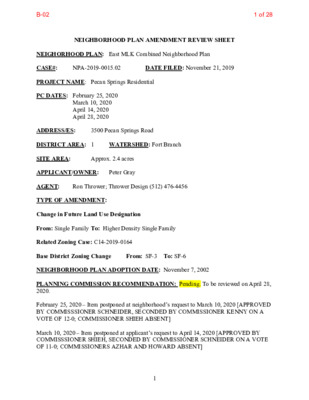
NEIGHBORHOOD PLAN AMENDMENT REVIEW SHEET DATE FILED: November 21, 2019 NPA-2019-0015.02 3500 Pecan Springs Road March 10, 2020 April 14, 2020 April 28, 2020 NEIGHORHOOD PLAN: East MLK Combined Neighborhood Plan CASE#: PROJECT NAME: Pecan Springs Residential PC DATES: February 25, 2020 ADDRESS/ES: DISTRICT AREA: 1 SITE AREA: APPLICANT/OWNER: AGENT: TYPE OF AMENDMENT: Change in Future Land Use Designation From: Single Family To: Higher Density Single Family Related Zoning Case: C14-2019-0164 Ron Thrower; Thrower Design (512) 476-4456 WATERSHED: Fort Branch Approx. 2.4 acres Peter Gray Base District Zoning Change From: SF-3 To: SF-6 NEIGHBORHOOD PLAN ADOPTION DATE: November 7, 2002 PLANNING COMMISSION RECOMMENDATION: Pending. To be reviewed on April 28, 2020. February 25, 2020 – Item postponed at neighborhood’s request to March 10, 2020 [APPROVED BY COMMISSSIONER SCHNEIDER, SECONDED BY COMMISSIONER KENNY ON A VOTE OF 12-0; COMMISSIONER SHIEH ABSENT] March 10, 2020 – Item postponed at applicant’s request to April 14, 2020 [APPROVED BY COMMISSSIONER SHIEH, SECONDED BY COMMISSIONER SCHNEIDER ON A VOTE OF 11-0; COMMISSIONERS AZHAR AND HOWARD ABSENT] 1 B-021 of 28 April 14, 2020 – Item postponed at staff’s request to April 28, 2020 [APPROVED BY COMMISSSIONER SCHNEIDER, SECONDED BY COMMISSIONER KENNY ON A VOTE OF 12-0; COMMISSIONER LLANES PULIDO ABSENT] STAFF RECOMMENDATION: Recommended BASIS FOR STAFF’S RECOMMENDATION: The Long-Range Planning staff met on Monday, January 27, 2020 to discuss this case and the community meeting which was held on January 13, 2020. Staff voted to recommend the FLUM change from Single Family land use to Higher Density Single Family land use with a vote of 6- 0. Staff recommends the project because it will provide additional housing and density along Springdale Road which is an Imagine Austin Growth Concept Map corridor. The project will also create new opportunities for home ownership, a goal of the East MLK Neighborhood Plan. The site is within ¼ mile of the Capital Metro #300 bus line and less than a mile to the Little Walnut Creek Greenbelt. Land Use (excerpts from neighborhood plan) Goal One Preserve established residential areas and improve opportunities for home ownership by promoting the rehabilitation of existing housing and new, infill housing compatible with the existing style of this neighborhood. Goal Four Promote the development and enhancement of the neighborhood’s major corridors. Goal Nine Improve bicycle and pedestrian traffic safety on neighborhood streets. Goal Twelve Improve the quality, safety, and cleanliness of area creeks, and reduce the impact of flooding in the neighborhood. LAND USE DESCRIPTIONS EXISTING LAND USE ON THE PROPERTY Single Family Single family detached or two-family residential uses at typical urban and/or suburban densities. Purpose 1. Preserve the land use pattern and future viability of existing neighborhoods; 2. Encourage new infill development that continues existing neighborhood patterns of development; and 2 B-022 of 28 ‐ ‐ 3. Protect residential neighborhoods from incompatible business or industry and the loss of existing housing. Application 1. Existing single established neighborhoods; and 2. May include small lot options (Cottage, Urban Home, Small Lot Single Family) and two family residential options (Duplex, Secondary Apartment, Single Family Attached, Family Residential) in areas considered appropriate for this type of infill development. Two ‐ family areas should generally be designated as single family to preserve lot single family. family housing, generally up to 15 units per acre, which includes PROPOSED LAND USE ON THE PROPERTY Higher Density Single Family Single townhouses and condominiums as well as traditional small Purpose 1. Provide options for the development of higher areas; and 2. Encourage a mixture of moderate intensity residential on residential corridors. Application 1. Appropriate to manage development on major corridors that are primarily residential in nature, and 2. Can be used to provide a buffer between high areas. 3. Applied to existing or proposed mobile home parks. density commercial and low density, owner occupied housing in urban ‐ ‐ ‐ ‐ ‐ ‐ density residential IMAGINE AUSTIN PLANNING PRINCIPLES 1. Create complete neighborhoods across Austin that provide a mix of housing types to suit a variety of household needs and incomes, offer a variety of transportation options, and have easy access to daily needs such as schools, retail, employment, community services, and parks and other recreation options. • The property is located in an area primarily comprised of single family uses. The sidewalk network is nonexistent on Pecan Springs Road. There are sidewalks on the western side of Springdale Road and striped bike lanes on both sides of Springdale Road. The project would introduce sidewalks, water retention improvements, and housing ownership opportunities in the area. 2. Support the development of compact and connected activity centers and corridors that are well-served by public transit and designed to promote walking and bicycling as a way of reducing household expenditures for housing and transportation. • The property is a corner lot and the eastern edge of the property is on Springdale Road, which is an Imagine Austin Activity Corridor. The Capital Metro #300 bus routes runs on this stretch of Springdale Road with a bus stop on either side of the 3 B-023 of 28 street within ¼ of mile from the site. This is a high frequency route running 15- minute headways. 3. Protect neighborhood character by ensuring context-sensitive development and directing more intensive development to activity centers and corridors, redevelopment, and infill sites. • This corner lot property is on an Imagine Austin Activity Corridor with a current address on Pecan Springs Road. There are similar uses as the one proposed for this site immediately north on Springdale Road and future large planned developments across Springdale Road. The condo/townhouse residential type is context-sensitive and can serve as a transition zone to the activity corridor. 4. Expand the number and variety of housing choices throughout Austin to meet the financial and lifestyle needs of our diverse population. • The applicant estimates the construction of 25 townhome/condo units which will provide additional ownership housing choices for the area and the city. The units are expected to be priced at market rate. 5. Ensure harmonious transitions between adjacent land uses and development intensities. • Townhome/Condo units are considered an appropriate intensity along Imagine Austin Activity Corridors and at the edge of the large lot single-family home area. 6. Protect Austin’s natural resources and environmental systems by limiting land use and transportation development over environmentally sensitive areas and preserve open space and protect the function of the resource. • The property is not in an environmentally sensitive area. 7. Integrate and expand green infrastructure—preserves and parks, community gardens, trails, stream corridors, green streets, greenways, and the trails system—into the urban environment and transportation network. 8. Protect, preserve and promote historically and culturally significant areas. • Not applicable. • Not applicable. 9. Encourage active and healthy lifestyles by promoting walking and biking, healthy food choices, access to affordable healthcare, and to recreational opportunities. • The project aims to provide a sidewalk segment in front of the property. The project is located within a ¼ mile walking distance to the #300 Capital Metro bus stop and is less than 1 mile from the Little Walnut Creek Greenbelt. 10. Expand the economic base, create job opportunities, and promote education to support a 11. Sustain and grow Austin’s live music, festivals, theater, film, digital media, and new creative strong and adaptable workforce. • Not applicable. art forms. • Not applicable 4 B-024 of 28 12. Provide public facilities and services that reduce greenhouse gas emissions, decrease water and energy usage, increase waste diversion, ensure the health and safety of the public, and support compact, connected, and complete communities. • Not applicable BACKGROUND: The application was filed on November 21, 2019. The applicant requests to amend the Future Land Use Map from Single Family to Higher Density Single Family to allow a higher density single family residential development of up to 25 dwelling/condo units. Current FLUM category and zoning would only allow for dwelling 2 units. The property is 2.4 acres located on the corner of Pecan Springs Road and Springdale Road. The property has a frontage on Springdale Road which is a designated Imagine Austin Activity Corridor. The project aims to provide a housing type that is more affordable than a lower-density Single Family product. The applicant proposes to change the zoning from SF-3-NP (Family Residential district – Neighborhood Plan) to SF-6-PDA (Townhouse and Condominium Residence district – Neighborhood Plan) to allow for construction of residential uses. For more information on the zoning request, please see the case report for case number C14-2019-0164. PUBLIC MEETING: The ordinance required plan amendment meeting was held on January 13, 2020. Approximately 107 notices were mailed to property owners and renters located within 500 feet of the subject property. Victoria Haase from Thrower Design gave a presentation going over the client application stating that they are hoping to build no more than 25 dwelling units of the Townhouse/duplex style. They are sticking with the 35 ft. height cap and 2-3 stories for each structure. Of the 2.4 acre site, maybe 1.5 acres are actually developable due to the floodplain. A conceptual rendering of the housing type was handed out as well as a map with current conditions photographs and summary tables of development standards, definitions, and parking requirements. Attendance: 2 project team, 1 city staff, 13 public including neighborhood association and neighborhood contact team members. Q&A Question #1: What are the environmental controls/constraints on the property? Answer: The city has stormwater development criteria that the project must adhere to. The project is required to provide a water detention infrastructure on site. The Austin Watershed Protection Department has updated its Atlas-14 floodplain maps. Question #2: The property is half in the floodplain area. 5 B-025 of 28 Answer: Yes, it is. Question #3: Have you conducted a tree survey of the property? Answer: Yes. There is one heritage tree on site as well as 8 protected trees. Question #4: Are you expecting to demolish the current house for this development? Answer: Yes, the house will need to be cleared for this new development to be constructed. Question #5: Under which land development code will this project fall under? Existing code or the new land development code that is being worked on? Answer: Sunil Lavani, project developer – we will build using whichever existing code is available. Project agent, Victoria Haase – we don’t know how the city will roll out the new LDC, we don’t know when it’s going to pass. Sunil – we are required to build a detention pond on site, and it cannot be built in the floodplain itself. Question #6: What is the best end result for you? And what benefits will the neighbors receive? Answer: the best result for us would be to receive the FLUM and zoning change we are requesting. Community benefits include sidewalks, better infrastructure, stormwater mediation. Comment: Some of us don’t want sidewalks. We like the trees and the semi-rural look of the neighborhood. We don’t want property values to go up. Question #7: What can actually be built on the buildable part of the property? It seems like the units would be quite small. Answer: There is still a lot that needs to be worked out. Looking at 1,500 to 1,800 square feet per unit, possibly 10 buildings, 2-3 stories, maybe a few stand alone units. Question #8: Where do you plan on having the primary entrance? Answer: We are trying to have Springdale be the primary entry point to the project. Comment: This project to me feels like it would fit better on 51st and Springdale. I worry about the cut-through traffic. Comment: The visibility is terrible making a turn onto Springdale? The traffic really backs up on Springdale. It’s a hairy situation. Question #9: Why ask for SF-6 when SF-5 gives you the same allowances? Answer: Spacing and location requirements are more favorable to this project under SF-6. Question #10: When is the earliest that the project would begin? Answer: At least a year. We still need to create a site plan, it needs to go through PC and CC. 6 B-026 of 28 Question #11: Can any enhancements be made to the floodplain? Answer: If the city will allow it, then yes. Question #12: How close would you build to the floodplain and creek? Answer: We are required to build a detention pond onsite and it cannot be in the floodplain. The detention pond will serve as a buffer between the buildings and the creek. Question #13: Who will maintain the detention pond? Answer: The city could, but it will be the condo association that will maintain it through their fees. Question #14: What is the price range for the condominiums? Will there be any affordable housing? Answer: These will be market rate housing. Will use the Austin median price range - #380,000- $425,000. It will be a single-family product with condo ownership of the land. Question #15: Could you build commercial uses on the property? Answer: We would need to seek an up zoning to something other than SF-6. Properties north of Pecan Springs have GR-MU zoning and can build a lot more including housing, commercial, or a mix of uses. Question #16: Have you looked at the buildable yield at SF-3? Answer: We have not looked at that. Question #17: This area has a neighborhood plan that has goals and visions, which of the plans goals are you helping to meet with your project? Answer: Goal 4: Promote the development and enhancement of the neighborhood’s major corridors. Objective 5.1: allow a mix of residential types on larger tracts having access to major roadways. Objective 7.1: increase pedestrian safety by constructing new sidewalks and improving pedestrian crossings Comment: I like the rural look of the area. Question #18: What could be built as a of right with current zoning? Answer: Rough calculations – possibly subdivide into 6 single family lots all fronting on Pecan Springs Rd. 7 B-027 of 28 Comment: All are invited to Pecan Springs Neighborhood Association meeting on February 8th. Question #19: With SF-3 you could have shared driveways. Answer: SF-3 zoning will mean a much more expensive housing product due to the cost of building and fees to subdivide. Comment: Sunil Lavani – we created a similar project in Montopolis that yielded a diverse range of housing product and price points. Question #20: What are the bedroom types and configurations? Answer: 2-3 bedroom units Question #21: Will there be enough parking on site for all of the units and all of the bedrooms? What if someone has 3 roommates. Will they park on the street? The new code requires less parking even. Answer: We are required to create 1.5 parking spots per one bedroom under current code. With our product we won’t be able to sell units without parking spots, people just won’t buy. Austin does not have the transit infrastructure to truly get people out of their cars. Comment: Sunil Lavani – we are open to talks and input from neighbors and community. We hope to come to a happy medium. CITY COUNCIL DATE: May 21, 2020 ACTION: Pending CASE MANAGER: Jesse Gutierrez EMAIL: jesse.gutierrez@austintexas.gov PHONE: 512-974-1606 8 B-028 of 28 Imagine Austin Centers and Corridors 3500 Pecan Springs Road 9 B-029 of 28 IMAGINE AUSTIN GROWTH CONCEPT MAP Definitions Neighborhood Centers - The smallest and least intense of the three mixed-use centers are neighborhood centers. As with the regional and town centers, neighborhood centers are walkable, bikeable, and supported by transit. The greatest density of people and activities in neighborhood centers will likely be concentrated on several blocks or around one or two intersections. However, depending on localized conditions, different neighborhood centers can be very different places. If a neighborhood center is designated on an existing commercial area, such as a shopping center or mall, it could represent redevelopment or the addition of housing. A new neighborhood center may be focused on a dense, mixed-use core surrounded by a mix of housing. In other instances, new or redevelopment may occur incrementally and concentrate people and activities along several blocks or around one or two intersections. Neighborhood centers will be more locally focused than either a regional or a town center. Businesses and services—grocery and department stores, doctors and dentists, shops, branch libraries, dry cleaners, hair salons, schools, restaurants, and other small and local businesses—will generally serve the center and surrounding neighborhoods. Job Centers - Job centers accommodate those businesses not well-suited for residential or environmentally- sensitive areas. These centers take advantage of existing transportation infrastructure such as arterial roadways, freeways, or the Austin-Bergstrom International airport. Job centers will mostly contain office parks, manufacturing, warehouses, logistics, and other businesses with similar demands and operating characteristics. They should nevertheless become more pedestrian and bicycle friendly, in part by better accommodating services for the people who work in those centers. While many of these centers are currently best served by car, the growth Concept map offers transportation choices such as light rail and bus rapid transit to increase commuter options. Corridors - Activity corridors have a dual nature. They are the connections that link activity centers and other key destinations to one another and allow people to travel throughout the city and region by bicycle, transit, or automobile. Corridors are also characterized by a variety of activities and types of buildings located along the roadway — shopping, restaurants and cafés, parks, schools, single-family houses, apartments, public buildings, houses of worship, mixed-use buildings, and offices. Along many corridors, there will be both large and small redevelopment sites. These redevelopment opportunities may be continuous along stretches of the corridor. There may also be a series of small neighborhood centers, connected by the roadway. Other corridors may have fewer redevelopment opportunities, but already have a mixture of uses, and could provide critical transportation connections. As a corridor evolves, sites that do not redevelop may transition from one use to another, such as a service station becoming a restaurant, or a large retail space being divided into several storefronts. To improve mobility along an activity corridor, new and redevelopment should reduce per capita car use and increase walking, bicycling, and transit use. Intensity of land use should correspond to the availability of quality transit, public space, and walkable destinations. Site design should use building arrangement and open space to reduce walking distance to transit and destinations, achieve safety and comfort, and draw people outdoors. 10 B-0210 of 28 Applicant’s Summary Letter 11 B-0211 of 28 Letter of Recommendation from the Neighborhood Plan Contact Team NOT AVAILABLE AT THIS TIME 12 B-0212 of 28 Correspondence from Property Owner(s) 13 B-0213 of 28 Reference to Case Number: NPA-2019-0015.02 February 21, 2020 From: AJ Crittendon Jr. Address: 3408 Pecan Spring Rd. Email: critteaj@outlook.com City of Austin Planning and Zoning Department Jesse Gutierrez P.O. Box 1088 Austin, TX 78767-8810 Jesse.gutierrez@austintexas.gov Case Number: NPA-2019-0015.02 Contact: Jesse Gutierrez, 512-974-1606 I object Public Hearing Comment Public Hearing: Feb 25, 2020 – Planning Commission Mar 26, 2020 – City Council To the rezoning of 3500 Pecan Spring Rd. from SF-3 to SF-6 with the intent of the developer to build 25 units on a buildable area of approximately 1.5 acers. There are only fifty-five residential households in the entire four street neighborhood, Pecan Spring Rd., Touchstone St., Rimrock Trail and Marlow Dr., and twenty-seven in the 500 ft. notification boundary. This is a semi isolated neighborhood with people that still have gardens and enjoy observing small families of wildlife species driven out by other developments around the area, i.e. Nesting pair of Hawks, mated pair of Gray Fox’s, the every elusive & vanishing “Road Runner” and so on. 25 units will add an extra 25 to 50 plus automobiles to the existing one plus mile of 51st St., Springdale Rd, MLK rush hour, lane jumping traffic jam. And where is that many extra automobiles going to park? The SF-3 zone will still allow the developer to build approximately eight to ten units, divided into the minimum 50 ft width. The SF-6 will diminish the single-family characteristics of the neighborhood with 25 units of Condo “Apartment”. If anything, why not SF-5 Urban Family Residence? The developer can still build their “Condos” but 25 is way too many. At 400 to 500K per unit, Where is the affordable housing? The Loft at St. Stephens, 5000 Pecan Spring Rd at 51st St., is about the same building acreage, 1.5, as 3500 Pecan Spring Rd and they squeezed in 20, three story units. But that area of Pecan Spring Rd did not have any 40-foot trees or close proximity to an active creek flowing through the property or the flood potential to up or down stream neighbors. Thanks AJ Crittendon Jr 14 B-0214 of 28 April 12, 2020 Ellen Scott 3312 Pecan Springs Rd Austin, Texas 78723 512.992.3021 puppetry709@gmail.com City of Austin Planning and Zoning Department Jesse Gutierrez, 512-974-1606 P.O. Box 1088 Austin, Texas 78767-8810 Jesse.gutierrez@austintexas.gov CASE NUMBER: NPA-2019-0015.02 CONTACT: Jesse Gutierrez PUBLIC HEARINGS: Feb 25, 2020 – Planning Commission I OBJECT We have lived at 3312 Pecan Springs Rd, for 37 years. Our main concerns with Peter Gray’s proposal for a zoning change at 3500 Pecan Springs Rd are as follows. Mar 26, 2020 – City Council FLOODING - Fort Branch Creek is prone to flooding already and adding more impervious cover to the existing watershed will increase the potential for increased flooding of downstream properties and the saturation of the remaining natural surfaces. We have experienced flooding on numerous occasions, most recently on May 25, 2015. In 2015, the water flooded Springdale Rd., causing the road to be shut down, right at the north edge of Mr. Gray’s property. Here are photos taken of our property that day. I’m also attaching a video. SAFETY – Several years ago the City switched Springdale Road from 4 lanes to 2 lanes with a middle turn lane. Since then, driving north on Springdale and moving to the middle lane to turn left (west) on Pecan Springs Road has become extremely dangerous, especially during peak traffic. The hill blocks the site line and, on a number of occasions, members of my family, including myself, have had to swerve back into the northbound traffic lane to avoid a head-on collision with an impatient driver who is improperly using 15 B-0215 of 28 the middle lane to pass southbound traffic. The entrance to the property on Springdale or Pecan Springs is problematic and unsafe. PARKING – Mr. Gray intends to build 20-25, 2-3 BRs units, 1500-1800sf each, on 1.5 acres of developable land. Under current code, the owner is required to provide 1.5 parking spots per bedroom. I have not seen any plans, but I can’t imagine being able to accommodate parking for that many homeowners. There is no parking on Springdale Road, so that leaves Pecan Springs for overflow. If two cars are parked directly across the street from one another, as it stands today, the driver is forced to Navigate past them by crossing the middle line. IMAGINE AUSTIN GROWTH CORRIDOR - Mr. Gray mentions the Imagine Austin Growth Corridor as one of the reasons he is justified requesting the rezoning of his property from SF-3 to SF-6. Specifically, the Objective 5.1: Allow a mix of residential types on larger tracts having access to major roadways. There are so many new opportunities for homeownership of this scale already in our neighborhood, all having access to major roadways and enhancing the neighborhood’s major corridors. Examples of this wide mix of residential types can be easily located along Springdale Road, Pecan Springs Road and 51st Street. Condos, apartments, townhouses, gated communities, lofts, houses on larger tracts, etc. – the list is extremely diverse. And many more are in the planning, already approved. Some of the developments are having difficulty selling their properties because, in my opinion, the market is already saturated with exactly the type of housing the owner is proposing. We vote NO to change the neighborhood zoning to accommodate one developer. Thank you, Ellen Scott 16 B-0216 of 28 Re: Plan Amendment Case: NPA-2019-0015.02 Zoning Case: C14-2019-0164 NPA & Rezoning of 3500 Pecan Springs Road April 14, 2020 To: Planning Commission Members, 3500 Pecan Springs Road is part of the Marlo Heights neighborhood (within the PSSNA boundaries), which was established in July, 1949 with deed restrictions recorded and filed to protect the integrity of the neighborhood when lots were purchased and, additionally, specified what type of home could be built. Victoria Haase, of Thrower Designs, came to the February 8th Pecan Springs Springdale Hills Neighborhood Association (PSSNA) meeting to describe the changes her client(s) were proposing to the established Neighborhood Plan (2002), the current zoning and to hear concerns/feedback from the PSSNA members (e.g. increased density from existing SF-3, compatibility with deed restrictions, environmental impact, traffic impact, wildlife impact, proposed product type, flooding impact, etc.). In that meeting, as well as our March neighborhood association meeting and follow up emails, we asked a number of questions regarding making adjustments to their development plan for impervious cover, flooding, parking & traffic safety, environment, wildlife, other developments, and inclusion of retail. Responses to PSSNA Questions: ● 20-0218 Letter to PSSNA ● Response to additional questions – 03252020 Specific neighbor quotes (see detailed typed responses in the Appendix): ● “At some point, you have to trust that citizens know what is best for themselves and take them at their word they are not arbitrarily opposing projects to deny opportunity to others, but are defending their own investments (well beyond monetary). That they are willing to live with the consequences if time proves them wrong. It should be up to the applicant to convince the neighborhood- the existing residents, that this is something they should support. If the 17 B-0217 of 28 applicant fails to do that, but the Plan is amended anyway, against the citizens' wishes; then the system is fundamentally flawed. If the default is to approve requests such as this, with unanimous opposition; it defeats the purpose of Zoning Laws and Neighborhood Plans altogether. The bottom line is the neighborhood- that is, the existing residents, after hearing what must be assumed to be the most impassioned arguments possible for supporting it, voted unanimously to oppose a 20 unit condominium project being built on the site. Do they really need a reason?” - Chris Ring, 4809 Pecan Springs Road. ● ● “By continuing to build, they are continuing to enhance the problem. We want a transportation study, but none is conducted. The area does not need rooftops but we feel our City doesn’t get behind us. They could offer some incentives for commercial places to be built. If we had an eatery or grocery store, we would use that.” - Jacqueline Williams on Carsonhill, Clifton Bailey on Bundyhill, and Ursula Carter on Northdale. “Developer claims all automobiles will exit from condos onto Springdale. Previously, Springdale was a 4 lane street, 2 lanes going south, two north. Recently, Springdale was reduced to one lane north and south. This reduction in lanes has provided quite a traffic jam, especially at peak travel times in the morning and afternoon. Vehicles exiting the condos will add significant congestion onto Springdale, no matter which direction the vehicles try to turn as they try to exit.” - Gari Gardner, Marlo Heights neighborhood The PSSNA’s response is that we unanimously don’t support the above-referenced plan amendment and related zoning case at this time since the concerns/feedback brought up listed above have not adequately been addressed. We held our April 2020 meeting remotely via Zoom for the first time; we had our normal quorum of members attend remotely even during this stressful and complicated time. We are a tight knit group of neighbors navigating the change in Austin with realistic expectations and high ideals for the community we want to live in. We have engaged with our Councilmember, Natasha Harper-Madison, in the year that she’s been in office, and expressed our willingness to collaborate in order to adjust to the changing circumstances facing Austin. Our hope is that they’ll reconsider and try and get our NA’s support, prior to moving forward. If not, we hope the Planning Commission will deny the proposed neighborhood plan amendment and rezoning request. Sincerely, 18 B-0218 of 28 Nathaniel Bradford PSSNA President PSSNApresident@gmail.com https://pecansprings.org/ Appendix I. Chris Ring, 4809 Pecan Springs Road. 19 B-0219 of 28 It is difficult for me to articulate my opposition to the NP and zoning change because to dwell on any particular topic diminishes the others; to flesh out all the facets, you end up writing a novel. It is like trying to prove a negative, or explain why one might vote for Biden over Trump. At some point, you have to trust that citizens know what is best for themselves and take them at their word they are not arbitrarily opposing projects to deny opportunity to others, but are defending their own investments (well beyond monetary). That they are willing to live with the consequences if time proves them wrong. It should be up to the applicant to convince the neighborhood- the existing residents, that this is something they should support. If the applicant fails to do that, but the Plan is amended anyway, against the citizens' wishes; then the system is fundamentally flawed. If the default is to approve requests such as this, with unanimous opposition; it defeats the purpose of Zoning Laws and Neighborhood Plans altogether. The bottom line is the neighborhood- that is, the existing residents, after hearing what must be assumed to be the most impassioned arguments possible for supporting it, voted unanimously to oppose a 20 unit condominium project being built on the site. Do they really need a reason? Having said all that, my main objection is that the lot is on the corner of a main corridor where it could be argued higher density is desired, and a quiet residential side street where a higher density is wholly inappropriate (IMO). The problem for the applicant is the lot fronts on the quiet residential street. The applicant has been unable or unwilling to formulate a mechanism that would assure the neighborhood their project will not impact the quiet residential street. If they could simply make that assurance, I believe opposition to their project would diminish considerably. At some point it was said that it would be counterproductive if the PSSNA had a reputation for not supporting residential re-development in general. It may be useful (or not, because of precedent) to point out that ultimately, PSSNA voted to support Mike Pruitt's zoning change request. Despite having taken place during one of the most favorable economic periods in Austin history, that project has been a failure by anyone's measure. Given that history, in my opinion, it is a cautionary tale; an unfortunate that should be learned from. Jacqueline Williams, Bundyhill neighborhood ● Austin’s growth was considered in our neighborhood plan, it was taken into account when our neighborhood association was formed. We are in a significant flood area, and the water is a huge potential hazard. We banned service / gas stations intentionally. We understand the city’s position and wanting to bring people in. Our city has invited the country & the world to this city, but we are concerned this has been done without transportation planning. By continuing to build, they are continuing to enhance the problem. We want a transportation study, but none is conducted. The area does not need rooftops but we feel our City doesn’t get behind us. They could offer some incentives for commercial places to be built. If we had an eatery or grocery store, we would use that; today we are in a unique situation where we are asked to not leave our houses due to the 20 B-0220 of 28 Gari Gardner: Covid-19 virus, but we cannot feed our families by staying in our neighborhood. The City of Austin designated East Austin as the area we should live. The Association planned accordingly, and we stand by the plan today. Ellen Scott https://mail.google.com/mail/u/0/?tab=rm&ogbl#inbox/WhctKJVqtvRSsfZlvTPmdSBgbwddQrZWhHMcCH TzpRJTpcWdpfjCjldCsgHvSXlFHmSxVpL?projector=1&messagePartId=0.1 ● Developer stated at Loyola Library meeting that he planned only 2.5 parking spaces per 3 bedroom condo. Developer is absolutely not planning for sufficient parking. Ex: for a three bedroom condo with three owners/renters, family members or visitors, where will the extra cars park? The street bordering this property to the south, Pecan Springs Road, is not an option as an alternative for parking. It is a narrow residential street, and increasing traffic will be nothing more than increasing a danger and a bottleneck for vehicles and pedestrians, as there are no sidewalks. ● Developer claims all automobiles will exit from condos onto Springdale. Previously, Springdale was a 4 lane street, 2 lanes going south, two north. Recently, Springdale was reduced to one lane north and south. This reduction in lanes has provided quite a traffic jam, especially at peak travel times in the morning and afternoon. Vehicles exiting the condos will add significant congestion onto Springdale, no matter which direction the vehicles try to turn as they try to exit. Isn’t Springdale being referred to as a “Corridor”? If that infers a speedy way to get across Austin, this will not help! Gari P. S. - A personal note…………. I am against the idea of “pack and stack” density for the acreage in question at 3500 Pecan Springs Road, or being planned for any established neighborhood. This neighborhood was built with the designation of one house on one lot, not 20-25-36 homes with ADUs or 20-25-36 condos, townhomes, and/or duplexes on 1 or 2 lots. I support Austinites that have this ongoing fight to preserve the integrity of the neighborhoods they currently live in. As a longtime resident of Marlo Heights, I am for the preservation of our neighborhood. I am against changing the FLUM, and against the proposed re-zoning change from SF3 to SF6. 21 B-0221 of 28 I have no sympathy for the developer who claims (as he did at the Loyola Library meeting) that the Fort Branch Creek limits the developable land from 36 to 25-20 units, (which curbs his profit). He would have known this if doing proper research prior to purchase of the land. 22 B-0222 of 28 FUTURE LAND USE MAP NEIGHBORHOOD PLAN AREA 23 B-0223 of 28 FUTURE LAND USE MAP B&W 24 B-0224 of 28 FUTURE LAND USE MAP DETAIL 25 B-0225 of 28 ZONING 26 B-0226 of 28 TRANSIT ACCESS 27 B-0227 of 28 PARKS AND OPEN SPACE 28 B-0228 of 28