B-02 Citizen Comments.pdf — original pdf
Backup
Backup
Backup
ZONING CHANGE REVIEW SHEET CASE: C14-2021-0003 (Sun Auto) DISTRICT: 6 ZONING FROM: LR TO: GR ADDRESS: 2610 ½ South Lakeline Boulevard SITE AREA: 3.2437 acres PROPERTY OWNER: Ozone Technology Inc. (Thomas J. Wolf, Jr.) AGENT: Pohl Partners (Jennie Braasch) CASE MANAGER: Sherri Sirwaitis (512-974-3057, sherri.sirwaitis@austintexas.gov) STAFF RECOMMENDATION: The staff recommends GR, Community Commercial District, zoning. ZONING AND PLATTING COMMISSION ACTION / RECOMMENDATION: May 4, 2021: Approved staff's request for a postponement to May 18, 2021, by consent (8-0, C. Acosta and E. Ray-absent); H. Smith-1st, D. King-2nd. May 18, 2021: Approved applicant's request for a postponement to June 15, 2021, by consent (9-0, A. Denkler-off the dais); H. Smith-1st, D. King-2nd. June 15, 2021: Motion to reopen the public hearing and postpone to August 3, 2021 by the Commission (9-0, C. Thompson-No); H. Smith-1st, J. Kiolbassa-2nd. August 3, 2021: Approved applicant's request for a postponment to September 21, 2021 by consent (9-0, A. Denkler-off the dais); H. Smith-1st, C. Thompson-2nd. September 21, 2021 CITY COUNCIL ACTION: ORDINANCE NUMBER: 1 of 14B-1 C14-2021-0003 ISSUES: N/A CASE MANAGER COMMENTS: 2 The property in question is undeveloped and moderately vegetated. There is floodplain along the eastern portion of the tract (please see Aerial Map – Exhibit B). The site is located to the northwest of Lakeline Mall on South Lakeline Boulevard. The front portion of this property is within the City of Austin and takes access to S. Lakeline Boulevard. The rear portion of this tract of land is within the City of Cedar Park’s jurisdiction and has access of off West Rivera Circle, a residential collector street. There is undeveloped land and a single-family residential neighborhood to the north. To the east of this site, along Lakeline Boulevard, there is a floodplain area and a multifamily use/apartment complex (The Park at Lakeline). To the west there is an undeveloped lot within the City of Cedar Park. The parcel to the south, across S. Lakeline Boulevard, zoned P and is parkland (Lakeline Neighborhood Park). The applicant is requesting Community Commercial zoning for this tract of land so that they may develop automotive uses on the property. The staff recommends GR, Community Commercial District, zoning. The property meets the purpose statement of the Community Commercial district as it is located on an arterial roadway and will provide services to the surrounding community. The site under consideration has constraints as only a corner (western portion) …
ZONING CHANGE REVIEW SHEET TO: MF-2 DISTRICT: 6 CASE: C14-2021-0126 (7911 and 8001 N FM 620 Rd) ADDRESS: 7911 and 8001 North FM 620 Road ZONING FROM: W/LO-CO, LR-MU-CO, CS-CO SITE AREA: 17.175 acres PROPERTY OWNER: Joseph F. Lucas and Margaret Lucas AGENT: Smith Robertson LLP (David Hartman) CASE MANAGER: Sherri Sirwaitis (512-974-3057, sherri.sirwaitis@austintexas.gov) STAFF RECOMMENDATION: Staff recommends MF-2, Multifamily Residence-Low Density District, zoning. ZONING AND PLATTING COMMISSION ACTION / RECOMMENDATION: September 21, 2021 CITY COUNCIL ACTION: ORDINANCE NUMBER: 1 of 12B-2 C14-2021-0126 2 ISSUES: N/A CASE MANAGER COMMENTS: The property in question is 17.175 acre tract of land that fronts onto and takes access to FM 620 Road. There is MF-2 zoning and a multifamily development (Nolina Flats Apartments) and GR zoning and a financial services use (Chase Bank) to the north, a convenience storage use (Longhorn Boat and Camper Storage) to the south, an undeveloped tract zoned LO to the east and retail (Home Depot) and restaurant (Nik’s Italian Kitchen and Bar) uses across North FM 620 Road to the west. The applicant is requesting MF-2 zoning to develop the site with a 340-unit multi-family apartment complex. (Please see Exhibit C). The staff recommends the applicant’s request for MF-2, Multifamily Residence-Low Density District, zoning at this location because of the commercial character of the area and because the property takes access to a major arterial roadway, North FM 620 Road. The proposed zoning is compatible with the residential/MF-2 zoning directly to the north. The Multifamily Residence-Low Density District will permit the applicant to provide additional residential housing in this area that can serve the students of a college and university facility (Concordia University) in the R&D-PDA to the northeast. The applicant agrees with the staff’s recommendation. BASIS OF RECOMMENDATION: 1. The proposed zoning should be consistent with the purpose statement of the district sought. Multifamily Residence (Low Density) district is intended to accommodate multifamily use with a maximum density of up to 23 units per acre, depending on unit size. This district is appropriate for multifamily residential areas located near single-family neighborhoods, and in selected areas where low density multifamily use is desirable. 2. The proposed zoning should promote consistency and orderly planning. The proposed MF-2 zoning will be compatible with surrounding land uses because there are multifamily uses to the north and commercial uses to the south and west. The site under consideration is located 0.32 miles …
ZONING CHANGE REVIEW SHEET DISTRICT: 1 TO: GR-MU CASE: C14-2021-0091 (The Rhett) ZONING FROM: LR-CO ADDRESS: 1000 East Yager Lane SITE AREA: 2.68 acres (116,740 sq. ft.) PROPERTY OWNER: Zydeco Development Corporation AGENT: Thrower Design, LLC (A. Ron Thrower) CASE MANAGER: Sherri Sirwaitis (512-974-3057, sherri.sirwaitis@austintexas.gov) STAFF RECOMMENDATION: Staff recommends GR-MU-CO zoning, Community Commercial-Mixed Use- Conditional Overlay Combining District, zoning. The conditional overlay will prohibit Automotive Rentals, Automotive Repair Services, Automotive Sales, Automotive Washing (of any type), Drop Off Recycling Collection Facility, Exterminating Services, Funeral Services, Service Station, Outdoor Entertainment and Outdoor Sports and Recreation uses on the property. ZONING AND PLATTING COMMISSION ACTION / RECOMMENDATION: September 7, 2021: Postponed to September 21, 2021 at the applicant's request by consent (10-0, N. Barrera-Ramirez-arrived late); H. Smith-1st, T. Bray-2nd. September 21, 2021 CITY COUNCIL ACTION: ORDINANCE NUMBER: B-31 of 34 ISSUES: N/A CASE MANAGER COMMENTS: The property in question is a 2.68 acre undeveloped tract of land that fronts onto East Yager Lane. The tract of land directly to the north and west is zoned LR-CO and is undeveloped. Further to the north, there is a residential neighborhood/SF-3 zoning with single-family and duplex residences. To the east, at the northwest corner of E. Yager Lane and Tompkins Drive, there is an office/retail center (Yager Technology Center) and convenience store (Yager Food Store) with a service station (Citgo) zoned GR. The tract of land to the south, across E. Yager Lane is zoned DR and is developed with townhouse residences (Coppertree). The applicant is requesting GR-MU zoning to develop a mixed-use project that with up to 250 multi-family dwelling units. This 2.68 acre tract is part of a larger development of the 5 acre site that will participate in the Affordability Unlocked program. (Please see Applicant’s Request Letter – Exhibit C). The staff is recommending GR-MU-CO zoning, with a conditional overlay that will prohibit the more intensive commercial uses of Automotive Rentals, Automotive Repair Services, Automotive Sales, Automotive Washing (of any type), Drop Off Recycling Collection Facility, Exterminating Services, Funeral Services, Service Station, Outdoor Entertainment and Outdoor Sports and Recreation uses on the property adjacent to the existing residential developments to the north, south and west. The site under consideration meets the intent of the Community Commercial-Mixed Use Combining District as it is accessible from major traffic way, East Yager Lane and is approximately 0.70 linear miles from the East Parmer Lane Activity …
MEMORANDUM ************************************************************************ TO: Nadia Barrera-Ramirez, Chair Members of the Zoning and Platting Commission FROM: Wendy Rhoades Housing and Planning Department DATE: September 15, 2021 RE: C14-2021-0122 – Rees Tract ************************************************************************ The Staff requests a postponement of the above-referenced zoning case to October 5, 2021 in order to continue discussions with the Owner and Agent about development considerations for this uniquely situated tract. Attachment: Map of Property 1 of 2B-4 PAREDES\MIDDLE\SCHOOL SF-6 C14-2019-0109 97-0031 SF-2 C14-97-0031 I-RR ( ( ( I-SF-2 ( ( ( L P K O O R B L I B ( ( ( ( V C R E V R I R E T A W T E E W S ( ( ( ( ( ( ( I-SF-2 ( ( S W I-SF-2 E E T ( W A T E ( ( ( IS E R N I A D R ( ( ( ( R R I V E ( ( R D R ( ( ( ( ( ( ( ( ( ( I-SF-2 ( ( ( ( ( ( ( ( ( ( SILCANTU DR ( ( LA CROSSE AVE ( ( ( ( ( ( ( ( ( ( ( ( ( ( ( ( AN GLETON CV ( ( ( ( ( ( ( ( ( ( ( ( ( ( I-SF-2 ( ( ( ( ( ( ( ( ( ( ( ( ( ( ( ( ( ( R D R E V I R T T A L P H T R O N ( ( ( ( ( ( ( ( ( ( ( ( I-SF-2 ( ( ( ( S E ( N T E ( N A L D R ( ( ( ( ( ( ( ( ( ( ( ( ( ( ( ( ( ( ( ( ( ( ( I-SF-2 C O O L W AT E R D R I-SF-2 ( ( ( ( ( ( C A R O V I L L I D R ( I-SF-2 ( ( ( ( ( ( R D X O F L U F H C T A W I-RR ! ! ! ! ! ! ! ! ! ! ! ! ! ! ! ! ! ! ! ! ! ! ! ! ! ! ! ! ! ! ! ! ! ! ! ! ! ! ( ( …
ZONING CHANGE REVIEW SHEET DISTRICT: 5 TO: SF-3 CASE: C14-2021-0129 – Keilbar ZONING FROM: DR ADDRESS: 1807 and 1809 Keilbar Lane SITE AREA: 0.5952 acres (25,927 square feet) PROPERTY OWNER / AGENT: Capital River Group, LLC – Series 16 (Stuart Cody Carr) CASE MANAGER: Wendy Rhoades (512-974-7719, wendy.rhoades@austintexas.gov) STAFF RECOMMENDATION: The Staff recommendation is to grant family residence (SF-3) district zoning. For a summary of the basis of Staff’s recommendation, see case manager comments on page 2. ZONING AND PLATTING COMMISSION ACTION / RECOMMENDATION: September 21, 2021: CITY COUNCIL ACTION: October 14, 2021: ORDINANCE NUMBER: ISSUES: None at this time. CASE MANAGER COMMENTS: The subject rezoning area consists of two platted lots, is located near the end of the block and zoned development reserve (DR) district. There is a concrete pad / driveway on the west lot and a vacant manufactured home on the east lot. Keilbar Lane contains undeveloped land, single family residences and manufactured homes on lots annexed into the City limits in the mid-1980s. There are single family residences and manufactured homes to the north and east (SF-3; DR), a detached condominium community to the south that takes access to Menchaca Road (MF-2-CO), and undeveloped lots on Keilbar Lane to the west (SF-6). Please refer to Exhibits A (Zoning Map) and A-1 (Aerial Exhibit). The Applicant has requested family residence (SF-3) district zoning in order to build a two- family residence at each address. 1 of 12B-5 C14-2021-0129 Page 2 BASIS OF RECOMMENDATION: 1. The proposed zoning should be consistent with the purpose statement of the district sought. The family residence (SF-3) district is the designation for a moderate density single-family residential use and a duplex use on a lot that is a minimum of 5,750 square feet. An SF-3 district designation may be applied to a use in an existing single-family neighborhood with moderate sized lots or to new development of family housing on lots that are 5,750 square feet or more. A duplex use that is designated in an SF-3 district is subject to development standards that maintain single-family neighborhood characteristics. 2. The requested SF-3 zoning would allow for four residences on the two lots. Staff recommends the Applicant’s request because the tract meets the intent of the SF-3 district as it fronts on a local residential street and is located within an existing residential neighborhood. EXISTING ZONING AND LAND USES: Zoning changes should promote …
C14-2021-0119 1 ZONING CHANGE REVIEW SHEET CASE: C14-2021 -0119 – McHeath 1.48 DISTRICT: 2 ZONING FROM: DR & SF-2 (Tract 1) DR (Tract 2) ADDRESS: 911 West Dittmar (Tract 1) 915 West Dittmar (Tract 2) SITE AREA: 0.99 acres (Tract 1) 0.49 acres (Tract 2) Total 1.48 acres (64,555 sq. ft.) PROPERTY OWNER: McHeath Ventures, LLC (Chris McClearin) TO: MF-2 AGENT: Bennett Consulting (Rodney Bennett) CASE MANAGER Mark Graham (512-974-3574, mark.graham@austintexas.gov ) STAFF RECOMMENDATION: The Staff recommendation is to grant multifamily residence low density (MF-2) district zoning. For a summary of the basis of staff’s recommendation, see case manager comments on page 2. ZONING AND PLATTING COMMISSION ACTION / RECOMMENDATION: September 21, 2021: September 7, 2021: APPROVED A POSTPONEMENT REQUEST BY THE NEIGHBORHOOD TO SEPTEMBER 21, 2021, BY CONSENT. [H. SMITH; T. BRAY – 2ND] (10-0) N. BARRERA-RAMIREZ – NOT PRESENT FOR PASSAGE OF THE CONSENT AGENDA CITY COUNCIL ACTION: September 30, 2021 ORDINANCE NUMBER: 1 of 20B-6 C14-2021-0119 2 ISSUES The neighborhood has collected signatures on petitions to oppose the project as described in the application, with 30 residential units in two, or three-story buildings. The neighbors and applicant met and discussed a smaller project with 17 to 23 residences and site layouts and building heights that minimize impacts on adjacent properties. At the time of this writing the parties have not reached agreement. Staff has not received the original signatures on the petitions in order to calculate the percentage of landowners within 200 feet of the rezoning tract that oppose the rezoning. If the original signatures are received and calculated to be more than twenty percent, then the petition will be valid. If this occurs before the third reading at City Council, then the required votes will be three-fourths of the quorum for Council to approve the rezoning request. CASE MANAGER COMMENTS: Applicant requests multifamily residence - low density (MF-2) district zoning to build 30 dwelling units on 1.48 acres (64,468 sq. ft.). The rezoning tract has frontage on and access to West Dittmar Road. The rezoning tract is located about 0.5 miles west of South 1st St. and almost a mile east of Menchaca Rd. The subject rezoning site is a few hundred feet east of the Dittmar Park and Recreation Center. The rezoning tract was annexed into the City in November of 1984 with full jurisdiction. The site has two existing zone types: single family residence …
SUBDIVISION REVIEW SHEET CASE NO.: C8-2020-0037.1A COMMISSION DATE: Sept. 21, 2021 SUBDIVISION NAME: Marshall Ranch Subdivision ADDRESS: 1300 Lost Creek Blvd APPLICANT: Eanes Marshall Ranch, LP (Linda K. Haines) AGENT: Jonathan Fleming (KTCivil) ZONING: SF-2 (single family residence) AREA: 37.23 acres LOTS: 55 COUNTY: Travis DISTRICT: 8 WATERSHED: Barton Creek & Eanes Creek JURISDICTION: Full Purpose SIDEWALKS: Sidewalks will be constructed along Eanes Homestead Road, Eternity Terrace and Marshall Ranch Road. DEPARTMENT COMMENTS: The request is for the approval of Marshall Ranch Subdivision, a subdivision out of the approved Marshall Ranch Subdivision preliminary plan, comprised of 55 lots (49 single family) on 37.23 acres. The plat does not comply with the criteria for approval in LDC 25-4-84(B) and staff recommends disapproval for the reasons listed in the attached comment report. An application that has been disapproved with reasons may be updated to address those reasons until the application expires. If the applicant submits an update to address the reasons for disapproval, that update will be presented to the Land Use Commission within fifteen days of submittal. STAFF RECOMMENDATION: Staff recommends disapproval of the plat for the reasons listed in the comment report dated September 17, 2021 and attached as Exhibit C. CASE MANAGER: Joey de la Garza PHONE: 512-974-2664 E-mail: joey.delagarza@austintexas.gov ATTACHMENTS Exhibit A: Vicinity map Exhibit B: Proposed plat Exhibit C: Comment report dated September 17, 2021 1 of 13B-7 E G E RID L T S A C R O O M T R A D LA S C I MA S WHITEMARSH VALLEY N O Y N A N C D I A I N WORCHESTER Q U A K E R R I D G E DIA M O N D H E A D d x m . p a M n o i t a c o L e t i S - t c a r T l l a h s r a M \ s t i b h x E S G I \ i \ t c a r T l l a h s r a M - 1 0 0 0 2 B C M \ e n o t s e l i \ M T C E J O R P \ : L : g n w a r D i SUBJECT SITE S S A R G W A S A R R …
ZONING & PLATTING COMMISSION AGENDA Tuesday, September 21, 2021 The Zoning and Platting Commission will convene at 6:00 PM on Tuesday, September 21, 2021 at Austin City Hall, Council Chambers, Room 1001 301 W. Second Street, Austin, TX. Some members of the Zoning and Platting Commission may be participating by videoconference. The meeting may be viewed online at: http://www.austintexas.gov/page/watch-atxn-live Cesar Acosta Nadia Barrera-Ramirez –Chair Timothy Bray Ann Denkler – Parliamentarian Betsy Greenberg David King - Secretary Jolene Kiolbassa – Vice-Chair Ellen Ray Hank Smith Carrie Thompson Roy Woody EXECUTIVE SESSION (No public discussion) The Zoning & Platting Commission will announce it will go into Executive Session, if necessary, pursuant to Chapter 551 of the Texas Government Code, to receive advice from Legal Counsel on matters specifically listed on this agenda. The commission may not conduct a closed meeting without the approval of the city attorney. Private Consultation with Attorney – Section 551.071 CITIZEN COMMUNICATION The first four (4) speakers signed up prior to the start of the meeting will each be allowed a three- minute allotment to address their concerns regarding items not posted on the agenda. A. APPROVAL OF MINUTES 1. Approval of minutes from September 7, 2021. Attorney: Erika Lopez, 512-974-3588 Commission Liaison: Andrew Rivera, 512-974-6508 B. PUBLIC HEARINGS C14-2021-0003 - Sun Auto; District 6 2610-½ South Lakeline Boulevard, Buttercup Creek Watershed 1. Rezoning: Location: Owner/Applicant: Ozone Technology Inc. (Thomas J. Wolf, Jr.) Agent: Request: Staff Rec.: Staff: Pohl Partners (Jennie Braasch) LR to GR Recommended Sherri Sirwaitis, 512-974-3057, sherri.sirwaitis@austintexas.gov Housing and Planning Department 2. Rezoning: Location: Owner/Applicant: Agent: Request: Staff Rec.: Staff: C14-2021-0126 - 7911 and 8001 N FM 620 Rd; District 6 7911 and 8001 North FM 620 Road, Bull Creek Watershed Joseph F. Lucas and Margaret Lucas Smith Robertson LLP (David Hartman) W/LO-CO, LR-MU-CO, CS-CO to MF-2 Recommended Sherri Sirwaitis, 512-974-3057, sherri.sirwaitis@austintexas.gov Housing and Planning Department C14-2021-0091 - The Rhett; District 1 1000 E. Yager Lane, Walnut Creek Watershed 3. Rezoning: Location: Owner/Applicant: Zydeco Development Corporation (Eric Marcella) Agent: Request: Staff Rec.: Staff: Thrower Design, LLC (A. Ron Thrower) LR-CO to GR-MU Recommendation of GR-MU-CO Sherri Sirwaitis, 512-974-3057, sherri.sirwaitis@austintexas.gov Housing and Planning Department 4. Zoning: C14-2021-0122 - Rees Tract; District 5 10221 David Moore Drive, Slaughter Creek Watershed Location: Owner/Applicant: Charles and Janice Rees Agent: Request: Staff Rec.: Staff: Dunaway Associates (Meg Greenfield) I-RR to SF-5 Pending; Postponement request by the Staff to October 5, …
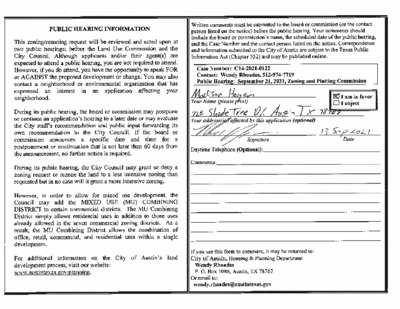
ADDITIONAL INFORMATION FOR CASE C14-2021-0003 (SUN AUTO) From: To: Subject: Date: Attachments: Andreina Davila-Quintero Sirwaitis, Sherri RE: Request for PD Zoning off of S. Rivera Circle Thursday, September 16, 2021 11:34:44 AM CP-logo-H-CMYK(ai9)[Converted]_0d1c0728-5141-4dff-9823-81ea96f2e8a2.png *** External Email - Exercise Caution *** Good morning Sherri. I hope I find you well. Thank you for your email. We have not received an application to rezone this property to PD. I have spoken to the property owner and Ms. Braasch regarding the PD request and application process; however, the application has not been submitted as of today. The only case we have on file is the former rezoning case when they were requesting Neighborhood Business with a Conditional Overlay (NB-CO). If I may be of further assistance, please do not hesitate to let me know. Thank you, ADQ Andreina Davila-Quintero, AICP Assistant Director of Development Services Development Services 450 Cypress Creek Rd., Bldg. 2 Cedar Park, Texas 78613 Phone: 512-401-5057 From: Sirwaitis, Sherri <Sherri.Sirwaitis@austintexas.gov> Sent: Thursday, September 16, 2021 10:57 AM To: Planning Division <Planning@cedarparktexas.gov> Subject: Request for PD Zoning off of S. Rivera Circle Importance: High Hello, It is my understanding that Jennie Braasch, with Pohl Partners, has a rezoning case in where she is requesting PD zoning for a property off of South Rivera Circle. The City of Austin is currently processing a rezoning request to the south of this site at 2610 ½ South Lakeline Boulevard (Please see attached zoning case report for Sun Auto, case C14-2021-0003). Could let me know the status of Ms. Braasch’s rezoning request in Cedar Park? The City of Austin Zoning and Platting Commission will review case C14-2021-0003 again on September 21, 2021 and would like to know what is occurring on the adjacent property to the north within Cedar Park. I appreciate your help! Thank you, Sherri Sirwaitis City of Austin Housing & Planning Department sherri.sirwaitis@austintexas.gov 512-974-3057(office) CAUTION: This email was received at the City of Austin, from an EXTERNAL source. Please use caution when clicking links or opening attachments. If you believe this to be a malicious and/or phishing email, please forward this email to cybersecurity@austintexas.gov.
From: To: Cc: Subject: Date: Attachments: Victoria Sirwaitis, Sherri Rivera, Andrew; Ron Thrower FW: The Rhett - 1000 E Yager Lane Thursday, September 16, 2021 6:07:09 PM image001.png *** External Email - Exercise Caution *** Sherri and Andrew – it occurred to me that I had not shared the following email chain with a number of Q&A from discussions with the Neighborhood. Please include this in back-up for Tuesday. Thank you, Victoria Haase Thrower Design www.throwerdesign.com Mail: P.O. Box 41957 Austin, Texas 78704 512-998-5900 Cell 512-476-4456 Office From: Victoria Sent: Thursday, September 9, 2021 1:02 PM To: Cc: Ron Thrower <> Subject: RE: The Rhett - 1000 E Yager Lane Good Afternoon All, We’ve received some additional questions that are addresses below. 1. How will the privacy be maintained for homes that back up to the west side of Copperfield Drive? The structures on the three lots (addressed from Zeller Lane) are nearly 300ft and more from the proposed structures to be built. This creates a significant buffer such that the new units will not be looming over the yards of those homes. The houses on Markham that back up to the subject tract are, at a minimum, 134feet and as far as 189ft from the proposed buildings. In addition to trees being preserved on the property, more trees will be planted with some along Copperfield Drive. 2. Additional concerns that the proposed development will be run-down and not taken care of. Reiterating that as an affordable housing development, the owner is required to keep ownership of the development for a minimum of 15 years. Therefore, this will not be a scenario where the property is developed and flipped to someone else with little to no knowledge of these conversations/concerns. Further, there will be state and local oversight, with various inspections, some occurring annually, to ensure that the project is meeting the requirements of the program. It is in the best interest of the landowner to keep the property in good standing because if not, the landowner/developer will have financial penalties/repercussions. 3. Is this development Section 8 housing? No. 4. How much are the proposed rents? The following are the rent maximums according to 2021 Austin Metropolitan Statistical Area data and are subject to change over time as the data changes. This development is proposed to have all units at 60% or 50% MFI levels. Therefore, a family of 4 …
POSTPONEMENT REQUEST FOR CASE C14-2021-0091 - THE RHETT From: To: Cc: Subject: Date: rabmcniel "rabmcniel" Sirwaitis, Sherri; "taossey"; "rabmcniel" additional information RE: Request for hearing to be moved Thursday, September 16, 2021 5:24:06 PM *** External Email - Exercise Caution *** Sherri, This is the Case information that I was referring to in my earlier email. Thank You, Rachel McNiel CASE: C14-2021-0091 (The Rhett) DISTRICT: 1 ZONING FROM: LR-CO TO: GR-MU ADDRESS: 1000 East Yager Lane SITE AREA: 2.68 acres (116,740 sq. ft.) PROPERTY OWNER: Zydeco Development Corporation AGENT: Thrower Design, LLC (A. Ron Thrower) CASE MANAGER: Sherri Sirwaitis (512-974-3057, sherri.sirwaitis@austintexas.gov) ----------------------------------------- From: rabmcniel To: "Sherri.Sirwaitis@austintexas.gov", "taossey", "rabmcniel" Cc: Sent: Thursday September 16 2021 5:17:40PM Subject: Request for hearing to be moved Sherri, Westview Canyon HOA is requesting that the hearing concerning Case SP-2021-0264C, which is scheduled for September 21, be rescheduled for a later date. We are requesting an October date; however, not Tuesday October 5. Tuesday October 5 is National Neighborhood Night Out and our HOA is holding an outdoor event for the neighborhood. We require additional time to meet with the developer as the neighboring HOA. We have also updated our City Registration and we are requesting that all notifications be sent to: Westview Canyon HOA c/o Rachel McNiel, president 12305 Zeller Lane Austin, Tx. 78753 Thank you, Rachel McNiel 512-913-1382 CAUTION: This email was received at the City of Austin, from an EXTERNAL source. Please use caution when clicking links or opening attachments. If you believe this to be a malicious and/or phishing email, please forward this email to cybersecurity@austintexas.gov.
From: To: Subject: Date: Rodney K. Bennett Graham, Mark 911/915 West Dittmar Tuesday, September 21, 2021 11:14:40 AM *** External Email - Exercise Caution *** Mark, please accept this request for a postponement of our case until Oct 5th. Thank you, Rodney K. Bennett Bennett Consulting 529 Evening Star Kyle, Texas 78640 Rodney 512-627-7227 CAUTION: This email was received at the City of Austin, from an EXTERNAL source. Please use caution when clicking links or opening attachments. If you believe this to be a malicious and/or phishing email, please forward this email to cybersecurity@austintexas.gov.
ZONING CHANGE REVIEW SHEET CASE: C14-2021-0040 – 1501 Crozier Lane Zoning ZONING FROM: I-RR ADDRESS: 1501 Crozier Lane PROPERTY OWNER: Old Man City, LLC (Lauren Carson) AGENT: Kimley-Horn and Associates, Inc. (Amanda Brown) DISTRICT: 2 ZONING TO: CS-CO SITE AREA: 32.93 acres CASE MANAGER: Wendy Rhoades (512-974-7719, wendy.rhoades@austintexas.gov) STAFF RECOMMENDATION (Amended): The Staff recommendation is to grant general commercial services – conditional overlay (CS-CO) combining district zoning. The Conditional Overlay: 1) prohibits the following uses: automotive rentals, automotive repair services, automotive sales, automotive washing (of any type), bail bond services, bed and breakfast (group 1), bed and breakfast (group 1), building maintenance services, campground, commercial blood plasma center, construction sales and services, convenience storage, day care services (commercial), day care services (commercial), day care services (general), day care services (limited), drop-off recycling collection facility, electronic prototype assembly, electronic testing, equipment repair services, equipment sales, exterminating services, indoor crop production, kennels, laundry services, maintenance and service facilities, monument retail sales, outdoor entertainment, outdoor sports and recreation, plant nursery, private primary educational facility, private secondary educational facility, public primary educational facility, public secondary educational facility, service station, short term rental, transportation terminal, urban farm, vehicle storage, and veterinary services; 2) establishes custom manufacturing as a conditional use; and 3) establishes that Chapter 25-2, Article 10 (Compatibility Standards) applies along the south property line adjacent to a mobile home residential use. For a summary of the basis of Staff’s recommendation, please see page 2. ZONING AND PLATTING COMMISSION ACTION / RECOMMENDATION: September 7, 2021: August 17, 2021: APPROVED A POSTPONEMENT TO SEPTEMBER 7, 2021 CITY COUNCIL ACTION: October 14, 2021: ORDINANCE NUMBER: [B. GREENBERG; J. KIOLBASSA – 2ND] (10-0) R. WOODY – ABSENT 1 of 15B-1 C14-2021-0040 Page 2 ISSUES: In late-March 2021 and on Saturday, August 21, 2021, the Applicant met to discuss the zoning case with residents of the Capitol Manor Mobile Home Park. On August 20, 2021 and September 1, 2021, the Applicant amended the zoning request to add uses to the prohibited use list (see attached correspondence). The Staff does not object to these uses and has incorporated them into the Staff recommendation. CASE MANAGER COMMENTS: The Applicant proposes to zone the property to the general commercial services – conditional overlay (CS-CO) district so that it may be developed with a limited warehousing and distribution use, and is intended for the storage of wine collections. The Applicant’s Conditional Overlay …
ZONING CHANGE REVIEW SHEET DISTRICT: 2 AGENT: Hector Avila CASE: C14-2021-0120 – Rezoning Liquor Store TO: CS-1 ZONING FROM: GR-CO ADDRESS: 3131 East SH 71 Service Road Westbound, Suite 200 SITE AREA: 0.023 acres (1,000 square feet) APPLICANT: 3131 East 71 LLC (Najib F. Wehbe) CASE MANAGER: Wendy Rhoades (512-974-7719, wendy.rhoades@austintexas.gov) STAFF RECOMMENDATION: The Staff recommendation is to grant commercial - liquor sales – conditional overlay (CS-1-CO) combining district zoning. The Conditional Overlay prohibits automotive repair services, automotive washing, and pawn shop services. For a summary of the basis of Staff’s recommendation, see page 2. ZONING AND PLATTING COMMISSION ACTION / RECOMMENDATION: September 1, 2021: CITY COUNCIL ACTION: October 14, 2021: ORDINANCE NUMBER: ISSUES: The Applicant is in agreement with the Staff recommendation. CASE MANAGER COMMENTS: The subject rezoning area is a 1,000 square foot unoccupied lease space at the east end of a recently constructed commercial development that contains a service station and a food sales use, and is located on the East SH 71 westbound service road at its intersections with Cheviot Lane and Royster Avenue. The property was annexed into the City in September 2001 and zoned community commercial – conditional overlay (GR-CO) district by a 2008 case. The Conditional Overlay limits development to 2,000 vehicle trips per day, and prohibits automotive repair services, automotive washing, and pawn shop services. The property is located just outside of the Airport Overlay Zone-3 district, also known as the ½ mile buffer. There are residential uses to the north and east (I-SF-2; LO-MU); and commercial uses, including a concrete pad for a former restaurant (limited) and auto-related uses to the west (GR; GR-CO; CS-CO). Please refer to Exhibits A (Zoning Map) and A-1 (Aerial View). 1 of 10B-2 C14-2021-0120 Page 2 The Applicant proposes commercial – liquor sales (CS-1) district zoning in order to occupy the lease space with a liquor sales use. The approved site plan shows driveways to East SH 71 service road, Royster Avenue and Cheviot Lane. BASIS FOR RECOMMENDATION 1. The proposed zoning should be consistent with the purpose statement of the district sought. The commercial – liquor sales (CS-1) zoning district is intended for commercial and industrial activities of a service nature which typically have operating characteristics or traffic service requirements generally incompatible with residential environments, and specifically includes liquor sales as a permitted use. The Conditional Overlay (CO) combining district may be applied in …
ZONING CHANGE REVIEW SHEET CASE: C14-2021-0012 (Research Park Rezoning) DISTRICT: 6 ADDRESS: 12455, 12501 Research Boulevard North Bound, 12489, 12515 ½, 12517 ½ Research Boulevard Service Road NB, 12220 ½ Riata Trace Parkway ZONING FROM: LI TO: LI-PDA The applicant is requesting a rezoning to add a Planned Development Area overlay with the following conditions: Applicable Site Development Regulations A. Unless otherwise modified herein development of Lot 11 shall comply with applicable City of Austin rules, regulations and ordinances. B. If there is a conflict between this Ordinance and applicable City of Austin rules, regulations and ordinances, this Ordinance including the Exhibits shall control. Authorized Uses A. All Limited Industrial (LI) uses are permitted uses of Lot 11, except as set forth in Subsection B of this Section. The following are additional permitted uses: B. The following uses are prohibited as principal uses of Lot 11: Multi-Family Residential Research Testing Services Research Warehousing Services Automotive Repair Services Campground Drop-Off Recycling Collection Facility Funeral Services Kennels Pedicab Storage and Dispatch Recycling Center Resource Extraction Scrap and Salvage Service Station Theater Site Development Regulations A. Base District Regulations 1) Development of the Property shall conform to the site development regulations authorized for the Limited Industrial Services (LI) district as set forth in the City Code, except as provided for in this Ordinance. 2) The following development regulations shall apply only to Lot 11. a) The minimum lot size is 5,750 square feet. 1 of 78B-3 C14-2021-0012 2 b) The minimum lot width is 50 feet. c) There is no minimum interior side yard, rear yard, front yard, or street yard setbacks. d) The maximum height is 60 feet. e) The maximum impervious cover and maximum building coverage is set forth by the applicable watershed limitation. f) The maximum floor-to-area ratio is 2:1. SITE AREA: 179.14 acres PROPERTY OWNER: Karlin Research Park Development, LLC, Karlin Research Park, LLC (Matthew Schwab) AGENT: Armbrust & Brown, PLLC (Richard T. Suttle) CASE MANAGER: Sherri Sirwaitis (512-974-3057, sherri.sirwaitis@austintexas.gov) STAFF RECOMMENDATION: Staff recommends LI-PDA, Limited Industrial-Planned Development Area Combining District, zoning. ZONING AND PLATTING COMMISSION ACTION / RECOMMENDATION: August 17, 2021: Postponed to September 7, 2021 at the neighborhood's request by consent (10-0, R. Woody-absent); E. Ray-1st, A. Dankler-2nd. September 7, 2021 CITY COUNCIL ACTION: ORDINANCE NUMBER: 2 of 78B-3 C14-2021-0012 ISSUES: N/A CASE MANAGER COMMENTS: 3 The property in question is a 179+ tract of land that …
C14-2021-0117 1 ZONING CHANGE REVIEW SHEET CASE: C14-2021-0117 – West Slaughter Lane Residences ZONING FROM: DR DISTRICT: 5 TO: GR-MU-V ADDRESS: 1017 W Slaughter Lane SITE AREA: 3.15 acres (137,214 sq. ft.) PROPERTY OWNER: Jamee F. & Charles Stewart AGENT: Alice Glasco Consulting (Alice Glasco) CASE MANAGER: Mark Graham (512-974-3574, mark.graham@austintexas.gov ) STAFF RECOMMENDATION: The Staff recommendation is to grant community commercial mixed use-vertical mixed use (GR-MU-V) combining district zoning. For a summary of the basis of staff’s recommendation, see page 4. ZONING AND PLATTING COMMISSION ACTION / RECOMMENDATION: September 7, 2021 CITY COUNCIL ACTION: September 30, 2021 ORDINANCE NUMBER: 1 of 18B-4 C14-2021-0117 2 ISSUES None at this time. CASE MANAGER COMMENTS: Applicant requests zoning to build 290 apartment units with 10% designated affordable as required with the requested vertical mixed use building (V) zoning. 3,000 square feet of proposed commercial space make it a mixed use project in the requested community commercial – mixed use – vertical mixed use building (GR-MU-V) combining district zoning. 1017 West Slaughter, the rezoning tract (“Tract”) is located on the south side of West Slaughter Lane between Menchaca Road and South 1st Street. The Tract has approximately 178 feet of frontage along W. Slaughter Ln. and the only access is from W. Slaughter Ln. The 3.15 acre (137,214 square foot) Tract is undeveloped other than a 2400 square foot canopy, according to Travis County Appraisal District records. The view into the site is blocked with vegetation from all sides. An Austin Energy substation is located west of the Tract. Two narrow (about 84 feet) lots separate the proposed rezoning Tract from the neighborhood with townhouse and condominium residence (SF-6) district zoning to the east. On the adjacent narrow lot, there is an autobody repair shop. The second narrow lot has two modular buildings, possibly residences. The SF-6 neighborhood is developed with two story detached homes on compact lots. This neighborhood wraps around the south side of the narrow lots and the rezoning Tract. City maps show a creek buffer area running diagonally from northwest to southeast through the Austin Energy site and continuing through the rezoning Tract and SF-6 neighborhood beyond. Creek Buffers are unbuildable areas. The creek buffer has the effect of pushing site development north, toward W. Slaughter Ln. (see attached Exhibit B: Aerial Map). Existing Zoning The Tract was annexed into the City limits with full jurisdiction in November 1984 …
C14-2021-0104 1 ZONING CHANGE REVIEW SHEET CASE: C14-2021-0104 – Acts Fellowship Church DISTRICT: 1 ZONING FROM: I-RR ADDRESS: 9807 Dessau Road SITE AREA: 3.2 acres (139,392 sq. ft.) PROPERTY OWNER: Alpha Anchor Investments, LLC, (Andrew Kim) TO: GR AGENT: Dunaway Associates (Meg Greenfield) CASE MANAGER Mark Graham (512-974-3574, mark.graham@austintexas.gov ) STAFF RECOMMENDATION: The Staff recommendation is to grant community commercial – conditional overlay (GR- CO) combining district zoning. The conditional overlay includes a list of prohibited uses: Alternative Financial Services, Automotive Rentals, Automotive Repair Services, Automotive Sales, Automotive Washing (of any type), Bail Bond Services, Drop-Off Recycling Collection Facility, Exterminating Services, Pawn Shop Services, Service Station. For a summary of the basis of staff’s recommendation, see case manager comments starting on page 2. ZONING AND PLATTING COMMISSION ACTION / RECOMMENDATION: September 7, 2021 CITY COUNCIL ACTION: September 30, 2021 ORDINANCE NUMBER: ISSUES No issues have been identified for this case. 1 of 12B-5 C14-2021-0104 2 CASE MANAGER COMMENTS: Zoning Request The proposed Acts Fellowship Church is a 10,156 square foot building and parking area to be built on the east side of Dessau Road south of Breaker Lane and north of Rundberg Lane. Site access from Dessau Road is aligned with Childress Drive that goes west from Dessau Rd. The rezoning tract is 3.2 acres (139,392 sq. ft) of land. Applicant requests community commercial (GR) district zoning which permits religious assembly (church) uses. The site is in the Walnut Creek Watershed. Commercial zoning in this Suburban watershed is allowed a maximum of 80% impervious cover. Religious Assembly (church) use is permitted in most zone districts. The applicant in this case requested community commercial (GR) district zoning to obtain development regulations that permit 80% impervious coverage. With the proposed conditional overlay, staff believes that the requested GR zoning will be compatible with future development of the multifamily residence moderate high density (MF-4) district zoning on adjoining land to the north. The MF-4 district, and all multifamily residence districts in this watershed permit a maximum of 60% impervious coverage. There are three existing churches on the east side of Dessau Rd. between Childress Dr. and Rundberg Ln. The subject 3.2 acre rezoning tract is part of a 16.602 acre tract of land zoned interim – rural residence (I-RR) when annexed in 2003. South of the subject tract and within the I-RR zoning, two new buildings were built since 2015: A 4,797 sq. …
C14-2021-0119 1 ZONING CHANGE REVIEW SHEET CASE: C14-2021 -0119 – McHeath 1.48 DISTRICT: 2 ZONING FROM: DR & SF-2 (Tract 1) DR (Tract 2) ADDRESS: 911 West Dittmar (Tract 1) 915 West Dittmar (Tract 2) SITE AREA: 0.99 acres (Tract 1) 0.49 acres (Tract 2) Total 1.48 acres (64,555 sq. ft.) PROPERTY OWNER: McHeath Ventures, LLC (Chris McClearin) TO: MF-2 AGENT: Bennett Consulting (Rodney Bennett) CASE MANAGER Mark Graham (512-974-3574, mark.graham@austintexas.gov ) STAFF RECOMMENDATION: The Staff recommendation is to grant multifamily residence low density (MF-2) district zoning. For a summary of the basis of staff’s recommendation, see case manager comments on page 2. ZONING AND PLATTING COMMISSION ACTION / RECOMMENDATION: September 7, 2021 CITY COUNCIL ACTION: September 30, 2021 ORDINANCE NUMBER: 1 of 14B-6 C14-2021-0119 2 ISSUES No issues have been identified at this time. CASE MANAGER COMMENTS: Applicant requests multifamily residence - low density (MF-2) district zoning to build 30 dwelling units on 1.48 acres (64,468 sq. ft.). The rezoning tract has frontage on and access to West Dittmar Road. The rezoning tract is located about 0.5 miles west of South 1st St. and almost a mile east of Menchaca Rd. The subject rezoning site is a few hundred feet east of the Dittmar Park and Recreation Center. The rezoning tract was annexed into the City in November of 1984 with full jurisdiction. The site has two existing zone types: single family residence standard lot (SF-2) district zoning; and development reserve (DR) district zoning. For a buildable lot SF-2 zoning requires a minimum lot size of 5,750 square feet and allows 1 dwelling per lot. Building height in SF-2 is 2 stories and 35 feet. Buildings in MF-2 require a minimum of 8,000 square feet, and multiple dwellings can be built on a lot. Maximum density is 23 dwelling units per acre. The land area of the lot limits the number of dwellings based on the number of bedrooms: Number of Bedrooms Required land (square feet) Efficiency 1 2 or more 1,200 1,500 1800 The applicant is proposing to build up to 30 dwelling units on 1.48 acres of land. One existing dwelling unit would be razed with development. Unit sizes, room counts, and affordability were not addressed in the application. There is some variety in the neighborhood housing including detached manufactured and mobile homes in the MH zoning north of W. Dittmar Road which is next to SF-2 …