MEMORANDUM ************************************************************************ TO: Nadia Barrera-Ramirez, Chair Members of the Zoning and Platting Commission July 15, 2021 Housing and Planning Department C14-2021-0094 – Fox Hollow Multifamily FROM: Wendy Rhoades DATE: RE: ************************************************************************ The Staff requests a postponement of the above-referenced zoning case to August 3, 2021 in order to continue review of the Applicant’s request. Attachment: Map of Property B-21 of 2 ! ! ! ! ! ! ! ! ! ! ! ! ! ! ! ! ! ! ! ! ! ! ! ! ! ! ! ! ! ! C7A-04-027 04-0204 OFFICE/WHSE SP-01-0345D GO-CO C14-04-0204 ! ! ! ! ! ! ! ! ! ! ! ! ! ! ! ! ! I-RR ! ! ! ! ! ! ! ! ! ! ! ! ! ! ! ! ! ! ! ! ! ! ! ! ! ! C14-2018-0106 GR-CO ! ! ( ( ( ( ! ! ! ! ( ( ( ( ( ( ( ( ( ( ( ( ( ( ( P I O N ( ( E E R F ( ( ( O R E SF-4A ( ( ( ( ( ( ( ( ( ( ( C7A-02-003 ( ( 02-0120a.SH ( 02-0120.SH ( 02-0120a.SH ( ( ( SF-4A ( ( ( ( ( ( ( ( ( ( ( ( ( SF-4A ( ( ( ( ( ( ( 02-0120a.SH ( ( I D L E W I L D E R U N D R ( ( ( ( ( ( ( ( ( ( ( ( ( ( ( ( ( ( ( ( ( ( ( S T D R ( ( ( UNDEV ( ( ( SF-4A ( ( ( ( ( S T E P H A N N E C R E E K C V ( ( ( ( ( ( ( ( ( ( ( C14-02-0120A.SH ( ( ( ( ( ( ( ( ( ( ( ( ( ( ( ( ( ( SF-4A ( ( ( ( ( ( ( ( ( ( ( ( ( ( ( ( ( ( ( ( ( ( ( ( ( ( ( ( ( ( ( ( ( ( ( ( ( ( ( ( ( ( ( ( POND B R A N D T R D ( ( B R A N D T S W ( ( ( O …
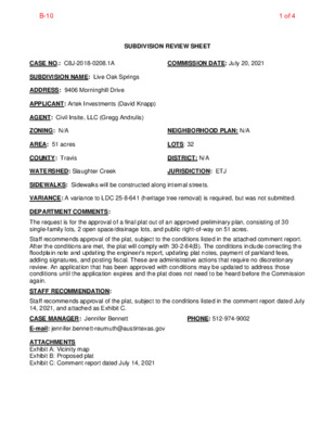
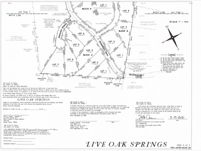
SUBDIVISION REVIEW SHEET CASE NO.: C8J-2018-0208.1A COMMISSION DATE: July 20, 2021 SUBDIVISION NAME: Live Oak Springs ADDRESS: 9406 Morninghill Drive APPLICANT: Artek Investments (David Knapp) AGENT: Civil Insite, LLC (Gregg Andrulis) ZONING: N/A NEIGHBORHOOD PLAN: N/A AREA: 51 acres COUNTY: Travis LOTS: 32 DISTRICT: N/A WATERSHED: Slaughter Creek JURISDICTION: ETJ SIDEWALKS: Sidewalks will be constructed along internal streets. VARIANCE: A variance to LDC 25-8-641 (heritage tree removal) is required, but was not submitted. DEPARTMENT COMMENTS: The request is for the approval of a final plat out of an approved preliminary plan, consisting of 30 single-family lots, 2 open space/drainage lots, and public right-of-way on 51 acres. Staff recommends approval of the plat, subject to the conditions listed in the attached comment report. After the conditions are met, the plat will comply with 30-2-84(B). The conditions include correcting the floodplain note and updating the engineer’s report, updating plat notes, payment of parkland fees, adding signatures, and posting fiscal. These are administrative actions that require no discretionary review. An application that has been approved with conditions may be updated to address those conditions until the application expires and the plat does not need to be heard before the Commission again. STAFF RECOMMENDATION: Staff recommends approval of the plat, subject to the conditions listed in the comment report dated July 14, 2021, and attached as Exhibit C. CASE MANAGER: Jennifer Bennett PHONE: 512-974-9002 E-mail: jennifer.bennett-reumuth@austintexas.gov ATTACHMENTS Exhibit A: Vicinity map Exhibit B: Proposed plat Exhibit C: Comment report dated July 14, 2021 B-101 of 4 LIVE OAK SPRINGS 0 9 S 2 U Z Y L E R D SITE R BLAZYK D FM 1826 SH 45 LOCATION MAP CIVIL INSITE, LLC 1" = 3000' CONSULTING ENGINEERS 12600 HILL COUNTRY BLVD, SUITE R-275 AUSTIN, TX 78738 512.820.0643 FIRM REGISTRATION NO. F-19483 B-102 of 4 B-103 of 4 B-104 of 4
CITY OF AUSTIN – TRAVIS COUNTY – SINGLE SUBDIVISION OFFICE SUBDIVISION APPLICATION – MASTER COMMENT REPORT CASE NUMBER: REVISION #: CASE MANAGER: C8J-2018-0208.1A 00 Jennifer Bennett UPDATE: PHONE #: U0 512-974-9002 PROJECT NAME: LOCATION: Live Oak Springs 9406 MORNINGHILL DR SUBMITTAL DATE: June 21, 2021 FINAL REPORT DATE: July 14, 2021 STAFF REPORT: This report includes all staff comments received to date concerning your most recent subdivision application submittal. The comments may include requirements, recommendations, or information. The requirements in this report must be addressed by an updated submittal. The subdivision application will be approved when all requirements from each review discipline have been addressed. If you have any questions, concerns or if you require additional information about this report, please contact your case manager at the phone number listed above or by using the contact information listed for each reviewer in this report. Any change to the plan/plat shall not cause noncompliance with any applicable code or criteria. In addition, any change to the plat may trigger new comments. UPDATE DEADLINE (LDC 30-2-56; 30-2-82): All comments must be addressed by filing an updated submittal prior to the update deadline of December 31, 2021. Otherwise, the application will expire. If this date falls on a weekend or City of Austin holiday, the next City of Austin workday will be the deadline. Extension of Review Period, Extension of Update Deadline and Tolling of Application Period do not apply to applications for preliminary plan, plat or subdivision construction plans (LDC). UPDATE SUBMITTAL INSTRUCTIONS (LDC 30-1-113): 1. Applicants must make an appointment with Intake Staff (974-1770) in order to submit an update. 2. Your update must include the following items: a. This report b. The revised plat/plan in pdf format c. A letter that addresses each comment in the master comment report 3. Updates must be submitted on an approved submittal date, between the hours of 8:30 am and 4:00 pm. Refer to the submittal calendar for a list of approved submittal dates. REVIEWERS: Planner 1: Elsa Garza PARD / Planning & Design: Justin Stewart Environmental: Pamela Abee-Taulli Flood Plain: Karol Susan Menhard Subdivision: Jennifer Bennett Water Quality: David Marquez Travis Co. Drainage Engineering: Teresa Calkins B-101 of 6 Travis Co. Drainage Engineering Review - Teresa Calkins - 512-854-7569 DE 1. Update FEMA FIRM Panel No.in the floodplain note on the final plat: 48453C0555J, effective January 22, 2020. (LDC § 30-4-33) DE 2. …
SUBDIVISION REVIEW SHEET CASE NO.: C8-2018-0165.3A Z.A.P. DATE: July 20, 2021 SUBDIVISION NAME: Cascades at Onion Creek East, Phase Three AREA: 23.1107 acres LOTS: 120 APPLICANT: M/I Homes of Austin, LLC (William G. Peckman) AGENT: LJA Engineering Inc. (Russell Kotara, P.E.) ADDRESS OF SUBDIVISION: 2333 Cascades Ave WATERSHED: Onion Creek COUNTY: Travis EXISTING ZONING: I-SF-2 JURISDICTION: Full Purpose PROPOSED LAND USE: Residential / Open Space / Right-of-Way DEPARTMENT COMMENTS: The request is for the approval of Cascades at Onion Creek East, Phase Three, comprised of 120 lots on 23.1107 acres. The plat does not comply with the criteria for approval in LDC 25-4-84(B) and staff recommends disapproval for the reasons listed in the attached comment report. An application that has been disapproved with reasons may be updated to address those reasons until the application expires. If the applicant submits an update to address the reasons for disapproval, that update will b e presented to the Land Use Commission within fifteen days of submittal. STAFF RECOMMENDATION: Disapproval for reason listed in Exhibit C in the support material. CASE MANAGER: Cesar Zavala E-mail: cesar.zavala@austintexas.gov PHONE: 512-974-3404 ATTACHMENTS Exhibit A: Vicinity map Exhibit B: Proposed plat Exhibit C: Comment report dated July 15, 2021 B-111 of 8 B-112 of 8 B-113 of 8 B-114 of 8 B-115 of 8 CITY OF AUSTIN –DEVELOPMENT SERVICES DEPARTMENT SUBDIVISION APPLICATION – MASTER COMMENT REPORT 11601 S IH 35 SVRD NB U0 512-974-3404 C8-2018-0165.3A CASE NUMBER: REVISION #: UPDATE: 00 CASE MANAGER: Cesar Zavala PHONE #: PROJECT NAME: Cascades at Onion Creek East Phase Three Final Plat LOCATION: SUBMITTAL DATE: June 21, 2021 REPORT DUE DATE: July 20, 2021 FINAL REPORT DATE: July 15, 2021 STAFF REPORT: This report includes all staff comments received to date concerning your most recent subdivision application submittal. The comments may include requirements, recommendations, or information. The requirements in this report must be addressed by an updated submittal. The subdivision application will be approved when all requirements from each review discipline have been addressed. If you have any questions, concerns or if you require additional information about this report, please contact your case manager at the phone number listed above or by using the contact information listed for each reviewer in this report. Any change to the plan/plat shall not cause noncompliance with any applicable code or criteria. In addition, any change to the plat may trigger new comments. UPDATE DEADLINE INFORMATION …
Zoning and Platting Commission Recommendations on City of Austin FY 2022 Budget The Zoning and Platting Commission respectfully urges the City Council Members to consider the following recommendations regarding the City of Austin FY 2022 budget. Equity Office: • Provide resources to review City budget, capital improvement projects and provide training on racial equity. • Provide funding to implement the City Council resolution on reconciliation and healing for disenfranchisement of Black people in Austin. Housing and Planning Department and Development Services Department: • Purchase software or provide digital tools to facilitate application reviews for increased transparency, faster review times, and cost savings. • Ensure adequate staffing and resources to timely update Amanda and GIS with information on localized flooding and wildfire interface. • Ensure adequate staffing and resources in all City income-restricted housing programs to timely monitor compliance with income restricted housing requirements including the number of units provided, how quickly the units are filled, and whether health and safety maintenance is provided on a regular and sufficient basis. • Provide adequate planning staff and resources to initiate and facilitate concurrent small area planning processes for: o Equitable Transit Oriented Development associated with Project Connect. o Displacement prevention and mitigation in low-income neighborhoods and communities of color in the East Austin. o Historic surveys of neighborhoods and community assets impacted by rapid redevelopment and displacement in the Eastern Crescent. • Ensure adequate staffing and resources to monitor and provide public updates on compliance with City income-restricted housing programs. Code Enforcement: • Ensure adequate staffing and resources to proactively monitor and enforce compliance with health and safety regulations by commercial residential developments that participate in City, state, and federal income-restricted housing, rental assistance, or home repair assistance programs in Austin. Citywide: • Ensure adequate resources for the Office of Performance Management to adequately analyze data to ensure to policy recommendations achieve the desired outcomes in the Council’s Strategic Plan. • Provide funding to allow the public to participate virtually in public meetings held by boards and commissions when in-person meetings resume in September 2021. Cc: Spencer Cronk, Kerri Lang
SITE PLAN REVIEW SHEET ENVIRONMENTAL VARIANCE REQUEST ONLY PLANNING COMMISSION DATE: July 20th, 2021 CASE: SP-2021-0021D PROJECT NAME: 3800 Island Way APPLICANT: Chris Hester AGENT: Janis Smith Consulting, LLC (Janis Smith, PE) ADDRESS OF SITE: 3800 Island Way COUNTY: Travis WATERSHED: Lake Austin JURISDICTION: Full Purpose EXISTING ZONING: LA, SF-3 PROPOSED DEVELOPMENT: The applicant is proposing to construct a boat dock. DESCRIPTION OF VARIANCES: The applicant is requesting to vary from LDC 25-8-281(C)(2)(b) to allow construction of a boat dock within a 150-foot Critical Environmental Feature (CEF). STAFF RECOMMENDATION: The findings of fact have been met, and staff recommends approval for construction within a 150 foot Critical Environmental Feature (CEF) with the following conditions: 1) All construction activities to be completed by barge. AREA: .5 acres ENVIRONMENTAL BOARD ACTION: July 7th, 2021: With a 8-0 vote, the Environmental Commission recommends support of the request for a variance from LDC 25-8-281(C)(2)(b) with the following conditions; 1) All construction activities to be completed by barge. WATERSHED PROTECTION STAFF: Eric Brown PHONE: 978-1539 Eric.Brown@austintexas.gov CASE MANAGER: Clarissa Davis Clarissa.Davis@austintexas.gov PHONE: 974-1423 B-091 of 53 ITEM FOR DEVELOPMENT COMMITTEE MEETING MEETING DATE: NAME & NUMBER OF PROJECT: June 16, 2021 3800 Island Way SP-2021-0021D NAME OF APPLICANT OR ORGANIZATION: Janis Smith, PE Janis Smith Consulting, LLC LOCATION: 3800 Island Way Austin, Texas 78746 COUNCIL DISTRICT: Council District #10 ENVIRONMENTAL REVIEW STAFF Eric Brown Senior Environmental Scientist Watershed Protection Department Eric.Brown@austintexas.gov WATERSHED: Lake Austin Watershed, Water Supply Rural Classification, Drinking Water Protection Zone REQUEST: STAFF RECOMMENDATION: RECOMMENDED CONDITIONS: Request to vary from LDC 25-8-281(C)(2)(B) to allow construction within 150-feet of Critical Environmental Feature (Rimrock) Staff recommends this variance having determined the findings of facts have been met. 1. Construction to be completed by barge. B-092 of 53 Staff Findings of Fact B-093 of 53 3800 ISLAND WAY– BOAT DOCK REPLACEMENT SP- 2021-0021D Eric Brown Hydrogeologic Reviewer Watershed Protection Department B-094 of 53 B-095 of 53 PROPERTY DATA • LAKE AUSTIN WATERSHED • WATER SUPPLY RURAL CLASSIFICATION • CRITICAL ENVIRONMENTAL FEATURES ON SITE • COUNCIL DISTRICT 10 B-096 of 53 B-097 of 53 B-098 of 53 BACKGROUND • • • • BOAT DOCK ON THE LAKE NEAR RIMROCK BRINGING EXISTING NON-COMPLIANT DOCK INTO COMPLIANCE ADDING SECOND STORY B-099 of 53 CODE REFERENCE •TITLE 25 – LAND DEVELOPMENT CODE, CHAPTER 25-8-281(C)(2)(B). B-0910 of 53 VARIANCE REQUEST REQUEST TO VARY FROM LDC 25-8- 281(C)(2)(B) TO ALLOW CONSTRUCTION WITHIN …
ZONING AND PLATTING COMMISSION RECOMMENDATION 20210721-C-02 Date: July 21, 2021 Subject: FY 2021 – 2022 Budget Motioned By: Commissioner Denkler Seconded By: Commissioner King Recommendation: Propose recommendations, as amended, for FY 2021-2022, per attachment. For: Chair Barrera-Ramirez and Commissioners Acosta, Bray, Denkler, Greenberg, King, Smith Thompson and Woody Absent: Vice-Chair Kiolbassa and Commissioner Ray Vote: 9-0 Attest: Andrew D. Rivera Land Use Commission Liaison 1 of 1 Zoning and Platting Commission Recommendations on City of Austin FY 2022 Budget The Zoning and Platting Commission respectfully urges the City Council Members to consider the following recommendations regarding the City of Austin FY 2022 budget. Equity Office: • Provide resources to review City budget, capital improvement projects and provide training on racial equity. • Provide funding to implement the City Council resolution on reconciliation and healing for disenfranchisement of Black Austinites. Housing and Planning Department: • Ensure adequate staffing and resources in all City income-restricted housing programs to timely monitor compliance with income restricted housing requirements including the number of units provided, how quickly the units are filled, and whether health and safety maintenance is provided on a regular and sufficient basis. • Ensure adequate staffing and resources to monitor and provide public updates on compliance with City income-restricted housing programs. • Encourage more funding for down payment assistance which was listed as the greatest barrier to purchasing a home in the Neighborhood Housing Community Development’s comprehensive analysis of impediments to housing to leverage limited dollars. The analysis was based on the participation of 6,000 low-income residents, 43% of the participants were of color. • Provide adequate planning staff and resources to initiate and facilitate concurrent small area planning processes for: o Equitable Transit Oriented Development associated with Project Connect. o Displacement prevention and mitigation in low-income neighborhoods and communities of color in the East Austin. o Historic surveys of neighborhoods and community assets impacted by rapid redevelopment and displacement in the Eastern Crescent. Development Services Department: • Purchase software or provide digital tools to facilitate application reviews for increased transparency, faster review times, and cost savings. • Ensure adequate staffing and resources to timely update Amanda and GIS with information on localized flooding and wildfire interface. • Ensure staffing levels are adequate to meet review times. Communications and Technology Management: • Explore the possibility of purchasing software to allow speakers to queue up to speak in virtual or hybrid meetings similar …
ZONING CHANGE REVIEW SHEET CASE: C14-2020-0146 (11705 Research Blvd Zoning) DISTRICT: 6 ZONING FROM: LI-CO TO: LI The applicant is requesting a rezoning to remove the conditional overlay that requires the following on the property ((please see Applicant’s Request Letter - Exhibit C):: 1) Building height is limited to a maximum of 40 feet. 2) The following uses are prohibited: Scrap and Salvage Automotive Rentals Automotive Sales Resource Extraction Basic Industry Convenience Storage Automotive Repair Automotive Washing Hotel-Motel Vehicle Storage 3) The following uses shall be prohibited on approximately 1.67 acres on the rear portion of the property for a depth of 150 feet: General Warehousing and Distribution Equipment Repair Services Equipment Sales Kennels 4) Development on the property shall be subject to the conditions of the Transportation Impact Analysis (TIA) prepared by Watson, Hall and Machemekl Transportation Engineering Consultants, Inc. dated February 1989. 5) No building permit for construction on the property shall be issued unless at the time an application for a building permit is submitted all city requirements have been met and one of the following has occurred: i. a site plan for development of the property or any portion of the property has been approved and released by the City of Austin or construction contracts have been awarded for roadway improvements along U.S. Highway 183 between the Williamson County Line and Balcones Drive. ii. ADDRESS: 11705 Research Boulevard Service Road Northbound SITE AREA: 5.580 acres (243,065 sq. ft.) PROPERTY OWNER: 3M Company AGENT: Drenner Group, PC (Amanda Swor) CASE MANAGER: Sherri Sirwaitis (512-974-3057, sherri.sirwaitis@austintexas.gov) STAFF RECOMMENDATION: Staff recommends LI-CO, Limited Industrial Conditional Overlay Combining District, zoning. The conditional overlay will maintain the following conditions from the current zoning ordinance for this property (Ordinance No. 900118-B): 1 of 144B-1 1) The following uses are prohibited on the Property: Scrap and Salvage Resource Extraction Basic Industry Vehicle Storage portion of the property for a depth of 150 feet: General Warehousing and Distribution Equipment Sales Equipment Repair Services Kennels 2) The following uses shall be prohibited on approximately 1.67 acres on the rear ZONING AND PLATTING COMMISSION ACTION / RECOMMENDATION: April 20, 2021: Approved staff's request for a postponement to May 4, 2021, by consent (9-0, J. Kiolbassa – absent); H. Smith- 1st, D. King – 2nd. May 4, 2021: Approved neighborhood's request for a postponement to June 1, 2021, by consent (8-0, C. Acosta and E. Ray-absent); H. …
MEMORANDUM ************************************************************************ TO: FROM: Zoning and Platting Commission Members Sherri Sirwaitis Housing and Planning Department July 1, 2021 C14-2021-0090 (620 Hill Country Center) Postponement Request DATE: RE: ************************************************************************ The staff would like to request a postponement of the above mentioned case to July 20, 2021. The staff is asking for a postponement because there was a notification error and the case will need to be re-notified before it can be presented for the Commission’s review. The postponement request was made in a timely manner and meets the Zoning and Platting Commission’s policy. 1 of 1B-2
ZONING CHANGE REVIEW SHEET CASE: C14-2020-0143 12121 N. IH 35 Rezoning DISTRICT: 1 ZONING FROM: GR-CO TO: MF-4 ADDRESS: 12121 North IH 35 Northbound SITE AREA: 11.845 acres PROPERTY OWNER: Dupius Investments, Ltd. (Daniel McCormack) AGENT: John M. Joseph (Coats Rose) CASE MANAGER: Heather Chaffin (512-974-2122, heather.chaffin@austintexas.gov) STAFF RECOMMENDATION: Staff supports the Applicant’s request for rezoning to MF-4. For a summary of the basis of staff’s recommendation, see case manager comments on page 2. ZONING AND PLATTING COMMISSION ACTION / RECOMMENDATION: July 6, 2021: June 1, 2021: To be postponed to July 6, 2021 as requested by Neighborhood, approved on consent. CITY COUNCIL ACTION: TBD ORDINANCE NUMBER: 1 of 21B-3 C14-2020-0143 ISSUES: No issues at this time. 2 CASE MANAGER COMMENTS: The subject property is located on the east side of IH 35 and is bounded by VFW Road to the north and Bowery Trail to the south. The undeveloped parcel is zoned GR-CO with the conditional overlay limiting the property to a maximum of 2,000 vehicle trips per day (v.p.d) and prohibiting numerous commercial land uses. These land uses are listed in the attached ordinance. Please see Exhibit C- Zoning Ordinance. Across VFW Road to the north is the VFW lodge which is zoned GO-CO. Also across the road are two multifamily developments that are zoned MF-3-CO. Immediately east and southeast of the rezoning tract is land zoned SF-6-CO that is developed with detached townhouse/condominium properties. Across Bowery Trail to the south is undeveloped land zoned GO. Across IH 35 to the west are commercial properties zoned LI, including headquarter offices of the Texas Council on Environmental Quality (TCEQ). Please see Exhibits A and B- Zoning Map and Aerial Exhibit. Staff supports the requested MF-4 zoning. MF-4 zoning is compatible with nearby multifamily and townhouse condominium properties. The applicant has stated their intent to construct approximately 330 market-rate apartments, providing additional housing opportunities in the area. BASIS FOR RECOMMENDATION 1. The proposed zoning should be consistent with the goals and objectives of the City Council. 2. 3. Zoning should be consistent with approved and existing residential densities. Granting of the request should result in an equal treatment of similarly situated properties. The addition of multifamily units at this location will increase housing opportunities and be consistent with nearby residential properties. Staff has received correspondence in opposition to the rezoning request. Please see Exhibit D- Correspondence. EXISTING ZONING AND LAND …
1 ZONING CHANGE REVIEW SHEET DISTRICT: 1 CASE: C14-2021-0087 CKB Johnny Morris ZONING FROM: LI-CO TO: GR-MU-CO ADDRESS: 6402 Johnny Morris Road SITE AREA: 22.114 Acres PROPERTY OWNER/APPLICANT: LSIR (Carey Legett III) CASE MANAGER: Heather Chaffin (512-974-2122, heather.chaffin@austintexas.gov) STAFF RECOMMENDATION: Staff supports the Applicant’s request to rezone the property to GR-MU-CO. The conditional overlay includes the following restrictions: AGENT: Drenner Group PC, (Dave Anderson) 1. The following uses are not permitted uses of the Property: Automotive rentals, Automotive repair services, Automotive sales, Automotive washing (of any type), Exterminating services, Pawn shop services, Bail bond services, Drop off recycling collection facility, Off site accessory parking, Pedicab storage and dispatch, Service station, and Custom manufacturing. 2. Drive-in service is prohibited as an accessory use to all commercial uses on the Property. For a summary of the basis of staff’s recommendation, see case manager comments on page 2. ZONING AND PLATTING COMMISSION ACTION/ RECOMMENDATION: July 6, 2021: CITY COUNCIL ACTION: TBD ORDINANCE NUMBER: 1 of 10B-4 C14-2021-0087 2 ISSUES: A restrictive covenant amendment (RCT) has been filed in conjunction with this rezoning request (City File # C14-88-0137(RCT)). CASE MANAGER COMMENTS: The 22.114 acre subject property is located on the west side of Johnny Morris Road approximately 1,000 feet south of Loyola Lane. The property currently has one single family residence that is considered an existing nonconforming land use on the LI-CO zoned property. The 1989 zoning conditional overlay limits floor-to-area ratio (FAR) to 0.96 to 1, lot size to 10,000 square feet, requires Planned Development Area (PDA) standards, and limits permitted land uses to those allowed in IP zoning. Please see Exhibit C- Existing Zoning Ordinance. Immediately north of the property is undeveloped property zoned SF-3. This property is located at the intersection of Johnny Morris Road and Loyola Lane and is owned by Capital Metro. Immediately south of the subject tract is property zoned IP that is occupied with construction sales and services land use. Across Johnny Morris Road to the east is undeveloped land zoned LR, a mobile home community zoned MH, and an undeveloped property that was recently rezoned from LI-CO and W/LO-CO to GR-MU-CO. A Capital Metro bus stop is located directly across Johnny Morris. Immediately west of the property is railroad right-of-way (MoKan) that is planned to be part of the Capital Metro Green Line. Further west is Walnut Creek Metro Park and trail system, zoned P. Please …
1 RESTRICTIVE COVENANT TERMINATION REVIEW SHEET CASE: C14-88-0137(RCT) -- Johnny Morris Multi-Family DISTRICT: 1 ADDRESS: 6402 Johnny Morris Road SITE AREA: 22.114 Acres PROPERTY OWNER/APPLICANT: LSIR (Carey Legett III) AGENT: Mahoney Engineering (Daniel Mahoney) CASE MANAGER: Heather Chaffin (512-974-2122, heather.chaffin@austintexas.gov) STAFF RECOMMENDATION: Staff supports the Applicant’s request to terminate the restrictive covenant. For a summary of the basis of staff’s recommendation, see case manager comments on page 2. ZONING AND PLATTING COMMISSION ACTION/ RECOMMENDATION: July 6, 2021: CITY COUNCIL ACTION: TBD ORDINANCE NUMBER: 1 of 18B-5 C14-88-0137(RCT) 2 ISSUES: A rezoning request has been filed in conjunction with the restrictive covenant amendment (City File # C14-2021-0087). CASE MANAGER COMMENTS: The subject property is located on the east side of Ed Bluestein Boulevard between Loyola Lane and Manor Road, slightly south of Purple Sage Drive. Most of the undeveloped property is zoned GR (8.27 acres), while a small strip along the northern boundary is zoned SF-3 (0.99 acres). To the north is a residential neighborhood that is zoned SF-3 and will trigger compatibility standards. This neighborhood is primarily developed with duplex residences and LBJ High School. Immediately to the south and east is undeveloped land zoned GR-MU. A small tributary to Walnut Creek is located adjacent to the southern tract boundary; no floodplain or creek buffers are associated with this tributary. Further west are undeveloped properties zoned SF-2-CO. Immediately west of the property is Ed Bluestein Boulevard; across Ed Bluestein Boulevard are properties zoned GR-V-NP, GR-NP, and GR-MU-CO-NP. These properties include retail uses (including a grocery store), undeveloped property, and civic land uses (Boys and Girls Club). Immediately to the east is a small tributary to Walnut Creek that has 100-year floodplain and a 200' wide creek buffer centered on the tributary. East of the tributary is undeveloped land zoned SF-2-CO. Please see Exhibits A and B—Zoning Map and Aerial Exhibit. In 1988-1989, a restrictive covenant (RC) was placed on the property in conjunction with a rezoning from GR to LI-CO. The RC references SF-3 zoning across Johnny Morris Road, however there is no longer any SF-3 zoning across the street (now zoned MH). The RC requires that access to the subject tract be designed to minimize traffic conflicts with the SF-3 tract; current Code requires that all driveways be designed to minimize traffic conflicts. The RC also references a future “MoKan Expressway” alignment that was anticipated adjacent to the subject …
ZONING AND PLATTING COMMISSION SITE PLAN CONDITIONAL USE PERMIT AND COMPATIBILITY VARIANCE SP-2019-0141C ZONING AND PLATTING COMMISSION HEARING DATE: July 6, 2021 Howard Plaza 3127 East Howard Lane Attn: Peter Pham c/o Platron Manufacturing 13930 Immanuel Rd. Pflugerville, TX 78660 (512) 989-1362 CASE NUMBER: PROJECT NAME: ADDRESS: APPLICANT: AGENT: Attn: Way Atmadja, PE WAY Consulting Engineers, Inc. 11615 Angus Road, Suite 119 Austin, TX 78759 (512) 343-0766 (512) 974-3338 Randall Rouda Randall.Rouda@austintexas.gov CASE MANAGER: NEIGHBORHOOD PLAN: None PROPOSED DEVELOPMENT: The applicant is proposing to develop a vacant lot, zoned W/LO (Warehouse/Limited Office) with two warehouse buildings and one building for alternating Daycare Services (Commercial) during daily business hours and Community Recreation (Private) in the evenings and weekends. Those uses are defined as follows: DAY CARE SERVICES (COMMERCIAL) use is the use of a site for the provision of daytime care for more than 20 persons. This use includes nursery schools, preschools, day care centers for children or adults, and similar uses, and excludes public and private primary or secondary educational facilities. COMMUNITY RECREATION (PRIVATE) use is the use of a site for the provision of an indoor or outdoor recreational facility for use by residents or guests of a residential development, planned unit development, church, private primary or secondary educational facility, club or lodge, or non-profit organization. Warehouse and Dare Care Services (Commercial) are allowed uses in the W/LO Zone. Community Recreation (Private) is allowed with a Conditional Use Permit. Each of the three buildings is single story with 5,000 square feet of gross floor area. A 6,000 square foot pavilion is also proposed in the vicinity of the day care/community recreation building. Total gross floor area is 51,000 square feet. Total proposed parking is 242 spaces, (including 7 ADA spaces) and bike rack (6 spaces). The site will have a single driveway, shared with the parcel to the east, accessing East Howard Lane. Public sidewalk improvements are proposed along East Howard Lane. One variance from compatibility setback requirements is being requested. 1 of 8B-6 DESCRIPTION OF COMPATIBILITY VARIANCE: 1) From 25 feet to 5.1 feet for the easterly setback. [LDC § 25-2-1063] SUMMARY STAFF RECOMMENDATION: Staff recommends approval of the Conditional Use Permit for Community Recreation (Private) Use and approval of the Compatibility Waiver with the following condition of approval: 1) That all remaining informal administrative comments are cleared prior to site plan approval The site borders the ETJ …
Regular Meeting of the Zoning and Platting Commission July 6, 2021 Zoning and Platting Commission to be held July 6, 2021 with Social Distancing Modifications Public comment will be allowed via telephone; no in-person input will be allowed. All speakers, including applicants and representatives, must register in advance (Day before the scheduled meeting, July 5, 2021 by noon. ) To speak remotely at the July 6, 2021 Zoning and Platting Commission Meeting, residents must: Preferably email Commission Liaison, Andrew Rivera at andrew.rivera@austintexas.gov or call 512-974-6508 (the day before the meeting). The following information is required: 1. The speaker name. 2. Item number(s) they wish to speak on. 3. Whether they are for/against/neutral. 4. Mailing address. 5. Telephone number. Must be the number that will be used to call-in. Failure to provide the required information by noon July 5, 2021 shall render a request null and void. automatically roll over. A registered speaker may not sign up another speaker. Previous registration on an item does not •Once a request to register to speak has been called in or emailed to the board liaison, residents will receive either an email or phone call with additional information regarding the call in process. •Handouts or other information must be emailed to andrew.rivera@austintexas.gov by 1:00 PM Tuesday July 6, 2021. This information will be provided to Commission members in advance of the meeting. •Residents may watch the meeting here: http://www.austintexas.gov/page/watch-atxn-live Time Allotment: Speakers: 3 minutes. Applicant: 6 minutes and 3 minutes rebuttal. Postponement requests must be submitted to the case manager and Andrew Rivera by 5PM Monday, July 5, 2021. Reunión de la Comisión de Zoning and Platting Fecha 6 de julio de 2021 La Comisión de Zoning and Platting se reunirá el 6 de julio de 2021 modificaciones de distanciamiento soial. Se permitirán comentarios públicos por teléfono; no se permitirá ninguna entrada en persona. Llame o envíe un correo electrónico al enlace de la junta en 512-974-6508 andrew.rivera@austintexas.gov a más tardar al mediodía (el día antes de la reunion, 5 de julio de 2021 . ) 1. El nombre del orador. 2. Número (s) de artículo sobre el que desean hablar. 3. Si están a favor / en contra / neutrales. 4. Dirección postal. 5. Número de teléfono. Debe ser el número que se utilizará para llamar a la persona que desea hablar. Si la información solicitada no se envía antes del mediodía del …
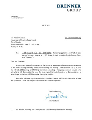
Amanda Swor direct dial: (512) 807-2904 July 6, 2021 Ms. Rosie Truelove Housing and Planning Department City of Austin Street-Jones Bldg., 1000 E. 11th Street Austin, TX 78752 Via Electronic Delivery Re: 11705 Research Blvd. – (C14-2020-0146) – Rezoning application for the 5.60-acre piece of property located at 11705 Research Blvd. in Austin, Travis County, Texas (the “Property”) Dear Ms. Truelove: As representatives of the owners of the Property, we respectfully request postponement of the public hearing currently scheduled for Zoning and Platting Commission on July 6, 2021 to the July 20, 2021 Zoning and Platting Commission meeting. This postponement request is to allow for a full Commission to hear the case given the limited number of Commissioners in attendance at the July 6, 2021 meeting due to the Holiday. Please let me know if you or your team members require additional information or have any questions. Thank you for your time and attention to this project. Very truly yours, Amanda Swor CC: Joi Harden, Planning and Zoning Review Department (via electronic delivery) Sherri Sirwaitis, Planning and Zoning Review Department (via electronic delivery) -2-
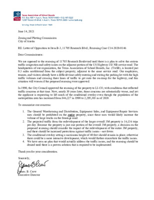
June 14, 2021 Zoning and Platting Commission City of Austin RE: Letter of Opposition to Item B-3, 11705 Research Blvd.; Rezoning Case C14-2020-0146 Dear Commissioners: We are opposed to the rezoning of 11705 Research Boulevard until there is a plan to solve the serious traffic congestion and safety issues on the adjacent portion of the US Highway 183 NB service road. The headquarters of our organization, the Texas Association of School Boards, Inc. (TASB), is located just 0.3 miles northbound from the subject property, adjacent to the same service road. Our employees, tenants, and visitors already have a difficult time safely entering and exiting the parking lot with the high traffic volumes and crossing three lanes of traffic to get onto the on-ramp for the highway, and this situation will worsen if the proposed rezoning were approved. In 1990, the City Council approved the rezoning of the property to LI-CO, with conditions that reflected traffic concerns at that time. Now, nearly 30 years later, those concerns are substantially worse, and yet the applicant is requesting to lift much of the conditional overlay even though the population of the metropolitan area has increased from 846,227 in 1990 to 2,295,303 as of 2020. To summarize our concerns: 1. The General Warehousing and Distribution, Equipment Sales, and Equipment Repair Services uses should be prohibited on the entire property, since these uses would likely increase the volume of large trucks on the frontage road. 2. The projected traffic from the redevelopment of the larger overall 3M property is 16,136 trips per day. Because the property is just one portion of the overall 3M property, a decision on the proposed rezoning should consider the impact of the redevelopment of the entire 3M property, and there should be increased protections against traffic issues—not fewer. 3. The conditional overlay setting a maximum height of 40 feet should remain in place; otherwise there could be a more intensive development, which would further exacerbate the traffic issues. 4. We have seen no plan that would actually address the traffic issues, and the rezoning should be denied until there is a proven solution that is required to be implemented. Thank you for your consideration. Sincerely, James. B. Crow Executive Director
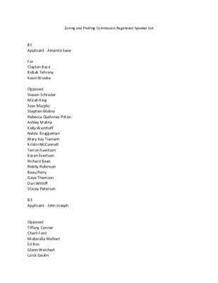
Zoning and Platting Commission Registered Speaker List B1 Applicant - Amanda Swor For Clayton Baca Bobak Tehrany Kevin Brooke Opposed Steven Schrader Micah King June Murphy Stephen Malina Rebecca Quiñonez-Piñón Ashley Malina Kelly Wamhoff Nelda Bruggeman Mary Kay Tiernam Kristin McConnell Terron Evertson Karen Evertson Richard Bean Robby Robinson Beau Perry Gaye Thomson Dan Wittliff Stacey Peterson B3 Applicant - John Joseph Opposed Tiffany Conner Charli Ford Mubaraka Malbari Ed Bos Glenn Weichert Loick Gaulin B4 / B5 Applicant - Dave Anderson Aneil Naik Cary Krier Keith Buchannan Tyler Boykin B-6 Way Atmadja
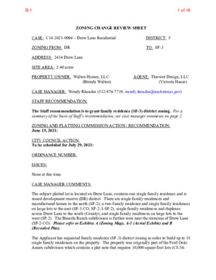
ZONING CHANGE REVIEW SHEET CASE: C14-2021-0094 – Drew Lane Residential ZONING FROM: DR ADDRESS: 2414 Drew Lane SITE AREA: 2.40 acres PROPERTY OWNER: Walton Homes, LLC (Brenda Walton) DISTRICT: 5 TO: SF-3 AGENT: Thrower Design, LLC (Victoria Haase) CASE MANAGER: Wendy Rhoades (512-974-7719, wendy.rhoades@austintexas.gov) STAFF RECOMMENDATION: The Staff recommendation is to grant family residence (SF-3) district zoning. For a summary of the basis of Staff’s recommendation, see case manager comments on page 2. ZONING AND PLATTING COMMISSION ACTION / RECOMMENDATION: June 15, 2021: CITY COUNCIL ACTION: To be scheduled for July 29, 2021: ORDINANCE NUMBER: ISSUES: None at this time. CASE MANAGER COMMENTS: The subject platted lot is located on Drew Lane, contains one single family residence and is zoned development reserve (DR) district. There are single family residences and manufactured homes to the north (SF-2); a two-family residence and single family residences on large lots to the east (SF-3-CO; SF-2; I-SF-2); single family residences and duplexes across Drew Lane to the south (County); and single family residences on large lots to the west (SF-2). The Bauerle Ranch subdivision is further west near the terminus of Drew Lane (SF-2-CO). Please refer to Exhibits A (Zoning Map), A-1 (Aerial Exhibit) and B (Recorded Plat). The Applicant has requested family residence (SF-3) district zoning in order to build up to 18 single family residences on the property. The property was originally part of the Ford Oaks Annex subdivision which contains a plat note that requires 10,000 square foot lots (C8-54- 1 of 16B-1 C14-2021-0089 Page 2 020). The plat restriction also applies to the west that front on Wommack Road and to the north that access Gail Road. In 1961, the subject property was resubdivided as Lot 2 of the Drew Lane Addition, and the Applicant intends to adhere to the lot size restriction in redevelopment of the property. BASIS OF RECOMMENDATION: 1. The proposed zoning should be consistent with the purpose statement of the district sought. The family residence (SF-3) district is the designation for a moderate density single-family residential use and a duplex use on a lot that is a minimum of 5,750 square feet. An SF-3 district designation may be applied to a use in an existing single-family neighborhood with moderate sized lots or to new development of family housing on lots that are 5,750 square feet or more. A duplex use that is designated in an SF-3 district …