ZONING CHANGE REVIEW SHEET CASE: C14-2021-0123 – 7900 South Congress ZONING FROM: DR; NO-CO TO: GR-MU-V-CO for Tract 1; DISTRICT: 2 CS-MU-V-CO for Tract 2, as amended ADDRESSES: 7809 Peaceful Hill Lane; 7713 and 7715 and Byrdhill Ln; 7604, 7900 and 7900 1/2 South Congress Avenue SITE AREA: 43.033 acres total Tract 1 – 11.844 acres; Tract 2 – 31.189 acres PROPERTY OWNERS: Agape Christian Ministries Austin, Inc. (Lawrence A. Wilkerson) – Tract 1 RDO Properties, LLC (Ron and Denise Ormand) – Tract 2 AGENT: Husch Blackwell (Nikelle Meade) CASE MANAGER: Wendy Rhoades (512-974-7719, wendy.rhoades@austintexas.gov) STAFF RECOMMENDATION: The Staff recommendation is to grant community commercial – mixed use – vertical mixed use building – conditional overlay (GR-MU-V-CO) combining district zoning for Tract 1 and general commercial services – mixed use – vertical mixed use building – conditional overlay (CS-MU-V-CO) combining district zoning for Tract 2. The Conditional Overlay is for the following items: 1) requires a 30-foot wide vegetative buffer along the western property line of Tract 1 (Peaceful Hill Lane); 2) prohibits vehicular access to Peaceful Hill Lane from Tract 1, except for the portion that will be dedicated as public right-of-way for the extension of Foremost Drive; 3) prohibits the following uses on Tract 1: Alternative financial services, Automotive rentals, Automotive repair services, Automotive sales, Automotive washing (of any type), Bail bond services, Business or trade school, Business support services, Drop-off recycling collection facility, Exterminating services, Food preparation, Funeral services, Hospital services (general), Hotel-motel, Indoor entertainment, Indoor sports and recreation, Outdoor entertainment, Outdoor sports and recreation, Pawn shop services, Research services, Service station, and Theater; 4) establishes the following conditional uses on Tract 1: Community recreation (private), Community recreation (public), Custom manufacturing, Medical offices (exceeding 5,000 square feet of gross floor area), and Hospital services (limited); 5) establishes that no more than 50 percent of all building facades shall be located between 30 feet and 75 feet of the western property line; 1 of 552 C14-2021-0123 Page 2 6) requires that at least 20 percent of all building facades shall be located more than 240 feet from the western property line; and 7) prohibits the following uses on Tract 2: alternative financial services, bail bond services, and pawn shop services. For a summary of the basis of Staff’s recommendation, see pages 2-4. The Restrictive Covenant includes all recommendations listed in the Traffic Impact Analysis memo, dated October 6, …
ZONING CHANGE REVIEW SHEET SITE AREA: 1.71 acres DISTRICT: 2 TO: SF-6 CASE: C14-2022-0135 – 5807 Ross Road ZONING FROM: DR ADDRESS: 5807 Ross Road OWNER / AGENT: Radhe Investment Group - RIG 11 Series (Ravi Thakkar) CASE MANAGER: Wendy Rhoades, wendy.rhoades@austintexas.gov; (512) 974-7719 STAFF RECOMMENDATION: The Staff recommendation is to grant townhouse and condominium residence (SF-6) district zoning. For a summary of the basis of Staff’s recommendation, see the Case Manager Comments section of this report. ZONING AND PLATTING ACTION / RECOMMENDATION: December 6, 2022: CITY COUNCIL ACTION: January 26, 2023: ORDINANCE NUMBER: ISSUES: None at this time. CASE MANAGER COMMENTS: The subject rezoning area consists of one unplatted, generally rectangular shaped tract and contains one vacant single family residence on the east side of Ross Road, approximately 700 feet south of the Pearce Lane / Ross Road intersection. The property is zoned development reserve (DR) district since annexation into the full purpose City limits in 1986. It is located just north of a narrow rectangular shaped “landscape area” lot on Sky Harbor Drive and south of platted lots within the Los Cielos subdivision. The rezoning area does not have access to Angel Drive, a cul-de-sac that terminates just to the north. Ross Road features single family residences on the east side (SF-4A; I-SF-4A) and low density residential and undeveloped properties on the west side (County). Please refer to Exhibits A (Zoning Map) and A-1 (Aerial Exhibit). The Applicant has requested townhouse and condominium residence (SF-6) district zoning in order to construct 16 residential units on the property, served by a cul-de-sac extending east 31 of 10 of Ross Road. The requested SF-6 zoning designation does allow for the clustering of the proposed units which would allow for more flexibility with the potential design and the maximization of common open space on-site. The district has a maximum building height of 35 feet and a maximum building cover of 40%. BASIS OF RECOMMENDATION: 1. The proposed zoning should be consistent with the purpose statement of the district sought. The townhouse & condominium (SF-6) district is the designation for a moderate density single-family residential, duplex, two-family, townhouse, or condominium use on a lot that is a minimum of 5,750 square feet. An SF-6 district designation may be applied to a use in an existing single-family or smaller multi-family residential neighborhood with moderately sized lots or to new development with lots that …
ZONING CHANGE REVIEW SHEET TO: GR-MU DISTRICT: 7 CASE: C14-2022-0153 (Sungold 1.51) ADDRESS: 13704 Ida Ridge Drive ZONING FROM: IP SITE AREA: 1.51 acres (65,775 sq. ft.) PROPERTY OWNER: SUNGOLD SM LLC (Arjun Demla) AGENT: Bennett Consulting (Rodney K. Bennett) CASE MANAGER: Sherri Sirwaitis (512-974-3057, sherri.sirwaitis@austintexas.gov) STAFF RECOMMEDATION: The staff recommendation is to grant GR-MU, Community Commercial Services- Mixed Use, Combining District zoning. ZONING AND PLATTING COMMISSION ACTION / RECOMMENDATION: December 6, 2022 CITY COUNCIL ACTION: ORDINANCE NUMBER: 41 of 11 ISSUES: N/A CASE MANAGER COMMENTS: The property in question is and undeveloped lot fronting onto Ida Ridge Drive. To the north, there are undeveloped lots and office and day care facility uses. To the south, there is a parking lot for a religious assembly use (New Life Church). Across Ida Ridge Drive to the east, there is an office complex and a concrete plant. The large lot to the west contains a shopping center (Market at Wells Branch) located at the corner of Burnet Road and W. Howard Lane. The applicant is requesting to down zone the property and to add a mixed-use overlay because they would like to develop approximately 69 multifamily units on the site. The staff is recommending GR-MU zoning at this location because the property is within an area that contains a mixture of residential and commercial uses. This site meets the intent of the GR, Community Commercial District, as it fronts onto a Level 3 (collector street/minor arterial) roadway and is near the intersection with a major arterial roadway, W. Howard Lane. GR-MU zoning would be consistent with the current GR-MU, GR-CO and GR zoning to the north and west of this site. The addition of the MU combining would provide more opportunities for the development of these lots with residential uses in support of the goals stated in the Imagine Austin Comprehensive Plan and the Strategic Housing Blueprint. The proposed zoning will create a transition from the commercial (GR, CS-1) zoning along Burnet Road/Mopac Expressway frontage road to the west to the office (GO) and multifamily (MF-3-CO) zoning across Ida Ridge Drive to the east. The applicant agrees with the staff recommendation. BASIS OF RECOMMENDATION: 1. The proposed zoning should be consistent with the purpose statement of the district sought. Community commercial (GR) district is the designation for an office or other commercial use that serves neighborhood and community needs and that generally …
ZAP DATE: 11/15/2022 SUBDIVISION REVIEW SHEET CASE NO.: C8J-2022-0129.1A SUBDIVISION NAME: Premier Logistics Park Subdivision AREA: 148.27 acres OWNER/APPLICANT: Premier Logistics Park, Inc. (Toby Rogers) AGENT: Parnell Engineering Inc. (Will Parnell) ADDRESS OF SUBDIVISION: 2900 ½ Ferguson Lane GRIDS: MN28 WATERSHED: Walnut Creek LOT(S): 7 COUNTY: Travis JURISDICTION: 2-Mile ETJ MUD: N/A EXISTING ZONING: N/A PROPOSED LAND USE: Industrial ADMINISTRATIVE WAIVERS: N/A VARIANCES: None SIDEWALKS: Sidewalks will be provided on all internal streets. DEPARTMENT COMMENTS: The request is for approval with conditions of Premier Logistics Park Subdivision consisting of 7 lots on 148.27 acres. Water and wastewater will be provided by the City of Austin. Staff recommends approval of the plat subject to the conditions listed in the attached comment report. After the conditions are met, the plat will comply with City of Austin Land Development Code, Chapter 30-2-84(B). The conditions include adding plat notes, showing a wetland boundary and adding a street table. These are administrative actions that require no discretionary review. An application that has been approved with conditions may be updated to address those conditions until the application expires and the plat does not need to be heard before the Commission again. STAFF RECOMMENDATION: The staff recommends approval with conditions of this subdivision. This plan meets all applicable County, State and City of Austin LDC requirements. ZONING AND PLATTING COMMISSION ACTION: 1 1 of 85 CASE MANAGER: Sarah Sumner Email address: sarah.sumner@traviscountytx.gov PHONE: 512-854-7687 2 2 of 85 SPRINKLE ROAD (60' R.O.W.) LOT 1 BLOCK A (INDUSTRIAL) RUNDBERG (R.O.W. VARIES) I ) S E R A V . . W O R ( . E N A L N O S U G R E F LOT 7 BLOCK D (INDUSTRIAL) LOT 6 BLOCK D (INDUSTRIAL) PREMIER LOGISTICS DRIVE (64' R.O.W.) LOT 5 BLOCK C (INDUSTRIAL) LOT 2 BLOCK B (INDUSTRIAL) MCCLAIN DRIVE (64' R.O.W.) ) . . W O R . ' I 4 6 ( E V R D L L E N R A P LOT 4 BLOCK C (INDUSTRIAL) LOT 3 BLOCK C (INDUSTRIAL) SHEET LAYOUT 1) OVERALL BOUNDARY 2) DETAIL WEST 3) DETAIL CENTRAL 4) DETAIL EAST 5) NOTES PREMIER LOGISTICS PARK SUBDIVISION Travis County, Texas A Limited Liability Company PO Box 90876, Austin Texas 78709 WWW.4WARDLS.COM (512) 537-2384 TBPLS FIRM #10174300 3 of 85 E T A M I X O R P P A N O I T A C …
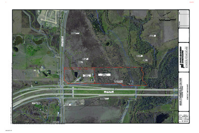
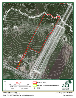
SITE PLAN REVIEW SHEET ENVIRONMENTAL VARIANCE REQUEST ONLY ZAP DATE: December 6, 2022 CASE: SP-2021-0446D PROJECT NAME: 8020 Parmer SH 130 NW APPLICANT: 8020 Parmer RD LLC AGENT: Pape-Dawson Engineers ADDRESS OF SITE: 8030 E Parmer Lane COUNTY: Travis WATERSHED: Gilleland Creek and Harris Branch EXISTING ZONING: ETJ PROPOSED DEVELOPMENT: The applicant is proposing multi-family housing with associated improvements. DESCRIPTION OF VARIANCES: The applicant is requesting the following: 1) Vary from LDC 25-8-342 to allow fill over 4 feet to 15 feet. 2) Vary from 25-8-261(G) to allow floodplain modification in a critical water quality zone buffer. STAFF RECOMMENDATION: The findings of fact have been met, and staff recommends approval for fill over 4 feet to 15 feet and floodplain modification in a critical water quality zone buffer, with the following conditions: JURISDICTION: ETJ AREA: 39 acres 1. The applicant will pay into the Riparian Zone Mitigation Fund for both the area of Zone 1 (Floodplain outside of the CWQZ) and the area of Zone 2 (Floodplain within the CWQZ) using the appropriate ratios per ECM 1.7.6. 2. Development of the site will be carried out as described in Exhibits 1-6, attached in the staff variance packet. ENVIRONMENTAL BOARD ACTION: June 1, 2022: With a 9-0 vote, the Environmental Commission recommends support of the request, with staff conditions. ENVIRONMENTAL REVIEW STAFF: DSD: Pamela Abee-Taulli Pamela.Abee-Taulli@austintexas.gov PHONE: 512-974-1879 CASE MANAGER: WPD: Miranda Reinhard Miranda.reinhard@austintexas.gov PHONE; 512-978-1537 Jennifer Bennett jennifer.bennett@austintexas.gov PHONE: 512-974-9002 1 of 2356 1 ENVIRONMENTAL COMMISSION MOTION 20220601 003c Date: June 1, 2022 Seconded by: Ana Aguirre Subject: 8020 Parmer Lane, SH 130 NW C8J-2021-0141.0A Motion by: Jennifer Bristol RATIONALE: WHEREAS, the Environmental Commission recognizes the applicant is requesting a variance from LDC 30- 5-342 to allow fill over 4 feet to 15 feet and to vary from 30-5-261(G) to allow floodplain modification in a critical water quality zone buffer; and WHEREAS, the Environmental Commission recognizes the site is located in the Gilleland Creek and Harris Branch Creek Watersheds, Suburban Classification, Desired Development Zone; and WHEREAS, the Environmental Commission recognizes that Staff recommends this variance, (with two staff conditions) having determined the required Findings of Fact have been met. THEREFORE, the Environmental Commission recommends the variance request with the following: Staff Conditions: 1. The applicant will pay into the Riparian Zone Mitigation Fund for both the area of Zone 1 (Floodplain outside of the CWQZ) and the area of Zone …
E N A L R E M R A P . E TEXAS 130 S A L L A D I H T R O W T R O F I N O T S U O H I O I N O T N A N A S I N I T S U A 1 1 7 4.8 5 2.4 1 5 I 9 5 7 8 7 X T TIN, S U A I 0 0 2 E T S 3, G D L B Y, P X E C A P O M N 1 0 8 0 1 1 0 8 8 2 0 0 1 # N O I T A R T S I G E R M R I F S L P B T I 0 7 4 # N O I T A R T S I G E R M R I F E P B T I I T B H X E P A M T X E T N O C / W N 0 3 1 H S R E M R A P 0 2 0 8 S A X E T , I N T S U A 01 OF 01 Backup page 13 of 18860 of 2356 EXHIBIT 5 – TOPOGRAPHIC MAPS Backup page 14 of 18861 of 2356 E N A L R E M R A P . E LEGEND LOC CWQZ 100YR CEF CEF X X OHE OHE W X W X S A L L A D I H T R O W T R O F I N O T S U O H I O I N O T N A N A S I N I T S U A 1 1 7 4.8 5 2.4 1 5 I 9 5 7 8 7 X T TIN, S U A I 0 0 2 E T S 3, G D L B Y, P X E C A P O M N 1 0 8 0 1 1 0 8 8 2 0 0 1 # N O I T A R T S I G E R M R I F S L P B T I 0 7 4 # N O I T A R T S I G E R M R I F E P B T I I T …
Well d x m . y h p a r g o p o T t f - 2 h t i w p a M l l e W d n a F E C _ 4 - 9 Q \ I R E _ 1 _ k s a t \ s p a m \ s i g \ I R E r e m r a P 0 2 0 8 4 7 1 - 0 2 - 5 3 \ s r e d l o F t c e j o r P \ P : CEF-1 ³ This map is intended for planning purposes only. All map data should be considered preliminary. All boundaries and designations are subject to confirmation. 400 200 DRAFT 0 400 Feet Subject Area Critical Environmental Features 1:4,800 1 inch = 400 feet Well 8020 East Parmer ERI Q9-4: CEF and Well Map with 2-ft Topography aci Project No.: 35-20-160 December 2020 Backup page 115 of 188162 of 2356 d x m . ) Z Q W C ( e n o Z y t i l a u Q r e t a W l a c i t i r C n i t s u A f o y t i C _ 5 - 9 Q \ I R E _ 1 _ k s a t \ s p a m \ s i g \ I R E r e m r a P 0 2 0 8 4 7 1 - 0 2 - 5 3 \ s r e d l o F t c e j o r P \ P : ³ This map is intended for planning purposes only. All map data should be considered preliminary. All boundaries and designations are subject to confirmation. 400 200 DRAFT 0 1:4,800 1 inch = 400 feet 400 Feet Subject Area Critical Water Quality Zone 8020 East Parmer ERI Q9-5: City of Austin Critical Water Quality Zone (CWQZ) aci Project No.: 35-20-174 December 2020 Backup page 116 of 188163 of 2356 d x m . s e n o Z d r a z a H d o o l F A M E F _ 6 - 9 Q \ I R E _ 1 _ k s a t \ s p a m \ s i g \ …
SUBDIVISION REVIEW SHEET LOT(S): 9 COUNTY: Travis (AJ Zorn) ZAP DATE: December 6, 2022 JURISDICTION: Limited Purpose AGENT: Carlson, Brigance, and Doering,Inc (Charles Brigance) CASE NO.: C8J-2021-0112 SUBDIVISION NAME: Easton Park Section Section 5A Preliminary Plan AREA: 58.63 acres OWNER/APPLICANT: Carma Easton, LLC ADDRESS OF SUBDIVISION: William Cannon and Hwy 183 GRIDS: L12 WATERSHED: North Fork Dry Creek EXISTING ZONING: Planned Unit Development (PUD) MUD PLAN: Pilot Knob MUD PROPOSED LAND USE: Multi-Family Residential, commercial, drainage/water quality, parkland and public ROW VARIANCES: None SIDEWALKS: Sidewalks will be provided along all internal streets and the boundary street. DEPARTMENT COMMENTS: The request is for the approval of the Easton Park Section 5A Preliminary Plan. The plan is comprised of 9 lots on 58.63 acres, proposing 2 multi-family residential lots, 3 commercial, 3 drainage/water quality, and 1 parkland lot. There is approximately 2,308 linear feet of right-of-way/streets. The property connects to William Cannon Road and Hwy 183. Sidewalks are proposed on all streets. The proposed lots comply with the PUD zoning requirements for use and lot size. Parkland will be in compliance with the PUD. Water and wastewater will be provided by the City of Austin. Staff recommends approval of the preliminary plan, subject to the conditions listed in the attached comment report. After the conditions are met, the plan will comply with LDC 30-2-84. The conditions include remove or update notes, update engineer’s report and drainage information, etc. These are administrative actions that require no discretionary review. An application that has been approved with conditions may be updated to address those conditions until the application expires and the plan does not need to be heard before the Commission again. STAFF RECOMMENDATION: Staff recommends approval of the preliminary plan, subject to the conditions listed in the comment report dated November 30, 2022 and attached as Exhibit C. CASE MANAGER: Sue Welch, Travis County Single Office Email address: Sue.Welch@traviscountytx.gov PHONE: 512-854-7637 1 of 147 Exhibit A: Easton Park 5A Preliminary Plan Exhibit B: Easton Park 5A Location Map Exhibit C: Easton Park 5A Preliminary Plan Comment Report 2 of 147 OOO13SHEETOFJOB NUMBERDATEFILE PATH:J:\AC3D\5367\dwg\PRELIMINARY\5367-PRELIMINARY PLAN.dwg - Sep 26, 2022 - 1:22pmDESIGNEDBY:DRAFTEDBY:BDFIRM ID #F3791Carlson, Brigance & Doering, Inc.CJOB NAME:PROJECT:SHEET NAME:Main Office5501 West William Cannon Dr.Austin, Texas 78749Phone No. (512) 280-5160Civil Engineering SurveyingNorth Office12129 RR 620 N., Ste. 600Austin, Texas 78750www.cbdeng.com5367EASTON PARK SECTION 5APRELIMINARY PLANCBCPJUNE 20213 of 147 2GENERAL NOTES3SHEETOFJOB NUMBERDATEFILE PATH:J:\AC3D\5367\dwg\PRELIMINARY\5367-PRELIMINARY PLAN.dwg - Sep 26, 2022 …
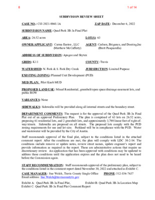
SUBDIVISION REVIEW SHEET LOT(S): 63 COUNTY: Travis AGENT: Carlson, Brigance, and Doering,Inc ZAP DATE: December 6, 2022 JURISDICTION: Limited Purpose (Brett Pasquarella) CASE NO.: C8J-2021-0048.1A SUBDIVISION NAME: Quad Park 3B-3a Final Plat AREA: 26.52 acres OWNER/APPLICANT: Carma Easton , LLC (Matthew McCafferty) ADDRESS OF SUBDIVISION: Apogee and Skytex GRIDS: K11 WATERSHED: N. Fork & S. Fork Dry Creek EXISTING ZONING: Planned Unit Development (PUD) MUD PLAN: Pilot Knob MUD PROPOSED LAND USE: Mixed Residential, greenbelt/open space/drainage easement lots, and public ROW VARIANCES: None SIDEWALKS: Sidewalks will be provided along all internal streets and the boundary street. DEPARTMENT COMMENTS: The request is for the approval of the Quad Park 3B-3a Final Plat out of an approved Preliminary Plan. The plan is comprised of 63 lots on 26.52 acres, proposing 61 residential lots, and 2 greenbelt lots, and approximately 3,790 linear feet of right-of- way/streets. Sidewalks are proposed on all streets. The proposed lots comply with the PUD zoning requirements for use and lot size. Parkland will be in compliance with the PUD. Water and wastewater will be provided by the City of Austin. Staff recommends approval of the final plat, subject to the conditions listed in the attached comment report. After the conditions are met, the plan will comply with LDC 30-2-84. The conditions include remove or update notes, review street names, update engineer’s report and provide information as required in the report. These are administrative actions that require no discretionary review. An application that has been approved with conditions may be updated to address those conditions until the application expires and the plan does not need to be heard before the Commission again. STAFF RECOMMENDATION: Staff recommends approval of the preliminary plan, subject to the conditions listed in the comment report dated November 30, 2022 and attached as Exhibit C. CASE MANAGER: Sue Welch, Travis County Single Office Email address: Sue.Welch@traviscountytx.gov Exhibit A: Quad Park 3B-3a Final Plat, Exhibit C: Quad Park 3B-3a Final Plat Comment Report PHONE: 512-854-7637 Exhibit B. Quad Park 3B-3a Location Map 1 of 148 COLTO N-BLUFF SPRIN GS ROAD E. W I L L I A M C A N N O N APOGEE BOULEVARD FINIAL DRIVE SITE C B D Carlson, Brigance & Doering, Inc. FIRM ID #F3791 REG. # 10024900 Civil Engineering Surveying 5501 West William Cannon Austin, Texas 78749 Phone No. (512) 280-5160 Fax No. (512) 280-5165 2 of 148 SANTIAGO DEL …
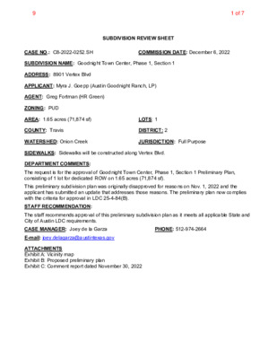
SUBDIVISION REVIEW SHEET CASE NO.: C8-2022-0252.SH COMMISSION DATE: December 6, 2022 SUBDIVISION NAME: Goodnight Town Center, Phase 1, Section 1 ADDRESS: 8901 Vertex Blvd APPLICANT: Myra J. Goepp (Austin Goodnight Ranch, LP) AGENT: Greg Fortman (HR Green) ZONING: PUD AREA: 1.65 acres (71,874 sf) LOTS: 1 COUNTY: Travis DISTRICT: 2 WATERSHED: Onion Creek JURISDICTION: Full Purpose SIDEWALKS: Sidewalks will be constructed along Vertex Blvd. DEPARTMENT COMMENTS: The request is for the approval of Goodnight Town Center, Phase 1, Section 1 Preliminary Plan, consisting of 1 lot for dedicated ROW on 1.65 acres (71,874 sf). This preliminary subdivision plan was originally disapproved for reasons on Nov. 1, 2022 and the applicant has submitted an update that addresses those reasons. The preliminary plan now complies with the criteria for approval in LDC 25-4-84(B). STAFF RECOMMENDATION: The staff recommends approval of this preliminary subdivision plan as it meets all applicable State and City of Austin LDC requirements. CASE MANAGER: Joey de la Garza PHONE: 512-974-2664 E-mail: joey.delagarza@austintexas.gov ATTACHMENTS Exhibit A: Vicinity map Exhibit B: Proposed preliminary plan Exhibit C: Comment report dated November 30, 2022 1 of 79 2 of 79 OWNER/DEVELOPER: ENGINEER: SURVEYOR: NOTES: AUSTIN GOODNIGHT RANCH, L.P. 610 W. 5TH ST. SUITE 601 AUSTIN, TEXAS 78701 (512) 472-7455 HR GREEN 4201 W. PARMER, SUITE C-100 AUSTIN, TEXAS 78727 (512) 872-6696 HR GREEN 5508 HIGHWAY 290 WEST, SUITE 150 AUSTIN, TEXAS 78735 (512) 872-6696 1. THIS SUBDIVISION IS WITHIN THE CITY OF AUSTIN'S FULL PURPOSE JURISDICTION. 2. GOODNIGHT TOWN CENTER PHASE 1, SECTION 1 PRELIMINARY PLAN CONTAINS 1.65 ACRES OF LAND. 3. 4. THIS PROJECT IS LOCATED WITHIN THE ONION CREEK WATERSHEDS (CLASSIFIED AS SUBURBAN) AND SHALL BE DEVELOPED, CONSTRUCTED AND MAINTAINED IN ACCORDANCE WITH THE GOODNIGHT RANCH PUD ORDINANCE (20061116-053 AND 20210930-134) AND CHAPTER 25 OF THE CODE OF THE CITY OF AUSTIN. THIS PROJECT IS NOT WITHIN THE EDWARDS AQUIFER RECHARGE ZONE AS DEFINED BY THE CITY OF AUSTIN. THIS PROJECT IS NOT WITHIN THE EDWARDS AQUIFER RECHARGE ZONE AS REGULATED BY THE TEXAS COMMISSION ON ENVIRONMENTAL QUALITY (TCEQ). GOODNIGHT TOWN CENTER PHASE 1, SECTION 1 PRELIMINARY PLAN AUSTIN, TEXAS LEGAL DESCRIPTION 1.65 ACRES OF LAND IN THE SANTIAGO DEL VALLE GRANT, ABSTRACT NO. 24, TRAVIS COUNTY, TEXAS TH A XT O N R D V A N B M T V A N B T M B T T B E S L A U G H T E …
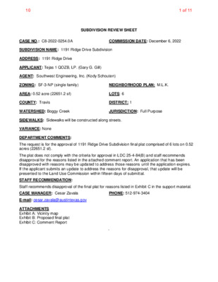
SUBDIVISION REVIEW SHEET CASE NO.: C8-2022-0254.0A COMMISSION DATE: December 6, 2022 SUBDIVISION NAME: 1191 Ridge Drive Subdivision ADDRESS: 1191 Ridge Drive APPLICANT: Tejas 1 QOZB, LP. (Gary G. Gill) AGENT: Southwest Engineering, Inc. (Kody Schouten) ZONING: SF-3-NP (single family) NEIGHBORHOOD PLAN: M.L.K. AREA: 0.52 acre (22651.2 sf) LOTS: 6 COUNTY: Travis DISTRICT: 1 WATERSHED: Boggy Creek JURISDICTION: Full Purpose SIDEWALKS: Sidewalks will be constructed along streets. VARIANCE: None DEPARTMENT COMMENTS: The request is for the approval of 1191 Ridge Drive Subdivision final plat comprised of 6 lots on 0.52 acres (22651.2 sf). The plat does not comply with the criteria for approval in LDC 25-4-84(B) and staff recommends disapproval for the reasons listed in the attached comment report. An application that has been disapproved with reasons may be updated to address those reasons until the application expires. If the applicant submits an update to address the reasons for disapproval, that update will be presented to the Land Use Commission within fifteen days of submittal. STAFF RECOMMENDATION: Staff recommends disapproval of the final plat for reasons listed in Exhibit C in the support material. CASE MANAGER: Cesar Zavala PHONE: 512-974-3404 E-mail: cesar.zavala@austintexas.gov ATTACHMENTS Exhibit A: Vicinity map Exhibit B: Proposed final plat Exhibit C: Comment Report ` 1 of 1110 Location Map 1191 Ridge Drive, Austin, Texas 78721 2 of 1110 0' 30' 60' LEGEND PROPERTY CORNER FOUND AS NOTED SET 1/2" ROD WITH ORANGE PLASTIC CAP RPLS 5367 SITE BOUNDARY ADJOINER PARCEL LINE RIGHT OF WAY LINE JUAE JOINT UTILITY/ACCESS EASEMENT SIDEWALK TO BE CONSTRUCTED PUE PUBLIC UTILITY EASEMENT WWE WASTE WATER EASEMENT 1191 RIDGE DRIVE SUBDIVISION 0.517 ACRE PARCEL BEING A PORTION OF LOTS 2 AND 3, SAM HUSTON HEIGHTS, ACCORDING TO THE MAP OR PLAT THEREOF FIELD FOR RECORD IN VOLUME 3, AT PAGE 249, PLATS RECORDS, TRAVIS COUNTY TEXAS (P.R.T.C.), CITY OF AUSTIN, COUNTY OF TRAVIS, STATE OF TEXAS ELNITA M. LEE DOC. NO. 2004233353 PART OF LOTS 1-3 SAM HUSTON HEIGHTS VOL. 03, PG. 249 LESLIE A. MARTINE DOC. NO. 2005144153 LOT 1, BREEDLOVE ADDITION VOL. 05, PG. 71 N 2 7 ° 2 5 ' 3 2 " W 1 3 1 . 9 2 ' POINT OF BEGINNING 1/2" IRON ROD W/ PLASTIC CAP MARKED "CAPLUGS B-14" COTTON SPINDLE 1/2" IRON ROD W/ PLASTIC CAP MARKED "DEAN WOODLEY" N 78°36'24" E 89.04' 3.85' PUE10' 4 3 . 9 6 ' 10' SANITARY SEWER EASEMENT …
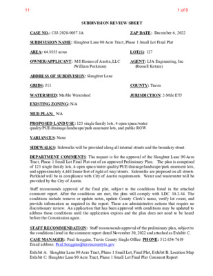
SUBDIVISION REVIEW SHEET LOT(S): 127 COUNTY: Travis JURISDICTION: 2-Mile ETJ ZAP DATE: December 6, 2022 (William Peckman) AGENT: LJA Engineering, Inc (Russell Kotara) CASE NO.: C8J-2020-0057.1A SUBDIVISION NAME: Slaughter Lane 90 Acre Tract, Phase 1 Small Lot Final Plat AREA: 64.8855 acres OWNER/APPLICANT: M/I Homes of Austin, LLC ADDRESS OF SUBDIVISION: Slaughter Lane GRIDS: J11 WATERSHED: Marble Watershed EXISTING ZONING: N/A MUD PLAN: N/A PROPOSED LAND USE: 123 single family lots, 4 open space/water quality/PUE/drainage/landscape/park easement lots, and public ROW VARIANCES: None SIDEWALKS: Sidewalks will be provided along all internal streets and the boundary street. DEPARTMENT COMMENTS: The request is for the approval of the Slaughter Lane 90 Acre Tract, Phase 1 Small Lot Final Plat out of an approved Preliminary Plan. The plan is comprised of 123 single family lots, 4 open space/water quality/PUE/drainage/landscape/park easement lots, and approximately 4,448 linear feet of right-of-way/streets. Sidewalks are proposed on all streets. Parkland will be in compliance with City of Austin requirements. Water and wastewater will be provided by the City of Austin. Staff recommends approval of the final plat, subject to the conditions listed in the attached comment report. After the conditions are met, the plan will comply with LDC 30-2-84. The conditions include remove or update notes, update County Clerk’s name, verify lot count, and provide information as required in the report. These are administrative actions that require no discretionary review. An application that has been approved with conditions may be updated to address those conditions until the application expires and the plan does not need to be heard before the Commission again. STAFF RECOMMENDATION: Staff recommends approval of the preliminary plan, subject to the conditions listed in the comment report dated November 30, 2022 and attached as Exhibit C. CASE MANAGER: Paul Scoggins, Travis County Single Office PHONE: 512-854-7619 Email address: Paul.Scoggins@traviscountytx.gov Exhibit A: Slaughter Lane 90 Acre Tract, Phase 1 Small Lot, Final Plat, Exhibit B. Location Map Exhibit C: Slaughter Lane 90 Acre Tract, Phase 1 Small Lot Final Plat Comment Report 1 of 911 2 of 911 CITY OF AUSTIN – TRAVIS COUNTY – SINGLE SUBDIVISION OFFICE SUBDIVISION APPLICATION – MASTER COMMENT REPORT UPDATE: PHONE #: U0 (512)854-7619 C8J-2020-0057.1A 00 Slaughter Ln 90 Ac Tract, Phase One 0-826 E SLAUGHTER LN CASE NUMBER: REVISION #: CASE MANAGER: Paul J. Scoggins PROJECT NAME: LOCATION: SUBMITTAL DATE: November 7, 2022 REPORT DUE DATE: November 28, 2022 FINAL REPORT …
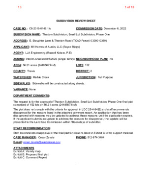
SUBDIVISION REVIEW SHEET CASE NO.: C8-2019-0146.1A COMMISSION DATE: December 6, 2022 SUBDIVISION NAME: Thaxton Subdivision, Small Lot Subdivision, Phase One ADDRESS: E. Slaughter Lane & Thaxton Road (TCAD Parcel: 0339010369) APPLICANT: M/I Homes of Austin, LLC (Royce Rippy) AGENT: LJA Engineering (Russell Kotara, P.E) ZONING: Interim-Annexed 8/8/2022 (single family) NEIGHBORHOOD PLAN: n/a AREA: 56.21 acres (2448507.6 sf) LOTS: 152 COUNTY: Travis DISTRICT: 2 WATERSHED: Marble Creek JURISDICTION: Full Purpose SIDEWALKS: Sidewalks will be constructed along streets. VARIANCE: None DEPARTMENT COMMENTS: The request is for the approval of Thaxton Subdivision, Small Lot Subdivision, Phase One final plat comprised of 152 lots on 56.21 acres (2448507.6 sf). The plat does not comply with the criteria for approval in LDC 25-4-84(B) and staff recommends disapproval for the reasons listed in the attached comment report. An application that has been disapproved with reasons may be updated to address those reasons until the application expires. If the applicant submits an update to address the reasons for disapproval, that update will be presented to the Land Use Commission within fifteen days of submittal. STAFF RECOMMENDATION: Staff recommends disapproval of the final plat for reasons listed in Exhibit C in the support material. CASE MANAGER: Cesar Zavala PHONE: 512-974-3404 E-mail: cesar.zavala@austintexas.gov ATTACHMENTS Exhibit A: Vicinity map Exhibit B: Proposed final plat Exhibit C: Comment Report ` 1 of 1313 2 of 1313 9/29/20229/29/2022C8-2019-0146.1ADETENTION REQUIREMENTS FOR ALL LOTS WITHIN THE THAXTON ROAD PRELIMINARY PLAN (C8J-2019-0146), INCLUDING THE DEVELOPMENT OF BLOCK C LOT 78 WITH 65% OFIMPERVIOUS COVER, WILL BE PROVIDED BY A PROPOSED DETENTION POND(S) IN THIS PHASE.22.3 of 1313 4 of 1313 5 of 1313 C8-2019-0146.1A6 of 1313 CITY OF AUSTIN SUBDIVISION APPLICATION – MASTER COMMENT REPORT U0 512-974-3404 Thaxton Subdivision, Phase One 8617-8924 THAXTON RD C8-2019-0146.1A CASE NUMBER: REVISION #: UPDATE: 00 CASE MANAGER: Cesar Zavala PHONE #: PROJECT NAME: LOCATION: SUBMITTAL DATE: November 7, 2022 REPORT DUE DATE: December 2, 2022 FINAL REPORT DATE: November 30, 2022 STAFF REPORT: This report includes all staff comments received to date concerning your most recent subdivision application submittal. The comments may include requirements, recommendations, or information. The requirements in this report must be addressed by an updated submittal. The subdivision application will be approved when all requirements from each review discipline have been addressed. If you have any questions, concerns or if you require additional information about this report, please contact your case manager at the phone number …
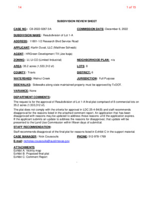
SUBDIVISION REVIEW SHEET CASE NO.: C8-2022-0267.0A COMMISSION DATE: December 6, 2022 SUBDIVISION NAME: Resubdivision of Lot 1-A ADDRESS: 11801-1/2 Research Blvd Service Road APPLICANT: Karlin Duval, LLC (Matthew Schwab) AGENT: HRGreen Development TX (Joe Isaja) ZONING: LI, LI-CO (Limited Industrial) NEIGHBORHOOD PLAN: n/a AREA: 35.2 acres (1,533,312 sf) LOTS: 8 COUNTY: Travis DISTRICT: 6 WATERSHED: Walnut Creek JURISDICTION: Full Purpose SIDEWALKS: Sidewalks along state maintained property must be approved by TxDOT. VARIANCE: None DEPARTMENT COMMENTS: The request is for the approval of Resubdivision of Lot 1-A final plat comprised of 8 commercial lots on 35.2 acres (1,533,312 sf). The plat does not comply with the criteria for approval in LDC 25-4-84(B) and staff recommends disapproval for the reasons listed in the attached comment report. An application that has been disapproved with reasons may be updated to address those reasons until the application expires. If the applicant submits an update to address the reasons for disapproval, that update will be presented to the Land Use Commission within fifteen days of submittal. STAFF RECOMMENDATION: Staff recommends disapproval of the final plat for reasons listed in Exhibit C in the support material. CASE MANAGER: Nick Coussoulis PHONE: 512-978-1769 E-mail: nicholas.coussoulis@austintexas.gov ATTACHMENTS Exhibit A: Vicinity map Exhibit B: Proposed final plat Exhibit C: Comment Report ` 1 of 1514 2 of 1514 3 of 1514 4 of 1514 5 of 1514 6 of 1514 CITY OF AUSTIN –DEVELOPMENT SERVICES DEPARTMENT SUBDIVISION APPLICATION – MASTER COMMENT REPORT CASE NUMBER: UPDATE: CASE MANAGER: C8-2022-0267.0A U0 Nicholas Coussoulis Email: Nicholas.Coussoulis@austintexas.gov PROJECT NAME: LOCATION: Resubdivision of Lot 1-A 11801-1/2 RESEARCH BLVD SVRD NB SUBMITTAL DATE: November 14, 2022 FINAL REPORT DATE: December 1, 2022 STAFF REPORT: This report includes all staff comments received to date concerning your most recent subdivision application submittal. The comments may include requirements, recommendations, or information. The requirements in this report must be addressed by an updated submittal. The subdivision application will be approved when all requirements from each review discipline have been addressed. If you have any questions, concerns or if you require additional information about this report, please contact your case manager at the phone number listed above or by using the contact information listed for each reviewer in this report. Any change to the plan/plat shall not cause noncompliance with any applicable code or criteria. In addition, any change to the plat may trigger new comments. UPDATE DEADLINE INFORMATION (LDC 25-4-56; …
ZONING & PLATTING COMMISSION AGENDA Tuesday, December 6, 2022 The Zoning and Platting Commission will convene at 6:00 PM on Tuesday, December 6, 2022 at Austin City Hall, Council Chambers, Room 1001 301 W. Second Street, Austin, TX. Some members of the Zoning and Platting Commission may be participating by videoconference. The meeting may be viewed online at: http://www.austintexas.gov/page/watch-atxn-live Cesar Acosta Nadia Barrera-Ramirez – Chair Scott Boone Ann Denkler – Parliamentarian Betsy Greenberg David King – Secretary Jolene Kiolbassa – Vice-Chair Hank Smith Lonny Stern Carrie Thompson Roy Woody EXECUTIVE SESSION (No public discussion) The Zoning & Platting Commission will announce it will go into Executive Session, if necessary, pursuant to Chapter 551 of the Texas Government Code, to receive advice from Legal Counsel on matters specifically listed on this agenda. The commission may not conduct a closed meeting without the approval of the city attorney. Private Consultation with Attorney – Section 551.071 PUBLIC COMMUNICATION The first four (4) speakers signed up prior to the speaker registration deadline will each be allowed a three-minute allotment to address their concerns regarding items not posted on the agenda. APPROVAL OF MINUTES 1. Approval of minutes from November 15, 2022. Attorney: Chrissy Mann, 512-974-2179 Commission Liaison: Andrew Rivera, 512-974-6508 PUBLIC HEARINGS 2. Rezoning: Location: C14-2021-0123 - 7900 South Congress; District 2 7809 Peaceful Hill Lane; 7713 and 7715 and Byrdhill Lane; 7604, 7900 & 7900 1/2 South Congress Avenue, South Boggy Creek Watershed Owner/Applicant: Agape Christian Ministries Austin, Inc. (Lawrence A. Wilkerson); RDO Agent: Request: Staff Rec.: Staff: Properties, LLC (Rob & Denise Ormand) Husch Blackwell LLP (Nikelle Meade) DR and NO-CO to GR-MU-V-CO for Tract 1; CS-MU-V-CO for Tract 2, as amended Recommended, with conditions Wendy Rhoades, 512-974-7719, wendy.rhoades@austintexas.gov Housing and Planning Department C14-2022-0135 - 5807 Ross Road; District 2 5807 Ross Road, Dry Creek East Watershed 3. Rezoning: Location: Owner/Applicant: Radhe Investment Group - RIG 11 Series (Ravi Thakkar) Request: Staff Rec.: Staff: DR to SF-6 Recommended Wendy Rhoades, 512-974-7719, wendy.rhoades@austintexas.gov Housing and Planning Department C14-2022-0153 - Sungold; District 7 13704 Ida Ridge Drive, Walnut Creek Watershed 4. Rezoning: Location: Owner/Applicant: SUNGOLD SM LLC (Arjun Demla) Agent: Request: Staff Rec.: Staff: Bennett Consulting (Rodney K. Bennett) IP to GR-MU Recommended Sherri Sirwaitis, 512-974-3057, sherri.sirwaitis@austintexas.gov Housing and Planning Department 5. Site Plan: Location: Staff Rec.: Staff: Owner/Applicant: BSREP III Decker Lane Agent: Request: SP-2021-0095C - Park 290 Logistics Center; District 1 9921 …
Vertical Mixed-Use (VMU) Update December 6, 2022 Zoning and Platting Commission Overview VMU Background VMU Participation Data VMU-2 Amendments Questions 2 Vertical Mixed-Use (VMU) Austin needs 135,000 new housing units by 2025 to keep pace with population growth The market is not providing adequate housing for low-income and moderate-income people Affordable housing is not equitably distributed throughout the city The cost to close the gap in low-income housing in Austin was estimated at over $11 billion in 2017 3 Vertical Mixed-Use (VMU) VMU is a voluntarydensity bonus program designed to generate community benefits through the use of development incentives. Development Incentive Community Benefit Adopted in 2010 – Included a one-time opt-in/opt-out process for neighborhood associations or neighborhood planning teams Applicable along 2010 “core transit corridors” – Connects housing and services to transit – May also include other roadways based on original neighborhood opt-in process Offers development incentives in exchange for community benefits – Improves flexibility for site development – Creates enhanced pedestrian environment – Regulates affordability – Support sustainable development patterns Site Development Flexibility Reduced Parking Requirement No FAR restrictions Additional Allowable Uses Regulated Affordability Heightened design standards Mix of land uses Active ground floor use 4 Our Toolkit • Local Funding • Federal Funding • Density Bonus • Fee Waivers • Regulations • Subsidize Affordable Housing • Incentivize (Affordable) Housing Current Density Bonus Programs • Citywide: – SMART Housing – Affordability Unlocked • Geographically Specific: • Downtown (+ Rainey) Density Bonus • East Riverside Corridor Regulating Plan • North Burnet Gateway Regulating Plan • Transit Oriented Development Regulating Plans • Plaza Saltillo, MLK, North Lamar/Airport • University Neighborhood Overlay • Vertical Mixed-Use (VMU) • Planned Unit Developments (PUD) 6 Key Strategies: • Market Austin’s 10-Year Affordable Housing Goals 135,000 Units in 10 Years Key Strategies: • Federal funding • Local funding Key Strategies: • Federal funding • Local funding • Density Bonus Programs Key Strategies: • Density Bonus Programs • Strike Fund • Other Incentives Key Strategies: • Strike Fund • LDC Revisions VMU Combining District Example Zoning String: CS-MU-V-CO-NP VMU-Zoned Sites Base Zones Description Max Height % of Sites Impervious Cover CS commercial services GR community commercial LO limited office neighborhood commercial general office neighborhood office LR GO NO 60ft 60ft 40ft 40ft 60ft 35ft 95% 90% 70% 80% 80% 60% 67% 18% 5% 5% 3% 1% …
Equitable Transit-Oriented Development ETOD Policy Plan Zoning and Platting Commission- December 2022 Purpose of the Plan Provide a comprehensive framework to help the Austin community ensure that future development around the Project Connect transit system supports residents of all incomes and backgrounds, especially those who have been disproportionately burdened by past transportation and land use decisions. ETOD Resolution 20210610-093 • Prioritization of equitable outcomes • Categorization of TODs by tiers using context-sensitive criteria • Anti-displacement strategies • Preservation of existing and creation of affordable housing • Creation of market-rate housing • Compact, connected and transit-supportive • Mix of land uses • Codify community benefits What is ETOD? TOD vs. Equitable TOD Why we are going from this.... To this! 4 The ETOD Team 5 Austin’s ETOD Journey Corridor Bond, ASMP, and Project Connect ETOD Study ETOD POLICY PLAN REGULATION AND IMPLEMENTATION Established corridors of Establishes protypes for TOD Recommendations for focus, mode split goals, that reflect Austin’s vision to planning prioritization, and procured funding for equitably share the benefits typologies, policy tools, high-capacity transit of transit investments for and next steps to project delivery. residents of all income levels, implement ETOD in Austin. to zoning. Could be and backgrounds. Adopt ETOD station area plans and code amendments that may include updates expanded to other geographies in the future. WE ARE HERE 2016 - 2020 2021 - 2022 2022 - 2023 2023 - onward 6 ETOD Study • $1.65 million in Federal Transit Administration (FTA) TOD planning grants • 98 stations across all Project Connect lines 1 2 Quantitative analysis of existing conditions within ½ mile of station areas Qualitative data collection through robust community engagement 7 Dashboard – Existing Conditions Dashboard Home Page Multifamily Inventory Total Jobs by Industry Station Tour Interactive Data : • Population • Displacement Risk • Jobs • Urban Fabric • Real Estate • Mobility s c i m a n y D s c i t s i r e t c a r a h c l a i c o S l a c i s y h P 8 8 Engagement Touchpoints Community Presentation Large format meetings to present project milestones CAC Working Group Briefings Monthly meetings, Ongoing guidance throughout project and major milestones Tabling/Intercept Surveys In-person events to target specific neighborhoods or demographics Focus Groups & One-on-ones Guided discussions with groups to identify vision and needs and to build consensus amongst …
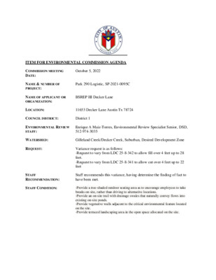
ITEM FOR ENVIRONMENTAL COMMISSION AGENDA COMMISSION MEETING DATE: October 5, 2022 NAME & NUMBER OF PROJECT: NAME OF APPLICANT OR ORGANIZATION: Park 290 Logistic, SP-2021-0095C BSREP III Decker Lane LOCATION: 11653 Decker Lane Austin Tx 78724 COUNCIL DISTRICT: District 1 ENVIRONMENTAL REVIEW STAFF: Enrique A Maiz-Torres, Environmental Review Specialist Senior, DSD, 512-974-3035 WATERSHED: Gilleland Creek/Decker Creek, Suburban, Desired Development Zone REQUEST: Variance request is as follows: -Request to vary from LDC 25-8-342 to allow fill over 4 feet up to 28 feet. -Request to vary from LDC 25-8-341 to allow cut over 4 feet up to 22 feet STAFF RECOMMENDATION: Staff recommends this variance, having determine the finding of fact to have been met. STAFF CONDITION: -Provide a tree-shaded outdoor seating area as to encourage employees to take breaks on-site, rather than driving to alternative locations. -Provide an on-site trail with drainage swales that naturally convey flows into existing on-site ponds. -Provide vegetative walls adjacent to the critical environmental feature located on the site. -Provide terraced landscaping area in the open space allocated on the site. Development Services Department Staff Recommendations Concerning Required Findings Park 290 Logistic (SP-2021-0095C) Watershed Protection Ordinance Project Name: Ordinance Standard: Variance Request: To allow cut over -4 feet up to -22 feet within the Desired Development Zone Include an explanation with each applicable finding of fact. A. Land Use Commission variance determinations from Chapter 25-8-41 of the City Code: 1. The requirement will deprive the applicant of a privilege available to owners of similarly situated property with approximately contemporaneous development subject to similar code requirements. Yes, The variance will not be providing a special privilege to the applicant. The proposed buildings are similar in size to similarly situated property. To facilitate this type of development, significant levelling is required to enhance maneuverability into loading docks, allowing trucks to operated safely on site following FFE standards. The building configuration and placement on the property was based on lot configuration, existing topography, and roadways connectivity. To meet all the above requirements cut and fill limits is necessary to create a level finished- floor elevation and level loading dock and to maintain drives at minimal grades for maneuverability. Therefore, by not allowing this variance would deprive the applicant of a privilege available to owner of similarly situated property. Example: Dalfen Industrial - (SP-2020-0407D), Applied Materials Logistic Service Center- (SP-2020-0321C), Crossroad Logistic Center- (SP-2021- 0015D) 2. The variance: a) …
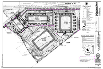
1 3 8 0 . 5 8 4 . 2 1 5 : T 0 2 3 E T U S I , Y P X E C A P O M . N 1 0 7 8 0 0 0 8 0 0 0 1 - S L M R F G N Y E V R U S I I . G E R X T I 9 6 4 - F M R F G N R E E N G N E I I . G E R X T 9 5 7 8 7 X T , I N T S U A R E T N E C S C I T S I G O L 0 9 2 K R A P E N A L R E K C E D 3 5 6 1 1 S A X E T , Y T N U O C S I V A R T , N I T S U A F O Y T I C C S E 1 E S A H P N O I T C U R T S N O C GENERAL NOTES: IF DISTURBED AREA IS NOT TO BE WORKED ON FOR MORE THAN 14 DAYS, DISTURBED AREA NEEDS TO BE STABILIZED BY REVEGETATION MATTING. [ECM 1.4.4.B.3, SECTION 5,1.] ENVIRONMENTAL INSPECTOR HAS THE AUTHORITY TO ADD AND/OR MODIFY EROSION/SEDIMENTATION CONTROLS ON SITE TO KEEP PROJECT IN-COMPLIANCE WITH THE CITY OF AUSTIN RULES AND REGULATIONS. [LDC 25-8-183] CONTRACTOR SHALL UTILIZE DUST CONTROL MEASURES DURING SITE CONSTRUCTION SUCH AS IRRIGATION TRUCKS AND MULCHING AS PER ECM 1.4.5(A), OR AS DIRECTED BY THE ENVIRONMENTAL INSPECTOR. THE CONTRACTOR WILL CLEAN UP SPOILS THAT MIGRATE ONTO THE ROADS A MINIMUM OF ONCE DAILY.” [ECM 1.4.4.D.4] PROJECT LOCATION TRAVIS COUNTY VICINITY MAP DESIGN DRAWN DATE SHEET NO. 19 SP-2021-0095C 1 3 8 0 . 5 8 4 . 2 1 5 : T 0 2 3 E T U S I , Y P X E C A P O M . N 1 0 7 8 0 0 0 8 0 0 0 1 - S L M R F G N Y E V R U S I I . G E R X T I 9 6 4 - F M R F G N R E E N G N E I I . G …
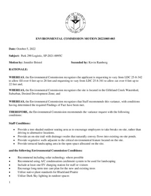
1 ENVIRONMENTAL COMMISSION MOTION 20221005-003 Date: October 5, 2022 Subject: Park 290 Logistic, SP-2021-0095C Motion by: Jennifer Bristol RATIONALE: Seconded by: Kevin Ramberg WHEREAS, the Environmental Commission recognizes the applicant is requesting to vary from LDC 25-8-342 to allow fill over 4 feet up to 28 feet and requesting to vary from LDC 25-8-341 to allow cut over 4 feet up to 22 feet and; WHEREAS, the Environmental Commission recognizes the site is located in the Gilleland Creek Watershed, Suburban, Desired Development Zone; and WHEREAS, the Environmental Commission recognizes that Staff recommends this variance, with conditions having determined the required Findings of Fact have been met. THEREFORE, the Environmental Commission recommends the variance request with the following conditions: Staff Conditions: • Provide a tree-shaded outdoor seating area as to encourage employees to take breaks on-site, rather than driving to alternative locations. • Provide an on-site trail with drainage swales that naturally convey flows into existing on-site ponds. • Provide vegetative walls adjacent to the critical environmental feature located on the site. • Provide terraced landscaping area in the open space allocated on the site. and the following Environmental Commission Conditions: • • • • • • Recommend including solar technology where possible Recommend using A/C condensation catchment system to be used for landscaping Include at least one EV charging station for staff or visitors Encourage long-term tree care plan for the new and existing trees Utilize native plant standards for Blackland Prairie Utilize Dark Sky lighting in outdoor spaces The applicant will work with staff and landscape architect to increase the number of trees on site by 50 additional trees beyond what is on the plan set to the maximum extent practicable per site condition availability. Incorporate plants that support pollinators. The applicant will work with staff to review the reflective glass product they have proposed to ensure it is reducing bird strikes onsite. VOTE 9-0 For: Aguirre, Bedford, Brimer, Bristol, Ramberg, Schiera, Scott, Thompson, and Qureshi Against: None Abstain: None Recuse: None Absent: Barrett Bixler and Nickells Approved By: Kevin Ramberg, Environmental Commission Chair • • • 2
From: To: Subject: Date: Wendy, Rhoades, Wendy Peaceful Hill Rezoning Sunday, December 4, 2022 4:40:19 PM *** External Email - Exercise Caution *** I'm writing on behalf of our adjacent neighbors just across South Boggy Creek. When the new apartments were approved at 7400 South Congress just beside my home at 301 Blackberry, we were able to keep the entry and exit to those new buildings channeled out onto South Congress, and avoided having our Blackberry connected as a through street to Congress to provide a rear access. I notice in the case of this new and otherwise similar apartment development just across the creek from us that Foremost is being planned as a through street in the name of "connectivity." It will completely change the existing character of the residential neighborhood if Foremost becomes a connector from Peaceful Hill all the way through to I- 35. Providing denser housing on public transit routes is a worthy goal, but changing the character of an existing neighborhood is a sacrilege, and should be avoided at all costs. The same is true of forcing an existing residential neighborhood to accept the presence of four story apartments towers over the current single story owner occupied private homes. Connectivity and denser housing are worthwhile goals, but not in the context of ruining the quality of life of people who have invested years of their earnings in a quiet and calm existence that will be destroyed by this proposed new group of dense apartments. Peaceful hill should be granted the same right to a deeply wooded set-back and no heavily traveled connector street that was afforded to our neighborhood just to the north of them by a few blocks. Please, be considerate. Thank you. ~Ed Miller CAUTION: This email was received at the City of Austin, from an EXTERNAL source. Please use caution when clicking links or opening attachments. If you believe this to be a malicious and/or phishing email, please forward this email to cybersecurity@austintexas.gov. From: To: Subject: Date: Rhoades, Wendy Peaceful Hill Rezoning Sunday, December 4, 2022 4:45:21 PM *** External Email - Exercise Caution *** Hello Wendy, I'm writing on behalf of our adjacent neighbors just across South Boggy Creek. When the new apartments were approved at 7400 South Congress just beside my home at 301 Blackberry, we were able to keep the entry and exit to those new buildings channeled out …