10 C8-2022-0254.0A - 1191 Ridge Drive Subdivision; District 1.pdf — original pdf
Backup
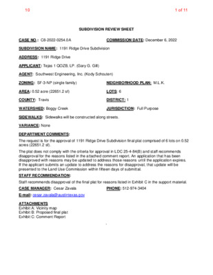
SUBDIVISION REVIEW SHEET CASE NO.: C8-2022-0254.0A COMMISSION DATE: December 6, 2022 SUBDIVISION NAME: 1191 Ridge Drive Subdivision ADDRESS: 1191 Ridge Drive APPLICANT: Tejas 1 QOZB, LP. (Gary G. Gill) AGENT: Southwest Engineering, Inc. (Kody Schouten) ZONING: SF-3-NP (single family) NEIGHBORHOOD PLAN: M.L.K. AREA: 0.52 acre (22651.2 sf) LOTS: 6 COUNTY: Travis DISTRICT: 1 WATERSHED: Boggy Creek JURISDICTION: Full Purpose SIDEWALKS: Sidewalks will be constructed along streets. VARIANCE: None DEPARTMENT COMMENTS: The request is for the approval of 1191 Ridge Drive Subdivision final plat comprised of 6 lots on 0.52 acres (22651.2 sf). The plat does not comply with the criteria for approval in LDC 25-4-84(B) and staff recommends disapproval for the reasons listed in the attached comment report. An application that has been disapproved with reasons may be updated to address those reasons until the application expires. If the applicant submits an update to address the reasons for disapproval, that update will be presented to the Land Use Commission within fifteen days of submittal. STAFF RECOMMENDATION: Staff recommends disapproval of the final plat for reasons listed in Exhibit C in the support material. CASE MANAGER: Cesar Zavala PHONE: 512-974-3404 E-mail: cesar.zavala@austintexas.gov ATTACHMENTS Exhibit A: Vicinity map Exhibit B: Proposed final plat Exhibit C: Comment Report ` 1 of 1110 Location Map 1191 Ridge Drive, Austin, Texas 78721 2 of 1110 0' 30' 60' LEGEND PROPERTY CORNER FOUND AS NOTED SET 1/2" ROD WITH ORANGE PLASTIC CAP RPLS 5367 SITE BOUNDARY ADJOINER PARCEL LINE RIGHT OF WAY LINE JUAE JOINT UTILITY/ACCESS EASEMENT SIDEWALK TO BE CONSTRUCTED PUE PUBLIC UTILITY EASEMENT WWE WASTE WATER EASEMENT 1191 RIDGE DRIVE SUBDIVISION 0.517 ACRE PARCEL BEING A PORTION OF LOTS 2 AND 3, SAM HUSTON HEIGHTS, ACCORDING TO THE MAP OR PLAT THEREOF FIELD FOR RECORD IN VOLUME 3, AT PAGE 249, PLATS RECORDS, TRAVIS COUNTY TEXAS (P.R.T.C.), CITY OF AUSTIN, COUNTY OF TRAVIS, STATE OF TEXAS ELNITA M. LEE DOC. NO. 2004233353 PART OF LOTS 1-3 SAM HUSTON HEIGHTS VOL. 03, PG. 249 LESLIE A. MARTINE DOC. NO. 2005144153 LOT 1, BREEDLOVE ADDITION VOL. 05, PG. 71 N 2 7 ° 2 5 ' 3 2 " W 1 3 1 . 9 2 ' POINT OF BEGINNING 1/2" IRON ROD W/ PLASTIC CAP MARKED "CAPLUGS B-14" COTTON SPINDLE 1/2" IRON ROD W/ PLASTIC CAP MARKED "DEAN WOODLEY" N 78°36'24" E 89.04' 3.85' PUE10' 4 3 . 9 6 ' 10' SANITARY SEWER EASEMENT BK. 1818, PG. 22 LOT 1, BLOCK 1 0.086 ACRES (3,757 SQ. FT.) N 78°40'38" E 89.08' LOT 2, BLOCK 1 0.086 ACRES (3,753 SQ. FT.) 4 3 . 8 4 ' 4 3 . 8 4 ' N 78°40'38" E 89.09' LOT 3, BLOCK 1 0.086 ACRES (3,753 SQ. FT.) R I D G E D R I V E ( 5 0 ' R . O . W . ) 4 3 . 8 4 ' N 2 7 ° 2 4 ' 3 N 78°40'38" E 89.10' LOT 4, BLOCK 1 0.086 ACRES (3,754 SQ. FT.) 8 " W 2 6 3 . 0 6 ' 4 3 . 8 4 ' GEORGE ALEX WHITE SR. DOC. NO. 5045718 LOT 8, BREEDLOVE ADDITION VOL. 05, PG. 71 8 2 . 9 9 ' 4 3 . 8 4 ' 5/8" IRON PIPE 15' PUE 4 3 . 8 4 ' S 2 7 ° 2 5 ' 3 DIANNA OLIVER SALAZAR AND CHESTER G. SALAZAR III DOC. NO. 2007036939 LOT 9, BREEDLOVE ADDITION VOL. 05, PG. 71 2 " E 2 6 1 3 1 . 4 3 . 3 1 ' 0 ' 4 3 . 8 4 ' 10' PUE N 78°40'38" E 89.12' LOT 5, BLOCK 1 0.086 ACRES (3,754 SQ. FT.) 4 3 . 8 4 ' 1/2" IRON ROD 10' PUE STEVEN AND JULIE DONIE DOC. NO. 2014030434 LOT 10, BREEDLOVE ADDITION VOL. 05, PG. 71 4 3 . 8 4 ' 10' PUE N 78°40'38" E 89.13' LOT 6, BLOCK 1 0.086 ACRES (3,761 SQ. FT.) 4 3 . 8 6 ' S 78°44'51" W 89.17' 15' PUE 3/4" IRON ROD 4 3 . 9 7 ' NOTHING FOUND FENCE CORNER POST BEARS S 81°20'33" W 1.9' AUSTIN RDP, LLC DOC. NO. 2016121315 LOT 3A-3 RESUBDIVISION OF LOT 3-A, G.R. OWENS, JR. SUBDIVISION DOC. NO. 200700296 25' JUAE & PUE 15' WWE, JUAE & PUE SCALE: 1"=30' DATE: 05/27/22 REV: C AFE NO: CLIENT NAME: TEJAS TIERRA 1 QOZB, LP SHEET: JOB NO.: T229005 REV. # REVISION DATE JOB NAME: 1191 RIDGE DR ADDRESS 8/03 COMMENTS - 08/11/2022 DRAWN: JAH CHK: DWC REVISED NOTE 24 - 09/08/2022 A B C REVISED PER CITY COMPLETENESS CHECK COMMENTS - 10/05/2022 Acklam, Inc. 133 S. 27th Avenue Brighton, CO 80601 11713 Shoreview Overlook Austin, TX 78732 Texas Firm#10194171 1 OF 2 FILE: T:\AUSTIN JOBS\2022\OTHERS\T229005 1191 RIDGE DR\DRAWINGS\T229005_1191 RIDGE DR SUBD (W-O PUE)_REV_C.DWG PLOTTED:Oct 05, 2022 4:38pm 3 of 1110 PLAT NOTES: UTILITY. 1. NO LOT SHALL BE OCCUPIED UNTIL THE STRUCTURE IS CONNECTED TO THE CITY OF AUSTIN WATER AND WASTEWATER UTILITY. 2. ELECTRIC SERVICE TO THIS SUBDIVISION SHALL BE PROVIDED BY AUSTIN ENERGY. 3. WATER / WASTEWATER SERVICE WILL BE PROVIDED BY THE CITY OF AUSTIN WATER & WASTEWATER 4. ALL STREETS, DRAINAGE, SIDEWALKS, EROSION CONTROL, AND WATER AND WASTEWATER LINES ARE REQUIRED TO BE CONSTRUCTED AND INSTALLED TO CITY OF AUSTIN STANDARDS. 5. PRIOR TO CONSTRUCTION ON LOTS IN THIS SUBDIVISION, DRAINAGE PLANS MUST BE SUBMITTED TO THE CITY OF AUSTIN FOR REVIEW. (RAINFALL-RUNOFF SHALL BE HELD TO THE AMOUNT EXISTING AT UNDEVELOPED STATUS BY PONDING OR OTHER APPROVED METHODS). 6. THE OWNER OF THIS SUBDIVISION, AND HIS OR HER SUCCESSORS AN ASSIGNS, ASSUMES RESPONSIBILITY FOR THE PLANS FOR CONSTRUCTION OF SUBDIVISION IMPROVEMENTS WHICH COMPLY WITH APPLICABLE CODES AND REQUIREMENTS OF THE CITY OF AUSTIN. THE OWNER UNDERSTANDS AND ACKNOWLEDGES THAT PLAT VACATION OR REPLATTING MAY BE REQUIRED, AT THE OWNER’S SOLE EXPENSE. IF PLANS TO CONSTRUCT THIS SUBDIVISION DO NOT COMPLY WITH SUCH CODES AND REQUIREMENTS. 7. BUILDING SETBACK LINES SHALL BE IN CONFORMANCE WITH CITY OF AUSTIN ZONING ORDINANCE REQUIREMENTS. 8. EROSION AND SEDIMENTATION CONTROLS ARE REQUIRED FOR ALL CONSTRUCTION ON EACH LOT, PURSUANT TO THE L.D.C. AND THE ENVIRONMENTAL CRITERIA MANUAL. 9. THIS SUBDIVISION SHALL BE DEVELOPED, CONSTRUCTED AND MAINTAINED IN ACCORDANCE WITH THE TERMS AND CONDITIONS OF CHAPTER 25 OF THE LAND DEVELOPMENT CODE. 10. THE WATER AND WASTEWATER UTILITY SYSTEM SERVING THIS SUBDIVISION MUST BE IN ACCORDANCE WITH THE CITY OF AUSTIN UTILITY DESIGN CRITERIA. THE WATER AND WASTEWATER UTILITY PLAN MUST BE REVIEWED AND APPROVED BY AUSTIN WATER. ALL WATER AND WASTEWATER CONSTRUCTION MUST BE INSPECTED BY THE CITY OF AUSTIN. THE LANDOWNER MUST PAY THE CITY INSPECTION FEE WITH THE UTILITY CONSTRUCTION. 11. BY APPROVING THIS PLAT, THE CITY OF AUSTIN ASSUMES NO OBLIGATION TO CONSTRUCT ANY INFRASTRUCTURE IN CONNECTION WITH THIS SUBDIVISION, ANY SUBDIVISION INFRASTRUCTURE REQUIRED FOR THE DEVELOPMENT OF THE LOTS IN THIS SUBDIVISION IS THE RESPONSIBILITY OF THE DEVELOPER AND / OR THE OWNERS OF THE LOTS. FAILURE TO CONSTRUCT ANY REQUIRED INFRASTRUCTURE TO CITY STANDARDS MAY BE JUST CAUSE FOR THE CITY TO DENY APPLICATIONS FOR CERTAIN DEVELOPMENT PERMITS, SITE PLAN APPROVALS AND / OR CERTIFICATES OF OCCUPANCY. 12. PUBLIC SIDEWALKS, BUILT TO THE CITY OF AUSTIN STANDARDS, ARE REQUIRED ALONG SHERWOOD ROAD AND FOREST WOOD DRIVE AS SHOWN BY A DOTTED LINE ON THE FACE OF THE PLAT. THE REQUIRED SIDEWALKS SHALL BE IN PLACE PRIOR TO THE LOT BEING OCCUPIED. FAILURE TO CONSTRUCT THE REQUIRED SIDEWALKS MAY RESULT IN THE WITHHOLDING OF CERTIFICATES OF OCCUPANCY, BUILDING PERMITS, OR UTILITY CONNECTIONS BY THE GOVERNING BODY OR UTILITY COMPANY. 13. PUBLIC SIDEWALKS, BUILT TO CITY OF AUSTIN STANDARDS, ARE REQUIRED ALONG THE FOLLOWING STREETS AND AS SHOWN BY A DOTTED LINE ON THE FACE OF THE PLAT: RIDGE DRIVE. THESE SIDEWALKS SHALL BE IN PLACE PRIOR TO THE LOTS BEING OCCUPIED. FAILURE TO CONSTRUCT THE REQUIRED SIDEWALKS MAY RESULT IN THE WITHHOLDING OF CERTIFICATES OF OCCUPANCY, BUILDING PERMITS, OR UTILITY CONNECTIONS BY THE GOVERNING BODY OR UTILITY COMPANY. 14. ALL RESTRICTIONS AND NOTES FROM THE PREVIOUS EXISTING SUBDIVISION, SAM HUSTON HEIGHTS, AS RECORDED IN VOLUME 3, PAGE 249, PLAT RECORDS, TRAVIS COUNTY, TEXAS, SHALL APPLY TO THIS RESUBDIVISION PLAT. 15. PRIOR TO CONSTRUCTION, EXCEPT DETACHED SINGLE FAMILY ON ANY LOT IN THIS SUBDIVISION, A SITE DEVELOPMENT PERMIT MUST BE OBTAINED FROM THE CITY OF AUSTIN. 16. A FEE-IN LIEU OF PARKLAND DEDICATION AND PARK DEVELOPMENT HAS BEEN PAID FOR SIX (6) RESIDENTIAL UNITS. 17. EACH SINGLE-FAMILY LOT IN A RESIDENTIAL SUBDIVISION MUST CONTAIN AT LEAST TWO TREES FOR SF4 ZONING AND THREE TREES FOR ALL OTHER SF ZONING. TREES MUST BE OF AT LEAST TWO DIFFERENT SPECIES LISTED IN ECM APPENDIX F. EACH TREE MUST HAVE A MINIMUM DIAMETER OF 2 INCHES AND EACH TREE MUST BE MAINTAINED IN ACCORDANCE WITH THE ECM. 18. AUSTIN ENERGY HAS THE RIGHT TO PRUNE AND TO REMOVE TREES, SHRUBBERY AND OTHER OBSTRUCTIONS TO THE EXTENT NECESSARY TO KEEP ALL ELECTRIC FACILITY EASEMENTS CLEAR. 19. THE SUBDIVISION OWNER MUST PROVIDE AUSTIN ENERGY WITH ANY EASEMENT AND ACCESS REQUIRED, IN ADDITION TO THOSE INDICATED, FOR THE INSTALLATION AND ONGOING MAINTENANCE OF OVERHEAD AND UNDERGROUND ELECTRIC FACILITIES TO PROVIDE ELECTRIC SERVICE TO THE DEVELOPMENT AND WILL NOT BE LOCATED SO AS TO CAUSE THE SITE TO BE OUT OF COMPLIANCE THE CITY OF AUSTIN LAND DEVELOPMENT CODE. 20. THE OWNER IS RESPONSIBLE FOR INSTALLATION OF TEMPORARY EROSION CONTROL, REVEGETATION AND TREE PROTECTION. IN ADDITION, THE OWNER IS RESPONSIBLE FOR THE PERFORMANCE OF ANY REQUIRED INITIAL TREE PRUNING AND TREE REMOVAL FOR VEGETATION THAT IS WITHIN TEN FEET OF THE CENTER LINE OF THE PROPOSED OVERHEAD ELECTRICAL FACILITIES DESIGNED TO PROVIDE ELECTRIC SERVICE TO THIS PROJECT. THE LIMITS OF CONSTRUCTION FOR THE OWNER'S PROJECT SHALL INCLUDE AUSTIN ENERGY'S WORK AREA. 21. THE PROPERTY OWNER IS RESPONSIBLE FOR MAINTAINING CLEARANCES REQUIRED BY THE NATIONAL ELECTRICAL SAFETY CODE, NATIONAL ELECTRICAL CODE, OSHA REGULATIONS, CITY OF AUSTIN RULES AND REGULATIONS AND TEXAS STATE LAWS PERTAINING TO CLEARANCES WHEN WORKING IN CLOSE PROXIMITY TO OVERHEAD POWER LINES AND EQUIPMENT. AUSTIN ENERGY WILL NOT RENDER ELECTRIC SERVICE UNLESS REQUIRED CLEARANCES ARE MAINTAINED. ALL COSTS INCURRED BY AE AS A RESULT OF AN OWNER'S FAILURE TO MAINTAIN REQUIRED CLEARANCES WILL BE CHARGED TO AND SHALL BE THE RESPONSIBILITY OF THE PROPERTY OWNER. 22. THIS SUBDIVISION PLAT WAS APPROVED AND RECORDED BEFORE THE CONSTRUCTION AND ACCEPTANCE OF STREETS AND OTHER SUBDIVISION IMPROVEMENTS. PURSUANT TO THE TERMS OF A SUBDIVISION CONSTRUCTION AGREEMENT BETWEEN THE SUBDIVIDER AND THE CITY OF AUSTIN, DATED , 20 , THE SUBDIVIDER IS RESPONSIBLE FOR THE CONSTRUCTION OF ALL STREETS AND FACILITIES NEEDED TO SERVE THE LOTS WITHIN THE SUBDIVISION. THIS RESPONSIBILITY MAY BE ASSIGNED IN ACCORDANCE WITH THE TERMS OF THAT AGREEMENT. FOR THE CONSTRUCTION AGREEMENT PERTAINING TO THIS SUBDIVISION, SEE THE SEPARATE INSTRUMENT RECORDED IN DOC#. , IN THE OFFICIAL PUBLIC RECORDS OF TRAVIS COUNTY, TEXAS. 23. ANY RELOCATION OF ELECTRIC FACILITIES SHALL BE AT LANDOWNER’S/DEVELOPER’S EXPENSE. 1191 RIDGE DRIVE SUBDIVISION 0.517 ACRE PARCEL BEING A PORTION OF LOTS 2 AND 3, SAM HUSTON HEIGHTS, ACCORDING TO THE MAP OR PLAT THEREOF FIELD FOR RECORD IN VOLUME 3, AT PAGE 249, PLATS RECORDS, TRAVIS COUNTY TEXAS (P.R.T.C.), CITY OF AUSTIN, COUNTY OF TRAVIS, STATE OF TEXAS PLAT NOTES: (CONTINUED) 24. A FULL RESIDENTIAL SPRINKLER SYSTEM DESIGNED, INSTALLED AND TESTED IN ACCORDANCE WITH THE 2019 NFPA 13D OR THE 2021 IRC P2904 STANDARDS WILL BE INSTALLED IN THIS PROPERTY. THE PLANS FOR THE SPRINKLER SYSTEM MUST BE DESIGNED AND INSTALLED BY A TEXAS LICENSED SPRINKLER CONTRACTOR FOR NFPA 13D SYSTEMS OR A TEXAS LICENSED PLUMBER WITH THE MULTIPURPOSE RESIDENTIAL FIRE PROTECTION SPRINKLER SPECIALIST (MRFPSS) ENDORSEMENT. THE SPRINKLER PLANS MUST BE SUBMITTED, REVIEWED, APPROVED, TESTED AND INSPECTED BY AFD PRIOR TO COVERING THE WALLS AND CEILINGS. A FLOW TEST OF THE MOST DEMANDING AREA WILL BE REQUIRED. 25. THE WATER AND/OR WASTEWATER EASEMENTS INDICATED ON THIS PLAT ARE FOR THE PURPOSE OF CONSTRUCTION, OPERATION, MAINTENANCE, REPAIR, REPLACEMENT, UPGRADE, DECOMMISSIONING AND REMOVAL OF WATER AND/OR WASTEWATER FACILITIES AND APPURTENANCES. NO OBJECTS, INCLUDING BUT NOT LIMITED TO, BUILDINGS, RETAINING WALLS, TREES OR OTHER STRUCTURES ARE PERMITTED IN WATER AND/OR WASTEWATER EASEMENTS EXCEPT AS APPROVED BY AUSTIN WATER. STATE OF TEXAS KNOW ALL MEN BY THESE PRESENTS COUNTY OF TRAVIS: THAT GARY G. GILL VICE PRESIDENT OF TEJAS 1 QOZB, LP., BEING OWNERS OF THAT 0.517 ACRE PARCEL SITUATED IN OUTLOTS 16 AND 17, DIVISION “B” OF THE OUTLOT OF THE CITY OF AUSTIN, BEING ALSO A PORTION OF LOTS 2 AND 3, SAM HUSTON HEIGHTS, ACCORDING TO THE MAP OR PLAT THEREOF FIELD FOR RECORD IN VOLUME 3, AT PAGE 249, PLATS RECORDS, TRAVIS COUNTY TEXAS (P.R.T.C.), MORE PARTICULARLY DESCRIBED BY METES AND BOUNDS AS FOLLOWS: BEGINNING AT A FOUND 1/2 INCH IRON ROD WITH PLASTIC CAP MARKED “CAPLUGS B-14”FOR THE NORTHEAST CORNER OF THIS 0.517 ACRE PARCEL, IN THE WEST LINE OF LOT 1, BREEDLOVE ADDITION, ACCORDING TO THE MAP OR PLAT THEREOF FIELD FOR RECORD IN VOLUME 5, AT PAGE 71, P.R.T.C., SAME BEING IN THE EAST LINE OF THAT PARCEL DESCRIBED IN WARRANTY DEED TO ELNITA M. LEE, FILED FOR RECORD AT DOCUMENT NO.2004233353, O.P.R.T.C., FROM WHICH A FOUND 5/8 INCH IRON ROD IN CONCRETE FOR THE NORTHWEST CORNER OF SAID LOT 1, SAME BEING THE NORTHEAST CORNER OF SAID LEE PARCEL BEARS NORTH 27°25'32" WEST A DISTANCE OF 131.95 FEET; THENCE SOUTH 27°25'32" EAST, ALONG THE WEST LINE OF SAID BREEDLOVE ADDITION, THE EAST LINE OF SAID LEE PARCEL AND THE EAST LINE OF THE HEREIN DESCRIBED PARCEL, PASSING AT A DISTANCE OF 3.85 FEET A FOUND COTTON SPINDLE FOR THE SOUTH CORNER OF SAID LOT 1 AND THE WEST CORNER OF LOT 8 OF SAID BREEDLOVE ADDITION, PASSING AT A DISTANCE OF 86.84 FEET A FOUND 5/8 INCH IRON PIPE FOR THE SOUTHWEST CORNER OF SAID LOT 8 AND THE WEST CORNER OF LOT 9 OF SAID BREEDLOVE ADDITION, PASSING AT A DISTANCE OF 201.15 FEET A FOUND 1/2 INCH IRON ROD FOR THE SOUTHWEST CORNER OF SAID LOT 9 AND THE WEST CORNER OF LOT 10 OF SAID BREED LOVE ADDITION AND CONTINUING FOR A TOTAL DISTANCE OF 263.30 FEET TO THE NORTH LINE OF LOT 3A-3, RESUBDIVISION OF LOT 3-1 G.R. OWENS, JR. ADDITION, ACCORDING TO THE MAP OR PLAT THEREOF FILED FOR RECORD AT DOCUMENT NO. 200700296, P.R.T.C. FOR THE SOUTHEAST CORNER OF THE HEREIN DESCRIBED PARCEL, AND THE SOUTHWEST CORNER OF SAID LOT 10, FROM WHICH A FOUND FENCE POST BEARS SOUTH 81°20’33” WEST A DISTANCE OF 1.9 FEET; THENCE SOUTH 78°44'51" WEST, ALONG THE NORTH LINE OF SAID LOT 3A-3, THE SOUTH LINE OF SAID LEE PARCEL AND THE SOUTH LINE OF THE HEREIN DESCRIBED PARCEL, A DISTANCE OF 89.17 FEET TO A FOUND 3/4 INCH IRON ROD FOUND IN THE EAST RIGHT OF WAY LINE OF RIDGE DRIVE, THE SOUTHWEST CORNER OF SAID LEE PARCEL AND THE SOUTHWEST CORNER OF THE HEREIN DESCRIBED PARCEL; THENCE NORTH 27°24'38" WEST, ALONG SAID RIGHT OF WAY LINE AND THE WEST LINE OF THE HEREIN DESCRIBED PARCEL, A DISTANCE OF 263.06 FEET TO A FOUND 1/2 INCH IRON ROD WITH PLASTIC CAP MARKED “DEAN WOODLEY” FOR THE NORTHWEST CORNER OF THE HEREIN DESCRIBED PARCEL; THENCE NORTH 78°36'24" EAST, DEPARTING SAID RIGHT OF WAY LINE AND ALONG THE NORTH LINE OF THE HEREIN DESCRIBED PARCEL, A DISTANCE OF 89.04 FEET TO THE POINT OF BEGINNING. CONTAINING 0.517 ACRES (22531 SQUARE FEET) OF LAND, MORE OR LESS. CONVEYED BY DEED OF RECORD, DOCUMENT NO. 2022032938, OFFICIAL PUBLIC RECORDS, TRAVIS COUNTY TEXAS (O.P.R.T.C.), DO HEREBY SUBDIVIDE 0.517 ACRES IN ACCORDANCE WITH THE MAP OR PLAT ATTACHED HERETO, TO BE KNOWN AS: 1191 RIDGE DRIVE SUBDIVISION AND DO HEREBY DEDICATE TO THE PUBLIC THE USE OF ALL STREETS AND EASEMENT SHOWN HEREON, SUBJECT TO ANY AND ALL EASEMENTS OR RESTRICTIONS HERETOFORE GRANTED AND NOT RELEASED. WITNESS MY HAND, THIS THE _________ DAY __________________ OF 20___, AD, _________________________________________ GARY G. GILL VICE PRESIDENT OF TEJAS 1 QOZB, LP. . T S Y R E L L I T A I R P O R T B L V D . 12TH ST. R I D D R G . E . E V A D O O W N E E R G . T S Y E N O L E D SUBJECT PROPERTY PENNSYLVANIA AVE. OAK SPRINGS DR. Y ST. TILLE R R ST. NTE U G VICINITY MAP N.T.S. THIS SUBDIVISION PLAT IS LOCATED WITHIN THE FULL PURPOSE JURISDICTION OF THE CITY OF AUSTIN ON THIS THE _________ DAY __________________ OF 20___, AD. APPROVED, ACCEPTED AND AUTHORIZED FOR RECORD BY THE DIRECTOR, DEVELOPMENT SERVICES DEPARTMENT, CITY OF AUSTIN, COUNTY OF TRAVIS, THIS THE _________ DAY __________________ OF 20___, AD, FOR: DENISE LUCAS, DIRECTOR DEVELOPMENT SERVICES DEPARTMENT APPLICATION DATE: / / 20 . STATE OF TEXAS COUNTY OF TRAVIS: I, DANA DEBEAUVOIR, CLERK OF TRAVIS COUNTY, TEXAS, DO HEREBY CERTIFY THAT THE FOREGOING INSTRUMENT OF WRITING AND ITS CERTIFICATE OF AUTHORIZATION WAS FILED FOR RECORD IN MY OFFICE ON THE _________ DAY __________________ OF 20___, AD, AT __________________, O'CLOCK, __.M., PLAT RECORDS OF SAID COUNTY AND STATE AS DOCUMENT NUMBER __________________, OFFICIAL PUBLIC RECORDS OF TRAVIS COUNTY. WITNESS MY HAND AND SEAL OF THE OFFICE OF THE COUNTY CLERK, THIS THE _________ DAY __________________ OF 20___, AD, DANA DEBEAUVOIR, COUNTY CLERK TRAVIS COUNTY, TEXAS DEPUTY . FILED FOR RECORD AT , O'CLOCK, .M., THIS THE _________ DAY __________________ OF 20 , AD, STATE OF TEXAS COUNTY OF _____________: BEFORE ME THE UNDERSIGNED AUTHORITY, ON THIS DAY PERSONALLY APPEARED GARY G. GILL, KNOWN TO ME TO BE THE PERSON WHOSE NAME IS SUBSCRIBED TO THE FOREGOING INSTRUMENT OR WRITING, ACKNOWLEDGED TO ME THAT THEY EXECUTED THE SAME FOR THE PURPOSES AND CONSIDERATIONS THEREIN EXPRESSED AND IN THE CAPACITY THEREIN STATED. WITNESS MY HAND AND SEAL OF OFFICE, THE _________ DAY __________________ OF 20___, AD, DANA DEBEAUVOIR , COUNTY CLERK TRAVIS COUNTY, TEXAS DEPUTY . NOTARY PUBLIC IN AND FOR ____________ COUNTY, TEXAS. _________________________________________ NOTARY SIGNATURE AND DATE MY COMMISSION EXPIRES _________________________________________ WITNESS MY HAND, THIS THE _________ DAY __________________ OF 20___, AD, JOB NO.: T229005 REV. # REVISION DATE SCALE: N/A DATE: 05/27/22 REV: C AFE NO: CLIENT NAME: TEJAS TIERRA 1 QOZB, LP SHEET: JOB NAME: 1191 RIDGE DR ADDRESS 8/03 COMMENTS - 08/11/2022 DRAWN: JAH CHK: DWC REVISED NOTE 24 - 09/08/2022 A B C REVISED PER CITY COMPLETENESS CHECK COMMENTS - 10/05/2022 Acklam, Inc. 133 S. 27th Avenue Brighton, CO 80601 11713 Shoreview Overlook Austin, TX 78732 Texas Firm#10194171 2 OF 2 FILE: T:\AUSTIN JOBS\2022\OTHERS\T229005 1191 RIDGE DR\DRAWINGS\T229005_1191 RIDGE DR SUBD (W-O PUE)_REV_C.DWG PLOTTED:Oct 05, 2022 4:38pm 4 of 1110 CITY OF AUSTIN –DEVELOPMENT SERVICES DEPARTMENT SUBDIVISION APPLICATION – MASTER COMMENT REPORT C8-2022-0254.0A U0 1191 Ridge Drive Subdivision 1191 Ridge Drive CASE NUMBER: UPDATE: CASE MANAGER: Cesar Zavala PHONE Email: cesar.zavala@austintexas.gov PROJECT NAME: LOCATION: SUBMITTAL DATE: November 7, 2022 FINAL REPORT DATE: December 1, 2022 STAFF REPORT: This report includes all staff comments received to date concerning your most recent subdivision application submittal. The comments may include requirements, recommendations, or information. The requirements in this report must be addressed by an updated submittal. The subdivision application will be approved when all requirements from each review discipline have been addressed. If you have any questions, concerns or if you require additional information about this report, please contact your case manager at the phone number listed above or by using the contact information listed for each reviewer in this report. Any change to the plan/plat shall not cause noncompliance with any applicable code or criteria. In addition, any change to the plat may trigger new comments. UPDATE DEADLINE INFORMATION (LDC 25-4-56; 25-4-82): All comments must be addressed by filing an updated submittal prior to the update deadline of February 6, 2023 . Otherwise, the application will expire. If this date falls on a weekend or City of Austin holiday, the next City of Austin workday will be the deadline. Extension of Review Period, Extension of Update Deadline and Tolling of Application Period do not apply to applications for preliminary plan, plat or subdivision construction plans (LDC 25-1-88; 25-1-89; 25-1- 90). UPDATE SUBMITTAL INSTRUCTIONS (LDC 25-1-83): 1. Applicants must make an appointment with Intake Staff (512-974-1770) in order to submit an update. 2. Your update must include the following items: a. This report b. The revised plat/plan in pdf format c. A letter that addresses each comment in the master comment report 3. Updates must be submitted on an approved submittal date, between the hours of 8:30 am and 4:00 pm. Refer to the submittal calendar for a list of approved submittal dates. REVIEWERS: Planner 1 : Chima Onyia 911 Addressing: Janny Phung ATD Engineering: Daniil Kontsevoy Austin Water Utility: Bradley Barron City Arborist: Taylor Horton Drainage Engineering: Kyle Virr Electric: Cody Shook PARD: Paul Books Site Plan Plumbing: Cory Harmon Subdivision: Cesar Zavala Water Quality: Kyle Virr 5 of 1110 PARD / Planning & Design Review - Paul Books - 512-974-9372 PR 1: The parkland dedication and park development fee is required (City Code 25-1-601) and must be paid prior to site plan approval (medium density fee for a project greater than 6 units per acre but less 12). This reviewer will issue the fee bill in AMANDA on a future update when the number of residential units is confirmed. Currently, the proposed unit count is 6. Please confirm. PR 2: Add the following note to the plat: Parkland dedication has been satisfied through payment of fee-lieu of land dedication and park development for six (6) units. Subdivision Review - Cesar Zavala - 512-974-3404 SR 1. This application was submitted on November 7, 2022, and is subject to the following deadlines (25-1-83; 30-1-113; 25-4-84; 30-2-84; 25-4-85): Update deadline: February 6, 2023 Fiscal due (if any): May 8, 2023 Recording due: May 31, 2023 SR 2. On the plat inside Lot 3, remove the dashed line. Or, annotate accordingly if the dashed line is showing an easement or other property feature. LDC 25-1-83, 30-1-113 SR 3. Add the case number on the lower right margin of each sheet, C8-2022-025.0A . LDC 25-1-83, 30-1-113 SR 4. Verify the scale on plat is correct to avoid amending the plat during the residential or site plan phases. LDC 25-1-83, 30-1-113 SR 5. Provide Lot Summary Table, the table should include lot acreages, square footage, and totals. LDC 25-1-83, 30-1-113 SR 6. On Sheet #2 of the plat, verify with City Arborist reviewer if plat Note # 17 is applicable. This property is zoned SF-3 with Cottage use. 25-1-83, 30-1-113: SR 7. Will the case require fiscal posting? If fiscal posting is needed remove Note #11. LDC 25-1-83, 30-1-113: SR 8. If fiscal is not posted for the case, delete Note # 22. LDC 25-1-83, 30-1-113: SR 9. Include a note on the plat that state the lots will have Cottage Use. LDC 25-1-83, 30-1-113: SR 10. Revise the Owner’s dedication statement as follows, list the owner first as shown on the current deed followed by individual representing the company or group. Remove the meets and bounds for the property, this information is not needed to approve the case. 25-1-83 (or 30-1-113), TX LGC 212.014 and 212.004(c) That (owner) being owner of (legal description of subject property, lot, block, subdivision) a subdivision of record in document No. XXX of the official public records of _______ County, Texas, conveyed by deed of record (vol/pg, instrument #) of the real property records of _______ County, Texas, and said subdivision having been approved for resubdivision pursuant to the public notification and hearing provisions of Chapter 212.014 of the Local Government Code, do hereby resubdivide (subject property) in accordance with the map or plat attached hereto, to be known as: 6 of 1110 (Name of resubdivision plat) And do hereby dedicate to the public the use of all streets and easement shown hereon, subject to any and all easements or restrictions heretofore granted and not released. SR 11. Add/revise the notary signature block as follows: 25-1-83 or 30-1-113 State of _________________ § County of _____________________ § Before me, the undersigned authority, a notary public in and for the State of ________________, on this day did personally appear _____________________________, known to be the person whose name is subscribed to the foregoing instrument and has acknowledged to me that they have executed the same for the purpose and consideration therein expressed and in the capacity therein stated. _____________________________________ _____________________ Notary Public – State of ______________ Date SR 12. Please add the following administrative approval block: 25-1-83, 30-1-113 APPROVED, ACCEPTED AND AUTHORIZED FOR RECORD BY THE DIRECTOR, DEVELOPMENT SERVICES DEPARTMENT, CITY OF AUSTIN, COUNTY OF TRAVIS, THIS THE ____ DAY OF _____________, 20__, AD. _________________________________________________ Cesar Zavala for: Denise Lucas, Director Development Services Department SR 13. Modify the recordation block as shown: 25-1-83, 30-1-113 STATE OF TEXAS COUNTY OF TRAVIS I, Dyana Limon-Mercado, Clerk of Travis County, Texas, do hereby certify that the foregoing instrument of writing and its certificate of authentication was filed for record in my office on the __ day of ___________, 20__, A.D., at ____ o’clock ___.M., duly recorded on the __ day of __________, 20__, A.D., at __o’clock __.M, of said County and State in Document Number _______________ of the Official Public Records of Travis County. Witness my hand and seal of the office of the county clerk, this the __ day of _____________ 20__, A.D. ___________________________________ Deputy, County Clerk Travis County, Texas SR 14. The case requires commission approval since the plat has five or more lots. Add the Land Use Commission approval block as follows 25-1-83 (or 30-1-113): Accepted and authorized for record by the Land Use Commission of the City of Austin, Texas, on this, the ______day of ______20__. ___________________________ ________________________ Chair Secretary SR 15. Add the engineer’s certification as follows, and include a signature line to provide signatures and seal.: ;25-1-83, 30-1-113: 7 of 1110 “I, (name of engineer), am authorized under the laws of the State of Texas to practice the profession of engineering and hereby certify that this plat is feasible from an engineering standpoint and complies with the engineering related portions of Title 25 of the City of Austin Land Development Code, and is true and correct to the best of my knowledge.” SR 16. Add the surveyor’s certification as follows, and include a signature line to provide signatures and seal.: 25-1-83, 30-1-113: “I, (name of surveyor), am authorized under the laws of the State of Texas to practice the profession of surveying and hereby certify that this plat complies with the surveying related portions of Title 25of the City of Austin Land Development Code, and is true and correct to the best of my knowledge, and was prepared from an actual on the ground survey of the property made under my direction and supervision.” SR 17. New or current tax certificates will be needed showing that property taxes are paid for the 2022 year if the plat is recorded after January 31, 2023. 25-1-83, 30-1-113: Contact the Intake group to verify application fees for the resubdivision. The plat is a resubdivision with commission approval and notice of approval. 25-1-83, 30-1-113: AW Utility Development Services - Bradley Barron - 512-972-0078 Per Utility Criteria Manual Section 2, §25-4, and the Uniform Plumbing Code: Replace note 1 with the following note: NO LOT SHALL BE OCCUPIED UNTIL THE STRUCTURE IS CONNECTED TO THE CITY OF AUSTIN WATER AND WASTEWATER UTILITY SYSTEM. Water Quality Review - Kyle Virr - 512-974-2538 Release of this application does not constitute a verification of all data, information, and calculations supplied by the applicant. The engineer of record is solely responsible for the completeness, accuracy, and adequacy of his/her submittal, whether or not the application is reviewed for code compliance by city engineers. WQ1: Provide a water quality plan using the assumed impervious cover as described in Land Development Code Section 25-8-64. Include all items specified in the Subdivision Application Packet, Page 17. WQ2: If payment in lieu is requested, please provide justification of Type 1 per ECM 1.6.4.B.1. Please also use the most current Appendix T form located online. You can email the completed form to this reviewer. https://www.austintexas.gov/department/stormwater-management WQ3: ECM 1.6.8 states, “On-site control of the two-year storm is achieved when the developed- conditions peak runoff rate leaving the site for a given drainage area is less than or equal to the existing-conditions runoff rate. The flow rates can be considered equal if the developed rate is no more than one-half (0.5) cfs greater than the existing rate or if the developed rate is no more than one-half (0.5) percent greater than the existing rate and there are no existing erosion problems downstream of the site” (LDC 25-7-61). Please provide compliance. City Arborist Review - Taylor Horton - 512-974-1218 DATE: 11/28/22 CA1 Not Cleared; Grading within the ½ CRZ of Heritage trees exceeds 4”. 8 of 1110 Removal of heritage trees is not allowed by code. Demonstrate compliance with LDC 25-8-641. Provide conceptual buildability exhibits for all lots with heritage trees. Include existing regulated trees shown with conceptual footprints, driveway, proposed grading, and all utilities required to serve each lot. CA2 Not Cleared; Grading within the ½ CRZ exceeds 4”. If Heritage trees will be impacted greater than what is required to be considered preserved (outlined below) then redesign or request a recommendation for a variance from LDC 25-8-641 through the Project Assessment process. The recommendation for a variance request is required for the subdivision application submittal to be considered complete. Trees proposed to be preserved must meet the following criteria: (1) a minimum of 50% of the critical root zone must be preserved at natural grade, with natural ground cover; (2) cut or fill is limited to 4 inches from the 1/2 critical root zone to the 1/4 critical root zone; and (3) no cut or fill is permitted within the 1/4 critical root zone. (4) No more than 25% of a tree’s canopy can be removed. Site Plan Plumbing - Juan Beltran - 512-972-2095 Pursuant to compliance with Sections 307.1, 609.6, and 721.1 of the 2021 Uniform Plumbing Code, add a plat note that conveys the following: Each Lot within this subdivision shall have separate sewer taps, separate water meters, and their respective private water and sewer service lines shall be positioned or located in a manner that will not cross lot lines. Drainage Engineering Review - Kyle Virr - 512-974-2538 Release of this application does not constitute a verification of all data, information, and calculations supplied by the applicant. The engineer of record is solely responsible for the completeness, accuracy, and adequacy of his/her submittal, whether or not the application is reviewed for code compliance by city engineers. DE1: DCM 1.2.2(D) states, “Stormwater runoff peak flow rates shall not be increased at any point of discharge from a site for the two (2), ten (10), twenty-five (25) and one hundred (100) year storm frequency events”. Please provide the information necessary to verify compliance. DE2: Provide detention pond details. Please show the elevations for the 2, 10, 25, and 100-year storm events in the detention pond and outlet structure details. DE3: DCM 8.3.4(G) states, “Detailed hydraulic design calculations shall be provided for all SWM ponds. Stage-discharge rating data shall be presented in tabular form with all discharge components, such as orifice, weir, and outlet conduit flows, clearly indicated. Stage-storage table shall also be provided. In all cases the effects of tailwater or other outlet control considerations should be included in the rating table calculations”. Please provide this table. DE4: Please provide an electronic copy of the model used for hydrologic engineering and planning for the site. DE5: Engineer's seal, signature and date required [LDC 25-7-62]. DE6: Add the following Floodplain Note [LDC 25-7-152]: "The 100 year floodplain is contained within the drainage easement(s) shown hereon. (No or A) portion of this tract is within the boundaries of the 100 year flood plain of any waterway that is within the limits of study of the Federal Flood Insurance Administration FIRM panel # _________________, dated ___________ for _____________________(name of city of county)." 9 of 1110 This must be certified by registered professional engineer. DE7: Fiscal arrangements are required for street, sidewalk, drainage, restoration, erosion controls and boundary street improvements [LDC 25-1-112]: In the City of Austin jurisdiction, fiscal surety is not collected for local streets and drainage. Please contact me to discuss what will need to be included in the fiscal estimate. Remember to include fiscal for sidewalks located next to greenbelts, open spaces, landscape areas, and other common areas. Please provide an engineer’s estimate of fiscal requirements for review and approval. Electric Review - Cody Shook - Cody.Shook@austinenergy.com EL 1. LDC § 25-4-132 - EASEMENTS AND ALLEYS. (A) Easements for public utilities and drainage ways shall be retained in all subdivisions in the widths and locations determined necessary by the director. All easements shall be dedicated to public use for the named purpose and shall be aligned to minimize construction and future maintenance costs. Source: § 13-2-421; Ord. 990225-70; Ord. 010607-8; Ord. 031211-11; Ord. 20131017-046 Ten-foot electric distribution, electric telecommunications, and electric fiber easement is required adjacent to Ridge Dr R.O.W. Show the easement(s) on the face of the plat. 911 Addressing Review - Janny Phung - janny.phung@austintexas.gov AD1: This plat review is rejected for the following: AD2: Please remove the punctuation marks in all streets in the vicinity map AD2: Please update label for E 12TH ST the directional E must be included NOTE: Punctuation or diacritical marks cause confusion for first responders The standards applied to all new street names in Travis County can be found at this link: http://www.austintexas.gov/sites/default/files/files/Information_Technology/911Addressing/Street_ Name_Standards.pdf §25-4-155 ATD Engineering Review – Daniil Kontsevoy – 512-978-1561 ATD 1. Please add the following note to the subdivision: Development of structures that require a building permit on this plat will be subject to the City of Austin Street Impact Fee as applicable prior to acquiring the building permit. ATD 2. The Building Permits for this final plat are required to comply with the City’s Street Impact Fee. The fee was adopted by City Council in December 2020 and is applicable to all Building Permits submitted on or after June 22, 2022. (For more information: https://www.austintexas.gov/department/street-impact-fee). Please complete a copy of the SIF worksheet and submit it for review via the TDS KNACK Portal: https://atd.knack.com/development-services#sif-worksheet-portal/. Once the SIF estimator worksheet is finalized ATD staff will use the worksheet to generate a SIF Formal Calculation 10 of 1110 Memo to summarize potential future payments, including applicable reductions and Offset Agreements. ATD 3. ASMP calls for 58 feet of right-of-way for RIDGE DR. Dedicate 29 feet of right-of-way from the existing centerline along RIDGE DR in accordance with the Austin Strategic Mobility Plan (ASMP) [LDC 25-6-51 and 25-6-55]. ATD 4. Per Engineering Summary Letter all 6 proposed lots will have access to Ridge Drive through individual or joint-use driveways. Please, show the joint use access easements on the plat (if proposed). A joint-use driveway used as alternative access for a single-family residential use may serve not more than eight dwelling units. LDC 25-6-451(C). Provide a plat not restricting the number of dwelling units accessing the single joint use access easement driveway. ATD 5. Remove the plat note # 12. The proposed lots do not abut SHERWOOD RD and FOREST WOOD DR. Environmental Review - Babatunde Daramola - 512-974-6316 Update 0 11/28/2022 Approved End of Report 11 of 1110