Play video — original link
Play video
Play video
JOINT INCLUSION COMMITTEE RECOMMENDATION 20221207-011: Leadership Appointments December 7, 2022 Date: Subject: Leadership Appointments Recommendation to Council WHEREAS, the Joint Inclusion Committee (“Committee”) of the City of Austin (“City”) advises City Council (“Council”) on issues pertaining to diversity and inclusion; and WHEREAS, the City’s Equity Office and Office of Police Oversight have leadership vacancies, which are in the in the early stages of being filled; and WHEREAS, these leadership positions oversee city departments responsible for building public trust and addressing issues related to quality of life, racial equity, human rights, police misconduct, community engagement, transparency, and accountability; and WHEREAS, the Committee views a rigorous community engagement effort, particularly with communities which are historically underrepresented, as essential to the hiring process for these leadership positions; NOW, THEREFORE, BE IT RESOLVED that the Committee recommends that City Council direct staff to incorporate the following considerations in the hiring process for the Equity Office and Office of Police Oversight leadership positions: • That community engagement be a priority in the hiring of candidates, • That community engagement occur early and throughout the hiring process rather than solely with the candidate finalists, • That the community engagement effort includes gathering input from underrepresented communities, and, • That the candidates pool be representative of the communities served by these Offices, • That candidates be assessed and selected based on their experience, track record, and performance related to issues surrounding gender and racial equity, diversity, and inclusion. 1 JOINT INCLUSION COMMITTEE RECOMMENDATIONS 20221207-011: ON LEADERSHIP APPOINTMENTS • Hanna Huang – Asian American Quality of Life Advisory Commission • Rebecca Austen – Commission for Women • Juan Vences-Benitez – Commission on Immigrant Affairs • Amy Temperley – Commission on Aging • Raul Alvarez – Early Childhood Council • Amanda Afifi – Hispanic/Latino Quality of Life Resource Advisory Commission • Idonna Griffith – Human Rights Commission • Charles Curry – LGBTQ+ Quality of Life Advisory Commission • Robin Orlowski – Mayor’s Committee for People with Disabilities • Gregory Smith/Serita Fontanesi – African American Resource Advisory Commission Attest: Jeremy Garza, Staff Liaison, Equity Office: X_____________________________12/07/2022 VOTE For: Against: None. Abstain: None. Absent: 2
4. 1 ENVIRONMENTAL COMMISSION MOTION 20221207-003 Seconded by: Perry Bedford To vary from LDC 25-8-301 to allow driveways on slopes over 15% To vary from LDC 25-8-341 to allow cut over 4 feet up to 8 feet To vary from LDC 25-8-342 to allow fill over 4 feet up to 20.5 feet Date: December 7, 2022 Subject: Oltorf Site Plan, SP-2021-0091C Motion by: Jennifer L. Bristol RATIONALE: WHEREAS, the Environmental Commission recognizes the applicant is requesting 1. 2. 3. WHEREAS, the Environmental Commission recognizes the site is located in the Country Club West Watershed, Suburban, Desired Development Zone; and WHEREAS, Environmental Commission understands there is an additional overlay that establishes business hours; and WHEREAS, the Environmental Commission recognizes that Staff recommends this variance with conditions, with staff conditions having determined the required findings of fact have been met. THEREFORE, the Environmental Commission recommends the variance request with the following: Staff Conditions 1. 2. Environmental Commission Conditions 1. Recommend use dark skies lighting that casts down to reduce light emitting into the adjacent properties, including the lighting for business signage. Minimize lighting during non-business hours while still meeting safety needs. Provide 8 additional trees at 3 caliper inches. Provide structural containment of fill with retaining walls. 2. Review site with staff to see if there is space to add additional trees. 3. Consider installing electric vehicle charging spaces for employees or as a business opportunity for the convince store proprietor. Install recycling stations for patrons and businesses on the property. Follow all commercial recycling requirements. Prohibit gasoline sales or gas station business on the property. 5. Consider adding native pollinator-friendly plants. 6. VOTE: 7-2 For: Bedford, Brimer, Bristol, Qureshi, Ramberg, Schiera, and Scott Against: Aguirre and Thompson Abstain: None Recuse: None Absent: Barrett Bixler and Nickells Approved By: Kevin Ramberg, Environmental Commission Chair 2
Play video
Play audio
Play audio
MACC Staff Report – 12/7/22 Website - Facebook - Virtual Programs SIGNATURE EVENT: Dia de los Muertos WWW.DAYOFTHEDEADATX.NET Nov 2- Presentation of the Altars- An intimate, culturally rooted celebration that emphasized the ofrendas (altars). 300 people attended including a group of Latino veterans, neighbors, and community elders. -Altar presentation by Mariana Nuño Ruiz McEnroe, author of the book Dining with the Dead -Limpias by Marika Alvarado, Lipan Apache healer -Performance by Austin Samba -Over 200 AVA art kits by help heal veterans/ Austin Veterans Arts Fest -Photography portraits by Roj Rodriguez -Free hot chocolate, pan de muerto, tamales -Many attendees brought notes, flowers, photocopies of photographs to add to the collective altar Nov 5, Large Scale Festival – A well-attended (3200 people!) multidisciplinary event with visual and performing arts. Live music and dance performances by El Combo Oscuro, Conjunto Los Oinkys with Susan Torres, Sergio Guerrero Family Tribute Band, Danza Azteca Guadalupana, Ballet Folklorico de Austin. Hosted by Lorena Placencia from Telemundo. -MexAmeriCon, Austin’s first Latinx Comic Book Convention (Comic Con) -Local Womxn of Color-centered marketplace Frida Friday ATX -Interactive Shadow Puppet Show by the Austin Public Library, -Sugar skull decorating & face painting by MACC Education -Sculpture Installations by Las Piñatas ATX / Latinos in Architecture -Loteria games, children’s face painting -Outreach fair with 12 local non-profits including Tejano Genealogy Society of Austin -4 food trucks plus food vendor in the concession stand NEW RESOURCE: “My MACC” “Welcome to My MACC, your guide to MACC programming while we are closed for construction!” www.MyMACC.org Browse, sort by location or program, updated daily. Locations for our programs and office www.MACCVirtual.org Watch our videos and online content including art galleries, performances, lessons Exhibits: December Events: Education: After School: Austin Studio Tours On display Nov 1- December 8 in the Sam Z Coronado Gallery Figuralo Youth Art Exhibit Will go live online on Dec 10th Access the artwork online at Smithsonian Learning Lab or www.MaccVirtual.org Groundbreaking Ceremony, Dec 10th PRESS RELEASE: ENGLISH/ SPANISH 9:30 am - Music by Daniel Llanes 9:50 am - Blessing of the Grounds - Daniel Llanes 10 am - Groundbreaking Speakers and Ceremony • MACC instructors: Cassie Smith, Vanessa Montano, and Donna Hoffman • Completed 2 month of programming • Group Site: Meadowbrook, Bouldin Creek, Santa Rita, Booker T. Washington • SmartKids Coordinators: Elvira Gutierrez • After School will run through spring semester • Dates: October 10 – May …
Commission for Women Working Group Membership Updated December 2022 Recognition of Equity for Women and Girls Priscilla Cortez Diana Melendez Quality of Life Study Rebecca Austen Diana Melendez Pam Rattan Josie Serrata Jocelyn Tau Rebecca Austen Vanessa Bissereth Flannery Bope Juliana Gonzales Jocelyn Tau FY2023-24 Budget To Be Assigned Desiree Bermea Neva Fernandez
Play audio
REGULAR MEETING of the MBE/WBE and Small Business Enterprise Procurement Program Advisory Committee Tuesday, December 6, 2022 at 5:30 p.m. City of Austin SMBR Office 811 Barton Springs Road, Suite 805 Austin, Texas 78704 Some members of this MBE/WBE Advisory Committee may be participating by videoconference. PUBLIC PARTICIPATION GUIDELINES The public will be allowed to speak at the Advisory Committee meeting remotely by phone or in-person at the address listed above. To participate remotely, speakers must register in advance with the board liaison before the registration deadline. Public Communication: General The first 10 speakers will be allowed to speak on any topic that is not posted on the agenda. The Committee Chair will call upon speakers at the beginning of the meeting. A person may not speak at general communication more often than once out of every three regularly scheduled committee meetings. Public Comment on Agenda Items Members of the public may speak on any item posted to the agenda. Speakers will be called upon when this agenda item is taken up by the Committee Chair. How to Register to Speak Remotely All speakers are required to register for remote participation. Registered speakers will be allowed 3 minutes to speak by telephone only. The deadline to register is at 12:00pm on the day before the meeting. To register to speak, email the board liaison, Nakia James at nakia.james@austintexas.gov before the deadline. Once registration closes, the board liaison will send all speakers an email to confirm registration, provide instructions on speaking at the meeting, and the number to call in on the day of the meeting. How to Sign-Up to Speak In-Person Speakers that would like to address the committee in person will be allowed to sign up until 15 minutes before the start of the meeting. Speakers will be allowed 3 minutes to speak. The City of Austin is committed to compliance with the American with Disabilities Act. Reasonable modifications and equal access to communications will be provided upon request. Meeting locations are planned with wheelchair access. If requiring Sign Language Interpreters or alternative formats, please give notice at least 2 days (48 hours) before the meeting date. Please contact Nakia James at (512) 974-9108 or nakia.james@austintexas.gov for additional information; TTY users route through Relay Texas at 711. For more information on the MBE/WBE and Small Business Procurement Program Advisory Committee, contact Nakia James at (512) 974-9108 or nakia.james@austintexas.gov. Page …
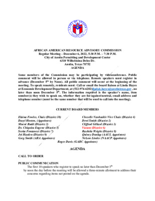
AFRICAN AMERICAN RESOURCE ADVISORY COMMISSION Regular Meeting – December 6, 2022, 5:30 P.M. – 7:30 P.M. City of Austin Permitting and Development Center 6310 Wilhelmina Delco Dr. Austin, Texas 78752 AGENDA Some members of the Commission may be participating by videoconference. Public comment will be allowed in person or via telephone. Remote speakers must register in advance (December 5th by Noon). All public comment will occur at the beginning of the meeting. To speak remotely, residents must: Call or email the board liaison at Linda Hayes at Economic Development Department, at (512-974-6282)lindak.hayes@austintexas,gov , no later than noon December 5th. The information required is the speaker’s name, item number(s) they wish to speak on, whether they are for/against/neutral, email address and telephone number (must be the same number that will be used to call into the meeting). CURRENT BOARD MEMBERS Cherelle Vanbrakle Vice Chair (District 4) Dewi Smith (District 1) Clifford Gillard (District 3) Vacant (District 6) Rashida Wright (District 8) Quincy Dunlap (AAUL Appointee) Nelson Linder (NAACP Appointee) Elaina Fowler, Chair (District 10) Daryl Horton, (Appointee) Mueni Rudd (District 2) Dr. Chiquita Eugene (District 5) Serita Fontanesi (District 7) Joi Harden (District 9) Greg Smith (ARA Appointee) CALL TO ORDER PUBLIC COMMUNICATION Roger Davis (GABC Appointee) AGENDA The first 10 speakers who register to speak no later than December 5th by noon the day before the meeting will be allowed a three-minute allotment to address their concerns regarding items not posted on the agenda. APPROVAL OF MINUTES – 1. November 15th meeting minutes DISCUCSSION AND POSSIBLE ACTION ITEMS 2. Michael Lofton President/CEO/Founder – African American Youth Harvest Foundation – providing an update on the Foundation. 3. Brie Franco Intergovernmental Relations Officer updates government relations 4. Florinda Bryant Program Coordinator, African American Cultural & Heritage Facility Cultural Art Division COA Economic Development Department - update on the facility and update on her process for FY23 5. Working groups Chair assignments 6. Retreat dates discussion WORKING GROUPS AND ASSIGNMENTS DISCUCSSION AND POSSIBLE ACTION ITEMS 7. Safety – Recommendation on being safe in our home, at work and in our African American Community 8. Economic Opportunity and Affordability – Recommendation on having economic opportunities and resources that enable us to thrive in our African American community 9. Health and Environment – Recommendations on enjoying a sustainable environment and a healthy life, physically and mentally as an African American 10. Culture and Lifelong Learning …
REGULAR MEETING of the URBAN TRANSPORTATION COMMISSION TUESDAY DECEMBER 6th 2022 at 5pm BOARDS AND COMMISSIONS ROOM 1101 CITY HALL- 301 W 2nd St, AUSTIN, TEXAS Some members of the Urban Transportation Commission may be participating by videoconference. The meeting may be viewed online at: http://www.austintexas.gov/page/watch- atxn-live. Public comment will be allowed in-person or remotely by telephone. Speakers may only register to speak on an item once either in-person or remotely and will be allowed up to three minutes to provide their comments. Registration no later than noon the day before the meeting is required for remote participation. To register please call or email the staff liaison in advance at (512) 978-1568 or Christopher.Parks@austintexas.gov by noon on Tuesday December 6th, with the following information: name, item number(s) to speak on, telephone number, and email address. CURRENT BOARD MEMBERS/COMMISSIONERS: Mario Champion, Chair Ruven Brooks Samuel Franco Allison Runas Diana Wheeler AGENDA CALL TO ORDER PUBLIC COMMUNICATION: GENERAL Susan Somers, Vice Chair Anali Martinez- Gonzalez Athena Leyton Cynthia Weatherby Cecilla Ramos The first 10 speakers signed up prior to the meeting being called to order will each be allowed a three-minute allotment to address their concerns regarding items not posted on the agenda. APPROVAL OF MINUTES Approve the minutes of the Urban Transportation Commission REGULAR MEETING on November 1st, 2022. 1. DISCUSSION AND ACTION ITEMS 2. Discussion and possible action on writing draft recommendations Facilitator: Mario Champion, UTC Chair BRIEFINGS 3. 4. 5. 6. 7. 8. Downtown Commission: Commissioner Cynthia Weatherby Joint Sustainability Commission: Commissioner Diana Wheeler Bicycle Advisory Council: Commissioner Athena Leyton Pedestrian Advisory Council: Commissioner Allie Runas City Council Mobility Committee: Commissioner Mario Champion Community Advisory Committee for Austin Transit Partnership Board: Susan Sommers FUTURE AGENDA ITEMS ADJOURNMENT The City of Austin is committed to compliance with the American with Disabilities Act. Reasonable modifications and equal access to communications will be provided upon request. Meeting locations are planned with wheelchair access. If requiring Sign Language Interpreters or alternative formats, please give notice at least 2 days (48 hours) before the meeting date. Please call Christopher Parks, at (512)-978-1568, for additional information; TTY users route through Relay Texas at 711 For more information on the Urban Transportation Department, please contact Christopher Parks at christopher.parks@austintexas.gov
ZONING CHANGE REVIEW SHEET CASE: C14-2021-0123 – 7900 South Congress ZONING FROM: DR; NO-CO TO: GR-MU-V-CO for Tract 1; DISTRICT: 2 CS-MU-V-CO for Tract 2, as amended ADDRESSES: 7809 Peaceful Hill Lane; 7713 and 7715 and Byrdhill Ln; 7604, 7900 and 7900 1/2 South Congress Avenue SITE AREA: 43.033 acres total Tract 1 – 11.844 acres; Tract 2 – 31.189 acres PROPERTY OWNERS: Agape Christian Ministries Austin, Inc. (Lawrence A. Wilkerson) – Tract 1 RDO Properties, LLC (Ron and Denise Ormand) – Tract 2 AGENT: Husch Blackwell (Nikelle Meade) CASE MANAGER: Wendy Rhoades (512-974-7719, wendy.rhoades@austintexas.gov) STAFF RECOMMENDATION: The Staff recommendation is to grant community commercial – mixed use – vertical mixed use building – conditional overlay (GR-MU-V-CO) combining district zoning for Tract 1 and general commercial services – mixed use – vertical mixed use building – conditional overlay (CS-MU-V-CO) combining district zoning for Tract 2. The Conditional Overlay is for the following items: 1) requires a 30-foot wide vegetative buffer along the western property line of Tract 1 (Peaceful Hill Lane); 2) prohibits vehicular access to Peaceful Hill Lane from Tract 1, except for the portion that will be dedicated as public right-of-way for the extension of Foremost Drive; 3) prohibits the following uses on Tract 1: Alternative financial services, Automotive rentals, Automotive repair services, Automotive sales, Automotive washing (of any type), Bail bond services, Business or trade school, Business support services, Drop-off recycling collection facility, Exterminating services, Food preparation, Funeral services, Hospital services (general), Hotel-motel, Indoor entertainment, Indoor sports and recreation, Outdoor entertainment, Outdoor sports and recreation, Pawn shop services, Research services, Service station, and Theater; 4) establishes the following conditional uses on Tract 1: Community recreation (private), Community recreation (public), Custom manufacturing, Medical offices (exceeding 5,000 square feet of gross floor area), and Hospital services (limited); 5) establishes that no more than 50 percent of all building facades shall be located between 30 feet and 75 feet of the western property line; 1 of 552 C14-2021-0123 Page 2 6) requires that at least 20 percent of all building facades shall be located more than 240 feet from the western property line; and 7) prohibits the following uses on Tract 2: alternative financial services, bail bond services, and pawn shop services. For a summary of the basis of Staff’s recommendation, see pages 2-4. The Restrictive Covenant includes all recommendations listed in the Traffic Impact Analysis memo, dated October 6, …
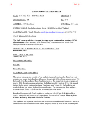
ZONING CHANGE REVIEW SHEET SITE AREA: 1.71 acres DISTRICT: 2 TO: SF-6 CASE: C14-2022-0135 – 5807 Ross Road ZONING FROM: DR ADDRESS: 5807 Ross Road OWNER / AGENT: Radhe Investment Group - RIG 11 Series (Ravi Thakkar) CASE MANAGER: Wendy Rhoades, wendy.rhoades@austintexas.gov; (512) 974-7719 STAFF RECOMMENDATION: The Staff recommendation is to grant townhouse and condominium residence (SF-6) district zoning. For a summary of the basis of Staff’s recommendation, see the Case Manager Comments section of this report. ZONING AND PLATTING ACTION / RECOMMENDATION: December 6, 2022: CITY COUNCIL ACTION: January 26, 2023: ORDINANCE NUMBER: ISSUES: None at this time. CASE MANAGER COMMENTS: The subject rezoning area consists of one unplatted, generally rectangular shaped tract and contains one vacant single family residence on the east side of Ross Road, approximately 700 feet south of the Pearce Lane / Ross Road intersection. The property is zoned development reserve (DR) district since annexation into the full purpose City limits in 1986. It is located just north of a narrow rectangular shaped “landscape area” lot on Sky Harbor Drive and south of platted lots within the Los Cielos subdivision. The rezoning area does not have access to Angel Drive, a cul-de-sac that terminates just to the north. Ross Road features single family residences on the east side (SF-4A; I-SF-4A) and low density residential and undeveloped properties on the west side (County). Please refer to Exhibits A (Zoning Map) and A-1 (Aerial Exhibit). The Applicant has requested townhouse and condominium residence (SF-6) district zoning in order to construct 16 residential units on the property, served by a cul-de-sac extending east 31 of 10 of Ross Road. The requested SF-6 zoning designation does allow for the clustering of the proposed units which would allow for more flexibility with the potential design and the maximization of common open space on-site. The district has a maximum building height of 35 feet and a maximum building cover of 40%. BASIS OF RECOMMENDATION: 1. The proposed zoning should be consistent with the purpose statement of the district sought. The townhouse & condominium (SF-6) district is the designation for a moderate density single-family residential, duplex, two-family, townhouse, or condominium use on a lot that is a minimum of 5,750 square feet. An SF-6 district designation may be applied to a use in an existing single-family or smaller multi-family residential neighborhood with moderately sized lots or to new development with lots that …
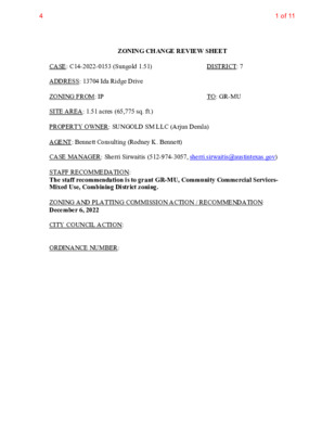
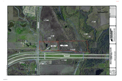
ZONING CHANGE REVIEW SHEET TO: GR-MU DISTRICT: 7 CASE: C14-2022-0153 (Sungold 1.51) ADDRESS: 13704 Ida Ridge Drive ZONING FROM: IP SITE AREA: 1.51 acres (65,775 sq. ft.) PROPERTY OWNER: SUNGOLD SM LLC (Arjun Demla) AGENT: Bennett Consulting (Rodney K. Bennett) CASE MANAGER: Sherri Sirwaitis (512-974-3057, sherri.sirwaitis@austintexas.gov) STAFF RECOMMEDATION: The staff recommendation is to grant GR-MU, Community Commercial Services- Mixed Use, Combining District zoning. ZONING AND PLATTING COMMISSION ACTION / RECOMMENDATION: December 6, 2022 CITY COUNCIL ACTION: ORDINANCE NUMBER: 41 of 11 ISSUES: N/A CASE MANAGER COMMENTS: The property in question is and undeveloped lot fronting onto Ida Ridge Drive. To the north, there are undeveloped lots and office and day care facility uses. To the south, there is a parking lot for a religious assembly use (New Life Church). Across Ida Ridge Drive to the east, there is an office complex and a concrete plant. The large lot to the west contains a shopping center (Market at Wells Branch) located at the corner of Burnet Road and W. Howard Lane. The applicant is requesting to down zone the property and to add a mixed-use overlay because they would like to develop approximately 69 multifamily units on the site. The staff is recommending GR-MU zoning at this location because the property is within an area that contains a mixture of residential and commercial uses. This site meets the intent of the GR, Community Commercial District, as it fronts onto a Level 3 (collector street/minor arterial) roadway and is near the intersection with a major arterial roadway, W. Howard Lane. GR-MU zoning would be consistent with the current GR-MU, GR-CO and GR zoning to the north and west of this site. The addition of the MU combining would provide more opportunities for the development of these lots with residential uses in support of the goals stated in the Imagine Austin Comprehensive Plan and the Strategic Housing Blueprint. The proposed zoning will create a transition from the commercial (GR, CS-1) zoning along Burnet Road/Mopac Expressway frontage road to the west to the office (GO) and multifamily (MF-3-CO) zoning across Ida Ridge Drive to the east. The applicant agrees with the staff recommendation. BASIS OF RECOMMENDATION: 1. The proposed zoning should be consistent with the purpose statement of the district sought. Community commercial (GR) district is the designation for an office or other commercial use that serves neighborhood and community needs and that generally …
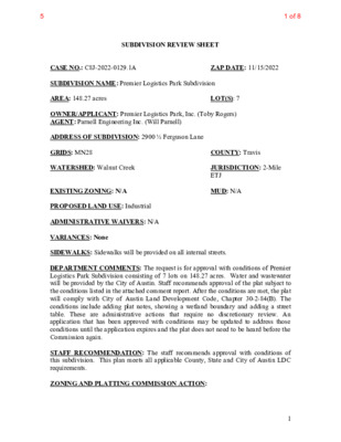
ZAP DATE: 11/15/2022 SUBDIVISION REVIEW SHEET CASE NO.: C8J-2022-0129.1A SUBDIVISION NAME: Premier Logistics Park Subdivision AREA: 148.27 acres OWNER/APPLICANT: Premier Logistics Park, Inc. (Toby Rogers) AGENT: Parnell Engineering Inc. (Will Parnell) ADDRESS OF SUBDIVISION: 2900 ½ Ferguson Lane GRIDS: MN28 WATERSHED: Walnut Creek LOT(S): 7 COUNTY: Travis JURISDICTION: 2-Mile ETJ MUD: N/A EXISTING ZONING: N/A PROPOSED LAND USE: Industrial ADMINISTRATIVE WAIVERS: N/A VARIANCES: None SIDEWALKS: Sidewalks will be provided on all internal streets. DEPARTMENT COMMENTS: The request is for approval with conditions of Premier Logistics Park Subdivision consisting of 7 lots on 148.27 acres. Water and wastewater will be provided by the City of Austin. Staff recommends approval of the plat subject to the conditions listed in the attached comment report. After the conditions are met, the plat will comply with City of Austin Land Development Code, Chapter 30-2-84(B). The conditions include adding plat notes, showing a wetland boundary and adding a street table. These are administrative actions that require no discretionary review. An application that has been approved with conditions may be updated to address those conditions until the application expires and the plat does not need to be heard before the Commission again. STAFF RECOMMENDATION: The staff recommends approval with conditions of this subdivision. This plan meets all applicable County, State and City of Austin LDC requirements. ZONING AND PLATTING COMMISSION ACTION: 1 1 of 85 CASE MANAGER: Sarah Sumner Email address: sarah.sumner@traviscountytx.gov PHONE: 512-854-7687 2 2 of 85 SPRINKLE ROAD (60' R.O.W.) LOT 1 BLOCK A (INDUSTRIAL) RUNDBERG (R.O.W. VARIES) I ) S E R A V . . W O R ( . E N A L N O S U G R E F LOT 7 BLOCK D (INDUSTRIAL) LOT 6 BLOCK D (INDUSTRIAL) PREMIER LOGISTICS DRIVE (64' R.O.W.) LOT 5 BLOCK C (INDUSTRIAL) LOT 2 BLOCK B (INDUSTRIAL) MCCLAIN DRIVE (64' R.O.W.) ) . . W O R . ' I 4 6 ( E V R D L L E N R A P LOT 4 BLOCK C (INDUSTRIAL) LOT 3 BLOCK C (INDUSTRIAL) SHEET LAYOUT 1) OVERALL BOUNDARY 2) DETAIL WEST 3) DETAIL CENTRAL 4) DETAIL EAST 5) NOTES PREMIER LOGISTICS PARK SUBDIVISION Travis County, Texas A Limited Liability Company PO Box 90876, Austin Texas 78709 WWW.4WARDLS.COM (512) 537-2384 TBPLS FIRM #10174300 3 of 85 E T A M I X O R P P A N O I T A C …
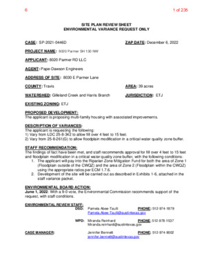
SITE PLAN REVIEW SHEET ENVIRONMENTAL VARIANCE REQUEST ONLY ZAP DATE: December 6, 2022 CASE: SP-2021-0446D PROJECT NAME: 8020 Parmer SH 130 NW APPLICANT: 8020 Parmer RD LLC AGENT: Pape-Dawson Engineers ADDRESS OF SITE: 8030 E Parmer Lane COUNTY: Travis WATERSHED: Gilleland Creek and Harris Branch EXISTING ZONING: ETJ PROPOSED DEVELOPMENT: The applicant is proposing multi-family housing with associated improvements. DESCRIPTION OF VARIANCES: The applicant is requesting the following: 1) Vary from LDC 25-8-342 to allow fill over 4 feet to 15 feet. 2) Vary from 25-8-261(G) to allow floodplain modification in a critical water quality zone buffer. STAFF RECOMMENDATION: The findings of fact have been met, and staff recommends approval for fill over 4 feet to 15 feet and floodplain modification in a critical water quality zone buffer, with the following conditions: JURISDICTION: ETJ AREA: 39 acres 1. The applicant will pay into the Riparian Zone Mitigation Fund for both the area of Zone 1 (Floodplain outside of the CWQZ) and the area of Zone 2 (Floodplain within the CWQZ) using the appropriate ratios per ECM 1.7.6. 2. Development of the site will be carried out as described in Exhibits 1-6, attached in the staff variance packet. ENVIRONMENTAL BOARD ACTION: June 1, 2022: With a 9-0 vote, the Environmental Commission recommends support of the request, with staff conditions. ENVIRONMENTAL REVIEW STAFF: DSD: Pamela Abee-Taulli Pamela.Abee-Taulli@austintexas.gov PHONE: 512-974-1879 CASE MANAGER: WPD: Miranda Reinhard Miranda.reinhard@austintexas.gov PHONE; 512-978-1537 Jennifer Bennett jennifer.bennett@austintexas.gov PHONE: 512-974-9002 1 of 2356 1 ENVIRONMENTAL COMMISSION MOTION 20220601 003c Date: June 1, 2022 Seconded by: Ana Aguirre Subject: 8020 Parmer Lane, SH 130 NW C8J-2021-0141.0A Motion by: Jennifer Bristol RATIONALE: WHEREAS, the Environmental Commission recognizes the applicant is requesting a variance from LDC 30- 5-342 to allow fill over 4 feet to 15 feet and to vary from 30-5-261(G) to allow floodplain modification in a critical water quality zone buffer; and WHEREAS, the Environmental Commission recognizes the site is located in the Gilleland Creek and Harris Branch Creek Watersheds, Suburban Classification, Desired Development Zone; and WHEREAS, the Environmental Commission recognizes that Staff recommends this variance, (with two staff conditions) having determined the required Findings of Fact have been met. THEREFORE, the Environmental Commission recommends the variance request with the following: Staff Conditions: 1. The applicant will pay into the Riparian Zone Mitigation Fund for both the area of Zone 1 (Floodplain outside of the CWQZ) and the area of Zone …
E N A L R E M R A P . E TEXAS 130 S A L L A D I H T R O W T R O F I N O T S U O H I O I N O T N A N A S I N I T S U A 1 1 7 4.8 5 2.4 1 5 I 9 5 7 8 7 X T TIN, S U A I 0 0 2 E T S 3, G D L B Y, P X E C A P O M N 1 0 8 0 1 1 0 8 8 2 0 0 1 # N O I T A R T S I G E R M R I F S L P B T I 0 7 4 # N O I T A R T S I G E R M R I F E P B T I I T B H X E P A M T X E T N O C / W N 0 3 1 H S R E M R A P 0 2 0 8 S A X E T , I N T S U A 01 OF 01 Backup page 13 of 18860 of 2356 EXHIBIT 5 – TOPOGRAPHIC MAPS Backup page 14 of 18861 of 2356 E N A L R E M R A P . E LEGEND LOC CWQZ 100YR CEF CEF X X OHE OHE W X W X S A L L A D I H T R O W T R O F I N O T S U O H I O I N O T N A N A S I N I T S U A 1 1 7 4.8 5 2.4 1 5 I 9 5 7 8 7 X T TIN, S U A I 0 0 2 E T S 3, G D L B Y, P X E C A P O M N 1 0 8 0 1 1 0 8 8 2 0 0 1 # N O I T A R T S I G E R M R I F S L P B T I 0 7 4 # N O I T A R T S I G E R M R I F E P B T I I T …
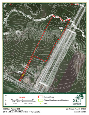
Well d x m . y h p a r g o p o T t f - 2 h t i w p a M l l e W d n a F E C _ 4 - 9 Q \ I R E _ 1 _ k s a t \ s p a m \ s i g \ I R E r e m r a P 0 2 0 8 4 7 1 - 0 2 - 5 3 \ s r e d l o F t c e j o r P \ P : CEF-1 ³ This map is intended for planning purposes only. All map data should be considered preliminary. All boundaries and designations are subject to confirmation. 400 200 DRAFT 0 400 Feet Subject Area Critical Environmental Features 1:4,800 1 inch = 400 feet Well 8020 East Parmer ERI Q9-4: CEF and Well Map with 2-ft Topography aci Project No.: 35-20-160 December 2020 Backup page 115 of 188162 of 2356 d x m . ) Z Q W C ( e n o Z y t i l a u Q r e t a W l a c i t i r C n i t s u A f o y t i C _ 5 - 9 Q \ I R E _ 1 _ k s a t \ s p a m \ s i g \ I R E r e m r a P 0 2 0 8 4 7 1 - 0 2 - 5 3 \ s r e d l o F t c e j o r P \ P : ³ This map is intended for planning purposes only. All map data should be considered preliminary. All boundaries and designations are subject to confirmation. 400 200 DRAFT 0 1:4,800 1 inch = 400 feet 400 Feet Subject Area Critical Water Quality Zone 8020 East Parmer ERI Q9-5: City of Austin Critical Water Quality Zone (CWQZ) aci Project No.: 35-20-174 December 2020 Backup page 116 of 188163 of 2356 d x m . s e n o Z d r a z a H d o o l F A M E F _ 6 - 9 Q \ I R E _ 1 _ k s a t \ s p a m \ s i g \ …
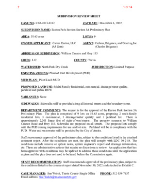
SUBDIVISION REVIEW SHEET LOT(S): 9 COUNTY: Travis (AJ Zorn) ZAP DATE: December 6, 2022 JURISDICTION: Limited Purpose AGENT: Carlson, Brigance, and Doering,Inc (Charles Brigance) CASE NO.: C8J-2021-0112 SUBDIVISION NAME: Easton Park Section Section 5A Preliminary Plan AREA: 58.63 acres OWNER/APPLICANT: Carma Easton, LLC ADDRESS OF SUBDIVISION: William Cannon and Hwy 183 GRIDS: L12 WATERSHED: North Fork Dry Creek EXISTING ZONING: Planned Unit Development (PUD) MUD PLAN: Pilot Knob MUD PROPOSED LAND USE: Multi-Family Residential, commercial, drainage/water quality, parkland and public ROW VARIANCES: None SIDEWALKS: Sidewalks will be provided along all internal streets and the boundary street. DEPARTMENT COMMENTS: The request is for the approval of the Easton Park Section 5A Preliminary Plan. The plan is comprised of 9 lots on 58.63 acres, proposing 2 multi-family residential lots, 3 commercial, 3 drainage/water quality, and 1 parkland lot. There is approximately 2,308 linear feet of right-of-way/streets. The property connects to William Cannon Road and Hwy 183. Sidewalks are proposed on all streets. The proposed lots comply with the PUD zoning requirements for use and lot size. Parkland will be in compliance with the PUD. Water and wastewater will be provided by the City of Austin. Staff recommends approval of the preliminary plan, subject to the conditions listed in the attached comment report. After the conditions are met, the plan will comply with LDC 30-2-84. The conditions include remove or update notes, update engineer’s report and drainage information, etc. These are administrative actions that require no discretionary review. An application that has been approved with conditions may be updated to address those conditions until the application expires and the plan does not need to be heard before the Commission again. STAFF RECOMMENDATION: Staff recommends approval of the preliminary plan, subject to the conditions listed in the comment report dated November 30, 2022 and attached as Exhibit C. CASE MANAGER: Sue Welch, Travis County Single Office Email address: Sue.Welch@traviscountytx.gov PHONE: 512-854-7637 1 of 147 Exhibit A: Easton Park 5A Preliminary Plan Exhibit B: Easton Park 5A Location Map Exhibit C: Easton Park 5A Preliminary Plan Comment Report 2 of 147 OOO13SHEETOFJOB NUMBERDATEFILE PATH:J:\AC3D\5367\dwg\PRELIMINARY\5367-PRELIMINARY PLAN.dwg - Sep 26, 2022 - 1:22pmDESIGNEDBY:DRAFTEDBY:BDFIRM ID #F3791Carlson, Brigance & Doering, Inc.CJOB NAME:PROJECT:SHEET NAME:Main Office5501 West William Cannon Dr.Austin, Texas 78749Phone No. (512) 280-5160Civil Engineering SurveyingNorth Office12129 RR 620 N., Ste. 600Austin, Texas 78750www.cbdeng.com5367EASTON PARK SECTION 5APRELIMINARY PLANCBCPJUNE 20213 of 147 2GENERAL NOTES3SHEETOFJOB NUMBERDATEFILE PATH:J:\AC3D\5367\dwg\PRELIMINARY\5367-PRELIMINARY PLAN.dwg - Sep 26, 2022 …