C14-2020-0029 1 ZONING CHANGE REVIEW SHEET CASE: C14-2020-0029 – Montopolis Acres Rezoning DISTRICT: 3 ZONING FROM: SF-3-NP TO: SF-6-NP ADDRESS: 1013 and 1017 Montopolis Dr SITE AREA: 3.12 acres PROPERTY OWNER: Montopolis Acres LP (Danny Walker) AGENT: Thrower Design (A. Ron Thrower) CASE MANAGER: Kate Clark (512-974-1237, kate.clark@austintexas.gov) STAFF RECOMMENDATION: Staff recommends townhouse and condominium residence – neighborhood plan (SF-6-NP) combining district zoning. For a summary of the basis of staff’s recommendation, see page 2. PLANNING COMMISSION ACTION / RECOMMENDATION: July 14, 2020 Scheduled for Planning Commission June 23, 2020 Approved Neighborhood’s request to postpone to July 14, 2020 on the consent agenda. 12-0 [J. Thompson, R. Schneider – 2nd; P. Seeger was off the dais]. CITY COUNCIL ACTION: July 30, 2020 Scheduled for City Council ORDINANCE NUMBER: ISSUES: On May 26, 2020 the Montopolis Neighborhood Planning Contact Team (MNPCT) held their monthly meeting to discuss zoning cases in their area. They were not able to discuss this case at their meeting and have requested to postpone it to the next Planning Commission meeting on July 14th. On June 18, 2020 staff received a letter of opposition from the MNPCT President for this rezoning case. All communication received for this rezoning case can be found in Exhibit C: Correspondence Received. 1 of 15B-01 C14-2020-0029 2 CASE MANAGER COMMENTS: This property is approximately 3.12 acres and is located on the east side of Montopolis Drive. It is currently zoned SF-3-NP. Across Montopolis Drive to the west are properties zoned SF-3-NP with single-family residential buildings. Adjacent to the north is a property zoned LO-MU-CO- NP which is undeveloped. Adjacent to the east and south of the property are tracts zoned SF-3- NP with single-family residential (to the east) and religious assembly uses (to the south), see Exhibit A: Zoning Map and Exhibit B: Aerial Map. BASIS OF RECOMMENDATION: 1. The proposed zoning should be consistent with the purpose statement of the district sought. Zoning changes should promote compatibility with adjacent and nearby uses. The applicant is requesting a base zoning district of SF-6. This district is intended as an area for moderate density single family, duplex, two family, townhouse and condominium use. It is appropriate for areas in which unusually large lots predominate with access to other than minor residential streets, and in selected areas where a transition from single-family to multifamily use is appropriate. This property is adjacent to Montopolis Drive, …
C14-2020-0030 1 ZONING CHANGE REVIEW SHEET CASE: C14-2020-0030 – 200 Montopolis Rezoning DISTRICT: 3 ZONING FROM: SF-3-NP TO: SF-6-NP ADDRESS: 200 Montopolis Drive and 6208 Clovis Street SITE AREA: 1.32 acres PROPERTY OWNER: Nine Banded Holdings LLC (Taylor Jackson) AGENT: Thrower Design (A. Ron Thrower) CASE MANAGER: Kate Clark (512-974-1237, kate.clark@austintexas.gov) STAFF RECOMMENDATION: Staff recommends townhouse and condominium residence – neighborhood plan (SF-6-NP) combining district zoning. For a summary of the basis of staff’s recommendation, see page 2. PLANNING COMMISSION ACTION / RECOMMENDATION: July 14, 2020 Scheduled for Planning Commission June 23, 2020 Case was pulled from the agenda due to a notification issue; No action taken. CITY COUNCIL ACTION: July 30, 2020 Scheduled for City Council ORDINANCE NUMBER: ISSUES: On May 26, 2020 the Montopolis Neighborhood Planning Contact Team (MNPCT) held their monthly meeting to discuss zoning cases in their area. They were not able to discuss this case at their meeting and have requested to postpone it to the next Planning Commission meeting on July 14th. On June 18, 2020 staff received a letter of opposition from the MNPCT President for this rezoning case. All communication received for this rezoning case can be found in Exhibit C: Correspondence Received. 1 of 29B-02 C14-2020-0030 2 On June 22, 2020 staff received a petition in opposition to the rezoning of this property. Due to current events, staff accepted electronic signatures to start the verification process. The petition organizer was informed that original signatures are required to complete the validation process and was sent the case manager’s mailing address. A current map and list of property owners of the petition area and the electronic signatures received to date are included in Exhibit D: Formal Petition. To date, the petition is not considered “valid” because staff has not received the original signatures. Staff was informed that this property was readdressed from 6206 Clovis Street to 6208 Clovis Street after the zoning application was filed. While this rezoning case was properly notified, the Law Department advised pulling this case from the June 23, 2020 Planning Commission agenda and notifying for the next available Planning Commission meeting. CASE MANAGER COMMENTS: The subject property is currently zoned SF-3-NP and consists of two parcels approximately 1.34 acres in total size. It can be accessed by Montopolis Drive and Clovis Street. Adjacent to the south are properties zoned SF-3-NP district zoning. These tracts contain a mixture of …
C14-2020-0039 1 ZONING CHANGE REVIEW SHEET CASE: C14-2020-0039 – Clovis and Kemp Rezone DISTRICT: 3 ZONING FROM: SF-3-NP TO: SF-6-NP ADDRESS: 6201 Clovis Street and 301 Kemp Street SITE AREA: 1.167 acres PROPERTY OWNER: 3SC Venture LLC (Gary O’Dell) AGENT: Thrower Design (A. Ron Thrower) CASE MANAGER: Kate Clark (512-974-1237, kate.clark@austintexas.gov) STAFF RECOMMENDATION: Staff recommends townhouse and condominium residence – neighborhood plan (SF-6-NP) combining district zoning. For a summary of the basis of staff’s recommendation, see page 2. PLANNING COMMISSION ACTION / RECOMMENDATION: July 14, 2020 Scheduled for Planning Commission June 23, 2020 Approved Neighborhood’s request to postpone to July 14, 2020 on the consent agenda. 12-0 [J. Thompson, R. Schneider – 2nd; P. Seeger was off the dais]. CITY COUNCIL ACTION: July 30, 2020 Scheduled for City Council ORDINANCE NUMBER: ISSUES On May 26, 2020 the Montopolis Neighborhood Planning Contact Team (MNPCT) held their monthly meeting to discuss zoning cases in their area. They were not able to discuss this case at their meeting and have requested to postpone it to the next Planning Commission meeting on July 14th. On June 18, 2020 staff received a letter of opposition from the MNPCT President for this rezoning case. 1 of 34B-03 C14-2020-0039 2 All communication received for this rezoning case can be found in Exhibit C: Correspondence Received. On June 22, 2020 staff received a petition in opposition to the rezoning of this property. Due to current events, staff accepted electronic signatures to start the verification process. The petition organizer was informed that original signatures are required to complete the validation process and was sent the case manager’s mailing address. A current map and list of property owners of the petition area and the electronic signatures received to date are included in Exhibit D: Formal Petition. To date, the petition is not considered “valid” because staff has not received the original signatures. CASE MANAGER COMMENTS: The subject property consists of two undeveloped lots approximately 1.167 acres in size. They are located at the southeast corner of Kemp Street and Clovis Street. Adjacent to the east and south of the subject property are tracts zoned SF-3-NP containing single-family residential buildings. Directly the north across Clovis Street and west across Kemp street are tracts zoned SF-3-NP and P-NP which are undeveloped. The P-NP zoned property is the northeast section of Roy Guerrero Metropolitan Park. Across Clovis Street to the northeast are tracts …
C14-2020-0044 1 ZONING CHANGE REVIEW SHEET CASE: C14-2020-0044 – Saxon Acres Residential Zoning DISTRICT: 3 ZONING FROM: SF-3-NP TO: SF-6-NP ADDRESS: 316 Saxon Lane & 6328 El Mirando Street SITE AREA: 2.9 acres PROPERTY OWNER: Saxon Acres LLC (Danny Walker) AGENT: Thrower Design (A. Ron Thrower) CASE MANAGER: Kate Clark (512-974-1237, kate.clark@austintexas.gov) STAFF RECOMMENDATION: Staff recommends townhouse and condominium residence – neighborhood plan (SF-6-NP) combining district zoning. For a summary of the basis of staff’s recommendation, see page 2. PLANNING COMMISSION ACTION / RECOMMENDATION: July 14, 2020 Scheduled for Planning Commission June 23, 2020 Approved Neighborhood’s request to postpone to July 14, 2020 on the consent agenda. 12-0 [J. Thompson, R. Schneider – 2nd; P. Seeger was off the dais]. CITY COUNCIL ACTION: July 30, 2020 Scheduled for City Council ORDINANCE NUMBER: ISSUES On May 26, 2020 the Montopolis Neighborhood Planning Contact Team (MNPCT) held their monthly meeting to discuss zoning cases in their area. They were not able to discuss this case at their meeting and have requested to postpone it to the next Planning Commission meeting on July 14th. All communication received for this rezoning case can be found in Exhibit C: Correspondence Received. 1 of 25B-04 C14-2020-0044 2 On June 18, 2020 staff received a letter and petition in opposition to the rezoning of this property from the MNPCT President. Due to current events, staff accepted electronic signatures to start the verification process. The petition organizer was informed that original signatures are required to complete the validation process and was sent the case manager’s mailing address. A current map and list of property owners of the petition area and the electronic signatures received to date are included in Exhibit D: Formal Petition. To date, the petition is not considered “valid” because staff has not received the original signatures. CASE MANAGER COMMENTS: This property is approximately 2.9 acres in size and is accessed by either Saxon Lane or El Mirando Street. It is currently zoned SF-3-NP and is not developed. Adjacent to the north, west and south of the property are tracts zoned SF-3-NP with a mixture of single family and duplex residential buildings. Across Saxon Lane to the east and southeast are tracts zone GR-NP and LR-NP. Both of these are undeveloped. See Exhibit A: Zoning Map and Exhibit B: Aerial Map for visual context. BASIS OF RECOMMENDATION: 1. The proposed zoning should be consistent with the …
ZONING CHANGE REVIEW SHEET CASE: C14-2020-0031.SH – E MLK Rezoning DISTRICT:1 ZONING FROM: SF-3-NP TO: MF-6-NP SITE AREA: 2.64 Acres ADDRESS: 5201 East Martin Luther King Jr. Boulevard PROPERTY OWNERS/APPLICANT: 5201 E MLK LP (Ryan Walker) AGENT: Thrower Design (Ron Thower) CASE MANAGER: Heather Chaffin (512-974-2122, heather.chaffin@austintexas.gov) STAFF RECOMMENDATION: Staff recommends MF-3-NP. For a summary of the basis of staff’s recommendation, see case manager comments on page 3. PLANNING COMMISSION ACTION / RECOMMENDATION: July 14, 2020: June 23, 2020: Motion to grant MF-3-NP as recommended by Staff approved (8-3) [Shaw- 1st, Schneider-2nd; Howard, Thompson, Anderson- Nay; Kazi- Off the dais] Substitute motion to grant MF-6-NP with a 60’ height limit failed (6-3-2) [Anderson- 1st, Thompson- 2nd; Flores, Llanes-Pulido, Shaw- Nay; Azar, Schneider- Abstain; Kazi- Off the dais] Motion to reconsider vote approved (9-2) [Shieh- 1st, Azar- 2nd; Llanes-Pulido, Shaw- Nay; Kazi- Off the dais] Motion to postpone public hearing to July 14, 2020 approved (9-2) [Shieh- 1st, Azar- 2nd; Llanes-Pulido, Shaw- Nay; Kazi- Off the dais] June 9, 2020: Meeting canceled. May 26, 2020: To postpone to June 9, 2020, as requested by Neighborhood, on consent. CITY COUNCIL ACTION: July 30, 2020: June 11, 2020: To postpone to July 30, 2020, as requested by Staff, on consent. June 4, 2020: To postpone to June 11, 2020, as requested by Staff, on consent. ORDINANCE NUMBER: 1 of 22B-05 C14-2020-0031.SH ISSUES: The proposed rezoning was approved for MF-3-NP by Planning Commission on June 23, 2020; however, later in the meeting a motion to reconsider the vote and postpone the item to the July 14, 2020 was approved. See page 1 for details. The proposed rezoning is a SMART Housing project. 2 CASE MANAGER COMMENTS: The subject property is located on the south side of East Martin Luther King Jr. Boulevard (E MLK) roughly halfway between Springdale Road and Tannehill Lane. The property is zoned SF- 3-NP and is developed with a single family residence. The property is surrounded by SF- 3-NP zoned land to the west, south, and east. The areas to the west and south are developed with a single family residential neighborhood; the property to the east is Blair Woods Nature Preserve, Austin Wildlife Rescue, and Ulit Baptist Church. Further to the west, near the intersection with Springdale Road, are properties zoned GR-MU-NP and GR-NP. These are developed with two single family houses and a range of commercial land uses …
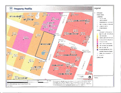
NEIGHBORHOOD PLAN AMENDMENT REVIEW SHEET Planning Commission: July 14, 2020 DATE FILED: February 5, 2020 (In-cycle) NEIGHORHOOD PLAN: Crestview/Wooten CASE#: NPA-2020-0017.01 PROJECT NAME: 7113 Burnet PC DATE: June 23, 2020 ADDRESS: 7113 Burnet Road DISTRICT AREA: 7 SITE AREA: 4.388 acres OWNER/APPLICANT: Ronan Corporation AGENT: Armbrust & Brown, PLLC (Michael J. Gaudini) CASE MANAGER: Maureen Meredith STAFF EMAIL: Maureen.meredith@austintexas.gov TYPE OF AMENDMENT: Change in Future Land Use Designation PHONE: (512) 921-6223 From: Commercial Base District Zoning Change To: Multifamily Related Zoning Case: C14-2020-0016 Related RCA: C14-72-032(RCT) From: CS-1-CO-NP, CS-CO-NP and LO-CO-NP To: MF-6-NP NEIGHBORHOOD PLAN ADOPTION DATE: April 1, 2004 PLANNING COMMISSION RECOMMENDATION: July 14, 2020 – (pending) June 23, 2020 – Postponed to July 14, 2020 at the request of the neighborhood. [J. Thompson – 1st; R. Schneider – 2nd] Vote: 12-0-1 [P. Seeger absent]. 1 of 25B-06 Planning Commission: July 14, 2020 STAFF RECOMMENDATION: Recommended. BASIS FOR STAFF’S RECOMMENDATION: Staff supports the applicant’s request for Multifamily land use because the property is located along Burnet Road which is a commercial corridor with a mix of uses. Burnet Road is identified as an Activity Corridor in the Imagine Austin Comprehensive Plan where a mixed of commercial, office, and residential uses are appropriate. Below are sections of the Crestview/Wooten Neighborhood Plan that supports the applicant’s request. 2 LAND USE DESCRIPTIONS EXISTING LAND USE ON THE PROPERTY Commercial -Lots or parcels containing retail sales, services, hotel/motels and all recreational services that are predominantly privately owned and operated for profit (for example, theaters and bowling alleys). Included are private institutional uses (convalescent 2 of 25B-06 Planning Commission: July 14, 2020 homes and rest homes in which medical or surgical services are not a main function of the institution), but not hospitals. Purpose 1. Encourage employment centers, commercial activities, and other non‐ residential development to locate along major thoroughfares; and 2. Reserve limited areas for intense, auto‐oriented commercial uses that are generally not compatible with residential or mixed use environments. Application major highways; and 1. Focus the highest intensity commercial and industrial activities along freeways and 2. Should be used in areas with good transportation access such as frontage roads and arterial roadways, which are generally not suitable for residential development. PROPOSED LAND USE ON THE PROPERTY Multifamily Residential - Higher-density housing with 3 or more units on one lot. 1. Preserve existing multifamily and affordable housing; 2. Maintain and create affordable, safe, …
RESTRICTIVE COVENANT TERMINATION REVIEW SHEET DISTRICT: 7 CASE: C14-72-032 (RCT) – 7113 Burnet Rd EXISTING ZONING: CS-1-CO-NP, CS-CO-NP, LO-CO-NP ADDRESS: 7113 Burnet Road SITE AREA: 1.1166 acres (48,638 square feet) PROPERTY OWNER: Ronan Corporation (Craig Hopper) AGENT: Armbrust & Brown PLLC (Michael Gaudini) CASE MANAGER: Mark Graham (512-974-3574, mark.graham@austintexas.gov ) STAFF RECOMMENDATION: Staff recommends granting a Termination of the Restrictive Covenant. PLANNING COMMISSION ACTION / RECOMMENDATION: JULY 14, 2020: [J. THOMPSON; R. SCHNEIDER – 2ND] (12-0) P. SEEGER - ABSENT June 23, 2020: APPROVED POSTPONEMENT REQUEST BY NEIGHBORHOOD TO JULY 14, 2020: CITY COUNCIL ACTION: July 30, 2020: RESTRICTIVE COVENANT TERMINATION RECORDING NUMBER: ISSUES: No issues were identified for this request. CASE MANAGER COMMENTS: The subject Restrictive Covenant is less restrictive than current compatibility standards by Code. At the time that the subject property zoning was changed from residential to office, the Restrictive Covenant was provided to increase the setback between the office and the houses on Hardy Circle. Applicant is requesting the termination of the Restrictive Covenant which established a twenty- foot building setback from the north property line of the 48,638 square foot tract of land that was rezoned from residential to office in 1973 (Ordinance No. 73 0628-D). 1 of 6B-07 C14-72-032(RCT) 2 The Restrictive Covenant is recorded in volume 4674, page 2281 of the Deed Records of Travis County, Texas. Paragraph number 1. “No Building or any part thereof shall be located within twenty (20) feet of the north property line of said property”. Please refer to Exhibit “A”. The standard building setback to an internal property line, in the office zoning district is five feet when the office is surrounded by other offices or commercial zoning and use. The Restrictive Covenant provided additional setback from the detached family residences on north of the tract being rezoned to office. Compatibility Standards in Article 10 (LDC 25-2-1063) apply to the subject site because it is located next to SF-3-NP zoning and the development site is bigger than 20,000 square feet. The minimum setback is 25 feet from SF-5 or more restrictive zoned land and it applies to the new building, the drive aisle and parking lots. There are also requirements for landscape buffering and screening (LDC 25-2-1066) in the area between multi-family buildings and buildings in the SF-5 or more restrictive districts. BASIS OF RECOMMENDATION: Staff supports the Termination request. The Restrictive Covenant was created in 1973 …
CASE: C14-2020–0016 7113 Burnet Road DISTRICT: 7 ZONING CHANGE REVIEW SHEET ZONING FROM: CS-1-CO-NP, CS-CO-NP, LO-CO-NP TO: MF-6-NP ADDRESS: 7113 Burnet Rd SITE AREA: 4.3881 acres (191,145.64 sq. ft.) PROPERTY OWNER: Ronan Corporation (Craig Hopper) AGENT: Armbrust & Brown, PLLC (Michael Gaudini) CASE MANAGER: Mark Graham (512-974-3574, mark.graham@austintexas.gov ) STAFF RECOMMENDATION: Staff offers an alternative recommendation to grant Multifamily Residence (Moderate- High Density) - conditional use - neighborhood plan (MF-4-CO-NP) district zoning. For a summary of the basis of staff’s recommendation, see case manager comments below. PLANNING COMMISSION ACTION / RECOMMENDATION: JULY 14, 2020: JUNE 23, 2020: APPROVED POSTPONEMENT REQUEST BY NEIGHBORHOOD TO JULY 14, 2020 [J. THOMPSON; R. SCHNEIDER – 2ND] (12-0) P. SEEGER - ABSENT CITY COUNCIL ACTION: Planned to be scheduled for July 30, 2020 ORDINANCE NUMBER: ISSUES The Future Land Use Map from Commercial to Multi-family residential is also under consideration (NPA-2020-0017.01). Access to Burnet Road requires agreement with adjacent property owner and approval by the Austin Transportation Department. Neighbors are concerned about potential impacts from the proposed building and multi-family residential use. 1 of 44B-08 C14-2020-0016 2 CASE MANAGER COMMENTS: Applicant seeks zoning to build 360 residential units on the 4.39 acre (191,228.4 sq. ft.) parcel of land at 7113 Burnet Road. The requested zoning is multi-family residence highest density- neighborhood plan (MF-6-NP) zoning. The subject tract is mid-block with frontage only on Burnet Road and currently has 3 curb cuts. Current Conditions The site is a commercial development with a parking lot fronting Burnet Road. The buildings are set back more than 150 feet from the road. The largest single space appears to be the bar closest to Burnet Road. The adjacent buildings are occupied by small businesses providing, for instance: driving instruction and martial arts coaching; coffee and kolaches; hair-cuts and massages. The site is auto oriented. With the exception of the bar, the businesses face north and are not visible from the street. There is a large multi-tenant sign only about half full with business names. There appear to be several vacant tenant spaces. There is a free-standing building in the office zoned (east) part of the site. There appear to be new vehicles stored on that portion of the site as they are on the adjacent commercially zoned lot to the south. Buffers to residences have not been maintained. Vehicle Access and Circulation Safe access to and from Burnet Road is …
Planning Commission: July 14, 2020 NEIGHBORHOOD PLAN AMENDMENT REVIEW SHEET DATE FILED: July 28, 2016 (In-cycle) NEIGHORHOOD PLAN: Southeast Combined Neighborhood Plan (Franklin Park) CASE#: NPA-2016-0014.01.SH PROJECT NAME: Nuckols Crossing – S.M.A.R.T. Housing PC DATE: July 14, 2020 May 26, 2020 April 14, 2020 February 25, 2020 September 10, 2019 July 23, 2019 June 25, 2019 May 28, 2019 December 11, 2018 ADDRESS: 4400 Nuckols Crossing Road DISTRICT AREA: 2 SITE AREA: 9.978 acres OWNER: Angelos Angelou & John Sasaridis, February 27, 2018 January 23, 2018 January 9, 2018 December 12, 2017 November 14, 2017 May 23, 2017 April 11, 2017 February 28, 2017 January 10, 2017 November 13, 2018 October 9, 2018 August 28, 2018 July 24, 2018 June 12, 2018 May 22, 2018 April 10, 2018 March 27, 2018 March 13, 2018 APPLICANT: McDowell Housing Partners (Ariana Brendle) AGENT: Thrower Design (A. Ron Thrower) CASE MANAGER: Maureen Meredith, Planning & Zoning Department PHONE: (512) 974-2695 EMAIL: maureen.meredith@austintexas.gov TYPE OF AMENDMENT: Change in Future Land Use Designation From: Single Family To: Multifamily 1 NPA-2016-0014.01 1 of 33B-09 Planning Commission: July 14, 2020 (Application was revised on February 13, 2017. Original FLUM request was for Single Family, Multifamily and Recreation/Open Space to Multifamily and Recreation/Open Space) Base District Zoning Change Related Zoning Case: C14-2017-0010.SH From: SF-2-NP To: MF-4-NP (as amended on February 10, 2020) NEIGHBORHOOD PLAN ADOPTION DATE: October 10, 2002 PLANNING COMMISSION RECOMMENDATION: July 14, 2020 – (pending) May 26, 2020 – Postponed to July 14, 2020 at the request of Staff on the consent agenda. [C. Hempel – 1st; R. Schneider – 2nd] Vote: 12-0 [C. Llanes Pulido not present for the passage of the consent agenda]. April 14, 2020 – Postponed to May 26, 2020 at the request of Staff on the consent agenda. [R. Schneider – 1st; C. Kenny – 2nd] Vote: 12-0 [C. Llanes Pulido absent]. February 25, 2020 – Postponed to April 14, 2020 at the request of Staff on the consent agenda. [R. Schneider -1st; C. Kenny – 2nd] Vote: 12-0-1 [J. Shieh absent]. September 10, 2019- Approved for indefinite postponement request by Staff on the consent agenda. [J. Thompson – 1st; J. Shieh – 2nd] Vote: 10-0 [R. Schneider and P. Seeger absent. T. Shaw no present for the passage of the consent agenda]. July 23, 2019 – Postponed to September 10, 2019 at the request of Staff was approved on the …
ZONING CHANGE REVIEW SHEET P.C. DATE: July 25, 2017 CASE: C14-2017-0010.SH – Nuckols Crossing Road Rezoning – SMART Housing November 14, 2017 December 12, 2017 January 9, 2018 January 23, 2018 February 27, 2018 March 13, 2018 March 27, 2018 April 10, 2018 May 22, 2018 June 12, 2018 July 24, 2018 August 28, 2018 October 9, 2018 November 13, 2018 December 11, 2018 May 28, 2019 June 25, 2019 July 23, 2019 September 10, 2019 February 25, 2020 April 14, 2020 May 26, 2020 July 14, 2020 (Ariana Brendle) ADDRESS: 4400 Nuckols Crossing Road DISTRICT AREA: 2 OWNERS: Angelos Angelou and John Sasaridis APPLICANT: McDowell Housing Partners ZONING FROM: SF-2-NP AREA: 9.978 acres NEIGHBORHOOD PLANNING AREA: Southeast Combined (Franklin Park) SUMMARY STAFF RECOMMENDATION (Revised on June 29, 2020): The Staff recommendation is to grant multifamily residence – low density – neighborhood plan (MF-2-NP) combining district zoning. AGENT: Thrower Design TO: MF-4-NP, as amended (Ron Thrower) 1 of 48B-10 C14-2017-0010.SH Page 2 The Restrictive Covenant includes all recommendations listed in the Neighborhood Traffic Analysis memo, dated June 16, 2020, as provided in Attachment A. PLANNING COMMISSION RECOMMENDATION: July 25, 2017: APPROVED AN INDEFINITE POSTPONEMENT REQUEST BY THE APPLICANT [J. SHIEH, P. SEEGER – 2ND] (12-0) N. ZARAGOZA – ABSENT November 14, 2017: APPROVED A POSTPONEMENT REQUEST BY THE STAFF TO DECEMBER 12, 2017 [J. SHIEH, P. SEEGER – 2ND] (12-0) A. DE HOYOS HART – ABSENT December 12, 2017: APPROVED A POSTPONEMENT REQUEST BY THE STAFF TO JANUARY 9, 2018 [J. SHIEH, T. WHITE – 2ND] (13-0) January 9, 2018: APPROVED A POSTPONEMENT REQUEST BY STAFF TO JANUARY 23, 2018 [P. SEEGER; A. DE HOYOS HART – 2ND] (11-0) F. KAZI – NOT PRESENT FOR PASSAGE OF THE CONSENT AGENDA; T. NUCKOLS – ABSENT January 23, 2018: APPROVED A POSTPONEMENT REQUEST BY THE STAFF TO FEBRUARY 27, 2018 [P. SEEGER; G. ANDERSON – 2ND] (10-0) A. DE HOYOS HART, J. SCHISSLER – NOT PRESENT FOR PASSAGE OF THE CONSENT AGENDA; K. MCGRAW – ABSENT February 27, 2018: APPROVED A POSTPONEMENT REQUEST BY THE STAFF TO MARCH 13, 2018 [J. SCHISSLER; J. SHIEH – 2ND] (12-0) J. THOMPSON – ABSENT March 13, 2018: APPROVED A POSTPONEMENT REQUEST BY THE STAFF TO MARCH 27, 2018 [T. WHITE; P. SEEGER – 2ND] (8-0) A. DE HOYOS HART, T. NUCKOLS, J. SHIEH, T. SHAW, J. THOMPSON – ABSENT March 27, 2018: APPROVED A POSTPONEMENT …
************************************************************************ MEMORANDUM TO: Planning Commission Members FROM: Sherri Sirwaitis Planning and Zoning Department DATE: July 6, 2020 RE: NPA-2018-0005.02 and C814-97-0002.01 (Mary Vice Estates PUD Lot 27 Amendment #1) Postponement Request ************************************************************************ The staff would like to request an indefinite postponement of the above mentioned cases. The staff is asking for this postponement to complete our review. The postponement request was made in a timely manner and meets the Planning Commission’s policy. 1 of 1B-11
************************************************************************ MEMORANDUM TO: Planning Commission Members FROM: Sherri Sirwaitis Planning and Zoning Department DATE: July 6, 2020 RE: NPA-2018-0005.02 and C814-97-0002.01 (Mary Vice Estates PUD Lot 27 Amendment #1) Postponement Request ************************************************************************ The staff would like to request an indefinite postponement of the above mentioned cases. The staff is asking for this postponement to complete our review. The postponement request was made in a timely manner and meets the Planning Commission’s policy. 1 of 1B-12
Conor Kenny, Chair and Planning Commission Members MEMORANDUM ************************************************************************ TO: FROM: Maureen Meredith, Senior Planner DATE: RE: Long Range Planning Division, Planning and Zoning Department NPA-2019-0013.01 – 909, 911, 915, 1001, 1003 S. 2nd Street & 604, 606 Copeland Street (No associated zoning case at this time) Indefinite Postponement Request by the Applicant July 7, 2020 ************************************************************************ The Applicant requests an indefinite postponement of the above-mentioned plan amendment. Please see the attached email from Jarred Corbell. The postponement request was made in a timely manner and meets the Planning Commission’s policy. Attachment: E-mail from Jarred Corbell, Applicant’s Agent Map of property location 1 of 3B-13 From: Jarred Corbell Sent: Thursday, June 25, 2020 7:23 AM To: Meredith, Maureen <Maureen.Meredith@austintexas.gov> Subject: RE: New Indef PP?: NPA-2019-0013.01_Copeland I think eventually we do want to move forward with it but are probably 8 months away from neighborhood support. If we think we can get an indefinite postponement, I would say let’s do it. Due to land dev code mapping being on complete hold, it is too difficult to know JARRED CORBELL Austin/San Antonio Acquisitions and Entitlements Manager 2 of 3B-13 3 of 3B-13
MEMORANDUM ************************************************************************ TO: Conor Kenny, Chair Planning Commission Members FROM: Kate Clark Planning and Zoning Department DATE: July 1, 2020 RE: C14-2020-0056 - Wickersham Retail Center Request for Postponement by the Neighborhood Contact Team ************************************************************************ The EROC Contact Team requests a postponement of the above referenced rezoning case to July 28, 2020. Their bylaws state that electronic votes should be open for 14 days and they request additional time to discuss this rezoning case with the residents of the surrounding properties. The EROC Contact Team’s request is attached; the applicant is not opposed to this postponement request. Attachment: Map of Property EROC Contact Team’s Postponement Request B-141 of 4 B-142 of 4 This response will be the request to postpone the Planning Commission for case C14‐2020‐0056 to July 28. When would you need the results of the EROC vote? The next available date for Planning Commission will be July 28th. Would you like me to use your email below for your postponement request, or are you going to send a separate letter/memo? Clark, Kate From: Sent: To: Subject: Malcolm Yeatts Friday, June 19, 2020 12:07 PM Clark, Kate RE: C14-2020-0056 Malcolm Yeatts Chair, EROC Contact Team From: Clark, Kate <Kate.Clark@austintexas.gov> Sent: Friday, June 19, 2020 10:51 AM To: Malcolm Yeatts Subject: RE: C14‐2020‐0056 Mr. Yeatts, Kate Clark, AICP, LEED AP Senior Planner City of Austin | Planning and Zoning Department Mailing Address: P.O.Box 1088, Austin, Texas 78767 Physical Address: 505 Barton Springs Rd, 5th floor, Austin, Texas 78704 Tel: 512-974-1237 Email: kate.clark@austintexas.gov From: Malcolm Yeatts Sent: Friday, June 19, 2020 10:44 AM To: Clark, Kate <Kate.Clark@austintexas.gov> Subject: RE: C14‐2020‐0056 Malcolm Yeatts Chair, EROC Contact Team From: Clark, Kate <Kate.Clark@austintexas.gov> Sent: Tuesday, June 9, 2020 5:09 PM To: Malcolm Yeatts Subject: RE: C14‐2020‐0056 Mr. Yeatts, 1 The EROC Contact Team requests a postponement of case C14‐2020‐0056 that will be on the agenda of the Planning Commission meeting of July 14. The EROC Bylaws state that electronic votes should be open for 14 days. The EROC Contact Team needs more time to discuss this case with the residents of the surrounding properties. We cannot have the results of the EROC vote sent to you by June 30. When would the next date available at the Planning Commission? B-143 of 4 I would need to have the results of the EROC vote by June 30th in order to include it in my staff …
PLANNING COMMISSION SITE PLAN CONDITIONAL USE PERMIT REVIEW SHEET 76 Rainey St. 76 Rainey CUP SPC-2019-0590A PC DATE: 5/26/20 Regalado Joe Martin 7712 Kiva Dr. Austin, TX 78749 WGI (Cliff Kendall) 2021 E. 5th St. Suite 200 Austin, TX 78702 (512) 669-5560 CASE NUMBER: PROJECT NAME: ADDRESS: APPLICANT: AGENT: CASE MANAGER: Renee Johns, (512) 974-2711 or at Renee.Johns@austintexas.gov WATERSHED: Waller Creek/Lady Bird Lake PROPOSED USE: Cocktail Lounge EXISTING ZONING: CBD NEIGHBORHOOD PLAN: N/A PROPOSED DEVELOPMENT: The applicant is requesting a conditional use permit for a cocktail lounge in one existing building located in the historic Rainey Street District, totaling 2,000 sf of indoor space and 3,500 sf of outdoor covered and uncovered areas, for a grand total of 5,500 sf of CUP Cocktail Lounge space. The hours of operation will be Monday – Wednesday 5pm to 2am, Thursday 4pm to 2am, and Saturday and Sunday 11am to 2am. No construction will occur with this permit but will be permitted either as a B-plan (construction site plan) or as a site plan exemption. SUMMARY STAFF RECOMMENDATION: Staff recommends approval of the conditional use permit. Cocktail lounge is a use allowed in a CBD zoning district, the Waterfront Overlay Rainey sub district triggers the conditional use for the cocktail lounge. Several cocktail lounge uses are already located within this sub district. The site plan will comply with all requirements of the Land Development Code prior to its release. CONDITIONAL USE PERMIT REVIEW AND EVALUATION CRITERIA The following evaluation is included to provide staff evaluation on each point of the conditional use permit criteria. Section 25-5-145 of the Land Development Code states: “The Commission shall determine whether the proposed development or use of a conditional use site plan complies with the requirements of this section.” A conditional use site plan must: 1. Comply with the requirements of this title; Staff response: This application complies with the requirements of this title. 1 of 6B-15 2. Comply with the objectives and purposes of the zoning district; Staff response: This application complies with the objectives and purposes of the zoning district. The CBD zoning district allows cocktail lounge use. The Waterfront Overlay Rainey sub district triggers the conditional use for the cocktail lounge. Several cocktail lounge uses are already located within this sub district 3. Have building height, bulk, scale, setback, open space, landscaping, drainage, access, traffic circulation, and use that are compatible with the use …
PLANNING COMMISSION SITE PLAN WAIVER REQUEST SP-2019-0589C The Colorfield CASE NUMBER: PROJECT NAME: ADDRESS OF SITE: 1006 Baylor St WATERSHED: APPLICANT/ OWNERS: Shoal Creek (Urban) PC HEARING DATE: July 14, 2020 COUNCIL DISTRICT: 9 JURISDICTION: Full Purpose 1012 Baylor LLC 9229 Waterford Centre Blvd Suite 100 Austin, TX 78758 Jones Carter (William McAshan) 3100 Alvin Devane Blvd Suite 150 Austin, Texas 78741 AGENT: (512) 441-9493 (512) 974-2711 Renee.Johns@austintexas.gov CASE MANAGER: Renee Johns EXISTING ZONING: MF-6-CO-NP PROPOSED DEVELOPMENT: The applicant requests a compatibility waiver from 25-2-1063 (B), which requires structures to be setback 25 feet from a triggering property. The compatibility waiver is requested because the proposed development includes a fence, a gate and a pedestrian walkway in the 25’ compatibility setback on the south end of the property. DESCRIPTION OF WAIVERS: The applicant is requesting a waiver from § 25-2-1063. The site is subject to a 25’ compatibility setback on the southern property line. A proposed fence, gate, and pedestrian walkway are located 20’ from the triggering property located south of the proposed development. COMPATIBILITY: Section 25-2-1051 states that Article 10 Compatibility Standards apply if a use in a SF-6 or less restrictive zoning district is located on a property across the street from or adjoining a property on which is zoned SF-5 or more restrictive or a use is permitted in a SF-5 or more restrictive zoning district is located. § 25-2-1063 (B)– HEIGHT LIMITATIONS AND SETBACKS FOR LARGE SITES In this section, the term “structure” excludes a rain garden using no concrete that is designed in accordance with the Environmental Criteria Manual. A person may not construct a structure 25 feet or less from a property: (1) in an urban family residence (SF-5) or more restrictive zoning district; or (2) on which a use permitted in a SF-5 or more restrictive district is located; and SUMMARY STAFF RECOMMENDATION: Staff recommends approval of the compatibility waiver. The site plan will comply with all other requirements of the Land Development Code. 1 of 8B-16 0.67 acres SUMMARY OF SITE PLAN: LAND USE: The site is zoned MF-6-CO-NP (Multifamily), and is currently the vacated graffiti park. ENVIRONMENTAL: An update has been submitted and the environmental discipline is in review. TRANSPORTATION: An update has been submitted and the transportation discipline is in review. PROJECT INFORMATION SITE AREA EXISTING ZONING FLOOR-AREA RATIO BUILDING COVERAGE IMPERVIOUS COVERAGE PARKING EXISTING ZONING AND LAND USES Site …
SITE PLAN REVIEW SHEET ENVIRONMENTAL VARIANCE REQUEST ONLY P.C. COMMISSION DATE: 06/23/2020 CASE: SP-2019-0253C COUNCIL DISTRICT: District 3 PROJECT NAME: Springdale Farms APPLICANT: Storybuilt ADDRESS OF SITE: 755 Springdale Road, Austin, TX 78702 COUNTY: Travis WATERSHED: Boggy Creek - Urban EXISTING ZONING: CS-MU-CO-NP PROPOSED DEVELOPMENT: Mixed use development along with associated improvements. DESCRIPTION OF VARIANCE: The applicant requests the following: AGENT: Casey Giles, P.E. JURISDICTION: Full Purpose AREA: 4.85 acres 1. Request to vary from LDC 25-8-261 – to allow development in a Critical Water Quality Zone STAFF RECOMMENDATION: Staff recommends that the required findings of fact have not been met. ENVIRONMENTAL BOARD ACTION: 06/03/2020: The Environmental Board voted in 8 favor, 1 against, 2 absentia ZONING AND PLATTING COMMISSION ACTION: ENVIRONMENTAL REVIEW STAFF: Kristy Nguyen CASE MANAGER: Jeremy Siltala PHONE: 512-974-3035 PHONE: 512-974-2945 1 of 31B-17 ENVIRONMENTAL COMMISSION MOTION 20200603-006a Date: June 3, 2020 Subject: Springdale Farms, SP-2019-0253C Motion by: Kevin Ramberg Seconded by: Mary Ann Neely RATIONALE: WHEREAS, the Environmental Commission recognizes the applicant is requesting a variance from LDC 25- 8-261 to allow development in a critical water quality zone. WHEREAS, the Environmental Commission recognizes that staff does not recommend this variance, having determined that the findings of fact have not been met. THEREFORE, the Environmental Commission recommends denial of the requested variance from LDC 25- 8-261 to allow development in a critical water quality zone. VOTE 8-1 For: Smith, Neely, Coyne, Maceo, Ramberg, Guerrero, Gordon, and Bedford Against: Thompson Abstain: None Recuse: None Absent: Creel, Nill Approved By: Linda Guerrero, Environmental Commission Chair 2 of 31B-17 Staff Findings of Fact Variance to LDC 25-8-261 3 of 31B-17 Development Services Department Staff Recommendations Concerning Required Findings Project Name: Ordinance Standard: Watershed Protection Ordinance Variance Request: Springdale Farms SP-2019-0253C LDC 25-8-261 – to allow development in a Critical Water Quality Zone Include an explanation with each applicable finding of fact. A. Land Use Commission variance determinations from Chapter 25-8-41 of the City Code: 1. The requirement will deprive the applicant of a privilege available to owners of similarly situated property with approximately contemporaneous development subject to similar code requirements. No Approximately 3.2 acres of the 4.85 acre property are uplands and can be developed without the need for a variance from the Land Development Code. The Land Development Code does not provide an allowance for non-complying development within the CWQZ to maximize the amount of development that can …
PLANNING COMMISSION SITE PLAN COMPATIBILITY WAIVER REQUEST REVIEW SHEET Mountain Sun Development Group (Russ Hooper, PE) 707-502-4319 Mountain Sun Development Group (Russ Hooper, PE) 707-502-4319 PLANNING COMMISSION DATE: July 14, 2020 CASE: SP-2019-0559C PROJECT NAME: W 7th Street Passive ADDRESS OF SITE: 1118 W 7th St APPLICANT: AGENT: AREA: 0.2 acre WATERSHED: Town Lake (Urban) WATERSHED ORDINANCE: Comprehensive Watershed Ordinance C.I.P. STATUS: N/A T.I.A.: N/A CAPITOL VIEW: N/A PROPOSED DEVELOPMENT: The applicant is proposing to construct a duplex behind an existing single-family dwelling, with parking, detention and water quality. The development is taking access to West 7th Street and the alley to the north. EXISTING ZONING: The site is zoned MF-4-HD-NP. The site plan complies with the zoning ordinance. DESCRIPTION OF WAIVER: Waiver request is as follows: LDC Section 25-2-1062(B): If a site has street frontage of 50 feet or less, a person may not construct a structure 15 feet or less from property: (1) In an urban family residence (SF-5) or more restrictive zoning district, or; (2) On which a use permitted in an SF-5 or more restrictive zoning district is located. The applicant requests a waiver from a 15-foot to an approximately 5-foot compatibility setback for a walkway leading to the duplex and for drainage/detention structures. The site is adjacent to single-family houses to the west, multifamily to the east, an alley and a mix of single-and multifamily residential to the north and a mix of single-and multifamily uses to the south across W 7th Street. SUMMARY STAFF RECOMMENDATION: Staff recommends approval of the waiver from LDC Section 25-2-1062 to reduce the Compatibility setback requirement from 15 feet to approximately five feet from adjacent MF-4-HD-NP- zoned properties used as single family. The site measures less than 50 feet wide, and the duplex will be behind the existing house. The proposed use is similar to other uses within the neighborhood. CASE MANAGER: Christine Barton-Holmes, CNUa, LEED AP Christine.Barton-Holmes@austintexas.gov PHONE: 974-2788 1 of 12B-18 PROP. BUILDING CVR: 51% (4474 sf) PROP. IMP. CVRG.: 69% (6025 sf) PROPOSED F.A.R.: 0.749:1 PROP. HEIGHT: 27’10” PROVIDED PARKING: 6 spaces (1 on-street) PROJECT INFORMATION: 0.20 acre EXIST. ZONING: MF-4-HD-NP MAX. BLDG. COVERAGE : 60% MAX. IMPERV. CVRG.: 70% ALLOWED F.A.R.: 0.75:1 HEIGHT: 32’ per Historic District REQUIRED PARKING: 6 spaces PROPOSED ACCESS: Driveway access to W 7th Street and alley SUMMARY COMMENTS ON SITE PLAN: Land Use: The applicant is requesting a waiver from …
PLANNING COMMISSION SITE PLAN COMMISSION APPROVAL REVIEW SHEET PC DATE: 7/14/2020 SPC-2012-0104D(R4) 2338 Columbus Drive City of Austin Parks and Recreation Department Axiom Engineering Inc, Nicole Findeseisen, P.E., (512) 784-5892 CASE NUMBER: PROJECT NAME: Zilker Metro Park - Maintenance Barn Replacement ADDRESS: APPLICANT: AGENT: CASE MANAGER: Jeremy Siltala (512) 974-2945 or jeremy.siltala@austintexas.gov WATERSHED: APPLICATION REQUEST: Sites zoned Public (P) with limits of construction greater than one acre in size are a Conditional Use that require Land Use Commission approval according to Land Development Code section 25-2-625. PROJECT DESCRIPTION: The applicant proposes construction of a new maintenance facility with associated improvements. STAFF RECOMMENDATION: Staff recommends approval of the conditional use permit request. The site plan will comply with all other requirements of the Land Development Code prior to its release. Eanes Creek PROJECT INFORMATION: SITE AREA WITHIN LOC ZONING LAND USE IMPERVIOUS COVER BUILDING HEIGHT VEHICULAR ACCESS 4.8 acres or 211.557 SF Public (P) Park 29,545 SF, 0.68 AC 23 FT, 1 STORY COLOMBUS DRIVE NEIGHBORHOOD ORGANIZATIONS: Austin Lost and Found Pets Austin Neighborhoods Council Bike Austin Friends of Austin Neighborhoods Homeless Neighborhood Association Neighborhood Empowerment Foundation Preservation Austin SELTexas Save Barton Creek Assn. Save Our Springs Alliance Sierra Club, Austin Regional Group South Central Coalition TNR BCP - Travis County Natural Resources Zilker Neighborhood Association 1 of 4B-19 Page 2 SPC-2012-0104D(R4) CONDITIONAL USE PERMIT REVIEW AND EVALUATION CRITERIA The following evaluation is included to provide staff position on each point of the conditional use permit criteria. Section 25-5-145 of the Land Development Code states: “The Commission shall determine whether the proposed development or use of a conditional use site plan complies with the requirements of this section. Zilker Metro Park - Maintenance Barn 1. Comply with the requirements of this title; Staff response: This application complies with the requirements of this A conditional use site plan must: title. 2. Comply with the objectives and purposes of the zoning district; Staff response: This application complies with the objectives and purposes of the zoning district. 3. Have building height, bulk, scale, setback, open space, landscaping, drainage, access, traffic circulation, and use that are compatible with the use of an abutting site; Staff response: This application is compatible with the abutting sites. 4. Provide adequate and convenient off-street parking and loading facilities; Staff response: Adequate parking and loading facilities have been provided. 5. Reasonably protect persons and property from erosion, flood, fire, noises, …
SUBDIVISION REVIEW SHEET CASE NO.: C8-2018-0211.0A PC DATE: July 14, 2020 SUBDIVISION NAME: Cherico resubdivision AREA: 0.41 acre LOTS: 2 APPLICANT: Una Kerensa AGENT: Jennifer Hanlen, Permit Partners ADDRESS OF SUBDIVISION: 3409 Neal Road DISTRICT: 3 NEIGHBORHOOD PLAN: Govalle VARIANCES: flag lot variance SIDEWALKS: Sidewalks will be constructed along Neal Street. GRIDS: ML22 COUNTY: Travis WATERSHED: Boggy Creek JURISDICTION: Full Purpose EXISTING ZONING: SF-3-NP LAND USE: residential DEPARTMENT COMMENTS: The request is for the approval of the Resubdivision of the east half of Lot 3, Block A, Cherico subdivision, with a flag lot variance. The plat is comprised of two lots on 19,660 sf. The applicant proposes to resubdivide an existing lot into two lots for residential use. Lot 3A is 49.1 feet wide, but the minimum required width is 50 feet. On May 11, 2020, the Board of Adjustment approved a lot width variance for Lot 3A. With the flag lot variance, the lots comply with zoning requirements for use, lot width and lot size. STAFF RECOMMENDATION: Staff recommends approval of the plat. With the flag lot variance, the resubdivision meets all applicable State and City of Austin Land Development Code requirements. PLANNING COMMISSION ACTION: CASE MANAGER: Steve Hopkins PHONE: 512-974-3175 E-mail: steve.hopkins@austintexas.gov 1 of 7B-20 Bowman Consulting Group, Ltd. 1120 South Capital of Texas Hwy, Bldg 3, Suite 220, Austin, Texas 78746 Phone: (512) 327-1180 Fax: (512) 327-4062 www.bowmanconsulting.com (cid:136) Bowman Consulting Group, Ltd. 2 of 7B-20 Bowman Consulting Group, Ltd. 1120 South Capital of Texas Hwy, Bldg 3, Suite 220, Austin, Texas 78746 Phone: (512) 327-1180 Fax: (512) 327-4062 www.bowmanconsulting.com (cid:136) Bowman Consulting Group, Ltd. 3 of 7B-20 4 of 7B-20 5 of 7B-20 6 of 7B-20 7 of 7B-20
Street Impact Fee Briefing: Study Results & Policy Recommendation Urban Transportation Commission July 10, 2020 Austin Transportation Department Overview • Impact Fees in Texas • Street Impact Fee Study Results • Staff Recommendation • Next Steps 2 Texas Local Government Code Chapter 395 • "Impact fee" means a charge or assessment imposed by a political subdivision against new development in order to generate revenue for funding or recouping the costs of capital improvements or facility expansions necessitated by and attributable to the new development. • Water, Wastewater, Stormwater, Roadways 3 Why Street Impact Fees? • Determining a method for growth to pay for necessary infrastructure in a way that is: • Equitable – the same type and intensity development pays equal fee within a Service Area • Predictable – can determine the fee without doing an intensive study • Transparent – a worksheet to calculate the fee would be publicly available • Flexible – fees collected can be spent within a Service Area on any projects identified in the study within 10 years of being collected • Ultimate purpose is to develop a fair and reasonable fee development should pay for vehicle capacity improvements 4 Example Developments Austin Development Round Rock+ Frisco+ Fort Worth+ Prosper+ Austin Mitigation/TIA 298 Apartments $86,288 $424,104 55,000 ft2 Office $317,388 $107,402 $631,164 $177,870 397,000 ft2 Office 46,700 ft2 Restaurant 250 Apartment 100 Room Hotel Single Family: 153 D.U. Office: 7,700 ft2 Retail: 7,700 ft2 $561,325 $1,566,632 $2,274,362 $260,000 $1,051,057 $624,023 $365,348 - $803,408 $216,315 - $475,915 $2,395,819 - $5,270,671 $375,130 - $785,925 $1,059,688 - $1,397,620 $214,005 - $282,260 $2,785,632 - $3,674,050 $761,045- $1,003,832 + Note: Comparison cities are collection rate. 5 LGC Chapter 395 Required Study • Project new growth for the next 10 years • Establish Service Areas within which a maximum impact fee is determined • Develop Land Use Assumptions and corresponding growth projections within each Service Area • Project corresponding roadway capacity needs (Roadway Capacity Plan) to accommodate that growth within each Service Area 6 Texas Law: CIP Definition • Roadway (Street) facilities means arterial or collector streets or roads that have been designated on an officially adopted roadway plan of the political subdivision, together with all necessary appurtenances. The term includes the political subdivision share of cost for roadways and associated improvements designated on the federal or Texas highway system, including local matching funds and costs related to utility line relocation …
4. 5. Special Meeting of the Planning Commission July 14, 2020 Planning Commission to be held July 14, 2020 with Social Distancing Modifications Public comment will be allowed via telephone; no in-person input will be allowed. All speakers, including applicants and representatives, must register in advance (Day before the scheduled meeting, July 13, 2020 by Noon). To speak remotely at the July 14, 2020 Planning Commission Meeting, residents must: Call or preferably email the board liaison at 512-974-6508 and andrew.rivera@austintexas.gov (the day before the meeting). The following information is required: 1. The speaker name. 2. Item number(s) they wish to speak on. 3. Whether they are for/against/neutral. Mailing address. Telephone number. Must be the number that will be used to call-in. Failure to provide the required information by noon July 13, 2020 shall render a request null and void. A registered speaker may not sign up another speaker. Previous registration on an item does not automatically roll over. • Once a request to register to speak has been called in or emailed to the board liaison, residents will receive either an email or phone call with additional information regarding the call in process. • Handouts or other information must be emailed to andrew.rivera@austintexas.gov by 1:00 PM Tuesday, July 14, 2020. This information will be provided to Commission members in advance of the meeting. • Residents may watch the meeting here: http://www.austintexas.gov/page/watch-atxn-live Postponement requests must be submitted to the case manager and Andrew Rivera by 5PM Monday, July 13, 2020 Order of Meeting Determination of Quorum / Meeting Called to Order Reading of Proposed Consent Agenda *Vote and Disposal of Consent Agenda **Determination of Discussion Postponement Items Discussion Cases (Including public comment, staff and applicant / representative presentations) Other Business Adjournment * The consent agenda may be acted upon by one vote without separate discussion. Speakers are allowed to provide testimony on an item proposed for the consent agenda. At the discretion of the Commission the item may remain on the consent agenda. ** Discussion postponement consists of public comment by 2 individuals for the postponement and 2 individuals against the postponement at 2 minutes each per speaker. Testimony should not delve into the merits of the case. The granting of a postponement must be approved by affirmative vote of the Commission. Speaker Applicant / Agent Speakers For Speakers For Primary Speaker Against Speakers Against Speakers Against Speaker Testimony Time Allocation …
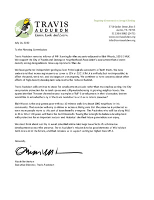
Inspiring Conservation through Birding 3710 Cedar Street, Box 5 Austin, TX. 78705 512.300. BIRD (2473) www.travisaudubon.org info@travisaudubon.org July 14, 2020 To the Planning Commission: Travis Audubon remains in favor of MF-3 zoning for the property adjacent to Blair Woods, 5201 E MLK. We support the City of Austin and Stonegate Neighborhood Association’s assessment that a lower- density zoning designation is more appropriate for the site. We have gathered independent geological and hydrological assessments of both tracts. We now understand that increasing impervious cover to 65% at 5201 E MLK is unlikely (but not impossible) to affect the pond, wetlands, and drainages on our property. We continue to have concerns about other effects of high-density development adjacent to the restored habitat. Travis Audubon will continue to stand for development at scale rather than maximal up-zoning; the City can provide protection for natural spaces and still provide housing in growing neighborhoods. We appreciate that Thrower showed several examples of MF-6 development in their discussion, but we would like to ask whether any of them are next door to a 10-acre nature preserve? Blair Woods is the only greenspace within a 10-minute walk for almost 1000 neighbors in this community. That number will only continue to increase. Being sure that the preserve is protected as even more people move to this part of town benefits everyone. The Austinites who will live along MLK in 20 or 50 or 100 years will thank the Commission for having the foresight to balance development with protection for an important natural and historical site that future generations can enjoy. We must think about and try to avoid potential unintended negative effects of such intense development so near the preserve. Travis Audubon’s mission is to be good stewards of this habitat both now and in the future, and that requires us to support zoning no higher than MF-3. Sincerely, Nicole Netherton Executive Director, Travis Audubon 10-Minute Walk Impact Report The Trust for Public Land August 6, 2019 P a g e 1 o f 2 P r o j e c t A r e a s B l a i r W o o d s A l l s t a t i s t i c a l r e s u l t s a r e a g g r e g a t e d f o r t h e l …
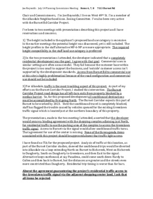
Joe Reynolds July 14 Planning Commission Meeting Items 6, 7, 8 7113 Burnet Rd Chair and Commissioners, I’m Joe Reynolds; I live on West 49th St. I’m a member of the Allandale Neighborhood Assn. Zoning Committee. I’ve also been very active with the Burnet Rd Corridor Project. I’ve been to two meetings with presentations describing this project and I have reservations and concerns. 1] The height included in the applicant’s proposed land use category is excessive. In the earlier meetings the potential height was disavowed, yet is still included. The height profiles in the staff alternative MF-6-NP are more appropriate. The required height compatibility in the staff land use category is preferred. 2] In the two presentations I attended, the developer indicated that a completely residential development was the goal. I agree with that goal. Commercial uses in similar settings are often unsuccessful. They fail because the customer base within the project is too small to support the business, and ‘outside’ customer access isn’t supported by the development standards. Access from Burnet Rd to commercial use at this site is highly problematical because of the road configuration and commercial use should not be included. 3] For Allandale, traffic is the most troubling aspect of this project. As part of my efforts on the Burnet Corridor Project, I studied this intersection. The Burnet Corridor Project road design has all left-turn exits from property blocked by a median barrier. So, for this proposed development all southbound destinations must be accomplished by first going North. The Burnet Corridor expects this part of Burnet to be worked by 2023. Until the southbound travel is completely blocked, staff has flagged the trouble caused by vehicles queued for the existing Greenlawn traffic signal which is located just at the northern boundary of this property. The presentations, made in the two meeting I attended, asserted that the developer would secure a binding agreement with the shopping complex adjoining just North, for residential traffic to use the parking area of the complex to access the Greenlawn traffic signal. Access to Burnet via the signal would allow southbound traffic turns. That agreement for use of the center is missing. None of the three agenda items associated with this project should be approved absent that traffic light access. I have found no TIA for the proposed project. Analysis of traffic at this location, as part of the Burnet Corridor studies, …
MEMORANDUM ************************************************************************ TO: Conner Kenny, Chair Planning Commission Members July 13, 2020 Planning and Zoning Department C14-2020-0016, – 7113 Burnet Road Late Backup – Reciprocal Access Easement Agreement FROM: Mark Graham, Senior Planner DATE: RE: ************************************************************************ On Thursday, July 9, 2020, Michael Gaudini, Agent with Armbrust and Brown, submitted a copy of the executed and recorded “Reciprocal Access Easement Agreement” that provides signalized access to 7113 Burnet Road. The Agreement was reviewed by Austin Transportation Engineering, Sangeeta Jain, and her comments were revised in the Amanda system on Friday July 10, 2020. These comments were received after the staff report was submitted for the July 14, 2020 Planning Commission meeting. Please see Sangeeta Jain comments below. Updated July 10, 2020: “A reciprocal access easement has been created and recorded by the owner with the tract to the north of this site. This will allow for safe ingress and egress from this property at the Greenlawn Parkway, which has a traffic signal. Additional mitigations may be required at the time of site plan, when the land uses and intensities have been finalized. Attachment: Reciprocal Access Easement Agreement
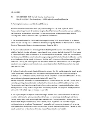
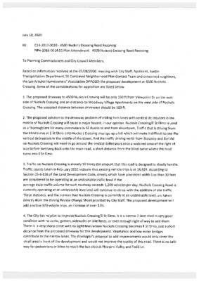
July 10, 2020 RE: C14-2017-0010 - 4500 Nuckols Crossing Road Rezoning NPA-2016-0014.01 Plan Amendment - 4500 Nuckols Crossing Road Rezoning To Planning Commissioners and City Council Members, Based on information received at the 07/08/2020 meeting with City Staff, Applicant, Austin Transportation Department, SE Combined Neighborhood Plan Contact Team and concerned neighbors, the Los Arboles Homeowners' Association OPPOSES the proposed development at 4500 Nuckols Crossing. Some of the considerations for opposition are listed below. 1. The proposed driveway to 4500 Nuckols Crossing will be only 150 ft from Viewpoint Dr on the east side of Nuckols Crossing and an entrance to Woodway Village Apartments on the west side of Nuckols Crossing. The accepted distance between driveways should be 500 ft. 2. The proposed solution to the driveway problem of adding turn lanes with vertical delineators in the middle of Nuckols Crossing will cause a major hazard, in our opinion. Nuckols Crossing/E St Elmo is used as a thoroughfare for many commuters in SE Austin to and from downtown. Traffic that is driving from the blind curve at E St Elmo onto Nuckols Crossing must go up a hill which will make it difficult to see the vertical delineators in the middle of the street. And the traffic driving north from Stassney and Teri Rd on Nuckols Crossing will need to go around the vertical delineators onto a widened area of the right of way before swerving back onto the main road, a short distance from the blind curve where the road turns into E St Elmo. 3. Traffic on Nuckols Crossing is already 10 times the amount that this road is designed to ideally handle. Traffic counts taken in February 2020 indicate that existing vehicle trips is at 14,929. According to Section 25-6-116 of the Land Development Code, streets which have pavement width less than 30 feet are considered to be operating at an undesirable traffic level if the average daily traffic volume for such roadway exceeds 1,200 vehicles per day. Nuckols Crossing Road is currently operating at an undesirable level and will continue to do so with the addition of site traffic. These statistics, and the opinion that Nuckols Crossing is currently at an undesirable level, are taken directly from the Zoning Review Change Sheet provided by City Staff. The proposed development will add another 979 vehicle trips, an increase of over 13%. 4. The City has no plan to …
From: Fred McGhee < Sent: Monday, July 13, 2020 5:41:59 PM To: Rivera, Andrew <Andrew.Rivera@austintexas.gov> Subject: Planning Commission, 7/14/20 *** External Email - Exercise Caution *** Dear Andrew, Please sign me up in opposition and not wishing to speak for the following cases at tomorrow's Planning Commission meeting: (C14-2020-0029 - Montopolis Acres Rezoning; District 3) (C14-2020-0030 - 200 Montopolis Rezoning; District 3) (C14-2020-0039 - Clovis and Kemp Rezone; District 3) (C14-2020-0044 - Saxon Acres Residential Zoning; District 3) Thanks, flm
July 14, 2020 Jerry Rusthoven Assistant Director Planning & Zoning Department City of Austin Re: 200 Montopolis Rezoning, C14-2020-0030 Respectfully, Victoria Haase Ron Thrower On behalf of the property owners, we respectfully request a postponement of this case from July 14, 2020 to July 28, 2020 to assure that surrounding property owners and renters have access to accurate information before the cases are discussed at public hearing. We remain available for any questions or clarifications on the matter.
July 14, 2020 Jerry Rusthoven Assistant Director Planning & Zoning Department City of Austin Re: Clovis & Kemp Rezoning, C14-2020-0039 Respectfully, Victoria Haase Ron Thrower On behalf of the property owners, we respectfully request a postponement of this case from July 14, 2020 to July 28, 2020 to assure that surrounding property owners and renters have access to accurate information before the cases are discussed at public hearing. We remain available for any questions or clarifications on the matter.
July 14, 2020 Jerry Rusthoven Assistant Director Planning & Zoning Department City of Austin Re: Saxon Acres Rezoning, C14-2020-0044 Respectfully, Victoria Haase Ron Thrower On behalf of the property owners, we respectfully request a postponement of this case from July 14, 2020 to July 28, 2020 to assure that surrounding property owners and renters have access to accurate information before the cases are discussed at public hearing. We remain available for any questions or clarifications on the matter.
Allandale Neighborhood Association • P.O. Box 10886 • Austin, Texas 78766 July 14, 2020 Reference: Austin Planning Commission Meeting of July 14 2020 Items B6-7-8 PROJECT NAME: 7113 Burnet Dear Chairman and Planning Commission Members, I am writing on behalf of the Allandale Neighborhood Association regarding items B6-7-8 on the agenda for the July 14th meeting. While our neighborhood association supports a transition from commercial to multi-family zoning on this property, we do not support the MF-6 zoning that is requested. Instead, we favor the city staff recommendation to grant multifamily residence, moderate high density - neighborhood plan (MF-4-NP) district zoning. A 90-foot height limit far exceeds any other nearby development and is not in keeping with the neighborhood. Further, we are concerned that the applicant suggests that this project is not in an environmentally sensitive area. Flooding, water quality and utility infrastructure are all key concerns to Allandale residents and others in the Shoal Creek watershed. Per the staff recommendation, the proposed zoning should be consistent with the purpose statement of the district sought. We oppose the applicant’s request for MF-6-NP – Multifamily Residence (Highest Density) district that would enable building 360 residential units on the property (an estimated 81 units per acre). We concur with the staff recommendation for a change to MF-4 – Multifamily Residence (Moderate-High Density) district, which can accommodate multifamily residential use with a maximum density of 36 - 54 units per acre, depending on unit size. This change will allow for moderate-high density housing near supporting transportation and commercial facilities, while supporting and respecting the adjacent neighborhoods. The MF-4-NP zoning is more compatible with our neighborhoods and nearby businesses, July 14, 2020 Page | 2 providing for increased setbacks near the Single-Family zones and reduced building heights. There are many questions remaining about ingress/egress to Burnet Road and related traffic problems that will cause – predominantly to Allandale residents. For these and other reasons, we urge you to vote against the proposal to grant MF-6-NP zoning and to support MF-4-Multifamily Residence zoning on this project. Allandale Neighborhood Association Board of Directors
7713 Burnet Zoning & FLUM Amendment Overview • Request: • Rezone from CS-1-CO-NP/CS-CO-NP/LO-CO-NP to MF-6-NP. • Amend the Future Land Use Map (FLUM) to reflect multi-family. • Terminate an outdated restrictive covenant. • Bottom Line: The applicant is requesting the ability to provide a 360-unit apartment on Burnet, with 10 percent of units affordable at 60 percent MFI. • Rationale: Approving this downzoning would support the City’s housing and mobility goals while decreasing overall site development entitlements. 7113 Burnet Rd. 7113 Burnet Rd. CS-CO-NP CS-1-CO-NP LO-CO-NP Existing Use: Outdated Commercial/Bar Burnet Road is Key to City Goals Burnet Road is Key to City Goals Imagine Austin Corridor Burnet Road is Key to City Goals Imagine Austin Corridor Core Transit Corridor Burnet Road is Key to City Goals Imagine Austin Corridor Core Transit Corridor Transit Priority Network Roadway Burnet Road is Key to City Goals Imagine Austin Corridor Core Transit Corridor Transit Priority Network Roadway 2016 Mobility Bond Corridor Affordable Housing Along Burnet The City has a goal of 1,098 units up to 80 percent MFI by 2027 for Burnet Road… City Goal (1,098 units) Affordable Housing Along Burnet …but is starting with only a limited stock of affordable units… City Goal (1,098 units) Built/Active Affordable Units (168 units) Affordable Housing Along Burnet …and only has a limited number of projects in the pipeline… City Goal (1,098 units) Built/Active + Pipeline (344 units total) Affordable Housing Along Burnet …leaving a meaningful gap that will need to be filled to hit the City’s goals. City Goal (1,098 units) Units Needed by 2027 (930 units total) 7113 Burnet Supports Affordability Goals ON-SITE 60% MFI 10% OF ALL UNITS Total Proposed Housing: Proposed Affordable Housing: Average Annual Affordable Unit Production (Burnet): ~360 units ~36 units ~15 units The City has a goal of 135,197 new units by 2027, or 13,520 per year on average… Housing Goals City Goal Housing Goals …but has not been on track to meet its goal. City Goal Net New Units 7113 Burnet Supports Mobility Goals TRANSIT-SUPPORTIVE DENSITY. “Establishing transit-supportive densities along planned high-capacity transit is essential to its success.” (p. 36) SUPPORTING AFFORDABILITY. “Increase the percentage of affordable housing available at 30%, 50%, 60%, and 80% MFI within 1/2 mile of transit and bicycle priority networks.” (p. 221) ✓ ✓ REDUCING CURB CUTS. “We should require and incentivize reducing the number and size of curb cuts.” (p. 21) ✓ …
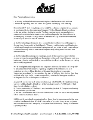
Dear Planning Commission, I'm writing on behalf of the Crestview Neighborhood Association Executive Committee regarding item B6-7-8 on the agenda for the July 14th meeting.. Before Covid-19 shut everything down, we (CNA and some neighbors) had a couple of meetings with the developer and his agent (Michael Gaudini) to discuss their exploring options for that property. The first meeting was in January but was requested too late to be included on our published agenda. We allowed them to come anyway and speak though because there wasn’t any previous notice to the community there wasn’t much turnout. At that time the biggest request of us seemed to be whether we would support a change from Commercial to Multi-Family. This was exciting to the neighborhood as a whole and brought us to the table hoping to work out a deal to both create a large amount of housing where there was none previously, along a corridor and near transportation. At that time (and in subsequent meetings), most of the usual concerns with the current occupants such as ill placed dumpsters with poorly timed disposal pick-ups, inadequate fencing and the lack of compatibility standards under the current zoning were quickly appeased. We encouraged the developer and the neighbors immediately behind the property to talk about potential concerns regarding height over their backyards and reduction in privacy. They did discuss this, and the developer produced a "compromise package" in June, pushing the start of 40 feet a little further than they could do it by right under current compatibility standards. We appreciated the willingness to talk, and it kept us at the table. As you will see in your back-up material on page 10, at the March 3 public meeting we were told the height of the front of the building would be "60-75 feet" at that time. Here is what was asked: Q. The current zoning of CS allows a maximum height of 60 ft. The proposed zoning of MF-6 allows up to 90 feet. A. We don’t want the 90 feet that would be allowed under the MF-6. We maybe need 60-75 feet with five to six floors. Mid March through April was, admittedly, a down time for our communication as a neighborhood association. We didn't have a lot of pressing items on our plate and were unclear as to what was going to be prioritized by the city. Clearly, this became …
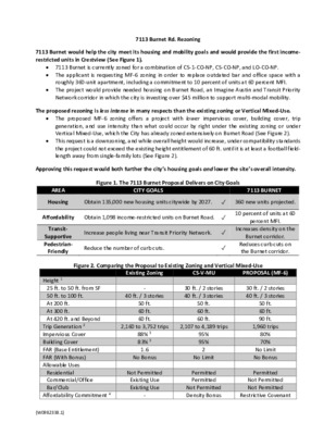
7113 Burnet Rd. Rezoning 7113 Burnet would help the city meet its housing and mobility goals and would provide the first income- restricted units in Crestview (See Figure 1). 7113 Burnet is currently zoned for a combination of CS-1-CO-NP, CS-CO-NP, and LO-CO-NP. The applicant is requesting MF-6 zoning in order to replace outdated bar and office space with a roughly 360-unit apartment, including a commitment to 10 percent of units at 60 percent MFI. The project would provide needed housing on Burnet Road, an Imagine Austin and Transit Priority Network corridor in which the city is investing over $45 million to support multi-modal mobility. The proposed rezoning is less intense in many respects than the existing zoning or Vertical Mixed-Use. The proposed MF-6 zoning offers a project with lower impervious cover, building cover, trip generation, and use intensity than what could occur by right under the existing zoning or under Vertical Mixed-Use, which the City has already zoned extensively on Burnet Road (See Figure 2). This request is a downzoning, and while overall height would increase, under compatibility standards the project could not exceed the existing height entitlement of 60 ft. until it is at least a football field- length away from single-family lots (See Figure 2). Approving this request would both further the city’s housing goals and lower the site’s overall intensity. Figure 1. The 7113 Burnet Proposal Delivers on City Goals AREA CITY GOALS 7113 BURNET Housing Obtain 135,000 new housing units citywide by 2027. ✓ 360 new units projected. Affordability Obtain 1,098 income-restricted units on Burnet Road. ✓ Transit- Supportive Pedestrian- Friendly Increase people living near Transit Priority Network. ✓ Reduce the number of curb cuts. ✓ 10 percent of units at 60 percent MFI. Increases density on the Burnet corridor. Reduces curb cuts on the Burnet corridor. Figure 2. Comparing the Proposal to Existing Zoning and Vertical Mixed-Use Existing Zoning CS-V-MU PROPOSAL (MF-6) 40 ft. / 3 stories 30 ft. / 2 stories 40 ft. / 3 stories 30 ft. / 2 stories 40 ft. / 3 stories Height 1 25 ft. to 50 ft. from SF 50 ft. to 100 ft. At 200 ft. At 300 ft. At 420 ft. and Beyond Trip Generation 2 Impervious Cover Building Cover FAR (Base Entitlement) FAR (With Bonus) Allowable Uses Residential Commercial/Office Bar/Club Affordability Commitment 4 50 ft. 60 ft. 60 ft. 88% …
MEMORANDUM ************************************************************************ TO: Conner Kenny, Chair Planning Commission Members July 13, 2020 Planning and Zoning Department C14-2020-0016, – 7113 Burnet Road Late Backup – Reciprocal Access Easement Agreement FROM: Mark Graham, Senior Planner DATE: RE: ************************************************************************ On Thursday, July 9, 2020, Michael Gaudini, Agent with Armbrust and Brown, submitted a copy of the executed and recorded “Reciprocal Access Easement Agreement” that provides signalized access to 7113 Burnet Road. The Agreement was reviewed by Austin Transportation Engineering, Sangeeta Jain, and her comments were revised in the Amanda system on Friday July 10, 2020. These comments were received after the staff report was submitted for the July 14, 2020 Planning Commission meeting. Please see Sangeeta Jain comments below. Updated July 10, 2020: “A reciprocal access easement has been created and recorded by the owner with the tract to the north of this site. This will allow for safe ingress and egress from this property at the Greenlawn Parkway, which has a traffic signal. Additional mitigations may be required at the time of site plan, when the land uses and intensities have been finalized. Attachment: Reciprocal Access Easement Agreement
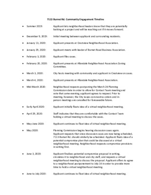
7113 Burnet Rd. Community Engagement Timeline Summer 2019: Applicant lets neighborhood leaders know that they are potentially looking at a project and will be reaching out if it moves forward. December 9, 2019: Initial meeting between applicant and surrounding residents. January 13, 2020: January 29, 2020: February 3, 2020: Applicant files cases. Applicant presents at Crestview Neighborhood Association. Applicant meets with leader of Burnet Road Business Association. February 20, 2020: Applicant presents at Allandale Neighborhood Association Zoning Committee. March 3, 2020: City hosts meeting with community and applicant in Crestview on cases. March 4, 2020: Applicant presents at Allandale Neighborhood Association. Mid-March 2020: Neighborhood requests postponing the March 24 Planning Commission date in order to allow for Contact Team meeting and vote that same evening; applicant agrees to request. Prior to meeting, however, the City issues coronavirus orders and in- person meetings are cancelled for foreseeable future. Early April 2020: Applicant initially floats idea of a virtual neighborhood meeting. April 29, 2020: Staff indicates that they are comfortable with the Contact Team holding a virtual meeting to discuss the cases. May-June 2020: Applicant continues to float idea of virtual neighborhood meeting. May 2020: June 3, 2020: Planning Commission begins hearing discussion cases again. Applicant requests that since discussion cases are now being scheduled, 7113 Burnet Rd. should similarly be scheduled. Applicant floats idea of a potential compromise plan that could be discussed at a virtual neighborhood meeting. Neighborhood requests compromise provisions in writing first. Applicant finalizes potential compromise proposal in writing, circulates it to neighborhood and city staff, and requests a virtual neighborhood meeting to discuss the proposal. Applicant offers to agree to a neighborhood postponement to July 14 in order to provide more time to hold a virtual neighborhood meeting. June to July 2020: Applicant continues to float idea of virtual neighborhood meeting. ARMBRUST & BROWN, PLLC A T T O R N E Y S A N D C O U N S E L O R S 100 CONGRESS AVENUE, SUITE 1300 AUSTIN, TEXAS 78701-2744 512-435-2300 FACSIMILE 512-435-2360 July 13, 2020 Planning Commission 301 W. 2nd St. Austin, TX 78701 Dear Members: Re: Voluntary affordable housing commitments for 7113 Burnet Rd. In our cover letter dated January 30, 2019 for the land use applications related to 7113 Burnet Rd., we described our …
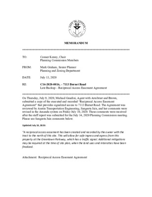
Existing Retaining Wall to Remain LOT 2 : MF-s-CO-NP - io'setback r. ,l lrtI I B O LT -9 'LO FACE OF SOIL RETENTION WALL FENCE AND GATE FOR COLORFIELD RESIDENTS LOT 1 : MF-6-CO-NP 3-51aqr ct'iq PARkttJG tllu.r;.FA?,rit? lll t,r{:i5 -l -_-L Gate for Maiqtenance/Resident lngress/Egress r tGoL I I I I I I I I I I I l lLrt l:f lL lb lliil II f--; l! L-l t c -e4* - , a
Springdale Farms Item B-17 07/14/2020 Planning Commission 9/6/2019 1 Site Location • • • • • Area: 4.85 acres Zoning: CS-MU-CO-NP Along Imagine Austin Corridor 2 Blocks from Transit priority (in both directions) Activity Corridor 2 Neighborhood Outreach • Held community meetings to: • Understand from our future neighbors what the Farm has meant to the community • Get a sense of what future uses could be beneficial to • Introduce StoryBuilt and discuss overall design the community strategy the site) • Preservation (trees, existing features important to • Sustainability • Green infrastructure • Neighborhood fabric • Mixed Use (residential for sale and commercial) 3 Community Feedback and Project Goals Feedback from community meetings: • Keep some level of farming and farm-stand operational • Mixed use (residential and commercial) • Open space • Independent grocery • Coffee shop/cafe • Welcoming environment • Pedestrian oriented • Sub-grade parking and limited Impervious cover • Affordable housing component – based on % of total Units built 4 Neighborhood Support Letter of Support for all Entitlements asks including the site plan as presented today 5 Site Overview and Hardship • • • • Total Area = 211,000 sf Buildable area = 108,000 or 50% of total area due to preserving 10 Heritage Trees, floodplain, CWQZ and compatibility setbacks CWQZ created due to basin being approximately 2 acres over 64 ac minimum even though channel is manmade Less than ½ % slope to Boggy Creek drastically increases floodplain and CWQZ. 6 Site Plan Site Plan: • 87 For sale Units • • • • • • • +/- 65,000 sf of commercial Open Space: 2.25 ac (includes 23k sf of Urban Farm 50% Imp cover (95% Allowed) FAR: 0.8:1 (1.2:1 allowed under existing entitlements, 2:1 per Zoning) Tree Preservation Limited alternatives for fire lane so proposed utilization of compatibility setback, as grassed, pervious pavers, with minimal impacts Collaboration of StoryBuilt and the NPCT to accomplish the goals: • • • • Mixed Use Farming Sub-grade parking Pedestrian Oriented Alternative turn- around 7 Proposed Encroachments Fire Lane Encroachment: • Approximately 3500 SF of “Grass- Crete” permeable paving system within Floodplain/CWQZ with only 1200 sf being within the initial 50- ft offset to serve as Fire access Approximately 810 SF of building overhang into proposed urban farm area (overhang: avg 6’5”; max 13ft ) CWQZ Encroachment Calcs: • Total: 73,130 sf Encroachment within 50-ft setback: 1200sf (1.6%) …
Springdale Farms Item B-17 07/14/2020 Planning Commission 9/6/2019 1 Site Location • • • • • Area: 4.85 acres Zoning: CS-MU-CO-NP Along Imagine Austin Corridor 2 Blocks from Transit priority (in both directions) Activity Corridor Page 1 2 Neighborhood Outreach • Held community meetings to: • Understand from our future neighbors what the Farm has meant to the community • Get a sense of what future uses could be beneficial to • Introduce StoryBuilt and discuss overall design the community strategy the site) • Preservation (trees, existing features important to • Sustainability • Green infrastructure • Neighborhood fabric • Mixed Use (residential for sale and commercial) Page 2 3 Community Feedback and Project Goals Feedback from community meetings: • Keep some level of farming and farm-stand operational • Mixed use (residential and commercial) • Open space • Independent grocery • Coffee shop/cafe • Welcoming environment • Pedestrian oriented • Sub-grade parking and limited Impervious cover • Affordable housing component – based on % of total Units built 4 Neighborhood Support Letter of Support for all Entitlements asks including the site plan as presented today 5 Site Overview and Hardship • • • • Total Area = 211,000 sf Buildable area = 108,000 or 50% of total area due to preserving 10 Heritage Trees, floodplain, CWQZ and compatibility setbacks CWQZ created due to basin being approximately 2 acres over 64 ac minimum even though channel is manmade Less than ½ % slope to Boggy Creek drastically increases floodplain and CWQZ. 6 Site Plan Site Plan: • 87 For sale Units • • • • • • • +/- 65,000 sf of commercial Open Space: 2.25 ac (includes 23k sf of Urban Farm 50% Imp cover (95% Allowed) FAR: 0.8:1 (1.2:1 allowed under existing entitlements, 2:1 per Zoning) Tree Preservation Limited alternatives for fire lane so proposed utilization of compatibility setback, as grassed, pervious pavers, with minimal impacts Collaboration of StoryBuilt and the NPCT to accomplish the goals: • • • • Mixed Use Farming Sub-grade parking Pedestrian Oriented Alternative turn- around 7 Proposed Encroachments Fire Lane Encroachment: • Approximately 3500 SF of “Grass- Crete” permeable paving system within Floodplain/CWQZ with only 1200 sf being within the initial 50- ft offset to serve as Fire access Approximately 810 SF of building overhang into proposed urban farm area (overhang: avg 6’5”; max 13ft ) CWQZ Encroachment Calcs: • Total: 73,130 sf Encroachment within …
1118 West 7th Street SP-2019-0559C Planning Commission July 14, 2020 Property Facts • Zoning: MF-4-HD-NP • Surrounding zoning: mostly MF with some SF • Many parcels in the area are developed with low density multifamily structures • Castle Hills Historic District – the existing contributing structure to the historic district will be preserved and is not proposed for demolition. • Proposed improvements received support by Historic Landmark Commission on September 23, 2019 Proposed Project • New single-family, attached structure (duplex) at rear of the property along alley • Existing single-family home fronting W. 7th Street will remain • 3 single family units total in 2 structures • 3 or more units on a property constitutes a “multifamily” land use which triggers compatibility standards Land Use • Structures individually are single family land uses, which normally does not trigger compatibility standards • More than 2 units on a property constitutes a “multifamily” land use on the site which does trigger compatibility standards Request • Waiver to reduce the no-build compatibility setback from 15 feet to 5 feet Commission-Approved Waiver from Compatibility Standards • LDC Section 25-2-1081 • (A) The Land Use Commission, or council on appeal from a Land Use Commission decision, may waive a requirement of [Compatibility Standards] if the Land Use Commission or council determine that a waiver is appropriate and will not harm the surrounding area. • (B) The Land Use Commission or council may not approve a waiver that reduces a required setback to less than five feet. Justification for Waiver Request • Compatibility is triggered based on use only (surrounding tracts are zoned for multifamily) • Project with otherwise comply with all base zoning site development regulations, including the 5’ interior side yard setbacks • Project is not proposing waivers to compatibility height stepback requirements SITE • Project will not alter or harm the neighborhood character, as it is preserving the existing historic home on the lot while proposing additional single- family residential land uses. • Neighborhood is developed with a mixture of single family and low-density multifamily uses 1119 W. 9th St • 3 units • Approx. 40 feet from 1118 W. 7th St. 807 Blanco St • 16 unit multifamily use • Approx. 100 feet from 1118 W. 7th St. 1115 W. 9th St • 11 unit multifamily use • Approx. 100 feet from 1118 W. 7th St. (across the alley, fronting W. 9th …
PLANNING COMMISSION July 14, 2020 MINUTES The Planning Commission convened in a meeting on July 14, 2020 via videoconference (http://www.austintexas.gov/page/watch-atxn-live) Chair Kenny called the Commission Meeting to order at 6:15 p.m. Commission Members in Attendance: Greg Anderson Awais Azhar Yvette Flores Claire Hempel Patrick Howard Fayez Kazi – Vice-Chair Conor Kenny – Chair Carmen Llanes Pulido Robert Schneider Patricia Seeger Todd Shaw James Shieh Jeffrey Thompson Don Leighton-Burwell – Ex-Officio Absent: Ann Teich – Ex-Officio EXECUTIVE SESSION (No public discussion) The Planning Commission will announce it will go into Executive Session, if necessary, pursuant to Chapter 551 of the Texas Government Code, to receive advice from Legal Counsel on matters specifically listed on this agenda. The Commission may not conduct a closed meeting without the approval of the city attorney. Private Consultation with Attorney – Section 551.071 A. APPROVAL OF MINUTES 1. Approve the minutes of June 26, 2020. Motion to approve the minutes of June 26, 2020 was approved on the consent agenda on the motion by Commissioner Azhar, seconded by Commissioner Shieh on a vote of 13-0. B. PUBLIC HEARINGS 1. Rezoning: Location: C14-2020-0029 - Montopolis Acres Rezoning; District 3 1013 and 1017 Montopolis Drive, Country Club East and Colorado River Watersheds; Montopolis NP Area Owner/Applicant: Montopolis Acres LP (Danny Walker) Agent: Request: Staff Rec.: Staff: Thrower Design (A. Ron Thrower) SF-3-NP to SF-6-NP Recommended Kate Clark, 512-974-1237, kate.clark@austintexas.gov Planning and Zoning Department Motion to grant Staff’s request for indefinite postponement of this item was approved on the consent agenda on the motion by Commissioner Azhar, seconded by Commissioner Shieh on a vote of 13-0. 2. Rezoning: Location: C14-2020-0030 - 200 Montopolis Rezoning; District 3 200 Montopolis Drive and 6208 Clovis Street, Country Club East and Colorado River Watersheds; Montopolis NP Area Owner/Applicant: Nine Banded Holdings LLC (Taylor Jackson) Agent: Request: Staff Rec.: Staff: Thrower Design (A. Ron Thrower) SF-3-NP to SF-6-NP Recommended Kate Clark, 512-974-1237, kate.clark@austintexas.gov Planning and Zoning Department Motion to grant Applicant’s request for postponement of this item to July 28, 2020 was approved on the consent agenda on the motion by Commissioner Azhar, seconded by Commissioner Shieh on a vote of 13-0. 3. Rezoning: Location: Owner/Applicant: Agent: Request: Staff Rec.: Staff: C14-2020-0039 - Clovis and Kemp Rezone; District 3 6201 Clovis Street and 301 Kemp Street, Country Club East Watershed; Montopolis NP Area 3SC Venture LLC (Gary O’Dell) Thrower Design (A. Ron Thrower) SF-3-NP …