B-01 (C14-2020-0029 - Montopolis Acres Rezoning; District 3) — original pdf
Backup
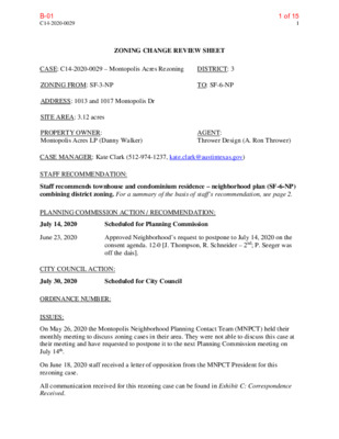
C14-2020-0029 1 ZONING CHANGE REVIEW SHEET CASE: C14-2020-0029 – Montopolis Acres Rezoning DISTRICT: 3 ZONING FROM: SF-3-NP TO: SF-6-NP ADDRESS: 1013 and 1017 Montopolis Dr SITE AREA: 3.12 acres PROPERTY OWNER: Montopolis Acres LP (Danny Walker) AGENT: Thrower Design (A. Ron Thrower) CASE MANAGER: Kate Clark (512-974-1237, kate.clark@austintexas.gov) STAFF RECOMMENDATION: Staff recommends townhouse and condominium residence – neighborhood plan (SF-6-NP) combining district zoning. For a summary of the basis of staff’s recommendation, see page 2. PLANNING COMMISSION ACTION / RECOMMENDATION: July 14, 2020 Scheduled for Planning Commission June 23, 2020 Approved Neighborhood’s request to postpone to July 14, 2020 on the consent agenda. 12-0 [J. Thompson, R. Schneider – 2nd; P. Seeger was off the dais]. CITY COUNCIL ACTION: July 30, 2020 Scheduled for City Council ORDINANCE NUMBER: ISSUES: On May 26, 2020 the Montopolis Neighborhood Planning Contact Team (MNPCT) held their monthly meeting to discuss zoning cases in their area. They were not able to discuss this case at their meeting and have requested to postpone it to the next Planning Commission meeting on July 14th. On June 18, 2020 staff received a letter of opposition from the MNPCT President for this rezoning case. All communication received for this rezoning case can be found in Exhibit C: Correspondence Received. 1 of 15B-01 C14-2020-0029 2 CASE MANAGER COMMENTS: This property is approximately 3.12 acres and is located on the east side of Montopolis Drive. It is currently zoned SF-3-NP. Across Montopolis Drive to the west are properties zoned SF-3-NP with single-family residential buildings. Adjacent to the north is a property zoned LO-MU-CO- NP which is undeveloped. Adjacent to the east and south of the property are tracts zoned SF-3- NP with single-family residential (to the east) and religious assembly uses (to the south), see Exhibit A: Zoning Map and Exhibit B: Aerial Map. BASIS OF RECOMMENDATION: 1. The proposed zoning should be consistent with the purpose statement of the district sought. Zoning changes should promote compatibility with adjacent and nearby uses. The applicant is requesting a base zoning district of SF-6. This district is intended as an area for moderate density single family, duplex, two family, townhouse and condominium use. It is appropriate for areas in which unusually large lots predominate with access to other than minor residential streets, and in selected areas where a transition from single-family to multifamily use is appropriate. This property is adjacent to Montopolis Drive, a Level 3 Road classified by the Austin Strategic Mobility Plan (ASMP). It is also in between a property zoned LO-MU-CO-NP to the north and SF-3-NP to the south. Rezoning this property to SF-6-NP would provide a transition in use and site development standards between the two properties. EXISTING ZONING AND LAND USES: Site North South East West Zoning Land Uses SF-3-NP LO-MU-CO-NP SF-3NP SF-3-NP SF-3-NP Residential Vacant Residential Residential Religious Assembly Building NEIGHBORHOOD PLANNING AREA: Montopolis Neighborhood Plan (NP Ordinance No. 010927-05) TIA: The TIA determination is deferred until site plan submittal as final land use mix and intensities will be available with the site development application. WATERSHED: Carson Creek (suburban) OVERLAYS: Airport Overlay (Controlled Compatible Land Use Area), Residential Design Standards. SCHOOLS: Allison Elementary, Martin Middle and Eastside Memorial High Schools. 2 of 15B-01 C14-2020-0029 3 Number Request Commission City Council SF-3-NP to SF-6-NP To grant SF-6-NP as Larch Terrace Neighborhood Association Montopolis Community Alliance Montopolis Neighborhood Plan Contact Team Montopolis Tributary Trail Association Neighborhood Empowerment Foundation Pleasant Valley Preservation Austin SELTexas Sierra Club, Austin Regional Group Vargas Neighborhood Association Vasquez Fields Neighborhood Association Approved SF-6-NP as Commission recommended. (11/14/19) Approved LO-MU- CO-NP as Commission recommended. (12/11/14) recommended by Staff. To grant LO-MU- CO-NP, CO consisted of a set of prohibited uses, limiting vehicular trips per day, limiting height of buildings to 2-stories and requirement of a fence along the property line. In review. In review. NEIGHBORHOOD ORGANIZATIONS Austin Independent School District Austin Neighborhoods Council Bike Austin Carson Ridge Neighborhood Association Crossing Gardenhome Owners Assn. (The) Del Valle Community Coalition Del Valle Independent School District East Austin Conservancy El Concilio Mexican-American Neighborhoods Friends of Austin Neighborhoods Homeless Neighborhood Association AREA CASE HISTORIES: C14-2019-0093 1411 Montopolis Drive C14-2014-0127 / NPA-2014-0005.02 1007 & 1011 Montopolis Drive LO-CO-NP to LO-MU-NP C814-97-0002.01 / NPA-2018-0005.02 Mary Vice Estates PUD, Lot 27 Amendment The application is proposing an increase to maximum building square footage, reduce the building setbacks and allow townhouse, condo, and duplex residential uses to the existing use. 3 of 15B-01 C14-2020-0029 4 RELATED CASES: C14-01-0060: Montopolis Neighborhood Plan rezoning (Ordinance No. 010927-28). This property’s base zoning district was not rezoned (changed) during this process. EXISTING STREET CHARACTERISTICS: Street ROW Pavement Classification Sidewalks Bike Route Capital Metro (within ¼ mile) Shared Lane Yes Montopolis Drive 70’ 45’ Level 3 Yes OTHER STAFF COMMENTS: Comprehensive Planning The subject property for this rezoning case is located on the east side of Montopolis Drive and to the north of the Riverside Station Town Center. The property is approximately 3.12 acres in size and is located within the boundaries of the Montopolis Neighborhood Planning Area. Surrounding land uses include a vacant lot and single-family development to the north, to the south are single-family residences and a religious assembly building, and to the east and west are single-family residences. Connectivity There are public sidewalks located on both sides of this portion of Montopolis Drive. A CapMetro Transit Stop is located approximately 200 feet from the subject property. The Montopolis Neighborhood Park is located approximately 500 feet south of the property. There are two family grocery stores within a quarter of a mile radius. The mobility and connectivity options are average. Montopolis Neighborhood Plan The Montopolis Future Land Use Map classifies this portion of Montopolis Drive as single family. For all plans adopted prior to January 2002 (the Montopolis Plan was adopted in 2001), the zoning district SF-6 is permitted in the “Single Family” land use designation. The following goal, objections and actions are taken from the Montopolis Plan. • Goal 2: Create Homes for all Stages of Life within Montopolis. (p 14) o Objective 4: Enhance and protect existing single family housing. Action 12: Preserve the existing Single Family uses and zoning in the older, established areas of Montopolis. o Objective 5: Create multiple housing types of varied intensities. 4 of 15B-01 C14-2020-0029 5 Based on the policies above, this proposed townhouse/condominium project supports the Montopolis Neighborhood Plan because it is providing new housing and housing choice of a varied intensity. Imagine Austin The Imagine Austin Growth Concept Map found in the Imagine Austin Comprehensive Plan (IACP) identifies this project as being north of the Riverside Station Town Center. The Town Center’s actual boundaries would need to be clarified through a small area planning process. These types of centers are intended to have a variety of housing types and range in size from one-to three-story houses, duplexes, townhouses, and rowhouses, to low-to midrise apartments, mixed use buildings, and office buildings. The following policies are relevant to this case: • HN P10. Create complete neighborhoods across Austin that have a mix of housing types and land uses, affordable housing and transportation options, and access to schools, retail, employment, community services, and parks and recreation options. • HN P1. Distribute a variety of housing types throughout the City to expand the choices able to meet the financial and lifestyle needs of Austin’s diverse population. The Austin Strategic Housing Blueprint, which is an amendment to Imagine Austin, includes goals for affordable housing in every City Council district. While this applicant has not identified this as an affordable housing project, it will provide additional missing middle housing near a Town Center. Based on Imagine Austin and Montopolis Neighborhood Plan polices that support a variety of housing types and the policies above, this project supports the Imagine Austin Comprehensive Plan. 5 of 15B-01 C14-2020-0029 6 6 of 15B-01 C14-2020-0029 7 Environmental The property is not located over the Edwards Aquifer Recharge Zone. The site is in the Carson Creek Watershed of the Colorado River Basin, which is classified as a Suburban Watershed by Chapter 25-8 of the City's Land Development Code. Under current watershed regulations, development or redevelopment on this site will be subject to the following impervious cover limits: % of Gross Site Area % of Gross Site Area with Transfers 50% 60% Development Classification Single-Family (minimum lot size 5750 sq. ft.) Other Single-Family or Duplex 55% Multifamily 60% 80% Commercial 60% 70% 90% According to floodplain maps there is no floodplain within or adjacent to the project location. Standard landscaping and tree protection will be required in accordance with LDC 25-2 and 25-8 for all development and/or redevelopment. At this time, site specific information is unavailable regarding vegetation, areas of steep slope, or other environmental features such as bluffs, springs, canyon rimrock, caves, sinkholes, and wetlands. Under current watershed regulations, development or redevelopment requires water quality control with increased capture volume and control of the 2-year storm on site. At this time, no information has been provided as to whether this property has any preexisting approvals that preempt current water quality or Code requirements. Site Plan Site plans will be required for any new development other than single-family or duplex residential. Any new development is subject to Subchapter E. Design Standards and Mixed Use. Additional comments will be made when the site plan is submitted. Additional design regulations will be enforced at the time a site plan is submitted. Any development which occurs in an SF-6 or less restrictive zoning district which is located 540 feet or less from property in an SF-5 or more restrictive zoning district will be subject to compatibility development regulations. Compatibility Standards The site is subject to compatibility standards due to the adjacency of SF-3-NP zoning to the south, east, and the proximity of SF-3-NP zoning across Montopolis Drive to the west. The following standards apply: • No structure may be built within 25 feet of the property line. 7 of 15B-01 C14-2020-0029 8 • No structure in excess of two stories or 30 feet in height may be constructed within 50 feet of the property line. • Landscaping or screening is required along the south and east property lines in accordance with the screening requirements (Section 25-2-1006 and ECM 2.9.1.), Parking Design Standards (Section 25-6-563) and/or Screening Standards (Section 25.2.1066) to screen adjoining properties from views of parking, mechanical equipment, storage, and refuse collection. • An intensive recreational use, including a swimming pool, tennis court, ball court, or playground, may not be constructed 50 feet or less from property in an SF-5 or more restrictive zoning district. Airport Overlay This site is located within the Austin-Bergstrom Airport Controlled Compatible Land Use Area Overlay. No use will be allowed that can create electrical interference with navigational signals or radio communications between airport and aircraft, make it difficult for pilots to distinguish between the airport lights and others, result in glare in the eyes of pilots using the airport, impair visibility in the vicinity of the airport, create bird strike hazards or otherwise in any way endanger or interfere with the landing, taking off, or maneuvering of aircraft intending to use the Austin-Bergstrom Airport. Height limitations and incompatible uses with each Airport Overlay zone are established in the Airport Overlay Ordinance. Airport Hazard Zoning Committee review may be required prior to Planning Commission Hearing. Additional comments may be generated during the site plan review process. Demolition and Historic Resources The applicant is responsible for requesting relocation and demolition permits once the site plan is approved. The City Historic Preservation Officer will review all proposed building demolitions and relocations prior to site plan approval. If a building meets city historic criteria, the Historic Landmark Commission may initiate a historic zoning case on the property. Residential Design Standards Overlay The site is subject to 25-2 Subchapter F. Residential Design and Compatibility Standards. Transportation The traffic impact analysis (TIA) determination is deferred until site plan submittal as final land use mix and intensities will be available with the site development application. At the time of submittal of any site plan on the Property, a TIA is required if the proposed development or uses on the Property, considered cumulatively with all existing or previously authorized development and uses, generates traffic that exceeds 2,000 trips per day. The Austin Strategic Mobility Plan (ASMP) adopted 04/11/2019, calls for 80 feet of right-of- way for Montopolis Drive. It is recommended that 40 feet of right-of-way from the existing 8 of 15B-01 C14-2020-0029 9 centerline should be dedicated for Montopolis Road according to the Transportation with the first site plan or subdivision application. [LDC 25-6-51 and 25-6-55]. Austin Water Utility The landowner intends to serve the site with City of Austin water and wastewater utilities. The landowner, at own expense, will be responsible for providing any water and wastewater utility improvements, offsite main extensions, utility relocations and or abandonments required by the land use. The water and wastewater utility plan must be reviewed and approved by Austin Water for compliance with City criteria and suitability for operation and maintenance. Based on current public infrastructure configurations, service extension requests (SER) will be required to provide suitable and sufficient service to this lot. For more information pertaining to the SER process and submittal requirements contact Alberto Ramirez with Austin Water, Utility Development Services located at 625 East 10th Street 7th floor or by phone at 512-972-0211. The landowner must pay the City inspection fee with the utility construction. The landowner must pay the tap and impact fee once the landowner makes an application for a City of Austin water and wastewater utility tap permit. INDEX OF EXHIBITS TO FOLLOW Exhibit A: Zoning Map Exhibit B: Aerial Map Exhibit C: Correspondence Received 9 of 15B-01 C D 4 5 E F 6 15 17 14 I H G 17 8 7 14 6 5 4 3 16 15 2 1 13 12 11 10 1 6 5 FELIX A 4 3 8 7 V E 6 5 4 SF-3-NP 2 1 16 15 14 13 H O G A 12 11 N A V E 10 9 8 9 8 SF-3-NP 7 3 2 1 GR-NP 6 5 4 3 2 1 11 10 GR-NP R I C GR-MU-NP H A R GR-NP 16 CS-NP 8 7 6 5 4 D S O N L N SF-3-NP 1 3 2 1 SF-3-NP 13 12 18 19 20 11 10 9 8 CLU B TE R 21 22 23 18 19 24 25 17 16 15 SF-3-NP 17 20 7 16 22 21 28 27 26 25 14 13 12 11 PAL M CIR SF-3-NP 21 20 SF-3-NP 8 7 LA R C H T E R 2 P-NP 1 7 6 5 7 6 5 4 4 3 2 1 3 2 1A 1 26 27 28 29 R LIS D O P O T N O M GR-NP MF-3-NP 1 2 1 2 3 4 5 6 27 C I R 1 2 3 26 25 24 7 8 C U L O D 9 10 23 22 21 E A 1 M IS 11 12 T A D 13 14 20 PUD-NP 19 LO-MU-CO-NP 18 17 PUD-NP 16 15 C14-2020-0029 L19 13 12 11 T H R A S 10 2 H E R L N 3 LR-MU-NP 2 8 9 7 8 9 3 4 5 6 7 8 9 10 11 12 4 5 6 SF-3-NP 10 11 12 3 2 1 13 14-B SF-3-NP 14-A GR-MU-NP 13 1 LR-MU-NP 2 3 14 FELIX AVE 1 GR-NP GR-MU-NP 2 D S R A G R VA 10 9 SF-3-NP 26 25 EZ ST VALD 12 SF-3-NP 2 LR-MU-NP 17 M O N T A N A S T 3 4 5 7 20 SF-3-NP 28 27 SF-3-NP SF-3-NP SF-3-NP 1 2 3 4-A 5-A 15 14 13 T Z S E U Q S VA SF-3-NP SF-3-NP 17 8 PORTER ST SF-3-NP 2 3 D S R A G R VA CS 4 11 10 SF-3-NP GALINDO ST 16 SF-3-NP 21 22 23 LA W R E N C E ST 24 1 11 9 SF-3-NP SF-3-NP CAR 3 NATIO 2 N TER 1 2 LO-NP GR-NP 1 3 2 3 4 5 1 GR-NP P O R T E R S T 7 8 SF-3-NP GR-NP SF-3-NP 2 SF-3-NP SF-6-NP P-NP 13B 12 11 10 9 8 7 SF-3-NP M A RIG OLD TE R SF-3-NP MF-2-NP R LIS D 2 O P O T N O M 13C 13A ± 1'' = 300' SUBJECT TRACT ZONING BOUNDARY ! ! ! ! ! ! PENDING CASE CREEK BUFFER MONTOPOLIS ACRES REZONING ZONING CASE#: LOCATION: SUBJECT AREA: GRID: MANAGER: C14-2020-0029 1013-1017 Montopolis Dr 3.12 ACRES L19 KATE CLARK This map has been produced by the Communications Technology Management Dept. on behalf of the Planning Development Review Dept. for the sole purpose of geographic reference. No warranty is made by the City of Austin regarding specific accuracy or completeness. 10 of 15B-01 C D 4 5 E F 6 15 17 14 I H G 17 8 7 14 6 5 4 3 16 15 2 1 13 12 11 10 1 6 5 FELIX A 4 3 8 7 V E 6 5 4 SF-3-NP 2 1 16 15 14 13 H O G A 12 11 N A V E 10 9 8 9 8 SF-3-NP 7 3 2 1 GR-NP 6 5 4 3 2 1 11 10 GR-NP R I C GR-MU-NP H A R GR-NP 16 CS-NP 8 7 6 5 4 D S O N L N SF-3-NP 1 3 2 1 SF-3-NP 13 12 18 19 20 11 10 9 8 CLU B TE R 21 22 23 18 19 24 25 17 16 15 SF-3-NP 17 20 7 16 22 21 28 27 26 25 14 13 12 11 PAL M CIR SF-3-NP 21 20 SF-3-NP 8 7 LA R C H T E R 2 P-NP 1 7 6 5 7 6 5 4 4 3 2 1 3 2 1A 1 26 27 28 29 R LIS D O P O T N O M GR-NP MF-3-NP 1 2 1 2 3 4 5 6 27 C I R 1 2 3 26 25 24 7 8 C U L O D 9 10 23 22 21 E A 1 M IS 11 12 T A D 13 14 20 PUD-NP 19 LO-MU-CO-NP 18 17 PUD-NP 16 15 C14-2020-0029 L19 13 12 11 T H R A S 10 2 H E R L N 3 LR-MU-NP 2 8 9 7 8 9 3 4 5 6 7 8 9 10 11 12 4 5 6 SF-3-NP 10 11 12 3 2 1 13 14-B SF-3-NP 14-A GR-MU-NP 13 1 LR-MU-NP 2 3 14 FELIX AVE 1 GR-NP GR-MU-NP 2 D S R A G R VA 10 9 SF-3-NP 26 25 EZ ST VALD 12 28 27 SF-3-NP SF-3-NP SF-3-NP 1 2 3 4-A 5-A LR-MU-NP 17 M O N T A N A S T 3 4 5 7 20 SF-3-NP 15 14 13 T Z S E U Q S VA SF-3-NP SF-3-NP 17 8 PORTER ST 11 10 SF-3-NP LA W R E N C E ST Copyright nearmap 2015 24 1 21 22 23 11 9 GALINDO ST 16 SF-3-NP SF-3-NP 2 SF-3-NP SF-3-NP CAR 3 NATIO 2 N TER 1 2 LO-NP GR-NP 1 3 2 3 4 5 1 GR-NP P O R T E R S T 7 8 SF-3-NP GR-NP SF-3-NP 2 SF-3-NP SF-6-NP P-NP 13B 12 11 10 9 8 7 SF-3-NP 2 3 D S R A G R VA CS 4 SF-3-NP M A RIG OLD TE R SF-3-NP MF-2-NP R LIS D 2 O P O T N O M 13C 13A ± 1'' = 300' SUBJECT TRACT ZONING BOUNDARY ! ! ! ! ! ! PENDING CASE CREEK BUFFER MONTOPOLIS ACRES REZONING ZONING CASE#: LOCATION: SUBJECT AREA: GRID: MANAGER: C14-2020-0029 1013-1017 Montopolis Dr 3.12 ACRES L19 KATE CLARK This map has been produced by the Communications Technology Management Dept. on behalf of the Planning Development Review Dept. for the sole purpose of geographic reference. No warranty is made by the City of Austin regarding specific accuracy or completeness. 11 of 15B-01 Clark, Kate From: Sent: To: Subject: Susana Almanza Wednesday, June 10, 2020 9:59 AM Clark, Kate MNPCT Postponement Request *** External Email - Exercise Caution *** Hello Kate Clarek: The Montopolis Neighborhood Plan Contact Team is requesting a postponement for the following Cases. These case will be reviewed at our next scheduled MNPCT meeting scheduled for June 29th, 2020 at 6 pm at the Southeast Health and Wellness Center. 1. 6328 El Mirando Street from SF‐3 to SF‐6 Applicant Ron Thrower 2. 200 Montopolis Dr. from SF‐3 to SF‐6 Applicant Ron Thrower 3. 1013 Montopolis Dr. from SF‐3 to SF‐6 Applicant Ron Thrower 4. 6201 Clovis & 301 Kemp St. from SF‐3 to SF‐6 Applicant Ron Thrower I had a series of email discussions with Ron Thrower's representative, Victoria Hasse. She did not want to come to Montopolis due to COVID‐19. On May 18th, I requested that she email the materials of the zoning cases so that the MNPCT could review them and have a discussion at the May 26th scheduled meeting.and then send questions. I didn't receive the materials until the day of the meeting on May 26th at 4:13 pm. I was in meetings in the afternoon that day, and didn't see her email to late a night. Sending the materials a couple of hours before our meeting is not acceptable. Sincerely, Susana Almanza, President MNPCT PODER P.O. Box 6237 Austin, TX 78762‐6237 www.poder‐texas.org CAUTION: This email was received at the City of Austin, from an EXTERNAL source. Please use caution when clicking links or opening attachments. If you believe this to be a malicious and/or phishing email, please forward this email to CSIRT@austintexas.gov. 1 12 of 15B-01 June 18, 2020 To: Kare Clark, Planning Commissioners & Austin City Council Members Susana Almanza, President MNPCT From: Montopolis Neighborhood Plan Contact Team Re: Opposition to upzoning for the following properties: 1013 & 1017 Montopolis/C-14-2020-0029; 200 Montopolis/C-14-2020-0030; 6201 Clovis & 301 Kemp St/C-14-2020-0039; 200 Montopolis/C-14-2020-0030; 316 Saxon Lane and 6328 El Mirando Street/C-14-2020-0044. The Montopolis Neighborhood Plan Contact Team met on May 26th, 2020 at the Southeast Health and Wellness Center. No representative from Ron Thrower, of the Thrower Design Group appeared at the meeting, who are the representatives for all the above zoning cases. They refused to attend the Contact meeting because they were not comfortable coming to the Montopolis community. The meeting was being held at one of the most sanitized locations, Southeast Health and Wellness Center and the room was huge enough to have social distance. They sent backup material on the day of meeting at 4:13pm. The Montopolis Neighborhood Plan Contact Team opposes the zoning change for all the above listed properties! The Montopolis Neighborhood Plan was completed under City of Austin’s Neighborhood Planning Program and was adopted as part of the Austin Tomorrow Comprehensive Plan on September 27th, 2001. The property at 508 Kemp was approved as SF-3-NP. We ask that the Austin City Council respect the adopted Montopolis Neighborhood Plan. After emerging successful against the forces of rapacious development at the Montopolis Negro School in 2018, the Montopolis community is once again being besieged by profit-seeking real estate developers with little to no regard for the community’s fragile natural and cultural environment, or it iconic history. Montopolis, also known as “Poverty Island,” has a per capita income of $16,226, a Median Family Income of $31,875, and a poverty rate of 33% according to 2018 American Community Survey data. Accordingly, we guard our existing SF-3 owned property jealously, as we are a community of families. The Austin Human Rights Commission has declared gentrification to be a human rights violation. We call upon the Planning Commission and Austin City Council to reject this gentrifying up zoning in the name of racial justice and reconciliation. Montopolis has too much history and culture to be sliced up by the forces of unscrupulous real estate development in this fashion. The highest and best use of our land is protection, not speculation. 13 of 15B-01 Clark, Kate From: Sent: To: Subject: Bezner, Janet R Thursday, June 18, 2020 1:45 PM Clark, Kate Rezoning Concern *** External Email - Exercise Caution *** Dear Ms. Clark, I am writing to provide input for the Planning Commission meeting next week about the following properties, which are adjacent and near a property I own at 204 Montopolis: B-15 (C14-2020-0030 - 200 Montopolis Rezoning, District 3) B-16 (C14-2020-0029 - Montopolis Acres Rezoning, District 3) B-17 (C14-2020-0039 - Clovis and Kemp Rezone, District 3) B-18 (C14-2020-0044 - Saxon Acres Residential Zoning, District 3) B-19 (C14-2020-0038 - 508 Kemp Street, District 3) As you are probably aware, a developer has applied to rezone these lots to an SF‐6 designation, which we oppose. The lots are currently zoned SF‐3, which we believe is appropriate to preserve single family housing in the neighborhood. We are concerned if the lots are rezoned it will lead to increased traffic, increased property taxes, and greater density and crowding, further stressing our natural resources. Thank you, Janet Bezner and Nancy Lesch 204A Montopolis Austin, TX 78741 571‐234‐2841 CAUTION: This email was received at the City of Austin, from an EXTERNAL source. Please use caution when clicking links or opening attachments. If you believe this to be a malicious and/or phishing email, please forward this email to CSIRT@austintexas.gov. 1 14 of 15B-01 Clark, Kate From: Sent: To: Subject: Hedda Elias Friday, June 19, 2020 12:07 PM Clark, Kate Zoning Montopolis Neighborhood *** External Email - Exercise Caution *** Dear Planning Commission Members, In reference to: B‐15, B‐16, B‐17, B‐18, B‐19 Part of being the anti‐racist city that Austin claims to be is to seek out and listen to the voices of the people who live in the neighborhoods affected by development. Listen to how they are struggling to pay the taxes. Listen to how their children cannot afford to keep the house they grew up in. Listen to the Montopolis Contact team. Listen to their plan. Listen to our neighbors who took time out of their days to sign these petitions. If you are really committed to the ideals of being equitable and anti‐racist, you will ask this community how we want to develop and not pay it lip service. Because we do have a plan to keep the people in their homes who have lived here for generations. We do have a plan to help each other repair our houses. We do have a plan to build more affordable housing. Help us. Don't help the developers who in their proposal will sell this new housing for $400 a square foot. That is not something I can afford. That is definitely not something my neighbors, with a median income of $35,000 can afford. We are surrounded by 3 petitions to build townhomes all on the route my daughter practices riding her bicycle on each day. On our tiny street with no sidewalks. These developers did not come speak to the Montopolis Contact team. We are talking about the gentrification that is happening right now. My husband grew up 2 blocks from where we built our house. Our house is built on land we bought in 2012 for $65,000. Our property taxes are $9000 a year. As 2 teachers, we have an income more that most of our neighbors, yet it is difficult for us to pay our taxes. This will make it impossible for us to protest our property values. Impossible to build affordable housing on our street, as we have planned. Please do your part. We are counting on you, Hedda and Noe Elias 304 Kemp Street CAUTION: This email was received at the City of Austin, from an EXTERNAL source. Please use caution when clicking links or opening attachments. If you believe this to be a malicious and/or phishing email, please forward this email to CSIRT@austintexas.gov. 1 15 of 15B-01