B-01 C14-2022-0037 - 3131 E Howard Lane; District 1.pdf — original pdf
Backup
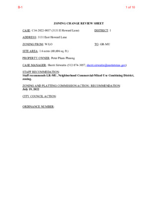
ZONING CHANGE REVIEW SHEET TO: GR-MU DISTRICT: 1 CASE: C14-2022-0037 (3131 E Howard Lane) ADDRESS: 3131 East Howard Lane ZONING FROM: W/LO SITE AREA: 1.6 acres (69,696 sq. ft.) PROPERTY OWNER: Peter Pham Phuong CASE MANAGER: Sherri Sirwaitis (512-974-3057, sherri.sirwaitis@austintexas.gov) STAFF RECOMMEDATION: Staff recommends LR-MU, Neighborhood Commercial-Mixed Use Combining District, zoning. ZONING AND PLATTING COMMISSION ACTION / RECOMMENDATION: July 19, 2022 CITY COUNCIL ACTION: ORDINANCE NUMBER: 1 of 10B-1 C14-2022-0037 2 ISSUES: N/A CASE MANAGER COMMENTS: The property in question is currently undeveloped. It was annexed by the City of Austin on December 31, 2007 (Case C7a-07-024) and received permanent W/LO zoning through zoning case C14-2016-0119. The lots to the north across E. Howard Lane have an interim zoning designation, I-SF-4A, and are developed with a single family residences (Cantarra Residential Subdivision). To the south, there is undeveloped land that is zoned W/LO. To the east there is a platted single family residential subdivision that is designated as Mixed Density Residential in the Pioneer Crossing PUD. The tract of land directly to the west is zoned W/LO and there are parcels of land located in the county. The applicant is requesting Community Commercial-Mixed Use District, zoning to develop condominium residential and retail uses on the property. The staff is recommending LR-MU, Neighborhood Commercial-Mixed Use Combining District, zoning for this site. The site under consideration meets the intent of the LR-MU district. The proposed LR-MU zoning will allow for low intensity commercial and residential uses on a tract of land that fronts onto an arterial roadway, East Howard Lane. The zoning will provide a transition across Howard Lane, to the planned residential uses to the north in the platted Cantarra Residential Neighborhood and to the east to the Mixed Residential Area in the Pioneer Crossing PUD. As the property is not located at an intersection, with more than one access point, LR-MU is more appropriate zoning designation adjacent to existing low density residential uses and office zoning. BASIS OF RECOMMENDATION: 1. The proposed zoning should be consistent with the purpose statement of the district sought. Neighborhood Commercial district is intended for neighborhood shopping facilities which provide limited business service and office facilities predominately for the convenience of residents of the neighborhood. Mixed Use combining district is intended for combination with selected base districts, in order to permit any combination of office, retail, commercial, and residential uses within a single development. 2. The proposed zoning should promote consistency and orderly planning. LR zoning will promote consistency and orderly planning as it will allow for low density office, civic and commercial uses that will provide services to the residential developments to the north and east. The MU Combining District will permit the applicant to develop new residential uses at this location. 2 of 10B-1 C14-2022-0037 3 3. The proposed zoning should allow for a reasonable use of the property. The proposed LR-MU zoning district would allow for a fair and reasonable use of the site as it will permit the applicant to develop and maintain a mixture of low density office, civic, commercial and residential uses on a property fronting onto East Howard Lane, a designated Activity Corridor in the Imagine Austin Comprehensive Plan (Howard Lane Activity Corridor). LAND USES Undeveloped Undeveloped: Platted Single Family Residential Lots (Cantarra Residential Subdivision) Undeveloped Single Family Residence, Undeveloped Single-Family Residence EXISTING ZONING AND LAND USES: Site North W/LO I-SF-4A, SF-4A ZONING South East County PUD (Pioneer Crossing PUD: Mixed Density Residential Designation) County West NEIGHBORHOOD PLANNING AREA: N/A TIA: Deferred to the time of Site Plan WATERSHED: Harris Branch SCHOOLS: Pflugerville I.S.D. NEIGHBORHOOD ORGANIZATIONS: Austin Lost and Found Pets Friends of Austin Neighborhoods Harris Branch Residential Property Owners Association Homeless Neighborhood Association Neighborhood Empowerment Foundation North Gate Neighborhood Association North Growth Corridor Alliance Pflugerville Independent School District SELTEXAS Sierra Club, Austin Regional Group Techridge Neighbors 3 of 10B-1 C14-2022-0037 4 AREA CASE HISTORIES: NUMBER C14-2016-0119 (3119 E Howard Lane) I-RR to LI REQUEST COMMISSION 1/03/17: Approved staff’s recommendation of W/LO zoning, w/ROW dedication (6-3, A. Denkler, J. Kiolbassa, B. Greenberg-No and S. Lavani, T. Weber-absent); B. Evans-1st, S. Harris-2nd. CITY COUNCIL 1/26/17: Approved W/LO zoning, with conditions on consent on 1st reading (11-0); D. Garza-1st, P. Renteria-2nd. 3/02/17: Ordinance No. 20170302-049 was approved for W/LO combining district zoning, with conditions, on Council Member Troxclair’s motion, Council Member Flannigan’s second on a 10-0 vote. Council Member Kitchen was off the dais. 4/16/15: Approved LR-MU-CO zoning, include the conditions of the Planning Commission recommendation, with the exception/removing the fencing prohibition, on first reading (11- 0); G. Casar-1st, O. Houston-2nd. 6/11/15: Approved LR-MU-CO zoning on consent on 2nd/3rd readings (11-0); A. Kitchen-1st, P. Renteria-2nd. 2/26/09: The public hearing was closed neighborhood commercial (LR) district zoning with TIA conditions was approved on consent on Council Member Morrison's motion, Council Member Cole's second on a 6-0 vote. Mayor Wynn was off the dais. 2/25/10: Case expired per LDC Section 25-2- 246(B). The applicant did not submit Corporate Authorization information as to who could sign the public restrictive covenant document for the TIA for this case. Therefore, this zoning case was not scheduled for 2nd/3rd readings to approve an ordinance and public C14-2014-0167 (Cantarra Mixed Use: 13007 Cantarra Drive) I-RR to LR-MU 3/03/15: Approved staff’s recommendation of LR-MU-CO zoning with conditions, adding a new condition to prohibit Off-Site Accessory Parking on the property (6-0, G. Rojas-absent); P. Seeger-1st, R. McDaniel-2nd. C14-2008-0127 (Cantarra Commercial Zoning: 3112 ½ Gregg Lane) 1/20/09: Approved staff recommendation of LR zoning with conditions by consent (4-0, K. Jackson, T. Rabago, R. Evans-absent) I-SF-4A to GR* *On January 7, 2009, the staff received an e- mail from the applicant stating that they would like to amend their zoning request to the ‘LR’ district (Attachment A). Neighborhood Commercial zoning will permit the uses that they have listed on their TIA submittal for this case. 4 of 10B-1 C14-2022-0037 5 C14-2008-0013 (Cantarra Zoning: Gregg Lane) I-SF-4A to Tract 1: SF-4A and Tract 2: GR 5/20/08: Approved staff’s recommendation for SF-4A zoning by consent (7-0, J. Martinez-absent); K. Jackson-1st, T. Rabago-2nd. restrictive covenant at City Council. 7/24/08 : Approved SF-4A zoning by consent (5-0, Cole and Shade-off the dais) RELATED CASES: C14-2016-0119 - Previous Rezoning Case C7a-07-024 - Annexation Case EXISTING STREET CHARACTERISTICS: Name E Howard Ln. ASMP Classification ASMP Required ROW Existing ROW Existing Pavement Sidewalks Bicycle Route ASMP Level 3 116’ 112’ 72’ Yes None Capital Metro (within ¼ mile) No OTHER STAFF COMMENTS: Comprehensive Planning Project Name and Proposed Use: 3131 E HOWARD LANE. C14-2022-0037. 1.6 acres from W/LO to MU. Mixed Use to Retail/Condo. (18 condo units and 20,000 sq. ft. of retail) Yes Y Imagine Austin Decision Guidelines Compact and Connected Measures Imagine Austin Growth Concept Map: Located close to, within or adjacent to an Imagine Austin Activity Center, Imagine Austin Activity Corridor, or Imagine Austin Job Center as identified on the Growth Concept Map. Name(s) of Activity Center/Activity Corridor/Job Center: Howard Lane Activity Corridor Mobility and Public Transit: Located within 0.25 miles of public transit stop and/or light rail station. Y Mobility and Bike/Ped Access: Adjoins a public sidewalk, shared path, and/or bike lane. Y Connectivity, Good and Services, Employment: Provides or is located within 0.50 miles to goods and services, and/or employment center. Connectivity and Food Access: Provides or is located within 0.50 miles of a grocery store/farmers market. Connectivity and Education: Is located within 0.50 miles from a public school or university. Connectivity and Healthy Living: Provides or is located within 0.50 miles from a recreational area, park and/or walking trail. Connectivity and Health: Provides or is located within 0.50 miles of health facility (ex: hospital, urgent care, doctor’s office, drugstore clinic, specialized outpatient care.) Housing Affordability: Provides a minimum of 10% of units for workforce housing (80% MFI or less) and/or fee in lieu for affordable house. Y 5 of 10B-1 C14-2022-0037 6 Y Housing Choice: Expands the number of units and housing choice that suits a variety of household sizes, incomes, and lifestyle needs of a diverse population (ex: apartments, triplex, granny flat, live/work units, cottage homes, and townhomes) in support of Imagine Austin and the Strategic Housing Blueprint. Y Mixed Use: Provides mixed use development (minimum 10% residential and 10% non-residential floor area). Culture and Creative Economy: Provides or is located within 0.50 miles of a cultural resource (ex: library, theater, museum, cultural center). Total Number of “Yes’s” 6 Imagine Austin Priority Program Bonus Features (Extra Points) Small Area Plan Policies: Supports applicable Small Area Plans, including the Future Land Use Map, goals, objectives, actions and text. List three small area plan policies that relate to this project. Name of Small Area Plan: Culture and Historic Preservation: Preserves or enhances a historically and/or culturally significant site. Culture and Creative Economy: Expands Austin’s creative economy (ex: live music venue, art studio, film, digital, theater.) Y Workforce Development, the Economy and Education: Expands the economic base by creating permanent jobs, especially an industry that is currently not represented in particular area or that promotes a new technology. Workforce Development, the Economy and Education: Promotes educational opportunities or workforce development training. Total Number of “Yes’s” from Up Top and Under Bonus Features 7 Environmental The site is not located over the Edwards Aquifer Recharge Zone. The site is in the Harris Branch Creek Watershed of the Colorado River Basin, which is classified as a Suburban Watershed by Chapter 25-8 of the City's Land Development Code. The site is in the Desired Development Zone. Under current watershed regulations, development or redevelopment on this site will be subject to the following impervious cover limits: % of Gross Site Area % of Gross Site Area with Transfers 50% 60% Development Classification Single-Family (minimum lot size 5750 sq. ft.) Other Single-Family or Duplex Multifamily Commercial 55% 60% 80% 60% 70% 90% According to floodplain maps there is no floodplain within or adjacent to the project location. Standard landscaping and tree protection will be required in accordance with LDC 25-2 and 25-8 for all development and/or redevelopment. At this time, site specific information is unavailable regarding vegetation, areas of steep slope, or other environmental features such as bluffs, springs, canyon rimrock, caves, sinkholes, and wetlands. Under current watershed regulations, development or redevelopment requires water quality control with increased capture volume and control of the 2 year storm on site. 6 of 10B-1 C14-2022-0037 7 At this time, no information has been provided as to whether this property has any preexisting approvals that preempt current water quality or Code requirements. Fire No HMP within 1K feet of the parcel. Parks and Recreation Parkland dedication will be required for the new applicable uses proposed by this development, condos and retail with MU zoning, at the time of subdivision or site plan, per City Code § 25-1-601. Whether the requirement shall be met with fees in-lieu or dedicated land will be determined using the criteria in City Code Title 25, Article 14, as amended. Should fees in-lieu be required, those fees shall be used toward park investments in the form of land acquisition and/or park amenities within the surrounding area, per the Parkland Dedication Operating Procedures § 14.3.11 and City Code § 25-1-607 (B)(1) & (2). If the applicant wishes to discuss parkland dedication requirements in advance of site plan or subdivision applications, please contact this reviewer: thomas.rowlinson@austintexas.gov. At the applicant’s request, PARD can provide an early determination of whether fees in-lieu of land will be allowed. Site Plan Site plans will be required for any new development other than single-family or duplex residential. Any development which occurs in an SF-6 or less restrictive zoning district which is located 540 feet or less from property in an SF-5 or more restrictive zoning district will be subject to compatibility development regulations. Any new development is subject to Subchapter E. Design Standards and Mixed Use. Additional comments will be made when the site plan is submitted. Compatibility Standards The site is subject to compatibility standards due to the I-SF-4A lot being adjacent to the north property line, across the street. Demolition and Historic Resources The applicant is responsible for requesting relocation and demolition permits once the site plan is approved. The City Historic Preservation Officer will review all proposed building demolitions and relocations prior to site plan approval. If a building meets city historic criteria, the Historic Landmark Commission may initiate a historic zoning case on the property. 7 of 10B-1 C14-2022-0037 8 Wildland Urban Interface This site is located within 150 feet of a wildland area, in the Wildland Urban Interface (WUI). Please see this website for more information about construction in the WUI: http://www.austintexas.gov/department/wildland-urban-interface-code Transportation ASMP Assessment Assessment of required transportation mitigation, including the potential dedication of right of way and easements and participation in roadway and other multi-modal improvements, will occur at the time of site plan application. A traffic impact analysis shall be required at the time of site plan if triggered per LDC 25-6-113. FYI. The Austin Strategic Mobility Plan (ASMP) calls for 116 feet of right-of-way for E Howard Ln. Water Utility The landowner intends to serve the site with City of Austin water and wastewater utilities. The landowner, at own expense, will be responsible for providing any water and wastewater utility improvements, offsite main extensions, utility relocations and or abandonments required by the land use. The water and wastewater utility plan must be reviewed and approved by Austin Water for compliance with City criteria and suitability for operation and maintenance. Depending on the development plans submitted, water and or wastewater service extension requests may be required. All water and wastewater construction must be inspected by the City of Austin. The landowner must pay the City inspection fee with the utility construction. The landowner must pay the tap and impact fee once the landowner makes an application for a City of Austin water and wastewater utility tap permit. INDEX OF EXHIBITS TO FOLLOW A: Zoning Map B. Aerial Map 8 of 10B-1 I-SF-4A I-SF-4A STIR R AT ST I-SF-4A I-SF-4A SF-4A EXHBIT A SF-4A PEARLMAN DR SF-4A INGHAM PASS R N D A M E N N E H I-SF-4A I-SF-4A R L D A R T N E D C N A R G I-SF-4A I-SF-4A R O K E B Y C V I-SF-4A R S D N R A E K B R A G G PL A R MID A L E D R I-SF-4A SF-4A R D N A M T U O H I-SF-4A TR ALA SF-4A G O N TRL C14-2008-0013 SF-4A FIR OJ D R SF-4A BA C H D R LR-MU-CO C14-2016-0125 C14-2014-0167 SF-4A I-SF-4A SF-4A I-SF-4A ! ! ! ! ! ! ! ! ! ! ! ! ! ! ! ! ! ! ! ! ! ! ! ! ! ! ! ! ! ! I-SF-4A R A D R R TA N A C ! ! Y A ! ! N W O T G RIVIN ! ! I-RR ! ! ! ! D ELA N C E Y D R E H O W A R D L N ! ! ! ! ! ! ! ! ! N E L V O R G W O L WIL ! ! ! ! ! JA D E O A SIS D R SF-4A C14-2017-0035 ! ! ! ! ! ! ! ! ! ! ! ! ! ! ! ! ! ! ! ! ! ! ! ! ! B O LTO N W ELLS D R T S S Y E L M U H C C814-96-0003 R U D S A R A K T R S O D A G O M N K L A E PL C R E S S A L D R C7A-02-007 C814-96-0003 ! ! ! ! ! ! ! ! ! ! ! ! ! ! ! ! ! ! ! ! ! ! ! ! ! ! ! ! ! ! ! ! ! ! ! ! ! ! ! ! ! ! ! ! W/LO C14-2016-0119 ! ! ! ! ! ! ! ! !! ! ! ! ! ! ! ! ! ! R T D TAT S L L A H ! ! ! ! PUD ! ! ! ! ! ! ! ! C814-96-0003.14 C814-96-0003.13 C814-96-0003.17 C814-96-0003.16 MONTGOMERY ST SP-2007-0279D ± 1 " = 400 ' SUBJECT TRACT ! ! ! ! ! ! PENDING CASE ZONING BOUNDARY ZONING ZONING CASE#: C14-2022-0037 This product is for informational purposes and may not have been prepared for or be suitable for legal, engineering, or surveying purposes. It does not represent an on-the-ground survey and represents only the approximate relative location of property boundaries. This product has been produced by the Housing and Planning Department for the sole purpose of geographic reference. No warranty is made by the City of Austin regarding specific accuracy or ! ! ! ! ! ! ! ! ! ! ! ! ! ! ! ! ! ! ! ! ! ! ! ! ! ! ! ! ! ! ! ! ! ! ! ! ! ! ! ! ! ! ! ! T Y S G O L O H T N A P E A R LIG H T R D Created: 3/23/2022 ! ! ! ! ! ! ! ! ! ! ! ! ! ! ! ! ! ! ! ! ! ! ! ! ! ! ! ! ! ! ! ! ! ! ! ! ! ! ! ! ! ! ! ! ! ! ! ! ! ! ! ! ! ! ! ! ! ! ! ! ! ! ! ! ! ! ! ! ! ! ! ! ! ! ! ! ! ! ! ! ! ! ! ! ! ! ! ! ! ! ! ! ! ! ! ! ! ! ! ! ! ! ! ! ! ! ! ! ! ! ! ! ! ! ! ! ! ! ! ! ! ! ! ! ! ! ! ! ! ! ! ! ! ! ! ! ! ! ! ! ! ! ! ! ! ! ! ! ! ! ! ! ! ! ! ! ! ! ! ! ! ! ! ! ! ! ! ! ! ! ! ! ! ! ! ! ! ! ! ! ! ! ! ! ! ! ! ! ! ! ! ! ! ! ! ! ! ! ! ! ! ! ! ! ! ! ! ! ! ! ! ! ! ! ! ! ! ! ! ! ! ! 9 of 10B-1 EXHIBIT B 12923226516141832157108613483612341315131110219252619301211694129374633213541A78221412381173233310404110821465227113153940535111116151414323351011621043115133110165236449846432384352917346638204212593168204191828333741757311234664715A179483513185239121344451222171221C14-2022-0037I-SF-4AI-SF-4AI-SF-4AW/LOI-SF-4AI-SF-4AI-SF-4ASF-4AI-SF-4AI-SF-4APUDBRAGGPLDELANCEY DRRIVINGTONWAYGRANDCENTRAL DRCHUMLEYS STKEARNSDRARMIDALE DRKARASU DRBOLTON WELLS DRJADE OASIS DRE HOWARD LNWILLOWGROVE LNHALLSTATT DRQ32P32Copyright nearmap 2015±This map has been produced by the Communications Technology Management Dept. on behalf of thePlanning Development Review Dept. for the sole purpose of geographic reference. No warranty is madeby the City of Austin regarding specific accuracy or completeness.ZONING CASE#:LOCATION:SUBJECT AREA:GRID:MANAGER:C14-2022-00373131 E Howard Lane1.6 AcresQ32SHERRI SIRWAITIS1'' = 200'CREEK BUFFERPENDING CASE!!!!!!ZONING BOUNDARYSUBJECT TRACT3131 E Howard Lane10 of 10B-1