B-02 (C14-2020-0060 - Avery Lakeline; District 6) — original pdf
Backup
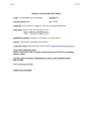
ZONING CHANGE REVIEW SHEET DISTRICT: 6 TO: CS-MU CASE: C14-2020-0060 (Avery Lakeline) ZONING FROM: MF-4 ADDRESS: 14231 North U.S. Highway 183A Service Road North Bound SITE AREA: Tract 1: 0.97 acres (42,253.2 sq. ft.) Tract 2: 0.66 acres (28,749.6 sq. ft.) Total: 1.63 acres (71,002.8 sq. ft.) PROPERTY OWNER: Lakeline Avery Partners, LP (Alex Clarke) AGENT: Alice Glasco Consulting (Alice Glasco) CASE MANAGER: Sherri Sirwaitis (512-974-3057, sherri.sirwaitis@austintexas.gov) STAFF RECOMMENDATION: Staff recommends CS-MU, General Commercial Services-Mixed Use Combining District, zoning. ZONING AND PLATTING COMMISSION ACTION / RECOMMENDATION: July 21, 2020 CITY COUNCIL ACTION: ORDINANCE NUMBER: 1 of 13B-02 C14-2019-0060 2 ISSUES: N/A CASE MANAGER COMMENTS: The property in question consists of two noncontiguous undeveloped parcels of land located to the east of the US Highway 183A between Avery Ranch Boulevard and Lakeline Boulevard. To the north, there is an undeveloped land that is zoned CS-MU. The lot to the south is zoned GR-MU and is also undeveloped. The tract of land to the east contains an office complex and state offices (Texas Department of Transportation Cedar Park Campus). The applicant is requesting a rezoning of these parcels to CS-MU to develop a hospital at this location. The staff recommends CS-MU, General Commercial Services-Mixed Use Combining District, zoning because the property meets the purpose statement of the district. These parcels of land are located near the intersection of two arterial roadways and a highway, U.S. Highway 183A North. The CS-MU zoning district is compatible and consistent with the surrounding uses because there is CS-MU and GR-MU zoning to the north and south of the site respectively. The property is within the vicinity of the Northwest Park & Ride Town Center Transit Oriented Development District (TOD) and by the Lakeline Station Regional Center as identified on the Growth Concept Map in the Image Austin Comprehensive Plan. The proposed CS-MU zoning is appropriate for this location because it will permit a mixture of commercial, office and residential uses along a highway that will provide services for the surrounding residential developments. The applicant agrees with the staff’s recommendation. BASIS OF RECOMMENDATION: 1. The proposed zoning should be consistent with the purpose statement of the district sought. General Commercial Services district is intended predominately for commercial and industrial activities of a service nature having operating characteristics or traffic service requirements generally incompatible with residential environments. Mixed Use combining district is intended for combination with selected base districts, in order to permit any combination of office, retail, commercial, and residential uses within a single development. 2. Zoning changes should promote compatibility with adjacent and nearby uses. The CS-MU zoning district is compatible and consistent with the surrounding uses because there is CS-MU zoning to the north along Avery Ranch Boulevard and GR- MU zoning to the south of the site along Lakeline Boulevard. 2 of 13B-02 C14-2019-0060 3 The property is located near to the Northwest Park & Ride Town Center Transit Oriented Development District (TOD) and just to the north of the Lakeline Station Regional Center as identified on the Growth Concept Map in the Image Austin Comprehensive Plan. Zoning should promote the policy of locating retail and more intensive zoning near the intersections of arterial roadways or at the intersections of arterials and major collectors. The parcels of land under consideration are located near the intersection of two arterial roadways, Avery Ranch Boulevard and Lakeline Boulevard, and a highway, U.S. Highway 183A North. EXISTING ZONING AND LAND USES: ZONING MF-4 CS-MU GR-MU MF-4, I-RR LAND USES Undeveloped Undeveloped Undeveloped Undeveloped Area, State Offices (Texas Department of Transportation Cedar Park Campus) Highway, Right-of-Way U.S. Highway 183A NB, I-RR NEIGHBORHOOD PLANNING AREA: N/A TIA: Not Required WATERSHED: Butter Cup Creek, South Brushy Creek Watersheds SCHOOLS: Round Rock I.S.D. Sommer Elementary School Elsa England Elementary School Pearson Ranch Middle School McNeil High School NEIGHBORHOOD ORGANIZATIONS: Bike Austin Friends of Austin Neighborhoods Davis Spring HOA Neighborhood Empowerment Foundation SELTEXAS Sierra Club, Austin Regional Group 3. Site North South East West 3 of 13B-02 C14-2019-0060 4 REQUEST AREA CASE HISTORIES: NUMBER C14-2019-0035 (Lakeline Mixed Use: 9500 North Lake Creek Parkway) I-RR to Tract 1: MF-4, Tract 2: CS-MU 4/16/19: Approved MF-4 zoning for Tract 1 and CS-MU zoning for Tract 2 (7-0, N. Barrera- Ramirez, B. Evans, A. Tatkow- absent); J. Duncan-1st, S. Lavani-2nd. COMMISSION CITY COUNCIL 5/23/19: The public hearing was conducted and a motion to close the public hearing and approve Ordinance No. 20190523-049 for MF-4 district zoning for Tract 1 and CS-MU district zoning for Tract 2 was approved on Council Member Flannigan’s motion, Council Member Harper- Madison’s second on a 9-0 vote. Council Members Alter and Casar were off the dais. 3/07/19: Approved MF-4 zoning on consent on all 3 readings (11-0); L. Pool-1st, J. Flannigan-2nd. 2/07/19: Approved GR-MU zoning on all 3 readings (11-0); P. Renteria’s motion, J. Flannigan-2nd. 7/26/07: Approved GR-CO by consent on all 3 readings (6-0); J. Kim-1st, B. Dunkerely-2nd. 7/28/05: Approved general commercial services-conditional overlay (CS-CO) district zoning on all 3 readings. 7/28/05: Approved CS-MU-CO on all 3 readings (7-0) I-RR to MF-4 2/05/19: Approved MF-4 zoning by consent (7-0, A. Aguirre, N. Barrera-Ramirez, D. Breithaupt, S. Lavani-absent); A. Denkler- 1st, B. Evans-2nd. C14-2018-0134 (Avery Ranch at 183A: U.S. Highway 183A Toll Road and Avery Ranch Boulevard) C14-2018-0133 (Lakeline at 183A: 14115 North U.S. Highway 183A North Bound Service Road) C14-2007-0046 (Wolf Hester Tract: 14000 U.S. Highway 183 North) C14-04-0166 (Lake Creek, Lakeline Boulevard and North Lake Creek Parkway) CH, GO, GR to GR-MU DR to GR GO to CS GR to CS C14-04-0165 (Lakeline Boulevard at Lake Creek Parkway) 1/15/19: Approved GR-MU-CO zoning, with a conditional overlay to prohibit Alternative Financial Services, Bail Bond Services and Pawn Shop Services uses by consent (10-0, N. Barrera-Ramirez-absent); S. Lavani-1st, J. Duncan-2nd. 6/05/07: Approved GR-CO with condition to prohibit Pawn Shops by consent (7-0, S. Hale, J. Martinez-absent); J. Pinnelli- 1st, J. Shieh-2nd. 06/21/05: Approved CS-CO zoning with to prohibit Pawn Shop Services, Exterminating Services, and Adult Oriented Businesses by consent (8-0, K. Jackson- absent); J. Martinez-1st, J. Gohil-2nd. 06/21/05: Approved CS-MU-CO zoning with to prohibit Pawn Shop Services, Exterminating Services, and Adult Oriented Businesses by consent (8-0, K. Jackson-absent); J. Martinez-1st, J. Gohil-2nd. conditions conditions 4 of 13B-02 C14-2019-0060 5 C14-01-0173 DR to GR 2/14/02: Approved GR-CO on 3 readings (7-0) C14-00-2094 DR to GR 1/15/02: Approved GR-CO zoning, with a condition prohibiting pawn shop services, by consent (8-0, K. Jackson- absent) 7/11/00: Approved staff rec. of GR by consent (7-0) C14-00-2107 MF-3 to GO 8/29/00: Approved staff rec. of GO by consent (7-1, RC-Nay) C14-94-0134 CH to GR 1/10/95: Approved GR-CO (7-0) 2/9/95: Approved GR w/ conditions 8/17/00: Approved GR on 1st reading (6-0, Goodman-absent) 8/31/00: Approved 2nd/3rd readings (6-0, KW-absent) 9/7/00: Approved GO on 1st reading only (7-0) 12/14/00: Approved GO (7-0); 2nd/3rd readings (6-0); 1st reading 2/29/95: Approved GR (6-0); 2nd/3rd readings 1/10/95: Approved GR w/ conditions (6-0); 1st reading 2/9/95: Approved GR w/ conditions (6-0); 2nd/ 3rd readings C14-94-0132 12/20/94: Approved GR w/ conditions (7-0) CH to GR GO to GR IP to GR LR to GR RELATED CASES: C14-2019-0035 - Previous Zoning Case C8-2019-0041 & C8-2019-0041A - Subdivision Cases EXISTING STREET CHARACTERISTICS: NAME ROW ASMP ASMP CLASSIFICATION Sidewalks Bicycle Route Capital Metro (with ¼ mile) Required ROW 0’ 78’ 2 No Yes No North Lake Creek Parkway (future road) 5 of 13B-02 C14-2019-0060 6 OTHER STAFF COMMENTS: Comprehensive Planning This case is located on two noncontiguous parcels located to the east of the 183A service road, on an undeveloped site. The property is located to the north of Imagine Austin’s Lakeline Regional Center. The undeveloped parcels, when combined, are approximately 1.63 acres in size. Surrounding land uses includes vacant land and a large single family subdivision to the north; to the south is an office building and the Parkline Shopping Center; to the east is vacant land, a TXDOT office building and a large single family subdivision; and to the west is the 183A toll road. The proposed use is a hospital. Connectivity There are public sidewalks and bike lanes located along Avery Ranch Blvd., but none along the frontage road of US 183A, which this property abuts. Public sidewalks, public transit and bike lanes are located partially along both sides of Lakeline Boulevard. There are no urban trails or parks located within a half of a mile from this property. The 183A Shared Use Path Trailhead and Bushy Creek Trailhead are located over a mile away to the north but there is no access available via a public sidewalk or a connecting trail. The connectivity and mobility options in this area are fair but expanding. Imagine Austin The property is located near the Lakeline Station Regional Center as identified on the Imagine Austin’s Growth Concept Map. A Regional Center is the most urban of the three activity centers outlined in the growth concept map. These centers are the places where the greatest density of people and jobs and the tallest buildings in the region will be located. Like many Imagine Austin Centers, they are represented by a circle or globular shape that reflects the general location where the center should be located in the future. The center’s actual boundaries would need to be clarified through a small area planning process. Regional, town, and neighborhood centers are supposed to be walkable, bikeable, and supported by transit. The following Imagine Austin policies are applicable to this case: • LUT P3 Promote development in compact centers, communities or along corridors that are connected by roads and transit, are designed to encourage walking and bicycling, and reduce healthcare, housing and transportation costs. • LUT P4. Protect neighborhood character by directing growth to areas of change that • includes designated redevelopment areas, corridors and infill sites. Recognize that different neighborhoods have different characteristics and new and infill development should be sensitive to the predominant character of these communities. LUT P7. Encourage infill and redevelopment opportunities that place residential, work, and retail land uses in proximity to each other to maximize walking, bicycling, and transit opportunities. Analyzing this specific site, there seems to be some mobility options available in the area (bike lanes and a public sidewalks along Avery Ranch Blvd. and bike lanes, public sidewalks and transit stops along South Lakeline Boulevard). The proposed hospital also will provide much needed civic/medical use to serve the nearby Regional Center. However, due to the 6 of 13B-02 C14-2019-0060 7 lack of connectivity and mobility options within walking distance (no public sidewalks along the service road to access nearby goods and services), this request appears to only partially support policies in the Imagine Austin Comprehensive Plan. Environmental The site is located over the North Edwards Aquifer Recharge Zone. The site is in the Buttercup Creek Watershed, which is classified as a Suburban Watershed by Chapter 25-8 of the City's Land Development Code. It is in the Desired Development Zone. Under current watershed regulations, development or redevelopment on this site will be subject to the following impervious cover limits: % of Gross Site Area % of Gross Site Area with Transfers 45% 50% Development Classification Single-Family Residential (min. lot size 5750 sq. ft.) One or Two Family Residential (lot size < 5750 sq. ft.) Multifamily Residential Commercial 55% 60% 65% 60% 65% 70% According to floodplain maps there is no floodplain within or adjacent to the project location. Standard landscaping and tree protection will be required in accordance with LDC 25-2 and 25-8 for all development and/or redevelopment. At this time, site specific information is unavailable regarding vegetation, areas of steep slope, or other environmental features such as bluffs, springs, canyon rimrock, caves, sinkholes, and wetlands. Under current watershed regulations, development or redevelopment requires water quality control with increased capture volume and control of the 2-year storm on site. At this time, no information has been provided as to whether this property has any ls that preempt current water quality or Code requirements. Site Plan This site will be subject to all requirements of Subchapter E Design Standards when the site plan is submitted for review. Compatibility will not apply. 7 of 13B-02 C14-2019-0060 Transportation 8 The Austin Strategic Mobility Plan (ASMP), adopted 04/11/2019, calls for 78 feet of right-of-way for the future roadway known as North Lake Creek Parkway. It is recommended that 78 feet of right- of- way from the existing centerline should be dedicated at the time of subdivision or site plan. A traffic impact analysis is not required as this site is subject to SB 1396. Austin Water Utility The landowner intends to serve the site with City of Austin water and wastewater utilities. The landowner, at own expense, will be responsible for providing any water and wastewater utility improvements, offsite main extensions, utility relocations and or abandonments required by the land use. The water and wastewater utility plan must be reviewed and approved by Austin Water for compliance with City criteria and suitability for operation and maintenance. Depending on the development plans submitted, water and or wastewater service extension requests may be required. All water and wastewater construction must be inspected by the City of Austin. The landowner must pay the City inspection fee with the utility construction. The landowner must pay the tap and impact fee once the landowner makes an application for a City of Austin water and wastewater utility tap permit. INDEX OF EXHIBITS TO FOLLOW A: Zoning Map B. Aerial Map C. Applicant’s Rezoning Request Map D. Northwest Park & Ride Town Center Map E. Imagine Austin Comprehensive Plan Growth Concept Map 8 of 13B-02 B N D R V S Y W H A 3 8 1 N L A K E L I N E B L V D T O 1 8 3 A N B R A M P UNDEV S B E L L B L V D P M A R H C N A R Y R E V A O T B S A 3 8 1 N P M A R L L E B O T D V L B H C N A R Y R E V A I-RR R I V I E R A D R ( ( ( ( ( ( ( V E R S A I L ( ( ( L E S D R ( ( ( ( ( ( ( ( ( ( ( ( ± PUD C814-99-0001.08 C814-99-0001.02 EXHIBIT A I-RR I-RR MF-4 C14-2018-0134 8 0 0 - 7 0 - a C 7 A V E R Y R A N C H B L V D N O R T H L A K E C R E E K P K W Y MF-4 ! ! ! ! ! ! ! ! C14-2019-0035 ! ! ! ! ! ! ! ! ! CS-MU H E M A D R ! ! ! ! ! ! ! ! ! ! L I ! N N A ! E ! ! ! A ! L N ! ! ! ! ! ! ! ! ! ! ! ! ! ! ! ! ! ! ! ! ! ! C A N N O N M A R K W A Y ! ! ! PUD I-RR C814-97-0001.07 C814-97-0001.05 ! ! ! ! ! ! PUD ! ! ! ! ! ! ! ! ! ! ! ! ! ! ! ! ! I-RR STATE OFFICES (UNDER CONSTRUCTION) 94-0132 94-0134 GR-MU C14R-85-392(RCT) C14-2018-0133 CS-CO C14-04-0166 SP-2007-0272C 04-0166 85-366 RC N 1 1 8 8 3 3 A A SP-98-0029C R85-392 RC N H B W T Y O N A B V N 1 8 3 A H W Y S B E R Y R A N C H R A M P E B L I N N R D T V L E K A T L B A A N 3 8 1 N U S 1 8 3 H W Y S V R D N B LAKELINE BLVD GR 94-0132 ( ( M O N A C O D R ( ( ( D V L E B L I N E K A S L SUBJECT TRACT ! ! ! ! ! ! PENDING CASE ZONING BOUNDARY GR-MU-CO C14-95-0146 GR C14-2007-0046 R85-355 RC SP97-0017C RETAIL CENTERS ZONING ZONING CASE#: C14-2020-0060 This product is for informational purposes and may not have been prepared for or be suitable for legal, engineering, or surveying purposes. It does not represent an on-the-ground survey and represents only the approximate relative location of property boundaries. 1 " = 400 ' This product has been produced by CTM for the sole purpose of geographic reference. No warranty is made by the City of Austin regarding specific accuracy or completeness. Created: 5/29/2020 9 of 13B-02 B Y A S R E 3 V 8 A 1 O N T P M A R H C N A R H C N A R Y R E V A A 3 8 1 O T D V L B P M A R B N I-RR MF-4 A V E R Y R A N C H B L V D N O R T PUD EXHIBIT B I-RR PUD C M A A N R N K O W N A Y PUD MF-4 N 183A SB AT AVERY RANCH TRN N 1 8 3 A N B A T A V E R Y R A N C H T R N H C N A R Y R E V A O T D V L B P M A R L L E B A V E T R S O Y 1 R B R 8 A A 3 N M A P C H S V R D N B N 1 8 3 A H W Y L A K E N T B O L I R 1 N E A 8 3 M A B P L V D R A T 1 N O 8 3 C A A H N H V E N W 1 8 R R B Y 3 S A B A Y M P I-RR R I V I E R A D R F41 H L A K E C R E E K P K W Y CS-MU C14-2020-0060 L I N N A E A L N R A D M E H F40 I-RR N 1 8 3 A H W S B E L L B L V D Y N N B 1 S 8 V 3 R A D H N W B Y C14-2020-0060 GR-MU CS-CO V E R S A I L L E S D R ± 1'' = 400' M O N A C O D R D V L E B L I N E K A S L 8 A L S 1 T L B U A E N B 3 S L I N E K R D T A N K 3 V B E N L I N E R D T 1 8 T L B A A L V N U S V H S R W 1 D Y 8 3 N B LAKELINE BLVD GR GR-MU-CO GR GR-CO Copyright nearmap 2015 SUBJECT TRACT ZONING BOUNDARY ! ! ! ! ! ! PENDING CASE CREEK BUFFER AVERY LAKELINE ZONING CASE#: LOCATION: SUBJECT AREA: GRID: MANAGER: C14-2020-0060 14231 N US 183A Hwy Service Rd NB 1.628 ACRES F40 & F41 Sherri Sirwaitis This map has been produced by the Communications Technology Management Dept. on behalf of the Planning Development Review Dept. for the sole purpose of geographic reference. No warranty is made by the City of Austin regarding specific accuracy or completeness. 10 of 13B-02 EXHIBIT C 11 of 13B-02 Appendix D Exhibit 5 ¥:-.;'%• .-.--f««aS3» 11 -5^» ! ,"?•>• -o^^'^'A' rr -•-''••'''" ^^^'i^P\f Northwest Park & Ride Town Center TOD District TOD District Zones Zon« EXHIBIT D Page 16 of 18 12 of 13B-02 EXHIBIT E Figure 4.5 Growth Concept Map Map Disclaimers: A comprehensive plan shall not constitute zoning regulations or establish zoning district boundaries. This product is for informational purposes and may not have been prepared for or be suitable for legal, engineering, or surveying purposes. It does not represent an on-the-ground survey and represents only the approximate relative location of property boundaries. This product has been produced by the gra for the sole purpose of geographic reference. No warranty is made by the City of Austin regarding specific accuracy or completeness. 13 of 13B-02