B-03 (C14-2020-0050 - 3100 Scofield Ridge Parkway; District 7) — original pdf
Backup
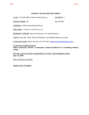
ZONING CHANGE REVIEW SHEET TO: GR-MU DISTRICT: 7 CASE: C14-2020-0050 (3100 Scofield Parkway) ZONING FROM: LR ADDRESS: 3100 Scofield Ridge Parkway SITE AREA: 3.28 acres (142,876.8 sq. ft.) PROPERTY OWNER: Tiger Creek Partners, LP (John Bultman) AGENT: Metcalfe, Wolff, Stuart & Williams, LLP (Michele Rogerson Lynch) CASE MANAGER: Sherri Sirwaitis (512-974-3057, sherri.sirwaitis@austintexas.gov) STAFF RECOMMENDATION: Staff recommends GR-MU, Community Commercial-Mixed Use Combining District, zoning. ZONING AND PLATTING COMMISSION ACTION / RECOMMENDATION: June 16, 2020 CITY COUNCIL ACTION: ORDINANCE NUMBER: 1 of 14B-3 C14-2020-0050 2 ISSUES: N/A CASE MANAGER COMMENTS: The property in question is currently undeveloped tract of land located at the northeast intersection Burnet Road/FM 1325 and Scofield Ridge Parkway. The applicant is requesting to rezone this site because they propose to develop multifamily uses on the property. The staff is recommending GR-MU zoning at this location because the applicant’s request meets the intent of the purpose statement for the base and combining zoning district designations. The proposed zoning will promote consistency and orderly planning as the site under consideration is adjacent to existing commercial zoning to the north (GR) and south (GR-MU) and multifamily zoning to the east (MF-3-CO). The properties directly to the east and south of this tract are developed with apartment complexes (Scofield Park at Austin Apartments and Scofield Apartments). The GR-MU zoning district would allow for a fair and reasonable use of the site because it will permit this site to be developed with commercial uses, residential uses or a mixture of commercial and residential uses at the intersection of two arterial roadways. The applicant agrees with the staff’s recommendation. BASIS OF RECOMMENDATION: 1. The proposed zoning should be consistent with the purpose statement of the district sought. The Community Commercial (GR) district is the designation for an office or other commercial use that serves neighborhood and community needs and that generally is accessible from major traffic ways. The purpose of a mixed use (MU) combining district is to allow office, retail, commercial, and residential uses to be combined in a single development. 2. The proposed zoning should promote consistency and orderly planning. The proposed zoning will promote consistency and orderly planning as the site under consideration is adjacent to existing commercial zoning to the north (GR) and south (GR- MU) and multifamily zoning to the east (MF-3-CO). The properties directly to the east and south of this tract are developed with apartment complexes (Scofield Park at Austin Apartments and Scofield Apartments). 2 of 14B-3 C14-2020-0050 3 3. The proposed zoning should allow for a reasonable use of the property. The GR-MU zoning district would allow for a fair and reasonable use of the site because it will permit this site to be developed with commercial and mixed use along a major arterial roadway. LAND USES Undeveloped Undeveloped, Hotel/Motel (Texas Bungalows Hotel and Suites), Office (Grande Communications) Multifamily (Scofield Apartments, Terraces at Scofield Ridge Apartments) Multifamily (Scofield Park at Austin Apartments) Mopac Expressway, Undeveloped EXISTING ZONING AND LAND USES: Site North ZONING LR GR, GO, GR-CO, IP South GR-MU East West MF-3-CO RR NEIGHBORHOOD PLANNING AREA: N/A TIA: Deferred to Site Plan WATERSHED: Walnut Creek SCHOOLS: Austin I.S.D. Summit Elementary School Murchison Middle School Anderson High School NEIGHBORHOOD ORGANIZATIONS: Austin Independent School District Austin Lost and Found Pets Bike Austin Friends of Austin Neighborhoods Homeless Neighborhood Association McNeil/Ashton Woods Neighborhood Association Neighborhood Empowerment Foundation North Growth Corridor Alliance Northwood Neighborhood Association Red Line Parkway Initiative SELTEXAS Sierra Club, Austin Regional Group The Ridge at Scofield Homeowners Association Wells Branch Neighborhood Association 3 of 14B-3 C14-2020-0050 4 AREA CASE HISTORIES: NUMBER C14-2019-0058 (Scofield Apartments: 3001 Scofield Ridge Parkway) COMMISSION 6/04/19: Approved staff’s recommendation of GR-MU zoning by consent (8-0, A. Tatkow-late, N. Barrera-Ramirez- absent); A. Denkler-1st, A. Aguirre-2nd. CITY COUNCIL 6/20/19: Approved GR-MU zoning by consent on all 3 readings (11-0); L. Pool-1st, N. Harper- Madison-2nd. REQUEST GR-MU-CO to GR-MU* *The applicant is requesting a rezoning to remove the conditional overlay (CO) placed on the Property through Ordinance No. 20161110-031 to allow access to the Property from Burnet Road. GR to GR-MU 10/04/16: Approved staff’s recommendation of GR-MU-CO zoning on consent (10-0, A. Denkler-absent); G. Rojas-1st, S. Lavani-2nd. 10/13/16: Approved GR-MU- CO zoning, with conditions, on consent (9-0, P. Renteria and E. Troxclair-absent); D. Zimmerman-1st, S. Gallo-2nd. 11/10/16: Approved GR-MU-CO zoning, with conditions, on consent on 2nd/3rd readings (11-0); D. Zimmerman-1st, O. Houston- 2nd. N/A LR to CS-CO 7/25/16: Case withdrawn by the applicant. GO to GR GO to GR 7/21/15: Approved staff’s recommendation of GR-CO zoning, with a CO to limit the development intensity for the site to less than 2,000 vehicle trips per day, by consent (11-0); L. Brinsmade-1st, B. Evans-2nd. 4/3/04: Approved staff’s recommendation of GR zoning, by consent (9-0); J. Martinez-1st, J. Gohil-2nd. 8/13/15: Approved GR-CO zoning on consent on all 3 readings (11-0); L. Pool-1st, D. Zimmerman-2nd. 3/04/04: Granted GR zoning (6-0, McCracken-absent); all 3 readings C14-2016-0037 (Scofield Apartments: 3001 Scofield Ridge Parkway) C14-2016-0035 (Scofield Farms: 3100 Scofield Ridge Parkway) C14-2015-0079 (The Bungalows: 13311 Burnet Road) C14-03-0188 (Cedar Elm- BWL: 13201- 13205 Burnet Road) 4 of 14B-3 C14-2020-0050 5 11/30/00: Approved SF-2-CO (TR1), SF-3-CO (TR2); MF-1-CO (TR3) w/condition of 2,000 vehicle trip per day limit (7-0); all 3 readings 10/26/00: Approved MF-3-CO (7-0); 1st reading 12/7/00: Approved MF-3-CO (7-0); 2nd/3rd readings IP to SF-2, SF-3, MF-1 10/17/00: Approved staff rec. of SF-2 (TR1), SF-3 (TR 2), and MF-1 (TR3) by consent (8-0) IP to MF-3 9/19/00: Approved staff alternate rec. of MF-3-CO by consent (9-0); conditions as follows: 1) 2,000 vehicle trip per day limit 2) Maximum of 23 residential units per acre 3) A residential structure or portion of a residential structure may not be constructed within 100 ft of the north property line between Ida Ridge and Orchid Lane 5/23/95: Approved staff alternate rec. of CS-CO w/conditions (7-0) GO to CS-CO 6/22/95: Approved CS-CO w/conditions (5-0); all 3 readings LO, LR to MF-3 9/27/94: Approved MF-2-CO (TR1), MF-3-CO (TR2) w/ conditions (9-0) 11/3/94: Approved MF-2-CO (TR1), MF-3-CO (TR2) w/conditions (5-0); all 3 readings IP to MF-3 11/24/92: Approved MF-3 IP to MF-3 11/24/92: Approved MF-3 12/3/92: Approved MF-3-CO; with following conditions: 1) Limit of 23 units per acre for multifamily development 2) Parkland dedication shall apply at site plan approval (6-0-1, RR-abstain); 1st reading 4/7/94: Approved MF-3-CO (5-0-1, RR-abstain); 2nd reading 4/21/94: Approved MF-3-CO (5-0-1, RR-abstain); 3rd reading 12/3/92: Approved MF-3-CO; with following conditions: 1) Limit of 23 units per acre for multifamily development 2) Parkland dedication shall apply at site plan approval (6-0-1, RR-abstain); 1st reading 4/7/94: Approved MF-3-CO (5-0-1, RR-abstain); 2nd reading C14-00-2179 (Century Park: Century Park Boulevard) C14-00-2112 (Century Park Apartments: 2700-2800 Century Park Boulevard) C14-95-0051 (Rainsoft: 13000 Ida Ridge) C14-94-0056 (Scofield Farms: Scofield Lane) C14-92-0109 (Century Park Subdivision Block C: 3201 Century Park) C14-92-0108 (Century Park Subdivision Block B: 2701 Century Park) 5 of 14B-3 C14-2020-0050 6 4/21/94: Approved MF-3-CO (5-0-1, RR-abstain); 3rd reading RELATED CASES: C14-2016-0035, C14-03-0188 (Previous Zoning Cases) C14-85-149 (North Lamar Area Study Zonings) EXISTING STREET CHARACTERISTICS: Existing ROW Pavement ASMP Required ROW ~122’ 120’ ’56 Name Scofield Ridge Parkway N. Mopac Expressway SVRD NB ASMP Classification Sidewalks 3 4 No Yes Bicycl e Route Yes Capital Metro (within ¼ mile) No ~415’ Defer to TxDOT 46’ Yes No OTHER STAFF COMMENTS: Site Characteristics The property in question is an undeveloped tract of land. The site is relatively flat and has a grassy terrain with clusters of trees. The property is located at the northeast intersection Burnet Road/FM 1325 and Scofield Ridge Parkway. The tract of land to the north of this site is undeveloped. There is a hotel use further to the north along Burnet Road (Texas Bungalows Hotel and Suites). To the south, across Scofield Ridge Parkway, there is a developing apartment complex (Scofield Apartments). To the east, there is another multifamily use (Scofield Park at Austin Apartments). The land to the west is developed with the Mopac Expressway/Toll Road North Bound. Comprehensive Planning Please note, a compliance report was submitted on this same parcel in March 2015 to go from LR to CS-CO but the zoning application was not approved. This zoning case is located on the northeast corner of Mopac Service Road/Burnet Road and Scofield Ridge Parkway, on an undeveloped parcel that is approximately 3.28 acres in size. An Activity Corridor and the Howard Lane Neighborhood Center are located approximately 0.65 miles north of the subject property. This property is not located within the boundaries of a planning area with an adopted neighborhood plan. Surrounding land uses include vacant land, a hotel and an office to the north; to the south is a large apartment complex, vacant land and a single family subdivision; to the east are multiple 6 of 14B-3 C14-2020-0050 7 apartment complexes; and to the west is the Mopac Service Road and the Mopac Expressway. The proposed use is a 158 unit multi-family apartment complex. Connectivity: Public sidewalks are located in front of this property along the Mopac Service Road/Burnet Road but are nonexistent along this portion of Scofield Ridge Parkway. Bike lanes are located along both sides of Scofield Ridge Parkway. There is a Cap Metro Transit Stop located within 1,600 feet of the property by walking along the Mopac service road public sidewalk. Retail and restaurants are located less than 0.75 miles away along the Mopac Service Road, which also has a public sidewalk. The mobility and connectivity options are fair but the heavy fast moving traffic along the Mopac service road makes accessing goods, services and the transit stop problematic. Imagine Austin An Activity Corridor and the Howard Lane Neighborhood Center are located approximately 0.65 miles north of the subject property. Like many Imagine Austin Centers, this center is represented by a circle that reflects the general location where the center should be located in the future. The center’s actual boundaries would need to be clarified through a small area planning process. Activity Corridors are characterized by a variety of activities and types of buildings located along the roadway — shopping, restaurants and cafés, parks, schools, single-family houses, apartments, public buildings, houses of worship, mixed-use buildings, and offices. The following Imagine Austin Policies are applicable to this case: • LUT P3. Promote development in compact centers, communities, or along corridors that are connected by roads and transit that are designed to encourage walking and bicycling, and reduce health care, housing and transportation costs. • LUT P5. Create healthy and family-friendly communities through development that includes a mix of land uses and housing types and affords realistic opportunities for transit, bicycle, and pedestrian travel and provides both community gathering spaces, parks and safe outdoor play areas for children. • HN P10. Create complete neighborhoods across Austin that have a mix of housing types and land uses, affordable housing and transportation options, and access to schools, retail, employment, community services, and parks and recreation options. Analysis: There are multiple large multifamily apartment complexes located along Scofield Ridge Parkway and an abundance of single family housing in the area. However, based upon this rezoning request not being a true mixed use project and the lack of connectivity options outside the project area, such as goods and services, parks, recreational areas, and public schools, this project only partially supports Imagine Austin Comprehensive Plan policies. Staff recommends the developer include a commercial component to the project by providing much needed neighborhood serving services to both the residents and the people who live in the large residential neighborhood located to the east. 7 of 14B-3 C14-2020-0050 8 Environmental The site is located over the Edwards Aquifer Recharge Zone. The site is in the Walnut Creek Watershed of the Colorado River Basin, which is classified as a Suburban Watershed by Chapter 25-8 of the City's Land Development Code. The site is in the Desired Development Zone. Under current watershed regulations, development or redevelopment on this site will be subject to the following impervious cover limits: % of Gross Site Area % of Gross Site Area with Transfers 50% 60% Development Classification Single-Family (minimum lot size 5750 sq. ft.) Other Single-Family or Duplex 55% 60% Multifamily Commercial 80% 60% 70% 90% According to floodplain maps there is a floodplain within or adjacent to the project location. Based upon the location of the floodplain, offsite drainage should be calculated to determine whether a Critical Water Quality Zone exists within the project location.> Standard landscaping and tree protection will be required in accordance with LDC 25-2 and 25-8 for all development and/or redevelopment. At this time, site specific information is unavailable regarding vegetation, areas of steep slope, or other environmental features such as bluffs, springs, canyon rimrock, caves, sinkholes, and wetlands. Under current watershed regulations, development or redevelopment requires water quality control with increased capture volume and control of the 2 year storm on site. At this time, no information has been provided as to whether this property has any preexisting approvals that preempt current water quality or Code requirements. Site Plan Site plans will be required for any new development other than single-family or duplex residential. Any development which occurs in an SF-6 or less restrictive zoning district which is located 540-feet or less from property in an SF-5 or more restrictive zoning district will be subject to compatibility development regulations. The site is approximately 510 feet from parcels zoned RR (Rural Residential). For a structure more than 300 feet but not more than 540 feet from property zoned SF-5 or 8 of 14B-3 C14-2020-0050 9 more restrictive, 60 feet plus one foot for each 4 feet of distance in excess of 300 feet from the property zoned SF-5 or more restrictive. Signage restrictions related to the Scenic Highways designation along Mopac Expressway will apply to portions of the site. Additional design regulations will be enforced at the time a site plan is submitted. Transportation The Austin Strategic Mobility Plan (ASMP), adopted 04/11/2019, calls for 120 feet of right- of-way for Scofield Ridge Parkway. It appears that sufficient right-of-way currently exists. A traffic impact analysis should be deferred to the site plan application when land uses and intensities will be finalized. Water and Wastewater The landowner intends to serve the site with City of Austin water and wastewater utilities. The landowner, at own expense, will be responsible for providing any water and wastewater utility improvements, offsite main extensions, utility relocations and or abandonments required by the land use. The water and wastewater utility plan must be reviewed and approved by Austin Water for compliance with City criteria and suitability for operation and maintenance. Depending on the development plans submitted, water and or wastewater service extension requests may be required. All water and wastewater construction must be inspected by the City of Austin. The landowner must pay the City inspection fee with the utility construction. The landowner must pay the tap and impact fee once the landowner makes an application for a City of Austin water and wastewater utility tap permit. INDEX OF EXHIBITS TO FOLLOW A: Zoning Map B. Aerial Map C. Applicant’s request letter 9 of 14B-3 RR MC NEIL DR RR HORSE STABLES PUD C814-04-0066 GO IP R D E G D I R A ID EXHIBIT A LI CS P M A R B S C A P O M O T N L D R A W O H P M A R H C N A R B S L L E W O T B N C A P O M GR-CO C14-2015-0079 85-054 GO OFFICE 92-109 C14-92-0109 MF-3-CO SP-94-0224C MF-3-CO C14-00-2112 00-2112 C E N T U R Y P A R K BL V D SP-03-0476C.SH ELM RID G E LN SP-94-0224C MF-3-CO C14-92-0109 92-108 SF-2-CO C14-00-2179 IP SP-94-0184C B S D R V S Y P X E C A P O M N 86-068RC 03-0188 GR C14-03-0188 ! ! ! ! ! ! ! ! ! ! ! ! ! ! ! ! LR ! ! ! ! ! ! ! ! ! ! ! ! ! ! 85-149 C14-2019-0058 GR-MU C14-2016-0037 C14-85-149.100.02(RCA) GAS STATION 85-149 MF-3-CO 94-0056 SP96-0149C SCOFIELD RIDGE PKWY 94-0056 MF-2-CO SP96-0148C SF-6-CO P O O L A S O R A N A EQUESTRIAN TRL SF-6-CO SF-6-CO SP-95-0065C SF-6-CO MF-1 SF-6-CO SF-6 L R T G N I P O R F L A C R O D E O DR SF-6-CO L R T S P O O R T G A M R A SF-6 SF-6 D S R G R I N P A S ( ( ( ( ( ( ( ( SF-2 SF-1 ( SF-1 ( ( ( Y A E W T A G WIN ( ( ( ( SF-1 ( ( ( ( ( SF-2 C14-85-149.100(RCA) ( ( SF-2 I-SF-2 ( ( ( H A R R ( SF-1 ( ( O W D E N D R ( I-SF-2 ( N O R T H S ( ( HIELD S D R ( ( ( ( ( ( ( ( ZONING ZONING CASE#: C14-2020-0050 Y A K W WIC WIN SF-2 B N Y P X E C A P O M N D R T E N R U B D R T E N R U B B S Y P X E C A P O M N RZ86-064 LO UNDEV P M A R B N C A P O M O T R E M R A P W 85-149 LO V E D N U ( SF-1 ( ( C 2 2 2 0 - 0 9 - P S LO ( SF-6 P M A R B S C A P O M O T R D L I E N C M UNDEV 85-149 C14-2016-0023.SH C14-00-2145 MF-4-CO SP-93-0252C 92-0135 CS-CO C14-92-0135 85-244 00-2145 UNDEV SF-6 RR OAK C REEK DR LO ± SUBJECT TRACT ! ! ! ! ! ! PENDING CASE ZONING BOUNDARY This product is for informational purposes and may not have been prepared for or be suitable for legal, engineering, or surveying purposes. It does not represent an on-the-ground survey and represents only the approximate relative location of property boundaries. 1 " = 400 ' This product has been produced by CTM for the sole purpose of geographic reference. No warranty is made by the City of Austin regarding specific accuracy or completeness. Created: 5/1/2020 10 of 14B-3 PUD B S D R V S Y P X E C A P O M N B S Y P X E C A P O M N B N C A P O M S L L E W O T P M A R H C N A R B GR-CO N L D R A W O H C A P O M O T P M A R B S GO D T R E N R U B GR C14-2020-0050 LR L36 RR M C N E I L D R RR MF-3-CO MF-3-CO ELM RID GE LN MF-3-CO IP MF-3-CO B S Y P X E C A P O M N B N Y P X E C A P O M N D R T E N R U B SCOFIELD RIDGE PKWY GR-MU MF-2-CO SF-6-CO Y A W K C W N W I I SF-6 CS-CO ± 1'' = 300' LO Y A E W SF-2 A R M A G R D L I E N C M C A P O M O T P M A R B S R E M R A P W C A P O M O T P M A R B N SF-1 NORTH SHIELDS DR LO SF-1 T A G W I N SF-1 SF-1 I-SF-2 A S P RIN SF-2 G S R D SUBJECT TRACT ZONING BOUNDARY ! ! ! ! ! ! PENDING CASE CREEK BUFFER 3100 SCOFIELD RIDGE PARKWAY ZONING CASE#: LOCATION: SUBJECT AREA: GRID: MANAGER: C14-2020-0050 3100 SCOFIELD RIDGE PARKWAY 3.28 ACRES L36 Sherri Sirwaitis This map has been produced by the Communications Technology Management Dept. on behalf of the Planning Development Review Dept. for the sole purpose of geographic reference. No warranty is made by the City of Austin regarding specific accuracy or completeness. 11 of 14B-3 PUD B S D R V S Y P X E C A P O M N B S Y P X E C A P O M N B N C A P O M S L L E W O T P M A R H C N A R B GR-CO N L D R A W O H C A P O M O T P M A R B S GO D T R E N R U B GR C14-2020-0050 LR L36 RR M C N E I L D R RR EXHIBIT B MF-3-CO MF-3-CO ELM RID GE LN MF-3-CO IP MF-3-CO B S Y P X E C A P O M N B N Y P X E C A P O M N D R T E N R U B SCOFIELD RIDGE PKWY GR-MU MF-2-CO SF-6-CO Y A W K C W N W I I Copyright nearmap 2015 SF-6 CS-CO ± 1'' = 300' LO Y A E W SF-2 A R M A G R D L I E N C M C A P O M O T P M A R B S R E M R A P W C A P O M O T P M A R B N SF-1 NORTH SHIELDS DR LO SF-1 T A G W I N SF-1 SF-1 I-SF-2 A S P RIN SF-2 G S R D SUBJECT TRACT ZONING BOUNDARY ! ! ! ! ! ! PENDING CASE CREEK BUFFER 3100 SCOFIELD RIDGE PARKWAY ZONING CASE#: LOCATION: SUBJECT AREA: GRID: MANAGER: C14-2020-0050 3100 SCOFIELD RIDGE PARKWAY 3.28 ACRES L36 Sherri Sirwaitis This map has been produced by the Communications Technology Management Dept. on behalf of the Planning Development Review Dept. for the sole purpose of geographic reference. No warranty is made by the City of Austin regarding specific accuracy or completeness. 12 of 14B-3 EXHIBIT C MICHELE ROGERSON LYNCH 512.404.2251 mlynch@mwswtexas.com April 23, 2020 Via electronic submittal Mr. Jerry Rusthoven, Assistant Director Planning and Zoning Department 505 Barton Springs Road, 5th Floor Austin, Texas 78704 “Property”) Dear Mr. Rusthoven: Re: Application for Rezoning; 3.28 acres located at 3100 Scofield Ridge Pkwy (the As representatives of the owner of the above stated Property we respectfully submit the attached application for rezoning. The Property is located at 3100 Scofield Ridge Pkwy (see Location Map attached), and is currently zoned LR (Neighborhood Commercial) and the proposed zoning is GR-MU (Community Commercial-Mixed Use). The purpose of the rezoning is to allow for a multifamily use. The Property is not within a Neighborhood Plan. Surrounding zoning is GR to the north, MF- 3-CO to the east, and Mopac to the west, and GR-MU to the south, across from Scofield Ridge Pkwy. Surrounding land uses includes multifamily to the east and south and is undeveloped to the north. The proposed development does not generate more than 2,000 trips per day, therefore a Traffic Impact Analysis (TIA) is not required at this time. If you have any questions about this application for rezoning or need additional information, please do not hesitate to contact me at your convenience. Thank you for your time and attention to this project. Very truly yours, Michele Rogerson Lynch 13 of 14B-3 Location Map Mr. Jerry Rusthoven April 15, 2020 Page 2 14 of 14B-3