B-04 (C14-2020-0055 - Cooper Tract Commercial; District 1) — original pdf
Backup
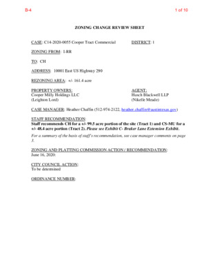
ZONING CHANGE REVIEW SHEET CASE: C14-2020-0055 Cooper Tract Commercial DISTRICT: 1 ZONING FROM: I-RR TO: CH ADDRESS: 10001 East US Highway 290 REZONING AREA: +/- 161.4 acre PROPERTY OWNERS: Cooper Milly Holdings LLC (Leighton Lord) AGENT: Husch Blackwell LLP (Nikelle Meade) CASE MANAGER: Heather Chaffin (512-974-2122, heather.chaffin@austintexas.gov) STAFF RECOMMENDATION: Staff recommends CH for a +/- 99.5 acre portion of the site (Tract 1) and CS-MU for a +/- 48.4 acre portion (Tract 2). Please see Exhibit C- Braker Lane Extension Exhibit. For a summary of the basis of staff’s recommendation, see case manager comments on page 3. ZONING AND PLATTING COMMISSION ACTION / RECOMMENDATION: June 16, 2020: CITY COUNCIL ACTION: To be determined ORDINANCE NUMBER: 1 of 10B-4 C14-2020-0055 2 ISSUES: The Applicant supports the Staff recommendation of CH and CS-MU. CASE MANAGER COMMENTS: The proposed rezoning is for a +/- 161.4 acre tract located along the west side of SH 130 approximately 1,800 feet south of US 290 East. The property is zoned I-RR and is undeveloped. North of the property are undeveloped tracts zoned CS-CO, PUD, and I-RR. West and northwest of the property is a residential property zoned I-RR and a property located outside the City Limits that is developed with automotive repair services and a recycling collection facility. The southern boundary of the rezoning property is the Southwestern railroad. South of the railroad is undeveloped land zoned PUD. Southwest of the property is land zoned P that is part of the Walter E. Long parkland. Across SH 130 to the east is property zoned PUD that is developed with commercial and residential land uses. Please see Exhibits A and B—Zoning Map and Aerial Exhibit. The PUD zoned properties to the north, east and south of the proposed rezoning are all part of the Wildhorse Planned Unit Development. The portion that is located immediately north of the rezoning is under the same ownership but is not part of the rezoning request. This parcel may be incorporated into the overall development by providing vehicular access to the SH 130 southbound service road. The portion of the PUD that is south of the railroad boundary is planned primarily for residential land uses with park and other amenities. The Austin Strategic Mobility Plan (ASMP) includes an extension of Braker Lane across the rezoning property that divides the property into a northern tract (Tract 1) and a southern tract (Tract 2). The Braker Lane extension has not been finalized, so some changes to the alignment may occur prior to dedication. The Applicant is aware that changes to the alignment may require revision of the zoning in the future to match the final design. At this time, the Braker Lane extension divides the property into the +/- 99.5 acre Tract 1 and the +/- 48.4 acre Tract 2. Please see Exhibit C- Braker Lane Extension Exhibit. Staff recommends the CH zoning as requested for Tract 1 and recommends CS-MU for Tract 2. The Applicant supports this alternative recommendation. CH zoning is defined in City Code as: (A) Commercial highway services (CH) district is the designation for a use that has operating and traffic generation characteristics that require that the use be located at the intersection of state maintained highways other than scenic arterial roadways. A CH district designation may be applied to a single major mixed use development of a service nature that includes any combination of office, retail, commercial, and residential uses. A CH district may include a high density residential use. Site development regulations and performance standards applicable to a CH district are designed to ensure adequate access to and from all uses. (B) A CH district may be located along the following highway corridors: a. IH-35; b. (2)US-183; c. (3)US-290 (including Ben White Boulevard); d. (4)SH-71; e. (5)FM-1325 north of US-183; and 2 of 10B-4 C14-2020-0055 3 f. Loop 1, at least 400 feet north of the northernmost right-of-way line of US 183. SH 130 is not listed as a CH corridor; however, the CH zoning category was created in 1999 and has not been modified since 2003. The Austin segment of SH 130 was not constructed at that time. Staff believes CH is appropriate in this location due to the proximity to both US 290 East and SH 130. Tracts along US 290 to the west and east have CH zoning, and the Wildhorse PUD has intensive commercial on the east side of the same intersection. CH zoning encourages greater height and less impervious cover and allows a cohesive mixed use development. Staff recommends CS-MU for Tract 2. This area is separated from the overall site by Braker Lane and will have frontage on the future Braker Lane road when it is constructed. The commercial highway character of Tract 1 does not apply to Tract 2 which is located near areas that are developed or planned for residential and parkland uses. CS-MU also allows mixed use development and will provide a transition from the CH area to the east to the residential areas to the west. BASIS OF RECOMMENDATION: 1. The proposed zoning should be consistent with the purpose statement of the district sought. CH zoning on Tract 1 is consistent with the Code definition listed above. Zoning should allow for reasonable use of the property. 2. The property is currently zoned Interim Rural Residence (I-RR) which allows very limited density single family residential. The propose rezoning will allow a variety of land uses at a density appropriate for the location. Zoning should promote the policy of locating retail and more intensive zoning near 3. the intersections of arterial roadways or at the intersections of arterials and major collectors. The property is located near the intersection of two highways. Zoning should promote a transition between adjacent and nearby zoning districts, 19. land uses, and development intensities. CS-MU zoning will provide a transition between the CH zoning adjacent to SH 130 to the less intensive uses to the west. EXISTING ZONING AND LAND USES: Site North CH-CO, PUD, I-RR South PUD, P East Undeveloped Undeveloped Undeveloped, Walter E. Long Park Limited Warehousing & Distribution, Single family residential Single family residential, Automotive repair services, Recycling collection facility I-RR, Unzoned LAND USES ZONING West I-RR PUD TIA: N/A- deferred to time of site plan 3 of 10B-4 C14-2020-0055 4 WATERSHED: Decker Creek and Gilleland Creek NEIGHBORHOOD ORGANIZATIONS: Bike Austin Homeless Neighborhood Association Austin Neighborhoods Council Del Valle Community Coalition Neighborhood Empowerment Foundation AREA CASE HISTORIES: NUMBER REQUEST COMMISSION C814-00-2063 Unzoned to PUD 11/27/01: To grant PUD with conditions City of Manor Friends of Northeast Austin Sierra Club Imperial Neighborhood Association Friends of Austin Neighborhoods CITY COUNCIL 12/6/01: Approved 1st Reading; 2/7/02: Approved 2nd reading with conditions; 2/14/02: Approve PUD per Staff rec. C14-2013-0112 DR to CH 11/5/13: To grant CH-CO as recommended by Staff, on consent 12/12/13: Approved CH-CO on consent. C14-2013-0054 DR to CH 6/18/13: To grant CH-CO as recommended by Staff, on consent 8/8/13: Approved CH-CO on consent. Capital Metro (within ¼ mile) No EXISTING STREET CHARACTERISTICS: Name Existing ROW ASMP Required ROW Pavement ASMP Classi- fication Side- walks Bicycle Route None 116’ Yes Yes Braker Lane Extension (Future) N. SH 130 4 travel lanes w raised median and bike facilities 120’ 3 5 ~1034’ Defer to TxDOT No Yes No OTHER STAFF COMMENTS: COMPREHENSIVE PLANNING Connectivity- There are no Capital Metro transit stops located within a mile of this this property. There are no public sidewalks located along this section of Texas Highway 130, which this property abuts. There is a shared path trail located along Highway 290, which this property does not abut. There is also the Walnut Creek Hike and Bike Trail located within the Louis René Barrera Indiangrass Wildlife Sanctuary, located to the south. The mobility and connectivity options (availability of nearby goods and services) in this area is below average. 4 of 10B-4 C14-2020-0055 5 Imagine Austin- The Imagine Austin Growth Concept Map, found in the Imagine Austin Comprehensive Plan (IACP) identifies this project as being within the nascent 290 & 130/Wildhorse PUD Town Center and next to an Activity Corridor. Like many Imagine Austin Centers, these centers are represented by a circle that reflects the general location where the center should be located in the future. The center’s actual boundaries would need to be clarified through a small area planning process. Regional, town centers, and neighborhood centers are supposed to be walkable, bikable, and supported by transit. Town Centers are defined by Imagine Austin as mid-sized activity centers that is less urban than a regional center, but more dense than a neighborhood center. They are intended to support a variety of housing types and a range of employers with regional customer and employee bases, and provide goods and services for the center as well as the surrounding areas. Town centers will range in size between approximately 10,000-30,000 people and 5,000-20,000 The following Imagine Austin policies are applicable to this case, which specifically discusses promoting a variety of land uses and a compact and connected city: LUT P1. Align land use and transportation planning and decision-making to achieve a compact and connected city in line with the growth concept map. LUT P3. Promote development in compact centers, communities, or along corridors that are connected by roads and transit that are designed to encourage walking and bicycling, and reduce health care, housing and transportation costs. LUT P5. Create healthy and family-friendly communities through development that includes a mix of land uses and housing types and affords realistic opportunities for transit, bicycle, and pedestrian travel and provides both community gathering spaces, parks and safe outdoor play areas for children. LUT P10. Direct housing and employment growth to activity centers and corridors, and preserving and integrating existing affordable housing where possible. Based upon the property being within the boundaries of a nascent Town Center, which supports a compact but dense residential and commercial uses and developing as an employment center; and the project proposing a mix of commercial and residential uses, this request appears to support Imagine Austin policies. ENVIRONMENTAL 1. The site is not located over the Edwards Aquifer Recharge Zone. The site is in the Gilleland Creek and Decker Creek Watershed of the Colorado River Basin, both are classified as a Suburban Watershed by Chapter 25-8 of the City's Land Development Code. 2. Under current watershed regulations, development or redevelopment on this site will be subject to the following impervious cover limits: 3. According to floodplain maps there is a floodplain within or adjacent to the project location. Based upon the location of the floodplain, offsite drainage should be calculated to determine whether a Critical Water Quality Zone exists within the project location. 5 of 10B-4 C14-2020-0055 6 4. Standard landscaping and tree protection will be required in accordance with LDC 25-2 and 25-8 for all development and/or redevelopment. 5. Trees will likely be impacted with a proposed development associated with this rezoning case. Please be aware that an approved rezoning status does not eliminate a proposed development’s requirements to meet the intent of the tree ordinances. If further explanation or specificity is needed, please contact the City Arborist at 974-1876. At this time, site specific information is unavailable regarding other vegetation, areas of steep slope, or other environmental features such as bluffs, springs, canyon rimrock, caves, sinkholes, and wetlands. 6. This site is required to provide on-site water quality controls (or payment in lieu of) for all development and/or redevelopment when 8,000 s.f. cumulative is exceeded, and on site control for the two-year storm. SITE PLAN SP 1. Site plans will be required for any new development other than single-family or duplex residential. SP 2. Any development which occurs in an SF-6 or less restrictive zoning district which is located 540 feet or less from property in an SF-5 or more restrictive zoning district will be subject to compatibility development regulations. SP 3. Any new development is subject to Subchapter E. Design Standards and Mixed Use. Additional comments will be made when the site plan is submitted. Compatibility Standards SP 4. The site is subject to compatibility standards. No structure may be built within 25 feet of the property line. No structure in excess of two stories or 30 feet in height may be constructed within 50 feet of the property line. No structure in excess of three stories or 40 feet in height may be constructed within 100 feet of the property line. No parking or driveways are allowed within 25 feet of the property line. A landscape area at least 25 feet wide is required along the property line. In addition, a fence, berm, or dense vegetation must be provided to screen adjoining properties from views of parking, mechanical equipment, storage, and refuse collection. For a structure more than 100 feet but not more than 300 feet from property zoned SF-5 or more restrictive, height limitation is 40 feet plus one foot for each 10 feet of distance in excess of 100 feet from the property line. An intensive recreational use, including a swimming pool, tennis court, ball court, or playground, may not be constructed 50 feet or less from adjoining SF-3 property. A landscape area at least 25 feet in width is required along the property line if the tract is zoned LR, GO, GR, L, CS, CS-1, or CH. TRANSPORTATION • The Austin Strategic Mobility Plan (ASMP), adopted 04/11/2019, calls for 116 feet of right-of-way for the future extension of Braker Lane. It is recommended that all of the 116 feet of right-of-way be dedicated for Braker Lane at the time of subdivision or first site plan. 6 of 10B-4 C14-2020-0055 7 • The applicant is working on the alignment of Braker Lane Extension. The applicant is collecting data and will propose an alignment for Braker Lane based on the ASMP and considerate of existing conditions. The proposed alignment of the Braker Lane Extension shall not significantly deviate from the CoA accepted alignment established in the ASMP. This will be memorialized in the final TIA memo. • A TIA is required. Since the analysis of the TIA is dependent upon the Braker Lane Extension and access from that proposed Braker Lane alignment, ATD has agreed to defer approval of the traffic impact analysis and issuance of the final TIA memo until prior to the 3rd reading at Council. This will allow the TIA to complete more accurate analyses based on the preferred Braker Lane alignment (TBD). Name Existing ROW ASMP Required ROW Pavement ASMP Classi- fication Side- walks Bicycle Route None 116’ Yes Yes Braker Lane Extension (Future) N. SH 130 4 travel lanes w raised median and bike facilities 120’ 3 5 ~1034’ Defer to TxDOT No Yes No Capital Metro (within ¼ mile) No WATER UTILITY 1. The landowner intends to serve the site with City of Austin water and wastewater utilities. The landowner, at own expense, will be responsible for providing any water and wastewater utility improvements, offsite main extensions, utility relocations and or abandonments required by the land use. Water and wastewater utility plans must be reviewed and approved by the Austin Water Utility for compliance with City criteria. All water and wastewater construction must be inspected by the City of Austin. The landowner must pay the City inspection fee with the utility construction. The landowner must pay the tap and impact fee once the landowner makes an application for a City of Austin water and wastewater utility tap permit. INDEX OF EXHIBITS TO FOLLOW A: Zoning Map B. Aerial Exhibit C. Braker Lane Extension Exhibit 7 of 10B-4 0 H W Y E B 0 H W Y S V R B D E 9 9 E U S 2 S 2 E U I-RR N S H 1 3 0 S V R D S B N S H 1 3 0 S V R D N B CH-CO PUD C14-2014-0096 C814-00-2063.06 PUD ! ! ! ! ! ! ! ! ! ! C814-00-2063ETJ EXHIBIT A N N S S H 1 H 1 3 3 0 S 0 N B B PUD C814-90-0003.14 C814-90-0003.13 GR-MU-CO 9 9 C14-04-0008 E U S 2 0 H W Y S V R D W B 0 H W Y W B E U S 2 E U S 2 9 0 E B T O N 1 3 0 N B R A M P C14-2008-0011 CH-CO CH-CO C14-2007-0143 N R L E K C E D ! ! ! ! ! ! ! ! ! ! ! ! ! ! ! ! ! ! ! I-RR ! ! ! ! ! ! ! ! ! ! ! ! ! ! ! ! ! ! ! ! ! ! ! ! ! ! ! ! ! ! ! ! ! ! ! ! ! ! ! ! ! ! ! ! C814-00-2063.05 PUD C814-00-2063.06 C814-00-2063ETJ ! ! ! ! ! ! ! LINDELL LN ! ! ! P C14-2016-0090 GR-MU 86-151 ± SUBJECT TRACT ! ! ! ! ! ! PENDING CASE ZONING BOUNDARY ZONING ZONING CASE#: C14-2020-0055 This product is for informational purposes and may not have been prepared for or be suitable for legal, engineering, or surveying purposes. It does not represent an on-the-ground survey and represents only the approximate relative location of property boundaries. 1 " = 600 ' This product has been produced by CTM for the sole purpose of geographic reference. No warranty is made by the City of Austin regarding specific accuracy or completeness. Created: 5/20/2020 8 of 10B-4 0 9 E U S 2 H W Y E B CH-CO PUD EXHIBIT B S28 PUD 0 H W Y D W B H W Y S V R D E B E U S 2 9 0 9 R S 2 V S E U B CH-CO 1 N 3 0 S H S B 0 9 2 D R V P S M B A O E S B R 0 3 N 1 W T N S V S R H D 1 3 N 0 B 9 S 2 E U 0 H W Y E N S H 1 N 3 S V S 0 R H N B D 1 3 S 0 B PUD N S V S N S R H D 1 H N 3 0 1 3 B 0 S B Q29 R29 PUD I-RR I-SF-2 B L U E G Q28 O O S PUD E R D 0 H W Y E B 9 E U S 2 0 H W Y W B 0 H W Y S V B D E R I-RR R28 9 9 E U S 2 S 2 E U GR-MU-CO P M A 0 9 B S 2 E U H W Y E 0 W B R 9 S 2 E U CH-CO CH-CO N R L E K C E D C14-2020-0055 I-RR PUD N S H 1 3 0 N B N S H 1 0 S B M R W I L E A D S N H T C O E H N R T S O L D R PUD B L S U H E 1 B 3 G R E B N L S U 3 L 0 U N F H E 1 B B F T 3 R L U 0 F S A O M N P B F T R A O M P S27 GR-MU B L U E B L U F F R D PUD S26 Copyright nearmap 2015 N L R E K C E D Q27 Q26 ± 1'' = 1000' R27 PUD LIN D ELL LN P UNZ R26 COOPER TRACT COMMERCIAL C14-2020-0055 Creek Buffers ZONING BOUNDARY ZONING CASE#: LOCATION: SUBJECT AREA: GRID: MANAGER: C14-2020-0055 10001 E US 290 Hwy Service Rd EB 147.848 Acres R27 & R28 Heather Chaffin This map has been produced by the Communications Technology Management Dept. on behalf of the Planning Development Review Dept. for the sole purpose of geographic reference. No warranty is made by the City of Austin regarding specific accuracy or completeness. 9 of 10B-4 US-290 LEGEND EXHIBIT C EXISTING 1’ CONTOURS SITE BOUNDARY/PROPERTY LINE APPROXIMATE FEMA FLOODPLAIN CITY OF AUSTIN WETLAND CEF CRITICAL ENVIRONMENTAL FEATURE (CEF) SETBACK S H - 1 3 0 CH ZONING 99.458 Acres IL R A G E X IS T IN Original Braker Ln. to Blue Bluff Rd. Alignment Per ASMP B r a k e r L n . t o B l u e B l u f f R d . CS ZONING 48.390 Acres Kimley Horn Alignment per COA N 0 250 500 750 GRAPHIC SCALE IN FEET COOPER MILLY - ZONING AREAS 4214 MEDICAL PKWY SUITE 300 AUSTIN, TX 78756 PHONE: 512-831-7700 TX FIRM NO 12207 DESIGNED: PELOTON DATE FILE SHEET SHEET DRAWN: PELOTON CHECKED: PELOTON n g .d s n itio d n o C g tin is x E e s a B e rs o H ild W _ 3 0 6 0 0 2 0 \2 e rs o H ild \W its ib h x \E g in n n la P \_ v e r D te s a \M N G B A _ L F E S _ 2 0 0 8 1 B W \S B O t\J n e m p lo e v e d d n \la 6 1 0 2 file rv \\s Future Braker Lane per ASMP (Approx. Alignment) D e c k e r L a n e rt e ilb G : T y b d te rin P M P 8 :4 1 :1 2 0 2 0 /2 /5 6 10 of 10B-4