B-06 (SPC-2019-0563D - Professional Contract Services) — original pdf
Backup
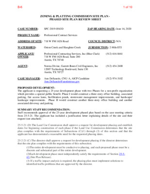
ZONING & PLATTING COMMISSION SITE PLAN - PHASED SITE PLAN REVIEW SHEET ZAP HEARING DATE: June 16, 2020 SPC-2019-0563D CASE NUMBER: PROJECT NAME: ADDRESS OF SITE: 718 W FM 1626 Road WATERSHED: Professional Contract Services COUNCIL DISTRICT: N/A APPLICANT/ OWNER: JURISDICTION: 2-Mile ETJ (512) 616-8461 Onion Creek and Slaughter Creek Professional Contracting Services, Inc (Blue Clark) 718 W FM 1626 Road, Suite 200 Austin, TX 78748 Norma Divine, Garrett-Ihnen Civil Engineers, Inc 12007 Technology Boulevard, Suite 150 Austin, TX 78727 (512) 974-3102 (512) 454-2400 Ann.DeSanctis@austintexas.gov AGENT: CASE MANAGER: Ann DeSanctis, CNU-A, AICP Candidate PROPOSED DEVELOPMENT: The applicant is requesting a 25-year development phase with two Phases for a non-profit organization which provides a special public benefit. Phase I would construct a three story office building, associated parking, fire access lanes, biofiltration ponds, stormwater management improvements, and hardscape/ landscape improvements. Phase II would construct another three-story office building and another associated driveway and parking. SUMMARY STAFF RECOMMENDATION: Staff recommends approval of the 25-year development phased plan based on the case meeting criteria from 25-5-21. The applicant has included a justification letter explaining details of the site and their request (see attached). 25-5-21 (D) The Land Use Commission shall approve a request for development phasing and establish dates for beginning construction of each phase if the Land Use Commission determines that the site plan complies with the requirements of Subsections (C)(1) through (3) of this section and that the applicant has demonstrated a reasonable need for the requested phasing dates. 25-2-21 (C) The director shall approve a request for development phasing if the director determines that the site plan complies with the requirements of this subsection. (1)The entire development must be conducive to phasing, and each proposed phase must be a discrete and substantial part of the entire development. (2)Each development phase must independently satisfy the requirements of Section 25-5- 43 (Site Plan Release). (3) If a traffic impact analysis is required, the phasing plan must implement solutions to identified traffic problems that are approved by the director. 1 of 10B-6 SP-2014-0071C(XT2) All Saints Presbyterian Church SUMMARY COMPONENTS OF SITE PLAN: LAND USE: The site is in the 2-mile ETJ, thus, there is no zoning. The site currently has three (3), one-story buildings and associated parking and driveways. ENVIRONMENTAL: All environmental comments have been cleared. TRANSPORTATION: All transportation comments have been cleared. PROJECT INFORMATION SITE AREA EXISTING ZONING FLOOR-AREA RATIO BUILDING COVERAGE IMPERVIOUS COVERAGE PARKING EXISTING ZONING AND LAND USES 523,155 sq. ft. N/A, 2-Mile ETJ Allowed N/A N/A 65% N/A Proposed 0.77:1 8% 42% 193 12.01 acres ZONING N/A, 2-Mile ETJ San Leanna Full Purpose N/A, 2-Mile ETJ N/A, 2-Mile ETJ N/A, 2-Mile ETJ Site North South East West ABUTTING STREETS Street LAND USES Office Buildings Undeveloped/Farmland Office Mobile Homes Single Family Residential Right-of-Way Width 105 ft Pavement Width Classification 50 ft Major Arterial W FM 1626 NEIGHBORHOOD ORGANIZATIONS: Bike Austin Friends of Austin Neighborhoods South Austin Neighborhood Alliance (SANA) 2 of 10B-6 3 of 10B-6 4 of 10B-6 E H O s t i i m L a n n a e L E n H a O S f o e g a l l i V 5086 5077 E H O l a i t n e d i s e R : e s U 5101 5100 5099 e t a G 5098 H 5097 P 5073 5072 E H O E H O 5071 5096 P 5095 . . . . T C T R P O . . , 0 6 0 9 3 1 9 9 9 1 # . C O D l a i t n e d i s e R : e s U 5086 5077 0 2 0 2 @ g w d . l n a P g n s a h P \ s t i e e h S t l o P \ t c e o r P j \ ) 6 2 6 1 M F 8 1 7 ( 3 0 0 9 1 I S C P i \ ) s e c v r e S t c a r n o C l a n o s s e i f o r P ( I S C P \ s e l i f b o J \ : H 0 2 0 2 / 1 2 / 5 5087 5088 CALLED 10.48 ACRES WALTER B. HECTOR VOL. 817, PG. 404, D.R.T.C.T. 5089 WW Phase 1 Proposed Sanitary Septic/ Drainage Field (By Others) 5102 P 5059 Wastewater Septic Tanks (By Others) 5058 Called 11.96 Acres (Tract 1) Home-Tech Industries, INC. & E. Richard Crum and Delores M. Crum Doc. #2015096702 Use: Residential X X X X 5055 W W 5053 5057 13.0801 Acres (569,770 sq ft) FM 1626 Office Warehouse Subdivision 5056 5054 Doc. #200600080 Lot 1 Block A WW WW WW XX 5158 XX 5103 5104 XX SD 200.8' XX 5157 XX 5156 5155 5105 XX 5154 XX 5153 XX 5152 5150 5151 5149 Called 2.0 Acres Homer Allan Sellars Vol. 4575, Pg. 884 Use: Residential 5081 50825083 5084 5080 5078 5079 5085 1 Story Siding Building for Pressure Tank & Controls X X X X 50495050 5048 5047 P 5052 5051 5046 H FH 5076 5075 5074 Suppression Fire Tank 5060 5045 H V A N Landing Asphalt Drive & Parking Lot WW Down Down Landing W W T.B.M. #2 Ex. Building 1 One-Story Office Building ' 9 . 5 6 7 7 Three-Story Office Building Phase 1 Prop. Building 3 40,212 s.f. FFE = 702.33 FH I G ' 4 x 4 ' 1 9 18" RCP Asphalt Drive n w o D WW WW T X X 24" RCP XX B J ' 5 x ' 8 X X Gate 4'x4' GI 5021 5011 5012 5020 5018 WW 5019 5017 5010 5009 5015 5016 5013 5008 5002 5004 5003 5007 5014 5006 5005 Asphalt Drive 1 AC Ex. Building 2 One-Story Office Building 5 ' 1 . 1 2 1 4 Asphalt drive & parking lot W W d n a k n a T c i t p e S d l e i F c i t p e S 4 4 " P V C Asphalt drive X X Cleanouts 51.2' E 5124 5123 5125 H 5119 5121 5120 5118 5117 5122 5115 5116 5113 5114 5112 5111 5110 5109 5108 5107 5092 5091 5090 5106 M obile H o m e (Typ) T.B.M. #1 Called 6.73 Acres Owner: Forest Oaks MHC, LLC Doc. #2014156103 Use: Mobile Home Park Phase I 5070 5069 5068 5093 5094 H 5067 5066 5161 5159 5160 5162 5063 H 5064 5062 5065 5061 H 5135 5136 Manufactured Home is Over Property Line 5133 5134 Propane Tank Propane Tank 5132 5131 5130 5129 5044 5128 5127 5126 XX Propane Tank XX 5148 SD 5147 5146 5145 5001 Headwall FL In 30": 683.71 E H O A K C O L B , 1 T O L Y C N E G R E M E Y T N U O C S I V A R T 5 # T C I R T S I D S E C I V R E S . . . . T C T R P O . . , 0 8 0 0 0 1 1 0 2 # . C O D n o i t a t S e r i F : e s U t s e W 6 2 6 1 . M F . ) s e i r a v h t d i W . . W O R ( . 17' R.O.W. Dedication 17' R.O.W. Dedication per PLat, Doc. # 201100080 3 1 - S 8 0 5 Sign 4' x 4' Grate Inlet Rim: 691.00 FL Out: 688.50 Asphalt Drive FM 1626 Office Warehouse 17' R.O.W. Dedication Lot 2 Block A Subdivision Doc. No. 200600080 Owner: PCSI, Inc Doc. No. 2004166285 E H O 6' 2 R 5 ' 2 R E H O E H O E H O 5000 5144 . E R C A 7 2 8 0 D E L L A C B B A R Y E R F F O E G 0 9 4 9 1 1 6 0 0 2 # . C O D . . . . T C T R P O . . l a i c r e m m o C : e s U 5088 Phase 1 Sanitary Septic/Drainage Field By Others CALLED 10.48 ACRES WALTER B. HECTOR VOL. 817, PG. 404, D.R.T.C.T. 5089 WW 5102 P 5059 Wastewater Septic Tanks (By Others) 5058 5081 50825083 5084 5080 5078 5079 5085 5076 5075 5074 Suppression Fire Tank Home-Tech Industries, INC. & E. Richard Crum and Delores M. Crum Doc. #2015096702 Use: Residential Called 2.0 Acres Homer Allan Sellars Vol. 4575, Pg. 884 Use: Residential Ex. Building 1 One-Story Office Building 7 7 X X X X 5055 W W 5053 5057 5056 5054 Lot 1 Block A 12.01 Acres (425,875 sq ft) FM 1626 Office Warehouse Subdivision Doc. #200600080 WW WW W SD Three-Story Office Building Three-Story Office Building Phase 2 Phase 2 Prop. Building 4 Prop. Building 4 40,000 s.f. 40,000 s.f. F.F.E.= 704.00 F.F.E.= 704.00 V V A A N N D D o o w w n n Landing Landing 5048 5047 P D D o o w w n n D S D S 5046 H FH WW WW Down Landing W W T.B.M. #2 5022 Three-Story Office Building Phase 1 Prop. Building 3 40,212 s.f. FFE = 702.33 5045 H N A V Approx. Location of 150' Radius Sanitary SD Control Easement VOL. 9352, PG. 614 5044 5126 5128 5127 XX Propane Tank XX SD 5124 5123 5125 H SD T.B.M. #1 Called 6.73 Acres Owner: Forest Oaks MHC, LLC Doc. #2014156103 Use: Mobile Home Park XX 5158 XX 5103 5104 XX SD XX 5157 XX 5156 5155 5105 XX 5154 XX 5153 XX 5152 5150 5151 5149 5148 SD 5147 5146 5145 5001 X X Drainage Esmt. Doc. #200600080 Phase 1 Biofiltration Pond 3 1 - S 8 0 5 Sign 2 ADA 1 3 9 FH " 2 1 1 WW T 1 AC Ex. Building 2 One-Story Office Building 5 W W 4 4 WW l l e W 5011 5012 5021 WW 5019 5017 5020 5018 5010 5009 5015 5016 5013 5008 5007 5014 5006 5005 SD 5004 5003 5002 SD 5119 5121 5120 5118 5117 5122 5115 5116 5113 5114 Gate X X 40.5' Access Esmt. Doc. #200600080 Drainage Esmt. Doc. #200600080 Lot 2 Block A FM 1626 Office Warehouse Subdivision Doc. No. 200600080 Owner: PCSI, Inc Doc. No. 2004166285 W X X 31' Access Easement Doc. #200600080 25' Drainage Easement Doc. #200600080 E 5112 SD SD 5108 5107 5092 5091 5090 5106 XX S D M obile H o m e (Typ) Phase II A K C O L B , 1 T O L Y C N E G R E M E Y T N U O C S I V A R T 5 # T C I R T S I D S E C I V R E S . . . . T C T R P O . . , 0 8 0 0 0 1 1 0 2 # . C O D n o i t a t S e r i F : e s U . E R C A 7 2 8 0 D E L L A C B B A R Y E R F F O E G 0 9 4 9 1 1 6 0 0 2 # . C O D . . . . T C T R P O . . l a i c r e m m o C : e s U E H O 26' R 5 ' 2 R E H O E H O E H O E H O 5000 5144 5095 5070 5069 5068 5093 5094 H 5067 5066 5161 5159 5160 5162 5063 H 5064 5062 5065 5061 H 5135 5136 Manufactured Home is Over Property Line 5133 5134 5132 5131 5130 5129 Propane Tank Propane Tank 0 2 - r a M - 2 1 : E T A D L S , W J E J , : D E N G S E D I E A , E J , W J : N W A R D D P , I L S : D E K C E H C 2 0 2 0 7 I S C P : O N B O J I S N O T C E R R O C S N O S V E R / I I / E T A D L A V O R P P A Y T C I I I N O T P R C S E D . O N 0 3 6 - F # m r i F E P B T 0 5 1 e t i u S , y g o l o n h c e T 7 0 0 2 1 7 2 7 8 7 s a x e T , n i t s u A 0 0 4 2 - 4 5 4 ) 2 1 5 ( 0 2 / 1 2 / 5 l n a P g n s a h P i i s e c v r e S t c a r t n o C l i a n o s s e f o r P d R 6 2 6 1 M F 8 1 7 8 4 7 8 7 s a x e T , n i t s u A Legend Phase Delineation Legal Description Lot 1, Block A, FM 1626 Office Warehouse Subdivision, Doc. No. 200060080, 12.01 Acres Call Before You Dig!! Benchmarks T.B.M. #1 - Mag nail with "4Ward Control" washer set in asphalt driveway, +/- 3.5' East of concrete ribbon curb, and +/- 89' Southwest of the Southwest corner of the 1-story metal and stone building (300). Elevation = 698.30'. T.B.M. #2 - Mag nail with "4Ward control" washer set on top of concrete ribbon curb +/- 21 South of the Southeast corner of the 1-story metal and stone building (300), and +/- 39' North of the Northwest corner of the 1-story stone building (100). Elevation = 698.21'. 00 60' 120' Scale 1" = 60' Contractor to field verify pipe size and locations of existing water line and fire lines located on the site. Any discrepancies between existing utility field verifications and proposed and existing call-outs on plans shall be immediately brought up to the engineer for further review. The location of all existing utilities shown on these plans has been based upon owner recollection and above ground observations only as no records are available of the existing underground utilities and may not match locations as constructed. The contractor shall contact Texas 811 for assistance in determining existing utility locations prior to beginning construction. Contractor shall field verify locations of utility crossings prior to beginning construction. Release of this application does not constitute a verification of all data, information and calculations supplied by the applicant. The engineer of record is solely responsible for the completeness, accuracy and adequacy of his/her submittal, whether or not the application is reviewed for Code compliance by City engineers. SHEET NUMBER 13 of 31 SPC-2019-0563D 5 of 10B-6 ' 0 4 . 6 0 1 W " 0 5 ' 5 4 ° 7 8 S X X LOC XX ' 5 . 9 6 1 G 2 G 3 G 3 G 1 G 3 G 3 G ' 5 2 5124 X X L O C X X L O C 0 2 0 2 @ LOC Phase 1 Proposed Sanitary Septic/ Drainage Field (By Others) WALTER B. HECTOR VOL. 817, PG. 404, D.R.T.C.T. LOC S1° 53' 11"E 798.14' 5089 LOC 5102 P LOC 5059 5058 698 LOC X X Home-Tech Industries, INC. & E. Richard Crum and Delores M. Crum Doc. #2015096702 Use: Residential 5055 5053 5057 5056 5054 Lot 1 Block A 13.0801 Acres (569,770 sq ft) FM 1626 Office Warehouse Subdivision Doc. #200600080 699 700 701 1 Story Siding Building for Pressure Tank & Controls Water Well X X Ex. ±2" PVC Water Line Ex. ±2" PVC Water Line X X 7 0 2 5' R ' 5 1 R ' 0 2 7 0 0 5052 5051 3 5 6 50495050 701 5048 5047 P ADA Route 5 2 5046 H 26' 698 XX Ex. PIV for Fire Line Hand Rail Down 5158 5103 Irrigation Control Valve XX L O C 5104 XX SD 1 x 1 Drain Inlet Ex. Fire Line Grate Inlet Rim: 697.19 FL Out: 695.37 6 9 7 200.8' Called 2.0 Acres Homer Allan Sellars Vol. 4575, Pg. 884 Use: Residential 6 9 6 XX 5 9 6 5157 XX 6 9 4 6 9 3 S3° 22' 48"E 5156 XX 828.66' C O L Ex. Building 1 One-Story Office Building ' 9 . 5 6 7 7 699 103.1' U G E Three-Story Office Building Phase 1 Prop. Building 3 40,212 s.f. FFE = 702.33 Down Landing Water Valve T.B.M. #2 Ex Water Service Connection to Building LOC 5' Sidewalk FH 3 " 2 1 1 ' I 1 Aproximate Location Underground Electric 8 Service UGE 2 4 x 4 G ' . ' 9 18" RCP 1 2 AC 4' x 4' Grate Inlet Rim: 697.02 FL In 12": 693.82 UGE FL Out: 693.22 Asphalt Drive n w o D ADA Route l l e W 5011 5012 5010 Abandoned Water 5019 Well Connection 5021 5020 5018 ±1" Water Valve T Telephone Junction Box LOC 4' x 4' Grate Inlet Rim: 693.98 FL Out: 691.25 UGE X X 2 3 9 9 6 6 4 9 6 5 9 6 1 9 6 24" RCP XX Aproximate Location Underground Electric Service U G E 4'x4' GI B J ' 5 x ' 8 5060 ' 9 13 18' 26' 8 6 4 FH 1 0 7 5' R 2 Approx. Location of 150' Radius Sanitary Control Easement VOL. 9352, PG. 614 5044 5126 2 0 7 5045 H 1 C 5 G 3 G 2 C ADA Route ' 8 . 7 7 1 2 AC G V A N 1 G 3 G 3 G 0 0 7 Open Parking Below 146' 5 699 27.5' 5009 Landing 2 AC Asphalt Drive & Parking Lot 5017 5016 5013 5015 5008 5002 5004 5003 5007 5014 5006 5005 Asphalt Drive R 2 5 ' Propane Tank Propane Tank 5132 5131 C 5130 LO 5129 1280.80' 5128 5127 N2° 52' 24"W LOC 5125 H XX 5123 1 5 . 7 ' LOC T.B.M. #1 5119 5121 5120 5118 5117 LOC 5115 5116 5122 5113 5114 5110 5109 5108 5107 5092 5091 5090 5106 1 AC 5 Ex. Building 2 One-Story Office Building ' . 1 1 2 1 Asphalt drive & parking lot 4 4 d n a k n a T c i t p e S d l e i F c i t p e S P V C 4 " Cleanouts W Asphalt drive 51.2' E 4' x 4' Grate Inlet Rim: 696.12 FL Out: 692.47 5112 LOC 5111 4 9 6 ' 8 7 X X . 5 1 1 W " 6 3 ' 7 0 ° 7 8 S L O C M obile H o m e Doc. #2015096702 Use: Residential Propane Tank Called 6.73 Acres Phase I LOC 5059 LOC LOC LOC 698 5058 9 9 6 0 0 7 5074 1 0 7 5063 H 5064 5062 5065 5067 5066 5161 5162 5159 5160 Suppression Fire Tank 702 5061 H LOC 5136 7 0 3 5135 703 5134 Manufactured Home 5133 is Over Property Line LOC LOC LOC LOC LOC LOC 5089 LOC LOC 5102 P LOC No buildings were observed to exist within 50' of adjoining property line east of lot 1 Block A. 2 9 6 691 6 9 0 6 8 9 6 8 8 5105 5155 XX 5154 LOC 5153 XX 6 8 6 685 5148 XX 5152 5150 5151 5149 LOC 7 8 6 0 9 6 9 8 6 6 8 8 Drainage Esmt. Doc. #200600080 Proposed 687 Biofiltration Pond 7 8 6 7 8 6 SD 5147 LOC 5146 5145 5001 E H O 4 8 6 Headwall FL In 30": 683.71 7 8 97' 6 ROW 7 8 06 9 6 1 9 6 1 9 6 Sign 5 8 6 E H O 6 8 6 ' 9 1 . 2 6 1 W " 4 1 ' 7 1 ° 8 8 S L O C 5 8 6 80' 686 ROW 17' R.O.W. Dedication t s e W 6 2 6 1 . M F . ) s e i r a v h t d i W . . W O R ( . 6 8 8 689 6' 2 R 690 5 ' 2 R 691 Storm Sewer Junction Box Rim: 693.70 FL In 24": 689.20 FL Out: 689.20 X X E T A G 693 Gate 28.16' N 48° 01' 15" W XX 4' x 4' Grate Inlet Rim: 693.77 FL Out: 690.51 Transformer UGE 31' Access Easement Doc. #200600080 4' x 4' Grate Inlet Rim: 691.00 FL Out: 688.50 692 Asphalt Drive 2 9 6 1 9 6 E Existing H O Driveway E H O 6 9 2 40.5' Access Esmt. Doc. #200600080 323.30' UGE N3° 22' 48"W UGE Drainage Esmt. Doc. #200600080 Lot 2 Block A FM 1626 Office Warehouse Subdivision Doc. No. 200600080 Owner: PCSI, Inc Doc. No. 2004166285 17' R.O.W. Dedication 25' Drainage Easement Doc. #200600080 LOC 690 690 Concrete Channel 690 LOC 690 LP Elev.: 688.90 6 9 3 6 9 4 E H O 0 9 6 97' ROW 6 9 2 6 9 3 L O C 0 9 6 E H O 2 9 6 3 9 6 5000 5144 694 CALLED 0.827 ACRE GEOFFREY RABB DOC. #2006119490 O.P.R.T.C.T. Use: Commercial 698 6 9 7 XX LOC LOC XX 5158 5103 LOC 5104 XX XX Called 2.0 Acres Homer Allan Sellars Vol. 4575, Pg. 884 Use: Residential 6 9 6 5 9 6 5157 XX 6 9 4 6 9 3 6 9 0 6 8 9 6 8 8 691 2 9 6 LOC 5156 XX 5105 5155 XX 5154 LOC 5153 XX LOC XX LOC 5152 5151 5150 LOC 5149 6 8 6 685 LOC 5148 7 8 6 No buildings were observed to exist within 50' of adjoining property line east of lot 1 Block A. Ex. Building 1 One-Story Office Building 7 7 LOC LOC LOC LOC 0 9 6 9 8 6 1 9 6 6 8 8 Drainage Esmt. Doc. #200600080 687 7 Phase 1 8 6 Biofiltration Pond 693 6 9 2 40.5' Access Esmt. Doc. #200600080 5055 5053 5057 5056 5054 Lot 1 Block A 12.01 Acres (425,875 sq ft) FM 1626 Office Warehouse Subdivision Doc. #200600080 699 W SD ' 2 . 6 4 1 3 G 8 ' . 2 1 2 3 G 3 G 3 G 3 G 95.8' Phase 2 Prop. Building 4 Three-Story Office Building 40,000 s.f. F.F.E.= 704.00 V A N 2 AC G 3 G 3 G 3 G 1 3 3 3 18' 25' 3 G 18' 26' Open Parking Below D o w n Landing 701 5048 5047 P D o w n 701 21 18' ' 9 4 2 AC 3 7 0 2 7 700 Suppression Fire Tank 7 0 0 ADA Route 7' Sidewalk D S D S 5046 H FH D S 1 0 7 Approx. Location of 150' Radius Sanitary Control Easement VOL. 9352, PG. 614 5044 5126 LOC 5128 5127 LOC XX XX SD L O C Down Landing 5022 699 Phase 1 Prop. Building 3 40,212 s.f. FFE = 702.33 Three-Story Office Building 5045 H N A V 0 0 7 699 LOC 2 ADA 1 3 FH " 2 1 1 l l e W 5011 5012 5021 5020 5018 5019 5017 5010 5009 5015 5016 5013 5008 5002 5004 5003 5007 5014 5006 5005 9 T 1 AC 5 Ex. Building 2 One-Story Office Building 4 4 Phase II LOC 5147 5146 LOC 5145 5001 SD E H O 4 8 LOC 6 7 8 06 9 6 1 9 6 1 9 6 6 8 6 L O C 5 8 6 E H O 2 9 6 1 9 6 E H O 5 8 6 686 7 8 6 6 8 8 689 26' R 690 5 ' 2 R 691 7 8 6 692 Drainage Esmt. Doc. #200600080 L O E C H O L O C L O C 0 9 6 E H O 0 9 6 E H O 2 9 6 3 9 6 5000 5144 694 Lot 2 Block A FM 1626 Office Warehouse Subdivision Doc. No. 200600080 Owner: PCSI, Inc Doc. No. 2004166285 690 690 6 9 3 6 9 4 6 9 2 6 9 3 CALLED 0.827 ACRE GEOFFREY RABB DOC. #2006119490 O.P.R.T.C.T. Use: Commercial 702 5061 H LOC 7 0 3 LOC 5135 LOC LOC 5067 5066 5161 5162 5159 5160 5063 H 5064 5062 5065 5136 703 R 2 5 ' R25' LOC 5134 Manufactured Home 5133 is Over Property Line LOC ' 5 2 LOC ' 3 . 7 1 Propane Tank Propane Tank LOC 5132 5131 5130 LOC 2 0 7 5129 SD SD SD SD SD E SD SD SD LO C LOC 5125 H 5124 LOC 5123 LOC 5119 LOC 5118 5121 5120 5117 LOC 5122 5115 LOC 5116 LOC 5113 5114 LOC 5112 LOC LOC 5108 5107 5092 5091 5090 5106 25' Drainage Easement Doc. #200600080 690 690 LOC LOC LOC LOC LOC LOC LOC 50825083 5081 5084 5080 8 9 6 5079 5085 5 1 t e e h S e n i l h c t a M 699 5076 5075 Phase 1 Sanitary Septic/Drainage Field By Others 50825083 5081 5084 5080 8 9 6 5079 5085 699 5076 5075 5 1 t e e h S e n i l h c t a M 9 9 6 0 0 7 5074 1 0 7 3 3 9 9 6 6 X X C O L C O X X L 2 3 9 9 6 6 4 9 6 5 9 6 XX 18' 18' 12.2' ' 9 9 9 W S D XX 4 9 6 X X 3 1 - S 8 0 5 3 1 - S 8 0 5 0 2 - r a M - 2 1 : E T A D L S , W J E J , : D E N G S E D I E A , E J , W J : N W A R D D P , I L S : D E K C E H C 2 0 2 0 7 I S C P : O N B O J TRAVIS COUNTY EMERGENCY SERVICES DISTRICT #5 DOC. #201100080, O.P.R.T.C.T. I I S N O T C E R R O C S N O S V E R / I I / E T A D L A V O R P P A Y T C I I N O T P R C S E D . O N 0 3 6 - F # m r i F E P B T 0 5 1 e t i u S , y g o l o n h c e T 7 0 0 2 1 7 2 7 8 7 s a x e T , n i t s u A 0 0 4 2 - 4 5 4 ) 2 1 5 ( TRAVIS COUNTY EMERGENCY SERVICES DISTRICT #5 DOC. #201100080, O.P.R.T.C.T. 0 2 / 1 2 / 5 1 t e e h S n a P e t i l S i s e c v r e S t c a r t n o C l i a n o s s e f o r P d R 6 2 6 1 M F 8 1 7 8 4 7 8 7 s a x e T , n i t s u A 00 50' 100' Scale 1" = 50' Walkways & Trails Note: Refer to Landscape Architectural drawings for all walkways and trail paths materials and details. Benchmarks T.B.M. #1 - Mag nail with "4Ward Control" washer set in asphalt driveway, +/- 3.5' East of concrete ribbon curb, and +/- 89' Southwest of the Southwest corner of the 1-story metal and stone building (300). Elevation = 698.30'. T.B.M. #2 - Mag nail with "4Ward control" washer set on top of concrete ribbon curb +/- 21 South of the Southeast corner of the 1-story metal and stone building (300), and +/- 39' North of the Northwest corner of the 1-story stone building (100). Elevation = 698.21'. Site Plan Release Notes: 1. All improvements shall be made in accordance with the released site plan. Any additional improvements will require site plan amendment and approval of the Development Services Department. Approval of this Site Plan does not include Building and Fire Code approval nor building permit approval. Additional electric easements may be required at a later date. 2. 3. 4. Water service will be provided by private onsite water well, wastewater will be on private OSSF. 5. No certificate of occupancy may be issued for the proposed residential condominium project until the owner or owners of the property have complied with Chapter 81 and 82 of the Property Code of the State of Texas or any other statutes enacted by the State concerning condominiums. For driveway construction: The owner is responsible for all costs for relocation of, or damage to utilities. For construction within the right-of-way, a ROW excavation permit is required. 6. 7. Contractor to field verify pipe size and locations of existing water line and fire lines located on the site. Any discrepancies between existing utility field verifications and proposed and existing call-outs on plans shall be immediately brought up to the engineer for further review. The location of all existing utilities shown on these plans has been based upon owner recollection and above ground observations only as no records are available of the existing underground utilities and may not match locations as constructed. The contractor shall contact Texas 811 for assistance in determining existing utility locations prior to beginning construction. Contractor shall field verify locations of utility crossings prior to beginning construction. Release of this application does not constitute a verification of all data, information and calculations supplied by the applicant. The engineer of record is solely responsible for the completeness, accuracy and adequacy of his/her submittal, whether or not the application is reviewed for Code compliance by City engineers. SHEET NUMBER of 31 14 SPC-2019-0563D Legal Description Lot 1, Block A, FM 1626 Office Warehouse Subdivision, Doc. No. 200060080, 12.01 Acres Call Before You Dig!! . g w d A O C n a P e l t i S \ s t e e h S t l o P \ t c e o r P j \ ) 6 2 6 1 M F 8 1 7 ( 3 0 0 9 1 I S C P i \ ) s e c v r e S t c a r n o C l a n o s s e i f o r P ( I S C P \ s e l i f b o J \ : H 0 2 0 2 / 1 2 / 5 6 of 10B-6 0 2 0 2 @ . g w d A O C n a P e l t i S \ s t e e h S t l o P \ t c e o r P j \ ) 6 2 6 1 M F 8 1 7 ( 3 0 0 9 1 I S C P i \ ) s e c v r e S t c a r n o C l a n o s s e i f o r P ( I S C P \ s e l i f b o J \ : H 0 2 0 2 / 1 2 / 5 CALLED 2.63 ACRES 5101 7 5 FRANK J. GUSZAK AND DIANA F. GUSZAK . 3 1 4 5100 5099 DOC. #2000077345, O.P.R.T.C.T. Use: Residential 4 9 6 ' E H O 6 9 6 7 9 6 8 9 6 5 9 6 e t a G 5098 H 5097 P 5073 5072 C O L 5071 5096 P 5095 4 9 6 C O L 5086 5077 C O L 4 9 C O L 6 C O L 5086 C O L C O L C O L 5077 E H O s t i i m L a E n H n O a e L n a S f o e g a l l i V E H O E " 5 1 ' 2 2 ° 7 8 N E H O s t i m i L a E n H n O a e L n a S f o e g a l l i V E H O E H O E H O E H O E H O 3 9 6 5087 LOC 5088 LOC CALLED 10.48 ACRES WALTER B. HECTOR VOL. 817, PG. 404, D.R.T.C.T. LOC S1° 53' 11"E 798.14' 5089 LOC 5102 P Phase 1 Proposed Sanitary Septic/ Drainage Field (By Others) 697 698 LOC 5059 5058 5055 5053 5057 5056 5054 Lot 1 Block A 13.0801 Acres (569,770 sq ft) FM 1626 Office Warehouse Subdivision Doc. #200600080 699 6 9 5 6 9 6 697 50825083 5081 5084 5080 6 9 8 5078 5079 5085 5070 5069 5068 5093 5094 H 5067 5066 5161 5162 5159 5160 5063 H 5064 5062 5065 9 9 6 LOC 0 0 7 5074 1 0 7 Suppression Fire Tank 702 5061 H LOC 5136 7 0 3 5135 Phase I LOC LOC Phase 1 Proposed Phase 1 Sanitary Sanitary Septic/ Drainage Field Septic/Drainage Field By Others (By Others) 703 5134 Manufactured Home 5133 is Over Property Line LOC 6 9 5 6 9 6 697 50825083 5081 5084 5080 8 9 6 5078 5079 5085 700 4 1 t e e h S e n i l h c t a M 699 5076 5075 4 1 t e e h S e n i l h c t a M 699 5076 5075 700 701 1 Story Siding Building for Pressure Tank & Controls Water Well X X Ex. ±2" PVC Water Line Ex. ±2" PVC Water Line X X 7 0 2 5' R ' 5 1 R ' 0 2 7 0 0 5052 5051 3 5 6 50495050 701 5048 5047 P 5046 H 26' 5060 ' 9 13 18' 26' 8 6 4 FH 1 0 7 5' R 2 Approx. Location of 150' Radius Sanitary Control Easement VOL. 9352, PG. 614 5044 5126 2 0 7 5132 5131 C 5130 LO 5129 1280.80' 5128 5127 N2° 52' 24"W 5 2 XX LOC ADA Route 5045 H 1 C 5 G 3 G 2 C LOC 5125 H LOC 698 5055 5053 5057 5056 5054 Lot 1 Block A 12.01 Acres (425,875 sq ft) FM 1626 Office Warehouse Subdivision Doc. #200600080 699 W 5058 7 0 0 ADA Route 7' Sidewalk ' 2 . 6 4 1 ' 3 G 8 . 2 1 2 3 G 3 G 3 G 3 G 95.8' Phase 2 Prop. Building 4 Three-Story Office Building 40,000 s.f. F.F.E.= 704.00 V A N 2 AC G 3 G 3 G 3 G 1 3 3 3 18' 25' 3 G 18' 701 21 18' ' 9 4 2 AC 3 7 0 2 7 26' Open Parking Below D o w n Landing 701 5048 5047 P D o w n 5046 H 5045 H FH 1 0 7 Approx. Location of 150' Radius Sanitary Control Easement VOL. 9352, PG. 614 5044 5126 LOC 5128 5127 LOC XX LOC 5125 H 703 R 2 5 ' R25' LOC 5134 Manufactured Home 5133 is Over Property Line LOC ' 5 2 LOC ' . 3 7 1 Propane Tank Propane Tank LOC 5132 5131 5130 LOC 2 0 7 5129 CALLED 2.63 ACRES FRANK J. GUSZAK AND DIANA F. GUSZAK DOC. #2000077345, O.P.R.T.C.T. Use: Residential 5101 5100 5099 4 9 6 E H O 5 9 6 e t a G 5098 H 5097 P 5073 5072 6 9 6 7 9 6 C O L C O L 8 9 6 9 9 6 5071 5096 P 5095 LOC LOC LOC 5070 5069 5068 5093 5094 H 5067 5066 5161 5162 5159 5160 Suppression Fire Tank 0 0 7 5074 1 0 7 702 7 0 3 LOC 5135 LOC 5061 H LOC 5063 H 5064 5062 5065 5136 Phase II 5087 C O L 5088 LOC LOC LOC LOC LOC 5089 LOC LOC 5102 P LOC LOC 5059 LOC 00 50' 100' Scale 1" = 50' Walkways & Trails Note: Refer to Landscape Architectural drawings for all walkways and trail paths materials and details. Benchmarks T.B.M. #1 - Mag nail with "4Ward Control" washer set in asphalt driveway, +/- 3.5' East of concrete ribbon curb, and +/- 89' Southwest of the Southwest corner of the 1-story metal and stone building (300). Elevation = 698.30'. T.B.M. #2 - Mag nail with "4Ward control" washer set on top of concrete ribbon curb +/- 21 South of the Southeast corner of the 1-story metal and stone building (300), and +/- 39' North of the Northwest corner of the 1-story stone building (100). Elevation = 698.21'. Legal Description Lot 1, Block A, FM 1626 Office Warehouse Subdivision, Doc. No. 200060080, 12.01 Acres Call Before You Dig!! Site Plan Release Notes: 1. All improvements shall be made in accordance with the released site plan. Any additional improvements will require site plan amendment and approval of the Development Services Department. Approval of this Site Plan does not include Building and Fire Code approval nor building permit approval. Additional electric easements may be required at a later date. 2. 3. 4. Water service will be provided by the City of Austin, wastewater will be on site septic. 5. No certificate of occupancy may be issued for the proposed residential condominium project until the owner or owners of the property have complied with Chapter 81 and 82 of the Property Code of the State of Texas or any other statutes enacted by the State concerning condominiums. For driveway construction: The owner is responsible for all costs for relocation of, or damage to utilities. For construction within the right-of-way, a ROW excavation permit is required. 6. 7. Contractor to field verify pipe size and locations of existing water line and fire lines located on the site. Any discrepancies between existing utility field verifications and proposed and existing call-outs on plans shall be immediately brought up to the engineer for further review. The location of all existing utilities shown on these plans has been based upon owner recollection and above ground observations only as no records are available of the existing underground utilities and may not match locations as constructed. The contractor shall contact Texas 811 for assistance in determining existing utility locations prior to beginning construction. Contractor shall field verify locations of utility crossings prior to beginning construction. Release of this application does not constitute a verification of all data, information and calculations supplied by the applicant. The engineer of record is solely responsible for the completeness, accuracy and adequacy of his/her submittal, whether or not the application is reviewed for Code compliance by City engineers. SHEET NUMBER of 31 15 SPC-2019-0563D 0 2 - r a M - 2 1 : E T A D L S , W J E J , : D E N G S E D I E A , E J , W J : N W A R D D P , I L S : D E K C E H C 2 0 2 0 7 I S C P : O N B O J I S N O T C E R R O C S N O S V E R / I I / E T A D L A V O R P P A Y T C I I I N O T P R C S E D . O N 0 3 6 - F # m r i F E P B T 0 5 1 e t i u S , y g o l o n h c e T 7 0 0 2 1 7 2 7 8 7 s a x e T , n i t s u A 0 0 4 2 - 4 5 4 ) 2 1 5 ( 0 2 / 1 2 / 5 2 t e e h S n a P e t i l S i s e c v r e S t c a r t n o C l i a n o s s e f o r P d R 6 2 6 1 M F 8 1 7 8 4 7 8 7 s a x e T , n i t s u A 7 of 10B-6 0 2 0 2 @ g w d . n a P l l o r t n o C l i a n o s n e m D \ s t i e e h S t l o P \ t c e o r P j \ ) 6 2 6 1 M F 8 1 7 ( 3 0 0 9 1 I S C P i \ ) s e c v r e S t c a r n o C l a n o s s e i f o r P ( I S C P \ s e l i f b o J \ : H 0 2 0 2 / 1 2 / 5 LOC 5102 P LOC 5059 LOC LOC XX 5058 5055 5057 5053 5056 5054 Lot 1 Block A 13.0801 Acres (569,770 sq ft) FM 1626 Office Warehouse Subdivision Doc. #200600080 L O C ' 0 4 . 6 0 1 X X W " 0 5 ' 5 4 ° 7 8 S X X X X 6" Curb Ribbon Curb Tree Protection Wall 6 R10' 34.5' 5052 5051 R 5' R 1 5' 3 T y p . ' 0 2 Asphalt Paving 1 Story Siding Building for Pressure Tank & Controls XX Water Well 5048 5047 P Ex. ±2" PVC Water Line Ex. ±2" PVC Water Line W X X X X Asphalt Paving 3 5 Tree Protection Wall 50495050 Construct 7' Sidewalk Construct 7' Sidewalk ' 7 ' 7 ' 7 Tree Protection Wall 5046 H R3' Tree Protection Wall 5045 H 5 2 ' 7 . 7 3 R 3' 4 18' Steps ' 6 . 3 4 R2' 16' ' 9 8 18' 26' 13.5' 26' 6 18' 13 18' ' 9 5060 LOC Manufactured Home is Over Property Line LOC 5132 5131 5130 Propane Tank X X 15.4' R 1 0' Ribbon Curb R 2 5 ' R25' Approx. Location of 150' Radius Sanitary Control Easement VOL. 9352, PG. 614 152.9' ' 5 2 5044 5129 LOC 1280.80' N2° 52' 24"W 5128 5127 5126 LOC XX Propane Tank XX Called 2.0 Acres Homer Allan Sellars Vol. 4575, Pg. 884 Use: Residential XX 5104 XX XX XX XX 5157 XX S3° 22' 48"E 5156 XX 828.66' LOC 5105 5155 XX XX 5154 LOC XX 5153 XX XX LOC 5158 XX LOC Ex. PIV for Fire Line Construct 7' Sidewalk w/ Handrail Down ' 7 5103 XX SD W D S L O C Irrigation Control Valve SD 1 x 1 Drain Inlet Ex. Fire Line Grate Inlet Rim: 697.19 FL Out: 695.37 Ex. Building 1 One-Story Office Building ' 9 . 5 6 7 7 X X C O L X X LOC LOC LOC UGE 103.1' Phase 1 Prop. Building 3 40,212 s.f. FFE = 702.33 Three-Story Office Building Down Landing 12" HDPE T.B.M. #2 19.3' U G E W 25' Water Valve Ex Water Service Connection to Building ' 4 3 " 2 1 1 SD R15' U G E Sawcut Line Aproximate Location Underground Electric Service 8 2 3 1 . ' I G ' 4 x 4 ' 9' UGE 1 8.9' 2 AC 9' 4' x 4' Grate Inlet Rim: 697.02 FL In 12": 693.82 FL Out: 693.22 SD 6' 18" RCP SD Asphalt Drive UGE 6' Steps Abandoned Water Well Connection 5021 5019 l l e W 5011 5012 ' 6 5020 5018 5017 ' 6 Construct 7' Sidewalk w/ Handrail ' 8 n w o D 1 C 5 G ' 9 3 G 18' 2 C 2' Curb Cut 1 G 2 G 3 G 1 G 3 G 3 G 2 AC G Concrete Paving V A N 1 G 3 G Concrete Paving 24' 18' 18' 24' 18' 21.4' Stairs 3 G ' 9 3 G 5010 ' 6 5009 ' 9 ' 8 Landing 2 AC Asphalt Drive & Parking Lot 5 18' 6' 5.3' 27.4' 5008 Connect to Existing Asphalt Drive Construct 5' Sidewalk 5007 5014 5015 5016 5013 9 SD W Existing Pavement UGE T ±1" Water Valve Telephone Junction Box 1 AC 5 Ex. Building 2 One-Story Office Building ' 1 . 1 2 1 29.2' 26' R5' R 5' 5' R R 5' Asphalt Paving 32.8' R 2 5 ' ' 8 . 8 ' 5 2 5006 5004 188 lf Curb & Gutter 5005 Sawcut Line Asphalt Drive 5125 H LOC LOC 5124 5123 L O C 5121 5120 5119 5118 5117 5115 5116 LOC 5114 5113 5122 T.B.M. #1 51.2' E ' 2 . 5 2 4' x 4' Grate Inlet Rim: 696.12 FL Out: 692.47 LOC 5112 Existing Pavement 5111 SD 4' x 4' Grate Inlet Rim: 693.98 FL Out: 691.25 UGE 24" RCP XX SD Aproximate Location Underground Electric Service UGE XX Sawcut Line U G E 4'x4' GI B J ' 5 x ' 8 4 4 Asphalt drive & parking lot 25.8' Septic Tank and Septic Field P V C 4 " W W W Cleanouts Storm Sewer Junction Box Rim: 693.70 FL In 24": 689.20 FL Out: 689.20 X X E T A G SD SD ' 9 . 4 3 Gate X X 28.16' N 48° 01' 15" W X X 4' x 4' Grate Inlet Rim: 693.77 FL Out: 690.51 Transformer 31' Access Easement Doc. #200600080 L O C LOC LOC 5110 5109 5108 5107 5092 5091 5090 5106 200.8' 5002 5003 25.3' Asphalt drive W " 6 3 ' 7 0 ° 7 8 S X X ' 8 7 . 5 1 1 X X M obile H o m e (Typ) Called 6.73 Acres Owner: Forest Oaks MHC, LLC Doc. #2014156103 Use: Mobile Home Park Handicap Parking and Accessible Route Notes 1. All handicapped parking spaces are to be signed as per City of Austin Specifications for van-accessible parking. 2. Each accessible parking space must be identified by a sign centered at a minimum of five feet above the parking surface at the head of the parking space. The sign must include the international symbol of accessibility and state "Reserved" or equivalent language and must not be obscured by a vehicle parked in the accessible space. 3. The maximum longitudinal slope and cross slope for the handicapped space and aisle is 2%. 4. All curb ramps will have a detectable warning texture extending the full width of the ramp including flares. 5. The slope for accessible routes can not exceed 5% along the horizontal slope and 2% for the cross-slope. 6. A minimum vertical clearance of 114" must be provided at accessible passenger loading zones and along vehicle access routes to such areas from site entrances. A minimum vertical clearance of 98" must be provided for van-accessible parking spaces and along the vehicular thereto. Walkways & Trails Note: Refer to Landscape Architectural drawings for all walkways and trail paths materials and details. Legal Description Lot 1, Block A, FM 1626 Office Warehouse Subdivision, Doc. No. 200060080, 12.01 Acres Call Before You Dig!! 00 30' 60' Scale 1" = 30' Benchmarks T.B.M. #1 - Mag nail with "4Ward Control" washer set in asphalt driveway, +/- 3.5' East of concrete ribbon curb, and +/- 89' Southwest of the Southwest corner of the 1-story metal and stone building (300). Elevation = 698.30'. T.B.M. #2 - Mag nail with "4Ward control" washer set on top of concrete ribbon curb +/- 21 South of the Southeast corner of the 1-story metal and stone building (300), and +/- 39' North of the Northwest corner of the 1-story stone building (100). Elevation = 698.21'. Contractor to field verify pipe size and locations of existing water line and fire lines located on the site. Any discrepancies between existing utility field verifications and proposed and existing call-outs on plans shall be immediately brought up to the engineer for further review. The location of all existing utilities shown on these plans has been based upon owner recollection and above ground observations only as no records are available of the existing underground utilities and may not match locations as constructed. The contractor shall contact Texas 811 for assistance in determining existing utility locations prior to beginning construction. Contractor shall field verify locations of utility crossings prior to beginning construction. Release of this application does not constitute a verification of all data, information and calculations supplied by the applicant. The engineer of record is solely responsible for the completeness, accuracy and adequacy of his/her submittal, whether or not the application is reviewed for Code compliance by City engineers. SHEET NUMBER of 31 16 SPC-2019-0563D 0 2 - r a M - 2 1 : E T A D L S , W J E J , : D E N G S E D I E A , E J , W J : N W A R D D P , I L S : D E K C E H C 2 0 2 0 7 I S C P : O N B O J I S N O T C E R R O C S N O S V E R I I / / E T A D L A V O R P P A Y T C I I I N O T P R C S E D . O N 0 3 6 - F # m r i F E P B T 0 5 1 e t i u S , y g o l o n h c e T 7 0 0 2 1 7 2 7 8 7 s a x e T , n i t s u A 0 0 4 2 - 4 5 4 ) 2 1 5 ( 0 2 / 1 2 / 5 1 e s a h P n a P l l o r t n o C l i a n o s n e m D i i s e c v r e S t c a r t n o C l i a n o s s e f o r P d R 6 2 6 1 M F 8 1 7 8 4 7 8 7 s a x e T , n i t s u A 8 of 10B-6 0 2 0 2 @ CALLED 10.48 ACRES WALTER B. HECTOR VOL. 817, PG. 404, D.R.T.C.T. LOC 5089 LOC 5102 P LOC 5059 LOC LOC XX Called 11.96 Acres (Tract 1) Home-Tech Industries, INC. & E. Richard Crum and Delores M. Crum Doc. #2015096702 Use: Residential L O C X X X X X X 5058 Lot 1 Block A 12.01 Acres (425,875 sq ft) FM 1626 Office Warehouse Subdivision Doc. #200600080 Connect to Existing Curb ' 2 . 1 0 1 26' 3 ' R Cosntruct 7' Sidewalk ADA Path 5055 5057 5053 5056 5054 Three-Story Office Building 4 10' 95.79' Phase 2 Prop. Building 4 40,000 s.f. F.F.E.= 704.00 Water Well ' 7 5' V A N 2 AC G ' 9 ' 9 ' 9 Concrete Paving 3 G ' 3 8 . 2 1 2 25' R 1 ' 3 G 18' 3 G 3 G 3 G 3 G 3 G 18' 3 G 3 G ' 3 7' D o w n Landing D o w n 5048 5047 P 1 3 3 3 18' 26' Cosntruct 10' Sidewalk p . y 2 T R Asphalt Paving ' 9 ' 9 ' 9 26' 2 AC 18' 3 7 26' 18' R 2 5' 18' 21 ' 9 18' D S D S D S ' 5 2 5' 2 R D S 121 lf Ribbon Curb SD SD UGE Three-Story Office Building Phase 1 Prop. Building 3 40,212 s.f. FFE = 702.33 5046 H D S R 1 Typ. 5045 H N A V W LOC XX XX 5158 XX LOC XX 5104 XX XX XX XX 5157 XX 5156 XX LOC 5105 5155 XX XX 5154 5103 XX SD D S L O C Irrigation Control Valve SD 1 x 1 Drain Inlet Ex. Fire Line Grate Inlet FL Out: 695.37 Down Landing 12" HDPE T.B.M. #2 5022 U G E Ex Water Service Connection to Building Water Valve LOC 3 2 ADA 1 Ex. Building 1 One-Story Office Building 7 7 X X C O L X X " 2 1 1 SD Aproximate Location Underground Electric Service I G ' 4 x 4 ' U G E SD 4' x 4' Grate Inlet Rim: 697.02 FL In 12": 693.82 FL Out: 693.22 UGE UGE 18" RCP SD Asphalt Drive SD 4' x 4' Grate Inlet Rim: 693.98 FL Out: 691.25 UGE 24" RCP XX SD Aproximate Location Underground Electric Service UGE Called 2.0 Acres Homer Allan Sellars Vol. 4575, Pg. 884 Use: Residential LOC LOC 9 SD W UGE T ±1" Water Valve Telephone Junction Box 1 AC 5 Ex. Building 2 One-Story Office Building Abandoned Water Well Connection 5021 5019 l l e W 5011 5012 5020 5018 5010 5009 5017 5016 5013 5015 5008 5007 5014 5006 5005 5004 5002 5003 e v i r D t l a h p s A t o L g n i k r a P & SD 5122 Asphalt SD Drive SD SD L O C 5121 5120 5119 5118 5117 5115 5116 LOC 5114 5113 LOC 5112 E 18" RCP SD SD SD SD LOC 5108 5107 5092 5091 5090 5106 X X Storm Sewer Junction Box FL In 24": 690.00 FL Out: 690.00 U G E S D B J ' 5 x ' 8 4'x4' GI E T A G X X 0 3 6 - F # m r i F E P B T 0 5 1 e t i u S , y g o l o n h c e T 7 0 0 2 1 7 2 7 8 7 s a x e T , n i t s u A 0 0 4 2 - 4 5 4 ) 2 1 5 ( 31' Access Easement Doc. #200600080 4 4 e v i r d t l a h p s A t o l g n i k r a p & 26' W 18' 9 ' 9 17.97' 12.25' 9 XX S D S D X X X X X X e v i r d t l a h p s A L O C M obile H o m e (Typ) 35' ' 5 2 Asphalt Paving 215.49' ' 5 2 Asphalt Paving LOC 5135 LOC 5134 5133 LOC Manufactured Home is Over Property Line 5132 5131 5130 5129 LOC Propane Tank Propane Tank X X 60 lf Ribbon Curb Approx. Location of 150' Radius Sanitary Control Easement VOL. 9352, PG. 614 SD SD SD SD SD 5044 5128 5127 5126 LOC XX Propane Tank XX 5125 H LOC LOC 5124 5123 T.B.M. #1 Called 6.73 Acres Owner: Forest Oaks MHC, LLC Doc. #2014156103 Use: Mobile Home Park 0 2 - r a M - 2 1 : E T A D L S , W J E J , : D E N G S E D I E A , E J , W J : N W A R D D P , I L S : D E K C E H C 2 0 2 0 7 I S C P : O N B O J I S N O T C E R R O C S N O S V E R I / I / E T A D L A V O R P P A Y T C I I I N O T P R C S E D . O N 0 2 / 1 2 / 5 2 e s a h P n a P l l o r t n o C l i a n o s n e m D i i s e c v r e S t c a r t n o C l i a n o s s e f o r P d R 6 2 6 1 M F 8 1 7 8 4 7 8 7 s a x e T , n i t s u A Handicap Parking and Accessible Route Notes 1. All handicapped parking spaces are to be signed as per City of Austin Specifications for van-accessible parking. 2. Each accessible parking space must be identified by a sign centered at a minimum of five feet above the parking surface at the head of the parking space. The sign must include the international symbol of accessibility and state "Reserved" or equivalent language and must not be obscured by a vehicle parked in the accessible space. 3. The maximum longitudinal slope and cross slope for the handicapped space and aisle is 2%. 4. All curb ramps will have a detectable warning texture extending the full width of the ramp including flares. 5. The slope for accessible routes can not exceed 5% along the horizontal slope and 2% for the cross-slope. 6. A minimum vertical clearance of 114" must be provided at accessible passenger loading zones and along vehicle access routes to such areas from site entrances. A minimum vertical clearance of 98" must be provided for van-accessible parking spaces and along the vehicular thereto. Walkways & Trails Note: Refer to Landscape Architectural drawings for all walkways and trail paths materials and details. Legal Description Lot 1, Block A, FM 1626 Office Warehouse Subdivision, Doc. No. 200060080, 12.01 Acres Call Before You Dig!! 00 30' 60' Scale 1" = 30' Benchmarks T.B.M. #1 - Mag nail with "4Ward Control" washer set in asphalt driveway, +/- 3.5' East of concrete ribbon curb, and +/- 89' Southwest of the Southwest corner of the 1-story metal and stone building (300). Elevation = 698.30'. T.B.M. #2 - Mag nail with "4Ward control" washer set on top of concrete ribbon curb +/- 21 South of the Southeast corner of the 1-story metal and stone building (300), and +/- 39' North of the Northwest corner of the 1-story stone building (100). Elevation = 698.21'. Contractor to field verify pipe size and locations of existing water line and fire lines located on the site. Any discrepancies between existing utility field verifications and proposed and existing call-outs on plans shall be immediately brought up to the engineer for further review. The location of all existing utilities shown on these plans has been based upon owner recollection and above ground observations only as no records are available of the existing underground utilities and may not match locations as constructed. The contractor shall contact Texas 811 for assistance in determining existing utility locations prior to beginning construction. Contractor shall field verify locations of utility crossings prior to beginning construction. Release of this application does not constitute a verification of all data, information and calculations supplied by the applicant. The engineer of record is solely responsible for the completeness, accuracy and adequacy of his/her submittal, whether or not the application is reviewed for Code compliance by City engineers. SHEET NUMBER of 31 17 SPC-2019-0563D g w d . 2 e s a h P n a P l l o r t n o C l i a n o s n e m D \ s t i e e h S t l o P \ t c e o r P j \ ) 6 2 6 1 M F 8 1 7 ( 3 0 0 9 1 I S C P i \ ) s e c v r e S t c a r n o C l a n o s s e i f o r P ( I S C P \ s e l i f b o J \ : H 0 2 0 2 / 1 2 / 5 9 of 10B-6 10 of 10B-6