B-10 (SPC-03-0005C(R1) - ALBERT H. ULLRICH WATER TREATMENT PLANT 160 MGD UPGRADE; District 8) — original pdf
Backup
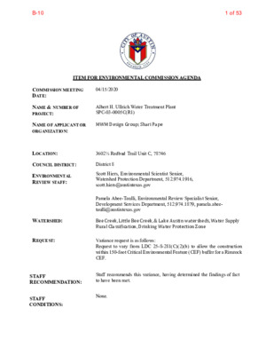
ITEM FOR ENVIRONMENTAL COMMISSION AGENDA COMMISSION MEETING DATE: 04/15/2020 NAME & NUMBER OF PROJECT: Albert H. Ullrich Water Treatment Plant SPC-03-0005C(R1) NAME OF APPLICANT OR ORGANIZATION: MWM Design Group; Shari Pape LOCATION: 3602½ Redbud Trail Unit C, 78746 COUNCIL DISTRICT: District 8 ENVIRONMENTAL REVIEW STAFF: Scott Hiers, Environmental Scientist Senior, Watershed Protection Department, 512.974.1916, scott.hiers@austintexas.gov WATERSHED: REQUEST: Pamela Abee-Taulli, Environmental Review Specialist Senior, Development Services Department, 512.974.1879, pamela.abee- taulli@austintexas.gov Bee Creek, Little Bee Creek, & Lake Austin watersheds, Water Supply Rural Classification, Drinking Water Protection Zone Variance request is as follows: Request to vary from LDC 25-8-281(C)(2)(b) to allow the construction within 150-foot Critical Environmental Feature (CEF) buffer for a Rimrock CEF. STAFF RECOMMENDATION: Staff recommends this variance, having determined the findings of fact to have been met. STAFF CONDITIONS: None. 1 of 53B-10 Staff Findings of Fact 2 of 53B-10 Development Services Department Staff Recommendations Concerning Required Findings Project Name & Case Number: Albert H. Ullrich Water Treatment Plant - SPC-03-0005C(R1) Ordinance Standard: Watershed Protection Ordinance Variance Request: To allow construction within 150-foot Critical Environmental Feature (CEF) buffer for a Rimrock CEF [LDC 25-8-281(C)(2)(b)]. Include an explanation with each applicable finding of fact. A. Land Use Commission variance determinations from Chapter 25-8-41 of the City Code: 1. The requirement will deprive the applicant of a privilege available to owners of similarly situated property with approximately contemporaneous development subject to similar code requirements. Yes. Other City of Austin water treatment plants have the same chemical feed system in place to help control zebra mussel infestations in the raw water transmission main. Chemical treatment is necessary to control zebra mussel infestations in raw water transmission mains. 2. The variance: a) Is not necessitated by the scale, layout, construction method, or other design decision made by the applicant, unless the design decision provides greater overall environmental protection than is achievable without the variance; Yes. The variance is not necessitated by the design. No alternative locations are available on site for a Zebra Mussel Mitigation System. The system must be placed in or near the existing intake pump house. There is not enough room in the existing pump station to house the entire system, such as the chemical storage. All the proposed construction coincides within areas of existing impervious cover. No additional impervious cover is being added. b) Is the minimum deviation from the code requirement necessary to allow a reasonable use of the property; 3 of 53B-10 Yes. The variance is a minimum deviation from the code requirement and is allowing for a reasonable use of the property. No new impervious cover is proposed. The Zebra Mussel Mitigation System and the associated construction activities is in areas, or adjacent to areas, with existing impervious cover or development. The piping for the chemical storage and metering station is the shortest and most direct route to the existing building, and the system is located where there is already an asphalt driveway or development. c) Does not create a significant probability of harmful environmental consequences. Yes. The variance with the staff recommended conditions does not create a probability of significant harmful environmental consequences. Construction is within existing structures or where there is existing impervious cover. The chemical tank and piping are double contained. The equipment pad is curbed and covered with a canopy. The pump metering station includes a virtual day tank and there are automated valves at the pump bay that close if the pumps fail or when the pumps are not running. No new impervious cover is being added. As part of the Stormwater Pollution Prevention Plan, temporary sedimentation and erosion controls will be installed prior to the start of construction activities. The applicant is providing wetland plantings along the shoreline that will reduce shoreline erosion and reduce the possibility of sediment-laden surface runoff from entering the lake. 3. Development with the variance will result in water quality that is at least equal to the water quality achievable without the variance. Yes, the variance will result in water quality that is at least equal to the water quality achievable without the variance. The proposed construction will not impact existing water quality. No new impervious cover is proposed. During construction, Stormwater Pollution Prevention Plan best practices will be employed to prevent construction sediment and debris from entering the stormwater runoff, and additional wetland plants along the shoreline will be provided to enhance the water quality of surface water runoff. Staff Recommendation: Staff recommends the Findings of Fact have been met. B. The Land Use Commission may grant a variance from a requirement of Section 25-8- 422 (Water Supply Suburban Water Quality Transition Zone), Section 25-8-452 (Water Supply Rural Water Quality Transition Zone), Section 25-8-482 (Barton Springs Zone Water Quality Transition Zone), Section 25-8-368 (Restrictions on Development Impacting Lake Austin, Lady Bird Lake, and Lake Walter E. Long), or Article 7, Division 1 ( Critical Water Quality Zone Restrictions ), after determining that: 1. The criteria for granting a variance in Subsection (A) are met; Yes / No N/A 4 of 53B-10 2. 3. The requirement for which a variance is requested prevents a reasonable, economic use of the entire property; Yes / No N/A The variance is the minimum deviation from the code requirement necessary to allow a reasonable, economic use of the entire property. Yes / No N/A Staff Recommendation: N/A. Hydrogeologic Reviewer (WPD) ___________________________ Scott E. Hiers Date: 04-02-2020 Environmental Officer (WPD) _____________________________ Chris Herrington Date: 04/02/2020 5 of 53B-10 Applicant Form and Findings of Fact 6 of 53B-10 ENVIRONMENTAL COMMISSION VARIANCE APPLICATION FORM Name of Applicant Minda Sarmiento, Austin Public Works 6800 Burleson Road, Bldg 312, Ste 200 Austin, Texas 78744 512-974-5645 minda.sarmiento@austintexas.gov PROJECT DESCRIPTION Applicant Contact Information Street Address City State ZIP Code Work Phone E-Mail Address Case Name Case Number Variance Case Information ALBERT H. ULLRICH WATER TREATMENT PLANT SPC-03-0005C(R1) Address or Location 3602 1/2 REDBUD TRL UNIT C Environmental Reviewer Name Pamela Abee-Taulli Environmental Resource Management Reviewer Name Jeremy Siltala Applicable Ordinance Watershed Name Watershed Classification LDC 25-8-261 LDC 25-8-42(A) Lake Austin; Bee Creek ☐Urban ☐ Suburban ☐Water Supply Suburban Water Supply Rural ☐ Barton Springs Zone Edwards Aquifer Recharge Zone ☐ Barton Springs Segment ☐ Not in Edwards Aquifer Zones Northern Edwards Segment Edwards Aquifer Contributing Zone ☐ Yes ☐No Scott Hiers7 of 53B-10 40' Distance to Nearest Classified Waterway Water and Waste Water service to be provided by Not Applicable Request Impervious cover square footage: acreage: percentage: Provide general description of the property (slope range, elevation range, summary of vegetation / trees, summary of the geology, CWQZ, WQTZ, CEFs, floodplain, heritage trees, any other notable or outstanding characteristics of the property) The variance request is as follows (Cite code references: Land Development Code 25-8-281: Construction is prohibited within 150’ of a Critical Environmental Feature (in our case, rimrock) Land Development Code 25-8-42: A variance under this section may not vary the requirements of Article 13 ( Save Our Springs Initiative ) and may not be granted for development of a property if any portion of the property abuts or is within 500 feet of the shoreline of Lake Austin, measured horizontally. Existing ________ ___8.81_____ ___6.24%_____ Proposed ____0_____ ____0_____ ____0_____ The site terrain slopes (~13%) towards the lake shoreline and is located in the Lake Austin and Bee Creek Watersheds. The chemical metering station will be installed at an elevation of ~562’ and the chemical piping will be installed under the access road, which is cut into the hillside, and slopes to the low service pump station (LSPS) at elevation ~512’. The terrain is covered with trees and brush. The trees are sycamore, juniper, cedar elm, live oaks, maple silverleaf and a Spanish oak. There is one heritage tree: a 33.5” live oak. The chemical metering station will be installed in the WQTZ and the chemical piping will have to cross through the CWQZ in order to reach the pump station. The trees dripline extends over the access road and so into the limits of construction, but the tree roots are either at a higher elevation than the road or a lower elevation than the road. There is rimrock adjacent to the LSPS so the proposed installation will be located inside of the 150’ rimrock CEF buffer. No work is proposed inside the 100-year floodplain. In addition, there are two identified wetlands areas on either side of the LSPS right at the shoreline. The wetlands will not be impacted by the proposed construction. (rimrock and wetlands).The site terrain slopes (~13%) towards the lake shoreline and is located in the Lake Austin and Bee Creek Watersheds. The chemical metering station will be installed at an elevation of ~562’ and the chemical piping will be installed under the access road, which is cut into the hillside, and slopes to the low service pump station (LSPS) at elevation ~512’. The terrain is covered with trees and brush. The trees are sycamore, juniper, cedar elm, live oaks, maple silverleaf and a Spanish oak. There is one heritage tree: a 33.5” live oak located outside of the LOC at an elevation higher than the proposed work ground, although the dripline extends over the LOC. The chemical metering station will be installed in the WQTZ and the chemical piping will have to cross through the CWQZ in order to reach the pump station. There is rimrock adjacent to the LSPS so the proposed installation will be located inside of the 150’ rimrock CEF buffer. No work is proposed inside the 100-year floodplain. In addition, there are two identified wetlands areas on either side of the LSPS right at the shoreline. The wetlands will not be impacted by the proposed construction. 8 of 53B-10 Clearly indicate in what way the proposed project does not comply with current Code (include maps and exhibits) • • Construction within 500’ of shoreline of Lake Austin. Construction will be performed within the 150’ rimrock CEF buffer. buffer and within 150' wetlands CEF buffer.9 of 53B-10 FINDINGS OF FACT As required in LDC Section 25-8-41, in order to grant a variance the Land Use Commission must make the following findings of fact: Include an explanation with each applicable finding of fact. Project: Zebra Mussel Mitigation Techniques – Chemical Storage and Feed System Ordinance: A. Land Use Commission variance determinations from Chapter 25-8-41 of the City Code: 1. The requirement will deprive the applicant of a privilege available to owners of similarly situated property with approximately contemporaneous development subject to similar code requirements. The proposed construction prevents zebra mussels from clogging the LSPS of Yes the water treatment plant. All water plants with LSPSs drawing water from zebra mussel infested water bodies will require treatment to prevent zebra mussels from settling on the pump intake equipment and piping. If there is no room in the existing pump station, then the new construction must be installed outdoors in protected areas adjacent to the lakeshore. 2. The variance: a) Is not necessitated by the scale, layout, construction method, or other design decision made by the applicant, unless the design decision provides greater overall environmental protection than is achievable without the variance; Yes The design decision to place the chemical storage and metering station next to the lakeshore is because the LSPS is already on the lakeshore. There is no other feasible location. b) Is the minimum deviation from the code requirement necessary to allow a reasonable use of the property; Yes The chemical storage and metering station was situated where there is already an asphalt driveway, which means the station will require no new impervious area. The chemical piping was routed in the shortest and most direct route and does not disturb any vegetated areas. c) Does not create a significant probability of harmful environmental consequences. The chemical storage and metering station is designed to prevent any Yes harmful environmental consequences. The tank and piping are double contained. The equipment pad is curbed and covered with a canopy. The pump metering station includes a virtual day tank and there are automated 10 of 53B-10 valves at each pump bay that automatically close if the pumps fail and whenever the pumps are not running. Development with the variance will result in water quality that is at least equal to the water quality achievable without the variance. Yes The proposed construction will not impact existing water quality. During construction, SWPPP best practices will be employed to prevent construction sediment and debris from entering the stormwater runoff. B. Additional Land Use Commission variance determinations for a requirement of Section 25-8-422 (Water Quality Transition Zone), Section 25-8-452 (Water Quality Transition Zone), Article 7, Division 1 (Critical Water Quality Zone Restrictions), or Section 25-8-368 (Restrictions on Development Impacting Lake Austin, Lady Bird Lake, and Lake Walter E. Long): The criteria for granting a variance in Subsection (A) are met; Yes Installing a utility line in the CWQZ is permitted per Article 7 Division 1 (D) as long as the utility line follows the most direct path to minimize disturbance, which is true for the proposed utility lines. The proposed construction is inside the WQTZ but is being installed where an existing asphalt driveway exists. No new impervious cover is proposed. The requirement for which a variance is requested prevents a reasonable, economic use of the entire property; Yes The chemical storage and metering station will prevent zebra mussels from clogging the pump intake equipment and piping. Without it, the City would have to constantly physically remove the zebra mussels settling on the equipment at great expense. The variance is the minimum deviation from the code requirement necessary to allow a reasonable, economic use of the entire property. Yes The variance requested is the minimum deviation necessary to allow reasonable, economic use of the entire property. The chemical storage and metering station will prevent zebra mussels from clogging the pump intake equipment and piping. Without it, the City would have to constantly physically remove the zebra mussels settling on the equipment at great expense. 3. 1. 2. 3. **Variance approval requires all above affirmative findings. 11 of 53B-10 CITY OF AUSTIN ULLRICH WTP ZEBRA MUSSEL CHEMICAL STORAGE AND FEED SYSTEM (8207.009) Project Location Map Legend ^* ULLRICH WTP / 0 Feet 800 800 1 inch = 1,700 feet BV PN 402943/198493 ^* OveriewUllrichWTPZebraMusselChemicalStorage&FeedSystem February 07, 2020 Edit this text with your name under File --> Map Document Properties --> Author 12 of 53B-10 ULLRICH LSPS WATER QUALITY TRANSITION ZONE 30' 15' 0' 30' 60' SCALE 1"=30' LEGEND CRITICAL WATER QUALITY ZONE CRITICAL ENVIRONMENTAL FEATURE: WETLANDS CEF CRITICAL ENVIRONMENTAL FEATURE (CANYON RIMROCK)* A S X E T F O E T A T S I R E M R O D . I P S R H C EER N I G D N E E 9 8 6 7 8 S N E C I L L A N O I S S F E P R O P P A K H C Y B . O N E S U F O D R O C E R D N A S N O S V E R I I E T A D 1 2 ) D N U O R G K C A B D E T A D P U ( 1 . O N M U D N E D D A / 0 2 0 2 0 1 1 0 / 2 . O N M U D N E D D A 0 2 0 2 9 1 / / 1 0 I I S E U Q N H C E T N O T A G T M L E S S U M A R B E Z I I I N T S U A F O Y T C I P T W H C R L L U I L A R E N E G T U O Y A L E T S I DESIGNED: MLS DETAILED: BWA CHECKED: AVK APPROVED: DAT DATE: NOVEMBER 2019 0 1/2 1 IF THIS BAR DOES NOT MEASURE 1" THEN DRAWING IS NOT TO FULL SCALE PROJECT NO. 402943 G-06 SHEET 39 6 OF F E C F E C F E C F E C F E C F E C F E C 2 EXISTING ULLRICH PAC BUILDING 2 PROPOSED CHEMICAL STORAGE AND METERING LAYOUT F E C F E C F E C F E C F E C F E C © 2019 Microsoft Corporation © 2019 DigitalGlobe ©CNES (2019) Distribution Airbus DS 2 D K E E H E S R R E C E T A W E B 2 TIN D E S H U S E A R E T K A A W L g w d . h c i r l l \ U - 6 0 - G 4 3 3 8 0 9 0 d \ s a c i r e m a _ w v b \ i g n k r o w _ w p \ : C : I E L F M A 5 1 : 7 0 2 0 2 / 7 1 / 2 : D E T T O L P 0 0 0 0 1 D F 0 0 0 0 1 D 2/20/202013 of 53B-10 L O C L O C L O C L O C L O C L O C L O C L O C L O C L O C LOC LOC LOC LOC LOC LOC ACCESS ROAD (ASPHALT) LOC LOC LOC LOC LOC LOC LOC LOC LOC LOC LOC LOC LOC LOC LOC LOC LOC LOC I - A A E N L H C T A M E E S LOC LOC R E D B U D T R A I L 2 L A K E A U S T I N W A T E R S H E D 2 PROPOSED CHEMICAL STORAGE AND METERING B E E C R E E K W A T E R S H E D W Q T Z 2 Z T Q W EXISTING BURIED PAC TANK L O C EXISTING PAC BUILDING 2 2 L O C L O C Z T Q W L O C L O C L O C L O C L O C L O C 2 L O C CRITICAL ENVIRONMENTAL FEATURE: RIMROCK C E F Z C W Q C E F C E F C E F CEF C W Q Z LOC C O L LOC Z Q W C L O C DOUBLE CONTAINED CHEMICAL FEED PIPING LO C L O C L O C L O C Z C W Q F C E E C T R I C F O R M E R S L E T R A N S L O C LOW SERVICE PUMP STATION 100 YR FLOODFLAIN (FEMA) 2 2 FULLY DEVELOPED FLOODPLAIN (CITY OF AUSTIN FLOODPLAIN MODEL) LAKE AUSTIN SEE ENLARGED PLAN SHEET C-01A LOC LOC LOC LOC LOC LOC LOC LOC LOC LOC LOC LOC L O C L O C L O C L O C LOC A C C E S S R O A D ( A S P H A L T ) LOC - LOC A A E N I L H C T A M E E S g w d . \ 1 0 - C 3 4 3 8 0 9 0 d \ s a c i r e m a _ w v b \ i g n k r o w _ w p \ : C : I E L F M A 3 5 : 6 0 2 0 2 / 7 1 / 2 : D E T T O L P 0 0 0 0 1 D F 0 0 0 0 1 D 60' 30' 0 60' 120' 1"=60' TREE TABLE TREE # DESCRIPTION 2002 16" SYCAMORE 2003 17" SYCAMORE 2004 18" SYCAMORE 2005 13" SYCAMORE 2006 15" SYCAMORE 2007 10" JUNIPER 2008 16" JUNIPER 1001 9" JUNIPER 1002 11" CEDAR ELM 1004 8" LIVE OAK 1005 8" LIVE OAK 1000 20" JUNIPER (10"/2-7"/6") 1006 14.5" JUNIPER (10"/5"/4") 1007 10" LIVE OAK 1008 10" JUNIPER 1010 10" LIVE OAK 1011 10" LIVE OAK 1009 10" MAPLE SILVERLEAF 1012 33.5" LIVE OAK (3-15"/7") 1013 9" JUNIPER 1014 11" LIVE OAK 1015 11" JUNIPER 1016 22" CEDAR ELM (15"/14") 1017 11" SPANISH OAK 1018 11" LIVE OAK 1019 9" JUNIPER LEGEND CWQZ WQTZ LOC EOP CEF 2 CRITICAL WATER QUALITY ZONE WATER QUALITY TRANSITIONAL ZONE LIMITS OF CONSTRUCTION EDGE OF PAVEMENT CRITICAL ENVIRONMENTAL FEATURE (CANYON RIMROCK)* *APPROXIMATE LIMITS OF CEF SHOWN BASED ON AVAILABLE CONTOUR DATA CRITICAL ENVIRONMENTAL FEATURE: WETLANDS WATERSHED LINE CEF BUFFER ZONE P P A K H C Y B . O N E S U F O D R O C E R D N A S N O S V E R I I E T A D 1 2 ) D N U O R G K C A B D E T A D P U ( 1 . O N M U D N E D D A / 0 2 0 2 0 1 1 0 / 2 . O N M U D N E D D A 0 2 0 2 9 1 / / 1 0 A S X E T F O E T A T S I R E M R O D . I P S R H C EER N I G D N E E 9 8 6 7 8 S N E C I L L A N O I S S F E P R O I I S E U Q N H C E T N O T A G T M L E S S U M A R B E Z I I I N T S U A F O Y T C I P T W H C R L L U I I I I N O T C U R T S N O C F O S T M L D N A S S E C C A E T S L L A R E V O I L I V C I DESIGNED: MLS DETAILED: BWA CHECKED: AVK APPROVED: DAT DATE: NOVEMBER 2019 0 1/2 1 IF THIS BAR DOES NOT MEASURE 1" THEN DRAWING IS NOT TO FULL SCALE PROJECT NO. 402943 C-01 SHEET 39 7 OF 2/20/202014 of 53B-10 TREE TABLE - JANUARY 2020 TREE # DESCRIPTION NORTHING AND EASTING TABLE OF STRUCTURAL/PIPE FITTINGS 2 NO. NORTHING EASTING DESCRIPTION 10080511.45 3099544.98 90 DEG BEND 10080649.63 3099604.67 45 DEG BEND Z T Q W 10080744.45 3099576.47 22.5 DEG BEND 10080791.57 3099581.38 22.5 DEG BEND 10080823.26 3099598.54 22.5 DEG BEND 10080847.69 3099628.64 22.5 DEG BEND 10080860.14 3099670.51 22.5 DEG BEND 10080853.53 3099734.03 45 DEG BEND 5 1 5 C W Q Z 5 2 0 L O C 5 3 5 5 3 0 5 2 5 STA 4+14 22.5 DEG BEND 6 LOC 6 " D I W L 1 5 7 STA 4+57 22.5 DEG BEND LOC 5 STA 3+75 22.5 DEG BEND 5 4 0 C O L 5 4 5 5 5 0 L O C C O L 1006 14.5" JUNIPER (10"/5"/4") 10080823.38 3099758.49 45 DEG BEND STA 3+39 22.5 DEG BEND 4 10080535.28 3099471.50 CONCRETE PAD 5 5 5 10080549.06 3099477.43 CONCRETE PAD 10080535.41 3099509.12 CONCRETE PAD 5 6 0 10080521.64 3099503.19 CONCRETE PAD 3 STA 2+92 22.5 DEG BEND 5 6 5 C O L L O C C LO 540 5 3 5 5 3 0 STA 5+60 45 DEG BEND SEE WALL PENETRATION 9 ON SHEET M-02 1 2 3 4 5 6 7 8 9 10 11 12 13 2002 16" SYCAMORE 2003 17" SYCAMORE 2004 18" SYCAMORE 2005 13" SYCAMORE 2006 15" SYCAMORE 2007 10" JUNIPER 2008 16" JUNIPER 1001 9" JUNIPER 1002 11" CEDAR ELM 1004 8" LIVE OAK 1005 8" LIVE OAK 1000 20" JUNIPER (10"/2-7"/6") 1009 10" MAPLE SILVERLEAF 1007 10" LIVE OAK 1008 10" JUNIPER 1010 10" LIVE OAK 1011 10" LIVE OAK 1012 33.5" LIVE OAK (3-15"/7") 1013 9" JUNIPER 1014 11" LIVE OAK 1015 11" JUNIPER 1016 22" CEDAR ELM (15"/14") 1017 11" SPANISH OAK Z T Q W 1018 11" LIVE OAK 1019 9" JUNIPER 0 9 5 STA 5+21 45 DEG BEND 8 M S LO C IP 5 0 6 IP M S CURB INLET S M S M S M 2 C O L M S IP 507 IP LO C M S CURB INLET ASPHALT PAVEMENT 1 48" (PV C) W L L O C 48" (PV C) W L 6" WL C O L TFD LO C 3 5 1 0 M S LO C 5 2 0 L O C 5 1 5 5 2 5 VALVE VAULT R W S T L 5 4 " 5 2 0 5 3 0 5 2 5 C E F 5 1 5 4 W L 6 " CHECK VALVE VAULT CHECK VALVE VAULT S R E RIC M R T O C F E S L N E A R T R W S T L 8 " 4 C O L 54" (C S C) W L LOW SERVICE PUMP STATION 100 YR FLOODFLAIN (FEMA) 2 FULLY DEVELOPED FLOODPLAIN (CITY OF AUSTIN FLOODPLAIN MODEL) 5 7 0 5 7 5 5 8 5 5 8 0 SEE NOTE 10 L O C 2 7 2 " R W W L L L O O C C L W I D " 6 1 C O L SEE NOTE 10 L O C 6 72" (CSC) W L 48" (P V C) W L C LO REEK W ATERSHED BEE C LAKE AUSTIN W ATERSHED ROUTE TO EX 2" PW INSIDE PAC BUILDING AND CONNECT WITH 2" TEE AND BALL VALVE Z T Q W 2" PW-TYPE K COPPER PIPE L O C W 11 W L O C F G 560.5' 0 8 5 RESTORE ASPHALT PAVEMENT - GRADE 1% CHEMICAL STORAGE AND METERING LAYOUT. SEE SHEET M-04 L O C 5 7 5 10 570 3" PVC STORM INLET PIPE BOLLARDS TYP OF 3 B C-03 REMOVE AND REPLACE CONCRETE DRIVEWAY PER DETAIL 433S-2 ON SHEET C-02 12 12" DR-RCP 48" (P V C) W L 13 FG 560.2' 5 6 5 LO C MEP W Q T Z LO C LO C 0 0 0 0 1 D F 0 0 0 0 1 D LO C g w d . h c i r l l \ - U A 1 0 - C 3 4 3 8 0 9 0 d \ s a c i r e m a _ w v b \ i g n k r o w _ w p \ : C : I E L F M A 6 2 : 6 0 2 0 2 / 7 1 / 2 : D E T T O L P 2 STA 1+93 45 DEG BEND SIX - 1" INSIDE 3" DOUBLE-CONTAINED SCH 80 PVC PIPE LOC LOC A C-03 L O C LOC 12" DR-RCP 8" RW-DI 2" SS-PVC 2" DR-PVC 2" PW-CU MEP STA 0+42 90 DEG BEND 1 S SEE NOTE 10 72" (CSC) W L S S L O C 2 LO C INSTALL CONCRETE WASHOUT. SEE NOTE 11. STA GIN G A R E A S L O C S L O C CEF 5 5 5 2 CEF CEF CRITICAL ENVIRONMENTAL FEATURE: RIMROCK CEF L S O C 0 6 5 S L O C CEF C W QZ CEF Z Q W C 5 3 5 5 4 0 F E C F E C WATER VAULT 7 5 5 0 5 4 5 CEF CEF Z Q W C P P A K H C Y B . O N E S U F O D R O C E R D N A S N O S V E R I I E T A D 1 2 ) D N U O R G K C A B D E T A D P U ( 1 . O N M U D N E D D A / 0 2 0 2 0 1 1 0 / 2 . O N M U D N E D D A 0 2 0 2 / 9 1 1 0 / A S X E T F O E T A T S I R E M R O D . I P S R H C EER N I G D N E E 9 8 6 7 8 S N E C I L L A N O I S S F E P R O I I S E U Q N H C E T N O T A G T M L E S S U M A R B E Z I I I N T S U A F O Y T C I P T W H C R L L U I I I I S L O R T N O C N O T A T N M D E S D N A N O S O R E D N A L V C I I I I N A L P E T S D E G R A L N E DESIGNED: MLS DETAILED: BWA CHECKED: AVK APPROVED: DAT DATE: NOVEMBER 2019 0 1/2 1 IF THIS BAR DOES NOT MEASURE 1" THEN DRAWING IS NOT TO FULL SCALE PROJECT NO. 402943 C-01A 39 7A SHEET OF 20' 10' 0 20' 40' 1"=20' NOTES: IN THE FIELD. 1. CONTRACTOR TO VERIFY ALL ELEVATIONS AND DIMENSIONS 2. CONTRACTOR TO ADJUST EROSION CONTROL AS REQUIRED FOR FIELD CONDITIONS TO MEET THE INTENT OF THE CONSTRUCTION DOCUMENTS. 3. ALL SEDIMENT SPILLED, DROPPED, WASHED, OR TRACKED ONTO PUBLIC ROADWAY MUST BE REMOVED IMMEDIATELY BY THE CONTRACTOR. 4. ENVIRONMENTAL INSPECTOR HAS THE AUTHORITY TO ADD AND/OR MODIFY EROSION/SEDIMENTATION CONTROLS ON SITE TO KEEP PROJECT IN COMPLIANCE WITH THE CITY OF AUSTIN RULES AND REGULATIONS. 5. CONTRACTOR SHALL UTILIZE DUST CONTROL MEASURES (PER ECM 1.4.8.C.) DURING SITE CONSTRUCTION SUCH AS IRRIGATION TRUCKS AND MULCHING OR AS DIRECTED BY THE ENVIRONMENTAL INSPECTOR. 6. 7. 8. IF DISTURBED AREA IS NOT TO BE WORKED ON FOR MORE THAN 14 DAYS, DISTURBED AREA NEEDS TO BE STABILIZED BE MULCH, TARP OR REVEGETATION. THE STAGING AND SPOILS AREA SHALL ONLY BE ALLOWED DURING THE CONSTRUCTION PERIOD. NO SPOILS SHALL REMAIN STAGED AFTER COMPLETION OF THE PROJECT. ALL DISTURBED AREAS SHALL BE REVEGETATED WITH NATIVE GRASSES (REFER TO APPENDIX P-1 ON GENERAL NOTES SHEET FOR SPECS). ALL DISTURBED AREAS WITH SLOPES 5:1 OR STEEPER, WHICH ARE NOTE ARMORED OTHERWISE, SHALL HAVE A SOIL RETENTION BLANKET (CURLEX II OR APPROVED EQUAL) INSTALLED TO ASSIST WITH REVEGETATION. 9. RESTORE ASPHALT PAVEMENT PER DETAIL 510S-3 ON SHEET C-02. 10. POTHOLE EXISTING 16", 48" AND 72" UTILITIES PRIOR TO CONSTRUCTION AND CONFIRM TOP OF PIPE ELEVATION. NOTIFY ENGINEER IF THERE IS INSUFFICIENT DEPTH TO PROVIDE MINIMUM DEPTH OF COVER OVER CHEMICAL PIPING WHILE MAINTAINING 12" MINIMUM SEPARATION DISTANCE BETWEEN OD OF CROSSING PIPES. 2 IF MINIMUM DEPTH OF COVER CANNOT BE PROVIDED, CENTER ONE JOINT OF CHEMICAL PIPING ON CROSSING AND PROVIDE CONCRETE ENCASEMENT OF CHEMICAL PIPING PER CITY STANDARD DETAIL 505S-1. 11. CONTRACTOR SHALL COORDINATE LOCATION OF CONCRETE 2 WASH OUT AREAS WITH ENVIRONMENTAL INSPECTOR IN FIELD. CONTRACTOR SHALL PROVIDE WASHOUT PER DETAIL D ON SHEET C-03. 12. ALL SPOILS ARE TO BE PLACED BACK IN TRENCH EVERY NIGHT. 13. PERPENDICULAR EROSION CONTROLS MUST BE INSTALLED EVERY 30 FEET AS THE TRENCH IS BACKFILLED. LEGEND CWQZ WQTZ CRITICAL WATER QUALITY ZONE WATER QUALITY TRANSITIONAL ZONE LOC EOP S TFD TP IP MS CEF FG MEP LIMITS OF CONSTRUCTION EDGE OF PAVEMENT SILT FENCE TRIANGULAR FILTER DYKE TREE PROTECTION INLET PROTECTION MULCH SOCK CRITICAL ENVIRONMENTAL FEATURE (CANYON RIMROCK)* 2 2 MATCH EXISTING PAVEMENT SURVEY BENCHMARK FLOW ARROW 2 FINISHED GRADE WETLANDS WATERSHED LINE CEF BUFFER ZONE *APPROXIMATE LIMITS OF CEF SHOWN BASED ON AVAILABLE CONTOUR DATA. HHTFDTFDTFDTFDTFDTFDTFDTFD2/20/202015 of 53B-10 Applicant Exhibits 16 of 53B-10 Case No.: (City use only) Environmental Resource Inventory For the City of Austin Related to LDC 25-8-121, City Code 30-5-121, ECM 1.3.0 & 1.10.0 The ERI is required for projects that meet one or more of the criteria listed in LDC 25-8-121(A), City Code 30-5-121(A). 1. SITE/PROJECT NAME: 2. COUNTY APPRAISAL DISTRICT PROPERTY ID (#’s): 3. ADDRESS/LOCATION OF PROJECT: 4. WATERSHED: 5. THIS SITE IS WITHIN THE (Check all that apply) Edwards Aquifer Recharge Zone* (See note below) .................. YES No Edwards Aquifer Contributing Zone*.................................. YES No Edwards Aquifer 1500 ft Verification Zone* ....................... YES No Barton Spring Zone* .......................................................... YES No *(as defined by the City of Austin – LDC 25-8-2 or City Code 30-5-2) Note: If the property is over the Edwards Aquifer Recharge zone, the Hydrogeologic Report and karst surveys must be completed and signed by a Professional Geoscientist Licensed in the State of Texas. 6. DOES THIS PROJECT PROPOSE FLOODPLAIN MODIFICATION?.......YES** NO If yes, then check all that apply: (1) The floodplain modifications proposed are necessary to protect the public health and safety; (2) The floodplain modifications proposed would provide a significant, demonstrable environmental benefit, as determined by a functional assessment of floodplain health as prescribed by the Environmental Criteria Manual (ECM), or (3) The floodplain modifications proposed are necessary for development allowed in the critical water quality zone under LDC 25-8-261 or 25-8-262, City Code 30-5-261 or 30-5-262. (4) The floodplain modifications proposed are outside of the Critical Water Quality Zone in an area determined to be in poor or fair condition by a functional assessment of floodplain health. ** If yes, then a functional assessment must be completed and attached to the ERI (see ECM 1.7 and Appendix X for forms and guidance) unless conditions 1 or 3 above apply. 7. IF THE SITE IS WITHIN AN URBAN OR SUBURBAN WATERSHED, DOES THIS PROJECT PROPOSE A UTILITY LINE PARALLEL TO AND WITHIN THE CRITICAL WATER QUALITY ZONE? ......................................................... YES*** NO ***If yes, then riparian restoration is required by LDC 25-8-261(E) or City Code 30-5-261(E) and a functional assessment must be completed and attached to the ERI (see ECM1.5 and Appendix X for forms and guidance). 8. There is a total of (#’s) Critical Environmental Feature(s)(CEFs) on or within150 feet of the project site. If CEF(s) are present, attach a detailed DESCRIPTION of the CEF(s), color PHOTOGRAPHS, the CEF WORKSHEET and provide DESCRIPTIONS of the proposed CEF buffer(s) and/or wetland mitigation. Provide the number of each type of CEFs on or within 150 feet of the site (Please provide the number of CEFs ): N/A - We are in the Water Supply Rural Watershed, not Urban or Suburban.17 of 53B-10 (#’s) Spring(s)/Seep(s) (#’s) Point Recharge Feature(s) (#’s) Bluff(s) (#’s) Canyon Rimrock(s) (#’s) Wetland(s) Note: Standard buffers for CEFs are 150 feet, with a maximum of 300 feet for point recharge features. Except for wetlands, if the standard buffer is not provided, you must provide a written request for an administrative variance from LDC 25-8-281(C)(1) and provide written findings of fact to support your request. Request forms for administrative variances from requirements stated in LDC 25-8-281 are available from Watershed Protection Department. 9. The following site maps are attached at the end of this report (Check all that apply and provide): All ERI reports must include: Site Specific Geologic Map with 2-ft Topography Historic Aerial Photo of the Site Site Soil Map Critical Environmental Features and Well Location Map on current Aerial Photo with 2-ft Topography Only if present on site (Maps can be combined): Edwards Aquifer Recharge Zone with the 1500-ft Verification Zone (Only if site is over or within 1500 feet the recharge zone) Edwards Aquifer Contributing Zone Water Quality Transition Zone (WQTZ) Critical Water Quality Zone (CWQZ) City of Austin Fully Developed Floodplains for all water courses with up to 64-acres of drainage 10. HYDROGEOLOGIC REPORT – Provide a description of site soils, topography, and site specific geology below (Attach additional sheets if needed): Surface Soils on the project site is summarized in the table below and uses the SCS Hydrologic Soil Groups*. If there is more than one soil unit on the project site, show each soil unit on the site soils map. Soil Series Unit Names, Infiltration Characteristics & Thickness *Soil Hydrologic Groups Definitions (Abbreviated) Soil Series Unit Name & Subgroup** Group* Thickness (feet) A. Soils having a high infiltration rate when thoroughly wetted. B. Soils having a moderate infiltration rate when thoroughly wetted. C. Soils having a slow infiltration rate when thoroughly wetted. D. Soils having a very slow infiltration rate when thoroughly wetted. **Subgroup Classification – See Classification of Soil Series Table in County Soil Survey. WPD ERM ERI-2014-01 Page 2 of 6 (Attachment 9.1)(Attachment 9.2)(Attachment 9.3)(Attachment 9.4)(Attachment 9.5){{(Attachment 9.6)(Attachment 9.7)Please see Attachment 9.4 for CEF descriptions.Please see Attachment 9.4 for CEF descriptions.18 of 53B-10 Description of Site Topography and Drainage (Attach additional sheets if needed): List surface geologic units below: Group Formation Member Geologic Units Exposed at Surface Brief description of site geology (Attach additional sheets if needed): Wells – Identify all recorded and unrecorded wells on site (test holes, monitoring, water, oil, unplugged, capped and/or abandoned wells, etc.): There are (#) wells present on the project site and the locations are shown and labeled (#’s)The wells are not in use and have been properly abandoned. (#’s)The wells are not in use and will be properly abandoned. (#’s)The wells are in use and comply with 16 TAC Chapter 76. There are (#’s) wells that are off-site and within 150 feet of this site. WPD ERM ERI-2014-01 Page 3 of 6 There are no wells within 150 feet of the project limits. See attachment 9.4 for location of wells onthe project property but farther than 150 feet from the project site.19 of 53B-10 11. THE VEGETATION REPORT – Provide the information requested below: Brief description of site plant communities (Attach additional sheets if needed): There is woodland community on site …………………….YES NO (Check one). If yes, list the dominant species below: Woodland species Common Name Scientific Name There is grassland/prairie/savanna on site……………..YES NO (Check one). If yes, list the dominant species below: Grassland/prairie/savanna species Common Name Scientific Name There is hydrophytic vegetation on site ………………..YES NO (Check one). If yes, list the dominant species in table below (next page): WPD ERM ERI-2014-01 Page 4 of 6 20 of 53B-10 Hydrophytic plant species Common Name Scientific Name Wetland Indicator Status A tree survey of all trees with a diameter of at least eight inches measured four and one- half feet above natural grade level has been completed on the site. YES NO (Check one). 12. WASTEWATER REPORT – Provide the information requested below. Wastewater for the site will be treated by (Check of that Apply): On-site system(s) City of Austin Centralized sewage collection system Other Centralized collection system Note: All sites that receive water or wastewater service from the Austin Water Utility must comply with City Code Chapter 15-12 and wells must be registered with the City of Austin The site sewage collection system is designed and will be constructed to in accordance to all State, County and City standard specifications. YES NO (Check one). Calculations of the size of the drainfield or wastewater irrigation area(s) are attached at the end of this report or shown on the site plan. YES NO Not Applicable (Check one). Wastewater lines are proposed within the Critical Water Quality Zone? YES NO (Check one). If yes, then provide justification below: WPD ERM ERI-2014-01 Page 5 of 6 Not applicable.21 of 53B-10 Is the project site is over the Edwards Aquifer? YES NO (Check one). If yes, then describe the wastewater disposal systems proposed for the site, its treatment level and effects on receiving watercourses or the Edwards Aquifer. 13. One (1) hard copy and one (1) electronic copy of the completed assessment have been provided. Date(s) ERI Field Assessment was performed: Date(s) My signature certifies that to the best of my knowledge, the responses on this form accurately reflect all information requested. Print Name Signature Telephone Email Address Name of Company Date For project sites within the Edwards Aquifer Recharge Zone, my signature and seal also certifies that I am a licensed Professional Geoscientist in the State of Texas as defined by ECM 1.12.3(A). P.G. Seal WPD ERM ERI-2014-01 Page 6 of 6 January 28, 202022 of 53B-10 City of Austin Environmental Resource Inventory - Critical Environmental Feature Worksheet Project Name: Project Address: Site Visit Date: Environmental Resource Inventory Date: 1 2 3 4 9 5 6 7 8 Primary Contact Name: Phone Number: Prepared By: Email Address: FEATURE TYPE {Wetland,Rimrock, Bluffs,Recharge Feature,Spring} FEATURE ID (eg S-1) FEATURE LONGITUDE (WGS 1984 in Meters) FEATURE LATITUDE (WGS 1984 in Meters) WETLAND DIMENSIONS (ft) RIMROCK/BLUFF DIMENSIONS (ft) coordinate notation coordinate notation X Y Length Avg Height X RECHARGE FEATURE DIMENSIONS Y Z Trend Springs Est. Discharge cfs City of Austin Use Only CASE NUMBER: For rimrock, locate the midpoint of the segment that describes the feature. For wetlands, locate the approximate centroid of the feature and the estimated area. For a spring or seep, locate the source of groundwater that feeds a pool or stream. DMS DD YES NO Wetland Rimrock Recharge Feature Spring Seep Please state the method of coordinate data collection and the approximate precision and accuracy of the points and the unit of measurement. Method Accuracy GPS Surveyed Other sub-meter □ □ □ Professional Geologists apply seal below □ □ □ > 1 meter meter WPD ERM ERI-CEF-01 Page 7 of 8 January 28, 2020**City of Austin does not consider the depression identified during the site visit to be a recharge feature per the January 30, 2020 email from Minda Sarmiento.**See note below.23 of 53B-10 ATTACHMENT 9.1 - SITE SPECIFIC GEOLOGIC MAP24 of 53B-10 ÿÿÿÿÿÿÿÿÿÿÿÿÿÿ Dr LAKE A U S TIN ÿÿÿÿÿ ÿ ÿ ÿ ÿ Wa ÿ ÿ ÿ Kgru E L ÿ N S E T K A L L T T H A U A I I T K S N B E K I U E E R C E A E L u ll ÿ ÿ C i r ÿ ÿ H id d e n C v Lake s h ore ÿ ÿ ÿ ÿ ÿ ÿ ÿ ÿ ÿ ÿ ÿ ÿ ÿ ÿ ÿ ÿ ÿÿÿÿÿÿÿÿ ÿÿÿÿÿÿÿÿÿÿÿÿÿÿ ÿ ÿ ÿ ÿ ÿ ÿ ÿ ÿ ÿ ÿ ÿ ÿ ÿ ÿ ÿ ÿ ÿ ÿ ÿ ÿ ÿ ÿ ÿ ÿ ÿ ÿ ÿ ÿ ÿ ÿ ÿ ÿ ÿ ÿ ÿ ÿÿÿÿÿ TCEQ Edwards Aquifer Contributing Zone Depressed Area at Base of Rimrock Geologic Formation Boundary Baer-identified Rimrock Kfr 0 Geologic Formations Kfr: Fredericksburg Group Kgru: Upper Glen Rose Formation Qal: Quaternary alluvium Qt: Quaternary fluviatile terrace deposits Redbud Trl Wa: Water ÿÿ Geologic Fault Line TCEQ Edwards Aquifer Recharge Zone TBPE Firm No. F-3181 TBPG Firm No. 50030 Base Map: NAIP Aerial Imagery, 2016 TIN S U E A K A L Kfr Qal E K A D L Y BIR D A L Redbud Trl Qal L a k e A u s t i n B l v d Qt Kfr Kfr L A D Y B I R D L A K E FEMA 100-year Floodplain Project Area µ Feet 200 400 Baer Project No. 172081.01 Date: October 1, 2019 Site Geologic Map Ullrich Water Treatment Plant Low Service Pump Station Improvements 1000 Forest View Drive Austin, Texas 78746 January 28, 202025 of 53B-10 December 16, 2019 Page 1 of 1Attachment 9.1 - USGS Texas Geology Area DescriptionUSGS Texas Geology describes this area as "Fredericksburg Group undivided, rock unit code Kfr.Edwards limestone, limestone, dolomite, and chert; limestone aphanitic to fine grained, massive tothin bedded, hard, brittle, in part rudistid blostromes, much miliolid biospraite; dolomite fine to veryfine grained, porous, medium gray to grayish brown; chert nodules and plates common, varies inamount from bed to bed, some intervals free of chert, mostly white to light gray; in zone ofweathering considerable recrystallized, "honeycombed," and cavernous forming an aquifer; formsflat areas and plateaus bordered by scarps; thickness 60-350 feet, things northward. Comanchepeak limestone, fine to very fined grained, fairly hard, nodular, light gray, weathers white,extensively burrowed, burrow fillings slightly coarser and darker, typically crops out in scarp facebeneath Edwards Limestone; thickness up to 80 feet, feathers out southward near WilliamsonTravis County line. Keys Valley Marl, soft, white; marine megafossils include Exogyra texana,Gryphaea mucronata, and other pelecypods, ammonites, gastropods, and echinoids; thickness upto 50 feet, feathers out southward near Williamson Travis County line. Cedar PArk Limestone, Kcp,lithologicvally and faunally similar to Comanche Peak Limestone; thickness 40 feet, south ofWilliamson Travis County line upper part interfingers with Edwards Limestone and lower part ismapped with Bee Cave Marl, Kbc, lithologically and faunally similar to Keys Valley Marl, exceptExogyra texana are more abundant and ammonites are scare; thickness 25-40 feet."Ullrich Pump Station – ERI Attachment 26 of 53B-10 ATTACHMENT 9.2 - HISTORIC AERIAL PHOTO OFTHE SITE27 of 53B-10 Ullrich LSPS 2008 - Historical Aerial Legend Image CAPCOG Image CAPCOG Image CAPCOG ➤➤ N N 800 ft LEGENDPROJECTVICINITY28 of 53B-10 ATTACHMENT 9.3 - SITE SOIL MAP29 of 53B-10 W ' ' 9 2 ' 7 4 ° 7 9 30° 17' 51'' N Soil Map—Travis County, Texas (Ullrich LSPS - Soil Map) 616230 616300 616370 616440 616510 616580 616650 W ' ' 2 1 ' 7 4 ° 7 9 30° 17' 51'' N 0 7 3 2 5 3 3 0 0 3 2 5 3 3 0 3 2 2 5 3 3 0 6 1 2 5 3 3 0 9 0 2 5 3 3 0 2 0 2 5 3 3 0 5 9 1 5 3 3 0 8 8 1 5 3 3 0 1 8 1 5 3 3 0 7 3 2 5 3 3 0 0 3 2 5 3 3 0 3 2 2 5 3 3 0 6 1 2 5 3 3 0 9 0 2 5 3 3 0 2 0 2 5 3 3 0 5 9 1 5 3 3 0 8 8 1 5 3 3 0 1 8 1 5 3 3 616230 616300 616370 616440 616510 616580 616650 Soil Map may not be valid at this scale. 30° 17' 32'' N W ' ' 9 2 ' 7 4 ° 7 9 Map Scale: 1:2,850 if printed on A portrait (8.5" x 11") sheet. N 0 40 80 160 Feet Meters 240 0 Map projection: Web Mercator Corner coordinates: WGS84 Edge tics: UTM Zone 14N WGS84 100 200 600 400 30° 17' 32'' N W ' ' 2 1 ' 7 4 ° 7 9 Natural Resources Conservation Service Web Soil Survey National Cooperative Soil Survey 12/16/2019 Page 1 of 3 30 of 53B-10 ATTACHMENT 9.4 - CEF AND WELL LOCATIONMAP31 of 53B-10 Ullrich LSPS CEF and Well Location Map Legend © 2018 Google © 2018 Google © 2018 Google ➤➤ N N 700 ft January 28, 2020LEGENDWETLANDWETLAND CRITICALENVIRONMENTALFEATURE (W-1)APPROX. 3,500 SF OFDISTURBANCEWETLANDCRITICALENVIRONMENTALFEATURE (W-2)RIM ROCKCRITICALENVIRONMENTALFEATURETHIS RECHARGEFEATURE/DEPRESSIONIDENTIFIED IN THE FIELD ISNOT A CEF AS DEFINED BYCITY OF AUSTINWATERSHED PROTECTIONGEOLOGISTS.32 of 53B-10 Ullrich Pump Station – ERI Attachment December 13, 2019 Page 1 of 3 CEF DESCRIPTIONS Baer Engineering conducted a field survey of the assessment area on August 28, 2019. The assessment area is defined as the project area plus a 150-ft buffer. Approximately five-tenths of an inch of rain were recorded near the project area in the week before commencement of the field surveys. No rain was recorded during field surveys. For wetland identification, Baer Engineering used the recommended routine method, outlined in the COA ECM Section 1.10.3. This method assumes adequate hydrology and hydric soils if the area under examination is dominated (over 50% vegetative cover) by Facultative-wet and/or Obligate plant species (as listed in the National List of Plant Species That Occur in Wetlands, South Plains, Region 6, U.S. Department of the Interior, Washington D.C.) and an abrupt boundary is evident between these Facultative-wet and/or Obligate plant community and the Upland plant communities. The wetlands described in this report met the criteria in the wetland delineation method described above. No official delineation was conducted and the dimensions provided in this report are estimates. Four (4) CEFs (two wetlands, one rimrock, & one recharge feature) were observed within the assessment area. The CEFs are described below. Wetland, W-1: This wetland was observed along the eastern edge of the assessment area, at the shore of the Colorado River. The river bank was dominated by bald cypress (Taxodium distichum, OBL), with some glossy privet (Ligustrum lucidum, UPL), green ash (Fraxinus pennsylvanica, FAC), and American sycamore (Platanus occidentalis, FAC). Jamaican sawgrass (Cladium mariscus, OBL) and taro (Colocasia esculenta, OBL) were observed beyond the fence line at the shore, but inaccessible. The wetland was approximately 5 to 60 feet wide, observed from the edge of the water, and approximately 250 feet long. Please see Photographs 1-2. Wetland, W-2: This wetland was observed northwest of the facility at the bank of the Colorado River, at the north end of the assessment area. Bald cypress, smallspike false nettle (Boehmeria cylindrica, FACW), and Emory sedge (Carex emoryii, FACW) dominated the area, along with some glossy privet and American sycamore. The wetland was approximately 15 feet wide from the edge of the water and 140 feet long following the shoreline. Please see Photographs 3-4. Rimrock, Ullrich Rimrock: Rimrock was observed at the center of the assessment area, northwest of the proposed roadway and southeast of the proposed work adjacent to the existing roadway. The rim rock extends northeast to southwest for approximately 430 feet. The estimated height of the rimrock is 30 feet from the base to the upper edge. Please see Photograph 5. Recharge Feature, Solution Recharge Feature: A recharge feature was observed within a depression that is approximately five to six feet below the nearby footpath surface and approximately three to four feet below the level of the nearby Colorado River. The depression contained several inches of leaf litter and detritus. The initial site visit was conducted after a rain event the evening before and little to no water was observed in the depression. Comparing the depression and rimrock discussed above to geologic maps of the area, these features appear to 33 of 53B-10 Ullrich Pump Station – ERI Attachment December 13, 2019 Page 2 of 3 correlate with a mapped fault depicted on the site. The feature was approximately 350 long, 20 feet wide, and 4 feet below the surrounding grade. Please see Photographs 5-6. VEGETATION REPORT BRIEF DESCRIPTION OF SITE PLANT COMMUNITIES: The Site is located in the U.S. EPA-defined Balcones Canyonlands ecoregion, described below: The Balcones Canyonlands are highly dissected through the erosion and solution of springs, streams, and rivers working both above and below ground; percolation through the porous limestone contributes to the recharge of the Edwards Aquifer. High gradient streams originating from springs in steep-sided canyons supply water for development on the Texas Blackland Prairies at the eastern base of the escarpment. This ecoregion supports a number of endemic plants and has a higher representation of deciduous woodland than elsewhere on the Edwards Plateau, with escarpment black cherry, Texas mountain-laurel, madrone, Lacey oak, bigtooth maple, and Carolina basswood. Some relicts of eastern swamp communities, such as baldcypress, American sycamore, and black willow, occur along major streamcourses. It is likely that these trees have persisted as relicts of moister, cooler climates following the Pleistocene glacial epoch. Toward the west, the vegetation changes gradually as the climate becomes more arid. Plateau live oak woodland is eventually restricted to north and east facing slopes and floodplains, and dry slopes are covered with open shrublands of juniper, sumac, sotol, acacia, honey mesquite, and ceniza. Vegetation within the project area was characterized by three habitat types: Juniper Woodland, Deciduous Floodplain Forest, and Mowed Grasses. The Juniper Woodland occupied the upland portions of the project area adjacent to the driveway. Canopy cover was mostly dense, with some open grassy areas on the eastern side. Trees were predominantly ashe juniper (Juniperus ashei) with some cedar elm (Ulmus crassifolia) and live oak (Quercus fusiformis). The moderately dense midstory included Texas persimmon (Diospyrus texana), Texas mountain laurel (Sephora secundaflora), agarita (Mahonia trifoliolata), yaupon (Ilex vomitoria), and elbowbush (Forestiera pubescens). Shrubby boneset (Ageratina havanensis) and cedar sedge (Carex planostachys) dominated the wooded understory. The grassy opening vegetation predominantly consisted of silver bluestem (Bothriochloa laguroides), doveweed (Croton monanthaginus), prairie coneflower (Ratibida columnifera), and other grasses and forbs as groundcover. Additionally, evergreen and flameleaf sumac (Rhus virens, Rhus lanceolata) and Texas kidneywood (Eysenhardtia texana) grew as a midstory with some prickly pear species (Opuntia sp.). Please see Photographs 7-9. The Deciduous Floodplain Forest was observed below the bluff, east of the paved driveway. Canopy cover was dense, with cottonwood (Populus deltoides), bald cypress, American sycamore, and glossy privet as overstory. Smaller woody vegetation included ash species (Fraxinus sp.) and chinaberry (Melia azedarach), with some groundcover from poison ivy (Toxicodendron radicans), frostweed (Verbesina virginica), and Virginia wild rye (Elymus virginicus). The understory vegetation had relatively low density. The previously- 34 of 53B-10 Ullrich Pump Station – ERI Attachment December 13, 2019 Page 3 of 3 described wetlands occurred along the river bank on the edges of this habitat. Please see Photograph 10. Mowed Grasses were observed along the paved driveway within the project area. Identifiable grasses included silver bluestem and perennial rye (Lolium perenne), and forbs included lemon beebalm (Monarda citriodora), tie vine (Ipomoea cordatotriloba), western ragweed (Ambrosia psilostachya), Indian Blanket (Gaillardia pulchella), marestail weed (Erigeron canadensis), as well as plants as found in the wooded openings in the Juniper Woodland, described above. Please see Photograph 11. 35 of 53B-10 Photograph 1: Wetland W-1 – A view of the wetland, dominated by bald cypress along the bank of the Colorado River. Photograph 2: Wetland W-1 – Photo through perimeter fence of taro at river bank. ERI Photolog Page 1 of 6 36 of 53B-10 Photograph 3: Wetland W-2 – Wetland observed on northern side of assessment area along bank of the Colorado River, outside of perimeter fence. Bald cypress and American sycamore can be seen. Photograph 4: Wetland W-2 – View of wetland vegetation at the river bank outside of perimeter fence, including sedges and shortspike false nettle. ERI Photolog Page 2 of 6 37 of 53B-10 Photograph 5: Ullrich Rimrock, Solution Recharge Feature – This depression was observed east of the paved driveway and at the foot of the rimrock. Rimrock Depressed area recharge feature adjacent to the rimrock Photograph 6: Ullrich Rimrock, Solution Recharge Feature – The figure below depicts the location of the feature in blue. ERI Photolog Page 3 of 6 38 of 53B-10 Photograph 7: Example of Juniper Woodland, west of paved driveway. Photograph 8: Example of Juniper Woodland, east of paved driveway and above floodplain bluff. ERI Photolog Page 4 of 6 39 of 53B-10 Photograph 9: Grassy opening in Juniper Woodland, east of paved driveway. Photograph 10: Example of Deciduous Floodplain Forest between the river bank and Ullrich Rimrock. ERI Photolog Page 5 of 6 40 of 53B-10 Photograph 11: Example of Mowed Grasses along paved driveway. ERI Photolog Page 6 of 6 41 of 53B-10 ATTACHMENT 9.5 - EDWARDS AQUIFERRECHARGE AND CONTRIBUTING ZONES MAP42 of 53B-10 Legend Jurisdiction FULL PURPOSE LIMITED PURPOSE EXTRATERRITORIAL JURISDICTION 2 MILE ETJ AGRICULTURAL AGREEMENT OTHER CITY LIMITS OTHER CITIES ETJ Edwards Aquifer Recharge Zone Edwards Aquifer Recharge Verification Zone Edwards Aquifer Contributing Zone 0.2 10/23/2018 NAD_1983_StatePlane_Texas_Central_FIPS_4203_Feet 0 0.08 0.2 Miles This product is for informational purposes and may not have been prepared for or be suitable for legal, engineering, or surveying purposes. It does not represent an on-the-ground survey. This product has been produced by the City of Austin for the sole purpose of geographic reference. No warranty is made by the City of Austin regarding specific accuracy or completeness. 1: 4,800 Notes Edwards Aquifer Recharge Zone, Contributing Zone, and Verification Zone Edwards Aquifer RechargeZoneEdwards Aquifer Recharge Verification ZoneEdwards Aquifer ContributingZone Edwards AquiferRecharge ZoneThis project is entirely in the EdwardsAquifer Recharge Zone. The Contributingand Verification Zones are outside of projectlimits.Ullrich LSPSProject VicinityEdwards Aquifer RechargeVerification Zone (Colorado River)43 of 53B-10 ATTACHMENT 9.6 - WQTZ AND CWQZ MAP44 of 53B-10 Legend Jurisdiction FULL PURPOSE LIMITED PURPOSE EXTRATERRITORIAL JURISDICTION 2 MILE ETJ AGRICULTURAL AGREEMENT OTHER CITY LIMITS OTHER CITIES ETJ Creek Buffers/Waterway Setbacks Critical Water Quality Zone Water Quality Transition Zone 0.2 11/6/2018 NAD_1983_StatePlane_Texas_Central_FIPS_4203_Feet 0 0.08 0.2 Miles This product is for informational purposes and may not have been prepared for or be suitable for legal, engineering, or surveying purposes. It does not represent an on-the-ground survey. This product has been produced by the City of Austin for the sole purpose of geographic reference. No warranty is made by the City of Austin regarding specific accuracy or completeness. 1: 4,800 Notes CWQZ and WQTZ Critical Water Quality ZoneCritical Water QualityTransition ZoneThis project is in the CWQZ and CWTZ.Ullrich LSPSProject Vicinity45 of 53B-10 ATTACHMENT 9.7 - CITY OF AUSTIN FULLYDEVELOPED FLOODPLAINS MAP46 of 53B-10 City of Austin FloodPro Map FEMA Floodplain 100 Year (Detailed-AE) 100 year (Shallow-AO) 100 Year (Approx-A) X Protected by Levee 500 Year This custom map was created with FloodPro and is for informational purposes only. It is not intended for or suitable for legal, engineering, or surveying purposes. It does not represent on-the-ground survey and represents only the approximate relative locations of property boundaries. No warranty is made by the City of Austin regarding the specific accuracy or completeness of the map. Final determination of floodplain status for a property must be based on topographic survey by a Texas registered professional. For regulatory purposes, floodplain elevations must be determined from an engineering model created in accordance with the Drainage Criteria Manual and approved by the City of Austin. 0 793 1,586 Feet Prepared: 12/18/2019 100-Year (Flood Zone AE)100-Year(FloodZone A)City of AustinFully Developed100-YearFloodplain500-year FloodplainProject Vicinity47 of 53B-10 48 of 53B-10 ENVIRONMENTAL COMMISSION MOTION 20200415 006b Date: April 15, 2020 RATIONALE: Subject: Albert H. Ullrich Water Treatment Plant, SPC-03-0005C(R1) Motion by: Kevin Ramberg Seconded by: Katie Coyne WHEREAS, the Environmental Commission recognizes the applicant is requesting a variance from LDC 25- 8-281 (C)(2)(b) to allow construction within the 150-foot buffer for a rimrock Critical Environmental Feature. WHEREAS, the Environmental Commission recognizes that staff recommend the variance without conditions having determined the findings of fact have been met. THEREFORE, the Environmental Commission recommends approval of the requested variance from LDC 25-8-281 (C)(2)(b) to allow construction within the 150-foot buffer for a rimrock Critical Environmental Feature with the following; Staff Conditions: None Environmental Commission Conditions: None VOTE 9-0 For: Smith, Nill, Neely, Gordon, Bedford, Ramberg, Guerrero, Coyne, and Maceo Against: None Abstain: None Recuse: None Absent: Creel, Thompson Approved By: Linda Guerrero, Environmental Commission Chair 1 49 of 53B-10 STA 5+21 45 DEG BEND 8 TFD LO C IP 5 0 6 NOTES: 20' 10' 0 20' 40' 1"=20' TREE TABLE - JANUARY 2020 TREE # DESCRIPTION NORTHING AND EASTING TABLE OF STRUCTURAL/PIPE FITTINGS 2 NO. NORTHING EASTING DESCRIPTION 10080511.45 3099544.98 90 DEG BEND 10080649.63 3099604.67 45 DEG BEND Z T Q W 10080744.45 3099576.47 22.5 DEG BEND 10080791.57 3099581.38 22.5 DEG BEND 10080823.26 3099598.54 22.5 DEG BEND 10080847.69 3099628.64 22.5 DEG BEND 10080860.14 3099670.51 22.5 DEG BEND 10080853.53 3099734.03 45 DEG BEND 5 1 5 C W Q Z 5 2 0 L O C 5 3 5 5 3 0 5 2 5 STA 4+14 22.5 DEG BEND 6 LOC 6 " D I W L 1 5 7 STA 4+57 22.5 DEG BEND LOC 5 STA 3+75 22.5 DEG BEND 5 4 0 C O L 5 4 5 5 5 0 L O C C O L 1006 14.5" JUNIPER (10"/5"/4") 10080823.38 3099758.49 45 DEG BEND STA 3+39 22.5 DEG BEND 4 10080535.28 3099471.50 CONCRETE PAD 5 5 5 10080549.06 3099477.43 CONCRETE PAD 10080535.41 3099509.12 CONCRETE PAD 5 6 0 10080521.64 3099503.19 CONCRETE PAD 3 STA 2+92 22.5 DEG BEND 5 6 5 C O L L O C C LO 540 5 3 5 5 3 0 STA 5+60 45 DEG BEND SEE WALL PENETRATION 9 ON SHEET M-02 1 2 3 4 5 6 7 8 9 10 11 12 13 2002 16" SYCAMORE 2003 17" SYCAMORE 2004 18" SYCAMORE 2005 13" SYCAMORE 2006 15" SYCAMORE 2007 10" JUNIPER 2008 16" JUNIPER 1001 9" JUNIPER 1002 11" CEDAR ELM 1004 8" LIVE OAK 1005 8" LIVE OAK 1000 20" JUNIPER (10"/2-7"/6") 1009 10" MAPLE SILVERLEAF 1007 10" LIVE OAK 1008 10" JUNIPER 1010 10" LIVE OAK 1011 10" LIVE OAK H1012 33.5" LIVE OAK (3-15"/7") 1013 9" JUNIPER 1014 11" LIVE OAK 1015 11" JUNIPER 1016 22" CEDAR ELM (15"/14") 1017 11" SPANISH OAK Z T Q W 1018 11" LIVE OAK 1019 9" JUNIPER 0 9 5 TFD IP 507 IP LO C TFD CURB INLET ASPHALT PAVEMENT 1 48" (PV C) W L L O C 48" (PV C) W L 6" WL C O L TFD LO C 3 IP TFD CURB INLET D F T D F T D F T 2 C O L 5 1 0 TFD LO C 5 2 0 L O C 5 1 5 5 2 5 VALVE VAULT R W S T L 5 4 " 5 2 0 5 3 0 5 2 5 C E F 5 1 5 4 W L 6 " CHECK VALVE VAULT CHECK VALVE VAULT S R E RIC M R T O C F E S L N E A R T R W S T L 8 " 4 C O L 54" (C S C) W L LOW SERVICE PUMP STATION 100 YR FLOODFLAIN (FEMA) 2 FULLY DEVELOPED FLOODPLAIN (CITY OF AUSTIN FLOODPLAIN MODEL) 2 WATER VAULT 7 5 5 0 5 4 5 CEF Z Q W C 5 3 5 5 4 0 F E C 5 7 0 5 7 5 5 8 5 5 8 0 SEE NOTE 10 L O C 2 7 2 " R W W L L L O O C C L W I D " 6 1 SEE NOTE 10 2 C O L 2 SEE NOTE 15 2 STA 1+93 45 DEG BEND L O C 6 72" (CSC) W L 48" (P V C) W L C LO REEK W ATERSHED BEE C LAKE AUSTIN W ATERSHED 0 8 5 ROUTE TO EX 2" PW INSIDE PAC BUILDING AND CONNECT WITH 2" TEE AND BALL VALVE Z T Q W 2" PW-TYPE K COPPER PIPE L O C W 11 W L O C F G 560.5' RESTORE ASPHALT PAVEMENT - GRADE 1% 10 CHEMICAL STORAGE AND METERING LAYOUT. SEE SHEET M-04 L O C 5 7 5 3" PVC STORM INLET PIPE BOLLARDS TYP OF 3 B C-03 REMOVE AND REPLACE CONCRETE DRIVEWAY PER DETAIL 433S-2 ON SHEET C-02 12 48" (P V C) W L 570 SEE NOTE 14 12" DR-RCP 13 FG 560.2' MEP W Q T Z 2 5 6 5 LO C LO C LO C 0 0 0 0 1 D F 0 0 0 0 1 D LO C g w d . h c i r l l \ - U A 1 0 - C 3 4 3 8 0 9 0 d \ s a c i r e m a _ w v b \ i g n k r o w _ w p \ : C : I E L F M A 6 3 : 8 0 2 0 2 / 4 / 3 : D E T T O L P 5 5 5 CEF CRITICAL ENVIRONMENTAL FEATURE: RIMROCK CEF Z Q W C CEF SIX - 1" INSIDE 3" DOUBLE-CONTAINED SCH 80 PVC PIPE LOC LOC A C-03 L O C LOC 12" DR-RCP 8" RW-DI 2" SS-PVC 2" DR-PVC 2" PW-CU MEP STA 0+42 90 DEG BEND 1 S SEE NOTE 10 72" (CSC) W L S S L O C 2 LO C INSTALL CONCRETE WASHOUT. SEE NOTE 11. L S O C 0 6 5 S L O C 2 CEF C W QZ STA GIN G A R E A S L O C S L O C CEF 2 WETLANDS WATERSHED LINE CEF BUFFER ZONE TREES TO BE REMOVED AND NUMBER P P A K H C Y B . O N E S U F O D R O C E R D N A S N O S V E R I I E T A D 1 2 ) D N U O R G K C A B D E T A D P U ( 1 . O N M U D N E D D A / 0 2 0 2 0 1 1 0 / 2 . O N M U D N E D D A 0 2 0 2 3 0 / / 3 0 I I S E U Q N H C E T N O T A G T M L E S S U M A R B E Z I I I N T S U A F O Y T C I P T W H C R L L U I I I I S L O R T N O C N O T A T N M D E S D N A N O S O R E D N A L V C I I I I N A L P E T S D E G R A L N E DESIGNED: MLS DETAILED: BWA CHECKED: AVK APPROVED: DAT DATE: NOVEMBER 2019 0 1/2 1 IF THIS BAR DOES NOT MEASURE 1" THEN DRAWING IS NOT TO FULL SCALE PROJECT NO. 402943 C-01A 39 7A SHEET OF 1. CONTRACTOR TO VERIFY ALL ELEVATIONS AND DIMENSIONS IN THE FIELD. 2. CONTRACTOR TO ADJUST EROSION CONTROL AS REQUIRED FOR FIELD CONDITIONS TO MEET THE INTENT OF THE CONSTRUCTION DOCUMENTS. 3. ALL SEDIMENT SPILLED, DROPPED, WASHED, OR TRACKED ONTO PUBLIC ROADWAY MUST BE REMOVED IMMEDIATELY BY THE CONTRACTOR. 4. ENVIRONMENTAL INSPECTOR HAS THE AUTHORITY TO ADD AND/OR MODIFY EROSION/SEDIMENTATION CONTROLS ON SITE TO KEEP PROJECT IN COMPLIANCE WITH THE CITY OF AUSTIN RULES AND REGULATIONS. 5. CONTRACTOR SHALL UTILIZE DUST CONTROL MEASURES (PER ECM 1.4.8.C.) DURING SITE CONSTRUCTION SUCH AS IRRIGATION TRUCKS AND MULCHING OR AS DIRECTED BY THE ENVIRONMENTAL INSPECTOR. 6. 7. 8. IF DISTURBED AREA IS NOT TO BE WORKED ON FOR MORE THAN 14 DAYS, DISTURBED AREA NEEDS TO BE STABILIZED BE MULCH, TARP OR REVEGETATION. THE STAGING AND SPOILS AREA SHALL ONLY BE ALLOWED DURING THE CONSTRUCTION PERIOD. NO SPOILS SHALL REMAIN STAGED AFTER COMPLETION OF THE PROJECT. ALL DISTURBED AREAS SHALL BE REVEGETATED WITH NATIVE GRASSES (REFER TO APPENDIX P-1 ON GENERAL NOTES SHEET FOR SPECS). ALL DISTURBED AREAS WITH SLOPES 5:1 OR STEEPER, WHICH ARE NOTE ARMORED OTHERWISE, SHALL HAVE A SOIL RETENTION BLANKET (CURLEX II OR APPROVED EQUAL) INSTALLED TO ASSIST WITH REVEGETATION. 9. RESTORE ASPHALT PAVEMENT PER DETAIL 510S-3 ON SHEET C-02. 10. POTHOLE EXISTING 16", 48" AND 72" UTILITIES PRIOR TO CONSTRUCTION AND CONFIRM TOP OF PIPE ELEVATION. NOTIFY ENGINEER IF THERE IS INSUFFICIENT DEPTH TO PROVIDE MINIMUM DEPTH OF COVER OVER CHEMICAL PIPING WHILE MAINTAINING 12" MINIMUM SEPARATION DISTANCE BETWEEN OD OF CROSSING PIPES. IF MINIMUM DEPTH OF COVER CANNOT BE PROVIDED, CENTER ONE JOINT OF CHEMICAL PIPING ON CROSSING AND PROVIDE CONCRETE ENCASEMENT OF CHEMICAL PIPING PER CITY STANDARD DETAIL 505S-1. 11. CONTRACTOR SHALL COORDINATE LOCATION OF CONCRETE 2 WASH OUT AREAS WITH ENVIRONMENTAL INSPECTOR IN FIELD. CONTRACTOR SHALL PROVIDE WASHOUT PER DETAIL D ON SHEET C-03. 12. ALL SPOILS ARE TO BE PLACED BACK IN TRENCH EVERY NIGHT. 13. PERPENDICULAR EROSION CONTROLS MUST BE INSTALLED EVERY 30 FEET AS THE TRENCH IS BACKFILLED. 14. COVER GRATE STORM INLETS ENTIRELY DURING CONSTRUCTION (TYP OF 3). 15. COA ARBORIST DETERMINED THAT TREE NO. 1009 IS IMMINENT HAZARD AND SHOULD BE REMOVED WITH 0% MITIGATION PER SITE VISIT. SEE DETAIL E ON SHEET C-03. LEGEND CWQZ WQTZ LOC EOP S TFD TP IP MS CEF FG MEP CRITICAL WATER QUALITY ZONE WATER QUALITY TRANSITIONAL ZONE LIMITS OF CONSTRUCTION EDGE OF PAVEMENT SILT FENCE TRIANGULAR FILTER DYKE TREE PROTECTION INLET PROTECTION 2 MULCH SOCK CRITICAL ENVIRONMENTAL FEATURE (CANYON RIMROCK)* FINISHED GRADE MATCH EXISTING PAVEMENT SURVEY BENCHMARK FLOW ARROW *APPROXIMATE LIMITS OF CEF SHOWN BASED ON AVAILABLE CONTOUR DATA. 50 of 53B-10 CITY OF AUSTIN ULLRICH WTP ZEBRA MUSSEL CHEMICAL STORAGE AND FEED SYSTEM (8207.009) Project Location Map Legend ^* ULLRICH WTP / 0 Feet 800 800 1 inch = 1,700 feet BV PN 402943/198493 ^* OveriewUllrichWTPZebraMusselChemicalStorage&FeedSystem February 07, 2020 Edit this text with your name under File --> Map Document Properties --> Author 51 of 53B-10 ZONING AND PLATTING COMMISSION SITE PLAN VARIANCE AND COMMISSION APPROVAL REVIEW SHEET SPC-03-0005C(R1) ZAP DATE: 5/5/2020 3602-1/2 Redbud Trail Unit C Bee Creek, Little Bee Creek, Lake Austin (Suburban) City of Austin MWM Design (512) 689-3289 CASE NUMBER: PROJECT NAME: Albert H. Ullrich Water Treatment Plant ADDRESS: APPLICANT: AGENT: CASE MANAGER: Jeremy Siltala (512) 974-2945 or jeremy.siltala@austintexas.gov WATERSHED: APPLICATION REQUEST: The applicant has requested a variance from LDC 25-8-281(C)(2)(b) to allow construction within the 150-foot buffer for a rimrock Critical Environmental Feature. The site is zoned Public (P) and is greater than one acre in size so a Conditional Use Permit is required [25-2-625]. PROJECT DESCRIPTION: The applicant is proposing installation of chemical storage and metering system at the Low Service Pump Station with associated improvements. SUMMARY STAFF COMMENT: This is an urgent City project to mitigate Zebra Mussels. STAFF RECOMMENDATION: Staff recommends approval of the variance and conditional use permit request. The site plan will comply with all other requirements of the Land Development Code prior to its release. PROJECT INFORMATION: SITE AREA ZONING LAND USE IMPERVIOUS COVER BUILDING COVERAGE BUILDING HEIGHT F.A.R VEHICULAR ACCESS PARKING 141.29 acres or 6,154,546 SF Public (P) Water Treatment Plant SF, % SF, % N/A N/A N/A 44 automobile NEIGHBORHOOD ORGANIZATIONS: Austin Lost and Found Pets Austin Neighborhoods Council Bike Austin City of Rollingwood Friends of Austin Neighborhoods Neighborhood Empowerment Foundation Preservation Austin SELTexas Save Barton Creek Assn. Save Our Springs Alliance Sierra Club, Austin Regional Group TNR BCP - Travis County Natural Resources 52 of 53B-10 Page 2 SPC-03-0005C(R1) CONDITIONAL USE PERMIT REVIEW AND EVALUATION CRITERIA The following evaluation is included to provide staff position on each point of the conditional use permit criteria. Section 25-5-145 of the Land Development Code states: “The Commission shall determine whether the proposed development or use of a conditional use site plan complies with the requirements of this section. Albert H. Ullrich Water Treatment Plant A conditional use site plan must: title. 1. Comply with the requirements of this title; Staff response: This application complies with the requirements of this 2. Comply with the objectives and purposes of the zoning district; Staff response: This application complies with the objectives and purposes of the zoning district. 3. Have building height, bulk, scale, setback, open space, landscaping, drainage, access, traffic circulation, and use that are compatible with the use of an abutting site; Staff response: This application is compatible with the abutting sites. 4. Provide adequate and convenient off-street parking and loading facilities; Staff response: Adequate parking and loading facilities have been provided. 5. Reasonably protect persons and property from erosion, flood, fire, noises, glare, and similar adverse effects; Staff response: The proposed project does not contribute to any of these adverse effects. A conditional use site plan may not: 1. More adversely affect an adjoining site than would a permitted use; Staff response: The site plan will conform with all regulations and standards established by the Land Development Code prior to its release. 2. Adversely affect the safety or convenience of vehicular or pedestrian circulation, including reasonably anticipated traffic and uses in the area; Staff response: The project is not anticipated to have any detriment to safety or convenience. 3. Adversely affect an adjacent property or traffic control through the location, lighting, or type of signs; Staff response: No signage or lighting is proposed that would affect adjacent properties or traffic control. COMMISSION ACTION: The Commission may either; approve, approve with conditions or deny the conditional use site plan permit. To make a determination required for approval under Section 25-5-145 (Evaluation of Conditional Use Site Plan), the Land Use Commission may require that a conditional use site plan comply with a condition of approval that includes a requirement for: 1) A special yard, open space, buffer, fence, wall, or screen; 2) Landscaping or erosion; 3) A street improvement or dedication, vehicular ingress and egress, or traffic circulation; 4) Signs; 5) Characteristics of operation, including hours; 6) A development schedule; or 7) Other measures that the Land Use Commission determines are required for compatibility with surrounding uses or the preservation of public health, safety, or welfare. 53 of 53B-10