11 Seton Med Ctr PUD Plans Part 4.pdf — original pdf
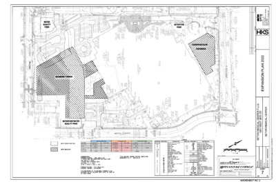
Backup

Backup
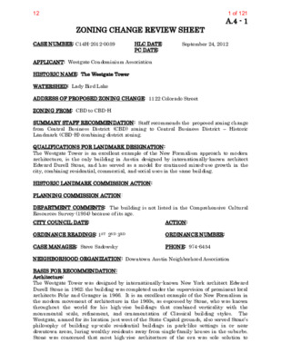
A.4 - 1 ZONING CHANGE REVIEW SHEET HLC DATE: PC DATE: September 24, 2012 CASE NUMBER: C14H-2012-0089 APPLICANT: Westgate Condominium Association HISTORIC NAME: The Westgate Tower WATERSHED: Lady Bird Lake ADDRESS OF PROPOSED ZONING CHANGE: 1122 Colorado Street ZONING FROM: CBD to CBD-H SUMMARY STAFF RECOMMENDATION: Staff recommends the proposed zoning change from Central Business District (CBD) zoning to Central Business District – Historic Landmark (CBD-H) combining district zoning. QUALIFICATIONS FOR LANDMARK DESIGNATION: The Westgate Tower is an excellent example of the New Formalism approach to modern architecture, is the only building in Austin designed by internationally-known architect Edward Durell Stone, and has served as a model for continued mixed-use growth in the city, combining residential, commercial, and social uses in the same building. HISTORIC LANDMARK COMMISSION ACTION: PLANNING COMMISSION ACTION: DEPARTMENT COMMENTS: The building is not listed in the Comprehensive Cultural Resources Survey (1984) because of its age. ACTION: PHONE: 974-6454 ORDINANCE NUMBER: CITY COUNCIL DATE: ORDINANCE READINGS: 1ST 2ND 3RD CASE MANAGER: Steve Sadowsky NEIGHBORHOOD ORGANIZATION: Downtown Austin Neighborhood Association BASIS FOR RECOMMENDATION: Architecture: The Westgate Tower was designed by internationally-known New York architect Edward Durell Stone in 1962; the building was completed under the supervision of prominent local architects Fehr and Granger in 1966. It is an excellent example of the New Formalism in the modern movement of architecture in the 1960s, as espoused by Stone, who was known throughout the world for his high-rise buildings that combined verticality with the monumental scale, refinement, and ornamentation of Classical building styles. The Westgate, named for its location just west of the State Capitol grounds, also served Stone’s philosophy of building up-scale residential buildings in park-like settings in or near downtown areas, luring wealthy residents away from single-family houses in the suburbs. Stone was concerned that most high-rise architecture of the era was sole solution to 1 of 12112 A.4 - 2 overdevelopment where going up was the only way to develop a site that was otherwise overbuilt already. The location of the Westgate Tower provided Stone the opportunity to express the ideals of downtown living with a green setting. The Westgate was also innovative in several other ways, providing a model for future central city development – combining residential and commercial uses, and a necessary amenity in the modern era – an integral parking garage that formed a significant part of the entire composition rather than as an …
September 22, 2022 Planning and Zoning Commission: Thank you for your consideration of making the Westgate Towers a Historical Landmark Combining District. I grew up in nearby Taylor, Texas and have always loved this building. When my mom and I traveled to downtown Austin to shop or visit the capitol we always drove by the Westgate. At that time (early 1970’s), there were few buildings that competed with the height and majesty of the Westgate. I was enthralled that people actually live in that building. What a dream! Fifty years later, I’m fortunate enough to have purchased a modest 1,100 square foot home in the amazing building. It was one of the buildings that inspired me to become an architect. I’m now a practicing architect in downtown Austin and have worked on architectural preservation projects around the country. My work has included the restoration of Radio City Music Hall, the Downtown Los Angeles Main Public Library, the main Cleveland Public Library, and the New Amsterdam Theatre in Manhattan. I’m currently working on historic projects at Texas Tech University, Stephen F. Austin University, and the City of Richardson, Texas. During my time living in New York City (31 years and moved back to central Texas in 2020), I’ve worked with the NY Landmarks Preservation Commission on multiple projects. I understand the importance and opportunities of historic buildings in maintaining rich, inviting, amazing neighborhoods and communities. In my 33 years of architectural practice, I believe the Westgate represents an extraordinary candidate as a Historical Landmark Combining District for the City of Austin. It has every component that’s important in designating a historic landmark: 1. It’s over 50 years old and a represents a period of architectural significance. 2. It retains a high degree of architectural integrity. 3. It’s listed on the National Register of Historic Places (2010) 4. It’s a recorded Texas Landmark (2012) 5. It’s a place of historical significance (capital view corridor, LBJ, Headliner Club, etc). 6. And very importantly, it represents an era of Austin-past. I say this because its astonishing to me that Planning & Zoning has not already unanimously approved this City of Austin designation. I’ve been involved in so many projects where building owners were fighting against historic designations and didn’t want to maintain the architectural significance of their building. The amount of time, money, and effort focused on maintaining the Westgate is substantial (I’m on …

Backup submitted for the Planning Commission on August 23, 2022. Backup - 19 Additional Backup and Public Correspondence Part 1.pdf (9.9MB) Backup - 19 Additional Backup and Public Correspondence Part 2.pdf (9.1MB) Backup - 19 C14H-2022-0099 - Delisle House; District 10.pdf (5.6MB) Backup - 19 Public Comment.pdf (72KB)
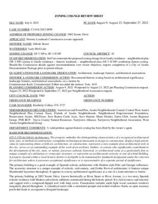
HLC DATE: July 6, 2022 PC DATE:August 9, August 23, September 27, 2022 ZONING CHANGE REVIEW SHEET CASE NUMBER: C141H-2022-0099 ADDRESS OF PROPOSED ZONING CHANGE: 2002 Scenic Drive APPLICANT: Historic Landmark Commission (owner-opposed) HISTORIC NAME: Delisle House WATERSHED: Lady Bird Lake ZONING CHANGE: SF-3-NP to SF-3-H-NP COUNCIL DISTRICT: 10 STAFF RECOMMENDATION: Staff recommends the proposed zoning change from family residence – neighborhood plan (SF-3-NP) zoning to family residence – historic landmark – neighborhood plan (SF-3-H-NP) combining district zoning. Should the Commission decide against recommendation over owner objection, require completion of a City of Austin Documentation Package prior to permit release. QUALIFICATIONS FOR LANDMARK DESIGNATION: Architecture, landscape features, and historical associations HISTORIC LANDMARK COMMISSION ACTION: Recommend historic zoning based on architectural significance, landscape features, and historical associations, on a motion by Commissioner Koch. Commissioner Tollett seconded the motion. Vote: 10-0 PLANNING COMMISSION ACTION: August 9, 2022- Postponed to August 23, 2022 per Planning Commission request. August 23, 2022-Postponed to September 27, 2022 per Neighborhood Association request. CITY COUNCIL DATE: TBD ORDINANCE READINGS: CASE MANAGER: Kimberly Collins, 974-2727 ACTION: ORDINANCE NUMBER: NEIGHBORHOOD ORGANIZATIONS: Austin Lost and Found Pets, Austin Neighborhoods Council, Central West Austin Neighborhood Plan Contact Team, Friends of Austin Neighborhoods, Neighborhood Empowerment Foundation, Preservation Austin, SELTexas, Save Barton Creek Assn., Save Historic Muny District, Sierra Club, Austin Regional Group, TNR BCP - Travis County Natural Resources, Tarrytown Alliance, Tarrytown Neighborhood Association, West Austin Neighborhood Group DEPARTMENT COMMENTS: A valid petition against historic zoning has been filed by the owner’s agent. BASIS FOR RECOMMENDATION: §25-2-352(A)(3)(b)(i) Architecture. The property embodies the distinguishing characteristics of a recognized architectural style, type, or method of construction; exemplifies technological innovation in design or construction; displays high artistic value in representing ethnic or folk art, architecture, or construction; represents a rare example of an architectural style in the city; serves as an outstanding example of the work of an architect, builder, or artisan who significantly contributed to the development of the city, state, or nation; possesses cultural, historical, or architectural value as a particularly fine or unique example of a utilitarian or vernacular structure; or represents an architectural curiosity or one-of-a-kind building. A property located within a local historic district is ineligible to be nominated for landmark designation under the criterion for architecture unless it possesses exceptional significance or is representative of a separate period of significance. The primary building is a good example of Spanish eclectic …
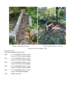
Bridge (Southside of property) Bench (South of primary residence) Historic Preservation Office, 2022 Occupancy History City Directory Research, March 2022 C. H. and Mildred E. Slator, owners Lawyer 1211 Perry-Brooks building C. H. and Mildred E. Slator, owners Lawyer 1211 Perry-Brooks building C. H. and Mildred E. Slator, owners Lawyer 1211 Perry-Brooks building C. H. and Mildred E. Slator, owners Lawyer 1211 Perry-Brooks building C. H. and Mildred E. Slator, owners Lawyer 709 Littlefield building 1947 Address not listed 1959 1957 1955 1952 1949 Aerials 1940 Aerial 1977 Aerial Permits 1977 Aerial Water service permit, 1951 Building permit, 1949 Fehr & Granger Stamp Fehr & Granger remodel plans, date. Fehr & Granger remodel plans. Fehr & Granger remodel plans. Timeline of Raymond Delisle family The Corpus Christi Caller Times: Sunday August 20, 1944. Allen, Amber From: Sent: To: Subject: Ila Falvey Monday, May 2, 2022 8:22 AM HPD Preservation Case number: GF22-047398-2002 Scenic Dr *** External Email - Exercise Caution *** Attn: Amber Allen Thank you for your research on the property. In addition to the attributes that you mentioned, this building contributes to the neighborhood of rock houses that are common in the area and represent an era of Austin's past. This neighborhood's importance was emphasized as it and several of the rock houses were included on Preservation Austin's Home Tour in 2010. I strongly oppose destroying an historic house, the long two story rock house with the whimsical carved keystones, and the bridges and paths that meander through the property. This property is a treasure and should be respected for its beauty not destroyed to maximize wealth. Ila Falvey CAUTION: This email was received at the City of Austin, from an EXTERNAL source. Please use caution when clicking links or opening attachments. If you believe this to be a malicious and/or phishing email, please forward this email to cybersecurity@austintexas.gov. 1 Laura Des Enfants 3706 Stevenson Avenue Austin TX 78703 x During this period of rapid growth Austin needs to be vigilant and preserve its architectural history or risk losing both its character and history. 5.2.2022 Allen, Amber From: Sent: To: Subject: Meredith Dreiss Monday, May 2, 2022 2:07 PM HPD Preservation case # GF22-047398-2002 Scenic Dr *** External Email - Exercise Caution *** Case # GF 22‐047398‐2002 Scenic Dr Dear Amber Allen, I am writing in hopes that a hold can be put on demolition plans for 2002 …
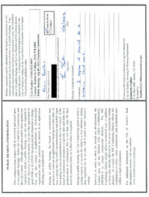
From: To: Subject: Date: Ila Falvey Collins, Kimberly Scenic Drive (Case # C14H-2022-0099) Monday, August 8, 2022 12:15:30 PM *** External Email - Exercise Caution *** I support historic designation for the property located at 2002 Scenic drive. The property serves as an anchor to the "mini historic historic district" of rock houses representative of Austin's early history. This unique property should be respected, not demolished. For the above reasons I am in favor of changing the designation to SF-3-NP-H. Sincerely, Ila Falvey CAUTION: This email was received at the City of Austin, from an EXTERNAL source. Please use caution when clicking links or opening attachments. If you believe this to be a malicious and/or phishing email, please forward this email to cybersecurity@austintexas.gov. From: To: Subject: Date: Alison Hanks Collins, Kimberly 2002 Scenic Drive. Case #C14H-2022-0099 Monday, August 8, 2022 6:42:17 PM *** External Email - Exercise Caution *** I am writing to you regarding 2002 Scenic Drive (Case # C14H-2022-0099). I urge you to support the unanimous recommendation of the Historic Landmark Commission to change the zoning to SF-3-NP-H. I lived at 2002 Scenic Dr. for eight years, (1996-2002). This home has a unique history in the growth of Austin. 100+- years ago it was being built when Scenic was a dirt track and entry to the home was from the lake. This house is the finest one out of the collection of six or so 'stone houses' up and down the block. I conducted many oral histories with the owners of the stone houses and know tearing down 2002 Scenic would mean the loss of a family legacy as well as the remarkable structure. What a pity. Please support the Historic Landmark Commission’s unanimous recommendation and help preserve the character of my neighborhood. Regards, Alison Hanks CAUTION: This email was received at the City of Austin, from an EXTERNAL source. Please use caution when clicking links or opening attachments. If you believe this to be a malicious and/or phishing email, please forward this email to cybersecurity@austintexas.gov. From: To: Subject: Date: Alison Hanks Collins, Kimberly 2002 Scenic Dr. Case #C14H-2022-0099 Monday, August 8, 2022 7:06:20 PM *** External Email - Exercise Caution *** I am writing to you regarding 2002 Scenic Drive (Case # C14H-2022-0099). I urge you to support the unanimous recommendation of the Historic Landmark Commission to change the zoning to SF-3-NP-H. I enjoyed living there from …
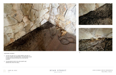
1. 2. APARTMENT INTERIOR 1. CEILING FAILURE HAS ALLOWED DEBRIS AND DIRT TO COLLECT INSIDE THE APARTMENT. THE WOODEN FLOOR IS CRACKING AND DETERIORATING FROM WATER DAMAGE. 2. THE WOODEN FLOOR IS FALLING APART AND SEPERATING FROM THE WALL. J U N E 2 8 , 2 0 2 2 1 5 2 0 0 2 S C E N I C D R I V E R E S I D E N C E Guest House - Interior 3. 1. 2. APARTMENT INTERIOR 1. WATER IS LEAKING THROUGH THE RETAINING WALL AND INTO THE APARTMENT. WATER CAN ACTIVELY BE SEEN DRIPPING DOWN THE ROCK WALL. 2. IN ORDER TO HOLD UP THE SECOND FLOOR, RAILWAY TIES ARE USED AS STEEL BEAMS. 3. WATER IS DRIPPING DOWN THE ROCK AND FINDS ITS WAY TO THE STRUCTURE’S CONCRETE BASE. J U N E 2 8 , 2 0 2 2 1 6 2 0 0 2 S C E N I C D R I V E R E S I D E N C E Guest House - Interior T w o S t o r y H o u s e J U N E 2 8 , 2 0 2 2 1 8 2 0 0 2 S C E N I C D R I V E R E S I D E N C E Site Diagram TWO STORY HOUSE EXTERIOR 1. THERE IS A CRACK THAT STARTS AT THE ROOF, GOES THROUGH THE STUCCO SECOND FLOOR, AND CONTINUES THROUGH THE STONE WALL TO THE GROUND. IT HAS BEEN FILLED AND COVERED WITH PLASTER. THE BOTTOM OF THE STONE WALL SHOWS WATER DAMAGE. 1. J U N E 2 8 , 2 0 2 2 1 9 2 0 0 2 S C E N I C D R I V E R E S I D E N C E Two Story House - Exterior 1. 2. TWO STORY HOUSE EXTERIOR 1. THERE IS A CRACK THAT STARTS AT THE STUCCO SECOND FLOOR WALL AND RUNS DOWN FROM THERE. 2. THE CRACK CONTINUES THROUGH THE ROCK FIRST FLOOR WALL. THE WATER DAMAGED STONE CAN BE SEEN AT THE BOTTOM OF THE WALL. J U N E 2 8 , 2 0 2 2 2 0 2 0 0 2 S C E N I C D R I V E R E S I …
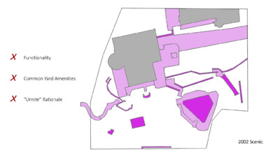
2002 Scenic’s landscaping is NOT historic. It largely consists of common yard amenities laid out in a functional manner. 2002 Scenic’s landscaping is NOT historic. It largely consists of common yard amenities laid out in a functional manner. Subject Area Precedent (McMath) 2002 Scenic Who What Where Historic Association — Integrated Site Features Common Yard Amenities Intentional Functional How Distinct and Unique Style Unverified “Urnite” Claims 2002 Scenic’s landscape features are not historic. It largely consists of common yard amenities laid out in a functional manner. Subject Area Precedent (McMath) 2002 Scenic Who What Where How ✓ ✓ ✓ ✓ X X X X 2002 Scenic’s landscape features are not historic. It largely consists of common yard amenities laid out in a functional manner. to have appears property “The a significant and unique designed landscape with aesthetic and historical value. Some landscape features, including the arched bridge and bench, appear to incorporate is Delisle’s Urnite material. This material rare today. Additionally, the landscape designed by Delisle specifically relates to his architectural vision for the house, with meandering walks, an expansive lawn, and an early swimming pool built into the hillside topography to provide a river view.” Staff Report’s Landscaping Rationale Relies on Three Claims: 1. 2. That Delisle designed the landscaping – UNVERIFIED That the landscaping features Urnite – UNVERIFIED 3. That the landscaping has significant and unique value. Urnite • “Urnite” is NOT historic. It was a short-lived and failed business venture. • Delisle is NOT historic. HLC chose not to invoke the Historic Association criterion. • Delisle’s connection to “Urnite” is tenuous. He was just one of “the men who owned stock.” r a e Y r e P e t i n r U t u o b A s e l c i t r A e u q n U i l a t o T We reviewed every newspaper archive reference available related to “urnite.” r a e Y r e P e t i n r U t u o b A s e l c i t r A e u q n U i l a t o T There were four unique articles about “urnite” in 1927, the year the Urnite Manufacturing Company was founded. r a e Y r e P e t i n r U t u o b A s e l c i t r …
MEMORANDUM ************************************************************************ TO: Planning Commission Members FROM: Sherri Sirwaitis Housing and Planning Department DATE: September 21, 2022 RE: ************************************************************************ The staff would like to request an indefinite postponement of the above mentioned case. The staff is asking for this postponement to complete our review of this PUD rezoning request. The postponement request was made in a timely manner and meets the Planning Commission’s policy. C814-2021-0175 (614 S. 1st Street PUD) Postponement Request 1 of 114
ZONING CHANGE REVIEW SHEET DISTRICT: 9 Parcel A Amendment CASE: C814-06-0175.03 – East Avenue PUD, ZONING FROM / TO: PUD-NP, to change conditions of zoning ADDRESSES: 1012, 1012 1/2, 1016, 1018, 1018 1/2 Concordia Avenue; 3500, 3500 1/2, 3502, 3506, 3508 1/2 North IH 35 Service Road Southbound SITE AREA: 1.13 acres PROPERTY OWNER: Westheimer Retail Center Ltd (David Foor) AGENT: Drenner Group, PC (Leah Bojo) CASE MANAGER: Wendy Rhoades (512-974-7719, wendy.rhoades@austintexas.gov) STAFF RECOMMENDATION: The Staff recommendation is to grant a third amendment to planned unit development – neighborhood plan (PUD-NP) combining district zoning, as shown in in Exhibit B-1, the proposed revised ordinance. For a summary of the basis of Staff’s recommendation, please see pages 3 and 4. PLANNING COMMISSION ACTION: September 27, 2022: May 24, 2022: APPROVED AN INDEFINITE POSTPONEMENT REQUEST BY STAFF [R. SCHNEIDER; J. THOMPSON – 2ND] (9-0) C. HEMPEL, Y. FLORES, J. MUSHTALER, J. SHEIH – ABSENT December 14, 2021: APPROVED AN INDEFINITE POSTPONEMENT REQUEST BY STAFF [A. AZHAR; R. SCHNEIDER – 2ND] (11-0) P. HOWARD – OFF THE DAIS; J. SHIEH – ABSENT CITY COUNCIL ACTION: October 27, 2022: ORDINANCE NUMBER: ISSUES: The proposed project will comply with the existing private Restrictive Covenant with Hancock that requires on-site affordable housing at rates of 5% at 135% MFI and an additional 5% at 150% MFI. 1 of 5315 C814-06-0175.03 Page 2 CASE MANAGER COMMENTS: The East Avenue PUD is located in central Austin at the northwest corner of Concordia Avenue and the southbound IH 35 frontage lanes. There are commercial uses near the intersection of IH 35 frontage road / East 38th Street to the north (CS-MU-NP), a new mixed use development construction at the southwest corner of the IH 35 frontage road / Concordia Avenue intersection within the East Avenue PUD area (PUD-NP), and two- and three-story multifamily residential buildings along Concordia Avenue and Harmon Avenue, and one single family residence to the west (PUD-NP; CS-MU-NP). There are single family residences and two-family residences on the west side of Harmon Avenue (SF-3-CO-NP). Please refer to Exhibits A and A-1 – Zoning Map and Aerial Exhibit. The approved Land Use Plan consists of an Internal Street or Driveway and Block Plan, a Maximum Building Area and Height Zones for each block, Ground Floor Pedestrian- Oriented Use Frontages, and Internal Street or Driveway sections, including an Alternative section. The subject property is identified as Parcel A …
ZONING CHANGE REVIEW SHEET DISTRICT: 3 TO: CS-MU-V-NP CASE: C14-2021-0190 3020 E. Cesar Chavez ZONING FROM: CS-MU-CO-NP ADDRESS: 3020 East Cesar Chavez Street SITE AREA: 2.35 acres PROPERTY OWNER: Eastside Partners LLC CASE MANAGER: Heather Chaffin (512-974-2122, heather.chaffin@austintexas.gov) STAFF RECOMMENDATION: Staff supports the Applicant’s request of CS-MU-V-NP, with the condition listed below, making the recommendation CS-MU-V-CO-NP. AGENT: Drenner Group PC (Leah Bojo) 1. The following land uses shall be prohibited: Adult oriented businesses, Automotive repair services, Automotive washing ( of any type), Automotive rentals, Automotive sales, Campground, Convenience storage, Equipment sales, Laundry services, Residential treatment, Equipment repair services, Kennels, Pawn shop services, and Vehicle storage. 2. The following land uses shall be conditional: Commercial off-street parking, Limited warehousing and distribution, Custom manufacturing, Service station, Transportation terminal, and Drive-in service as an accessory use to commercial uses. For a summary of the basis of staff’s recommendation, see case manager comments on page 2. PLANNING COMMISSION ACTION / RECOMMENDATION: September 27, 2022: March 8, 2022: To grant indefinite postponement as requested by Applicant, on consent. February 22, 2022: To grant postponement to March 8, 2022 as requested by Staff, on consent. CITY COUNCIL ACTION: October 27, 2022: ORDINANCE NUMBER: 1 of 916 C14-2021-0190 2 ISSUES: The conditional and prohibited land uses included in the Staff Recommendation are being carried over from the current CS-MU-CO-NP zoning on the site. The Applicant has agreed to these conditional and prohibited land uses. CASE MANAGER COMMENTS: The subject property is located on the north side of Cesar Chavez Street, between Linden Street and Tillery Street. The CS-MU-CO-NP property is currently developed with office land uses. Immediately east of the rezoning tract is a convenience store/service station, also zoned CS-MU-CO-NP. Across Linden Street to the west are properties zoned CS-MU-CO- NP and GR-MU-NP that are developed with office and restaurant land uses. Across East 2nd Street to the north are single family residences zoned SF-3-NP. Across East Cesar Chavez to the south are properties zoned CS-MU-CO-NP, GR-MU-CO-NP and SF-3-NP. These properties include a lumber yard, limited retail, and undeveloped land. Please see Exhibits A and B- Zoning Map and Aerial Exhibit. Staff supports the rezoning request with the addition of conditional and prohibited land uses. The property is served by Capital Metro bus routes 17 and 4, providing convenient transit opportunities. The addition of V/VMU will allow changes to site development standards for redevelopment that includes onsite …
ZONING CHANGE REVIEW SHEET DISTRICT: 3 AGENT: Drenner Group, PC (Amanda Swor) CASE: C14-2022-0001 2409 Town Lake Circle ZONING FROM: East Riverside Corridor (ERC) district - Neighborhood Mixed Use (NMU) subdistrict ZONING TO: East Riverside Corridor (ERC) district - Corridor Mixed Use (CMU) subdistrict and to increase the maximum building height through participation in the density bonus program. ADDRESS: 2409 and 2413 Town Lake Circle SITE AREA: 3.308 acres PROPERTY OWNER: 2409 Town Lake Circle, LLC CASE MANAGER: Heather Chaffin (512-974-2122, heather.chaffin@austintexas.gov) STAFF RECOMMENDATION: Staff supports the Applicant’s request to rezone the property from ERC to ERC to change the subdistrict from NMU to CMU. The Staff recommendation also amends Figure 1-8, (ERC Development Bonus Height Map), to allow for a maximum building height of 160 feet through participation in the density bonus program. For a summary of the basis of Staff’s recommendation, please see case manager comments on page 2. PLANNING COMMISSION ACTION / RECOMMENDATION: September 27, 2022: July 12, 2022: To grant ERC-CMU as recommended by staff, on consent. (9-0-1) [J. Shieh- 1st, J. Thompson- 2nd; A. Azhar- Abstained; S. Praxis, J. Mushtaler, C. Llanes-Pulido and Y. Flores- Absent] CITY COUNCIL ACTION: September 29, 2022: September 1, 2022: To postpone to September 29, 2033, on consent. July 28, 2022: First Reading approved on July 28, 2022, on consent. Vote: 10-0, Council Member Fuentes - off the dais. ORDINANCE NUMBER: 1 of 1417 C14-2022-0001 2 ISSUES: The rezoning request from ERC to ERC to change the subdistrict from NMU to CMU was approved on July 12, 2022 on consent by Planning Commission. It was determined that additional language about participation in the density bonus program and potential height increase to 160 feet required an additional review by Planning Commission. CASE MANAGER COMMENTS: The subject property is located on the south side of Town Lake Circle in the East Riverside Corridor (ERC) planning area. The property is in the Neighborhood Mixed Use (NMU) subdistrict and is developed with 120 multifamily units that are approximately 36 years old. All other properties on the same side of Town Lake Circle are also developed with multifamily land uses. While the subject property and the property immediately to the west are in the NMU subdistrict, the remainder of the properties on the street are in the Corridor Mixed Use (CMU) subdistrict. Across Town Lake Circle is property that was previously developed with apartments that …
MEMORANDUM ************************************************************************ TO: Todd Shaw, Chair Planning Commission Members September 27, 2022 Heather Chaffin, Senior Planner Housing and Planning Department Springdale Commercial -- C14-2022-0015 Springdale Commercial (Tract 2) Amended – C14-2022-0070 Postponement Request by Staff FROM: DATE: RE: ************************************************************************ Staff requests a postponement of these related cases from the September 27, 2022, Planning Commission agenda to the October 11, 2022, commission agenda. Housing and Planning Department staff needs additional time to establish a recommendation on the requests. 181 of 1
MEMORANDUM ************************************************************************ TO: Todd Shaw, Chair Planning Commission Members September 27, 2022 Heather Chaffin, Senior Planner Housing and Planning Department Springdale Commercial -- C14-2022-0015 Springdale Commercial (Tract 2) Amended – C14-2022-0070 Postponement Request by Staff FROM: DATE: RE: ************************************************************************ Staff requests a postponement of these related cases from the September 27, 2022, Planning Commission agenda to the October 11, 2022, commission agenda. Housing and Planning Department staff needs additional time to establish a recommendation on the requests. 1 of 119
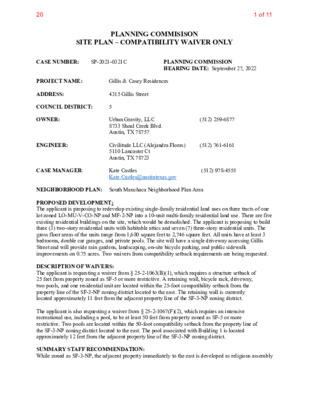
PLANNING COMMISISON SITE PLAN – COMPATIBILITY WAIVER ONLY 5 (512) 761-6161 (512) 259-6877 (512) 978-4555 4315 Gillis Street Gillis & Casey Residences SP-2021-0321C Kate Castles Kate.Castles@austintexas.gov Urban Gravity, LLC 8733 Shoal Creek Blvd. Austin, TX 78757 PLANNING COMMISSION HEARING DATE: September 27, 2022 Civilitude LLC (Alejandra Flores) 5110 Lancaster Ct Austin, TX 78723 CASE NUMBER: PROJECT NAME: ADDRESS: COUNCIL DISTRICT: OWNER: ENGINEER: CASE MANAGER: NEIGHBORHOOD PLAN: South Manchaca Neighborhood Plan Area PROPOSED DEVELOPMENT: The applicant is proposing to redevelop existing single-family residential land uses on three tracts of one lot zoned LO-MU-V-CO-NP and MF-2-NP into a 10-unit multi-family residential land use. There are five existing residential buildings on the site, which would be demolished. The applicant is proposing to build three (3) two-story residential units with habitable attics and seven (7) three-story residential units. The gross floor areas of the units range from 1,680 square feet to 2,746 square feet. All units have at least 3 bedrooms, double car garages, and private pools. The site will have a single driveway accessing Gillis Street and will provide rain gardens, landscaping, on-site bicycle parking, and public sidewalk improvements on 0.75 acres. Two waivers from compatibility setback requirements are being requested. DESCRIPTION OF WAIVERS: The applicant is requesting a waiver from § 25-2-1063(B)(1), which requires a structure setback of 25 feet from property zoned as SF-5 or more restrictive. A retaining wall, bicycle rack, driveway, two pools, and one residential unit are located within the 25-foot compatibility setback from the property line of the SF-3-NP zoning district located to the east. The retaining wall is currently located approximately 11 feet from the adjacent property line of the SF-3-NP zoning district. The applicant is also requesting a waiver from § 25-2-1067(F)(2), which requires an intensive recreational use, including a pool, to be at least 50 feet from property zoned as SF-5 or more restrictive. Two pools are located within the 50-foot compatibility setback from the property line of the SF-3-NP zoning district located to the east. The pool associated with Building 1 is located approximately 12 feet from the adjacent property line of the SF-3-NP zoning district. SUMMARY STAFF RECOMMENDATION: While zoned as SF-3-NP, the adjacent property immediately to the east is developed as religious assembly 1 of 1120 use. The adjacent property to the north is zoned GR-NP and developed as automotive repair services use. Of the remaining block, one single family house …
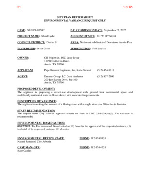
SITE PLAN REVIEW SHEET ENVIRONMENTAL VARIANCE REQUEST ONLY JURISDICTION: Full purpose AREA: Northwest subdistrict of Downtown Austin Plan CJI Properties, INC, Lucy Joyce 1809 Cresthaven Drive. Austin, TX 78704 P.C. COMMISSION DATE: September 27, 2022 ADDRESS OF SITE: 812 W 11th Street CASE: SP-2021-0350C PROJECT NAME: Shoal Cycle COUNCIL DISTRICT: District 9 WATERSHED: Shoal Creek OWNER: APPLICANT AGENT: PROPOSED DEVELOPMENT: The applicant is proposing a mixed-use development with ground floor commercial space and multifamily residential units on floors above with associated improvements. DESCRIPTION OF VARIANCE: The applicant is seeking the removal of a Heritage tree with a single stem over 30 inches in diameter. STAFF RECOMMENDATION: The request meets City Arborist approval criteria set forth in LDC 25-8-624(A)(2). The variance is recommended. Drenner Group, LC, Dave Anderson 200 Lee Barton Drive, Ste 100 Austin, TX 78704 Pape Dawson Engineers, Inc, Katie Stewart (512) 807-2900 (512) 454-8711 ENVIRONMENTAL BOARD ACTION: 09/07/2022: The Environmental Board voted in (10) favor for the approval of the requested variance, (1) in denial of the requested variance, (0) absentia. ENVIRONMENTAL REVIEW STAFF: Naomi Rotramel, City Arborist CASE MANAGER: Kate Castles PHONE: 512-974-9135 PHONE: 512-974-4555 1 of 6521 1 ENVIRONMENTAL COMMISSION MOTION 20220907-002 Seconded by: Perry Bedford Date: Sept. 7, 2022 Subject: Shoal Cycle, SP-2021-0350C Motion by: Jennifer L. Bristol WHEREAS, the Environmental Commission recognizes the applicant is seeking the removal of a Heritage tree with a single stem over 30 inches in diameter and; WHEREAS, the Environmental Commission recognizes the request meets City Arborist approval criteria set forth in LDC 25-8-624(A)(2) and that staff recommends this variance; WHEREAS, the Environmental Commission recognizes mitigation for this site shall be addressed by planting two (2) Live Oaks at 5-inch caliper as street trees. These two trees are proposed to have adequate soil to ensure survivability and, when planted, will have a combined crown surface area that will rival the thinning canopy of the existing 32-inch Live Oak. In addition, the remaining inches owed will be paid to the Urban Forest Replenishment Fund for a total of $18,500. THEREFORE, the Environmental Commission recommends the variance request with the following Environmental Commission Conditions: 1. VOTE 10-1 For: Aguirre, Barrett Bixler, Bedford, Bristol, Brimer, Nickells, Schiera, Scott, Ramberg, and Qureshi. Against: Pam Thompson Abstain: None Recuse: None Absent: None Approved By: Include the 5-year tree care plan for the 5-inch trees being planted to replace the Heritage Tree. Kevin Ramberg, Environmental …
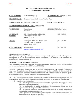
PLANNING COMMISSION SITE PLAN EXTENSION REVIEW SHEET SP-2014-0320C(XT3) CASE NUMBER: PROJECT NAME: Commerce Center South Section Two Site Plan ADDRESS OF SITE: 5811 Trade Center Drive NEIGHBORHOOD PLANNING AREA: McKinney NP WATERSHED: COUNCIL DISTRICT: 2 JURISDICTION: Full Purpose PC HEARING DATE: Sept. 27, 2022 APPLICANT/ OWNER: AGENT: Carson Creek (Suburban) SRP-A ComSouth, David Blackbird 515 Congress Ave, Ste 2100 Austin, TX 78701 Cunningham-Allen, Inc., Richard Couch 3103 Bee Caves Rd Suite 202 Austin, Texas, 78746 (512) 481-3000 (512) 327-2946 (512) 974-2784 rosemary.avila@austintexas.gov CASE MANAGER: Rosemary Avila PROPOSED DEVELOPMENT: The applicant is requesting a three year extension to a previously approved site plan. The proposed development is for an office/warehouse phased development. The extension is to complete the construction of Phase 6 (Building 5). SUMMARY STAFF RECOMMENDATION: Staff recommends approval to extend this site plan permit by three years, from 5/29/22 to 5/29/25 based on the case meeting criteria from LDC Section 25-5-62(C). 25-5-63(C) Extension of released site plan by the Land Use Commission: “the Land Use Commission may extend the expiration date of a released site plan beyond the date established by this chapter if the Land Use Commission determines that the request complies with the requirements for extension by the director under 25-5-62 (Extension of Released Site Plan by Director).” 25-5-62(C) The director may extend the expiration date of a released administrative site plan one time for a period of one year if the director determines that there is good cause for the requested extension; and “ (1) the director determines that: (a) the site plan substantially complies with the requirements that apply to a new application for site plan approval; (b) the applicant filed the original application for site plan approval with the good faith expectation that the site plan would be constructed; (c) the applicant constructed at least one structure shown on the original site plan that is suitable for permanent occupancy; or (d) the applicant has constructed a significant portion of the infrastructure required for development of the original site plan; and” 1 of 1022 SP-2014-0320C(XT3) Commerce Center South Section Two Site Plan Site Plan administrative approval, permit expiration 05/29/2018 One year administrative extension approved. Permit expiration moved to 05/29/2019. Planning Commission approved a 3 year extension. Permit expiration to 05/29/2022 SUMMARY OF SITE PLAN: LAND USE: The site is zoned LI-NP, all site calculations are within the allowed amount. ENVIRONMENTAL: All environmental comments have been …
Backup
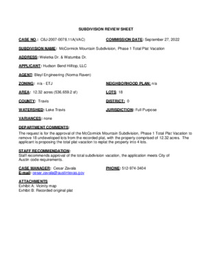
SUBDIVISION REVIEW SHEET CASE NO.: C8J-2007-0078.11A(VAC) COMMISSION DATE: September 27, 2022 SUBDIVISION NAME: McCormick Mountain Subdivision, Phase 1 Total Plat Vacation ADDRESS: Weletka Dr. & Watumba Dr. APPLICANT: Hudson Bend Hilltop, LLC AGENT: Bleyl Engineering (Norma Raven) ZONING: n/a - ETJ NEIGHBORHOOD PLAN: n/a AREA: 12.32 acres (536,659.2 sf) LOTS: 18 COUNTY: Travis DISTRICT: 0 WATERSHED: Lake Travis JURISDICTION: Full Purpose VARIANCES: none DEPARTMENT COMMENTS: The request is for the approval of the McCormick Mountain Subdivision, Phase 1 Total Plat Vacation to remove 18 undeveloped lots from the recorded plat, with the property comprised of 12.32 acres. The applicant is proposing the total plat vacation to replat the property into 4 lots. STAFF RECOMMENDATION: Staff recommends approval of the total subdivision vacation, the application meets City of Austin code requirements. CASE MANAGER: Cesar Zavala E-mail: cesar.zavala@austintexas.gov PHONE: 512-974-3404 ATTACHMENTS Exhibit A: Vicinity map Exhibit B: Recorded original plat McCormick Mountain Subdivision, Phase 1 C8J-2007-0078.11AVAC