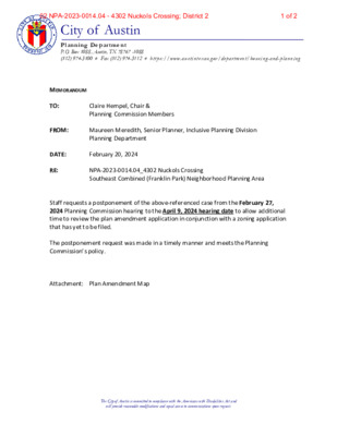
City of Austin Plann ing Departmen t P.O. Box 1088, Austin, TX 78767 -1088 (512) 974-3100 ♦ Fax (512) 974-3112 ♦ h tt ps://www.aust i nt exas.g ov/depar t ment /h ousi ng -and- planni ng MEMORANDUM TO: FROM: Claire Hempel, Chair & Planning Commission Members Maureen Meredith, Senior Planner, Inclusive Planning Division Planning Department DATE: February 20, 2024 RE: NPA-2023-0014.04_4302 Nuckols Crossing Southeast Combined (Franklin Park) Neighborhood Planning Area Staff requests a postponement of the above-referenced case from the February 27, 2024 Planning Commission hearing to the April 9, 2024 hearing date to allow additional time to review the plan amendment application in conjunction with a zoning application that has yet to be filed. The postponement request was made in a timely manner and meets the Planning Commission’s policy. Attachment: Plan Amendment Map The City of Austin is committed to compliance with the Americans with Disabilities Act and will provide reasonable modifications and equal access to communications upon request. 1 of 202 NPA-2023-0014.04 - 4302 Nuckols Crossing; District 2 The City of Austin is committed to compliance with the Americans with Disabilities Act and will provide reasonable modifications and equal access to communications upon request. 2 of 202 NPA-2023-0014.04 - 4302 Nuckols Crossing; District 2
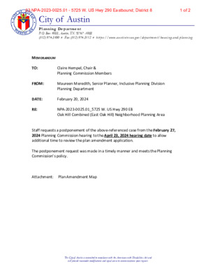
City of Austin Plann ing Departmen t P.O. Box 1088, Austin, TX 78767 -1088 (512) 974-3100 ♦ Fax (512) 974-3112 ♦ h tt ps://www.aust i nt exas.g ov/depar t ment /h ousi ng -and- planni ng MEMORANDUM TO: FROM: Claire Hempel, Chair & Planning Commission Members Maureen Meredith, Senior Planner, Inclusive Planning Division Planning Department DATE: February 20, 2024 RE: NPA-2023-0025.01_5725 W. US Hwy 290 EB Oak Hill Combined (East Oak Hill) Neighborhood Planning Area Staff requests a postponement of the above-referenced case from the February 27, 2024 Planning Commission hearing to the April 23, 2024 hearing date to allow additional time to review the plan amendment application. The postponement request was made in a timely manner and meets the Planning Commission’s policy. Attachment: Plan Amendment Map The City of Austin is committed to compliance with the Americans with Disabilities Act and will provide reasonable modifications and equal access to communications upon request. 1 of 203 NPA-2023-0025.01 - 5725 W. US Hwy 290 Eastbound; District 8 The City of Austin is committed to compliance with the Americans with Disabilities Act and will provide reasonable modifications and equal access to communications upon request. 2 of 203 NPA-2023-0025.01 - 5725 W. US Hwy 290 Eastbound; District 8
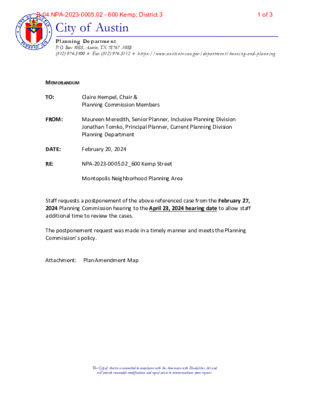
City of Austin Plann ing Departmen t P.O. Box 1088, Austin, TX 78767 -1088 (512) 974-3100 ♦ Fax (512) 974-3112 ♦ h tt ps://www.aust i nt exas.g ov/depar t ment /h ousi ng -and- planni ng MEMORANDUM TO: FROM: Claire Hempel, Chair & Planning Commission Members Maureen Meredith, Senior Planner, Inclusive Planning Division Jonathan Tomko, Principal Planner, Current Planning Division Planning Department DATE: February 20, 2024 RE: NPA-2023-0005.02_600 Kemp Street Montopolis Neighborhood Planning Area Staff requests a postponement of the above-referenced case from the February 27, 2024 Planning Commission hearing to the April 23, 2024 hearing date to allow staff additional time to review the cases. The postponement request was made in a timely manner and meets the Planning Commission’s policy. Attachment: Plan Amendment Map The City of Austin is committed to compliance with the Americans with Disabilities Act and will provide reasonable modifications and equal access to communications upon request. 1 of 3B-04 NPA-2023-0005.02 - 600 Kemp; District 3 The City of Austin is committed to compliance with the Americans with Disabilities Act and will provide reasonable modifications and equal access to communications upon request. 2 of 3B-04 NPA-2023-0005.02 - 600 Kemp; District 3 The City of Austin is committed to compliance with the Americans with Disabilities Act and will provide reasonable modifications and equal access to communications upon request. 3 of 3B-04 NPA-2023-0005.02 - 600 Kemp; District 3
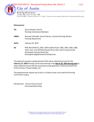
City of Austin Plann ing Departmen t P.O. Box 1088, Austin, TX 78767 -1088 (512) 974-3100 ♦ Fax (512) 974-3112 ♦ h tt ps://www.aust i nt exas.g ov/depar t ment /h ousi ng -and- planni ng Claire Hempel, Chair & Planning Commission Members Maureen Meredith, Senior Planner, Inclusive Planning Division Planning Department MEMORANDUM TO: FROM: RE: DATE: February 20, 2024 NPA-2023-0005.01_6202, 6204 Caddie Street; 1600, 1604, 1606, 1608, 1610, 1612, and 1614 Montopolis Drive; 6211, 6215 Fairway Street Montopolis-Fairway Mixed Use Montopolis Neighborhood Planning Area The applicant requests a postponement of the above-referenced case from the February 27, 2024 Planning Commission hearing to the March 26, 2024 hearing date to allow additional time to file the associated zoning application. Please see email from Victoria Haase, Thrower Design, LLC. The postponement request was made in a timely manner and meets the Planning Commission’s policy. Attachments: Victoria Haase’s email Plan Amendment Map The City of Austin is committed to compliance with the Americans with Disabilities Act and will provide reasonable modifications and equal access to communications upon request. 1 of 305 NPA-2023-0005.01 - Montopolis-Fairway Mixed Use; District 3 From: Victoria Sent: Thursday, February 8, 2024 3:50 PM To: Meredith, Maureen <Maureen.Meredith@austintexas.gov>; Ron Thrower Subject: RE: Feb 27 PC PP date? NPA-2023-0005.01_Montopolis/Fairway External Email - Exercise Caution Let’s postpone to March 26th. Thank you, Maureen. Victoria Haase www.throwerdesign.com 512-998-5900 Cell 512-476-4456 Office Mail: P.O. Box 41957 Austin, Texas 78704 The City of Austin is committed to compliance with the Americans with Disabilities Act and will provide reasonable modifications and equal access to communications upon request. 2 of 305 NPA-2023-0005.01 - Montopolis-Fairway Mixed Use; District 3 The City of Austin is committed to compliance with the Americans with Disabilities Act and will provide reasonable modifications and equal access to communications upon request. 3 of 305 NPA-2023-0005.01 - Montopolis-Fairway Mixed Use; District 3
City of Austin Plann ing Departmen t P.O. Box 1088, Austin, TX 78767 -1088 (512) 974-3100 ♦ Fax (512) 974-3112 ♦ h tt ps://www.aust i nt exas.g ov/depar t ment /h ousi ng -and- planni ng MEMORANDUM TO: FROM: Claire Hempel, Chair & Planning Commission Members Maureen Meredith, Senior Planner, Inclusive Planning Division Planning Department DATE: February 20, 2024 RE: NPA-2023-0023.03.SH_6404 Manor Rd University Hills/Windsor Park Combined Neighborhood Planning Area Staff requests a postponement of the above-referenced case from the February 27, 2024 Planning Commission hearing to the April 23, 2024 hearing date to allow time to review the plan amendment application with the recently-filed zoning change application. The postponement request was made in a timely manner and meets the Planning Commission’s policy. Attachment: Plan Amendment Map The City of Austin is committed to compliance with the Americans with Disabilities Act and will provide reasonable modifications and equal access to communications upon request. 1 of 206 NPA-2023-0023.03.SH - 6304 Manor Road; District 4 The City of Austin is committed to compliance with the Americans with Disabilities Act and will provide reasonable modifications and equal access to communications upon request. 2 of 206 NPA-2023-0023.03.SH - 6304 Manor Road; District 4
City of Austin Plann ing Departmen t P.O. Box 1088, Austin, TX 78767 -1088 (512) 974-3100 ♦ Fax (512) 974-3112 ♦ h tt ps://www.aust i nt exas.g ov/depar t ment /h ousi ng -and- planni ng MEMORANDUM TO: FROM: Claire Hempel, Chair & Planning Commission Members Maureen Meredith, Senior Planner, Inclusive Planning Division Planning Department DATE: February 20, 2024 RE: NPA-2023-0029.02_Humane Society of St. John/Coronado Hills Combined Neighborhood Planning Area Staff requests a postponement of the above-referenced plan amendment case from the February 27, 2024 to the April 23, 2024 hearing date to allow additional time to review the plan amendment application in conjunction with the pending zoning application The postponement request was made in a timely manner and meets the Planning Commission’s policy. Attachment: Plan Amendment Map The City of Austin is committed to compliance with the Americans with Disabilities Act and will provide reasonable modifications and equal access to communications upon request. 1 of 207 NPA-2023-0029.02 - Humane Society of Austin & Travis County; District 4 The City of Austin is committed to compliance with the Americans with Disabilities Act and will provide reasonable modifications and equal access to communications upon request. 2 of 207 NPA-2023-0029.02 - Humane Society of Austin & Travis County; District 4
Planning Commission: February 27, 2024 NEIGHBORHOOD PLAN AMENDMENT REVIEW SHEET NEIGHORHOOD PLAN: Southeast Combined (Southeast) CASE#: NPA-2023-0014.03 DATE FILED: July 24, 2023 PROJECT NAME: 7300 Metro Center PC DATE: February 27, 2024 ADDRESS/ES: 7300 Metro Center Drive DISTRICT AREA: 2 SITE AREA: 9.631 acres OWNER/APPLICANT: Veranda Apartment, LP AGENT: Drenner Group, PC (Leah M. Bojo) CASE MANAGER: Maureen Meredith PHONE: (512) 974-2695 STAFF EMAIL: Maureen.Meredith@austintexas.gov TYPE OF AMENDMENT: Change in Future Land Use Designation From: Industry To: Mixed Use Base District Zoning Change Related Zoning Case: C14-2023-0093 From: LI-NP To: LI-PDA-NP NEIGHBORHOOD PLAN ADOPTION DATE: October 10, 2002 CITY COUNCIL DATE: TBD ACTION: PLANNING COMMISSION RECOMMENDATION: February 27, 2024 – (action pending) 1 of 3308 NPA-2023-0014.03 - 7300 Metro Center; District 2 Planning Commission: February 27, 2024 STAFF RECOMMENDATION: To not recommend the application’s request for Mixed Use land use. BASIS FOR STAFF’S RECOMMENDATION: Staff does not support the applicant’s request to change the future land use map (FLUM) from Industry to Mixed Use to allow the construction of 280 multifamily residential units because the property is located with the McKinney Jobs Center where residential uses are not compatible with the dominant industrial character of the area. Industrial land uses should be preserved to provide much needed space for small businesses, warehouse, manufacturing, and blue-collar jobs. Below are sections from the Southeast Combined Neighborhood Plan document: Industrial Zones (Page 55) A distinctive element of the existing land use landscape within the Planning Areas is that there are defined districts with large amounts of existing industrial development, and numerous undeveloped properties with industrial zoning. The fact that this part of southeast Austin is surrounded by major Southeast Combined Neighborhood Plan transportation corridors, has a large amount of undeveloped land, and is in close proximity to the airport makes it a very attractive location for industrial development. The McKinney and Southeast NPAs host the majority of this type of construction, much of this in the form of large industrial office parks. Instead of rejecting industrial-type development around their homes, residents in the Franklin Park and McKinney NPAs have been successful at communicating and cooperating with nearby industrial property owners. Area residents have traditionally been amenable to those types of industrial uses that don’t interfere with neighborhood activities or infringe upon their quality of life. Goal 4: Ensure that existing residential and industrial zoned properties co-exist in a compatible manner. (Page 56) Objective …
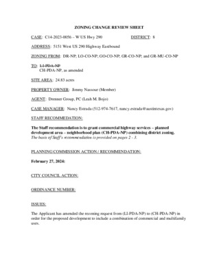
ZONING CHANGE REVIEW SHEET DISTRICT: 2 TO: LI-PDA-NP CASE: C14-2023-0093 – 7300 Metro Center ADDRESS: 7300 Metro Center Drive ZONING FROM: LI-NP SITE AREA: 9.631 acres PROPERTY OWNER: Veranda Apartments, LP (Christopher Sies) AGENT: Drenner Group, PC (Leah M. Bojo) CASE MANAGER: Nancy Estrada (512-974-7617, nancy.estrada@austintexas.gov) STAFF RECOMMEDATION: The Staff recommendation is to deny the Applicant’s request for limited industrial services – planned development area – neighborhood plan (LI-PDA-NP) combining district zoning. PLANNING COMMISSION ACTION / RECOMMENDATION: February 27, 2024: CITY COUNCIL ACTION: ORDINANCE NUMBER: ISSUES: On November 7, 2023, City of Austin staff sponsored a virtual community meeting to provide an opportunity for the neighborhood plan contact team, nearby residents, property owners, and any other interested parties to discuss the proposed development and the neighborhood plan amendment request. CASE MANAGER COMMENTS: The subject rezoning area is approximately 9.6 acres and is undeveloped. The property is situated just south of East Ben White Boulevard and north of Metropolis Drive and is located within the McKinney Jobs Center. Development in this area is generally characterized by C14-2023-0093 Page 2 industrial warehouses containing distribution and supply companies, fabrication companies, construction sales and service businesses, and outside storage uses (LI-NP; LI-CO-NP; LI- PDA-NP; CS-MU-CO-NP). Please refer to Exhibits A (Zoning Map), A-1 (Aerial View). The Bergstrom Spur, a planned urban trail and park facility for South Austin, will be developed south of this property. The Applicant proposes to rezone the property to the limited industrial services – planned development area – neighborhood plan (LI-PDA-NP) district for a multifamily project that will include 280 rental units with 441 vehicle parking spaces and 62 bicycle spaces. The Metro Center Drive right-of-way will be extended to provide access to the proposed development. As set forth in Land Development Code Section 25-2-441, the regulations of a planned development area (PDA) may modify: 1) permitted or conditional uses authorized by the base zoning district, 2) site development regulations except for compatibility standards, and 3) off-street parking or loading regulations, sign regulations or screening regulations applicable in the base district. The Applicant’s proposed PDA consists of the following elements: 1) Establishes the following additional permitted residential uses: Retirement Housing (Small Site) Single-Family Attached Residential Single-Family Residential Townhouse Residential Two-Family Residential Short -Term Rental Bed & Breakfast (Group 1) Bed & Breakfast (Group 2) Condominium Residential Duplex Residential Group Residential Multifamily Residential Retirement Housing (Large Site) 2) Establishes the following …
MEMORANDUM ************************************************************************ TO: Claire Hempel, Chair Planning Commission Members FROM: DATE: RE: Nancy Estrada Planning Department February 22, 2024 C14-2023-0094 – 4405 Merle Drive Postponement Request by Staff ************************************************************************ Staff requests a postponement of the above referenced rezoning case from the February 27, 2024, Planning Commission hearing to April 23, 2024, in order for the applicant to provide additional information.
************************************************************************ MEMORANDUM TO: Planning Commission Members FROM: Sherri Sirwaitis Planning Department DATE: February 21, 2024 RE: C14-2023-0080 (Anderson Square) Postponement Request ************************************************************************ staff would The case to April 9, 2024. from expiring so that the staff can continue our review of this rezoning request. the above mentioned We are asking for this postponement to prevent the case request a postponement of like to The postponement request was made in a timely manner and meets the Planning Commission’s policy. 1 of 210 C14-2023-0080 - Anderson Square, District 4 ( ( W O O TE ( SF-3-NP ( ( N D R N Y L Z A L ( ( ( SF-3-NP ( P-NP WOOTEN ELEMENTARY SCHOOL ( ( ( ( ( ( ( ( R E D L A D TIS ( ( = ( ( N Y L Z LA ( ( ( ( ( ( ( ( SF-3-NP = ( ( ( ( ( ( ( ( ( ( ( D ALE D R ( ( MF-3-NP ( ( ( ( SF-3-NP ( ( ( ( ( ( ( ( ( ( MF-4-NP D ALE D R SP95-0394C CHURCH GO-CO-NP S P 8 8 - 0 3 5 7 C SP96-0054C ( C14-07-0007 R E S E A R C H B L V 6 9 - 3 0 4 S P 9 4 - 0 1 0 5 C CS-NP P 8 5 - 0 2 3 D S V R D N B S P 8 9 - 2 3 2 C CS-CO-NP 12 0 01-0 S P - 0 5 - 1 4 5 9 C ( R D E IN A M ( ( ( ( ( ( ( ( ( ( ( ( SF-3-NP ( ( ( ( ( ( ( ( BANGOR BND ( ( ( ( ( SF-3-NP ( ( ( ( ( ( ( ( ( ( MH PARK MH-NP C14-2019-0083 CAR DEALERSHIP MH PARK CS-CO-NP R E S E A R C H B L V D S V R D S B R85-127 ( ( ( ( ( ( R84-315 SF-3-NP ( ( CS-1-MU-NP R E S E A R C H N B T O A N D E R S O N R A M P MF-4-NP 66-123 S T N E M T R PA A 66-123 TIRE CO. ! ! ( ( SF-3-NP ( ( …
City of Austin Plann ing Departmen t P.O. Box 1088, Austin, TX 78767 -1088 (512) 974-3100 ♦ Fax (512) 974-3112 ♦ h tt ps://www.aust i nt exas.g ov/depar t ment /h ousi ng -and- planni ng MEMORANDUM TO: FROM: Claire Hempel, Chair & Planning Commission Members Maureen Meredith, Senior Planner, Inclusive Planning Division Sherri Sirwaitis, Principal Planner, Current Planning Division Planning Department DATE: February 20, 2024 RE: NPA-2023-0017.01 and C14-2023-0080_Anderson Square The applicant requests a postponement of the above-referenced case from the February 27, 2024 Planning Commission hearing to the April 9, 2024 hearing date to allow staff additional time to review the applications. The postponement request was made in a timely manner and meets the Planning Commission’s policy. Attachments: Plan Amendment Map Zoning Map The City of Austin is committed to compliance with the Americans with Disabilities Act and will provide reasonable modifications and equal access to communications upon request. 1 of 311 NPA-2023-0017.01 - Anderson Square, District 4 The City of Austin is committed to compliance with the Americans with Disabilities Act and will provide reasonable modifications and equal access to communications upon request. 2 of 311 NPA-2023-0017.01 - Anderson Square, District 4 The City of Austin is committed to compliance with the Americans with Disabilities Act and will provide reasonable modifications and equal access to communications upon request. 3 of 311 NPA-2023-0017.01 - Anderson Square, District 4
ZONING CHANGE REVIEW SHEET CASE: C14-2023-0124 (West Lynn @ 12th Street) DISTRICT: 9 ADDRESS: 1101, 1113, 1115 West Lynn Street; 1102 and 1104 Eason Street ZONING FROM: CS-MU-CO-NP and SF-3-NP TO: CS-MU-CO-NP (with a change to a condition of zoning- height) SITE AREA: approximately 0.77 acres (approximately 33,541 sq. ft.) PROPERTY OWNER: Zydeco Development Corporation AGENT: Thrower Design, LLC (Ron Thrower) CASE MANAGER: Jonathan Tomko (512) 974-1057, jonathan.tomko@austintexas.gov STAFF RECOMMEDATION: Staff recommends granting general commercial services-mixed use- conditional overlay- neighborhood plan (CS-MU-CO-NP) combining district zoning with a change to a condition of zoning – allowing a maximum height of 60 feet. The conditional overlay would prohibit the following uses: - Adult-Oriented Businesses - Agricultural Sales and Services - Auto Sales - Automotive Rental - Automotive Repair Services - Automotive Washing – of any type - Bail Bonds Services - Building Maintenance Services - Campground - Commercial Blood and Plasma Center - Construction Sales and Services - Convenience Storage - Drop-Off Recycling Collection Facilities - Electronic Prototype Assembly - Equipment Repair Services - Equipment Sales - Exterminating Services - Indoor Crop Production - Kennels - Limited Warehousing and Distribution - Maintenance and Service Facilities - Monument Retail Services - Pawn Shop Services - Research Services - Service Station - Vehicle Storage See the basis of recommendation section below for more information. PLANNING COMMISSION ACTION / RECOMMENDATION: February 27, 2024: Case is scheduled to be heard by Planning Commission CITY COUNCIL ACTION: TBD 1 of 1712 C14-2023-0124 - West Lynn @ 12th Street; District 9 C14-2023-0124 2 ORDINANCE NUMBER: N/A ISSUES: Currently the subject tract CASE MANAGER COMMENTS: The subject tract is a little more than 3/4 of an acre at the southeast corner of West 12th Street and West Lynn Street. It currently has commercial space, including the vacant former Nau’s Drug Store, Anthony’s Drycleaners, and Café Medici Coffeeshop. It also has two single family homes which were built in approximately 1946 and 1941. The applicant indicated that houses approved for demolition by the Historic Landmark Commission could be moved if an alternative site could be found. To the north of the subject tract, across West 12th Street is Sledd’s Plant Nursery, built in approximately 1948. To the east, are three single-family homes built approximately from 1940 through 1999, and one duplex built in 1938. To the south, is the Aloha Marina clothing store, in a structure built in approximately 1950 …
ZONING CHANGE REVIEW SHEET (8,723 sq. ft.) DISTRICT: 10 ZONING TO: MF-3-NP CASE: C14-2023-0138 ZONING FROM: SF-3-NP ADDRESS: 1106 Enfield Road SITE AREA: 0.2003 acres PROPERTY OWNER: Carlson Caryn Leigh AGENT: Keepers Land Planning (Ricca Keepers) CASE MANAGER: Cynthia Hadri 512-974-7620, Cynthia.hadri@austintexas.gov STAFF RECOMMENDATION: The staff recommendation is to grant multifamily residential-medium density- neighborhood plan (MF-3-NP) combined district zoning. PLANNING COMMISSION ACTION / RECOMMENDATION: February 27, 2024: January 23, 2023: APPROVED THE NEIGHBORHOOD POSTPONEMENT REQUEST TO FEBRUARY 27, 2024. [G. ANDERSON; F. MAXWELL-2ND] (12-0) J. CONNOLLY-ABSENT CITY COUNCIL ACTION: ORDINANCE NUMBER: ISSUES: *Please note that this property is located within a National Register Historic District. Additional review by the Historic Preservation Office and/or Historic Landmark Commission is required prior to development on or changes to sites and structures within National Register districts. The Historic Landmark Commission must review all ground-up new construction within the district as well as demolition of properties that contribute to the historic district. Base zoning change approval does not remove the additional review requirements triggered by the National Register district overlay. Refer to the review process flowchart located at https://www.austintexas.gov/department/historic-preservation for more information on review requirements for historic district properties. To ensure efficient public C14-2023-0138 2 hearing scheduling, please begin the historic review process prior to the rezoning process if possible. CASE MANAGER COMMENTS: The property in question is 0.2003 acres, developed with one single family home, has access to West 15th Street (level 3) and Enfield Road (level 1), and is currently zoned single family- neighborhood plan (SF-3-NP). This site is in Old West Austin Neighborhood Plan and the National Register Historic District. The property has single family residences townhomes, Pease District Park and multifamily residences (SF-3, SF-6, P and MF-3) to the north, single family residences, a hotel and multifamily residences (SF-3-NP, GO-NP and MF-3-NP) to the south, and single family residences and multifamily residences (SF-3, SF3-NP, MF-3-NP, MF-3-CO-NP, MF-4-NP) so the east and west. Please refer to Exhibits A (Zoning Map) and B (Aerial View). The staff is recommending the multifamily residence medium density-neighborhood plan (MF-3-NP) combined district zoning to allow for the construction of seven (7) multifamily units as it is the same zoning as properties nearby. The owner plans to sell the lot after rezoning. Per the comprehensive plan review comments this site meets seven of the Imagine Austin Decision Guidelines. The site is located within or adjacent to an Imagine …
ZONING CHANGE REVIEW SHEET CASE: C14-2023-0110 (1230 E. 38th ½ Street) DISTRICT: 9 ADDRESS: 1230 East 38th ½ Street, 1400 East 38th ½ Street, 1402 East 38th ½ Street, and 1406 East 38th ½ Street ZONING FROM: CS-MU-V-CO-NP TO: CS-MU-V-CO-NP (change in condition of zoning to amend the conditional overlay by removing the height restriction maximum of forty (40) feet for the subject tract) SITE AREA: approximately 4.4369 acres (approximately square feet) PROPERTY OWNER: 38th Half St Holding LLC, 1230 E. 38th Half St Holding 2 LLC, Cherrywood Austin LLC, 706 W 34th LLC, Nasteb Keystone Family LTD AGENT: Drenner Group, P.C., (Amanda Swor) CASE MANAGER: Jonathan Tomko (512) 974-1057, jonathan.tomko@austintexas.gov STAFF RECOMMEDATION: Staff recommends granting the change in condition of zoning to amend the conditional overlay by removing the height restriction maximum of forty (40) feet for the subject tract. See the basis of recommendation section below for additional information. PLANNING COMMISSION COMMISSION ACTION / RECOMMENDATION: January 23, 2024: Applicant and neighborhood postponement to February 27, 2024. February 27, 2024: Case is scheduled to be heard by Planning Commission. CITY COUNCIL ACTION: TBD ORDINANCE NUMBER: N/A ISSUES: N/A 1 of 1214 C14-2023-0110 - 1230 E. 38th 12 Street; District 9 C14-2023-0110 2 CASE MANAGER COMMENTS: The subject tract includes a number of uses, Alma Cherrywood Apartment Complex (formerly known as Delwood Station Apartments); Westbank Dry Cleaning Warehouse; Cherrywood Coffeehouse; Monarch Food Mart, and GC Cleaners and Laundry. To the north (across the railroad tracks) are several duplexes that are part of what is known as “Duplex Nation,” a large collection of duplexes built in the late 1940s. To the east (across the railroad tracks) is Maplewood Elementary and several duplexes built in the late 1940s. To the west is Delwood Marketplace, a large shopping center of over 100,000 square feet built in approximately 1992. The shopping center includes a Fiesta Grocery Store and over 50,000 square feet of paved parking lot. To the south are several single family homes built in the 1940s and 1950s. There are at least three single family homes that operate small office uses, such as an acupuncture office, and some other home offices along the south side of East 38th 1/2 Street. BASIS OF RECOMMENDATION: Granting of the request should result in an equal treatment of similarly situated properties. Granting of this request would result in equal treatment of this tract. Parcels just to …
ZONING CHANGE REVIEW SHEET CASE: C14-2023-0129 (Pinnacle Plaza) DISTRICT: 1 ADDRESS: 1617 and 1617 ½ North IH-35 Service Road Northbound and 1002 East 16th Street ZONING FROM: CH-V-CO-NP TO: CH-PDA-NP SITE AREA: approximately 3.27 acres (approximately 142,441 square feet) PROPERTY OWNER: Pinnacle UT, LP (Barry Lall) AGENT: Alice Glasco Consulting (Alice Glasco) CASE MANAGER: Jonathan Tomko (512) 974-1057, jonathan.tomko@austintexas.gov STAFF RECOMMEDATION: Staff recommends granting commercial highway-planned development area combining district-neighborhood plan (CH-PDA-NP) combining district zoning. See the basis of recommendation section below for more information. The development standards and amendments to the conditional overlay can be found in the case manager comments section below. PLANNING COMMISSION ACTION / RECOMMENDATION: February 27, 2024: Case is scheduled to be heard by Planning Commission. CITY COUNCIL ACTION: TBD ORDINANCE NUMBER: N/A ISSUES: N/A CASE MANAGER COMMENTS: The subject tract is located at the southeast corner of the intersection of North IH-35 Service Road Northbound and East Martin Luther King Jr. Boulevard. It currently is home to a six-story Doubletree hotel with 149 rooms, a 3,000 square foot building used as meeting space, all built around 1997, and approximately 65,000 square feet of paved parking. To the east, is Oakwood Cemetery, approximately 40 acres dating back to the mid-1850s. To the south, is a small warehouse/manufacturing shed built in approximately 1915 for headstone manufacture/storage, a small apartment with approximately seven units built in approximately 1980, and a single-family home built in approximately 1905. To the west, is the Frank C. Erwin Special Events Center, the Arno Nowotny Building (constructed in 1857, it is one of the earliest buildings on the University of Texas campus), and surface parking. To the north, approximately 1,400 to 1,600 feet (across I-35) is the Moody Center, a multi-purpose area on the University of Texas campus that seats approximately 15,000 people, and other mechanical facilities servicing the University of Texas. 1 of 1315 C14-2023-0129 - Pinnacle Plaza; Districct 1 C14-2023-0129 2 Remove the following conditions from Ordinance # 951214-F 1: • General Retail Services (convenience) – remove from CO. • Cocktail lounge – remove from CO (will remain as a conditional use per code). • No structure of any kind shall be built to a height greater than 60 feet – remove from CO. • Development of Tract 1 shall be restricted to a maximum building coverage of 75%– remove from CO. from CO. • Development of Tract I shall …
ZONING CHANGE REVIEW SHEET CASE: C14-2023-0114 DISTRICT: 9 ZONING FROM: MF-6-CO ZONING TO: MF-6 ADDRESS: 1725 Toomey Road SITE AREA: 0.90 acres (39,204 sq. ft.) PROPERTY OWNER: Greg Smith AGENT: Drenner Group, PC (Amanda Swor) CASE MANAGER: Cynthia Hadri 512-974-7620, Cynthia.hadri@austintexas.gov STAFF RECOMMENDATION: The staff recommendation is to grant multifamily residence highest density (MF-6) district zoning. PLANNING COMMISSION ACTION / RECOMMENDATION: February 27, 2024: February 13, 2024: APPROVED THE NEIGHBORHOOD’S REQUEST FOR A POSTPONEMENT [A. AZHAR; F. MAXWELL-2ND] (12-0) ONE VACANCY ON THE DIAS CITY COUNCIL ACTION: ORDINANCE NUMBER: ISSUES: N/A CASE MANAGER COMMENTS: The property in question is 0.90 acres and is developed with a multifamily building on one tract of land. The property is located on the southeast corner of Toomey Road and east of Sterzing Street, both are level 1 streets. The adjacent zoning uses to the east and south are multifamily residences and restaurants (CS), across Sterzing Street there is a mix of office, commercial and restaurant uses (CS-CO, CS and LO), and to the north of Toomey Road is Lady Bird Lake and the Park (P). This property is located within the South Lamar Combined 1 of 1516 C14-2023-0114 - 1725 Toomey; District 9 C14-2023-0114 2 Neighborhood Planning Area (Zilker Neighborhood) which does not have an adopted Future Land Use Map (FLUM). Please refer to Exhibits A (Zoning Map) and B (Aerial View). Staff is recommending the grant multifamily residence (highest density) - neighborhood plan (MF-6) district zoning and remove the existing conditional overlay (CO) which restricts the height to 75 feet. Staff is in agreement with the removal of height restriction as this is a reasonable use of the property at this location and it is in line with the City Council’s goals and initiatives to add more housing in the City. Please refer to Exhibit D (Existing Ordinance). The applicant is requesting to rezone the property from multifamily residence highest density-conditional overlay (MF-6-CO) combined district zoning to multifamily residence highest density (MF-6) district zoning to allow for a residential development with approximately 203 multifamily units. Due to the number of proposed residential units, an Educational Impact Statement (EIS) is required and was submitted with the application. The previous rezoning case submitted was for 215 units, more than the current request for 203 units. The previous EIS showed that the schools will be able to accommodate the projected additional student population from the proposed …
ZONING CHANGE REVIEW SHEET CASE: C14-2023-0047 DISTRICT: 3 ADDRESS: 1911 Willow Creek Drive ZONING FROM: ERC-UR TO: ERC-CMU SITE AREA: approximately 10.12 acres (approximately 440,827 sq. ft.) PROPERTY OWNER: 1911 Willow L.P. (Anthony Clarke) AGENT: Drenner Group, P.C. (Amanda Swor) CASE MANAGER: Jonathan Tomko (512) 974-1057, (jonathan.tomko@austintexas.gov) STAFF RECOMMEDATION: Staff recommends granting the applicant’s request to change the zoning from East Riverside Corridor- Urban Residential (ERC-UR) to East Riverside Corridor-Corridor Mixed Use (ERC-CMU). PLANNING COMMISSION ACTION/RECOMMENDATION: September 26, 2023: Planning Commission postponement to October 24, 2023. October 24, 2023: Neighborhood postponement request to November 28, 2023, granted. November 28, 2023: Neighborhood postponement request to January 23, 2024, granted. January 23, 2024: Applicant postponement request to February 13, 2024, granted. February 13, 2024: Applicant postponement request to February 27, 2024, granted. February 27, 2024: Case is scheduled to be heard by Planning Commission. CITY COUNCIL ACTION: TBD ORDINANCE NUMBER: N/A ISSUES: N/A CASE MANAGER COMMENTS: The property in question currently has 256 apartment units built in 1969. The applicant has indicated that this zoning is being sought proactively and there is no intent to demolish the property for several years. The applicant has been in correspondence with the tenants of this property and they are aware of the intent to seek this rezoning (see exhibit D). If the applicant displaces residents they may be subject to the City's Tenant Relocation Ordinance as written at the time of displacement. The City's Community Displacement Prevention Officer has been notified about this rezoning case. The subject property lies between four large multifamily apartment complexes. Willow Hill Drive appears to be a cul-de-sac however ASMP shows the road connecting to Willow Creek Drive in the future as a level 2 ASMP roadway. Willow Creek Drive to the west is already a level 2 ASMP corridor and South Pleasant Valley is a level 3 ASMP corridor. the lies approximately 1,000 feet from intersection of Riverside Drive and South Pleasant Valley Road, The regulating plan for the East Riverside Corridor revised on October 26, 2015, by Ordinance No. 20151015-070 indicates this parcel is zoned as ERC-UC. With a proposed Blue Line station area at this the station. The property currently contains property approximately 25 dwelling units per acre. Target residential densities to support robust fixed- route range of 75 urban station area. Without to 150 dwelling units per acre within ½ mile redevelop within an increase the …
ZONING CHANGE REVIEW SHEET CASE: C14-2023-0148 (3805 Red River Street) DISTRICT: 9 ADDRESS: 3805 Red River Street ZONING FROM: SF-3-H-CO-CP-NP TO: LO-MU-H-CO-NP SITE AREA: approximately 0.3693 acres (16,086 square feet) PROPERTY OWNER: 3805 Red River Preservation LLC (Lindsey Derrington) AGENT: Civilitude LLC (Nhat Ho) CASE MANAGER: Jonathan Tomko (512) 974-1057, jonathan.tomko@austintexas.gov STAFF RECOMMEDATION: Staff recommends granting limited office-mixed use-historic landmark-conditional overlay-neighborhood plan (LO-MU-H-CO-NP) combining district zoning. The existing conditional overlay which establishes a maximum height of two stories or 30 feet will be retained. However, to be clear there are no changes to the structure proposed, this rezoning is only to change the possible uses allowed within the existing historic structure. See the basis of recommendation section below for more information. PLANNING COMMISSION ACTION / RECOMMENDATION: February 27, 2024: Case is scheduled to be heard by Planning Commission. CITY COUNCIL ACTION: TBD ORDINANCE NUMBER: N/A ISSUES: N/A CASE MANAGER COMMENTS: The property in question contains a historic structure and is currently being utilized as a single- family home. This rezoning request would not change the structure, only the allowed uses within the structure to include limited office uses, or any combination of those office uses and residential uses. The subject tract lies on the southeast intersection of Red River Street and East 38th Half Street (both ASMP level 3 street). This is just southeast of the Hancock Golf Course. To the north, is a single- family dwelling built in approximately 1938. To the east, is a single-family dwelling built in approximately 1939. To the south, is a single-family dwelling built in approximately 1937. To the west, is Hancock Golf Course, which dates back to 1899. There is a bus stop adjacent to the subject tract for the Capital Metro Route #10 high frequency South 1st/Red River, and across the street for the crosstown #335 35th/38th. BASIS OF RECOMMENDATION: Zoning should allow for reasonable use of the property. The requested zoning at this location would allow for a reasonable use of the property as a limited office or any combination of office and residential uses. 1 of 1018 C14-2023-0148 - 3805 Red River; District 9 C14-2023-0148 2 SF-3-H-CO-CP-NP Zoning should promote the policy of locating retail and more intensive zoning near the intersections of arterial roadways or at the intersections of arterials and major collectors. The requested zoning is not intense; however, it is relatively more intense than the single- family …
ZONING CHANGE REVIEW SHEET CASE: C14-2023-0133 DISTRICT: 4 ZONING FROM: CS-CO-NP and CS-1-CO-NP ZONING TO: CS-V-CO-NP and CS-1-V-CO-NP ADDRESS: 5555 North Lamar Boulevard SITE AREA: CS-V-CO-NP =9.328 acres (406,327 sq. ft.) CS-1-V-CO-NP = 0.0688 acres (3,000 sq. ft.) PROPERTY OWNER: B9 Sequoia Lamar Owner LP AGENT: Metcalfe Wolff Stuart and Williams (Michele R. Lynch) CASE MANAGER: Cynthia Hadri 512-974-7620, Cynthia.hadri@austintexas.gov STAFF RECOMMENDATION: The staff recommendation is to grant General Commercial Services-Vertical Mixed Use Building-Conditional Overlay-Neighborhood Plan (CS-V-CO-NP) combined district zoning and Commercial-Liquor Sales-Vertical Mixed Use Building-Conditional Overlay-Neighborhood Plan (CS-1-V-CO-NP) combined district zoning. The conditional overlays will prohibit the following uses: Adult Oriented Businesses Agricultural Sales and Services Automotive Sales Campground Commercial Blood Plasma Center Construction Sales and Services Convenience Storage Equipment Repair Services Equipment Sales Kennels Vehicle Storage PLANNING COMMISSION ACTION / RECOMMENDATION: February 27, 2024: January 23, 2024: APPROVED THE NEIGHBORHOOD POSTPONEMENT REQUEST TO FEBRUARY 27, 2024. [G. ANDERSON; F. MAXWELL-2ND] (12-0) J. CONNOLLY-ABSENT CITY COUNCIL ACTION: 1 of 1519 C14-2023-0133 - 5555 N. Lamar Rezoning; District 4 C14-2023-0133 2 ORDINANCE NUMBER: ISSUES: There are no issues at this time. CASE MANAGER COMMENTS: The property in question is 9.328 acres, developed with multiple commercial use buildings, has access to Guadalupe St (level 2) and Nelray Blvd (level 1), and is currently zoned general commercial services-conditional overlay-neighborhood plan (CS-CO-NP) combined district zoning and commercial-liquor sales-conditional overlay-neighborhood plan (CS-1-CO-NP). The property has multifamily residences and state property (CS-V-CO-NP and UNZ) to the north, multifamily residences and automotive uses (MF-3-NP, MF-2-NP, CS-CO-NP and CS-V-CO-NP) to the south, multifamily residences, single family residences and state property (MF-3-NP, MF-4-CO-NP, SF-3-NP and UNZ) to the east, multifamily residences and commercial uses (CS-V-CO-NP and CS-MU-V-CO-NP) to the west. Please refer to Exhibits A (Zoning Map) and B (Aerial View). Staff is recommending the general commercial services-vertical mixed use building- conditional overlay-neighborhood plan (CS-V-CO-NP) combined district zoning and commercial-liquor sales-vertical mixed use building-conditional overlay-neighborhood plan (CS-1-V-CO-NP ) combined district zoning for a large residential development that will include the property to the west already zoned with the vertical mixed use building (V). Per the comprehensive plan review comments this site meets ten of the Imagine Austin Decision Guidelines. The site is located within or adjacent to an Imagine Austin Activity Center, Imagine Austin Activity Corridor, or Imagine Austin Job Center as identified the Growth Concept Map, …
ZONING CHANGE REVIEW SHEET CASE: C14-2023-0154 (8120 Research Blvd – ALI) DISTRICT: 4 ADDRESS: 8120 Research Boulevard ZONING FROM: Tract 1: CS-1-MU-NP Tract 2: CS-MU-NP TO: Tract 1: CS-MU-NP Tract 2: CS-1-MU-NP SITE AREA: Tract 1: 0.20 acres Tract 2: 0.18 acres PROPERTY OWNER: OS CRESTVIEW LLC & LARI INC. (Mohammed Ali) APPLICANT/AGENT: Land Answers, Inc. (Tamara Mitchell) CASE MANAGER: Sherri Sirwaitis (512-974-3057, sherri.sirwaitis@austintexas.gov) STAFF RECOMMENDATION: Staff recommends CS-MU-NP, General Commercial Services-Mixed Use-Neighborhood Plan Combining District, zoning for Tract 1 and CS-1-MU-NP, Commercial-Liquor Sales district-Mixed Use-Neighborhood Plan Combining District, zoning for Tract 2. PLANNING COMMISSION ACTION / RECOMMENDATION: February 27, 2024 CITY COUNCIL ACTION: ORDINANCE NUMBER: 1 of 1220 C14-2023-0154 - 8120 Research Blvd – ALI; District 4 C14-2023-0152 ISSUES: N/A CASE MANAGER COMMENTS: 2 Tract 1 is currently developed with a vacant Indoor Entertainment use (Cap City Comedy Club) that is zoned CS-1-MU-NP and Tract 2 is a vacant suite zoned CS-MU-NP. These units are located within a commercial retail center (Crestview Crossing) at the southwest intersection of Anderson Square and Research Boulevard/U.S. 183 Service Road Southbound. The property is surrounded by CS-MU-NP zoning and commercial development to the north, south and east. There is a multifamily development (Research Pointe Apartments) and single-family residences to the west. The applicant is requesting to swap the CS-1-MU-NP and CS-MU-NP designated zoning locations/units within the retail center. The staff supports the applicant’s request for CS-MU- NP zoning for Tract 1 and CS-1-MU-NP zoning for Tract 2. The property in question meets the intent of these base districts. The existing retail center fronts onto a level 4/arterial roadway, Research Boulevard/U.S. 183 Service Road Southbound, and is near an activity corridor (West Anderson Lane Activity Corridor) as identified the Growth Concept Map in the Imagine Austin Comprehensive Plan. An associated NPA is not required because the current land use and proposed land use on the future land use map is Mixed Use. The staff agrees with the staff’s recommendation. BASIS OF RECOMMENDATION: 1. The proposed zoning should be consistent with the purpose statement of the district sought. General Commercial Services district is intended predominately for commercial and industrial activities of a service nature having operating characteristics or traffic service requirements generally incompatible with residential environments. Commercial-Liquor Sales district is intended predominately for commercial and industrial activities of a service nature which typically have operating characteristics or traffic service requirements generally incompatible with residential environments, …
C14-85-288.166(RCA2) 1 RESTRICTIVE COVENANT AMENDMENT REVIEW SHEET CASE: C14-85-288.166(RCA2) – Sunset Ridge DISTRICT: 8 ADDRESS: 8401 and 8401 ½ Southwest Parkway SITE AREA: approximately 9.606 acres EXISTING ZONING: GO-CO-NP PROPOSED ZONING: Amendment to Restrictive Covenant PROPERTY OWNER: Los Indios Ventures, Inc. AGENT: Armbrust & Brown, PLLC (Richard T. Suttle, Jr.) CASE MANAGER: Jonathan Tomko (512) 974-1057, jonathan.tomko@austintexas.gov STAFF RECOMMENDATION: Staff recommends amending the Restrictive Covenant as outlined in Exhibit D: Restrictive Covenant Amendment Redlines. Please see the basis of recommendation section for more details. PLANNING COMMISSION ACTION/RECOMMENDATION: February 27, 2024: Case is scheduled to be heard by Planning Commission CITY COUNCIL ACTION: TBD ORDINANCE NUMBER: N/A ISSUES: N/A CASE MANAGER COMMENTS: The subject tract of approximately 9.606 acres of undeveloped land. To the north is additional undeveloped land (across Southwest Parkway). To the south, east and west are single- family residences. This case seeks to add multifamily residential use as a permitted use of the property and establish a maximum impervious cover of 55% and 1:1 floor to area ratio for multifamily residential use. In exchange for the proposed modifications the project will: 1. Provide water quality controls in accordance with the Save Our Springs Initiative 1 of 10521 C14-85-288.166(RCA2) - Sunset Ridge; District 8 C14-85-288.166(RCA2) 2 2. Achieve a minimum one-star rating under the Austin Energy Green Building Program 3. Restrict access to Sunset Ridge 4. Provide a minimum of four EV charging stations 5. Remove invasive species in accordance with the City of Austin Invasive Species Management Plan BASIS OF RECOMMENDATION: Zoning should allow for reasonable use of the property. Austin currently has a housing shortage and an affordable housing shortage. Restricting the use of this property to prohibit multifamily residential use is unreasonable in light of this situation. The applicant has proposed modifications that address environmental quality, sustainability, transportation access, and removal of invasive species. The proposed zoning should be consistent with the goals and objectives of the City Council. Austin City Council adopted the Austin Strategic Housing Blueprint in 2017. In the last annual report (2022) HousingWorks Austin identified that Council District 8 had only attained 2% of the district’s 10-year goal for new affordable housing units. Approving this restrictive covenant agreement would help add additional income restricted affordable housing units to Council District 8, furthering this adopted goal. Intensive multifamily zoning should be located on major arterials and highways. Southwest Parkway is an ASMP level …
MEMORANDUM ************************************************************************ TO: Claire Hempel, Chair Planning Commission Members FROM: DATE: RE: Nancy Estrada Planning Department February 22, 2024 C14-2023-0094 – 4405 Merle Drive Postponement Request by Staff ************************************************************************ Staff requests a postponement of the above referenced rezoning case from the February 27, 2024, Planning Commission hearing to April 23, 2024, in order for the applicant to provide additional information.
CASE NUMBER: C14H-2023-0147 ZONING CHANGE REVIEW SHEET HLC DATE: January 10, 2024 PC DATE: February 27, 2024 CC Date: TBD APPLICANT: Jordan Nelson/Center for Women and their Work (property owner) ADDRESS OF PROPOSED ZONING CHANGE: 1311 E. Cesar Chavez St./94 Navasota St. HISTORIC NAME: Johnson & Johnson Grocery and Home WATERSHED: Town Lake ZONING CHANGE: CS-MU-CO-NP to CS-MU-H-CO-NP COUNCIL DISTRICT: 3 STAFF RECOMMENDATION: Staff recommends the proposed zoning change from general commercial services-mixed use-conditional overlay-neighborhood plan (CS-MU-CO-NP) to general commercial services-mixed use-historic landmark- conditional overlay-neighborhood plan (CS-MU-H-CO-NP) combining district zoning. QUALIFICATIONS FOR LANDMARK DESIGNATION: The property is designated as a Recorded Texas Historic Landmark. The building meets additional criteria for architecture and historical associations. HISTORIC LANDMARK COMMISSION ACTION: Recommend the proposed zoning change from general commercial services-mixed use-conditional overlay-neighborhood plan (CS-MU-CO-NP) to general commercial services-mixed use- historic landmark-conditional overlay-neighborhood plan (CS-MU-H-CO-NP) combining district zoning (10-0). PLANNING COMMISSION ACTION: CITY COUNCIL ACTION: CASE MANAGER: Kalan Contreras, 512-974-2727 NEIGHBORHOOD ORGANIZATIONS: Austin Independent School District, Austin Lost and Found Pets, Austin Neighborhoods Council, Del Valle Community Coalition, East Austin Conservancy, East Cesar Chavez IBIZ District, East Cesar Chavez Neighborhood Association, East Cesar Chavez Neighborhood Plan Contact Team, East Town Lake Citizens Neighborhood Association, El Concilio Mexican-American Neighborhoods, Friends of Austin Neighborhoods, Greater East Austin Neighborhood Association, Guadalupe Neighborhood Development Corporation, Homeless Neighborhood Association, Neighborhood Empowerment Foundation, Neighbors United for Progress, Preservation Austin, SELTexas, Sierra Club, Austin Regional Group, Tejano Town DEPARTMENT COMMENTS: The 2016 East Austin Historic Resource Survey recommends the main building as eligible for designation as a local landmark, individually eligible for listing in the National Register of Historic Places and contributing to potential local and National Register historic districts. The survey recommends the secondary building as contributing to potential local and National Register historic districts. BASIS FOR RECOMMENDATION: § 25-2-352(3)(c)(i) Architecture. The property embodies the distinguishing characteristics of a recognized architectural style, type, or method of construction; exemplifies technological innovation in design or construction; displays high artistic value in representing ethnic or folk art, architecture, or construction; represents a rare example of an architectural style in the city; serves as an outstanding example of the work of an architect, builder, or artisan who significantly contributed to the development of the city, state, or nation; possesses cultural, historical, or architectural value as a particularly fine or unique example of a utilitarian or vernacular structure; or represents an architectural curiosity or one-of-a-kind …
CASE NUMBER: C14H-2023-0145 HLC DATE: January 10, 2024 PC DATE: February 27, 2024 CC Date: ZONING CHANGE REVIEW SHEET APPLICANT: O’Connell Architecture, LLC (owner-initiated) HISTORIC NAME: Yarrington-Moore House WATERSHED: East Bouldin Creek, Blunn Creek ADDRESS OF PROPOSED ZONING CHANGE: 309 Park Lane ZONING CHANGE: SF-3-NCCD-NP to SF-3-H-NCCD-NP COUNCIL DISTRICT: 9 STAFF RECOMMENDATION: Staff recommends the proposed zoning change from single family-neighborhood conservation-neighborhood plan (SF-3-NCCD-NP) to single family-historic landmark-neighborhood conservation- neighborhood plan (SF-3-H-NCCD-NP) combining district. QUALIFICATIONS FOR LANDMARK DESIGNATION: Architecture and historical associations HISTORIC LANDMARK COMMISSION ACTION: Recommend the proposed zoning change from single family- neighborhood conservation-neighborhood plan (SF-3-NCCD-NP) to single family-historic landmark-neighborhood conservation-neighborhood plan (SF-3-H-NCCD-NP) combining district (10-0). PLANNING COMMISSION ACTION: CITY COUNCIL ACTION: CASE MANAGER: Kalan Contreras, 512-974-2727 NEIGHBORHOOD ORGANIZATIONS: DEPARTMENT COMMENTS: Austin Independent School District, Austin Lost and Found Pets, Austin Neighborhoods Council, Friends of Austin Neighborhoods, Greater South River City Combined Neighborhood Plan Contact Team, Homeless Neighborhood Association, Neighborhood Empowerment Foundation, Preservation Austin, SELTexas, Sierra Club, Austin Regional Group, South Central Coalition, South River City Citizens Assn., Zoning Committee of South River City Citizens BASIS FOR RECOMMENDATION: § 25-2-352(3)(c)(i) Architecture. The property embodies the distinguishing characteristics of a recognized architectural style, type, or method of construction; exemplifies technological innovation in design or construction; displays high artistic value in representing ethnic or folk art, architecture, or construction; represents a rare example of an architectural style in the city; serves as an outstanding example of the work of an architect, builder, or artisan who significantly contributed to the development of the city, state, or nation; possesses cultural, historical, or architectural value as a particularly fine or unique example of a utilitarian or vernacular structure; or represents an architectural curiosity or one-of-a-kind building. The house is an excellent example of the Free Classic variant of Queen Anne architecture and is likely one-of-a-kind in Austin. The application describes its significance as follows: The Yarrington-Moore House is a ca. 1889 Queen Anne-style residence that sits back on a corner lot at Newning Avenue and Park Lane. Arthur H. Yarrington purchased the property from Charles Newning as part of the original Fairview Park subdivision, now part of Travis Heights. It stands among the earliest houses in Fairview Park. Only a few houses in the district employ the architectural features and design details traditionally associated with the Queen Anne style. The Yarrington-Moore House is a well-known marker of the neighborhood, standing out for its …
PLANNING COMMISSION SITE PLAN CONDITIONAL USE PERMIT REVIEW SHEET (512) 476-4456 (512) 974-2140 SPC-2023-0406A PINS Mechanical CUP PC DATE: February 27, 2024 Heather.chaffin@austintexas.gov 9.333 acre site; 3,412 sq. ft. footprint Williamson Creek (Suburban) 4323 South Congress, Building B 3 East Congress Thrower Design, A. Ron Thrower P.O. Box 41957 Austin, TX 78704 SE Austin Global Land, LLC and St. Elmo Apartments, LP, LLC 4901 Keller Springs Road, Suite 101 Addison, Texas 75001 CASE NUMBER: PROJECT NAME: ADDRESS: COUNCIL DISTRICT: NEIGBORHOOD PLAN: APPLICANT: AGENT: CASE MANAGER: Heather Chaffin AREA: WATERSHED: WATERSHED ORDINANCE: Comprehensive Watershed Ordinance N/A T.I.A.: CAPITOL VIEW: N/A PROPOSED DEVELOPMENT: The applicant is requesting a conditional use permit for a cocktail lounge use within an existing building. The proposed cocktail lounge area is 3,412 square feet total within an existing building. No construction is proposed with this land use site plan. STAFF RECOMMENDATION: Staff recommends approval of the conditional use permit. The proposed land use site plan complies with all requirements of the Land Development Code. PROJECT INFORMATION: 3,412 sq. ft. footprint EXISTING ZONING: LI-PDA-NP ALLOWED F.A.R.: 1.5:1 MAX. BLDG. COVERAGE: 75% MAX. IMPERVIOUS COVER: 80% REQUIRED PARKING: 612 PROPOSED ACCESS: E. St Elmo Rd and Industrial Blvd *See the attached Site Plan sheet for the calculations of the entire lot. SUMMARY COMMENTS ON SITE PLAN: Land Use: The property is zoned LI-PDA-NP (Limited Industrial Services-Planned Development Area- Neighborhood Plan). Zoning established by Ordinance No. 20141120-137 establishes Cocktail Lounge as a conditional use. The 9.33 acre site includes multifamily, restaurant, brewery and food sales land uses. The Applicant proposes developing 3,412 square feet of cocktail lounge along with 35,196 square feet of indoor sports and recreation and 9,480 square feet of outdoor sports of recreation in and adjacent to EXISTING F.A.R.: 1.25:1 EXISTING BLDG. COVER: 37.89% EXISTING IMPERVIOUS COVER: 64.17% PROVIDED PARKING: 655 PIN Mechanical CUP Building B. Indoor and outdoor sports and recreation are permitted uses per the approved zoning ordinance. There are no schools, churches, or hospitals within 300 feet of the subject site. Staff recommends approval of the conditional use permit request. SPC-2023-0406A 2 Environmental: The site is located in the Williamson Creek Watershed and subject to the Suburban Watershed regulations. There were no Environmental review comments. No construction is proposed with this Land Use application. Transportation: All parking spaces are located on-site. All Transportation comments have been cleared. Access to the site is available from …
PLANNING COMMISSION SITE PLAN CONDITIONAL USE PERMIT REVIEW SHEET (512) 220-2248 (512) 974-2140 SPC-2023-0341A Yoga Peace East School Peaceful Playhouse, LLC PC DATE: February 27, 2024 15,423 square feet Tannehill Branch Creek (Urban) Heather.chaffin@austintexas.gov 3418 East Martin Luther King Jr Boulevard 1 SiteATX, LLC (Jennifer Hanlen) 4004 Banister Lane #307 Austin, TX 78704 CASE NUMBER: PROJECT NAME: ADDRESS: COUNCIL DISTRICT: NEIGBORHOOD PLAN: MLK (East MLK Combined) APPLICANT: AGENT: CASE MANAGER: Heather Chaffin AREA: WATERSHED: WATERSHED ORDINANCE: Comprehensive Watershed Ordinance T.I.A.: N/A CAPITOL VIEW: N/A PROPOSED DEVELOPMENT: The applicant is requesting a conditional use permit for a day care / child care land use for up to 34 children. No construction is proposed with this land use site plan. NOTE: This conditional use permit was filed with the City August 28, 2023. Day care / child care requirement sections of the Land Development Code (LDC) were modified and effective October 30, 2023. STAFF RECOMMENDATION: Staff recommends approval of the conditional use permit. The proposed land use site plan complies with all requirements of the Land Development Code. PROJECT INFORMATION: 15,423 square feet EXISTING ZONING: SF-3-NP MAX. BLDG. COVERAGE: 40% MAX. IMPERVIOUS COVER: 45% REQUIRED PARKING: N/A PROPOSED ACCESS: Greenwood Avenue SUMMARY COMMENTS ON SITE PLAN: Land Use: The property is zoned SF-3-NP (Single Family Residence) and is developed with a single family home. The applicant proposes changing the use of the house to day care / child care. This conditional use permit was filed prior to recently adopted changes to day care / child care land uses in single family zoned districts. Effective October 30, 2023, the proposed use would be permitted and not require a conditional use permit. Staff recommends approval of the conditional use permit request. EXISTING BLDG. COVER: 13% EXISTING IMPERVIOUS COVER: N/A PROVIDED PARKING: Minimum 4 spaces Environmental: The site is located in the Tannehill Branch Watershed and subject to Urban Watershed regulations. There were no Environmental review comments. No construction is proposed with this Land SPC-2023-0341A Yoga Peace East School Use application. Transportation: All parking spaces are located on-site. All Transportation comments have been cleared. Access to the site is existing from Greenwood Avenue; The property also has frontage on East Martin Luther King Boulevard. SURROUNDING CONDITIONS: Zoning/ Land Use 2 SF-3-NP, Single family residential SF-3-NP, Single family residential SF-3-NP, Single family residential SF-3-NP, Single family residential North: East: South: West: Austin Lost and Found Pets …
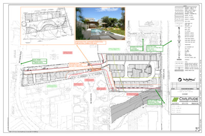
CASE NUMBER: PROJECT NAME: ADDRESS: APPLICANT: AGENT: PLANNIGN COMMISSION SITE PLAN COMPATIBILITY VARIANCE SP-2022-0536C PLANNING COMMISSION HEARING DATE: February 27, 2024 Kramer Condos 1517 Kramer Lane Joseph M. and Tina Hood 1517 Kramer LLC 13930 Immanuel Rd. Pflugerville, TX 78660 Attn: Esteban Gonzalez CIVILITUDE LLC 5110 Lancaster Court Austin, TX 78723 (512) 913-4760 (512) 761-6161 Randall Rouda Randall.Rouda@austintexas.gov CASE MANAGER: NEIGHBORHOOD PLAN: North Austin Civic Association PROPOSED DEVELOPMENT: The applicant is proposing to remove two existing single family residences and construct 55 multi-family residential units on a 3.88 acre site in the GO-MU-CO-NP and SF-6-NP Zones. The proposed development includes a pool. DESCRIPTION OF COMPATIBILITY VARIANCE: (512) 974-3338 1) From 50 feet to 25 feet for Intensive Recreation (pool) along the easterly setback. [LDC § 25-2-1067] SUMMARY STAFF RECOMMENDATION: Staff recommends approval of the Compatibility Waiver. The site consists of two separate parcels to be joined by a Unified Development Agreement. The southerly parcel is relatively narrow and residential development on that portion of the site is somewhat restricted by the SF-6-NP Zoning. The applicant proposes to use that portion of the site for access, the development of 14 of the multifamily residential (condominium) units and an open space area with a po (approximately 33 feet by 12 feet). The pool is within 50 feet of the rear yard fences of two existing single family residences to the east. A fence is shown along the shared property line. The site plan complies with all other compatibility standards. PROJECT INFORMATION TOTAL SITE AREA EXISTING ZONING PROPOSED ZONING 169,170 sq. ft. GO-MU-CO-NP and SF-6-NP GO-MU-CO-NP and SF-6-NP 3.88 acres Proposed N/A N/A N/A Little Walnut Creek (Urban) Comprehensive Watershed Ordinance None Kramer Land and Macmora Road Allowed/Required Existing 1:1 60% 80% Allowed/Required Existing NA 40% 55% 0 WATERSHED WATERSHED ORDINANCE TRAFFIC IMPACT ANALYSIS Not required CAPITOL VIEW CORRIDOR PROPOSED ACCESS GO-MU-CO-NP PARCEL FLOOR-AREA RATIO BUILDING COVERAGE IMPERVIOUS COVERAGE SF-6-NP PARCEL FLOOR-AREA RATIO BUILDING COVERAGE IMPERVIOUS COVERAGE TOTAL PROJECT PARKING COMPATIBILITY The subject site is bordered by a single-family residential land uses to the east and west. All hardscape and vertical improvements are located at least 25 feet from the east and west property lines. The proposed pool is located 25 feet from the easterly property line but is within the 50 foot setback for intensive recreational uses. The site complies with all other compatibility standard requirements. EXISTING ZONING AND LAND USES Site …
2 5 ' U N D I S T U R B E D B U F F E R 25' UNDISTURBED BUFFER 5 0 ' S E T B A C K A N D 2 S T O R Y 3 0 ' H E I G H T L I M I T 50' SETBACK AND 2 STORY 30' HEIGHT LIMIT 2 5 ' U N D I S T U R B E D B U F F E R 2 5 ' U N D I S T U R B E D B U F F E R 5 0 ' S E T B A C K A N D 2 S T O R Y 3 0 ' H E I G H T L I M I T 1 0 0 ' S E T B A C K A N D 3 S T O R Y 4 0 ' H E I G H T L I M I T 100' SETBACK AND 3 STORY 40' HEIGHT LIMIT N 50' SETBACK AND 2 STORY 30' HEIGHT LIMIT 25' UNDISTURBED BUFFER
ORDINANCE AMENDMENT REVIEW SHEET C20-2023-041 Amendment: C20-2023-041 Amendments to the Regulating Plan for the North Burnet/Gateway Zoning District Background and summary of proposed code amendment: Initiated by the City Council under Resolution No. 20231109-027. Council Sponsors: Council Member Leslie Pool, Mayor Pro Tem Paige Ellis, Council Member Mackenzie Kelly, Council Member José ''Chito'' Vela. Conduct a public hearing and consider a recommendation for an ordinance amending City Code Title 25 to modify the Regulating Plan for the North Burnet/Gateway Zoning District to create a new subdistrict called the Research and Sciences Mixed Use Subdistrict and to establish a new set of uses, including but not limited to, life sciences, lab, and biomedical uses, and to establish development regulations and standards applicable to the district as described in Exhibit “A”: 1. Amend Land Use Standards. 2. Amend Roadway Types. 3. Amend Circulation, Connectivity, and Streetscape. 4. Amend Collector Street Plan. 5. Amend Site Development Standards. 6. Amend Building Design Standards. 7. Amend Development Bonus Standards. 8. Amend Definitions. The Imagine Austin Comprehensive Plan identified the North Burnet/Gateway and Domain areas as a Regional Center and Austin's "second downtown." The North Burnet/Gateway Vision Plan was adopted in 2006, followed with adoption of the North Burnet/Gateway Regulating Plan (the Plan) in 2009 that set development and design standards for the area. Multiple amendments to the Plan since 2013 have facilitated the redevelopment of the area's older industrial, office, and warehouse sites in favor of mixed-use development with increased housing density, variety of office spaces, and vibrant store fronts for small retail business. The recent construction of two new Red Line commuter rail stations, one at the Uptown ATX campus and the other at McKalla to serve the Q2 Stadium have generated significant development interest in the area. The Plan has been updated on several occasions per City Council and Planning Commission initiation of amendments to City Code Title 25 including: 1. Amendments to the Commercial Mixed-Use (CMU) Gateway Subdistrict of the North Burnet/Gateway Regulating Plan to increase FAR and building height when using a development bonus as executed in Ordinance No. 20221027-044. 2. Planning Commission initiation of amendments to the Transit-Oriented Development (TOD) subdistrict when using a development bonus. The Commission requested an increase in the maximum FAR and building height when using a development bonus. As a result, the City Council approved Ordinance No. 20230209-046. 3. Creation of a new subdistrict: Commercial …
Regulating Plan for the North Burnet/Gateway Zoning District Austin, Texas Exhibit "A" DATE ADOPTED: March 12, 2009 DATE EFFECTIVE: March 23, 2009 Ordinance No: 20231019-056 Revisions include: Ordinance No: 20120322-088 Ordinance No: 20130425-104 O 140828-159 : 201 rdinance No Ordinance No: 20180412-051 Ordinance No: 20180628-088 Ordinance No: 20190620-112 Ordinance No: 20190808-101 Ordinance No: 20201210-073 Ordinance No: 20210204-058 Ordinance No: 20210826-069 Ordinance No: 20211014-079 Ordinance No: 20220127-082 Ordinance No: 20220609-101 Ordinance No: 20221027-044 Ordinance No: 20230209-046 BASED ON THE NORTH BURNET/GATEWAY MASTER PLAN: Adopted November 1, 2007 1 of 65 REGULATING PLAN for the North Burnet/Gateway Zoning District CONTENTS BACKGROUND…………………………………………………………………………………...iv HOW TO USE THIS DOCUMENT…………… ......... ……………………………………………...v 1.3. 1.1. 1.2. ARTICLE 1: GENERAL PROVISIONS ........................................................................................... 1 General Intent ................................................................................................................ 1 Applicability .................................................................................................................. 1 1.2.1. General Applicability ............................................................................................. 1 1.2.2. Land Use and General Development Standards ............................................... 4 1.2.3. NBG Design Standards .......................................................................................... 4 1.2.4. Exemption from Subchapter E of the Land Development Code ..................... 6 1.2.5. Conflicting Provisions ............................................................................................... 6 1.2.6. Accessibility ............................................................................................................... 6 1.2.7. State and Federal Facilities ................................................................................... 7 Review Process .............................................................................................................. 7 1.3.1. Standards Applicable During Subdivision Plan Review ................................... 7 1.3.2. Standards Applicable During Site Plan Review ................................................. 7 1.3.3. Standards Applicable During Building Permit Review ...................................... 8 Alternative Equivalent Compliance ............................................................................... 8 1.4.1. Purpose and Scope ................................................................................................. 8 1.4.2. Applicability ............................................................................................................. 8 1.4.3. Procedure .................................................................................................................. 9 1.4.4. Criteria ..................................................................................................................... 11 1.4.5. Effect of Approval ................................................................................................. 11 Nonconforming Uses and Noncomplying Structures ................................................... 12 Text and graphics within this Document ...................................................................... 12 1.5. 1.6. 1.4. 2.1. 2.2. 2.3. ARTICLE 2: LAND USE STANDARDS ........................................................................................ 13 Intent ............................................................................................................................ 13 Applicability ................................................................................................................ 13 North Burnet/Gateway Subdistricts .............................................................................. 14 2.3.1. Applicability ........................................................................................................... 14 2.3.2. NBG Subdistricts General .................................................................................... 14 2.3.3. Land Use Summary Table .................................................................................... 14 2.3.4. Subdistrict Typologies ........................................................................................... 16 2.3.5. Drive-Through Facilities ......................................................................................... 17 ARTICLE 3: CIRCULATION, CONNECTIVITY AND STREETSCAPE ............................................ 25 Intent ............................................................................................................................ 25 Applicability ................................................................................................................ 26 Sidewalk Standards ..................................................................................................... 26 3.3.1. General Applicability ........................................................................................... 26 3.3.2. Sidewalk Standards for All Roadway Types ................................................... 26 3.3.3. Alternative Requirements for Shallow Lots on NBG Core Transit Corridors 3.1. 3.2. 3.3. .................................................................................................................................. 29 3.3.4. Sidewalk Exemption for Edge Streets ............................................................... 31 3.4. On-Street Parking ......................................................................................................... 32 i City of Austin North Burnet/Gateway Zoning District Regulating Plan 2 of 65 Contents 4.3. 3.5. 4.1. 4.2. 3.4.1. Applicability ........................................................................................................... 32 3.4.2. Purpose .................................................................................................................... 32 3.4.3. On-Street Parallel Parking .................................................................................. 32 3.4.4. Head-in and Angle Parking Restrictions ............................................................ 34 Connectivity and Circulation …
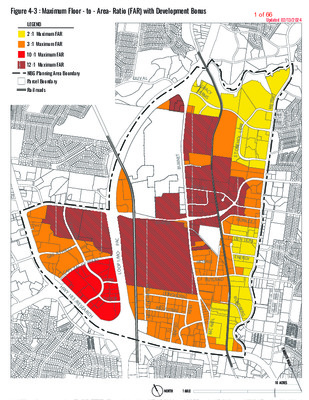
Figure 4-3 : Maximum Floor - to - Area- Ratio (FAR) with Development Bonus Updated 02/13/2024 LEGEND 2 :1 Maximum FAR 3 :1 Maximum FAR 10 :1 Maximum FAR 12 :1 Maximum FAR NBG Planning Area Boundary Parcel Boundary Rail roads DU V AL G R A F A R C Y M S C I R T E M W O L L O H E N O T S DONLEY DEN TON ENERGY R U N D B E R G T E N R U B KRAMER BRAKER MCHALE RUTLAND N O S P M O H T S L I E N LONGHORN INDUSTRIAL D I E R D E T I N U L I E N - C M S T O N E L A K E S L A T H I L E G R X A S E A L O F T T C A P I H W Y 1 8 3 / R E S E A R C H C A P - O M / 1 P O O L YORK TUDOR 1 of 66 Figure 4 - 4 : Maximum Height by Right (with no Development Bonus) Updated 02/13/2024 LEGEND Maximum Height 40 feet 60 feet 120 feet* See label on parcel for maximum height NBG Planning Area Boundary DUVAL Parcel Boundary Railroads *As regulated by Figure 4-1 RSMU for Life Science Uses G R A F A C Y R M S C I R T E M 25 ‘ W O L L O H E N O T S 35 ‘ DONLEY DENTON ENERGY R U N D B E R G T E N R U B BRAKER KRAMER MCHALE RUTLAND N O S P M O H T S L I E N LONGHORN INDUSTRIAL D I E R D E T I N U L I E N - C M 127’ 73’ 117’ C A P - O M / 1 P O O L 80 ‘ S T O N E L A K E L S L G R E A T H I 45 ‘ C A P I T A L O F T E X A S 90 ‘ 70 ‘ YORK H W 48 ‘ Y 1 8 3 / 70 ‘ 75 ‘ 55 ‘ TUDOR 75 ‘ R E …
Butler Trail Code Amendment Leslie Lilly Environmental Conservation Program Manager N I T S U A F O Y T I C W A T E R S H E D P R O T E C T I O N D E P A R T M E N T 1 of 11 N I T S U A F O Y T I C 2 Background • Construction of Ann and Roy Butler Hike and Bike Trail began in 1971 • Code compliant at time of construction • 2017 WPO code amendment restrictions on 50 ft setback • Current use today averages ~ 5 million visits annually W A T E R S H E D P R O T E C T I O N D E P A R T M E N T 2 of 11 N I T S U A F O Y T I C 3 Background Amendment initiated by City Council on May 18th, 2023 W A T E R S H E D P R O T E C T I O N D E P A R T M E N T 3 of 11 N I T S U A F O Y T I C 4 The Trail Conservancy • Urban Forestry and Natural Areas Management Guidelines • Safety and Mobility Study • Parkland Operations And Maintenance Agreement W A T E R S H E D P R O T E C T I O N D E P A R T M E N T 4 of 11 Site Conditions 5 N I T S U A F O Y T I C W A T E R S H E D P R O T E C T I O N D E P A R T M E N T 5 of 11 N I T S U A F O Y T I C 6 Proposed Amendment • • • 25-8-261 (B)(3)(c) to allow the Butler Trail to exceed 12 feet width (no administrative variance) 25-8-261 (B)(3)(f-g) to allow the Butler Trail to be located within 50 feet of the shoreline of Lady Bird Lake with a baseline of 1:1 restoration, and up to 2:1 restoration where feasible, for impacts associated with reconstruction and capital improvements or alternative compliance as approved by the Director of Watershed. Current code only allows this with …
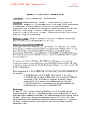
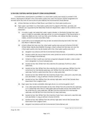
C20-2023-013 ORDINANCE AMENDMENT REVIEW SHEET Amendment: C20-2023-013 Butler Trail Code Amendment Description: Amendments to City Code Title 25-8-261(Critical Water Quality Zone Development) in response to City Council Resolution 20230518-044 to allow the Butler Trail to remain within the setbacks applicable to Lady Bird Lake; and to allow capital improvements made to the Butler Trail to comply with the recommendations from the 2015 Butler Trail Urban Forestry and Natural Area Management Guidelines, maintenance standards of care listed in the Butler Trail POMA, and the recommendations provided in the Butler Trail Safety and Mobility Study. Proposed Language: Consider an ordinance to amend Title 25 related to environmental protections at the Ann and Roy Butler Hike and Bike Trail. Summary of proposed code amendment In 2017, provisions were added to the Land Development Code section 25-8-261 (Critical Water Quality Zone Development) restricting development within the 50 ft setback of Lady Bird Lake including the construction of trails, including the existing Butler Trail, approximately 85% of which is currently located within the 50 ft setback of Lady Bird Lake. This restriction makes it more difficult to enhance, reconstruct and build the Butler Trail in its current alignment. In response to the Council Resolution 20230518-044, staff requests an amendment to existing code language to accommodate the current Butler Trail alignment and width while continuing to provide protection to the shoreline through mitigation and improvements to the health of the floodplain. Three amendments to 25-8-261 (CRITICAL WATER QUALITY ZONE DEVELOPMENT) are proposed: • • 25-8-261 (B)(3)(c) to allow the Butler Trail to exceed 12 feet width 25-8-261 (B)(3)(f-g) to allow the Butler Trail to be located within 50 feet of the shoreline of Lady Bird Lake with restoration provided for impact associated with capital improvements and reconstruction of the trail. 25-8-261 (C)(2) to remove the requirement for additional restoration for shoreline disturbance associated with the Butler Trail. • Background: On May 18th , 2023, City Council approved Resolution No. 20230518-044 to initiate amendments to City Code Title 25 (Land Development) to allow the Butler Trail to remain within the setbacks applicable to Lady Bird Lake; and to allow capital improvements made to the Butler Trail to comply with the recommendations from the 2015 Butler Trail Urban Forestry and Natural Area Management Guidelines, maintenance standards of care listed in the Butler Trail POMA, and the recommendations provided in the Butler Trail Safety and Mobility Study. 1 1 …
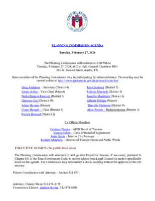
PLANNING COMMISSION AGENDA Tuesday, February 27, 2024 The Planning Commission will convene at 6:00 PM on Tuesday, February 27, 2024, at City Hall, Council Chambers 1001 301 W. Second Street, Austin, TX. Some members of the Planning Commission may be participating by videoconference. The meeting may be viewed online at: http://www.austintexas.gov/page/watch-atxn-live Greg Anderson – Secretary (District 4) Awais Azhar – Vice-Chair (Mayor) Nadia Barrera-Ramirez (District 3) Grayson Cox (District 10) Adam Haynes (Mayor) Claire Hempel – Chair (District 8) Patrick Howard (District 1) Ryan Johnson (District 7) Felicity Maxwell (District 5) Jennifer Mushtaler (District 6) Alberta Phillips (Mayor) Danielle Skidmore (District 9) Alice Woods – Parliamentarian (District 2) Ex-Officio Members Candace Hunter – AISD Board of Trustees Jessica Cohen – Chair of Board of Adjustment Jesús Garza – Interim City Manager Richard Mendoza – Director of Transportation and Public Works EXECUTIVE SESSION (No public discussion) The Planning Commission will announce it will go into Executive Session, if necessary, pursuant to Chapter 551 of the Texas Government Code, to receive advice from Legal Counsel on matters specifically listed on this agenda. The Commission may not conduct a closed meeting without the approval of the city attorney. Private Consultation with Attorney – Section 551.071 Attorney: Chrissy Mann 512-974-2179 Commission Liaison: Andrew Rivera, 512-974-6508 PUBLIC COMMUNICATION The first four (4) speakers signed up prior to the closure of speaker registration will each be allowed a three-minute allotment to address their concerns regarding items not posted on the agenda. APPROVAL OF MINUTES 1. Approve the minutes of January 23, 2024, and February 13, 2024. PUBLIC HEARING 2. Plan Amendment: Location: Owner/Applicant: Agent: Request: Staff Rec.: Staff: Postponement Request: 3. Plan Amendment: Location: Owner/Applicant: Agent: Request: Staff Rec.: Staff: Postponement Request: 4. Plan Amendment: Location: Owner/Applicant: Agent: Request: Staff Rec.: Staff: Postponement Request: NPA-2023-0014.04 - 4302 Nuckols Crossing; District 2 4302 Nuckols Crossing, Williamson Creek Watershed Katherine Barnidge LOC Consultants – Civil Division (Sergio Lozano Sanchez) Single Family to Multifamily Residential land use Pending Maureen Meredith, 512-974-2695, maureen.meredith@austintexas.gov Planning Department Staff postponement request to April 9, 2024 NPA-2023-0025.01 - 5725 W. US Hwy 290 Eastbound; District 8 5725 W. US Hwy 290 Eastbound, Barton Creek Watershed Cheryl Ogle DuBois Bryant & Campbell, LLP (David Hartman) Neighborhood Mixed Use to Mixed Use land use Pending Maureen Meredith, 512-974-2695, maureen.meredith@austintexas.gov Planning Department Applicant postponement request to April 23, 2024 NPA-2023-0005.02 - 600 Kemp; District 3 600 Kemp …
Steering Committee Members: Christopher Hurst AIA, Chair Paula Hern, Meghan Yancy, Claudette Kazzoun, Rob Kish, Steve Amos, Germaine Curry, Margaret Sullivan, William Osborn, David Schofman, Shawn Shillington, Adam Sumrall, Erika Tatum February 26, 2024 RE: C14-2023-0124 - West Lynn @ 12th Street - District 9 - Item 12 Dear Chair Hempel and Planning Commissioners, The Old West Austin Neighborhood Association (OWANA) Steering Committee has unanimously voted to support the requested re-zoning at West Lynn & 12th Street (Case number: C14-2023-0124). The owner of the properties, Zydeco Development Corporation, met with the OWANA Zoning Committee three times over the last four months to discuss their proposal for the property and to solicit support from the neighborhood. Zydeco agreed to provide community benefits and mitigate construction concerns under a Restrictive Covenant with our neighborhood. The site was the location of Nau’s Pharmacy and Anthony’s Dry Cleaners, It is one of the iconic buildings of our neighborhood and the center of the commercial district located within OWANA. Zydeco agreed to retain the historic facades of this building and incorporate them into their project, as well as preserve the contributing structure that is currently home to Café Medici. This proposal was presented at the last General Membership meeting in December. OWANA appreciates both Zydeco’s willingness to work with the neighborhood and their enthusiasm and thoughtfulness to build something special at this prominent location in our historic neighborhood. Please join us in supporting this project by voting to approve the necessary re-zoning. Sincerely, Christopher Hurst, AIA OWANA Steering Committee Chair
From: Teresa de Figueiredo December To: Hadri, Subject: 2, 2023 9:03 AM Cynthia Citizen concern on rezoning request Sent: Saturday, <£v.nthia.Hadri@austintexas.gov > Hi Cynthia, Hope you are doing well! My name is Teresa the notice for the rezoning C14-2023-0114 to 203units and wanted to express & remove the height my concerns restriction. request of & I'm a resident at 1717 Toomey Rd, Austin, TX 78704. I recently got on the rezoning request right next to me to go from 40 units One major concern in the number of units, issues being of on our streets. our community. is the potential impact the additional residents on traffic in our neighborhood. and their vehicles could lead to congestion increase and safety With a significant Toomey is already quite congested and I can only imagine this would hurt well Moreover, blockage of sunlight aesthetics of the heightened density to my apartment of the proposed building t raises developmen areas. and surrounding about the potential worries the This not only affects our neighborhood but may also impact the well-being of existing residents. considering the proximity impact. environmental posing of ecosystems, Lastly, potential balance Additionally area. immediate to Barton Increased Springs development to the biodiversity and the trail, a threat I am also concerned about the the delicate in this area could jeopardize around Barton Springs the direct could impact and the trail. in the ecosystem the lack of light with increased building height I would greatly appreciate more information about the the long-term environmental consequences and traffic management strategies associated with this rezoning proposal. While I assume that rezoning would create more income for the applicant, I worry the risks are too high to approve the request. I appreciate your attention to these matters and trust that you will consider the broader implications of this rezoning application. Thank you for your time and understanding!! Teresa <Cynthia.Hadr i@austintexas. gov> December 5, 2023 10:20 AM Cynthia From: Hadri, Sent: Tuesday, To: Teresa de Figueiredo Cc: Soutter, Subject: Ryan <Ryan.Soutter@austintexas.gov>; <Daniil.Kontsev oy@austintexas. gov> C14-2023-0114 - Re: Citizen concern on rezoning Daniil Kontsevoy, request Hi Ms. Teresa, Thank you for your concerns Commissioners. and comments, I will include them in the materials given to the Regarding reviewers any additional questions. your concerns and environmental for this case. They can help answer your questions for traffic impacts, below is the information for the for these items. Please reach out …
ZONING CHANGE REVIEW SHEET DISTRICT: 8 CASE: C14-2023-0056 – W US Hwy 290 ADDRESS: 5151 West US 290 Highway Eastbound ZONING FROM: DR-NP; LO-CO-NP; GO-CO-NP; GR-CO-NP; and GR-MU-CO-NP TO: LI-PDA-NP CH-PDA-NP, as amended SITE AREA: 24.83 acres PROPERTY OWNER: Jimmy Nassour (Member) AGENT: Drenner Group, PC (Leah M. Bojo) CASE MANAGER: Nancy Estrada (512-974-7617, nancy.estrada@austintexas.gov) STAFF RECOMMEDATION: The Staff recommendation is to grant commercial highway services – planned development area – neighborhood plan (CH-PDA-NP) combining district zoning. The basis of Staff’s recommendation is provided on pages 2 - 3. PLANNING COMMISSION ACTION / RECOMMENDATION: February 27, 2024: CITY COUNCIL ACTION: ORDINANCE NUMBER: ISSUES: The Applicant has amended the rezoning request from (LI-PDA-NP) to (CH-PDA-NP) in order for the proposed development to include a combination of commercial and multifamily uses. C14-2023-0056 Page 2 CASE MANAGER COMMENTS: The subject rezoning area is approximately 24.83 acres and is developed with a large specialty retail business and surface parking. Approximately half the acreage is undeveloped. The property is located at the intersection of the West US 290 Highway eastbound service road and Staggerbrush Road and is situated near the southwest corner of West US 290 Highway and South Mopac Expressway. Directly to the east of the site across Staggerbrush Road is a big box development (GR-CO-NP). To the west of the site is a storage facility and medical center (GR-MU-NP). Multifamily is located both west and south of the site (MF-2- NP; MF-3-CO-NP). This site is located within the Edwards Aquifer Recharge zone. A critical water quality zone and drainage easement area are south of this property across Staggerbrush Road (P-NP). (Please refer to Exhibits A (Zoning Map), A-1 (Aerial View). The 1998 Replat of Block A, Lots 1 & 2, Storm 290 recorded plat allows for a maximum of 60% impervious cover under Ordinance No. 911010-D which states that the tracts must comply with the Comprehensive Watershed Ordinance No. 860508-V. However, the applicant has been in communication with Watershed Protection staff and has agreed to reduce the impervious cover by 3.5 % to 56.5% which equates to approximately half an acre of impervious cover. The reduction of impervious cover will be included as part of the staff recommendation within the PDA. The applicant is requesting commercial highway services – planned development area – neighborhood plan (CH-PDA-NP) for a proposed mixed use development that will include both commercial and multifamily uses. The project will …
§ 25-8-261 CRITICAL WATER QUALITY ZONE DEVELOPMENT. In all watersheds, development is prohibited in a critical water quality zone except as provided in this Division. Development allowed in the critical water quality zone under this Division shall be revegetated and restored within the limits of construction as prescribed by the Environmental Criteria Manual. (A) A fence that does not obstruct flood flows is permitted in a critical water quality zone. (B) Open space is permitted in a critical water quality zone if a program of fertilizer, pesticide, and herbicide use is approved by the Watershed Protection Department, subject to the conditions in this Subsection. (1) In a water supply rural watershed, water supply suburban, or the Barton Springs Zone, open space is limited to sustainable urban agriculture or a community garden if the requirements in Subsection (B)(4) are met, multi-use trails, picnic facilities, and outdoor facilities, excluding stables, corrals for animals and athletic fields. (2) A park with a council-adopted plan may include recreational development other than that described in Subsection (B)(1). (3) A hard surfaced trail may cross the critical water quality zone pursuant to Section 25-8-262 (Critical Water Quality Zone Mobility Crossings). A hard surfaced trail that does not cross the critical water quality zone may be located within the critical water quality zone only if: (a) designed in accordance with the Environmental Criteria Manual; (b) (c) (d) (e) (f) (g) (a) (b) (c) located outside the erosion hazard zone unless protective works are provided as prescribed in the Drainage Criteria Manual; limited to 12 feet in width plus one-foot compacted sub-grade shoulders, unless a wider trail is designated in a Council-adopted plan; located not less than 25 feet from the centerline of a waterway if within an urban watershed; located not less than 50 feet from the centerline of a minor waterway, 100 feet from the centerline of an intermediate waterway, and 150 feet from the centerline of a major waterway if within a watershed other than an urban watershed; located not less than 50 feet from the shoreline of Lake Travis, Lake Austin, Lady Bird Lake, and Lake Walter E. Long, as defined in Section 25-8-92; and located not less than 100 feet from the ordinary high water mark of the Colorado River downstream from Longhorn Dam. (4) Open space may include sustainable urban agriculture or a community garden only if: in an urban watershed and …
Butler Trail Code Amendment Leslie Lilly Environmental Conservation Program Manager N I T S U A F O Y T I C W A T E R S H E D P R O T E C T I O N D E P A R T M E N T N I T S U A F O Y T I C 2 Background • Construction of Ann and Roy Butler Hike and Bike Trail began in 1971 • Code compliant at time of construction • 2017 WPO code amendment restrictions on 50 ft setback • Current use today averages ~ 5 million visits annually W A T E R S H E D P R O T E C T I O N D E P A R T M E N T N I T S U A F O Y T I C 3 Background Amendment initiated by City Council on May 18th, 2023 W A T E R S H E D P R O T E C T I O N D E P A R T M E N T N I T S U A F O Y T I C 4 The Trail Conservancy • Urban Forestry and Natural Areas Management Guidelines • Safety and Mobility Study • Parkland Operations And Maintenance Agreement W A T E R S H E D P R O T E C T I O N D E P A R T M E N T Site Conditions 5 N I T S U A F O Y T I C W A T E R S H E D P R O T E C T I O N D E P A R T M E N T N I T S U A F O Y T I C 6 Proposed Amendment • • • 25-8-261 (B)(3)(c) to allow the Butler Trail to exceed 12 feet width (no administrative variance) 25-8-261 (B)(3)(f-g) to allow the Butler Trail to be located within 50 feet of the shoreline of Lady Bird Lake with a baseline of 1:1 restoration, and up to 2:1 restoration where feasible, for impacts associated with reconstruction and capital improvements or alternative compliance as approved by the Director of Watershed. Current code only allows this with an administrative variance. 25-8-261 (C)(2) to remove the requirement for additional restoration for shoreline disturbance …
C20-2023-013 ORDINANCE AMENDMENT REVIEW SHEET Amendment: C20-2023-013 Butler Trail Code Amendment Description: Amendments to City Code Title 25-8-261(Critical Water Quality Zone Development) in response to City Council Resolution 20230518-044 to allow the Butler Trail to remain within the setbacks applicable to Lady Bird Lake; and to allow capital improvements made to the Butler Trail to comply with the recommendations from the 2015 Butler Trail Urban Forestry and Natural Area Management Guidelines, maintenance standards of care listed in the Butler Trail POMA, and the recommendations provided in the Butler Trail Safety and Mobility Study. Proposed Language: Consider an ordinance to amend Title 25 related to environmental protections at the Ann and Roy Butler Hike and Bike Trail. Summary of proposed code amendment In 2017, provisions were added to the Land Development Code section 25-8-261 (Critical Water Quality Zone Development) restricting development within the 50 ft setback of Lady Bird Lake including the construction of trails, including the existing Butler Trail, approximately 85% of which is currently located within the 50 ft setback of Lady Bird Lake. This restriction makes it more difficult to enhance, reconstruct and build the Butler Trail in its current alignment. In response to the Council Resolution 20230518-044, staff requests an amendment to existing code language to accommodate the current Butler Trail alignment and width while continuing to provide protection to the shoreline through mitigation and improvements to the health of the floodplain. Three amendments to 25-8-261 (CRITICAL WATER QUALITY ZONE DEVELOPMENT) are proposed: • • 25-8-261 (B)(3)(c) to allow the Butler Trail to exceed 12 feet width 25-8-261 (B)(3)(f-g) to allow the Butler Trail to be located within 50 feet of the shoreline of Lady Bird Lake with restoration provided for impact associated with capital improvements and reconstruction of the trail. 25-8-261 (C)(2) to remove the requirement for additional restoration for shoreline disturbance associated with the Butler Trail. • Background: On May 18th , 2023, City Council approved Resolution No. 20230518-044 to initiate amendments to City Code Title 25 (Land Development) to allow the Butler Trail to remain within the setbacks applicable to Lady Bird Lake; and to allow capital improvements made to the Butler Trail to comply with the recommendations from the 2015 Butler Trail Urban Forestry and Natural Area Management Guidelines, maintenance standards of care listed in the Butler Trail POMA, and the recommendations provided in the Butler Trail Safety and Mobility Study. 1 Board …
C20-2024-001 ORDINANCE AMENDMENT REVIEW SHEET Amendment: Onsite Water Reuse and Reclaimed Water Connection Requirements Description: City Code Sections 25-9-411 and 25-9-413 specify that certain new commercial, multifamily and mixed-use development projects are required to install onsite water reuse systems or connect to the City’s reclaimed water distribution network to supply a project’s irrigation systems, cooling systems, toilets/urinals, and other significant non-potable water demands with recycled water. These mandates apply to applicable site plans filed after April 1, 2024. Background: In November of 2018 Austin City Council adopted the Water Forward Plan. Water Forward is an adaptive management plan that evaluates and plans for water supply and demand management strategies for the City of Austin in a regional water supply context. The goal of the plan is to ensure the City of Austin will have a diversified, sustainable and resilient water future for the next 100 years. Adopted strategies from the 2018 Water Forward Plan include development of ordinances and incentives for new commercial and multifamily development projects to use alternative water sources such as rainwater, stormwater, graywater, air conditioning condensate, and wastewater that can be treated and reused to meet non-potable (non-drinking) water demands. In May of 2019, Austin City Council directed Austin Water to develop requirements for alternative water use within new large commercial and multifamily development projects (projects with 250,000 square feet or more of gross floor area) as part of the Land Development Code Revision process. Several public stakeholder workshops were held throughout 2019 to develop a framework for the new alternative water use regulations. Based on stakeholder input, Austin Water recommended a phased regulatory approach whereby new design and permitting criteria would be adopted into City Code for alternative water use in 2020, and new large commercial and multifamily development projects would be encouraged via incentives to voluntarily adopt alternative water use. After three years, in 2023, alternative water use would become mandatory for new large commercial, mixed use and multifamily development projects. In December 2020, Austin City Council adopted City Code Chapter 15-13 (Regulation of Onsite Water Reuse Systems) to establish new regulations for alternative water use in commercial and multifamily buildings, and in April 2021, City Council initiated a pilot incentive program for onsite water reuse systems that would rebate up to $500,000 per project. In September of 2021, Austin City Council adopted an ordinance to amend the Land Development Code to specify that …
1 2 3 4 5 6 7 8 9 10 11 12 13 14 15 16 17 18 19 20 21 22 23 24 25 26 27 28 29 30 31 32 33 ORDINANCE NO. AN ORDINANCE AMENDING CITY CODE CHAPTER 25-9 RELATING TO REQUIREMENTS FOR WATER CONSERVATION IN THE IMPLEMENTATION OF THE WATER FORWARD PLAN, INCLUDING MEASURING DISTANCES FOR THE RECLAIMED WATER CONNECTION REQUIREMENT, CLARIFYING DEFINITIONS, MODIFYING VARIANCES, AND ADDING CERTAIN AFFORDABLE HOUSING EXEMPTIONS FOR RECLAIMED WATER CONNECTIONS AND ONSITE WATER REUSE REQUIREMENTS. BE IT ORDAINED BY THE CITY COUNCIL OF THE CITY OF AUSTIN: PART 1. City Code Section 25-9-413 (Onsite Water Reuse System Requirement) is renumbered to be Section 25-9-414; Section 25-9-412 (Development Project Requirements) is renumbered to be Section 25-9-413; Section 25-9-411 (Reclaimed Water Connection Requirements) is renumbered to be Section 25-9-412; and Section 25-9-410 (Definitions) is renumbered to be Section 25-9-411. PART 2. City Code Chapter 25-9 (Water and Wastewater) is amended to add a new Section 25-9-410 to read: § 25-9-410 Applicability. This article applies to a site that includes multi-family and non-residential buildings and that receives retail water service from Austin Water or a successor department. PART 3. City Code Section 25-9-411 (Definitions) is amended to add new definitions of Commercial Building, Mixed Use Building, and Multi-Family Building to read as follows and to renumber the existing definitions accordingly: (1) COMMERCIAL BUILDING means a building that is developed for industry, commerce, trade, recreation, business, or municipal, institutional, or civic use. (4) MIXED USE BUILDING means a building developed for any combination of commercial and multi-family building uses. (5) MULTI-FAMILY BUILDING means a building that contains five or more residential housing units. PART 4. City Code Section 25-9-412 (Reclaimed Water Connection Requirements) is amended to read: 9/29/2023 11:30 AM Page 1 of 4 COA Law Department 34 35 36 37 38 39 40 41 42 43 44 45 46 47 48 49 50 51 52 53 54 55 56 57 58 59 60 61 62 63 64 65 66 § 25-9-412 Reclaimed Water Connection Requirements. (A) A small development project with a property boundary located within 250 feet in horizontal distance of a reclaimed water line, measured based on the closest practicable access route, shall connect to a reclaimed water line and use reclaimed water for irrigation, cooling, toilet flushing, and other significant non-potable water uses identified in the water balance calculator. (B) A …
M E M O R A N D U M TO: Mayor and Council Members THROUGH: Robert Goode, P.E., Interim Assistant City Manager FROM: Shay Ralls Roalson, P.E., Director, Austin Water DATE: October 25, 2023 SUBJECT: Water Forward Land Development Code Amendments This memo presents a report and possible actions for consideration relating to Water Forward Land Development Code amendments. In 2018, Council adopted Austin’s 100-year integrated water resource plan, Water Forward, which includes the development of new water supplies and an emphasis on water conservation and reuse. Requiring onsite water reuse and expanding the use of reclaimed water within new development projects are two strategies that build our resilience against drought and climate change by diversifying our water supply. These strategies will enable new developments to save an estimated 16 million gallons of potable water per day by 2040. Prior Council Action Council adopted Ordinance No. 20210930-117 to establish new requirements in the implementation of the Water Forward Plan, including Water Benchmarking, expanding the Reclaimed Water Connection Requirement, and requiring Onsite Water Resource System (OWRS) for large developments. These requirements were effective on December 1, 2021, with the exception of the following two components: • New large development projects with a multifamily component that are more than 250 feet but less than 500 feet from a reclaimed water line were granted a variance from the requirement to connect to reclaimed water until December 1, 2023. • The 2021 Land Development Code Amendments do not define what qualifies as an OWRS, and additional Land Development Code Amendments are needed to codify the requirements for OWRS. Council deferred the OWRS implementation date to December 1, 2023, to give staff time to develop the final set of regulatory requirements, evaluate potential impacts on housing affordability, and develop recommendations for offsetting affordability impacts. Austin Water Analysis Austin Water evaluated several potential reuse system strategies. The least costly strategies for the majority of multifamily housing units collect and treat rainwater and air conditioning condensate for irrigation, cooling, and toilet flushing. The report also identifies water utility cost offsets, co-benefits with other City sustainability initiatives, and qualified affordable housing projects that could be exempted from the requirements. The Affordability Impact Statement, conducted by the Housing Department, indicates that the identified reclaimed water connection requirements and onsite water reuse requirements will increase the cost of certain large multifamily housing projects. However, these costs could be offset …
M E M O R A N D U M TO: Mayor and Council Members THROUGH: Robert Goode, P.E., Interim Assistant City Manager FROM: Shay Ralls Roalson, P.E., Director, Austin Water DATE: February 26, 2024 SUBJECT: Austin Water’s GoPurple Program We want to share with all of you an overview of Austin Water’s upcoming Recommendations for Council Action that (1) expand requirements for new developments to connect to the centralized reclaimed water system and implement onsite water reuse systems and (2) launch the GoPurple Program, which includes offerings to advance the City’s reuse strategies while programmatically addressing affordability. When wastewater leaves a home or business, it enters the wastewater collection system and is treated at one of Austin's regional wastewater treatment facilities. After treatment, it can be recycled and reused. The pipelines that carry this reclaimed water back to the community are made of purple material. This industry-standard color makes the reclaimed water system easily recognized so it's never mistaken for drinking water, and AW’s new GoPurple program takes its name from this color scheme. The GoPurple Program includes cost-sharing, grants and incentives, and other measures, funded through the implementation of a new reuse-dedicated Community Benefit Charge (CBC) and a new voluntary rate. The CBC fee of $0.15 per thousand gallons is estimated to generate approximately $10 million per year, while increasing an average residential customer's bill by $1.47 per month. Customers enrolled in the Customer Assistance Program (CAP) do not pay the CBC, so this proposed fee will not impact their water and wastewater bills. Additionally, qualified affordable housing projects are proposed to be exempted from the expanded requirements. COUNCIL ACTIONS TO LAUNCH GOPURPLE On March 7, 2024, Austin Water (AW) is requesting consideration of the following items supporting the GoPurple Program: • • Conduct a public hearing and consider an ordinance to amend City Code Chapter 25-9 to expand requirements for new developments to connect to Austin Water’s reuse system and implement OWRS; this action includes an exemption for affordable housing. Amend City Code Chapter 15-13 to establish development project requirements to specify the required OWRS sources and required non-drinking water uses; this action includes an exemption for affordable housing. Page 1 of 5 • • Authorize use of $5.6 million this fiscal year to continue and expand Austin Water’s pilot program to issue incentives, up to $500,000 for each project, to support affordability of installing alternative OWRS …
PLANNING COMMISSION February 27, 2024 MINUTES The Planning Commission convened in a meeting on February 27, 2024, in Council Chambers of City Hall, 301 W. 2nd Street, Austin, Texas and via videoconference @ http://www.austintexas.gov/page/watch-atxn-live Chair Hempel called the Commission Meeting to order at 6:05 p.m. Commission Members in Attendance: Greg Anderson- Secretary Awais Azhar -Vice-Chair Nadia Barrera-Ramirez Grayson Cox Adam Haynes Claire Hempel - Chair Patrick Howard Felicity Maxwell Jennifer Mushtaler Alberta Phillips Danielle Skidmore Alice Woods Jessica Cohen – Ex-Officio Candice Hunter - Ex-Officio Absent Felicity Maxwell Richard Mendoza – Ex-Officio Jesús Garza– Ex-Officio PUBLIC COMMUNICATION The first four (4) speakers signed up prior to the closure of speaker registration will each be allowed a three-minute allotment to address their concerns regarding items not posted on the agenda. APPROVAL OF MINUTES 1. Approve the minutes of January 23, 2024 and February 13, 2024. Motion to approve the minutes of January 23, 2024 and postpone the minutes of February 13, 2024 was approved on the consent agenda on the motion by Vice-Chair Azhar, seconded by Commissioner Woods on a vote of 11-0. Commissioner Mushtaler off the dais. Commissioner Maxwell absent. PUBLIC HEARING 2. Plan Amendment: NPA-2023-0014.04 - 4302 Nuckols Crossing; District 2 4302 Nuckols Crossing, Williamson Creek Watershed Location: Owner/Applicant: Katherine Barnidge Agent: Request: Staff Rec.: Staff: LOC Consultants – Civil Division (Sergio Lozano Sanchez) Single Family to Multifamily Residential land use Pending Maureen Meredith, 512-974-2695, maureen.meredith@austintexas.gov Planning Department Staff postponement request to April 9, 2024 Postponement Request: Motion to grant Staff’s request for postponement of this item to April 9, 2024 was approved on the consent agenda on the motion by Vice-Chair Azhar, seconded by Commissioner Woods on a vote of 11-0. Commissioner Mushtaler off the dais. Commissioner Maxwell absent. 3. Plan Amendment: NPA-2023-0025.01 - 5725 W. US Hwy 290 Eastbound; District 8 5725 W. US Hwy 290 Eastbound, Barton Creek Watershed Location: Owner/Applicant: Cheryl Ogle Agent: Request: Staff Rec.: Staff: Postponement Request: DuBois Bryant & Campbell, LLP (David Hartman) Neighborhood Mixed Use to Mixed Use land use Pending Maureen Meredith, 512-974-2695, maureen.meredith@austintexas.gov Planning Department Applicant postponement request to April 23, 2024 Motion to grant Staff’s request for postponement of this item to April 23, 2024 was approved on the consent agenda on the motion by Vice-Chair Azhar, seconded by Commissioner Woods on a vote of 11-0. Commissioner Mushtaler off the dais. Commissioner Maxwell absent. 4. Plan Amendment: NPA-2023-0005.02 …