Play video — original link
Play video
Play video
ENVIRONMENTAL COMMISSION MEETING MINUTES Wednesday, February 2, 2022 The Environmental Commission convened in a public meeting on Wednesday, February 2, 2022 City Hall in Council Chambers at 301 W. 2nd Street, Austin, Texas 78701. Commissioners attending in person: Kevin Ramberg Commissioner attending remotely: Perry Bedford Pam Thompson Jennifer Bristol Linda Guerrero Rick Brimer Audrey Barrett Bixler Commissioners absent: Haris Qureshi Rachel Scott Staff in Attendance: Kaela Champlin Katie Coyne Ryan Hebrink Liz Johnston Keith Mars Daniel Priest Wendy Rhoades Naomi Rotramel Thain Maurer CALL TO ORDER Vice-Chair Ramberg called the meeting to order at 6:00 P.M. CITIZEN COMMUNICATION: GENERAL The first 10 speakers who register to speak no later than noon the day before the meeting will be allowed a three-minute allotment to address their concerns regarding items not posted on the agenda. None 1. APPROVAL OF MINUTES AND ACTION a. Approval of the January 19, 2022 Environmental Commission Regular Meeting Minutes (5 minutes) 1 2. 3. 4. A motion to approve the minutes of the January 19, 2022 Environmental Commission Regular Meeting was approved on Chair Guerrero’s motion, Commissioner Bedford’s second on a 6-0 vote. Commissioners Qureshi and Scott were absent. Commissioner Barrett Bixler was off the dais. ENVIRONMENTAL OFFICER UPDATES a. Update on discharge of acidic waste into tributary of Harris Branch Creek, Katie Coyne, Environmental Officer; Assistant Director, Watershed Protection Department Item conducted as posted. No action taken. STAFF BRIEFINGS a. Briefing on rule changes to Environmental Criteria Manual Section 3.5—Daniel Priest, Naomi Rotramel, and Keith Mars, Development Services Department Community Tree Preservation Division (1 hour) Item conducted as posted. No action taken. PUBLIC HEARINGS a. Name: 7715 1/2 West State Highway 71, C14-85-288.23(RCA) Applicant: Amanda Swor, Drenner Group Location: 7712 Oak Forest Lane, Austin TX 78736 Council District: District 8 Staff: Liz Johnston, Deputy Environmental Officer, Watershed Protection Department and Leslie Lilly, Environmental Program Coordinator Watershed: Williamson Creek, Barton Springs Zone (Contributing Zone), Drinking Water Protection Zone Request: Conduct a public hearing and approve a restrictive covenant amendment Staff Recommendation: To grant an amendment to the restrictive covenant (30 minutes) A motion to postpone Item 4a was approved on Commissioner Ramberg’s motion, Commissioner Bristol’s second on a 6-0 vote. Commissioners Qureshi and Scott were absent. 5. COMMITTEE REPORTS a. Urban Forestry Committee –Pam Thompson, Richard Brimer, Linda Guerrero, and Rachel Scott Commissioner Brimer gave an update on the Urban Forestry Committee. b. Report on the Joint …
Regular Meeting of the Environmental Commission January 19, 2022 at 6:00 P.M. Austin City Hall, Council Chambers, Room 1001 301 W. 2nd Street, Austin, Texas 78701 Some members of the Environmental Commission may be participating by videoconference. The meeting may be viewed online at: http://www.austintexas.gov/page/watch-atxn-live COMMISSIONERS: Haris Qureshi (D-1) Rachel Scott (D-2) Pam Thompson (D-3) Vacant (D-4) Vacant (D-6) Audrey Barrett Bixler (D-5) Linda Guerrero (D-9) Chair _________________________________________________________________________________ Jennifer Bristol (D-7) Secretary Perry Bedford (Mayor) Richard Brimer (D-10) Kevin Ramberg (D-8) Vice-Chair Agenda CALL TO ORDER CITIZEN COMMUNICATION: GENERAL Speakers should sign up to speak prior to the meeting being called to order; you will receive a three-minute allotment to discuss topics not posted on the agenda. APPROVAL OF MINUTES AND ACTION a. Approval of the December 1, 2021 Environmental Commission Regular Meeting Minutes (5 minutes) STAFF UPDATES a. Recognize Katie Coyne for her service on the Environmental Commission and her appointment as Watershed Protection Department's Environmental Officer and Assistant Director of the Watershed Protection Department over Planning, Monitoring, and Compliance branch of divisions—Jorge Morales, Director, Watershed Protection Department (10 minutes) 1. 2. 1 3. 4. PUBLIC HEARINGS ITEMS FOR CONSIDERATION AND POSSIBLE ACTION a. Presentation on Equitable Transit-Oriented Development strategies for Project Connect—Anna Lan, Principal Planner, Capital Metropolitan Transportation Authority and Warner Cook, Senior Planner, Housing and Planning Department (30 minutes) a. Name: Rainey Tower SPC-2021-0129C Applicant: Lincoln Ventures LLC Location (address): 78-84 Rainey Street Austin, Texas 78701 Council District: District 9 Watershed: Waller Creek and Lady Bird Lake Request: The applicant is seeking the removal of a Heritage tree with a single stem over Staff: Naomi Rotramel, City Arborist, Development Services Department 30 inches in diameter. Staff Recommendation: The request meets the City Arborist approval criteria set forth in LDC 25-8-624(A)(2), thus the variance is recommended. (30 minutes) b. Name: HEB Austin No. 33, SP-2020-0400D Applicant: Joe York, Jones & Carter Location: 12115 US-290, Austin, TX 78737 Council District: Located in the Extraterritorial Jurisdiction Staff: Pamela Abee-Taulli, Environmental Program Coordinator, Development Services Department Watershed: Bear Creek Watershed and Barton Creek Watershed, Barton Springs Zone, Drinking Water Protection Zone Request: Variance requests are as follows: 1. Request to vary from LDC 25-8-341 to allow cut to 12 feet. 2. Request to vary from LDC 25-8-342 to allow fill to 21 feet. 3. Request to vary from LDC 25-8-302(A)(2) to allow construction of a parking area on 4. Request to …
Equitable Transit-Oriented Development (ETOD) Environmental Commission Capital Metro & City of Austin Housing and Planning 6:00 p.m. Wednesday, January 19 Today 2 How We Define ETOD | Challenges of Traditional TOD While Project Connect and TOD investments will generate significant benefits for Austin, they may exacerbate current displacement trends without concurrent efforts to ensure equitable growth. Traditional TOD Returns Traditional TOD Externalities • Transit investments connect residents & businesses to jobs and housing. • TOD attracts private investment in walkable, mixed-use developments. • Rent growth displaces residents that would benefit most from transit. • Rising rents & declining customer bases drive out local businesses. Project Connect | A Generational Opportunity CHALLENGES • Recent population growth has strained city services and infrastructure. • Black and Latinx household incomes have not kept pace despite economic growth. • Rapid housing price growth can push residents and businesses out, which transit may accelerate. 36,000 units housing supply gap for very low- income households 9% & 14% decreases in Black and Latinx Household incomes between 1980 and 2016 $300 Million Will be spent over 13 years in anti-displacement efforts. 4 OPPORTUNITIES • The investment in Project Connect will generate growth in jobs and housing to help reverse unequal outcomes. • Austin voters have approved $300M to fund displacement prevention efforts and another $250M to support affordable housing. How We Define ETOD | Transition from Traditional TOD TRANSITION TO EQUITABLE TOD EQUITABLE OUTCOMES “DO NO HARM” “DO NO HARM” TRADITIONAL TOD TRADITIONAL TOD Create new economic opportunities for residents of all income levels Mitigate displacement and negative externalities of new development Encourage market- supported development along transit corridors What makes ETOD Equitable? ETOD advocates that people of all incomes and backgrounds experience benefits from dense, mixed-use, pedestrian-oriented development near transit hubs. Creating & Preserving Mixed-Use Affordable Housing Supporting Small Businesses Creating New Job Opportunities Improving Public Spaces and Community Hubs 6 Austin’s ETOD Journey Corridor Bond, ASMP, and Project Connect ETOD Study ETOD PLAN Council-adopted ETOD Policy (Implementation) Established corridors of Establishes protypes for TOD Recommendations for Adopt ETOD plan for focus, mode split goals, that reflect Austin’s vision to prioritization, typography and procured funding for equitably share the benefits (Systemwide) high-capacity transit project delivery. of transit investments for and Land Development residents of all income levels, Code amendments to corridor-specific zoning. Could be expanded to other geographies in the and backgrounds. formally designate station future. …
Equitable Transit-Oriented Development (ETOD) Environmental Commission Capital Metro & City of Austin Housing and Planning 6:00 p.m. Wednesday, January 19 Today 2 How We Define ETOD | Challenges of Traditional TOD While Project Connect and TOD investments will generate significant benefits for Austin, they may exacerbate current displacement trends without concurrent efforts to ensure equitable growth. Traditional TOD Returns Traditional TOD Externalities • Transit investments connect residents & businesses to jobs and housing. • TOD attracts private investment in walkable, mixed-use developments. • Rent growth displaces residents that would benefit most from transit. • Rising rents & declining customer bases drive out local businesses. Project Connect | A Generational Opportunity CHALLENGES • Recent population growth has strained city services and infrastructure. • Black and Latinx household incomes have not kept pace despite economic growth. • Rapid housing price growth can push residents and businesses out, which transit may accelerate. 36,000 units housing supply gap for very low- income households 9% & 14% decreases in Black and Latinx Household incomes between 1980 and 2016 $300 Million Will be spent over 13 years in anti-displacement efforts. 4 OPPORTUNITIES • The investment in Project Connect will generate growth in jobs and housing to help reverse unequal outcomes. • Austin voters have approved $300M to fund displacement prevention efforts and another $250M to support affordable housing. How We Define ETOD | Transition from Traditional TOD TRANSITION TO EQUITABLE TOD EQUITABLE OUTCOMES “DO NO HARM” “DO NO HARM” TRADITIONAL TOD TRADITIONAL TOD Create new economic opportunities for residents of all income levels Mitigate displacement and negative externalities of new development Encourage market- supported development along transit corridors What makes ETOD Equitable? ETOD advocates that people of all incomes and backgrounds experience benefits from dense, mixed-use, pedestrian-oriented development near transit hubs. Creating & Preserving Mixed-Use Affordable Housing Supporting Small Businesses Creating New Job Opportunities Improving Public Spaces and Community Hubs 6 Austin’s ETOD Journey Corridor Bond, ASMP, and Project Connect ETOD Study ETOD PLAN Council-adopted ETOD Policy (Implementation) Established corridors of Establishes protypes for TOD Recommendations for Adopt ETOD plan for focus, mode split goals, that reflect Austin’s vision to prioritization, typography and procured funding for equitably share the benefits (Systemwide) high-capacity transit project delivery. of transit investments for and Land Development residents of all income levels, Code amendments to corridor-specific zoning. Could be expanded to other geographies in the and backgrounds. formally designate station future. …
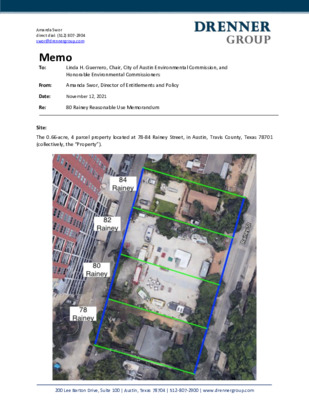
Amanda Swor direct dial: (512) 807-2904 swor@drennergroup.com Memo To: Re: Site: Linda H. Guerrero, Chair, City of Austin Environmental Commission, and Honorable Environmental Commissioners From: Amanda Swor, Director of Entitlements and Policy Date: November 12, 2021 80 Rainey Reasonable Use Memorandum The 0.66-acre, 4 parcel property located at 78-84 Rainey Street, in Austin, Travis County, Texas 78701 (collectively, the “Property”). 200 Lee Barton Drive, Suite 100 | Austin, Texas 78704 | 512-807-2900 | www.drennergroup.com Amanda Swor direct dial: (512) 807-2904 swor@drennergroup.com SITE CONDITIONS: Currently, the Property is being operated as follows: 1) 78 Rainey – Reina Cocktail Bar, 2) 80 Rainey – Food Truck Lot, 3) 82 Rainey – Food Truck Lot, and 4) 84 Rainey – General Office. REQUEST: There is one (1) heritage tree with a single stem over 30” in diameter, a 32.5” Pecan (Tree # 2145), that is being requested for removal. The tree is centrally located at the Property. See Exhibit A for the tree location. EXHIBIT A: Site Constraints Exhibit The tree location of 32.5’’ Pecan (Tree # 2145) combined with: (i) 18’-0” – minimum setback for Great Streets Master Plan Design along Rainey Street, (ii) 3’ setback from fire department access at 78 Rainey Street, (iii) 4’-0” Alley Setback for Drive Aisle, not including additionally requested alley easement by City of Austin, (iv) 3’-0” Setback for Fire Department Access and (v) preservation of the Rainey Street Bungalow at 78 Rainey Street. CONSTRAINTS: The Property consists of approximately 0.66 acres, or approximately 28,750 SF, is zoned CBD (Central Business District), and is located in the Rainey Street Subdistrict of the Downtown Austin Plan. The Rainey Street Subdistrict regulations (§25-2-739) create a maximum building height of forty (40) feet and a floor- to-area ration of 8:1 for residential or mixed-use buildings that do not both: (a) provide at least five (5%) percent of the dwelling units to persons whose household income is eighty percent (80%) or below the median family income (MFI) in the Austin metropolitan area, as further set forth in (§25-2-739(c)(4)) and (b) participate in the Downtown Density Bonus Program, as further set forth in (§25-2-739(c)(5)). As a requirement of the Downtown Density Bonus Program, the Great Streets Master Plan is triggered, 200 Lee Barton Drive, Suite 100 | Austin, Texas 78704 | 512-807-2900 | www.drennergroup.com Amanda Swor direct dial: (512) 807-2904 swor@drennergroup.com requiring the Property to have a setback of not less …
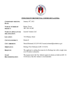
ITEM FOR ENVIRONMENTAL COMMISSION AGENDA COMMISSION MEETING DATE: January 19th, 2022 NAME & NUMBER OF PROJECT: Rainey Tower SPC-2021-0129C NAME OF APPLICANT OR ORGANIZATION: Lincoln Ventures LLC LOCATION: 78-84 Rainey Street COUNCIL DISTRICT: District 9 CITY ARBORIST: Naomi Rotramel (512) 974-9135 naomi.rotramel@austintexas.gov ORDINANCE: REQUEST: Heritage Tree Ordinance (LDC 25-8-641) The applicant is seeking the removal of a Heritage tree with a single stem over 30 inches in diameter. STAFF RECOMMENDATION: The request meets the City Arborist approval criteria set forth in LDC 25- 8-624(A)(2), thus the variance is recommended. Page 2 of 2 TO: FROM: DATE: MEMORANDUM City of Austin Environmental Commission Naomi Rotramel, City Arborist Program, Development Services Department January 19th, 2022 CASE FOLDER: SPC-2021-0129C REQUEST: The applicant is seeking the removal of a Heritage tree with a single stem over 30 inches in diameter. Project Description The subject property is located at 78-84 Rainey Street. The lot size is 0.6614 acres and is zoned CBD. The property is located in the Rainey Street – Waterfront overlay. The property is located in the Waller Creek and Lady Bird Lake watersheds, both classified as urban watersheds. The site is currently being operated as a Cocktail Lounge / Office with current impervious cover of 84%. The proposed use is for a 587 residential unit tower with retail, onsite parking and cocktail lounge with impervious cover of 92%. The applicant requested a predevelopment site consultation with the City Arborist. There are currently two Protected trees and three Heritage trees on site. One Protected tree and one Heritage tree are proposed to be removed. A 32.5 inch Heritage pecan is requested for removal and per Land Development Code would require a Land Use Commission variance. Tree Evaluation Tree 2145 Pecan Measurements The subject tree is one Heritage 32.5 inch pecan (#2145 / 5011) Canopy Conditions Unbalanced crown; thin canopy; 12+ limb breaks 3-6” diameter in canopy; heavily pruned likely due to several previous failures Structure / Trunk Page 2 of 2 Co-dominant leaders; previous 10” limb failure south side of trunk; previous 8” limb failure north side resulting in damage to roof and house of adjacent building; 27” longitudinal crack in main trunk (west side) 7 ft from grade. Tomography was done at the supporting union of the canopy, results indicate it may be structurally compromised. Root System Buried root flare – compacted 7-12” fill; damage to buttress root Overall Condition Fair condition; …

Rainey Tower SPC-2021-0129C January 19, 2022 Heritage Tree Variance Request NAME OF APPLICANT OR ORGANIZATION: Lincoln Ventures LLC LOCATION: 80 Rainey Street COUNCIL DISTRICT: District 9 CITY ARBORIST: NAOMI ROTRAMEL (512) 974-9135 NAOMI.ROTRAMEL@AUSTINTEXAS.GOV ORDINANCE: Heritage Tree Ordinance (LDC 25-8-641) REQUEST: The applicant is seeking the removal of a Heritage tree with a single stem over 30 inches in diameter. STAFF RECOMMENDATION: The request meets the City Arborist approval criteria set thus the variance is forth in LDC 25-8-624(A)(2), recommended. Reasonable Use • Heritage Tree Code Criteria • Project Description • Zoning • Site Constraints • Tree Evaluation • Staff Recommendation Heritage Tree Code Criteria The variance request is to allow removal of a Heritage tree with a stem greater than 30 inches as allowed under LDC § 25-8-643 and § 25-8- 624(A)(2) Project Description • • • • • The subject property is located at 80 Rainey Street. The lot size is 0.6614 acres and is zoned Central Business District (CBD). The property is located in the Waller Creek and Lady Bird Lake watersheds, both classified as urban watersheds. The site is currently being operated as a cocktail lounge/office with current impervious cover of 84%. The proposed use is for a 587 residential unit tower with retail, onsite parking and cocktail lounge with impervious cover of 92%. The applicant requested a predevelopment site consultation with the City Arborist. There are currently two Protected trees and three Heritage trees on site. One Protected tree and one Heritage tree are proposed to be removed. A 32.5 inch Heritage pecan is requested for removal and per Land Development Code would require a Land Use Commission variance. Zoning • Zoned Central Business District (CBD) • Waterfront Overlay Combining District • Participating in Downtown Density Bonus Program • Compliance with Rainey St. Subdistrict regulations and providing additional affordability • Green Building Mandatory • National Register of Historic Districts Zoning Code Compliance • Participating in Downtown Density Bonus Program §25-2-739(c)(4) and §25-2- 739(c)(5) • Compliance with Rainey St. Subdistrict regulations and providing additional affordability §25-2-739 • Participation in Great Streets Master Plan Site Constraints: Great Streets Master Plan • Requires 18 ft. setback along Rainey St. • • • • Limits the developable footprint 4’ alley setback for drive aisle 3’ setbacks both north and south sides of property from fire department Tree #2145 is centrally located at the property (middle third) Site Constrains- buildable floorplates …
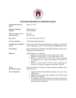
ITEM FOR ENVIRONMENTAL COMMISSION AGENDA COMMISSION MEETING DATE: January 19, 2022 NAME & NUMBER OF PROJECT: HEB Austin No 33 SP-2020-0400D NAME OF APPLICANT OR ORGANIZATION: Joe York Jones & Carter LOCATION: 12115 US-290, Austin, TX 78737 COUNCIL DISTRICT: NA (Extraterritorial jurisdiction) ENVIRONMENTAL REVIEW STAFF: Pamela Abee-Taulli, Environmental Program Coordinator, Development Services Department, 512.974.1879, pamela.abee-taulli@austintexas.gov WATERSHED: Bear Creek Watershed and Barton Creek Watershed, Barton Springs Zone, Drinking Water Protection Zone REQUEST: Variance requests are as follows: 1. Request to vary from LDC 25-8-341 to allow cut to 12 feet. 2. Request to vary from LDC 25-8-342 to allow fill to 21 feet. 3. Request to vary from LDC 25-8-302(A)(2) to allow construction of a parking area on a slope with a gradient of more than 15 percent. 4. Request to vary from LDC 25-8-301 to allow construction of a driveway on a slope with a gradient of more than 15 percent. STAFF RECOMMENDATION: Staff recommends these variances, having determined the findings of fact to have been met. STAFF CONDITION: 1. Applicant will restore illegal fill that currently exists on the site to 2. Applicant will use native plants appropriate for the Hill Country original grade. location for revegetation. 3. The applicant will provide mitigation in the form of payment or on-site plantings for removed trees with a diameter of 19 inches or greater at a rate of 100 percent. Development Services Department Staff Recommendations Concerning Required Findings Project Name: Ordinance Standard: Watershed Protection Ordinance Variance Request: HEB Austin No 33 Request to vary from LDC 25-8-341 to allow cut in excess of 4 feet (maximum cut 12 feet). Include an explanation with each applicable finding of fact. A. Land Use Commission variance determinations from Chapter 25-8-41 of the City Code: 1. The requirement will deprive the applicant of a privilege available to owners of similarly situated property with approximately contemporaneous development subject to similar code requirements. Yes The site descends from the northern boundary, at an elevation of 1195 feet above sea level, to the south-eastern corner, with an elevation of approximately 1089 feet. The project has a large footprint, comprised of a surface parking lot and grocery store. The size and layout are based on HEB’s standard practice for a suburban store. A development of similar scale, on a similarly situated property, subject to the same code requirements received similar variances. HEB 10, at 7901 US-290, Austin, TX 78736, …

HEB AUSTIN NO 33 Pamela Abee-Taulli Environmental Program Coordinator, Development Services Department 12115 US-290 SP-2020-0400D PROJECT LOCATION [ PROPERTY DATA • Bear Creek Watershed • Barton Springs Zone • Drinking Water Protection Zone • Extraterritorial Jurisdiction (Hays County) • No creeks or creek buffers; two (2) wetland Critical Environmental Features • Council District: NA [ VARIANCE REQUESTS Land Development Code § 25-8-341 - CUT REQUIREMENTS. (A) Cuts on a tract of land may not exceed four feet of depth. 1. The variance request is to allow cut over 4 feet to 12 feet. Land Development Code § 25-8-342 - FILL REQUIREMENTS. (A) Fill on a tract of land may not exceed four feet of depth. 2. The variance request is to allow fill over 4 feet to 21 feet. VARIANCE REQUESTS Land Development Code § 25-8- 302 - CONSTRUCTION OF A BUILDING OR PARKING AREA. (A) A (2) …a person may not construct: parking area on a slope with a gradient of more than 15 percent. 3. The variance request is to allow construction of a parking area on a slope with a gradient of more than 15 percent. Land Development Code § 25-8-301 - CONSTRUCTION OF A ROADWAY OR DRIVEWAY. (A) A person may not construct a roadway or driveway on a slope with a gradient of more than 15 percent unless the construction is necessary to provide primary access two contiguous acres with a gradient of 15 percent or less. 4. The variance request to allow construction of a driveway on a slope with a gradient of more than 15 percent. (1) at least to: is BACKGROUND 1195 feet at site descends boundary, from the The an northern to the elevation of 1195 feet, corner, with an south-eastern elevation of approximately 1089 feet. 1089 feet [ BACKGROUND 1195 feet The variances are necessitated by the naturally descending and terraced Hill-Country broadly slopes characteristic of the area. 1089 feet [ BACKGROUND the site has had For over a decade, unpermitted fill material, which changed both the topography and hydrology of the area, cutting off flow to a wetland critical environmental feature. Additionally, the Nutty Brown Café & Amphitheater had illegally expanded and increased its cover beyond the allowable limit. impervious NUTTY BROWN CAFÉ WETLAND ILLEGAL FILL AREAS WETLAND [ BACKGROUND the As part of this project, HEB will remove unpermitted development and the illegal fill. Areas outside of the …
Play video
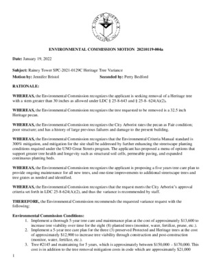
ENVIRONMENTAL COMMISSION MOTION 20210119-004a Date: January 19, 2022 RATIONALE: Subject: Rainey Tower SPC-2021-0129C Heritage Tree Variance Motion by: Jennifer Bristol Seconded by: Perry Bedford WHEREAS, the Environmental Commission recognizes the applicant is seeking removal of a Heritage tree with a stem greater than 30 inches as allowed under LDC § 25-8-643 and § 25-8- 624(A)(2). WHEREAS, the Environmental Commission recognizes the tree requested to be removed is a 32.5 inch Heritage pecan. WHEREAS, the Environmental Commission recognizes the City Arborist rates the pecan as Fair condition; poor structure; and has a history of large previous failures and damage to the present building. WHEREAS, the Environmental Commission recognizes that the Environmental Criteria Manual standard is 300% mitigation, and mitigation for the site shall be addressed by further enhancing the streetscape planting conditions required under the UNO Great Streets program. The applicant has proposed a menu of options that support greater tree health and longevity such as structural soil cells, permeable paving, and expanded continuous planting beds. WHEREAS, the Environmental Commission recognizes the applicant is proposing a five years tree care plan to provide ongoing maintenance for all new trees, and one-time improvements to additional streetscape trees and tree grates as needed and identified. WHEREAS, the Environmental Commission recognizes that the request meets the City Arborist’s approval criteria set forth in LDC 25-8-624(A)(2), and thus the variance is recommended by staff. THEREFORE, the Environmental Commission recommends the requested variance request with the following: Environmental Commission Conditions: 1. Implement a thorough 5-year tree care and maintenance plan at the cost of approximately $13,600 to increase tree viability over time for the eight (8) planted trees (monitor, water, fertilize, prune, etc.). 2. Implement a 5-year tree care plan for the three (3) preserved Protected and Heritage trees at the cost of approximately $12,900 to increase tree viability through construction and post-construction (monitor, water, fertilize, etc.). 3. Tree #2145 and maintaining for 5 years, which is approximately between $150,000 – $170,000. This cost is in addition to the tree removal mitigation costs in code which are approximately $21,000 1 (depending upon tree health valuation by staff), which we propose be used in on-site streetscape improvements. Therefore, we are proposing to provide an approximate total of $171,000 - $191,000 of improvements in lieu of preserving Tree #2145 for comprehensive and enhanced viability improvements to the pedestrian streetscape and paseo. 4. Ensure perpetual care of the remaining …
ENVIRONMENTAL COMMISSION MOTION 20210119-004b Date: Jan 19, 2022 Subject: HEB Austin No. 33, SP-2020-0400D Motion by: Jennifer Bristol Seconded by: Perry Bedford RATIONALE: WHEREAS, the Environmental Commission recognizes the applicant is requesting the Commission consider the following variance requests: 1. The variance request is to allow cut over 4 feet to 12 feet. 2. The variance request is to allow fill over 4 feet to 21 feet. 3. The variance request is to allow construction of a parking area on a slope with a gradient of more 4. The variance request is to allow construction of a driveway on a slope with a gradient of more than than 15 percent. 15 percent. WHEREAS, the Environmental Commission recognizes this action concerns land located in the Bear Creek in the Barton Springs Zone; and WHEREAS, the Environmental Commission recognizes that City of Austin staff recommends approval of the variance requests with conditions. Therefore, the Environmental Commission recommends approval of the request with the following Staff Conditions: 1. Applicant will restore illegal fill that currently exists on the site to the original grade. 2. Applicant will use native plants appropriate for the Hill Country location for revegetation. 3. The applicant will provide mitigation in the form of payment or on-site plantings for removed trees with a diameter of 19 inches or greater at a rate of 100%. 1 VOTE: 7-0 For: Perry Bedford, Haris Qureshi, Rachel Scott, Pam Thompson, Linda Guerrero, Jennifer Bristol, and Audrey Barrett Bixler Against: None Abstain: None Recuse: None Absent: Kevin Ramberg and Richard Brimer Approved By: Linda Guerrero, Environmental Commission Chair 2
ENVIRONMENTAL COMMISSION MEETING MINUTES Wednesday, January 19, 2022 The Environmental Commission convened in a public meeting on Wednesday, January 19, 2022 City Hall in Council Chambers at 301 W. 2nd Street, Austin, Texas 78701. Commissioners attending in person: Perry Bedford Haris Qureshi Rachel Scott Jennifer Bristol Audrey Barrett Bixler Commissioner attending remotely: Pam Thompson Commissioners absent: Rick Brimer Kevin Ramberg Staff in Attendance: Pamela Abee-Taulli Kaela Champlin Katie Coyne Greg Dutton Liz Johnston Keith Mars Mike McDougal Jorge Morales Anna Lan Naomi Rotramel CALL TO ORDER Chair Guerrero called the meeting to order at 6:09 P.M. CITIZEN COMMUNICATION: GENERAL Speakers should sign up to speak prior to the meeting being called to order; you will receive a three-minute allotment to discuss topics not posted on the agenda. Speakers Robert Kleeman 1. APPROVAL OF MINUTES AND ACTION 1 2. 3. 4. PUBLIC HEARINGS a. Approval of the December 1, 2021 Environmental Commission Regular Meeting Minutes (5 minutes) A motion to approve the December 1, 2021 Environmental Commission Regular Meeting Minutes were approved on Commissioner Bedford’s motion, Commissioner Bixler’s second on a 7-0 vote. Commissioners Brimer and Ramberg were absent. STAFF UPDATES a. Recognize Katie Coyne for her service on the Environmental Commission and her appointment as Watershed Protection Department's Environmental Officer and Assistant Director of the Watershed Protection Department over Planning, Monitoring, and Compliance branch of divisions—Jorge Morales, Director, Watershed Protection Department (10 minutes) Item conducted as posted. No action taken. ITEMS FOR CONSIDERATION AND POSSIBLE ACTION a. Presentation on Equitable Transit-Oriented Development strategies for Project Connect—Anna Lan, Principal Planner, Capital Metropolitan Transportation Authority and Warner Cook, Senior Planner, Housing and Planning Department (30 minutes) Item conducted as posted. No action taken. a. Name: Rainey Tower SPC-2021-0129C Applicant: Lincoln Ventures LLC Location (address): 78-84 Rainey Street Austin, Texas 78701 Council District: District 9 Watershed: Waller Creek and Lady Bird Lake Request: The applicant is seeking the removal of a Heritage tree with a single stem over Staff: Naomi Rotramel, City Arborist, Development Services Department 30 inches in diameter. Staff Recommendation: The request meets the City Arborist approval criteria set forth in LDC 25-8-624(A)(2), thus the variance is recommended. (30 minutes) Speakers Dave Anderson A motion to close the public hearing was approved on Commissioner Scott’s motion, Commissioner Bedford’s second on a 7-0 vote. Commissioners Brimer and Ramberg were absent. A motion to support the variance request with conditions was approved on …
1. 2. Regular Meeting of the Environmental Commission December 1, 2021 at 6:00 P.M. Austin City Hall, Council Chambers, Room 1001 301 W. 2nd Street, Austin, Texas 78701 Some members of the Environmental Commission may be participating by videoconference. The meeting may be viewed online at: http://www.austintexas.gov/page/watch-atxn-live COMMISSIONERS: Haris Qureshi (D-1) Rachel Scott (D-2) Pam Thompson (D-3) Vacant (D-4) Vacant (D-6) Audrey Barrett Bixler (D-5) Linda Guerrero (D-9) Chair _________________________________________________________________________________ Jennifer Bristol (D-7) Secretary Perry Bedford (Mayor) Richard Brimer (D-10) Kevin Ramberg (D-8) Vice-Chair Agenda CALL TO ORDER CITIZEN COMMUNICATION: GENERAL Speakers should sign up to speak prior to the meeting being called to order; you will receive a three-minute allotment to discuss topics not posted on the agenda. APPROVAL OF MINUTES AND ACTION a. Approval of the November 17, 2021 Environmental Commission Regular Meeting Minutes (5 minutes) STAFF UPDATES a. Update on amendments to City Code section 2.1 regarding rules for conducting remote/hybrid Board and Commission meetings—Kaela Champlin, Environmental Program Coordinator, Watershed Protection Department (5 minutes) 1 3. ITEMS FOR CONSIDERATION AND POSSIBLE ACTION a. Presentation on changes to improve issues with erosion-sedimentation controls in the Zilker/Barton Hills neighborhood—David Chapman, Environmental Compliance Supervisor, Development Services Department (30 minutes) b. Briefing on the Sound Ordinance—David Chapman, Environmental Compliance Supervisor, and Brian Block, Program Manager, Development Services Department (30 minutes) c. Make a recommendation regarding the creation, continuation, or termination and status of Lady Bird Lake concessions contained in the 2021 Annual Report of City of Austin/Parks and Recreation Department Managed Concessions on Town Lake— Margaret Stenz, Contract Management Specialist, Parks and Recreation Department (30 minutes) 4. COMMITTEE REPORTS a. Urban Forestry Committee –Pam Thompson, Richard Brimer, and Linda Guerrero b. Report on the Joint Sustainability Committee – Audrey Barrett Bixler c. Report on the Balcones Canyonlands Conservation Plan Citizen’s Advisory Committee – Kevin Ramberg d. Report on the Joint Committee of the Environmental Commission and Parks and Recreation Board –Linda Guerrero, Pam Thompson, and Rachel Scott e. Report on the South Central Waterfront Advisory Board – Linda Guerrero f. Other Updates: Update on Building Austin Tougher Strategic Initiative – Rachel Scott FUTURE AGENDA ITEMS ADJOURNMENT The City of Austin is committed to compliance with the American with Disabilities Act. Reasonable modifications and equal access to communications will be provided upon request. Meeting locations are planned with wheelchair access. If requiring Sign Language Interpreters or alternative formats, please give notice at …

Environmental Inspections 12/01/2021 David Chapman Environmental Division Manager 1 Objective FY2020: Top 10 Accomplishments • Erosion and Sediment Control (ESC) • Types of ESC’s • Inspection & Enforcement • Resources & Reference 2 Erosion & Sediment Controls FY2020: Top 10 Accomplishments What are Erosion and Sediment Controls? • Temporary Erosion and Sediment Control (ESC) is the practice of preventing or reducing the movement of sediment from a site during construction through the implementation of man-made structures, land management techniques, or natural processes. • ESC’s are installed at the perimeter of the construction site. 3 FY2020: Top 10 Accomplishments Rainfall Design MuniCode 2.3.0 Drainage Criteria Manual 4 Types of ESC’s FY2020: Top 10 Accomplishments Common types of ESC’s used within the City of Austin include (refer to MuniCode for design standards and allowances): 1. Mulch Socks 2. Silt Fence 3. Triangular Sediment Filter Dike 5 FY2020: Top 10 Accomplishments Mulch Socks 6 FY2020: Top 10 Accomplishments Silt Fence 7 FY2020: Top 10 Accomplishments Triangular Sediment Dike 8 FY2020: Top 10 Accomplishments Innovative Designs 9 FY2020: Top 10 Accomplishments Tree Protection 10 Inspection & Enforcement FY2020: Top 10 Accomplishments • • • • • • • Routine Inspections • • Residential = 1201 Commercial = 1285 Called Inspections • Enforcement of Non-Compliance • 311 Complaints • Emails Phone calls Weather Event Inspections • Hot Spots Average 5 more inspections per month from last year Average 550 Residential Tree Inspections Monthly • Average 801 Residential EV Inspections Monthly • Average 492 more inspections per month from last year 496 Total Complaints (117 Complaints lower then last year) 11 FY2020: Top 10 Accomplishments Enforcement of Non-Compliance 1. MuniCode Section 25-1-441, city inspector is responsible for environmental regulations and can take enforcement action for non-compliance with erosion and sedimentation requirement on a project site. 2. Enforcement Process: 1. Verbal – projects with required development permit/site plan where routine inspections reveal inadequacies in the controls, a verbal warning to the responsible personnel at the site is issued. – 1238 FY21 , 874 FY20 2. Written – 24 hours from the verbal warning, the deficiencies are not corrected, the inspector may deliver a written notice of non-compliance. – 134 FY21, 182 FY 20 Stop Work Order –24 hours, the deficiencies are not corrected, the inspector can issue a Stop Work Order to stop work on the project until the deficiencies are corrected. – 15 FY21, 33FY20 3. …

Amplified Sound Process 12/01/2021 Brian Block Entertainment Services Manager David Chapman Environmental Division Manger 1 Welcome FY2020: Top 10 Accomplishments • Chapter 9-2 Noise & Amplified Sound • General Restrictions • Outdoor Amplified Sound Permit Types • Review Process • Enforcement Process • Resources & Reference 2 FY2020: Top 10 Accomplishments Chapter 9-2 Noise & Amplified Sound General Restrictions • Noise may not be audible to an adjacent business or residence between 10:30pm-7:00am • At a business, sound equipment is limited to 85dB between 10:00am-2:00am, and may not be audible at the property line of the business between 2:00am-10:00am • In a residential area, sound equipment is limited to 75 dB from 10:00am-10:00pm and may not be audible beyond the property line from 10:00pm-10:00am • Businesses and Events can get a permit for the use of sound equipment that exempts them from the general restrictions 3 FY2020: Top 10 Accomplishments Outdoor Amplified Sound Permit Types • Outdoor Music Venue Permit (OMV) • Outdoor Amplified Sound at commercial establishments on a regular or recurring basis • Annual operating permit issued for outdoor amplified sound • Temporary Use of Sound Equipment • Outdoor Amplified Sound at commercial establishments on an event-by-event basis • Temporary permit for events and activities with outdoor amplified sound at permanent establishments that don’t require a Special Event Permit • Outdoor Amplified Sound at Special Events • Outdoor amplified sound at events is typically approved through the special event permit required for all special events • City Code Chapter 4-20 (Special Events) 4 Review Process FY2020: Top 10 Accomplishments (Entertainment Services Group) The purpose of the Outdoor Music Venue (OMV) permit is to assess and limit impacts to the surrounding community and to support both outdoor amplified sound at establishments and residential quality of life Every OMV permit includes a sound impact plan that specifies the allowances and restrictions for decibel limits and operating hours, as well as other details that the establishment must comply with City code sets maximum sound level and hours for different locations and contexts, and the criteria for the review. Staff conducts the review and customizes allowances and restrictions in a customized and context sensitive way based on the review criteria 5 Review Process FY2020: Top 10 Accomplishments (Entertainment Services Group) 1. Review for potential impacts to surrounding community may include a) On-site inspections, sound measurements, discussions with nearby residents and business owners; …
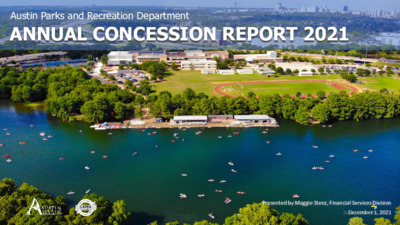
Austin Parks and Recreation Department ANNUAL CONCESSION REPORT 2021 Presented by Maggie Stenz, Financial Services Division December 1, 2021 AUSTIN CITY CODE Austin City Code § 8-1-73 requires delivery of an annual report to the Parks and Recreation Board and the Environmental Commission providing the following information regarding concessions on Lady Bird Lake Park: • Name and Location • Income and Expenditures • Total Number of Boats Rented • Environmental Concerns 2 Austin Rowing Club / Waller Creek Boathouse Name and Locations Butler Pitch & Putt EpicSUP Expedition School Lone Star Riverboat Cruises Rowing Dock Texas Rowing Center Zilker Café (temporarily closed) Zilker Park Boat Rentals Zilker Eagle Railroad (temporarily closed) 3 3 FY21 Gross Sales, Expenditures, and Payments to the City *Business Expenses, IRS Publication 535 4 Annual Gross Sales Since 2014 5 5 Capital Improvements Butler Pitch and Putt – $829,500 • Green restoration and irrigation improvements • Clubhouse remodeling • New restrooms and maintenance shed • Upgrades to HVAC, plumbing, and electrical • Upgrades to landscaping and hardscaping Texas Rowing Center – $93,343 Boathouse / Dock Construction • Completed multi-year $1.1 million floating boathouse project Totals – $922,843 6 Boat Inventory Type of Boat Kayaks Canoes Rowing Shells Stand-up Paddle Boards (SUPs) Coaching Boats / Launches Electric Boats Total (not including coaching launches) 150 105 0 53 10 15 Austin Rowing Club EpicSUP Expedition School Rowing Dock Texas Rowing Center Zilker Park Boat Rentals 27 116 0 0 0 0 39 40 7 0 0 0 161 156 23 0 0 0 203 462 23 151 11 0 75 62 56 0 0 0 323 143 86 340 839 193 Total Boat Inventory by Fiscal Year FY16 | 1456 FY17 | 1794 FY18 | 1694 FY19 | 1597 FY20 |1640 FY21 |1924 7 Zilker Park Boat Rentals 2006 2022 5 5 5 1 1 Contract Terms Concession Contract Begin Contract 0 0 0 End 2 Rowing Dock 2000 2022 2 Austin Rowing Club 2012 2023 EpicSUP* 2013 2023 Lone Star Riverboat 2015 2025 Butler Pitch & Putt 2019 2029 Texas Rowing Center 2020 2030 5 2 0 2 0 3 0 2 5 3 0 2 5 0 0 2 5 0 1 0 2 5 0 2 0 2 5 5 1 0 2 5 5 2 4 5 2 . o m 6 2 5 5 10 10 10 5 5 5 5 5 5 …
Play video
ENVIRONMENTAL COMMISSION MOTION 20211201 003a Date: December 1, 2021 Subject: Development Services Department’s changes and improvements to erosion and sedimentation controls Motion by: Kevin Ramberg RATIONALE: WHEREAS, the Environmental Commission appreciates the Development Services Department’s (DSD) changes and improvements to erosion and sedimentation controls citywide and in the Zilker Barton Hills Neighborhoods; and WHEREAS, the Environmental Commission appreciates the inspection report and presentation. THEREFORE, the Environmental Commission recommends: Seconded by: Linda Guerrero 1) DSD continue to improve erosion and sedimentation control types and implementation, tree inspection training, and arborist collaboration and certifications; 2) DSD continue to brief the Environmental Commission (at a minimum annually) on inspections and improvements related to erosion and sedimentation and tree protection citywide; and 3) DSD continue public outreach to communicate the best process to report concerns. VOTE 8-1 Approved By: For: Bedford, Qureshi, Scott, Barrett Bixler, Bristol, Ramberg, Guerrero, and Brimer Against: Thompson Abstain: None Recuse: None Absent: None Linda Guerrero, Environmental Commission Chair 1