02 C14-2026-0009 - 11819 IH-35 Zoning - 7.71 acres; District 5 - Staff Report — original pdf
Backup
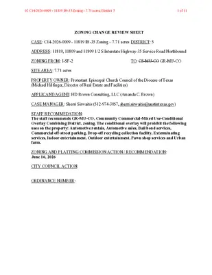
ZONING CHANGE REVIEW SHEET CASE: C14-2026-0009 - 11819 IH-35 Zoning – 7.71 acres DISTRICT: 5 ADDRESS: 11819, 11809 and 11809 1/2 S Interstate Highway-35 Service Road Northbound ZONING FROM: I-SF-2 SITE AREA: 7.71 acres TO: CS-MU-CO GR-MU-CO PROPERTY OWNER: Protestant Episcopal Church Council of the Diocese of Texas (Michael Hilfinger, Director of Real Estate and Facilities) APPLICANT/AGENT: HD Brown Consulting, LLC (Amanda C. Brown) CASE MANAGER: Sherri Sirwaitis (512-974-3057, sherri.sirwaitis@austintexas.gov) STAFF RECOMMEDATION: The staff recommends GR-MU-CO, Community Commercial-Mixed Use-Conditional Overlay Combining District, zoning. The conditional overlay will prohibit the following uses on the property: Automotive rentals, Automotive sales, Bail bond services, Commercial off-street parking, Drop-off recycling collection facility, Exterminating services, Indoor entertainment, Outdoor entertainment, Pawn shop services and Urban farm. ZONING AND PLATTING COMMISSION ACTION / RECOMMENDATION: June 16, 2026 CITY COUNCIL ACTION: ORDINANCE NUMBER: 02 C14-2026-0009 - 11819 IH-35 Zoning - 7.71 acres; District 51 of 11 C14-2026-0009 ISSUES: N/A CASE MANAGER COMMENTS: 2 The property under consideration is 7.71 acre undeveloped lot that takes access to the Interstate Highway-35 Northbound Service Road. This tract of land was granted an Interim-SF-2 designation when it was annexed by the city in 2014. The lots to the north, south and east have multifamily zoning (MF-2-CO and MF-4 respectively). To the west there is a religious assembly use (St. Alban’s Episcopal Church) that is located in the county and ROW/Interstate Highway-35. The applicant is requesting to establish permanent commercial-mixed use zoning to develop a retail use/service station at this location (please see Applicant's Request Letter - Exhibit C). The staff is recommending Community Commercial-Mixed Use-Conditional Overlay Combining District zoning as the property backs up to a multifamily development and will have a secondary access to Mayall Trail, a level 1/Residential designated street. The proposed GR-MU-CO zoning is consistent with planning principles as this site takes its primary access to the IH-35 frontage road and will provide services to the surrounding residential developments and the community at large. The applicant has proposed a conditional overlay to prohibit the more intensive commercial uses as the planned retail development will be adjacent to multifamily residential uses. The applicant agrees with the staff’s recommendation. BASIS OF RECOMMENDATION: 1. The proposed zoning should be consistent with the purpose statement of the district sought. Community Commercial district is intended for office and commercial uses serving neighborhood and community needs, including both unified shopping centers and individually developed commercial sites, and typically requiring locations accessible from major traffic ways. Mixed Use combining district is intended for combination with selected base districts, in order to permit any combination of office, retail, commercial, and residential uses within a single development. Conditional Overlay combining district may be applied in combination with any base district. The district is intended to provide flexible and adaptable use or site development regulations by requiring standards tailored to individual properties. 2. The proposed zoning should promote consistency and orderly planning. The proposed GR-MU-CO zoning is consistent with planning principles as this site takes its primary access to the IH-35 frontage road and will provide services to the surrounding residential developments. The applicant has proposed a conditional overlay to prohibit the more intensive commercial uses on this property as the planned retail development will be adjacent to multifamily residential uses. 02 C14-2026-0009 - 11819 IH-35 Zoning - 7.71 acres; District 52 of 11 C14-2026-0009 3 EXISTING ZONING AND LAND USES: ZONING LAND USES I-SF-2 Site North MF-2-CO South MF-4 East MF-4 West County Undeveloped Multifamily (Cascades Onion Creek) Multifamily (Bridge at Three Hills) Multifamily (Cascades Onion Creek) Religious Assembly (St. Alban’s Episcopal Church) NEIGHBORHOOD PLANNING AREA: N/A WATERSHED: Onion Creek CAPITOL VIEW CORRIDOR: No SCENIC ROADWAY: No NEIGHBORHOOD ORGANIZATIONS: Austin Independent School District Del Valle Community Coalition Friends of Austin Neighborhoods Onion Creek Homeowners Association SCHOOLS: Austin I.S.D. Blazier Elementary School Paredes Middle School Akins High School AREA CASE HISTORIES: NUMBER C14-2020-0053 – Cascades – Hilltop REQUEST I-SF-2, MF-2-CO to MF-4 COMMISSION 8/04/2020: Approved MF-4 district zoning, as staff recommended (10- 0); A. Denkler; D. King-2nd. CS-MU-CO to MF-4 To grant MF-4 C14-2018-0127 – IH 35 Apartments – 12001 South IH 35 Service Road Northbound CITY COUNCIL 8/27/2026: The public hearing was conducted and a motion to close the public hearing and approve Ordinance No. 20200827-106 for MF-4 district zoning was approved on Mayor Pro Tem Garza's motion, Council Member Pool's second on a 11-0 vote. 1-31-19: Approved MF-4 as Commission recommended. 02 C14-2026-0009 - 11819 IH-35 Zoning - 7.71 acres; District 53 of 11 C14-2026-0009 C14-06-0191 – Fox Hill – 11421 – 11717 S IH-35 Service Road NB (87.884 acres) C14-04-0044 & C14-04-0045 – Onion Creek Tracts 1 and 2 – 2510 Onion Creek Pkwy RELATED CASES: 4 I-RR to RR for Tract 1; MF-2- CO w/CO limited to 12 units per acre for Tract 2 I-RR to CR To grant RR-CO for Tract 1 w/CO limiting permitted improvements to drainage, underground utility improvements, hike and bike trails, etc. and MF- 2-CO for Tract 2, w/CO limiting development to 12 u.p.a., and the conditions of the TIA To grant CR-CO w/CO for list of prohibited uses 4-19-2007: Approved RR- CO for Tract 1 and MF-2-CO for Tract 2 as Commission recommended. 5-6-004: Approved CR- CO as Commission recommended C12M-2013-0001 - Cascades Municipal Utility District (MUD) C8S-85-079 Subdivision Case 02 C14-2026-0009 - 11819 IH-35 Zoning - 7.71 acres; District 54 of 11 C14-2026-0009 5 OTHER STAFF COMMENTS: Comprehensive Planning Project Name and Proposed Use: 11819 S IH 35 SERVICE ROAD NB. C14-2026-0009. Project: 11819 IH 35 Rezoning. 7.71 acres from I-SF-2 to CS-CO-MU. Existing: undeveloped. Proposed: service station (fuel pumps). Yes Imagine Austin Decision Guidelines Complete Community Measures * Imagine Austin Growth Concept Map: Located within or adjacent to an Imagine Austin Activity Center, Imagine Austin Activity Corridor, or Imagine Austin Job Center as identified the Growth Concept Map. Names of Activity Centers/Activity Corridors/Job Centers *: Mobility and Public Transit *: Located within 0.25 miles of public transit stop and/or light rail station. Y Mobility and Bike/Ped Access *: Adjoins a public sidewalk, shared path, and/or bike lane. Sidewalk present on Mayall Trl • Connectivity, Good and Services, Employment *: Provides or is located within 0.50 miles to goods and services, and/or employment center. Connectivity and Food Access *: Provides or is located within 0.50 miles of a grocery store/farmers market. Connectivity and Education *: Located within 0.50 miles from a public school or university. Connectivity and Healthy Living *: Provides or is located within 0.50 miles from a recreation area, park or walking trail. Connectivity and Health *: Provides or is located within 0.50 miles of health facility (ex: hospital, urgent care, doctor’s office, drugstore clinic, and/or specialized outpatient care.) Housing Choice *: Expands the number of units and housing choice that suits a variety of household sizes, incomes, and lifestyle needs of a diverse population (ex: apartments, triplex, granny flat, live/work units, cottage homes, and townhomes) in support of Imagine Austin and the Strategic Housing Blueprint. Housing Affordability *: Provides a minimum of 10% of units for workforce housing (80% MFI or less) and/or fee in lieu for affordable housing. Mixed use *: Provides a mix of residential and non-industrial uses. Culture and Creative Economy *: Provides or is located within 0.50 miles of a cultural resource (ex: library, theater, museum, cultural center). Culture and Historic Preservation: Preserves or enhances a historically and/or culturally significant site. Creative Economy: Expands Austin’s creative economy (ex: live music venue, art studio, film, digital, theater.) Workforce Development, the Economy and Education: Expands the economic base by creating permanent jobs, especially in industries that are currently not represented in a particular area or that promotes a new technology, and/or promotes educational opportunities and workforce development training. Industrial Land: Preserves or enhances industrial land. Y Not located over Edwards Aquifer Contributing Zone or Edwards Aquifer Recharge Zone 2 Number of “Yes’s” 02 C14-2026-0009 - 11819 IH-35 Zoning - 7.71 acres; District 55 of 11 C14-2026-0009 Drainage 6 The developer is required to submit a pre- and post-development drainage analysis at the subdivision and site plan stage of the development process. The City’s Land Development Code and Drainage Criteria Manual require that the Applicant demonstrate through engineering analysis that the proposed development will have no identifiable adverse impact on surrounding properties. Environmental The site is not located over the Edwards Aquifer Recharge Zone. The site is in the Onion Creek Watershed of the Colorado River Basin, which is classified as a Suburban Watershed by Chapter 25-8 of the City's Land Development Code. The site is in the Desired Development Zone. Under current watershed regulations, development or redevelopment on this site will be subject to the following impervious cover limits: Development Classification % of Gross Site Area % of Gross Site Area Single-Family (minimum lot size 5750 sq. ft.) Other Single-Family or Duplex Multifamily Commercial 50% 55% 60% 80% with Transfers 60% 60% 70% 90% According to floodplain maps there is no floodplain within or adjacent to the project location. Standard landscaping and tree protection will be required in accordance with LDC 25-2 and 25-8 for all development and/or redevelopment. At this time, site specific information is unavailable regarding vegetation, areas of steep slope, or other environmental features such as bluffs, springs, canyon rimrock, caves, sinkholes, and wetlands. Under current watershed regulations, development or redevelopment requires water quality control with increased capture volume and control of the 2 year storm on site. At this time, no information has been provided as to whether this property has any preexisting approvals that preempt current water quality or Code requirements. Fire No comments. 02 C14-2026-0009 - 11819 IH-35 Zoning - 7.71 acres; District 56 of 11 C14-2026-0009 Parks and Recreation 7 Parkland dedication fees may apply to any future site or subdivision applications resulting from this rezoning. As of January 1, 2024, new commercial, non-residential uses are not subject to parkland dedication requirements at the time of site plan and subdivision. Note that Heatherly Pocket Park is to the south of this site. Please ensure that any development that could result from this rezoning will not impact this parkland. Site Plan FYI: All comments regarding the effects of the proposed rezoning on subsequent Site Plan Review applications are intended to assist in identifying potential development constraints but do not include all regulations which may affect a specific proposal. Changes to property boundaries and requests for development cannot include all regulatory limitations which may apply to a specific subject to modification or reconsideration if affected by a change in property boundaries or if development is proposed on only a portion of the land proposed for rezoning. These comments are intended to assist in identifying potential development constraints, but do not address the actual restrictions which will apply to a specific development proposal. Austin Development Services offers a variety of pre- application review options to assist in evaluating specific development proposals prior to Site Plan Application. Site plans will be required for any new development except for residential only projects with up to 4 units. Any new development is subject to Subchapter E. Design Standards and Mixed Use. Additional comments will be made when the site plan is submitted. Transportation Additional right-of-way maybe required at the time of subdivision and/or site plan. 02 C14-2026-0009 - 11819 IH-35 Zoning - 7.71 acres; District 57 of 11 C14-2026-0009 8 The adjacent street characteristics table is provided below: Name ASMP Classification ASMP Required ROW Existing ROW Existing Pavement Sidewalks Bicycle Route Capital Metro (within ¼ mile) Mayall Trail Leve 1 58’ Varies 40’ Yes No No Varies Varies No Yes No S IH 35 Service Road NB Level 4 Coord. With TxDOT Water Utility No comments on zoning change. FYI: The landowner intends to serve the site with existing City of Austin water utilities. Depending on the development plans submitted, water and or wastewater service extension requests may be required. All water and wastewater construction must be inspected by the City of Austin. For more information pertaining to the Service Extension Request process and submittal requirements contact the Austin Water SER team at ser@austintexas.gov. INDEX OF EXHIBITS TO FOLLOW A: Zoning Map B. Aerial Map C. Applicant’s Request Letter 02 C14-2026-0009 - 11819 IH-35 Zoning - 7.71 acres; District 58 of 11 EXHIBIT A 02 C14-2026-0009 - 11819 IH-35 Zoning - 7.71 acres; District 59 of 11 EXHIBIT B 02 C14-2026-0009 - 11819 IH-35 Zoning - 7.71 acres; District 510 of 11 EXHIBIT C Via Electronic Submittal June 2, 2026 Lauren Middleton-Pratt City of Austin Planning Department 6310 Wilhelmina Delco Drive Austin, TX 78752 RE: Amended zoning request for a 7.7 acre portion of 11819 and portion of 11819 1/2 S IH 35 SVRD NB; Case # C14-2026-0009; A portion of TCAD Parcel 352004 (the “Property”) Dear Mrs. Middleton-Pratt: As representatives of the owner of the above stated Property, we respectfully submit an application for zoning for the Property. The current zoning is Interim Single Family (I-SF-2) and the proposed rezoning is Community Commercial-Mixed Use-Conditional Overlay (GR-MU-CO). The purpose of the rezoning is to allow for a commercial retail development. To maintain compatibility with the area, the proposed conditional overlay will prohibit the following uses, otherwise permitted in the GR zoning district: Automotive rentals, Automotive sales, Bail bond services, Commercial off-street parking, Drop-off recycling collection facility, Exterminating services, Indoor entertainment, Outdoor entertainment, Pawn shop services and Urban farm The Property is not within a Neighborhood Plan, therefore no FLUM amendment is not required. The surrounding zoning is MF-4 to the north and east, ETJ to the south, and IH 35 to the west. The surrounding uses are multi-family to the north across from Mayall Trail and east, IH 35 to the west, and a church to the south. If you have any questions regarding this request or need additional information, please do not hesitate to contact me at your convenience. Very truly yours, Amanda Couch Brown 214-695-9219 | AMANDA.BROWN@HDBROWNCONSULTING.COM | HDBROWNCONSULTING.COM02 C14-2026-0009 - 11819 IH-35 Zoning - 7.71 acres; District 511 of 11