02 C14-2025-0075 - Wehmeier 3.0; District 5 - Staff Report — original pdf
Backup
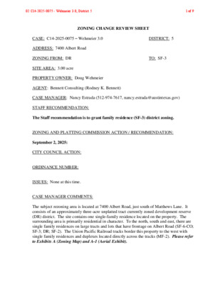
ZONING CHANGE REVIEW SHEET CASE: C14-2025-0075 – Wehmeier 3.0 DISTRICT: 5 ADDRESS: 7400 Albert Road ZONING FROM: DR SITE AREA: 3.00 acre PROPERTY OWNER: Doug Wehmeier AGENT: Bennett Consulting (Rodney K. Bennett) TO: SF-3 CASE MANAGER: Nancy Estrada (512-974-7617, nancy.estrada@austintexas.gov) STAFF RECOMMENDATION: The Staff recommendation is to grant family residence (SF-3) district zoning. ZONING AND PLATTING COMMISSION ACTION / RECOMMENDATION: September 2, 2025: CITY COUNCIL ACTION: ORDINANCE NUMBER: ISSUES: None at this time. CASE MANAGER COMMENTS: The subject rezoning area is located at 7400 Albert Road, just south of Matthews Lane. It consists of an approximately three-acre unplatted tract currently zoned development reserve (DR) district. The site contains one single-family residence located on the property. The surrounding area is primarily residential in character. To the north, south and east, there are single family residences on large tracts and lots that have frontage on Albert Road (SF-6-CO; SF-3; DR; SF-2). The Union Pacific Railroad tracks border this property to the west with single family residences and duplexes located directly across the tracks (MF-2). Please refer to Exhibits A (Zoning Map) and A-1 (Aerial Exhibit). 02 C14-2025-0075 - Wehmeier 3.0; District 51 of 9 C14-2025-0075 Page 2 The Applicant is requesting to rezone the subject property from development reserve (DR) district to family residence (SF-3) district zoning. The new HOME amendments will allow up to three dwelling units per lot. Currently, an addition to the existing single family residence is being proposed. Staff is recommending (SF-3) district zoning because it is compatible with the existing mix of residential zoning and housing types in the neighborhood. BASIS OF RECOMMENDATION: 1. The proposed zoning should be consistent with the purpose statement of the district sought. The family residence (SF-3) district zoning is the designation for a moderate density single-family residential use and a duplex use on a lot that is a minimum of 5,750 square feet. An SF-3 district designation may be applied to a use in an existing single-family neighborhood with moderate sized lots or to new development of family housing on lots that are 5,750 square feet or more. Up to three units are permitted under single-family residential development standards. 2. Zoning changes should promote compatibility with adjacent and nearby uses. Staff is recommending family residence (SF-3) district zoning for the subject property. The proposed zoning is consistent and compatible with the surrounding zoning and residential uses in this neighborhood. The tract meets the intent of the (SF-3) district as it fronts on a local residential street and is located within an established single family neighborhood. There are other (SF-3) zoned properties along Albert Road and on streets in the vicinity. EXISTING ZONING AND LAND USES: Site North ZONING DR SF-6-CO; DR; SF-2 South DR; SF-6 East SF-3; DR; SF-3-CO; SF-1 LAND USES One single family residence Single family residences on large lots and tracts; Convenience storage Single family residences on large lots and tracts Single family residences on large lots and tracts West MF-2; MF-2-CO Railroad tracks; Single family residences; Duplexes NEIGHBORHOOD PLANNING AREA: N/A WATERSHEDS: Williamson Creek – Suburban CAPITOL VIEW CORRIDOR: No SCENIC ROADWAY: No 02 C14-2025-0075 - Wehmeier 3.0; District 52 of 9 C14-2025-0075 Page 3 SCHOOLS: Austin Independent School District Casey Elementary School Bedichek Middle School Akins High School COMMUNITY REGISTRY LIST: Matthews Lane Neighborhood Association Onion Creek Homeowners Association SouthbridgeVillas Homeowners Association South Austin Neighborhood Alliance (SANA) Homeless Neighborhood Association TNR BCP – Travis County Naturel Resources AREA CASE HISTORIES: Austin Neighborhoods Council Austin Independent School District Friends of Austin Neighborhoods Preservation Austin Go!Austin Vamos!Austin 78745 NUMBER REQUEST COMMISSION CITY COUNCIL C14-2023-0014 – 7306 Albert Rd DR to SF-6 C14-2023-0006 – 7500 Wynne Lane C14-2022-0110 – 7605 Albert Rd MH to SF-3 DR to SF-6 DR to SF-6 To grant SF-6-CO limiting the number of units to 7 per acre To grant SF-3 To grant SF-6-CO limiting the number of units to 9 per acre To grant SF-6 SF-3 to SF-6 To grant SF-6 DR to SF-3 To grant SF-3-CO DR to SF-3 To grant SF-3 DR to SF-3 To grant SF-3 C14-2022-0100 – 7606 Albert Rd C14-2023-0032 – 1512 Damon Rd C14-2022-0056 – 7415 Albert Rd C14-2022-0004 – 1501 Damon Rd C14-2021-0060 – Albert Road Rezone – 7401 and 7407 Albert Rd RELATED CASES: There are no subdivision or site plan cases on the subject property. Apvd SF-6-CO (8-31-2023). Apvd SF-3 (5-4-2023). Apvd SF-6-CO (5-4-2023). Apvd SF-6 (1-18-2024). Apvd SF-6 (1-18-2024). Apvd SF-3-CO w/CO limited to 7 dwelling units & single shared driveway cut (10-13-2022). Apvd SF-3-CO w/CO prohibiting duplex (4-7-2022). Apvd SF-3 (8-26-2021). 02 C14-2025-0075 - Wehmeier 3.0; District 53 of 9 C14-2025-0075 Page 4 ADDITIONAL STAFF COMMENTS: Comprehensive Planning Project Name and Proposed Use: 7400 ALBERT ROAD. C14-2025-0075. Project: WEHMEIER 3.0. 3 acres from DR to SF3. Existing: residential (1 unit). Proposed: residential (1 unit). Yes Y Imagine Austin Decision Guidelines Complete Community Measures * Imagine Austin Growth Concept Map: Located within or adjacent to an Imagine Austin Activity Center, Imagine Austin Activity Corridor, or Imagine Austin Job Center as identified the Growth Concept Map. Names of Activity Centers/Activity Corridors/Job Centers *: • Adjacent to the William Cannon Drive Activity Corridor (within 0.34 miles) Mobility and Public Transit *: Located within 0.25 miles of public transit stop and/or light rail station. Mobility and Bike/Ped Access *: Adjoins a public sidewalk, shared path, and/or bike lane. Connectivity, Good and Services, Employment *: Provides or is located within 0.50 miles to goods and services, and/or employment center. Connectivity and Food Access *: Provides or is located within 0.50 miles of a grocery store/farmers market. Connectivity and Education *: Located within 0.50 miles from a public school or university. Connectivity and Healthy Living *: Provides or is located within 0.50 miles from a recreation area, park or walking trail. Connectivity and Health *: Provides or is located within 0.50 miles of health facility (ex: hospital, urgent care, doctor’s office, drugstore clinic, and/or specialized outpatient care.) Housing Choice *: Expands the number of units and housing choice that suits a variety of household sizes, incomes, and lifestyle needs of a diverse population (ex: apartments, triplex, granny flat, live/work units, cottage homes, and townhomes) in support of Imagine Austin and the Strategic Housing Blueprint. Housing Affordability *: Provides a minimum of 10% of units for workforce housing (80% MFI or less) and/or fee in lieu for affordable housing. Mixed use *: Provides a mix of residential and non-industrial uses. Culture and Creative Economy *: Provides or is located within 0.50 miles of a cultural resource (ex: library, theater, museum, cultural center). Culture and Historic Preservation: Preserves or enhances a historically and/or culturally significant site. Creative Economy: Expands Austin’s creative economy (ex: live music venue, art studio, film, digital, theater.) Workforce Development, the Economy and Education: Expands the economic base by creating permanent jobs, especially in industries that are currently not represented in a particular area or that promotes a new technology, and/or promotes educational opportunities and workforce development training. Industrial Land: Preserves or enhances industrial land. Y Not located over Edwards Aquifer Contributing Zone or Edwards Aquifer Recharge Zone 2 Number of “Yes’s” Drainage The developer is required to submit a pre- and post-development drainage analysis at the subdivision and site plan stage of the development process. The City’s Land Development Code and Drainage Criteria Manual require that the Applicant demonstrate through engineering analysis that the proposed development will have no identifiable adverse impact on surrounding properties. 02 C14-2025-0075 - Wehmeier 3.0; District 54 of 9 C14-2025-0075 Environmental Page 5 The site is not located over the Edwards Aquifer Recharge Zone. The site is in the Williamson Creek Watershed of the Colorado River Basin, which is classified as a Suburban Watershed by Chapter 25-8 of the City's Land Development Code. The site is in the Desired Development Zone. Under current watershed regulations, development or redevelopment on this site will be subject to the following impervious cover limits: Development Classification % of Gross Site Area % of Gross Site Area Single-Family (minimum lot size 5750 sq. ft.) Other Single-Family or Duplex Multifamily Commercial 50% 55% 60% 80% with Transfers 60% 60% 70% 90% According to floodplain maps there is no floodplain within or adjacent to the project location. Standard landscaping and tree protection will be required in accordance with LDC 25-2 and 25-8 for all development and/or redevelopment. At this time, site specific information is unavailable regarding vegetation, areas of steep slope, or other environmental features such as bluffs, springs, canyon rimrock, caves, sinkholes, and wetlands. Under current watershed regulations, development or redevelopment requires water quality control with increased capture volume and control of the 2-year storm on site. At this time, no information has been provided as to whether this property has any preexisting approvals that preempt current water quality or Code requirements. Impervious Cover The maximum impervious cover allowed by the (SF-3) zoning district would be 45%, which is based on the more restrictive zoning regulations. PARD – Planning & Design Review Parkland dedication will be required for the new applicable uses proposed by this development, residential with proposed SF-3 zoning, at the time of subdivision or site plan, per City Code § 25-1-601. Whether the requirement shall be met with fees in-lieu or dedicated land will be determined using the criteria in City Code Title 25, Article 14, as amended. Should fees in-lieu be required, those fees shall be used toward park investments in 02 C14-2025-0075 - Wehmeier 3.0; District 55 of 9 C14-2025-0075 Page 6 the form of land acquisition and/or park amenities within the surrounding area, per the Parkland Dedication Operating Procedures § 14.3.11 and City Code § 25-1-609, as amended. If the applicant wishes to discuss parkland dedication requirements in advance of site plan or subdivision applications, please contact this reviewer: ann.desanctis@austintexas.gov. At the applicant’s request, PARD can provide an early determination of whether fees in-lieu of land will be allowed. Site Plan Site plans will be required for any new development except for residential only project with up to 4 units. Transportation – Engineering Review The Austin Strategic Mobility Plan (ASMP) calls for 58 feet of right-of-way for Albert Road. It is recommended that 29 feet of right-of-way from the existing centerline should be dedicated for Albert Road according to the Transportation Plan with the first subdivision or site plan application. [LDC 25-6-51 and 25-6-55]. The adjacent street characteristics table is provided below: Name ASMP Classification Albert Road Level 1 – Residential ASMP Required ROW 58 feet Existing ROW Existing Pavement Sidewalks Bicycle Route Approx. 48 feet Approx. 22 feet None None Capital Metro (within ¼ mile) No A Traffic Impact Analysis is not required. Austin Water Utility No comments on zoning change. FYI: The landowner intends to serve the site with existing City of Austin water utilities. Based on current public infrastructure configurations, it appears that service extension requests (SER) will be required to provide service to this lot. For more information pertaining to the Service Extension Request process and submittal requirements contact the Austin Water SER team at ser@austintexas.gov. 02 C14-2025-0075 - Wehmeier 3.0; District 56 of 9 C14-2025-0075 Page 7 INDEX OF EXHIBITS AND ATTACHMENTS TO FOLLOW: A: Zoning Map A-1: Aerial Map 02 C14-2025-0075 - Wehmeier 3.0; District 57 of 9 R E D U H D O O W = = = = = = = ( ( ( ( ( ( ( ( ( AY T W RIF D WIN ( ( ( ( SF-3 ( ( ( ( ( ( ( ( ( ( ( ( ( ( ( ( ( ( ( SF-3 ( ( SF-3 = = = = H E W S LN M ATT ( ( ( 84-446RC 79-112 82-126 MF-2 UNDEV ( ( ( C O N V/G A S ( 1 9 71-2 LR ST O R E MIM LO O S A D S SP85-078 P-01-0254C R R 71-164 GR C14-71-164 SP-98-0471C ASSISTED\LIVING\CENTER 77-21 OFFICES ( LO-CO D A R C A H C N E M POST OFFICE SF-3 LO SF-2 C14-05-0062 ( C14-2020-0084 GR-MU-CO ( SALON 05-0062 = 85-310 SF-3 = ( ( ( ( ( ( ( ( R E D U G A E L N O N N A C ( SF-3 ( ( ( ( ( ( ( ( ( ( ( C H E R ( ( SF-3 ( ( ( ( ( R Y D A L E D R ( SF-3 ( ( ( R R Y M E A D O ( ( W CIR ( ( ( ( ( ( ( ( ( C H E ( ( ( ( ( ( ( ( ( ( R ( W D O D A E Y M R R E ( H C ( ( ( ( ( ( SP-99-0109C LI 86-081 93-0052 73-122 RZ87-024 ( ( ( SF-3 ( C 9 1 1 -0 9 9 P- S 5 5 -1 4 9 IR A P E O R T U A S C 1 9 0 -0 H 8 9 S P- A W S R A C SP96-0296C CS MF-2-NP C14-2014-0019 C 9 2 2 -0 8 9 P- S IR A P E E R O T V. S N O C N TIO A T S S A G O R T U A SP97-0244C SP-01-0418C 96-0117 SF-6-CO C14-96-0117 98-0228 = = = = MF-2 = = = POND ( ( ( ( ( MF-2-CO C14-2021-0056 DR = = = = = = W O O D H U E C T = = = = = = = ( BL D G. S U P PLIE S = = ( = = = = = = = = = = = = = = T C Y E K Y R O V I = = = = = V E C R U S A E R T = SF-3 = = = = = = = = = = = ( ( ( UNDER CONSTRUCTION SF-6 SP-06-0174C ( ( ( ( G AIN E S MILL LN ( U N D E V ( SF-3 LO ( 91-0085 = = = = = = MF-2-CO C14-2010-0165 CHURCH/SCHOOL 2010-0165 = = = = = = = R N D A E N J A D = = = = = = = MF-2 84-476 = = = = = = = O CIR TIN N TA S N O C = = = = = ! ! ! ! ! ! ! ! = = = 98-0025 LO-CO 98-0025 C14-2013-0037 M/H M/H ! ! ! ! DR ( 93-0063 M/H C14-2021-0150 C14-2023-0127 DR ( SF-3 C14-2022-0048 MINI-W A R E H O U S E S ! SF-6-CO ! C14-2023-0014 ! ! ! ! ! ! ! ( ! ( ! ! ! ! ! ( ( SF-2 ( ( ( ( ( ( 2009-0157 SF-2-CO C14-2009-0157 98-0008 ( SF-1 C14-2009-0158 2009-0158 DR ! ! ! ! ( ( ( ! ! D T R R E B AL ( SF-3 ( C14-2021-0060 C14-2018-0089 C14-2018-0139 SF-6 KEILBAR LN ( SF-3 C14-2021-0129 ( MF-2-CO C14-2012-0066 ( DR ( ( ( ( ( DR ( ( C14-2022-0056 SF-3-CO ( ( M/H DR ( SF-6-CO C14-2022-0110 SF-6 C14-2022-0100 C14-2023-0032 C14-2021-0035 ( D M R R A MIS F R E ( D A M O ( DR ( N R D ( DR ( ( SF-3-CO C14-2022-0004 C14-2007-0184 05-0091 R D I B I L A SF-3 C14-2023-0006 MH M/H SF-6-CO C14-05-0091 M/H C14-2011-0056 SF-6-CO 05-0091 C14-05-0091 85-055 C14-2012-0042 STEWART LODGE LN E A G L E S H A L E C V A M B E R C U R R E N T C T JA C K S T R A W C T GO GO W Y N N E L N C14-2015-0140 C14-2017-0110 SF-3 C14-2019-0060 M/H MH M/H M/H MH M/H M/H C14-2012-0110 SF-3 = = = ( ( ( ( = = = = ( ( ( ( ( ( ( ( ( ( ( ( ( D D R O O T W S E R O F ( ( ( ( ( ( ( ( ( ( SF-2 ( 87-085 ( ( ( ( ( ( D T R S E R O M F EL ( ( SF-2 ( ( SF-3 ( ( ( ( ( ( ( ( DR ( SF-3 ( C14-2023-0004 ( SHERWOOD RD ( ( ( ( ( SF-2 ( ( ( ( ( SF-2 ( ( ( ( ( ( ( ( ( ( ( ( ( SF-2 ( ( ( ( ( ( ( SF-2 ( ( ( SUBJECT TRACT ! ! ! ! ! ! PENDING CASE ZONING BOUNDARY ZONING ZONING CASE#: C14-2025-0075 EXHIBIT A This product is for informational purposes and may not have been prepared for or be suitable for legal, engineering, or surveying purposes. It does not represent an on-the-ground survey and represents only the approximate relative location of property boundaries. 1 " = 400 ' This product has been produced by the Planning Department for the sole purpose of geographic reference. No warranty is made by the City of Austin regarding specific accuracy or completeness. Created: 7/8/2025 ( C14-2019-0121 GO-MU ( C14-06-0096 GO-CO ± 02 C14-2025-0075 - Wehmeier 3.0; District 58 of 9 EXHIBIT A-1 !!!!!!!!!!!!!!!!!!!!!!!!!!!!!!!!!(!(!(!(!(!(!(!(!(!(!(!(!(!(!(!(!(!(!(!(!(!(!(!(!(!(!(!(!(!(!(!(!(!(!(!(!(!(!(!(!(!(!(!(!(!(!(!(!(!(!(!(!(!(!(!(!(!(!(!(!(!(!(!(!(!(!(!(!(!(!(!(!(!(!(!(!(!(!(!(!(!(!(!(!(!(!(!(!(!(!(!(!(!(!(!(!(!(!(!(!(!(!(!(!(!(!(!(!(!(!(!(!(!(!(!(!(!(!(!(!(!(!(!(!(!(!(!(!(!(!(!(!(!(!(!(!(!(!(!(!(!(!(!(!(!(!(!(!(!(!(!(!(!(!(!(!(!(!(!(!(!(!(!(!(!(!(!(!(!(!(!(!(!(!(!(!(!(!(!(!(!(!(!(!(!(!(!(!(!(!(!(!(!(!(!(!(!(!(!(!(!(!(!(!(!(!(!(!(!(!(!(!(!(!(!(!(!(!(!(!(!(!(!=!=!=!=!=!=!=!=!=!=!=!=!=!=!=!=!=!=!=!=!=!=!=!=!=!=!=!=!=!=!=!=!=!=!=!=!=!=!=!=!=!=!=!=!=!=!=!=!=!=!=!=!=!=!=!=!=!=!=!=!=!=!=!=!=!=!=!=!=!=!=!=!=!=!=!=!=!=!=!=!=!=!=!=!=!=!=!=!=!=!=!=!=!=!=!=!=!=!=!=!=!=!=!=!=!=C14-2025-0075C14-2012-0042C14-05-0091C14-96-0117C14-71-164C14-2010-0165C14-2012-0066C14-2019-0121C14-05-0091C14-2022-0110C14-2023-0014C14-2022-0100C14-2021-0060C14-2013-0037C14-2009-0157C14-2009-0158C14-2014-0019C14-2007-0184C14-06-0096C14-2022-0056C14-2023-0032C14-2021-0035C14-2020-0084C14-2021-0056C14-2021-0129C14-2023-0006C14-2012-0110C14-2023-0004C14-2021-0150C14-2023-0127C14-2022-0048C14-2018-0139C14-2011-0056C14-2019-0060C14-2017-0110C14-2015-0140C14-05-0062C14-2022-0004MATTHEWSLNALBERTRDSHERWOOD RDMENCHACARDFORESTWOODRDWOODHUEDRELMFORESTRDDANJEANDRERMISFARMRDSTEWART LODGE LNWYNNE LNCHERRYMEADOWDRDAMONRDWINDRIFTWAYALIBI DRKEILBARLNCANNONLEAGUEDRTREASURECVCONSTANTINOCIRCHERRYDALEDRIVORYKEYCTMIMOSADRMEADOWRUNWOODHUECTJACK STRAWCTAMBERCURRENTCTEAGLE SHALE CVCHERRYMEADOWCIRDRCSSF-3SF-2SF-2GRLO-COMF-2DRGOSF-3SF-6SF-6-COSF-2SF-6-COSF-2SF-2GOSF-6SF-2SF-3SF-3DRSF-3MF-2-CODRGO-MUDRSF-3MF-2SF-2DRMF-2-COLODRSF-1DRMHMF-2SF-3SF-6-COSF-6-COSF-3SF-3SF-3SF-6-COSF-3SF-2-COSF-3LRLIMHSF-3LOSF-3SF-3SF-3SF-3-COGO-COSF-2MHSF-3SF-6GR-MU-COMF-2-COMF-2-NPLO-COLOSF-3SF-3SF-3-CODRWEHMEIER 3.0±This product has been produced by Planning Department for the sole purpose of geographic reference. No warranty ismade by the City of Austin regarding specific accuracy or completeness.ZONING CASE#:LOCATION:SUBJECT AREA:MANAGER:C14-2025-00757400 Albert Rd3 AcresNancy EstradaCreated: 7/9/2025SUBJECT TRACTZONING BOUNDARY!!!!!PENDING CASECREEK BUFFER1inchequals400'02 C14-2025-0075 - Wehmeier 3.0; District 59 of 9