05 SPC-2024-0456C - FSD - NE Service Center; District 1 - Staff Report — original pdf
Backup
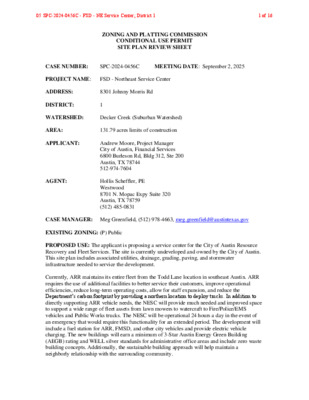
ZONING AND PLATTING COMMISSION CONDITIONAL USE PERMIT SITE PLAN REVIEW SHEET CASE NUMBER: SPC-2024-0456C MEETING DATE: September 2, 2025 PROJECT NAME: FSD - Northeast Service Center ADDRESS: 8301 Johnny Morris Rd DISTRICT: 1 WATERSHED: Decker Creek (Suburban Watershed) AREA: 131.79 acres limits of construction APPLICANT: AGENT: Andrew Moore, Project Manager City of Austin, Financial Services 6800 Burleson Rd, Bldg 312, Ste 200 Austin, TX 78744 512-974-7604 Hollis Scheffler, PE Westwood 8701 N. Mopac Expy Suite 320 Austin, TX 78759 (512) 485-0831 CASE MANAGER: Meg Greenfield, (512) 978-4663, meg.greenfield@austintexas.gov EXISTING ZONING: (P) Public PROPOSED USE: The applicant is proposing a service center for the City of Austin Resource Recovery and Fleet Services. The site is currently undeveloped and owned by the City of Austin. This site plan includes associated utilities, drainage, grading, paving, and stormwater infrastructure needed to service the development. Currently, ARR maintains its entire fleet from the Todd Lane location in southeast Austin. ARR requires the use of additional facilities to better service their customers, improve operational efficiencies, reduce long-term operating costs, allow for staff expansion, and reduce the Department’s carbon footprint by providing a northern location to deploy trucks. In addition to directly supporting ARR vehicle needs, the NESC will provide much needed and improved space to support a wide range of fleet assets from lawn mowers to watercraft to Fire/Police/EMS vehicles and Public Works trucks. The NESC will be operational 24 hours a day in the event of an emergency that would require this functionality for an extended period. The development will include a fuel station for ARR, FMSD, and other city vehicles and provide electric vehicle charging. The new buildings will earn a minimum of 3-Star Austin Energy Green Building (AEGB) rating and WELL silver standards for administrative office areas and include zero waste building concepts. Additionally, the sustainable building approach will help maintain a neighborly relationship with the surrounding community. 05 SPC-2024-0456C - FSD - NE Service Center; District 11 of 16 COMMISSION REQUEST: This site is zoned P (Public) and is greater than one acre in size; therefore, a Conditional Use Permit is required, according to the Land Development Code (Section 25-2-625). § 25-2-625 - PUBLIC (P) DISTRICT REGULATIONS. (A) This section applies in a public (P) district, except for a community events use. (B) Entities described in Section 25-2-145 (Public (P) District Designation) must comply with the requirements of this section. (C) For a residential use, the site development regulations of the most comparable residential zoning district apply. (D) Except as provided in Subsection (E), this subsection applies to a nonresidential use. (1) For a site less than one acre, the site development regulations of an adjoining zoning district apply for a distance of 100 feet into the site. The minimum lot size requirement of an adjoining zoning district does not apply to a use by the City. (2) For a site of one acre or more, the site development regulations are established by the approval of a conditional use site plan. (E) This subsection applies to a parks and recreation services (special) use. (1) The minimum site area is 10 acres. (2) Except for the requirement of Subsection (D)(1), the site development regulations are established by the approval of a conditional use site plan. (3) Locations for the sale of beer or wine, if any, must be identified on the site plan. (4) The Land Use Commission may not consider a site plan until it receives a recommendation from the Parks and Recreation Board. WAIVER REQUESTS: 1. An administrative environmental variance has been granted in accordance with LDC 25-8- 42(b)(6), to allow a cut or fill of not more than eight feet. 2. An administrative driveway variance has been granted to allow for a driveway width greater than 25 feet. TCM section 7.5.1.2. **These waivers are administrative; no ZAP action is needed on the waivers. SUMMARY STAFF RECOMMENDATION: Staff recommends approval of this site plan. PROJECT TIMELINE: 12/26/2013 – City acquired property (2013227429TR) 5/30/2024 – Council passed Ordinance 20240530-019 to issue 8.5 million tax exempt obligations for the negotiation and execution of a ground lease, an interlocal agreement, and all other documents necessary to develop the NESC 8/13/2024 – Early Design Consultation 9/12/2024 – Council passed Ordinance 20240912-090 to rezone the property from I-RR to P (Public) 10/10/2024 – Mid Design Consultation 12/12/24 – Council passed Ordinance 20241212-016 to amend the Fiscal Year 2024-2025 Financial Services Department Capital Budget (Ordinance No. 20240814-007) to increase appropriations by $245,000,000 for development of the NESC 12/31/2024 – Start of formal site plan review 1/8/2025 Presubmittal Design Consultation 8/21/2025 – Subdivision Plat recorded (C8-2024-0147.0A) to combine two lots into one PROJECT INFORMATION: AREA: 131.79 acres site EXIST. ZONING: P (Public) PROPOSED BLDG. CVRG: 15.10% PROPOSED IMPERVIOUS CVRG: 44.10% PROVIDED PARKING: 1,465 PROPOSED ACCESS: Johnny Morris Road 05 SPC-2024-0456C - FSD - NE Service Center; District 12 of 16 PROPOSED OPEN SPACE: 55.90% ZONING OVERLAYS: Hazardous Pipelines Overlay: KOCH Wildland Urban Interface: Proximity Class - undefined SUMMARY COMMENTS ON SITE PLAN: Late backup to be provided with most recent comment report. Approved Reviews: AW Facility Engineering AW OWB Underground Storage Tanks City Arborist Drainage Environmental Floodplain ROW Water Quality ERM Mapping PARD AW Utility Development Services Addressing Outstanding Reviews: Site Plan – all comments cleared except ZAP approval Wildland Urban Interface AW Reclaim and Reuse AW Pipeline Engineering Wetlands Biologist Site Plan Plumbing Industrial Waste TPW Electric Link to full plan set: https://austintexas.box.com/s/2kv9laysksa33rhamux13fl2nbjj8nxy SURROUNDING CONDITIONS: North: Vacant & Industrial (ETJ) East: Single Family (ETJ) West: Vacant & Community Recreation (P) South: Vacant & Industrial (ETJ) LEGAL DESCRIPTION: LOT 2A BLK A INDUSTRIAL GROUP 30.0 & 86.36 ACRE TRACTS BEING A REPLAT OF LOT 2A OF THE AMENDED PLAT OF LOTS 1 & 2, BLOCK "A" OF INDUSTRIAL GROUP 30.00 & 86.36 ACRE TRACTS AND A PORTION OF THAT CERTAIN 65.79 ACRE TRACT DESCRIBED IN A DEED TO THE CITY OF AUSTIN, DATED DECEMBER 26, 2013, RECORDED IN DOCUMENT NO. 2013227429, O.P.R.T.C.T. NEIGHBORHOOD ORGANIZATIONS: Austin Independent School District Austin Neighborhoods Council Colony Park/Lakeside Community Development Corp Del Valle Community Coalition Friends of Austin Neighborhoods Friends of Northeast Austin Homeless Neighborhood Association Overton Family Committee 05 SPC-2024-0456C - FSD - NE Service Center; District 13 of 16 Northeast Service Center • Austin Resource Recovery and Fleet Mobility Services • Location: 8301 Johnny Morris Road (District 1) • Construction: September 2025 - September 2027 • $253.5M Budget Approx. 750 employees, 345,000 sq. ft. of building space on 132 acres • Includes vehicle maintenance facilities, offices, and community space • Partnership with AISD for internships/vocational training • Redevelopment opportunity for existing Fleet facility located at 1182 Hargrave • Austin Energy Green Building 4-Star goal • Reclaimed water, Solar Power • Deconstructable/Recyclable building design • Emergency Generators 5 05 SPC-2024-0456C - FSD - NE Service Center; District 14 of 16 Property Profile Zoning Map Legend Property Jurisdiction FULL PURPOSE EXTRATERRITORIAL JURISDICTION 2 MILE ETJ AGRICULTURAL AGREEMENT Zoning 1 Zoning CH CS DR GR IP LI LO LR MF MH P PUD RR SF UNZ Zoning Text Notes 0 8/24/2025 1 2 mi This product is for informational purposes and may not have been prepared for or be suitable for legal, engineering, or surveying purposes. It does not represent an on-the-ground survey. This product has been produced by the City of Austin for the sole purpose of geographic reference. No warranty is made by the City of Austin regarding specific accuracy or completeness. 05 SPC-2024-0456C - FSD - NE Service Center; District 15 of 16 Property Profile Zoning Map Legend Zoning 1 Zoning Text Notes 0 8/25/2025 1 2 mi This product is for informational purposes and may not have been prepared for or be suitable for legal, engineering, or surveying purposes. It does not represent an on-the-ground survey. This product has been produced by the City of Austin for the sole purpose of geographic reference. No warranty is made by the City of Austin regarding specific accuracy or completeness. 05 SPC-2024-0456C - FSD - NE Service Center; District 16 of 16 Property Profile Surrounding Development Legend Review Cases Site Plan Review Cases (All) Notes 0 8/25/2025 1 2 mi This product is for informational purposes and may not have been prepared for or be suitable for legal, engineering, or surveying purposes. It does not represent an on-the-ground survey. This product has been produced by the City of Austin for the sole purpose of geographic reference. No warranty is made by the City of Austin regarding specific accuracy or completeness. 05 SPC-2024-0456C - FSD - NE Service Center; District 17 of 16 A.U.L.C.C. AUSTIN UTILITY LOCATION & COORDINATION COMMITTEE AULCC Completeness Letter (Non-CIP) Each General Permit, or Site Plan, application has specific submittal requirements. All applications will be reviewed for completeness of submittal requirements. It is the responsibility of the applicant, design engineer, or surveyor; to ensure that all items required in the submittal packet are complete. If the application is complete, it will be accepted for review and comments. If the application is incomplete, the applicant will be advised of the deficiencies, which must be addressed before the application is accepted for review for a certain cycle. Tracking # : UCC-241219-04-04 Row Id # : 13434060 Name of Project : AWU-8001 1/2 & 8301 Johnny Morris Rd-COA Northeast Service Center-Site Utilities - PuPR Contact Name : David Fusilier E-mail Address : david.fusilier@westwoodps.com Permit # Expires : 2024-154674 UC 07/02/2027 Checked for Completeness Complete Incomplete By the following Reviewers : Jaclyn Lozano & Brian Hoang Utility Coordination This project has completed the AULCC process. An approval granted by the AULCC Coordinator will not imply that utilities are clear of the proposed construction. All conflicts discovered after the date of this letter, will require resolution by the applicant or owner. This is an AULCC approval only. Applicant must still comply with all General Permit or Site Plan submittal requirements, Land Management Agreement processes, and all required Right of Way coordination and permitting requirements. All projects with the Downtown Austin Project Coordination Zone (DAPCZ) will require coordination per City Code 14-11-167. Please address all comments in writing and submit with your application AULCC Comments : 1) All possible conflicts may not be represented by information supplied by utilities and departments. Verification of utility locations, as represented by the utilities, are the sole responsibility of the Project Owner,and Project Engineer. Please have contractor call 811 or 1-800-DigTess for utility locates prior to excavation. 2) If utilities with "No Response" status are identified as a conflict, notify the AULCC Coordinator. 3) Applicant, or Project Owner, will be required to resolve all conflicts discovered after the date of this letter.If conflict resolution is requested of the AULCC, please resubmit for review. 4) 5) Project Owner, or Project Contact must work directly with private utility owners for resolutions to conflicts. Any additional developmental review disciplines, or additional reviewers, may be added for review and approval. Please see below for any additional information and required reviews. Complying with any additional requirements noted by the AULCC, will be the responsibility of the Project Owner. Please see below and attached for additional comments, and/or requirements. 1 05 SPC-2024-0456C - FSD - NE Service Center; District 18 of 16 A.U.L.C.C. AUSTIN UTILITY LOCATION & COORDINATION COMMITTEE AULCC Completeness Letter (Non-CIP) Additional Comments and/or Requirements continued: Coordination Opportunities: -PWD-ARR Northeast Service Center, Simon Tseng, 5123995374, stseng@dunaway.com 2 05 SPC-2024-0456C - FSD - NE Service Center; District 19 of 16 ORDINANCE NO. 20240530-019 AN ORDINANCE AlkEND_NG THE FISCAL YEAR 2023-2024 FINANCIAL SERVICES DEPARTMENT CAPITAL BUDGET (ORDINANCE NO. 20230816- 008) TO INCREASE A?₹07₹A- ONS FOR THE NORTHEAST SERVICE CENTER FACILITY. BE IT ORDAINED BY THE CITY COUNCIL OF THE CITY OF AUSTIN: Council amends the Fiscal Year 2023-2024 Financial Services Department PART 1. Capital Budget (Ordinance No. 20230816-008) to increase appropriations by $8,500,000 for the Northeast Service Center facility. PART 2. This ordinance takes effect on June 10,2024. PASSED AND APPROVED May 30 , 2024 APPROVED: fit. Anne L. Morgan City Attorney . i § §4444 § V Kirk Watson Mayor ATTEST: \17]oha]Ad, 44- + Myrna Rios City Clerk Page 1 of 1 05 SPC-2024-0456C - FSD - NE Service Center; District 110 of 16 ORDINANCE NO. 20240912-090 AN ORDINANCE ES-AB-_SPING INITAL iERNANENT ZONING FOR THE PROPERTY LOCATED AT 8001 1/2 AND 8301 JOHNNY MORRIS ROAD AND CHANGING THE ZONING MAP FRON INTER lk-lURAL RESIDENCE (I-RR) DISTRICT TO PUBLIC (P) DISTRICT. BE IT ORDAINED BY THE CITY COUNCIL OF THE CITY OF AUSTIN: PART 1. The zoning map established by Section 25-2-191 ofthe City Code is amended to change the base district from interim-rural residence (I-RR) base district to public (P) base district on the property described in Zoning Case No. C14-2023-0140, on file at the Planning Department, as follows: LOT 21 BLOCKA, AMENDED PLAT OF LOTS 1 & 2, BLOCK"A"OF INDUSTRIAL GROUP 30.00 & 86.36 ACRE TRACTS, a subdivision in the City of Austin, Travis County, Texas, according to the map or plat of record in Document No. 200000349 ofthe Official Public Records ofTravis County, Texas, and 65.79 acres of land, more or less, out of the James Burleson Survey No. 19, Abstract No. 4, in Travis County, Texas, being part of that certain 182.469 acre tract of land conveyed by deed recorded in Volume 11972, Page 1908, of the Travis County Real Property Records, said 65.79 acres of land being more particularly described by metes and bounds in Exhibit ordinance, incorporated into this (collectively, the "Property . locally known as 8001 1/2 and 8301 Johnny Morris Road in the City of Austin, Travis County, Texas, generally identified in the map attached as Exhibit "B". Page 1 of 2 05 SPC-2024-0456C - FSD - NE Service Center; District 111 of 16 PART 2. This ordinance takes effect on September 23,2024. PASSED AND APPROVED September 12 ,2024 § § 4411 +4(Ek § Kirk Watson Mayor APPROVED:02-din??a 24,00 ATTEST: Deborah Thomas Acting City Attorney *itir 4/ Myrna Rios City Clerk Page 2 of 2 05 SPC-2024-0456C - FSD - NE Service Center; District 112 of 16 EXHIBIT "A" EXHIBIT A - METES AND BOUNDS DESCRIPTION BEING 65.79 ACRES, MORE OR LESS, OUT OF THE JAMES BURLESON SURVEY NO. 19, ABSTRACT NO. 4, IN TRAVIS COUNTY, TEXS, AND BEING PART OF THAT CERTAIN 182.469 ACRE TRACT OF LAND CONVEYED TO INDUSTRIAL GROUP BY DEED RECORDED IN VOLUME 11972, PAGE 1908 OF THE TRAVIS COUNTY REAL PROPERTY RECORDS (TCRPR), SAID TRACT OF LAND BEING MORE PARTICULARLY DESCRIBED BY METES AND BOUNDS AS FOLLOWS: BEGINNING at a M" rebar found on the east right-of-way line of Johnny Morris Road, at the southwest corner of said 182.469 acre tract, for the southwest corner and PLACE OF BEGINNING heNof; THENCE with the east right-of-way line ofJohnny Morris Road, the following 3 courses: 1) with a curve to the left, whose radius is 1072.87 feet, arc length is 333.15 feet, and whose chord bears N 38°33'19" E 331.81 feet to a M"rebar set, capped "Harris Grant", at the south corner of parcel 2 conveyed to Travis County by deed recorded in Volume 11231, Page 730 of the TCRPR; · 2) with a curve to the left, whose radius is 1119.64 feet, arc length is 83.43 feet, and whose chord bears N 32°22'36" E 83.41 feetto a M"rebar found; 3) N 30°15'54 " E 711.35 feet to a 4" rebar set atthe southwest corner of Lot 2A of "Amended Plat of Lots 1 and 2, Block A, Industrial Group 30.00 and 86.36 Acre Tracts", a subdivision in Travis County, Texas as recorded in Document No. 200000349 of the Official Public Records of Travis County, Texas (OPRTCT), for the northwest corner hereof, from which point a M" rebar found on the east right-of-way line of Johnny Morris Road, at the common westerly corner between Lots 1A and 2A of said amended plat bears N 30°15'54" E [514.83 feet; THENCE with the south line ofsaid Lot 2A,'S 58°26'41" E 2102.75 feet to a !4" rel,ar found on the west right-of-way line ofthe S.P. (Northwestern) Railroad, at the southeast corner of said Lot 2A, for a point on the north line hereof, and on the east line ofsaid 182.469 acre tract; THENCE with the easterly lineof said 182.469 acretract,alsothewest right-of-way line of said railroad, the following 3 courses: 1) S 57°59'35" E 16.37 feet to a lh" rebar found; 2) S 14°26'57" W 960.61 feet to a !6" rebar set, capped "Harris Grant", at a point of curve to the right; 3) With said curve to the right, whose radius is ] 168.56 feet, arc length is 452.36 feet, and whose chord bears S 25°32'38" W 449.54 feet to a 92" rebar set, capped "Harris Grant", at the southeast corner of said 182.469 acres. for the southeast corner hereof; Page 1 of 2 05 SPC-2024-0456C - FSD - NE Service Center; District 113 of 16 THENCE with the south line of said 182.469 acres, and partially with the north line of Lots 1 and 2, Block A of "Lehne Addition", a subdivision in Travis County, Texas as recorded in Document No. 200700256 of the OPRTCT, N 52°52'31" W 2486.31 feet to the PLACE OF BEGINNING and containing 65.79 acres of land, more or less. See map prepared to accompany this description. HARRIS-GRANT SURVEYING, INC. (TBPLS Firm No. 10036100) P.O. BOX 807, MANCHACA TEXAS 78652 512-444-1781 Inh.. /* 4 4'Prof% lb. (« JAMES M. GRANT ? %<\1 191 5 &.- W L# A+ ?JAMES M. GRANT ?R.P.L.S. 1919 jg\carlson\11-13\44196\M&B December 3, 2013 05 SPC-2024-0456C - FSD - NE Service Center; District 114 of 16 C14-2011·0068 C 7a-05-010 2005117-018 P <P y0 C14-05-0185 SPC-06-0017C tb> lot N6-0461 D 4 SP-02-03180 i pITYTop ZONING EXHIBIT "B '1 ZONING CASE#: C14-2023-0140 -2 PUD 714-2014-0110.SH C814-201+0110 SH i-? SUBJECT TRACT ?--0? PENDING CASE L - . ZONING BOUNDARY This product is for informational purposes and may not have been prepared for or be suitable for legal, It does not represent an on-the-ground survey and represents only the engineering, or surveying purposes. approximate relative location of property boundaries. 1 " = 600 ' This product has been produced by the Planning Department for the sole purpose of geographic reference. No warranty is made by the City of Austin regarding specific accuracy or completeness. 43?4*03<3\ . i<»-4?"#r Created: 11/15/2023 05 SPC-2024-0456C - FSD - NE Service Center; District 115 of 16 ORDINANCE NO. 20241212-016 AN ORDINANCE AlkENDING THE FISCAL YEAR 2024-2025 FINANCIAL SE₹V CES DE?ARTIV INT CAPITAL BUDGET (ORDINANCE NO. 20240814-007) TO INCREASE A?7107-GLATIONS BY $245,000,000 FOR DEVELOPMENT OF THE NORTHEAST SERVICE CENTER FACILITY. BE IT ORDAINED BY THE CITY COUNCIL OF THE CITY OF AUSTIN: Council amends the Fiscal Year 2024-2025 Financial Services Department PART 1. Capital Budget (Ordinance No. 20240814-007) to increase appropriations by $245,000,000 for development of the Northeast Service Center facility. PART 2. This ordinance takes effect on December 23,2024. PASSED AND APPROVED December 12 ,2024 § § Kirk Watson Mayor APPROVED: Ai»16 ATTEST: 4% R. 9 Deborah Thcomas Interim City Attorney Myrna Rios City Clerk Page 1 of 1 05 SPC-2024-0456C - FSD - NE Service Center; District 116 of 16