04 SP-2022-0567C - RBI Austin Youth Development Complex; District 1 - Applicant Report Part 1 — original pdf
Backup
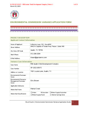
March 28, 2025 ENVIRONMENTAL COMMISSION VARIANCE APPLICATION FORM PROJECT DESCRIPTION Applicant Contact Information Name of Applicant Street Address City State ZIP Code Work Phone E-Mail Address Katherine Lauer, P.E., GarzaEMC 9442 N Capital of Texas Hwy, Plaza I, Suite 340 Austin, TX 78759 512-298-3284 klauer@garzaemc.com Variance Case Information RBI Austin Child Development Complex SP-2022-0567C 7401 Loyola Lane, Austin, TX John Clement Case Name Case Number Address or Location Environmental Reviewer Name Environmental Resource Management Reviewer Name Applicable Ordinance Watershed Name Walnut Creek Watershed Classification ☐Urban ☐Water Supply Rural X Suburban ☐Water Supply Suburban ☐ Barton Springs Zone City of Austin | Environmental Commission Variance Application Guide 1 04 SP-2022-0567C - RBI Austin Youth Development Complex; District 11 of 28 March 28, 2025 Edwards Aquifer Recharge Zone ☐ Barton Springs Segment ☐ Northern Edwards Segment X Not in Edwards Aquifer Zones Edwards Aquifer Contributing Zone Distance to Nearest Classified Waterway Water and Waste Water service to be provided by ☐ Yes X No The onsite waterway is classified as an intermediate waterway Austin Water – Wastewater SER approval The variance request is as follows (Cite code references): TITLE 25. – LAND DEVELOPMENT CHAPTER 25-8. – ENVIRONMENT SUBCHAPTER A. – WATER QUALITY Request ARTICLE 7. – REQUIREMENTS IN ALL WATERSHEDS Division 1 – Waterway and Floodplain Protection Section 25-8-261(G) CRITICAL WATER QUALITY ZONE DEVELOPMENT & Section 25-8-263 FLOODPLAIN MODIFICATION Proposal is to allow grading modification and the addition of a crossing through the CWQZ and the floodplain located within the CWQZ. Existing 0 0 0% Proposed 234,614 5.386 31.4% The site is currently undeveloped grassland and 17.14 acres. The site is along the Imagine Austin Corridor with the corridor located north of the site along Loyola Lane. Per surveyed topographic data, there is an elevation change of approximately 35’ from the highest point (524’) of the site to the lowest point (477’) of the draw City of Austin | Environmental Commission Variance Application Guide 2 Impervious cover square footage: acreage: percentage: Provide general description of the property (slope range, elevation range, summary of vegetation / trees, 04 SP-2022-0567C - RBI Austin Youth Development Complex; District 12 of 28 March 28, 2025 summary of the geology, CWQZ, WQTZ, CEFs, floodplain, heritage trees, any other notable or outstanding characteristics of the property) that runs east to west through the center of the site. There are three creek channels that converge on-site then flow west through the center of the property. Portions of the dry creek bed have steeper slopes. The lot has both gentle and steep slopes in the range of 0-15%. The site contains an Erosion Hazard Zone, Critical Water Quality Zone that runs through the center of the site, and wetlands within the eastern portion of the site. The site contains a heritage tree which aligns with the proposed Loyola Lane driveway. The site contains a 100-year fully developed floodplain along the creek centerlines. Per the Functional Assessment of Floodplain Health, the area of floodplain proposed for modification is currently in good condition. City of Austin | Environmental Commission Variance Application Guide 3 04 SP-2022-0567C - RBI Austin Youth Development Complex; District 13 of 28 March 28, 2025 Clearly indicate in what way the proposed project does not comply with current Code (include maps and exhibits) This project proposes grading and a crossing within the CWQZ and modification of the 100-year full developed floodplain within the CWQZ. This site is located in the Colony Park Station Imagine Austin Center and off of the Loyola Lane Imagine Austin Corridor. This designation permits a street or driveway to cross the CWQZ within the property in accordance with LDC 25-8-262.D, however, a variance is required to allow a bridge crossing and associated floodplain modifications within the CWQZ. In order to provide safe access to the southern half of the property, we request a variance to allow modifications of the floodplain within the CWQZ. Floodplain modifications within the CWQZ is necessary not only to make the crossing but to preserve a heritage tree and avoid impacting a CEF buffer within the property with the crossing. FINDINGS OF FACT As required in LDC Section 25-8-41, in order to grant a variance the Land Use Commission must make the following findings of fact: Include an explanation with each applicable finding of fact. Project: RBI Austin Child Development Complex Ordinance: A. Land Use Commission variance determinations from Chapter 25-8-41 of the City Code: 1. The requirement will deprive the applicant of a privilege available to owners of similarly situated property with approximately contemporaneous development subject to similar code requirements. Yes / No [provide summary of justification for determination] The site is located within the Imagine Austin Comprehensive Plan which allows a necessary crossing within the Critical Water Quality Zone per section 25-8-262 of Title 25 in the City of Austin Land Development Code. The Imagine Austin Comprehensive Plan was adopted by Ordinance No. 20120614-058 which aims to facilitate the development of the corridor for the benefit of the community. A non-profit organization is proposing a baseball and softball facility for underserved youth in the Austin community and aims to add value to the local area’s population. This variance will allow City of Austin | Environmental Commission Variance Application Guide 4 04 SP-2022-0567C - RBI Austin Youth Development Complex; District 14 of 28 March 28, 2025 access to and development of the southern half of the subject tract similar to the other properties along the Imagine Austin Corridor. This site is constrained to the proposed driveway location due to the existing CEF buffer that occupies the eastern portion of the site, a hazardous pipeline setback, the creeks running east to west through the middle of the site, a protected tree, and a heritage tree located within 100 feet of a classified waterway on-site. The proposed crossing will be in the form of a bridge that spans the creek but must form a Y within the CWQZ to preserve a protected tree and heritage tree. The impacts of the bridge on the 100-year fully developed floodplain requires grading modification within the CWQZ in order to provide safe access above the 100- year floodplain elevation to the southern half of the site. The floodplain modification within the CWQZ required to preserve the heritage tree and construct the bridge impacts the grading within the floodplain. The site plan layout is limited by the existing environmental features on the site which includes multiple waterways (creeks), a heritage tree, a protected tree, CEF buffers, EHZ, and CWQZ. According to the Functional Assessment of Floodplain Health, the area of floodplain proposed for modification is currently in good condition. The site proposes a baseball field, softball field, small building, associated drives & parking, and required water quality controls. 2. The variance: a) Is not necessitated by the scale, layout, construction method, or other design decision made by the applicant, unless the design decision provides greater overall environmental protection than is achievable without the variance; Yes / No [provide summary of justification for determination] The variance is necessitated to: 1. Provide pedestrian and vehicular access into the site from the public right- of-way and Imagine Austin Corridor on Loyola Lane. Access will be provided via a driveway from Loyola Lane that crosses the creek via a bridge. 2. Provide pedestrian and vehicular access through the site in a way that preserves an existing heritage and protected tree and reduces impacts to the greatest extent possible to the CEF buffer, EHZ, floodplain, and CWQZ. The location of the crossing is limited by the existing CEF buffer that occupies the eastern portion of the site from the north to south boundaries, the creeks running east to west through the middle of the site, the CWQZ, EHZ, a protected tree, and a heritage tree located within 100 feet of a classified waterway. All of these constraints limit the location of the crossing as well as it’s Y shape configuration. The protected tree and heritage tree are adjacent to each other. Both are located south of the waterway and outside of the CEF buffer meaning that it City of Austin | Environmental Commission Variance Application Guide 5 04 SP-2022-0567C - RBI Austin Youth Development Complex; District 15 of 28 March 28, 2025 resides in the limited area where proposed site improvements (buildings, fields, ponds, parking, etc.) are allowed. Per § 25-8-641 of the City of Austin Land Development Code, removal of a heritage is prohibited unless a variance is approved. The condition of the heritage tree would make it unlikely for a variance to be approved. There is not an alternative route around the classified waterway to access the southern half of the site due to multiple constraints and the fact that the classified waterway runs east to west across the entire site. The only public right-of-way is located along the northern site border. There is an existing City of Austin property to the east, and the properties to the south and west are privately owned with a residential use. There are three waterways that converge near the center of the site, so the only space to cross the waterways is along the western half of the site. The CWQZ, floodplain, & EHZ surround the waterway and must be crossed. The majority of developable land on the site is located south of the CWQZ & EHZ areas. Development of land on the north side of the CWQZ & EHS is restricted due to limited space and its proximity to a hazardous pipeline setback along Loyola Lane. The hazardous pipeline setback does not allow for buildings to be placed within it. The space on the northern half of the site that lies between the CWQZ/EHZ and the hazardous pipeline setback is not enough space for the proposed fields, building, parking and drives. b) Is the minimum deviation from the code requirement necessary to allow a reasonable use of the property; Yes / No [provide summary justification for determination] The challenge to meet the requirements of the City of Austin Wetlands, Floodplain, and Environmental departments has led to the proposed site plan configuration. The location of the crossing grants compliance with floodplain requirements, protected tree, and heritage tree criteria and limits development within the CEF buffer, EHZ, and CWQZ. The amount of proposed fill within the floodplain is less than 1% of the total floodplain volume per the requirements from the Floodplain Department. In order to achieve <1% net fill of the existing floodplain, grading within the floodplain had to be increased to accommodate the bridge structure and roadway across the creek. Without the waterway crossing and associated floodplain grading, the southern half of the site would be unable to be developed or accessed. c) Does not create a significant probability of harmful environmental consequences. Yes / No [provide summary justification for determination] City of Austin | Environmental Commission Variance Application Guide 6 04 SP-2022-0567C - RBI Austin Youth Development Complex; District 16 of 28 March 28, 2025 The crossing location provides minimal impacts to the environmental aspects of the site. The heritage tree and protected trees are allowed to remain, the CEF buffer is undisturbed by the crossing, and there is <1% of proposed net fill of the existing floodplain volume per the Floodplain requirements. The crossing and floodplain modifications do not have any adverse effects on the off-site floodplain. The disturbed area will be revegetated per standards provided by the Environmental department. A riparian restoration plan will be proposed for the floodplain modifications caused by the crossing & bridge impacts. Any restoration or mitigation that cannot be provided on-site will be paid into the Riparian Restoration fund per the standards in Section 1.7.5 of the Environmental Criteria Manual. Per zoning case C14-2020-0080, the zoning was changed from SF-2 (Single Family Residence – Standard Lot) to GR (Community Commercial). Under SF-2 zoning, the maximum allowable impervious cover is 45%, and GR zoning allows up to 90%. The current site plan is proposing 31% impervious cover under GR zoning which is significantly lower than what is allowed. The turf baseball field is included as impervious cover and makes up a large part of the impervious cover. The remaining proposed impervious cover is limited to what is necessary for the functionality of the site and what is required by COA Land Development Code. 3. Development with the variance will result in water quality that is at least equal to the water quality achievable without the variance. Yes / No [provide summary justification for determination] Development with the variance will not have any foreseeable effects on water quality. Runoff being conveyed to the floodplain will be treated by passing through stormwater quality measures. B. Additional Land Use Commission variance determinations for a requirement of Section 25-8-422 (Water Quality Transition Zone), Section 25-8-452 (Water Quality Transition Zone), Article 7, Division 1 (Critical Water Quality Zone Restrictions), or Section 25-8-368 (Restrictions on Development Impacting Lake Austin, Lady Bird Lake, and Lake Walter E. Long): 1. The criteria for granting a variance in Subsection (A) are met; Yes / No [provide summary of justification for determination] As stated previously, The Imagine Austin Comprehensive Plan aims to facilitate the development of the corridor for the benefit of the community. A non-profit organization is proposing a baseball and softball facility for underserved youth in the Austin community and aims to add value to the local area’s population. The variance is due to the site constraints with environmental features in order to allow reasonable use of the property. The development will not impact water quality. City of Austin | Environmental Commission Variance Application Guide 7 04 SP-2022-0567C - RBI Austin Youth Development Complex; District 17 of 28 March 28, 2025 2. The requirement for which a variance is requested prevents a reasonable, economic use of the entire property; Yes / No [provide summary of justification for determination] The site will serve the community and is being developed by a non-profit organization. The underserved youth of Austin will use the site for recreation. The proposed use of a baseball/softball field requires adequate space for fields, sport stands, and associated buildings, and there is not enough space north of the creek for all necessary improvements. The lack of access to the southern half of the site means that the property cannot be used at all for its proposed purpose. 3. The variance is the minimum deviation from the code requirement necessary to allow a reasonable, economic use of the entire property. Yes / No [provide summary of justification for determination] The existing environmental features and on-site waterways limit the developable area. Removing the crossing would make the site unusable for the proposed improvements. The north portion of the site that is outside of the CEF, CWQZ, & EHZ does not provide enough space for the sports fields and is located within a restricted pipeline area which restricts the development of structures. The proposed driveway and access from Loyola Lane will require modification of the floodplain within the CWQZ. The entrance is limited due to the surrounding sites and the waterways. **Variance approval requires all above affirmative findings. City of Austin | Environmental Commission Variance Application Guide 8 04 SP-2022-0567C - RBI Austin Youth Development Complex; District 18 of 28 June 4, 2025 ENVIRONMENTAL COMMISSION VARIANCE APPLICATION FORM PROJECT DESCRIPTION Applicant Contact Information Name of Applicant Street Address City State ZIP Code Work Phone E-Mail Address Katherine Lauer, P.E., GarzaEMC 9442 N Capital of Texas Hwy, Plaza I, Suite 340 Austin, TX 78759 512-298-3284 klauer@garzaemc.com Variance Case Information Case Name Case Number Address or Location Environmental Reviewer Name Environmental Resource Management Reviewer Name Applicable Ordinance RBI Austin Child Development Complex SP-2022-0567C 7401 Loyola Lane, Austin, TX Enrique Maiz-Torres Watershed Protection Ordinance - Current Code Watershed Name Walnut Creek Watershed Classification ☐Urban X Suburban ☐Water Supply Suburban ☐Water Supply Rural ☐ Barton Springs Zone City of Austin | Environmental Commission Variance Application Guide 1 04 SP-2022-0567C - RBI Austin Youth Development Complex; District 19 of 28 June 4, 2025 Edwards Aquifer Recharge Zone ☐ Barton Springs Segment ☐ Northern Edwards Segment X Not in Edwards Aquifer Zones Edwards Aquifer Contributing Zone Distance to Nearest Classified Waterway Water and Waste Water service to be provided by ☐ Yes X No The onsite waterway is classified as an intermediate waterway Austin Water – Wastewater SER approval The variance request is as follows (Cite code references): Code of Ordinances, updated 2024-03-25, effective 2023-12-25, Supplement No. 164 TITLE 25. – LAND DEVELOPMENT CHAPTER 25-8. – ENVIRONMENT Request SUBCHAPTER A. – WATER QUALITY ARTICLE 7. – REQUIREMENTS IN ALL WATERSHEDS Division 5. – Cut, Fill, and Spoil. Section 25-8-341 CUT REQUIREMENTS & Section 25-8-342 FILL REQUIREMENTS Proposal is to allow cut & fill over 4 feet to 8 feet within the Critical Water Quality Zone to develop this tract as shown. Existing 0 0 0% Proposed 234,614 5.386 31.4% The site is currently undeveloped grassland and 17.14 acres. The site is along the Imagine Austin Corridor with the corridor located north of the site along Loyola Lane. City of Austin | Environmental Commission Variance Application Guide 2 Impervious cover square footage: acreage: percentage: Provide general description of the property (slope range, elevation 04 SP-2022-0567C - RBI Austin Youth Development Complex; District 110 of 28 June 4, 2025 range, summary of vegetation / trees, summary of the geology, CWQZ, WQTZ, CEFs, floodplain, heritage trees, any other notable or outstanding characteristics of the property) Per surveyed topographic data, there is an elevation change of approximately 35’ from the highest point (524’) of the site to the lowest point (477’) of the draw that runs east to west through the center of the site. There are three creek channels that converge on-site then flow west through the center of the property. Portions of the dry creek bed have steeper slopes. The lot has both gentle and steep slopes in the range of 0-15%. The site contains an Erosion Hazard Zone, Critical Water Quality Zone that runs through the center of the site, and wetlands within the eastern portion of the site. The site contains a heritage tree which aligns with the proposed Loyola Lane driveway. The site contains a 100-year fully-developed floodplain along the creek centerlines. Per the Functional Assessment of Floodplain Health, the area of floodplain proposed for modification is currently in good condition. City of Austin | Environmental Commission Variance Application Guide 3 04 SP-2022-0567C - RBI Austin Youth Development Complex; District 111 of 28 June 4, 2025 Clearly indicate in what way the proposed project does not comply with current Code (include maps and exhibits) The project proposes cut and fill within 100 feet of a classified waterway. This site is located in the Colony Park Station Imagine Austin Center and off of the Loyola Lane Imagine Austin Corridor. This designation permits a street or driveway to cross the CWQZ within the property in accordance with LDC 25-8-262.D, however, a variance is required to allow cut and fill in excess of 4' within 100 feet of a classified waterway to construct a driveway crossing to access the southern half of the site. A bridge in excess of 8' in height is required to safely cross the CWQZ above the 100 year floodplain elevation. In order to provide safe access to the southern half of the property, we request a variance to allow cut and fill in excess of 4' within 100' of the CWQZ centerline. Cut and fill within the CWQZ is necessary not only to make the crossing but to preserve a heritage tree and avoid impacting a CEF buffer within the property with the crossing. FINDINGS OF FACT As required in LDC Section 25-8-41, in order to grant a variance the Land Use Commission must make the following findings of fact: Include an explanation with each applicable finding of fact. Project: RBI Austin Child Development Complex Ordinance: A. Land Use Commission variance determinations from Chapter 25-8-41 of the City Code: 1. The requirement will deprive the applicant of a privilege available to owners of similarly situated property with approximately contemporaneous development subject to similar code requirements. Yes / No [provide summary of justification for determination] The site is located within the Imagine Austin Comprehensive Plan which allows a necessary crossing within the Critical Water Quality Zone per section 25-8-262 of Title 25 in the City of Austin Land Development Code. The Imagine Austin Comprehensive Plan was adopted by Ordinance No. 20120614-058 which aims to facilitate the City of Austin | Environmental Commission Variance Application Guide 4 04 SP-2022-0567C - RBI Austin Youth Development Complex; District 112 of 28 June 4, 2025 development of the corridor for the benefit of the community. A non-profit organization is proposing a baseball and softball facility for underserved youth in the Austin community and aims to add value to the local area’s population. This variance will allow access to and development of the southern half of the subject tract similar to the other properties along the Imagine Austin Corridor. This site is constrained to the proposed driveway location due to the existing CEF buffer that occupies the eastern portion of the site, the hazardous pipeline setback, the creeks running east to west through the middle of the site, a protected tree, and a heritage tree located within 100 feet of a classified waterway on-site. The proposed crossing will be in the form of a bridge that spans the creek but must form a Y within the CWQZ to preserve a protected tree and heritage tree. The impacts of the bridge on the 100-year fully-developed floodplain requires cut and fill over 4’ within the CWQZ in order to provide safe access above the 100-year floodplain elevation to the southern half of the site; engineering efforts were made to the grading to minimize the areas requiring cut and fill >4’ within the CWQZ. Additionally, the bridge crossing design has been revised to keep proposed fill under 8’. The amount of fill required to preserve the heritage tree, protected tree, and construct the bridge impacts the floodplain and requires approximately the same amount of cut to balance the floodplain volume across the site. In addition to the cut and fill >4’ within the CWQZ & classified waterway, other areas of the site require cut greater than 4’ such as the proposed baseball field, covered practice field, water quality ponds, and for a section of the driveway. The grading on the two proposed sports fields is necessary to achieve grading that allows for the use of these sports fields. An administrative variance has been approved for the areas outside of the CWQZ requiring cut and fill over 4’. The site plan layout is limited by the existing environmental features on the site which includes multiple waterways (creeks), a heritage tree, a protected tree, CEF buffers, EHZ, and CWQZ. The site proposes a baseball field, softball field, small building, associated drives & parking, and required water quality controls. 2. The variance: a) Is not necessitated by the scale, layout, construction method, or other design decision made by the applicant, unless the design decision provides greater overall environmental protection than is achievable without the variance; Yes / No [provide summary of justification for determination] The variance is necessitated to: 1. Provide pedestrian and vehicular access into the site from the public right- of-way and Imagine Austin Corridor on Loyola Lane. Access will be provided via a driveway from Loyola Lane that crosses the creek via a bridge. City of Austin | Environmental Commission Variance Application Guide 5 04 SP-2022-0567C - RBI Austin Youth Development Complex; District 113 of 28 June 4, 2025 2. Provide pedestrian and vehicular access through the site in a way that preserves an existing heritage tree and reduces impacts to the greatest extent possible to the CEF buffer, EHZ, and CWQZ. The location of the crossing is limited by the existing CEF buffer that occupies the eastern portion of the site from the north to south boundaries, the creeks running east to west through the middle of the site, the CWQZ, EHZ, a protected tree, and a heritage tree located within 100 feet of a classified waterway. All of these constraints limit the location of the crossing as well as it’s Y shape configuration. The majority of the crossing resides within the CWQZ where grading exceeds 4’, but the proposed grading within the CWQZ has been minimized as much as possible while also being compliant with compensatory floodplain volume requirements. The heritage tree is located south of the waterway and outside of the CEF buffer meaning that is resides in the limited area where proposed site improvements (buildings, fields, ponds, parking, etc.) are allowed. Per § 25- 8-641 of the City of Austin Land Development Code, removal of a heritage is prohibited unless a variance is approved. The condition of the heritage tree would make it unlikely for a variance to be approved, and the cost of mitigation is not reasonable compared to the proposed site use by a non- profit. There is not an alternative route around the classified waterway to access the southern half of the site due to multiple constraints and the fact that the classified waterway runs east to west across the entire site. The only public right-of-way is located along the northern site border. There is an existing City of Austin property to the east, and the properties to the south and west are privately owned with a residential use. There are three waterways that converge near the center of the site, so the only space to cross the waterways is along the western half of the site. The CWQZ & EHZ surround the waterway and must be crossed. The majority of developable land on the site is located south of the CWQZ & EHZ areas. Development of land on the north side of the CWQZ & EHS is restricted due to limited space and its proximity to a hazardous pipeline setback along Loyola Lane. The hazardous pipeline setback does not allow for buildings to be placed within it. The space on the northern half of the site that lies between the CWQZ/EHZ and the hazardous pipeline setback is not enough space for the proposed fields, building, parking and drives. b) Is the minimum deviation from the code requirement necessary to allow a reasonable use of the property; Yes / No City of Austin | Environmental Commission Variance Application Guide 6 04 SP-2022-0567C - RBI Austin Youth Development Complex; District 114 of 28 June 4, 2025 [provide summary of justification for determination] The challenge to meet the requirements of the City of Austin Wetlands, Floodplain, and Environmental departments has led to the proposed site plan configuration. The location of the crossing grants compliance with floodplain requirements and heritage tree criteria and limits development within the CEF buffer, EHZ, and CWQZ. Without the waterway crossing and associated cut and fill >4’ within the CWQZ, the southern half of the site would be unable to be developed or accessed. c) Does not create a significant probability of harmful environmental consequences. Yes / No [provide summary justification for determination] Although grading within the CWQZ will disturb the natural condition of the area adjacent to and under the proposed crossing, efforts have been made to keep the proposed cut and fill ranging from 4-8 feet to minimal areas and depths. Previously a bridge pillar showed fill >8’ within the CWQZ, but that has been revised to be <8’ of fill. Per the specific methods mentioned below, restoration to these areas within the CWQZ is proposed to reduce environmental impacts from cut and fill >4’. The crossing location provides minimal impacts to the environmental aspects of the site. The heritage tree and protected tree are allowed to remain, and the CEF buffer is undisturbed by the crossing. The disturbed area will be revegetated per standards provided by the Environmental department. A riparian restoration plan will be proposed for the floodplain modifications caused by the crossing & bridge impacts. Any restoration or mitigation that cannot be provided on-site will be paid into the Riparian Restoration fund per the standards in Section 1.7.5 of the Environmental Criteria Manual. Per zoning case C14-2020-0080, the zoning was changed from SF-2 (Single Family Residence – Standard Lot) to GR (Community Commercial). Under SF-2 zoning, the maximum allowable impervious cover is 45%, and GR zoning allows up to 90%. The current site plan is proposing 31% impervious cover under GR zoning which is significantly lower than what is allowed. The turf baseball field is included as impervious cover and makes up a large part of the impervious cover. The remaining proposed impervious cover is limited to what is necessary for the functionality of the site and what is required by COA Land Development Code 3. Development with the variance will result in water quality that is at least equal to the water quality achievable without the variance. City of Austin | Environmental Commission Variance Application Guide 7 04 SP-2022-0567C - RBI Austin Youth Development Complex; District 115 of 28 June 4, 2025 Yes / No [provide summary justification for determination] Development with the variance will not have any foreseeable effects on water quality. Runoff being conveyed to the floodplain will be treated by passing through stormwater quality measures. B. Additional Land Use Commission variance determinations for a requirement of Section 25-8-422 (Water Quality Transition Zone), Section 25-8-452 (Water Quality Transition Zone), Article 7, Division 1 (Critical Water Quality Zone Restrictions), or Section 25-8-368 (Restrictions on Development Impacting Lake Austin, Lady Bird Lake, and Lake Walter E. Long): 1. The criteria for granting a variance in Subsection (A) are met; Yes / No [provide summary of justification for determination] N/A 2. The requirement for which a variance is requested prevents a reasonable, economic use of the entire property; Yes / No [provide summary of justification for determination] N/A 3. The variance is the minimum deviation from the code requirement necessary to allow a reasonable, economic use of the entire property. Yes / No [provide summary of justification for determination] N/A **Variance approval requires all above affirmative findings. City of Austin | Environmental Commission Variance Application Guide 8 04 SP-2022-0567C - RBI Austin Youth Development Complex; District 116 of 28 March 28, 2025 A Exhibits for Commission Variance o Aerial photos of the site o Site photos o Aerial photos of the vicinity o Context Map—A map illustrating the subject property in relation to developments in the vicinity to include nearby major streets and waterways o Topographic Map - A topographic map is recommended if a significant grade change on the subject site exists or if there is a significant difference in grade in relation to adjacent properties. o For cut/fill variances, a plan sheet showing areas and depth of cut/fill with topographic elevations. o Site plan showing existing conditions if development exists currently on the property o Proposed Site Plan- full size electronic or at least legible 11x17 showing proposed development, include tree survey if required as part of site or subdivision plan o Environmental Map – A map that shows pertinent features including Floodplain, CWQZ, WQTZ, CEFs, Setbacks, Recharge Zone, etc. o An Environmental Resource Inventory pursuant to ECM 1.3.0 (if required by 25-8-121) o Applicant’s variance request letter City of Austin | Environmental Commission Variance Application Guide 9 04 SP-2022-0567C - RBI Austin Youth Development Complex; District 117 of 28 EXHIBITS TABLE OF CONTENTS 1 - AERIAL SITE PHOTO 2 - AERIAL VICINITY PHOTO 3 - CONTEXT MAP 4 - TOPOGRAPHIC MAP 5 - CUT FILL MAPS 6 - PROPOSED SITE PLAN 7 - ENVIRONMENTAL MAP 8 - ERI 9 - SITE PHOTOS10 - FUNCTIONAL ASSESSMENT OF FLOODPLAIN HEALTH04 SP-2022-0567C - RBI Austin Youth Development Complex; District 118 of 28 AERIAL SITE PHOTO04 SP-2022-0567C - RBI Austin Youth Development Complex; District 119 of 28 AERIAL PHOTOSITE04 SP-2022-0567C - RBI Austin Youth Development Complex; District 120 of 28 AERIAL VICINITY PHOTO04 SP-2022-0567C - RBI Austin Youth Development Complex; District 121 of 28 Vicinity Map - RBI CHILD DEVELOPMENT COMPLEX Legend 7401 Loyola Ln Austin Fire Station 26 Overton Elementary School Image © 2024 Airbus Image © 2024 Airbus Image © 2024 Airbus ➤➤ N N 1000 ft 04 SP-2022-0567C - RBI Austin Youth Development Complex; District 122 of 28 CONTEXT MAP04 SP-2022-0567C - RBI Austin Youth Development Complex; District 123 of 28 Property Profile Context Map Legend Property Street Labels Review Cases Site Plan Review Cases (All) Long Range Planning Imagine Austin Corridors Environmental 1 Creek Centerlines Lakes Notes 0 5/1/2024 0.5 1 mi This product is for informational purposes and may not have been prepared for or be suitable for legal, engineering, or surveying purposes. It does not represent an on-the-ground survey. This product has been produced by the City of Austin for the sole purpose of geographic reference. No warranty is made by the City of Austin regarding specific accuracy or completeness. SITE04 SP-2022-0567C - RBI Austin Youth Development Complex; District 124 of 28 TOPOGRAPHIC &SLOPE MAPS04 SP-2022-0567C - RBI Austin Youth Development Complex; District 125 of 28 TREE LIST 5 2 1 e t i u S , . l d v B o I N O S V E R I t l i a R 8 0 7 7 2 9 5 2 - 8 9 2 ) 2 1 5 ( x a F 4 8 2 3 - 8 9 2 ) 2 1 5 ( . l e T 4 2 0 2 t h g i r y p o C © C L L , C M E a z r a G 9 2 6 4 1 - F # E P B T 5 3 7 8 7 s a x e T , n i t s u A LOYOLA LANE INT# 7964 LOYOLA LANE INT# 7965 EXISTING DEMO DESCRIPTION LEGEND 03/28/2024 . O N E T A D I I & S N O T D N O C G N T S X E I I DEMOLITION KEYNOTES DEMOLITION NOTES: X E L P M O C T N E M P O L E V E D D L I H C N T S U A I I B R E N A L A L O Y O L 1 0 4 7 I N A L P N O T I L O M E D I S E T R E P O R P E T A L P E M O H FOR CITY USE ONLY: 1 0 0 0 0 - 6 1 6 3 1 1 : . O N T C E J O R P : Y B D E N G S E D I : Y B N W A R D : C Q / A Q SHEET 06 61 OF SP 2022-0567C M A 9 5 : 0 1 4 2 , 9 1 r a M n o w e h e a l y b d e i f i d o m g w d . O M E D - 1 0 0 0 0 - 6 1 6 3 1 1 \ D A C - 0 0 \ l i i v C \ 1 0 0 0 0 - 6 1 6 3 1 1 \ : V 04 SP-2022-0567C - RBI Austin Youth Development Complex; District 126 of 28 LOYOLA LANE DETENTION POND 1 N E D R A G N A R I DETENTION POND 2 DETENTION POND 3 BIOFILTRATION POND 1 I N O T A R T L I F EDUCATION 2,189 SF FFE: 498.98 OFFICE 2,189 SF FFE: 498.98 RECREATIONAL 2,189 SF FFE: 498.98 FIRE ROOM COVERED PRACTICE FIELD 30,516 SF FFE: 499.75 / I N O T A T N E M D E S I 1 D N O P BASEBALL FIELD 101,352 SF F F E : 5 0 2 . 5 0 5 7 5 S F P R E S S B O X 1 3 5 S F , D U G F F E : 4 9 7 O U T 1 . 2 5 DUG OUT 2 135 SF, FFE: 498.85 2 9 5 2 - 8 9 2 ) 2 1 5 ( x a F 4 8 2 3 - 8 9 2 ) 2 1 5 ( . l e T 4 2 0 2 t h g i r y p o C © C L L , C M E a z r a G 9 2 6 4 1 - F # E P B T 5 3 7 8 7 s a x e T , n i t s u A 5 2 1 e t i u S l , . d v B o t l a R 8 0 7 7 i I N O S V E R I EXISTING PROPOSED DESCRIPTION LEGEND 07/29/2024 . O N E T A D P A M E P O L S X E L P M O C T N E M P O L E V E D D L I H C N T S U A I I B R E N A L A L O Y O L 1 0 4 7 I S E T R E P O R P E T A L P E M O H 1 0 0 0 0 - 6 1 6 3 1 1 : . O N T C E J O R P : Y B D E N G S E D I : Y B N W A R D : C Q / A Q SHEET EXH 01 OF . M P 2 3 2 1 4 2 : , 3 l u J n o s a c a m i i y b d e i f i . d o m g w d P A M E P O L S I I \ I - T B H X E S T B H X E D A C - 0 0 \ l i I \ i v C \ 1 0 0 0 0 - 6 1 6 3 1 1 \ : V SLOPE TABLE FOR CITY USE ONLY: DOOLEY TRAIL 04 SP-2022-0567C - RBI Austin Youth Development Complex; District 127 of 28 CUT FILL MAPS04 SP-2022-0567C - RBI Austin Youth Development Complex; District 128 of 28