07 C14-2025-0071 - Travis County West Service Center; District 10 - Staff Report — original pdf
Backup
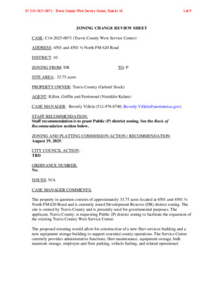
ZONING CHANGE REVIEW SHEET CASE: C14-2025-0071 (Travis County West Service Center) ADDRESS: 4501 and 4501 ½ North FM 620 Road DISTRICT: 10 ZONING FROM: DR TO: P SITE AREA: 33.75 acres PROPERTY OWNER: Travis County (Gabriel Stock) AGENT: Killen, Griffin and Farrimond (Nuriddin Kalam) CASE MANAGER: Beverly Villela (512-978-0740, Beverly.Villela@austintexas.gov) STAFF RECOMMENDATION: Staff recommendation is to grant Public (P) district zoning. See the Basis of Recommendation section below. ZONING AND PLATTING COMMISSION ACTION / RECOMMENDATION: August 19, 2025: CITY COUNCIL ACTION: TBD ORDINANCE NUMBER: No. ISSUES: N/A CASE MANAGER COMMENTS: The property in question consists of approximately 33.75 acres located at 4501 and 4501 ½ North FM 620 Road and is currently zoned Development Reserve (DR) district zoning. The site is owned by Travis County and is presently used for governmental purposes. The applicant, Travis County, is requesting Public (P) district zoning to facilitate the expansion of the existing Travis County West Service Center. The proposed rezoning would allow for construction of a new fleet services building and a new equipment storage building to support essential county operations. The Service Center currently provides administrative functions, fleet maintenance, equipment storage, bulk materials storage, employee and fleet parking, vehicle fueling, and related operational 07 C14-2025-0071 - Travis County West Service Center; District 101 of 9 C14-2025-0071 Page 2 support. The expansion would improve the County’s ability to deliver services efficiently and effectively to the community. Surrounding land uses include a water treatment facility to the north, undeveloped land and areas within Austin’s ETJ to the south, offices and undeveloped land to the east, and undeveloped land to the west. Please refer to Exhibits A (Zoning Map) and B (Aerial View). Staff recommends the requested P district zoning as it is consistent with the purpose statement of the Public district, which is intended for land owned or leased by a governmental entity. The proposed use is compatible with surrounding uses and zoning and will promote an orderly relationship among public service facilities in this area of western Travis County. BASIS OF RECOMMENDATION: 1. The proposed zoning should be consistent with the purpose statement of the district sought. The proposed public (P) district is intended for land owned or leased by federal, state, county, or city government. 2. Zoning changes should promote compatibility with adjacent and nearby uses. The site is surrounded by complementary or low-intensity uses, including a water treatment facility to the north, undeveloped land and areas within Austin’s ETJ to the south, offices and undeveloped land to the east, and undeveloped land to the west. The requested P zoning is consistent with these surrounding uses and will not introduce incompatible development. 3. Zoning changes should promote an orderly relationship among land uses. The rezoning will consolidate similar public service uses in one area, supporting operational efficiency and reducing potential land use conflicts. EXISTING ZONING AND LAND USES: ZONING LAND USES Site DR North DR South DR; ETJ East West DR DR Travis County Building Offices Water Treatment Facility Undeveloped; Austin ETJ Offices and Undeveloped Undeveloped NEIGHBORHOOD PLANNING AREA: N/A WATERSHED: Bear Creek West (Water Supply Rural) 07 C14-2025-0071 - Travis County West Service Center; District 102 of 9 C14-2025-0071 Page 3 CAPITOL VIEW CORRIDOR: N/A SCENIC ROADWAY: RM 620 SCHOOLS: Leander Independent School District Steiner Ranch Elementary School Canyon Ridge Middle School Vandegrift High School COMMUNITY REGISTRY LIST: 2222 Coalition of Neighborhood Associations, Inc., Friends of Austin Neighborhoods, Leander ISD Population and Survey Analysts, AREA CASE HISTORIES: Long Canyon Homeowners Assn., Steiner Ranch Community Association, TNR BCP - Travis County Natural Resources REQUEST DR to P COMMISSION To Grant Staff’s Recommendation of P (01/05/2013) CITY COUNCIL Approved P as Zoning and Platting Commission Recommended (02/28/2013) NUMBER C14-2012-0144 (Water Control and Improvement District No. 17- Mansfield Water Treatment Plant) RELATED CASES: N/A ADDITIONAL STAFF COMMENTS: Comprehensive Planning: Project Name and Proposed Use: 4501 N FM 620 ROAD. C14-2025-0071. Project: Travis County West Service Center. 33.75 acres from DR, DR, DR to P, P, P. Existing: public/ government. Proposed: public/ government. Demolition is proposed. Yes Imagine Austin Decision Guidelines Complete Community Measures * Imagine Austin Growth Concept Map: Located within or adjacent to an Imagine Austin Activity Center, Imagine Austin Activity Corridor, or Imagine Austin Job Center as identified the Growth Concept Map. Names of Activity Centers/Activity Corridors/Job Centers *: Mobility and Public Transit *: Located within 0.25 miles of public transit stop and/or light rail station. Mobility and Bike/Ped Access *: Adjoins a public sidewalk, shared path, and/or bike lane. Connectivity, Good and Services, Employment *: Provides or is located within 0.50 miles to goods and services, and/or employment center. Connectivity and Food Access *: Provides or is located within 0.50 miles of a grocery store/farmers market. 07 C14-2025-0071 - Travis County West Service Center; District 103 of 9 C14-2025-0071 Page 4 Connectivity and Education *: Located within 0.50 miles from a public school or university. Connectivity and Healthy Living *: Provides or is located within 0.50 miles from a recreation area, park or walking trail. Connectivity and Health *: Provides or is located within 0.50 miles of health facility (ex: hospital, urgent care, doctor’s office, drugstore clinic, and/or specialized outpatient care.) Housing Choice *: Expands the number of units and housing choice that suits a variety of household sizes, incomes, and lifestyle needs of a diverse population (ex: apartments, triplex, granny flat, live/work units, cottage homes, and townhomes) in support of Imagine Austin and the Strategic Housing Blueprint. Housing Affordability *: Provides a minimum of 10% of units for workforce housing (80% MFI or less) and/or fee in lieu for affordable housing. Mixed use *: Provides a mix of residential and non-industrial uses. Culture and Creative Economy *: Provides or is located within 0.50 miles of a cultural resource (ex: library, theater, museum, cultural center). Culture and Historic Preservation: Preserves or enhances a historically and/or culturally significant site. Creative Economy: Expands Austin’s creative economy (ex: live music venue, art studio, film, digital, theater.) Workforce Development, the Economy and Education: Expands the economic base by creating permanent jobs, especially in industries that are currently not represented in a particular area or that promotes a new technology, and/or promotes educational opportunities and workforce development training. Industrial Land: Preserves or enhances industrial land. Y Not located over Edwards Aquifer Contributing Zone or Edwards Aquifer Recharge Zone 1 Number of “Yes’s” Drainage The developer is required to submit a pre- and post-development drainage analysis at the subdivision and site plan stage of the development process. The City’s Land Development Code and Drainage Criteria Manual require that the Applicant demonstrate through engineering analysis that the proposed development will have no identifiable adverse impact on surrounding properties. Environmental The site is not located over the Edwards Aquifer Recharge Zone. The site is in the Bear Creek West Watershed of the Colorado River Basin, which is classified as a Water Supply Rural Watershed by Chapter 25-8 of the City's Land Development Code. It is in the Drinking Water Protection Zone. 07 C14-2025-0071 - Travis County West Service Center; District 104 of 9 C14-2025-0071 Page 5 Under the current watershed regulations, development or redevelopment on this site will be subject to the following impervious cover limits: Development Classification One or Two Family Residential Multifamily Residential Commercial % of Net Site Area n/a % NSA with Transfers n/a 20% 20% 25% 25% Allowable Density 1 unit/2 acres net site area n/a n/a Single family or duplex development within a Water Quality Transition Zone may not exceed a density of one unit per three acres, exclusive of land within a 100-year floodplain. According to floodplain maps there is no floodplain within or adjacent to the project location. Standard landscaping and tree protection will be required in accordance with LDC 25-2 and 25-8 for all development and/or redevelopment. At this time, site specific information is unavailable regarding vegetation, areas of steep slope, or other environmental features such as bluffs, springs, canyon rimrock, caves, sinkholes, and wetlands. Under current watershed regulations, development or redevelopment requires water quality control with increased capture volume and control of the 2 year storm on site. At this time, no information has been provided as to whether this property has any preexisting approvals that preempt current water quality or Code requirements. Fire No comments on zoning change. PARD – Planning & Design Review FYI: This site is across Old Manor Rd from existing Parkland (Walnut Creek Sports Park). When submitting for Site Plan or subdivision, please ensure there will be no impacts to parkland, and, if the parkland is within the area shown, label it as, “City of Austin (Parkland)”. PR1: Parkland dedication fees may apply to any future site or subdivision applications resulting from this rezoning. As of January 1, 2024, new commercial non-residential uses are not subject to parkland dedication requirements at the time of site plan and subdivision. Site Plan 07 C14-2025-0071 - Travis County West Service Center; District 105 of 9 C14-2025-0071 Page 6 This site is within the Low Intensity Zone of the FM 620 Hill Country Roadway overlay and will require Commission approval of the site plan. Sites zoned P, with limits of construction over an acre will require Land Use Commission approval. This can be done at the same time as the Hill Country Roadway Commission hearing. Austin Transportation and Public Works Department – Engineering Review N. FM 620 RD is adjacent to this site. Please coordinate with TXDOT to determine any ROW dedication requirements. LDC 25-6-55 The adjacent street characteristics table is provided below: Name ASMP Classification ASMP Required ROW Existing ROW Existing Pavement Sidewalks Bicycle Route Capital Metro (within ¼ mile) N FM 620 Level 5 NA TXDOT 122’ 81’ No No No TIA: A traffic impact analysis is not required. Traffic generated by the proposal does not exceed the thresholds established in the City of Austin Land Development Code (LDC). Austin Water Utility No comments on zoning change. INDEX OF EXHIBITS AND ATTACHMENTS TO FOLLOW: Exhibit A: Zoning Map Exhibit A-1: Aerial Map Exhibit B: Applicant’s Summary Letter 07 C14-2025-0071 - Travis County West Service Center; District 106 of 9 DR C14-2012-0144 P LAKE TRAVIS DR DR ! ! ! ! ! ! ! ! ! ! ! ! ! N F M 6 2 0 R D ! ! ! ! ! ! ! ! ! ! ! ! ! ! ! ! ! ! ! ! ! ! ! ! ! ! ! ! ! ! ! ! ! ! ! ! ! ! ! ! ! ! ! ! ! ! ! ! ! ! ! ! ! ! ! ! ! ! ! ! ! DR ! ! ! ! ! ! ! ! ! ! ! ! ! ! ! ! ! ! ! ! ! ! ! ! ! ! ! ! ! ! ! ! ! ! ! ! ! ! ! ( ( SF-2 ( MEDINA RIVER WAY M O N TVIE W D R SF-2 ± ( SUBJECT TRACT ! ! ! ! ! ! PENDING CASE ZONING BOUNDARY ZONING ZONING CASE#: C14-2025-0071 This product is for informational purposes and may not have been prepared for or be suitable for legal, engineering, or surveying purposes. It does not represent an on-the-ground survey and represents only the approximate relative location of property boundaries. 1 " = 400 ' This product has been produced by the Planning Department for the sole purpose of geographic reference. No warranty is made by the City of Austin regarding specific accuracy or completeness. Created: 6/23/2025 07 C14-2025-0071 - Travis County West Service Center; District 107 of 9 !!!!!!!!!!!!!!!!!!!!!!!!!!!!!!!!!!!!!!!!!!!!!!!!!!!!!!!!!!!!!!!!!!!!!!!!!!!!!!!!!!!!!!!!!!!!!!!!!!!!!!!!!!!!!!!!!!(!(!(!(C14-2025-0071C14-2012-0144N FM 620 RDMONTVIEW DRMEDINA RIVER WAYDRDRDRPDRSF-2SF-2Travis County West Service Center±This product has been produced by Planning Department for the sole purpose of geographic reference. No warranty ismade by the City of Austin regarding specific accuracy or completeness.ZONING CASE#:LOCATION:SUBJECT AREA:MANAGER:C14-2025-00714501 N FM 620 Rd33.75 AcresBeverly VillelaCreated: 7/9/2025SUBJECT TRACTZONING BOUNDARY!!!!!PENDING CASECREEK BUFFER1 inch equals 400 '07 C14-2025-0071 - Travis County West Service Center; District 108 of 9 07 C14-2025-0071 - Travis County West Service Center; District 109 of 9