04 C14-2024-0001 - 10911 Stonelake Boulevard; District 7.pdf — original pdf
Backup
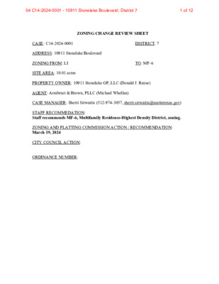
ZONING CHANGE REVIEW SHEET CASE: C14-2024-0001 DISTRICT: 7 ADDRESS: 10911 Stonelake Boulevard ZONING FROM: LI TO: MF-6 SITE AREA: 10.01 acres PROPERTY OWNER: 10911 Stonelake GP, LLC (Donald J. Reese) AGENT: Armbrust & Brown, PLLC (Michael Whellan) CASE MANAGER: Sherri Sirwaitis (512-974-3057, sherri.sirwaitis@austintexas.gov) STAFF RECOMMEDATION: Staff recommends MF-6, Multifamily Residence-Highest Density District, zoning. ZONING AND PLATTING COMMISSION ACTION / RECOMMENDATION: March 19, 2024 CITY COUNCIL ACTION: ORDINANCE NUMBER: 1 of 1204 C14-2024-0001 - 10911 Stonelake Boulevard; District 7 C14-2024-0001 ISSUES: N/A CASE MANAGER COMMENTS: 2 The site under consideration is a vacant soccer field that is zoned LI. To the north, south, east and west there are IP and LI zoned lots that are developed with office and office/warehouse uses. Further to the south, across W. Braker Lane, there is P zoned land that is undeveloped. The applicant is requesting MF-6 zoning to construct approximately 400 multifamily units on the property (please see Applicant’s Request Letter – Exhibit C). The staff supports the applicant’s request for MF-6, Multifamily Residence-Highest Density district, zoning. The property meets the intent of the district as it is located along Braker Lane/Blue Goose Corridor and is adjacent to North Burnet/Gateway Station. There are transportation services in this area as there is a Capital Metro bus route to the east along the Mopac Expressway frontage road and to the south along W. Braker Lane. In addition, there is an Urban Trail to the east (Northern Walnut Creek Trail to Stonelake Connector) and to the south (Jollyville Road to Metric Boulevard and W Braker Lane to Stonelake Boulevard) providing for pedestrian connectivity. BASIS OF RECOMMENDATION: 1. The proposed zoning should be consistent with the purpose statement of the district sought. Multifamily Residence (Highest Density) district is intended to accommodate multifamily and group residential use. This district is appropriate for highest density housing in centrally located areas near supporting transportation and commercial facilities, in areas adjoining downtown Austin and major institutional or employment centers, and in other selected areas where highest density multifamily use is desirable. The property in question is located along Braker Lane/Blue Goose Corridor as designated in the Imagine Austin Comprehensive Plan and it is adjacent to North Burnet/Gateway Station. It is located adjacent to the North Burnet/Gateway area to the south and east and to the University of Texas JJ Pickle West campus to the south. 2. The proposed zoning should promote consistency and orderly planning. MF-6 zoning would be compatible and consistent with development in this area because the surrounding zoning permits office and commercial uses that can provide for employment opportunities and services that can be utilized by the residents of this proposed development. In addition, the site is a block from the service road for North MoPac Expressway. There are transportation options at this location as there is a Capital Metro bus route to the east along the Mopac Expressway frontage road and to the south as well as a bus stop along West Braker Lane. In addition, there is an Urban Trail to the east (Northern Walnut Creek Trail to Stonelake Connector) and to the south (Jollyville 2 of 1204 C14-2024-0001 - 10911 Stonelake Boulevard; District 7 C14-2024-0001 3 Road to Metric Boulevard and W Braker Lane to Stonelake Boulevard) providing for pedestrian connectivity. EXISTING ZONING AND LAND USES: ZONING LAND USES Site North South East West LI LI, IP LI, P LI LI Undeveloped Office (Quarry Oaks II) Office/Warehouse (Stonelake Office Park) Hotel (Home Suites), Restaurant (The Boat) Office (Quarry Oaks III) NEIGHBORHOOD PLANNING AREA: N/A WATERSHED: Walnut Creek SCHOOLS: Austin I.S.D. NEIGHBORHOOD ORGANIZATIONS: Austin Independent School District, Austin Lost and Found Pets, Friends of Austin Neighborhoods, Homeless Neighborhood Association, Neighborhood Empowerment Foundation, SELTexas, Sierra Club, Austin Regional Group, TNR BCP - Travis County Natural Resources AREA CASE HISTORIES: NUMBER REQUEST C14-2023-0104 NBG-NP (Commercial Mixed- Use Subdistrict) to NBG-NP (Commercial Mixed Use-Midway Zone Subdistrict) COMMISSION 11/14/2023: Motion to grant staff’s recommendation of NBG-CMU-M- NP combining district zoning for C14-2023-0104 - North Burnet/Gateway CMU-Midway Rezoning located at area bounded by Loop 1/Mopac Expy; US Hwy 183; Capital of Texas Hwy; Stonelake Blvd; York Blvd; Tudor Blvd., was approved on the consent agenda on the motion by Commissioner Azhar, seconded by Commissioner Maxwell on a vote of 12-0. Commissioner Barrera- Ramirez off the dais. CITY COUNCIL 1/18/2024: The public hearing was conducted and amotion to close the public hearing and approve Ordinance No. 20240118-064 for North Burnet/Gateway-neighborhood plan (NBG-NP) combining district zoning (commercial mixed use-midway zone subdistrict) was approved on Council Member Qadri's motion, Council Member Ellis' second on an11-0vote. 3 of 1204 C14-2024-0001 - 10911 Stonelake Boulevard; District 7 C14-2024-0001 4 SF-2 to GO C14-2023-0067 (Student Union Addition and New Gymnasium - Hyde Park Schools: 11400 N Mopac Expressway Service Road South Bound) MF-2 to LO-MU C14-03-0060 (San Marin II Apartments: 4025 Duval Road) C14-97-0151 MF-2 to GO C14-97-00 17 Tract 1: MI to MI-PDA, Tract 2: MF-2 to MI- PDA RELATED CASES: N/A August 1, 2023: Approved staff's recommendation of GO district zoning by consent (7-0, C. Thompson, R. Johnson and K. Garrett-absent); A. Flores-1st, B. Greenberg-2nd. 9/9/03: Approve staff’s alternate recommendation of LO-MU, with the following added condition: No access for vehicles exceeding 1-ton capacity or more. (7-1, J. Martinez-Nay); K. Jackson-1st, M. Whaley-2nd 2/3/98: Approved GO-CO w/ conditions (6-0); Agreed to by Applicant/ Neighborhood Groups 7/8/97: Approved MI-PDA (5-0- 3); Applicant agreed to provide pedestrian/sidewalk access to Duval Road September 14, 2023: The public hearing was conducted and a motion to close the public hearing and approve Ordinance No. 20230914-120 for GO district zoning was approved on Council Member Ryan Alter’s motion, Council Member Kelly’s second on a 7-0 vote. Mayor Pro Tem Ellis was off the dais. Council Members Alison Alter, Harper- Madison, and Pool were absent. 10/30/03: Granted LO-MU zoning, with restrictive covenant for added ZAP Commission condition (7-0); all 3 readings 3/5/98: Approved PC rec. of GOCO & RR w/ conditions (6- 0); all 3 readings 8/14/97: Approved MI-PDA (7- 0); all 3 readings 4 of 1204 C14-2024-0001 - 10911 Stonelake Boulevard; District 7 C14-2024-0001 5 OTHER STAFF COMMENTS: Comprehensive Planning Project Name and Proposed Use: 10911 STONELAKE BOULEVARD. C14-2024-0001. Project: 10911 Stonelake. 10.01 acres from LI to MF-6. Existing: Vacant. Proposed: multifamily midrise proposing 400 residential units. Yes Y Imagine Austin Decision Guidelines Complete Community Measures * Imagine Austin Growth Concept Map: Located within or adjacent to an Imagine Austin Activity Center, Imagine Austin Activity Corridor, or Imagine Austin Job Center as identified the Growth Concept Map. Names of Activity Centers/Activity Corridors/Job Centers *: Located along Braker Lane/Blue Goose Corridor, and adjacent to North Burnet/ Gateway Station Y Mobility and Public Transit *: Located within 0.25 miles of public transit stop and/or light rail station. Mobility and Bike/Ped Access *: Adjoins a public sidewalk, shared path, and/or bike lane. Y Connectivity, Good and Services, Employment *: Provides or is located within 0.50 miles to goods and services, and/or employment center. Connectivity and Food Access *: Provides or is located within 0.50 miles of a grocery store/farmers market. Connectivity and Education *: Located within 0.50 miles from a public school or university. Connectivity and Healthy Living *: Provides or is located within 0.50 miles from a recreation area, park or walking trail. Y Connectivity and Health *: Provides or is located within 0.50 miles of health facility (ex: hospital, urgent care, doctor’s office, drugstore clinic, and/or specialized outpatient care.) Y Housing Choice *: Expands the number of units and housing choice that suits a variety of household sizes, incomes, and lifestyle needs of a diverse population (ex: apartments, triplex, granny flat, live/work units, cottage homes, and townhomes) in support of Imagine Austin and the Strategic Housing Blueprint. Housing Affordability *: Provides a minimum of 10% of units for workforce housing (80% MFI or less) and/or fee in lieu for affordable housing. Mixed use *: Provides a mix of residential and non-industrial uses. Culture and Creative Economy *: Provides or is located within 0.50 miles of a cultural resource (ex: library, theater, museum, cultural center). Culture and Historic Preservation: Preserves or enhances a historically and/or culturally significant site. Creative Economy: Expands Austin’s creative economy (ex: live music venue, art studio, film, digital, theater.) Workforce Development, the Economy and Education: Expands the economic base by creating permanent jobs, especially in industries that are currently not represented in a particular area or that promotes a new technology, and/or promotes educational opportunities and workforce development training. Industrial Land: Preserves or enhances industrial land. Not located over Edwards Aquifer Contributing Zone or Edwards Aquifer Recharge Zone 5 Number of “Yes’s” 5 of 1204 C14-2024-0001 - 10911 Stonelake Boulevard; District 7 C14-2024-0001 Environmental 6 The site is located over the Edwards Aquifer Recharge Zone. The site is in the Walnut Creek Watershed of the Colorado River Basin, which is classified as a Suburban Watershed by Chapter 25-8 of the City's Land Development Code. The site is in the Desired Development Zone. Under current watershed regulations, development or redevelopment on this site will be subject to the following impervious cover limits: Development Classification % of Gross Site Area % of Gross Site Area with Transfers Single-Family (minimum lot size 5750 sq. ft.) Other Single-Family or Duplex Multifamily Commercial 50% 55% 60% 80% 60% 60% 70% 90% According to floodplain maps there is no floodplain within or adjacent to the project location. Standard landscaping and tree protection will be required in accordance with LDC 25-2 and 25-8 for all development and/or redevelopment. At this time, site specific information is unavailable regarding vegetation, areas of steep slope, or other environmental features such as bluffs, springs, canyon rimrock, caves, sinkholes, and wetlands. Under current watershed regulations, development or redevelopment requires water quality control with increased capture volume and control of the 2 year storm on site. At this time, no information has been provided as to whether this property has any preexisting approvals that preempt current water quality or Code requirements. Fire No comments. Parks and Recreation Parkland dedication will be required for the new applicable uses proposed by this development, multifamily with MF-6 zoning, at the time of subdivision or site plan, per City Code § 25-1-601. Whether the requirement shall be met with fees in-lieu or dedicated land will be determined using the criteria in City Code Title 25, Article 14, as amended. Should fees in-lieu be required, those fees shall be used toward park investments in the form of land acquisition and/or park amenities within the surrounding area, per the Parkland Dedication Operating Procedures § 14.3.11. The area is currently park deficient. 6 of 1204 C14-2024-0001 - 10911 Stonelake Boulevard; District 7 C14-2024-0001 7 If the applicant wishes to discuss parkland dedication requirements in advance of site plan or subdivision applications, please contact this reviewer: thomas.rowlinson@austintexas.gov. At the applicant’s request, PARD can provide an early determination of whether fees in-lieu of land will be allowed. Site plan comments will be issued at time of site plan submittal. This site will be subject to Subchapter E Commercial Design Standards. Site Plan Transportation ZONING REVIEW COMMENTS The Austin Strategic Mobility Plan (ASMP) calls for 58 feet of right-of-way for Stonelake Blvd. It is recommended that 29 feet of right-of-way from the existing centerline should be dedicated for Stonelake Blvd according to the ASMP with the first subdivision or site plan application. [LDC 25-6-51 and 25-6-55]. It appears a portion of Stonelake Blvd is private. With the first subdivision or site plan it may be required to become public right of way if it meets the requirements of the TCM 3.4.2.3.1 - Conversion of Existing Private Streets to Public Streets. The adjacent street characteristics table is provided below: Name ASMP Classification ASMP Required ROW Existing ROW Existing Pavement Sidewalks Bicycle Route Capital Metro (within ¼ mile) Stonelake Blvd Local 58 feet 35 feet 27 feet None None None Mobility 1 (Measured from public portion of ROW) Water Utility No comments on zoning change. FYI: The landowner intends to serve the site with existing City of Austin water utilities. Depending on the development plans submitted, water and or wastewater service extension requests may be required. All water and wastewater construction must be inspected by the City of Austin. For more information pertaining to the Service Extension Request process and submittal requirements contact the Austin Water SER team at ser@austintexas.gov. 7 of 1204 C14-2024-0001 - 10911 Stonelake Boulevard; District 7 C14-2024-0001 8 INDEX OF EXHIBITS TO FOLLOW A. Zoning Map B. Aerial Map C. Applicant’s Request Letter 8 of 1204 C14-2024-0001 - 10911 Stonelake Boulevard; District 7 LO 85-244 SPC-93-0554A 92-0081 MF-2-CO 81-067 RC ( ( ( W E LLA N ( SF-2 ( SF-2 ( ( D CIR ( R T D N E R T ( ( ( ( ( ( ( ( ( ( ( SF-2 ( ( ( ( ( ( ( ( ( ( ( ( BISCAY D ( R ( ( ( SF-2 ( ( ( ( ( ( SF-2 ( ( ( ( ( ( SF-2 ( ( ( EXHIBIT A ( ( SF-2 ( M A D ( R I D D R ( ( ( ( ( ( ( ( ( ( R D O R G E L A ( ( ( ( ( G ALACIA D ( ( R ( ( ( ( ( ( R N D O G A R A ( ( ( ( ( ( ( ( ( ( ( ( ( ( ( ( ( ( ( ( ( SF-2 ( ( ( ALH A M B R A D R ( ( ( SF-2 ( ( ( ( ( ( ( ( ( CORDOVA DR R E D D R E E V L L A C ( ( ( ( ( ( ( SF-2 ( LO 85.244.4RC IP ( ( SF-2 ( ( SP07-0081C SP97-0231C SP-95-0485C 93-0123 ( ( P ( ( ( ( ( ( 85-244.5RC SP-06-0698C ! ! ! ! ! ! ! ! ! ! ! ! ! ! LI ! ! ! ! ! ! ! ! ! ! ! ! ! ! ! 85-244.11R.C. SP-99-2027C SP-97-0445C ! ! ! ! ! ! ! ! ! ! ! 83-115 ! SP94-0335C ! ! ! ! ! ! ! ! !! SP95-0305C SP94-0335C SP94-0335C 85.244.4RC PA O N M ! ! ! ! ! ! ! ! ! R ! ! ! ! ! ! R D TE EN S C E ! N ! S C 8 5 2 0-0 9 P S C 8 2 4 4-0 9 P S 8 5 - 2 4 4 . 8 R C SP90-0181C ! ! ! ! IP-NP C14-2008-0182 ! ! ! ! ! ! ! ! ! ! ! ! ! ! ! O ! ! ALC W B ! ! ! ! ! ! ! ! ! ! ! ! ! ! ! B D S R V Y S P X C E PA O R R A E K A R MP B Y S P X C E PA O N M N M B TO B C S P M A B R C N A P O O M R T E K A R W B B D N R V Y S P X C E A P O N M B Y N P X C E A P O N M C14H-00-2177 C14-2008-0182 NBG-NP H00-2177 C14-06-0077 06-0077 SP-04-0188C SP-06-0483C NBG-NP C14-2008-0182 C14-04-0146 LO 81-067RC SP97-0253C 93-0020 CS-CO SP-03-0158C W B R A K E R LN P P S T O N E L A K E B L V D NBG-NP ± SUBJECT TRACT ! ! ! ! ! ! PENDING CASE ZONING BOUNDARY ! ! ! ! ! ! ! ! ! ! ! ! ! ! ! ! ! ZONING ZONING CASE#: C14-2024-0001 This product is for informational purposes and may not have been prepared for or be suitable for legal, engineering, or surveying purposes. It does not represent an on-the-ground survey and represents only the approximate relative location of property boundaries. 1 " = 400 ' This product has been produced by the Planning Department for the sole purpose of geographic reference. No warranty is made by the City of Austin regarding specific accuracy or completeness. Created: 1/5/2024 ! ! ! ! ! ! ! ! ! ! ! ! ! ! ! ! ! ! ! ! ! ! ! ! ! ! ! ! ! ! ! ! ! ! ! ! ! ! ! ! ! ! ! ! ! ! ! ! ! ! ! ! ! ! ! ! ! ! ! ! ! ! ! ! ! ! ! ! ! ! ! ! ! ! ! ! ! ! ! ! ! ! ! ! ! ! ! ! ! ! ! ! ! ! ! ! ! ! ! ! ! ! ! ! ! ! ! ! ! ! ! ! ! ! ! ! ! ! ! ! ! ! ! ! ! ! ! ! ! ! ! ! ! ! ! ! ! ! ! ! ! ! ! ! ! ! ! ! ! ! ! ! ! ! ! ! ! ! ! ! ! ! ! ! ! ! ! ! ! ! ! ! ! ! ! ! ! ! ! ! ! ! ! ! ! ! ! ! ! ! ! ! ! ! ! ! ! ! ! ! ! ! ! ! ! ! ! ! ! ! ! ! ! ! ! ! ! ! ! ! ! ! ! ! ! ! ! ! ! ! ! ! ! ! ! ! ! ! ! ! ! ! ! ! ! ! 9 of 1204 C14-2024-0001 - 10911 Stonelake Boulevard; District 7 EXHIBIT B !!!!!!!!!!!!!!!!!!!!!!!!!!!!!!!!!!!!!!!!!!!!!!!!!!!!(!(!(!(!(!(!(!(!(!(!(!(!(!(!(!(!(!(!(!(!(!(!(!(!(!(!(!(!(!(!(!(!(!(!(!(!(!(!(!(!(!(!(!(!(!(!(!(!(!(!(!(!(!(!(!(!(!(!(!(!(!(!(!(!(!(!(!(!(!(!(!(!(!(!(!(!(!(!(!(!(!(!(!(!(!(!(!(!(!(!(!(!(!(!(!(!(!(!(!(!(!(!(!(!(!(!(!(!(!(!(!(!(!(!(!(!(!(!(!(!(!(!(!(!(!(!(!(!(!(!(J33J34C14-2024-0001C14-2008-0182C14-2008-0182C14H-00-2177C14-06-0077C14-04-0146C14-2008-0182NMOPACEXPYSBALHAMBRADRNMOPACEXPYNBGALACIADRNMOPACEXPYSVRDSBSTONELAKEBLVDNMOPACEXPYSVRDNBWBRAKERLNCALLEVERDEDRBISCAYDRCORDOVADRNMOPACSBTOBRAKERRAMPMADRIDDRARAGONDRWBALCONESCENTERDRTRENTDRWBRAKERTOMOPACNBRAMPWELLANDCIRALEGRODRLIPIPLOPIP-NPSF-2MF-2-CONBG-NPSF-2CS-COLOSF-2SF-2SF-2SF-2SF-2NBG-NPSF-2SF-2SF-2LOSF-2NBG-NPP10911 Stonelake±This product has been produced by the Planning Department for the sole purpose of geographic reference. No warrantyis made by the City of Austin regarding specific accuracy or completeness.ZONING CASE#:LOCATION:SUBJECT AREA:GRID:MANAGER:C14-2024-000110911 Stonelake Blvd10.01 Acres J33Sherri SirwaitisCreated: 1/24/2024SUBJECT TRACTZONING BOUNDARY!!!!!!PENDING CASECREEK BUFFER0200400600800100Feet10 of 1204 C14-2024-0001 - 10911 Stonelake Boulevard; District 7 EXHIBIT C ARMBRUST & BROWN, PLLC A T T O R N E Y S A N D C O U N S E L O R S 100 CONGRESS AVENUE, SUITE 1300 AUSTIN, TEXAS 78701-2744 512-435-2300 FACSIMILE 512-435-2360 December 29, 2023 Joi Hardin, Zoning Officer City of Austin Housing and Planning Department 1000 E. 11th St. Austin, Texas 78702 Dear Ms. Hardin, Re: Rezoning application for 10911 Stonelake Blvd. (the “Property”) On behalf of 10911 Stonelake, LP (the “Applicant”), please accept the attached rezoning application package requesting that the city downzone the Property from Limited Industrial Services (“LI”) to Multifamily Family – Highest Density (“MF-6”) in order to provide increased housing in the North Burnet/Gateway area. The Applicant is currently planning to develop approximately 400 units on the Property (roughly 10 acres), though these figures are subject to revision as the planning process proceeds (the “Project”). By downzoning the Property to MF-6, the Applicant is fully committing the Project to providing housing – and is giving up all industrial and commercial entitlements. The Property’s land use context is characterized by the following key features: It has direct access to employment opportunities and a number of commercial amenities. The Property is located within the Stonelake Office Park, an area that features a large number of office uses, various commercial amenities (including a gym and several restaurants), and some existing multifamily housing. It is zoned for a mix of Limited Industrial Services (“LI”), Industrial Park (“IP”), General Commercial Services (“CS”), Community Commercial (“GR”), Limited Office (“LO”), General Office (“GO”), and Multifamily – Low Density (“MF-2”). It is over 700 ft. from the closest single-family neighborhood. While the area was initially developed as a more suburban ‘office park’ context, the Project will help diversify the uses available at this location, providing additional housing options for workers in the area. It is directly adjacent to the North Burnet/Gateway area, including the Domain and the J.J. Pickle Research Campus. The Property is less than a mile from the Domain and the J.J. Pickle Research Campus, both of which are major employers. The Domain also offers extensive commercial amenities, including restaurants, shops, entertainment, and other services. The Project will increase housing opportunities close to these jobs and commercial amenities. It is located along the Braker Lane corridor – with access to transit. The Property is located along the Braker Lane corridor, an Imagine Austin corridor and Transit Priority Network roadway. It is also roughly a five-minute walk from a CapMetro bus stop with direct service to the Domain, downtown, Burnet Road, the University of Texas at Austin, South Lamar, the Arboretum, and Southpark Meadows, among other locations – and is less than a 10-minute drive from the Kramer Line Station, with commuter rail service. We believe that this land use context indicates that this Property is an appropriate location for increased housing growth. This Project will help add residential uses into an ‘office park’ context, improving the mix of uses and providing housing opportunities close to employment. Additionally, the Property has access to transit service and 11 of 1204 C14-2024-0001 - 10911 Stonelake Boulevard; District 7 is located adjacent to the North Burnet/Gateway area, with access to restaurant, shopping, entertainment, services, and other commercial amenities. I appreciate your consideration and look forward to answering any questions and providing further details. Respectfully, Michael J. Whellan 4873-7323-8167, v. 2 2 12 of 1204 C14-2024-0001 - 10911 Stonelake Boulevard; District 7