02 SP-2021-0095C - Park 290 Logistics Center; District 1.pdf — original pdf
Backup
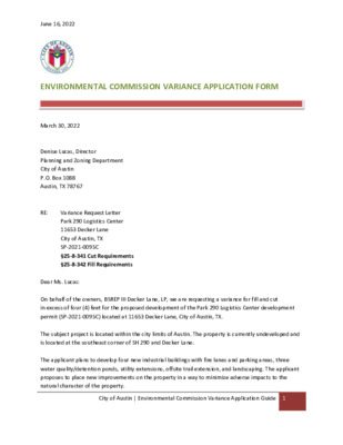
June 16, 2022 ENVIRONMENTAL COMMISSION VARIANCE APPLICATION FORM Variance Request Letter Park 290 Logistics Center 11653 Decker Lane City of Austin, TX SP-2021-0095C §25-8-341 Cut Requirements §25-8-342 Fill Requirements March 30, 2022 Denise Lucas, Director Planning and Zoning Department City of Austin P.O. Box 1088 Austin, TX 78767 RE: Dear Ms. Lucas: On behalf of the owners, BSREP III Decker Lane, LP, we are requesting a variance for fill and cut in excess of four (4) feet for the proposed development of the Park 290 Logistics Center development permit (SP-2021-0095C) located at 11653 Decker Lane, City of Austin, TX. The subject project is located within the city limits of Austin. The property is currently undeveloped and is located at the southeast corner of SH 290 and Decker Lane. The applicant plans to develop four new industrial buildings with fire lanes and parking areas, three water quality/detention ponds, utility extensions, offsite trail extension, and landscaping. The applicant proposes to place new improvements on the property in a way to minimize adverse impacts to the natural character of the property. City of Austin | Environmental Commission Variance Application Guide 1 June 16, 2022 The site is not located within the Drinking Water Protection Zone nor the Edwards Aquifer Recharge Zone. The site is in the Onion Creek Watershed of the Colorado River Basin and is classified as a Suburban Watershed by Chapter 25-8 of the City’s Land Development Code. The project requires leniency from the following code section: Division 5. – Cut, Fill, and Spoil § 25-8-341 - CUT REQUIREMENTS. (A)Cuts on a tract of land may not exceed four feet of depth, except: (1) in an urban watershed; (2 )in a roadway right-of-way; (3 )for construction of a building foundation or swimming pool; (4) for construction of a water quality control or detention facility and appurtenances for conveyance such as swales, drainage ditches, and diversion berms, if: (a) the design and location of the facility within the site minimize the amount of cut over four feet; (b) the cut is the minimum necessary for the appropriate functioning of the facility; and (c) the cut is not located on a slope with a gradient of more than 15 percent or within 100 feet of a classified waterway; (5) for utility construction or a wastewater drain field, if the area is restored to natural grade; (6) in a state-permitted sanitary landfill or a sand or gravel excavation located in the extraterritorial jurisdiction, if: (a) the cut is not in a critical water quality zone; (b) the cut does not alter a 100-year floodplain; (c) the landfill or excavation has an erosion and restoration plan approved by the City; and (d) all other applicable City Code provisions are met. Source: Subsections 13-7-16(b), (c), and (e); Ord. 990225-70; Ord. 031211-11; Ord. No. 20170615-102 , Pt. 20, 6-15-17. § 25-8-342 - FILL REQUIREMENTS. (A) Fill on a tract of land may not exceed four feet of depth, except: (1) in an urban watershed; (2) in a roadway right-of-way; (3) under a foundation with sides perpendicular to the ground, or with pier and beam construction; (4) for construction of a water quality control or detention facility and appurtenances for conveyance such as swales, drainage ditches, and diversion berms, if: City of Austin | Environmental Commission Variance Application Guide 2 June 16, 2022 (a) the design and location of the facility within the site minimize the amount of fill over four feet; (b) the fill is the minimum necessary for the appropriate functioning of the facility; and (c) the fill is not located on a slope with a gradient of more than 15 percent or within 100 feet of a classified waterway; (5) for utility construction or a wastewater drain field; or (6) in a state-permitted sanitary landfill located in the extraterritorial jurisdiction, if: (a) the fill is derived from the landfill operation; (b) the fill is not placed in a critical water quality zone or a 100-year floodplain; (c) the landfill operation has an erosion and restoration plan approved by the City; and (d) all other applicable City Code provisions are met. (B) A fill area must be restored and stabilized. (C) Fill for a roadway must be contained within the roadway clearing width described in Section 25-8- 322 (Clearing For A Roadway). The Land Development Code allows Land Use Commission Variances per the following: Division 3. – Variances § 25-8-41 - LAND USE COMMISSION VARIANCES. (A) It is the applicant's burden to establish that the findings described in this Section have been met. Except as provided in Subsections (B) and (C), the Land Use Commission may grant a variance from a requirement of this subchapter after determining that: (1) the requirement will deprive the applicant of a privilege available to owners of other similarly situated property with approximately contemporaneous development subject to similar code requirements; (2) the variance: (a) is not necessitated by the scale, layout, construction method, or other design decision made by the applicant, unless the design decision provides greater overall environmental protection than is achievable without the variance; (b) is the minimum deviation from the code requirement necessary to allow a reasonable use of the property; and (c) does not create a significant probability of harmful environmental consequences; and (3) development with the variance will result in water quality that is at least equal to the water quality achievable without the variance. City of Austin | Environmental Commission Variance Application Guide 3 June 16, 2022 Below you will find the findings of fact concerning the need for the variance. Your favorable consideration and support of our request would be appreciated. If you have any questions, please feel free to call. Sincerely, Hollis Scheffler, P.E. Project Manager TBPE Firm #F-469 City of Austin | Environmental Commission Variance Application Guide 4 PROJECT DESCRIPTION Applicant Contact Information June 16, 2022 Name of Applicant Street Address City State ZIP Code Work Phone E-Mail Address Hollis Scheffler – Pacheco Koch Consulting Engineers, Inc. 8701 N. Mopac Expy, Suite 320 Austin, Texas; 78759 512.485.0831 hscheffler@pkce.com Variance Case Information Case Name Case Number Park 290 Logistics Center (SP-2021-0095C) 11653 Decker Lane; Austin, TX 78744 Enrique Maiz-Torres Address or Location Environmental Reviewer Name Environmental Resource Management Reviewer Name Applicable Ordinance Watershed Protection Ordinance Watershed Name Gilleland Creek, Decker Creek Watershed Classification ☐Urban ☐ Suburban ☐Water Supply Suburban ☐Water Supply Rural ☐ Barton Springs Zone Edwards Aquifer Recharge Zone ☐ Barton Springs Segment ☐ Northern Edwards Segment ☐ Not in Edwards Aquifer Zones Edwards Aquifer Contributing Zone Distance to Nearest Classified Waterway ☐ Yes ☐ No 2320 ft to Decker Creek Water and Waste Water service to be provided by Austin Water City of Austin | Environmental Commission Variance Application Guide 5 June 16, 2022 Request Impervious cover square footage: acreage: percentage: Provide general description of the property (slope range, elevation range, summary of vegetation / trees, summary of the geology, CWQZ, WQTZ, CEFs, floodplain, heritage trees, any other notable or outstanding characteristics of the property) LDC §25-8-342 – Fill Requirements LDC §25-8-342 – Cut Requirements Existing ___0_____ ___0_____ ___0_____ Proposed 1,766,832 SF 41.2 AC ____62%___ The project is located at the intersection of US 290 and Decker Lane within the City of Austin Limits. The site has a Gross Site Area of 66.30 acres and is comprised of two tracts located at SWQ SH-130 and US Highway 290. The site is located within the Gilleland Creek Watershed and the Decker Creek Watershed, which is classified as a suburban watershed. No portion of the project limits of construction is located within the limits of the 100-yr floodplain. Site reconnaissance observations did not indicate any critical water quality zones (CWQZ), but there is an identified critical environmental feature (CEF) that is noted on both the topographical survey and existing site plan included. The property has slopes that vary from 0.13% to 18265.38%. The site slopes generally northeast-to-southwest across the site. Surface drainage flows mostly flows from the north to the south. The slope breakdown is as follows: 0-15% Slopes = 65.8 acres 15-25% Slopes = 0.66 acres 25-35% Slopes = 0.06 acres Over 35% Slopes = 0.004 acres Topography of the project limits of construction ranges from 602 to 653 feet. The vegetation of the site was classified as rangeland, consisting of a grazed herbaceous layer with scrubs and small groupings of trees. The trees present on the site were dominated by Ashe juniper, Texas ash, Monterrey oak, cedar elm, honey mesquite, and several others not listed. The site is located within the undivided Navarro and Taylor geologic formations. The surface soils on the project site can be summarized as mostly Houston Black and Heiden. City of Austin | Environmental Commission Variance Application Guide 6 June 16, 2022 Clearly indicate in what way the proposed project does not comply with current Code (include maps and exhibits) Construction of the Park 290 Logistics center project will require areas of cut and fill exceeding four (4) feet. Cut between 8’ and 21.76’ will be limited to mostly the internal area between buildings 1, 3, and 4. the This area is 10.62 acres, which is 16.02 percent of the gross site area. Pockets of cut between 4’ to 8’ throughout the site, the total area is 5.97 acres which is 9.4 percent of the gross site area. Fill between 8’ and 27.90’ mainly borders building 2 and 3. The total area is 7.35 acres, 11.09 percent of gross site area. Limited areas of fill between 4’ to 8’ border the higher sections of fill around building 3 and 4. This total area is 1.5 acres, 2.3 percent of the gross site area. City of Austin | Environmental Commission Variance Application Guide 7 As required in LDC Section 25-8-41, in order to grant a variance the Land Use Commission must make the following findings of fact: Include and explanation with each applicable finding of fact. Project: Park 290 Logistics Center (SP-2021-0095C) Land Use Commission variance determinations from Chapter 25-8-41 of the City Code: June 16, 2022 FINDINGS OF FACT Ordinance: 25-8-41 A. 1. The requirement will deprive the applicant of a privilege available to owners of similarly situated property with approximately contemporaneous development subject to similar code requirements. Yes / No Park 290 Logistics Center will be a Class-A logistics center that will include the construction of four LEED certified buildings. Building 1 is a 77,760 square foot building. Building 2 is a 322,420 square foot building. Building 3 is a 145,530 square foot building. Building 4 is a 243,000 square foot building. Building 1 and 3 have rear loading facilities and building 2 and 4 has a cross dock truck court. A variance request is common for large facilities of this type in this part of Austin; without this variance the applicant would be deprived of privileges available to owners of similar projects. The building configuration and placement on the property was based on lot configuration, existing topography, and roadway connectivity. Working around these considerations dictated the buildable area for the significant footprint of these four buildings. The finished floor elevations of the four proposed buildings were dictated by the desire to as closely balance the site as possible, while still being able to tie into existing roadways. There are two driveway connections on to FM 3177 (Decker Lane) that provide full access. The most southern driveway ties into matching grade at elevations of 615.0 and 615.1. The more northern connection ties into matching grade at elevations of 611.2 and 613.50. There is also a connection on to the US 290 northbound frontage road with matching grade elevations of 608.2 and 608.9. Based on these existing elevations an iterative process was followed to determine the finished floor elevations of the four buildings that provided the most balanced cut-fill for the site. Due to the aforementioned reasons of working around driveway tie in locations while still providing the desired square footage, the finished floor elevation of building 1 was set to 624.30, building 2 finished floor elevation was set to 653.00, building 3 finished floor elevation was set to 630.50, and building four finished floor elevation was set to City of Austin | Environmental Commission Variance Application Guide 8 June 16, 2022 2. a) 628.50. The parking areas, truck courts, and driveways surrounding the buildings where than set based off the building FFE and standard minimum and maximum grades. This resulted in cut and fill above the limits of 4 feet, with greater than 4’ of cut in the areas adjacent to the four buildings. The variance: Is not necessitated by the scale, layout, construction method, or other design decision made by the applicant, unless the design decision provides greater overall environmental protection than is achievable without the variance; Yes / No The configuration of the buildings and the placement of the property was dictated by the elevation of the existing, adjacent roadways and the need to have a balanced cut/fill. The site design provides three driveway connections to existing roadways: two full access connections to FM 3177 (Decker Lane) and one connection to the US 290 northbound frontage road. Both connections on to FM 3177 and the deceleration lane and connection from US 290 fall within the TXDOT Right-of-way, and must meet the design guidelines outlined by TXDOT, in the Access Management Manual, for driveway connections. Design guidelines require the roadway connections to into existing roadway elevation and dictate the allowable/required slopes of the connections, which set the elevations at both the top and bottom of the roadway connections. The parking areas, truck courts, and driveways internal to the site were designed to facilitate these roadway connections, while still meeting the standard design requirements for slope and grade. Ultimately, these design constraints set by the roadway connections lead to cut and fill above the required limit. However, an effort was made to keep the cut and fill on the site to a minimum and the current site design and layout was found to be the optimum option. Regardless of the proposed development on this site, some amount of cut and fill would be required above the allowable limit. The backing from this claim stems from the fact that any roadway connection from this site falls in the TXDOT Right-of-way, and therefore must meet the design criteria outlined above. Additionally, any development within the current land-use as outlined by the zoning assigned to this site will require a large amount of the site to be relatively flat, necessitating the need for considerable cut-fill based on the existing topography of the site. Also, based on site surveys there is some existing fill in the center of the site (see photographs 30 and 31 from the attached Phase 1 Environmental Site Assessment). Based upon historical topography it appears the current site’s topography, and cut and fill, may have been affected by the construction of US 290. Again, this would be a factor that any type of development would have to consider, but would especially influence City of Austin | Environmental Commission Variance Application Guide 9 August 30, 2022 projects with large, flat building floorplans including industrial or commercial sites. It should also be noted that major revisions to the site plan and building layouts have been made to lower the cut/fill requirements of the site. Building 1 was significantly reduced in size from 116,640 square feet to 77,760 square feet, a reduction of over 33 percent in an effort to reduce the cut/fil and next export off site. The FFE of building 2 was also changed from 632.75 feet to 653 feet, an increase of 20.25 feet. These two changes were done as an attempt to more closely follow the existing conditions of the site, which includes a high point where building 2 is proposed. By raising the FFE of building 2 the cut and fill associated with the building can be reduced. The reduction in the square footage of building 1 allows for the grade to drop more gradually down to the lower existing elevations of building 1. The total square footage of the four buildings will be 788,710 square feet. The use of all the buildings requires a uniform finished floor elevation similarly found in other industrial and commercial buildings. The building type, layout, and design features are based on the industrial nature of the buildings. Per the city code there is to be no more than 4’ of cut/fill in a suburban watershed on a site without a waiver or variance for development. With the industrial product that is being more and more prevalent in the City of Austin there are 4’ truck docks on the loading side of the building which has the finish floor and the parking adjacent to the building 4’ higher than the loading position on the building. With additional drainage needed on the loading dock, one runs into a problem on all the buildings with needing a variance of some sort for the product type. Generally, from the edge of the truck court to the parking in the front of the building there is 6’ of difference to allow for positive drainage on the buildings. This layout is similar to other such facilities in the Austin Area, and we feel that the variance does not provide special privilege not enjoyed by other similarly situated properties and similarity timed development (Dalfen Industrial – SP-2020-0407D). In order to mitigate the excessive cut and fill the products on this site are generating, we have proposed the following conditions to be included in our construction plans: • Preserve trees and natural areas to the best of our ability. • Provide a tree-shaded outdoor seating area as to encourage employees to take breaks on-site, rather than driving to alternative locations. • Provide an on-site trail with drainage swales that naturally convey flows into existing on-site ponds. • Provide vegetative walls adjacent to the critical environmental feature • Provide a terraced landscaping area in the open space allocated on the located on the site. site. City of Austin | Environmental Commission Variance Application Guide 10 June 16, 2022 b) c) Is the minimum deviation from the code requirement necessary to allow a reasonable use of the property; Yes / No As mentioned above, cut and fill above the City of Austin limits is required due to the elevations of the existing roadways and required design guidelines for connections, parking areas, truck courts, and buildings. The proposed building sites, parking areas, truck courts and fire lanes that are required for development require the fill to exceed 4 feet in portions of the site. Most of the required fill needed to raise the elevation of these areas will be structurally contained with gravity retaining walls. The grade at the top of the walls varies to meet the grading in the surrounding parking and driveways. Similarly, the grade at the bottom of the wall varies to meet the design requirements of the detention and water quality ponds. The wall also serves to reduce erosive flows from the site. Does not create a significant probability of harmful environmental consequences. Yes / No The proposed Park 290 Logistics Center project does not create a significant probability of harmful environmental consequences. The project will not impact any heritage trees. There is no floodplain or critical water quality zone on site that will be affected. There is a CEF on site, but as indicated by the proposed site plan the required 75-foot setback is met through the design. The project has been designed to prevent any future disturbances to local water quality by capturing and treating all impervious cover stormwater. The design includes three partial sedimentation/filtrations ponds that meet the necessary filtration and sedimentation requirements outlined by City of Austin water quality regulations. Water quality pond 1 provides 54,512.93 cubic feet of filtration storage and 45,079.16 cubic feet of sedimentation storage. Water quality pond 2 provides 39,773.05 cubic feet of filtration storage and 54,255.50 cubic feet of sedimentation storage. Water quality pond 3 provides 94,599.81 cubic feet of filtration storage and 31,286.88 cubic feet of sedimentation storage. Water quality pond 1, 2, and 3 all provide more water quality volume than the minimum required volume, indicating water quality has been fully considered. To meet interim design and construction stages, we have provided the site with a phased erosion control plan. This erosion control plan will help prevent the site from creating large dust impacts as well as managing silt runoff. We are providing multiple phases which include and initial phase to rough grade the City of Austin | Environmental Commission Variance Application Guide 11 June 16, 2022 3. 1. 2. 3. ponds and following phases to clear, grade and stabilize the site. These additional phases are held to a maximum of 32 acres in area and follow the natural topography of the site. In additional to these measures, the site will have monitored construction entrances, inlet projection, and tree protection to protect the site. Development with the variance will result in water quality that is at least equal to the water quality achievable without the variance. Yes / No Exceeding the fill limitation on this project will not reduce the level of water quality achievable. By containing the fill in gravity retaining walls, and reducing the probability of erosive flows, the proposed project will achieve the same level of water quality achievable without the variance. Also, as previously mentioned, all impervious cover stormwater runoff will be captured and treated on site in a water quality facility that meets compliance with the Land Development Code and Environmental Criteria Manual. Three partial sedimentation/filtration ponds are designed to provide 188,885.79 cubic feet of filtration storage and 130,621.54 cubic feet of sedimentation storage. B. Additional Land Use Commission variance determinations for a requirement of Section 25-8-422 (Water Quality Transition Zone), Section 25-8-452 (Water Quality Transition Zone), Article 7, Division 1 (Critical Water Quality Zone Restrictions), or Section 25-8-368 (Restrictions on Development Impacting Lake Austin, Lady Bird Lake, and Lake Walter E. Long): The criteria for granting a variance in Subsection (A) are met; N/A The requirement for which a variance is requested prevents a reasonable, economic use of the entire property; N/A The variance is the minimum deviation from the code requirement necessary to allow a reasonable, economic use of the entire property. N/A **Variance approval requires all above affirmative findings. City of Austin | Environmental Commission Variance Application Guide 12 June 16, 2022 A Exhibits for Commission Variance o Aerial photos of the site o Site photos o Aerial photos of the vicinity o Context Map—A map illustrating the subject property in relation to developments in the vicinity to include nearby major streets and waterways o Topographic Map - A topographic map is recommended if a significant grade change on the subject site exists or if there is a significant difference in grade in relation to adjacent properties. o For cut/fill variances, a plan sheet showing areas and depth of cut/fill with topographic elevations. o Site plan showing existing conditions if development exists currently on the property o Proposed Site Plan- full size electronic or at least legible 11x17 showing proposed development, include tree survey if required as part of site or subdivision plan o Environmental Map – A map that shows pertinent features including Floodplain, CWQZ, WQTZ, CEFs, Setbacks, Recharge Zone, etc. o An Environmental Resource Inventory pursuant to ECM 1.3.0 (if required by 25-8-121) o Applicant’s variance request letter City of Austin | Environmental Commission Variance Application Guide 13 June 16, 2022 AERIAL PHOTO – VICINITY City of Austin | Environmental Commission Variance Application Guide 14 June 16, 2022 AERIAL PHOTO – SITE City of Austin | Environmental Commission Variance Application Guide 15 June 16, 2022 SITE PHOTOS City of Austin | Environmental Commission Variance Application Guide 16 June 16, 2022 SITE PHOTOS – CONT. City of Austin | Environmental Commission Variance Application Guide 17 June 16, 2022 CONTEXT MAP City of Austin | Environmental Commission Variance Application Guide 18 June 16, 2022 TOPOGRAPHIC MAP See attached City of Austin | Environmental Commission Variance Application Guide 19 1 3 8 0 . 5 8 4 . 2 1 5 : T 0 2 3 E T U S I , Y P X E C A P O M . N 1 0 7 8 0 0 0 8 0 0 0 1 - S L M R F G N Y E V R U S I I . G E R X T I 9 6 4 - F M R F G N R E E N G N E I I . G E R X T 9 5 7 8 7 X T , I N T S U A R E T N E C S C I T S I G O L 0 9 2 K R A P E N A L R E K C E D 3 5 6 1 1 S A X E T , Y T N U O C S I V A R T , N I T S U A F O Y T I C P A M A E R A E G A N I A R D G N I T S I X E DESIGN DRAWN DATE SHEET NO. 39 SP-2021-0095C June 16, 2022 CUT/FILL EXHIBIT See attached City of Austin | Environmental Commission Variance Application Guide 20 1 3 8 0 . 5 8 4 . 2 1 5 : T 0 2 3 E T U S I , Y P X E C A P O M . N 1 0 7 8 0 0 0 8 0 0 0 1 - S L M R F G N Y E V R U S I I . G E R X T I 9 6 4 - F M R F G N R E E N G N E I I . G E R X T 9 5 7 8 7 X T , I N T S U A R E T N E C S C I T S I G O L 0 9 2 K R A P E N A L R E K C E D 3 5 6 1 1 S A X E T , Y T N U O C S I V A R T , N I T S U A F O Y T I C T I B I H X E L L I F T U C - DESIGN DRAWN DATE SHEET NO. 54 SP-2021-0095C June 16, 2022 EXISTING SITE PLAN See attached City of Austin | Environmental Commission Variance Application Guide 21 1 1 T E E H S - E N I L H C T A M 1 3 8 0 . 5 8 4 . 2 1 5 : T 0 2 3 E T U S I , Y P X E C A P O M . N 1 0 7 8 0 0 0 8 0 0 0 1 - S L M R F G N Y E V R U S I I . G E R X T I 9 6 4 - F M R F G N R E E N G N E I I . G E R X T 9 5 7 8 7 X T , I N T S U A R E T N E C S C I T S I G O L 0 9 2 K R A P E N A L R E K C E D 3 5 6 1 1 S A X E T , Y T N U O C S I V A R T , N I T S U A F O Y T I C 8 F O 1 N A L P N O I T I L O M E D & S N O I T I D N O C G N I T S I X E PROJECT LOCATION TRAVIS COUNTY VICINITY MAP DESIGN DRAWN DATE SHEET NO. 10 SP-2021-0095C MATCH LINE - SHEET 13 0 1 T E E H S - E N I L H C T A M 1 3 8 0 . 5 8 4 . 2 1 5 : T 0 2 3 E T U S I , Y P X E C A P O M . N 1 0 7 8 0 0 0 8 0 0 0 1 - S L M R F G N Y E V R U S I I . G E R X T I 9 6 4 - F M R F G N R E E N G N E I I . G E R X T 9 5 7 8 7 X T , I N T S U A R E T N E C S C I T S I G O L 0 9 2 K R A P E N A L R E K C E D 3 5 6 1 1 S A X E T , Y T N U O C S I V A R T , N I T S U A F O Y T I C 8 F O 2 N A L P N O I T I L O M E D & S N O I T I D N O C G N I T S I X E 2 1 T E E H S - E N I L H C T A M PROJECT LOCATION TRAVIS COUNTY VICINITY MAP MATCH LINE - SHEET 14 DESIGN DRAWN DATE SHEET NO. 11 SP-2021-0095C 1 1 T E E H S - E N I L H C T A M MATCH LINE - SHEET 15 1 3 8 0 . 5 8 4 . 2 1 5 : T 0 2 3 E T U S I , Y P X E C A P O M . N 1 0 7 8 0 0 0 8 0 0 0 1 - S L M R F G N Y E V R U S I I . G E R X T I 9 6 4 - F M R F G N R E E N G N E I I . G E R X T 9 5 7 8 7 X T , I N T S U A R E T N E C S C I T S I G O L 0 9 2 K R A P E N A L R E K C E D 3 5 6 1 1 S A X E T , Y T N U O C S I V A R T , N I T S U A F O Y T I C 8 F O 3 N A L P N O I T I L O M E D & S N O I T I D N O C G N I T S I X E PROJECT LOCATION TRAVIS COUNTY VICINITY MAP DESIGN DRAWN DATE SHEET NO. 12 SP-2021-0095C MATCH LINE - SHEET 10 7 1 T E E H S - E N I L H C T A M 4 1 T E E H S - E N I L H C T A M 1 3 8 0 . 5 8 4 . 2 1 5 : T 0 2 3 E T U S I , Y P X E C A P O M . N 1 0 7 8 0 0 0 8 0 0 0 1 - S L M R F G N Y E V R U S I I . G E R X T I 9 6 4 - F M R F G N R E E N G N E I I . G E R X T 9 5 7 8 7 X T , I N T S U A R E T N E C S C I T S I G O L 0 9 2 K R A P E N A L R E K C E D 3 5 6 1 1 S A X E T , Y T N U O C S I V A R T , N I T S U A F O Y T I C 8 F O 4 N A L P N O I T I L O M E D & S N O I T I D N O C G N I T S I X E PROJECT LOCATION TRAVIS COUNTY VICINITY MAP DESIGN DRAWN DATE SHEET NO. 13 SP-2021-0095C 3 1 T E E H S - E N I L H C T A M 5 1 T E E H S - E N I L H C T A M MATCH LINE - SHEET 11 MATCH LINE - SHEET 16 1 3 8 0 . 5 8 4 . 2 1 5 : T 0 2 3 E T U S I , Y P X E C A P O M . N 1 0 7 8 0 0 0 8 0 0 0 1 - S L M R F G N Y E V R U S I I . G E R X T I 9 6 4 - F M R F G N R E E N G N E I I . G E R X T 9 5 7 8 7 X T , I N T S U A R E T N E C S C I T S I G O L 0 9 2 K R A P E N A L R E K C E D 3 5 6 1 1 S A X E T , Y T N U O C S I V A R T , N I T S U A F O Y T I C 8 F O 5 N A L P N O I T I L O M E D & S N O I T I D N O C G N I T S I X E PROJECT LOCATION TRAVIS COUNTY VICINITY MAP DESIGN DRAWN DATE SHEET NO. 14 SP-2021-0095C MATCH LINE - SHEET 12 4 1 T E E H S - E N I L H C T A M 1 3 8 0 . 5 8 4 . 2 1 5 : T 0 2 3 E T U S I , Y P X E C A P O M . N 1 0 7 8 0 0 0 8 0 0 0 1 - S L M R F G N Y E V R U S I I . G E R X T I 9 6 4 - F M R F G N R E E N G N E I I . G E R X T 9 5 7 8 7 X T , I N T S U A R E T N E C S C I T S I G O L 0 9 2 K R A P E N A L R E K C E D 3 5 6 1 1 S A X E T , Y T N U O C S I V A R T , N I T S U A F O Y T I C 8 F O 6 N A L P N O I T I L O M E D & S N O I T I D N O C G N I T S I X E PROJECT LOCATION TRAVIS COUNTY VICINITY MAP DESIGN DRAWN DATE SHEET NO. 15 SP-2021-0095C MATCH LINE - SHEET 14 1 3 8 0 . 5 8 4 . 2 1 5 : T 0 2 3 E T U S I , Y P X E C A P O M . N 1 0 7 8 0 0 0 8 0 0 0 1 - S L M R F G N Y E V R U S I I . G E R X T I 9 6 4 - F M R F G N R E E N G N E I I . G E R X T 9 5 7 8 7 X T , I N T S U A R E T N E C S C I T S I G O L 0 9 2 K R A P E N A L R E K C E D 3 5 6 1 1 S A X E T , Y T N U O C S I V A R T , N I T S U A F O Y T I C 8 F O 7 N A L P N O I T I L O M E D & S N O I T I D N O C G N I T S I X E PROJECT LOCATION TRAVIS COUNTY VICINITY MAP DESIGN DRAWN DATE SHEET NO. 16 SP-2021-0095C 1 3 8 0 . 5 8 4 . 2 1 5 : T 0 2 3 E T U S I , Y P X E C A P O M . N 1 0 7 8 0 0 0 8 0 0 0 1 - S L M R F G N Y E V R U S I I . G E R X T I 9 6 4 - F M R F G N R E E N G N E I I . G E R X T 9 5 7 8 7 X T , I N T S U A R E T N E C S C I T S I G O L 0 9 2 K R A P E N A L R E K C E D 3 5 6 1 1 S A X E T , Y T N U O C S I V A R T , N I T S U A F O Y T I C 8 F O 8 N A L P N O I T I L O M E D & S N O I T I D N O C G N I T S I X E PROJECT LOCATION TRAVIS COUNTY VICINITY MAP DESIGN DRAWN DATE SHEET NO. 17 SP-2021-0095C 3 1 T E E H S - E N I L H C T A M T E E H S S I H T - E N I L H C T A M T E E H S S I H T - E N I L H C T A M June 16, 2022 PROPOSED SITE PLAN See attached City of Austin | Environmental Commission Variance Application Guide 22 SHEET 2(cid:27) SHEET 29 SHEET 30 T E E H S S I H T - E N I L H C T A M SHEET 31 SHEET 33 SHEET 32 1 3 8 0 . 5 8 4 . 2 1 5 : T 0 2 3 E T U S I , Y P X E C A P O M . N 1 0 7 8 0 0 0 8 0 0 0 1 - S L M R F G N Y E V R U S I I . G E R X T I 9 6 4 - F M R F G N R E E N G N E I I . G E R X T 9 5 7 8 7 X T , I N T S U A R E T N E C S C I T S I G O L 0 9 2 K R A P E N A L R E K C E D 3 5 6 1 1 S A X E T , Y T N U O C S I V A R T , N I T S U A F O Y T I C N A L P E T I S L L A R E V O PROJECT LOCATION TRAVIS COUNTY VICINITY MAP SHEET 3(cid:23) FOR OFFSITE IMPROVEMENTS SEE SHEETS 100 THROUGH 10(cid:27) T E E H S S I H T - E N I L H C T A M DESIGN DRAWN DATE SHEET NO. 27 SP-2021-0095C June 16, 2022 ENVIRONMENTAL MAP City of Austin | Environmental Commission Variance Application Guide 23 June 16, 2022 ENVIRONMENTAL RESOURCE INVENTORY (ERI) See attached City of Austin | Environmental Commission Variance Application Guide 24 Case No.: (City use only) Environmental Resource Inventory For the City of Austin Related to LDC 25-8-121, City Code 30-5-121, ECM 1.3.0 & 1.10.0 The ERI is required for projects that meet one or more of the criteria listed in LDC 25-8-121(A), City Code 30-5-121(A). 1. SITE/PROJECT NAME: Decker Lane 2. COUNTY APPRAISAL DISTRICT PROPERTY ID (#’s): 227143; 236734; 73135 3. ADDRESS/LOCATION OF PROJECT: 10800 block Decker Lane, Austin, Texas 78724 4. WATERSHED: Gilleland Creek; Decker Creek 5. THIS SITE IS WITHIN THE (Check all that apply) Edwards Aquifer Recharge Zone* (See note below) .................. YES No Edwards Aquifer Contributing Zone*.................................. YES No Edwards Aquifer 1500 ft Verification Zone* ....................... YES No Barton Spring Zone* .......................................................... YES No *(as defined by the City of Austin – LDC 25-8-2 or City Code 30-5-2) Note: If the property is over the Edwards Aquifer Recharge zone, the Hydrogeologic Report and karst surveys must be completed and signed by a Professional Geoscientist Licensed in the State of Texas. 6. DOES THIS PROJECT PROPOSE FLOODPLAIN MODIFICATION?.......YES** NO If yes, then check all that apply: (1) The floodplain modifications proposed are necessary to protect the public health and safety; (2) The floodplain modifications proposed would provide a significant, demonstrable environmental benefit, as determined by a functional assessment of floodplain health as prescribed by the Environmental Criteria Manual (ECM), or (3) The floodplain modifications proposed are necessary for development allowed in the critical water quality zone under LDC 25-8-261 or 25-8-262, City Code 30-5-261 or 30-5-262. (4) The floodplain modifications proposed are outside of the Critical Water Quality Zone in an area determined to be in poor or fair condition by a functional assessment of floodplain health. ** If yes, then a functional assessment must be completed and attached to the ERI (see ECM 1.7 and Appendix X for forms and guidance) unless conditions 1 or 3 above apply. 7. IF THE SITE IS WITHIN AN URBAN OR SUBURBAN WATERSHED, DOES THIS PROJECT PROPOSE A UTILITY LINE PARALLEL TO AND WITHIN THE CRITICAL WATER QUALITY ZONE? ......................................................... YES*** NO ***If yes, then riparian restoration is required by LDC 25-8-261(E) or City Code 30-5-261(E) and a functional assessment must be completed and attached to the ERI (see ECM1.5 and Appendix X for forms and guidance). 8. There is a total of 1 (#’s) Critical Environmental Feature(s)(CEFs) on or within150 feet of the project site. If CEF(s) are present, attach a detailed DESCRIPTION of the CEF(s), color PHOTOGRAPHS, the CEF WORKSHEET and provide DESCRIPTIONS of the proposed CEF buffer(s) and/or wetland mitigation. Provide the number of each type of CEFs on or within 150 feet of the site (Please provide the number of CEFs ): 0 0 (#’s) Spring(s)/Seep(s) (#’s) Point Recharge Feature(s) 0 (#’s) Bluff(s) (#’s) Canyon Rimrock(s) (#’s) Wetland(s) 0 1 Note: Standard buffers for CEFs are 150 feet, with a maximum of 300 feet for point recharge features. Except for wetlands, if the standard buffer is not provided, you must provide a written request for an administrative variance from LDC 25-8-281(C)(1) and provide written findings of fact to support your request. Request forms for administrative variances from requirements stated in LDC 25-8-281 are available from Watershed Protection Department. 9. The following site maps are attached at the end of this report (Check all that apply and provide): All ERI reports must include: Site Specific Geologic Map with 2-ft Topography Historic Aerial Photo of the Site Site Soil Map Critical Environmental Features and Well Location Map on current Aerial Photo with 2-ft Topography Only if present on site (Maps can be combined): Edwards Aquifer Recharge Zone with the 1500-ft Verification Zone (Only if site is over or within 1500 feet the recharge zone) Edwards Aquifer Contributing Zone Water Quality Transition Zone (WQTZ) Critical Water Quality Zone (CWQZ) City of Austin Fully Developed Floodplains for all water courses with up to 64-acres of drainage 10. HYDROGEOLOGIC REPORT – Provide a description of site soils, topography, and site specific geology below (Attach additional sheets if needed): Surface Soils on the project site is summarized in the table below and uses the SCS Hydrologic Soil Groups*. If there is more than one soil unit on the project site, show each soil unit on the site soils map. Soil Series Unit Names, Infiltration Characteristics & Thickness *Soil Hydrologic Groups Definitions (Abbreviated) Soil Series Unit Name & Subgroup** Group* Thickness (feet) A. Soils having a high infiltration rate when thoroughly wetted. Heiden clay, 3 to 5 percent slopes & 5 to 8 percent slopes, eroded (HeC2 & HeD2), Udic Chromusterts Heiden gravelly clay, 8 to 20 percent slopes, moderately eroded (HgF2), Udic Chomusterts Houston Black clay, 1 to 3 percent slopes (HnB), Udic Pellusterts Houston Black clay, 3 to 5 percent slopes, moderately eroded (HnC2), Udic Pellusterts Houston Black gravelly clay, 2 to 8 percent slopes, moderately eroded (HoD2), Udic Pellusterts D D D D D 0’ to 5’5” 0’ to >6’8” 0’ to >6’8” 0’ to >6’8” 0’ to >6’8” B. Soils having a moderate infiltration rate when thoroughly wetted. C. Soils having a slow infiltration rate when thoroughly wetted. D. Soils having a very slow infiltration rate when thoroughly wetted. **Subgroup Classification – See Classification of Soil Series Table WPD ERM ERI-2014-01 Page 2 of 6 Description of Site Topography and Drainage (Attach additional sheets if needed): The overall topography of the site was illustrated as a hilltop with slopes oriented northeast-to-southwest and south-to-north toward drainageways outside the survey area. The maximum elevation of the property was approximately 650 feet above mean sea level (amsl) and a minimum elevation of approximately 610 feet amsl. List surface geologic units below: Group Formation Member Geologic Units Exposed at Surface Quaternary Terrace and Alluvial Deposits Navarrow Group Taylor Group Sprinkle and Bergstrom Formation Quaternary Terrace and Alluvial Deposits Brief description of site geology (Attach additional sheets if needed): Soils in this area are underlain by the Navarro and Taylor Groups, undivided (Knt) and high gravel deposits (Qhg; McGowen et al 1987; USGS 2020; see Geologic Map). The Navarro and Taylor Groups are characterized by Late Cretaceous claystones and chalky limestones. High gravel deposits within the Austin Sheet feature minor quartzite, milky quartz, sandstone, and mudstone underlying silty clays. McGowen, J. H., C. V Proctor, Jr., W. T. Haenggi, and D. F. Reaser 1987 Geological Atlas of Texas, Austin Sheet. Bureau of Economic Geology. The University of Texas at Austin. U.S. Geological Survey (USGS) 2020 U.S. Department of the Interior Mineral Resources On-Line Spatial Data Website. http://mrdata.usgs.gov/sgmc/tx.html (accessed August 2020). Wells – Identify all recorded and unrecorded wells on site (test holes, monitoring, water, oil, unplugged, capped and/or abandoned wells, etc.): There are 0 (#) wells present on the project site and the locations are shown and labeled 0 0 0 (#’s)The wells are not in use and have been properly abandoned. (#’s)The wells are not in use and will be properly abandoned. (#’s)The wells are in use and comply with 16 TAC Chapter 76. There are 0 (#’s) wells that are off-site and within 150 feet of this site. WPD ERM ERI-2014-01 Page 3 of 6 11. THE VEGETATION REPORT – Provide the information requested below: Brief description of site plant communities (Attach additional sheets if needed): The survey area was characterized as rangeland, consisting of a grazed herbaceous layer with scrub and small groupings of trees scattered throughout the survey area. The rangeland vegetation community was dominated by Ashe juniper (Juniperus ashei), Texas ash (Fraxinus albicans), Monterrey oak (Quercus polymorpha), cedar elm (Ulmus crassifolia), agarita (Berberis trifoliolata), pricklyash (Zanthoxylum hirsutum), honey mesquite (Prosopis glandulosa), and Jerusalem thorn (Parkinsonia aculeata) in the tree and scrub strata. The herbaceous strata was mostly forbs with some scattered grasses, including Texas wintergrass (Nassella leucotricha), splitbeard bluestem (Andropogon ternarius), Maximilian sunflower (Helianthus maximiliani), Texas croton (Croton texensis), white heath aster (Symphyotrichum ericoides), prairie broomweed (Amphiachyris dracunculoides), old man’s beard (Clematis drummondii), common ragweed (Ambrosia artemisiifolia), snow-on-the-prairie (Euphorbia bicolor), saw greenbrier (Smilax bona-nox), southern dewberry (Rubus trivialis), sumpweed (Iva annua), frog fruit (Phyla nodiflora), and catchfly prairie gentian (Eustoma exaltatum). There is woodland community on site ............................. YES NO (Check one). If yes, list the dominant species below: Woodland species Common Name Scientific Name N/A N/A There is grassland/prairie/savanna on site ................... YES NO (Check one). If yes, list the dominant species below: Grassland/prairie/savanna species Common Name Scientific Name Texas wintergrass splitbeard bluestem prairie broomweed Texas croton white heath aster old man’s beard Nassella leucotricha Andropogon ternarius Amphiachyris dracunculoides Croton texensis Symphyotrichum ericoides Clematis drummondii Maximilian sunflower Helianthus maximiliani There is hydrophytic vegetation on site ....................... YES NO (Check one). If yes, list the dominant species in table below (next page): WPD ERM ERI-2014-01 Page 4 of 6 southern cattail soft rush Texas frogfruit sedge Hydrophytic plant species Common Name Scientific Name common spikerush Eleocharis palustris Typha domingensis Juncus effusus Phyla nodiflora Carex spp. Wetland Indicator Status OBL OBL OBL FAC FAC/FACW/OBL A tree survey of all trees with a diameter of at least eight inches measured four and one- half feet above natural grade level has been completed on the site. YES NO (Check one). 12. WASTEWATER REPORT – Provide the information requested below. On-site system(s) Wastewater for the site will be treated by (Check of that Apply): City of Austin Centralized sewage collection system Other Centralized collection system Note: All sites that receive water or wastewater service from the Austin Water Utility must comply with City Code Chapter 15-12 and wells must be registered with the City of Austin The site sewage collection system is designed and will be constructed to in accordance to all State, County and City standard specifications. YES NO (Check one). Calculations of the size of the drainfield or wastewater irrigation area(s) are attached at the end of this report or shown on the site plan. YES NO Not Applicable (Check one). Wastewater lines are proposed within the Critical Water Quality Zone? YES NO (Check one). If yes, then provide justification below: WPD ERM ERI-2014-01 Page 5 of 6 Is the project site is over the Edwards Aquifer? YES NO (Check one). If yes, then describe the wastewater disposal systems proposed for the site, its treatment level and effects on receiving watercourses or the Edwards Aquifer. 13. One (1) hard copy and one (1) electronic copy of the completed assessment have been provided. Date(s) ERI Field Assessment was performed: 08/06/2020 Date(s) My signature certifies that to the best of my knowledge, the responses on this form accurately reflect all information requested. Nicholas Schiwitz Print Name Signature 214-998-3029 Telephone nschiwitz@intenvsol.com Email Address Integrated Environmental Solutions, LLC Name of Company 03/25/2021 Date For project sites within the Edwards Aquifer Recharge Zone, my signature and seal also certifies that I am a licensed Professional Geoscientist in the State of Texas as defined by ECM 1.12.3(A). P.G. Seal WPD ERM ERI-2014-01 Page 6 of 6 1 2 3 4 9 City of Austin Environmental Resource Inventory - Critical Environmental Feature Worksheet Project Name: Project Address: Site Visit Date: Decker Lane 08/06/2020 03/25/2021 10800 block Decker Lane, Austin, Texas 78724 5 6 7 8 Primary Contact Name: Phone Number: Prepared By: Email Address: Nicholas Schiwitz 214-998-3029 Nicholas Schiwitz nschiwitz@intenvsol.com Environmental Resource Inventory Date: FEATURE TYPE {Wetland,Rimrock, Bluffs,Recharge Feature,Spring} FEATURE ID (eg S-1) Wetland – artificial pond that filled with sediment to develop seasonally saturated conditions preferred by wetland vegetation. 1:1 mitigation proposed in site plans. FEATURE LONGITUDE (WGS 1984 in Meters) FEATURE LATITUDE (WGS 1984 in Meters) WETLAND DIMENSIONS (ft) RIMROCK/BLUFF DIMENSIONS (ft) coordinate notation coordinate W-1 3,077,451.719850 N 963,108.340286 notation W X 123.3 Y 86.3 Length Avg Height RECHARGE FEATURE DIMENSIONS Z Y Trend X Springs Est. Discharge cfs Please state the method of coordinate data collection and the approximate precision and accuracy of the points and the unit of measurement. Method GPS Accuracy sub-meter Surveyed Other □ □ Professional Geologists apply seal below □ □ > 1 meter meter City of Austin Use Only CASE NUMBER: For rimrock, locate the midpoint of the segment that describes the feature. For wetlands, locate the approximate centroid of the feature and the estimated area. For a spring or seep, locate the source of groundwater that feeds a pool or stream. WPD ERM ERI-CEF-01 Page 7 of 8 Soils Map Decker Lane City of Austin Travis County, Texas 1 in = 600 feet Feet 0 600 File Ref. Date: 04.338.001 3/22/2021 - Survey Area 150-foot Buffer Soil Map Units Soil Map Units Outside of the Survey Area HeC2 - Heiden clay, 3 to 5 percent slopes, eroded HeD2 - Heiden clay, 5 to 8 percent slopes, eroded HgF2 - Heiden gravelly clay, 8 to 20 percent slopes, moderately eroded HnB - Houston Black clay, 1 to 3 percent slopes HnC2 - Houston Black clay, 3 to 5 percent slopes, moderately eroded HoD2 - Houston Black gravelly clay, 2 to 8 percent slopes, moderately eroded Legend Contours Year- 2017 2 Ft Contours 10 Ft Contours 0.3 03/22/2021 NAD_1983_StatePlane_Texas_Central_FIPS_4203_Feet 0 0.15 0.3 Miles This product is for informational purposes and may not have been prepared for or be suitable for legal, engineering, or surveying purposes. It does not represent an on-the-ground survey. This product has been produced by the City of Austin for the sole purpose of geographic reference. No warranty is made by the City of Austin regarding specific accuracy or completeness. 1: 9,600 Notes Topographic map with two-foot contours. Qhg Knt Geologic Map Decker Lane City of Austin Travis County, Texas 1 in = 600 feet Feet 0 600 File Ref. Date: 04.338.001 3/22/2021 - Survey Area 150-foot Buffer Geologic Formations - Central Texas Knt - Navarro and Taylor Groups, undivided Qhg - high gravel deposits Texas Water Development Board Well Report Sites Plugging Reports Well Reports March 22, 2021 The d ata in Wa te r D a ta In ter ac ti ve re pr es en ts th e b e st a va il ab le i nfo rm ati on p ro vid e d b y th e TW D B a nd thi rd -p a rty co o pe ra to rs o f th e TW D B. The TWD B p ro vi de s i n fo rm a ti o n v ia thi s w eb si te a s a pu b li c se rv ice . N ei the r th e S tate of Te xa s n o r the TWD B a ss u me s a ny le g al li ab il ity or r es po n si bi li ty or ma ke s a n y gu a ra nte e s o r w ar ran ti es a s to the a ccu ra cy, co mp l ete n es s o r su ita b ili ty o f th e in for ma tio n fo r a n y pa rti cu la r p u rpo se . The TWD B s yste ma tic a lly re vis e s or r em o ve s d ata d isc ov er ed to b e in co rre ct. If y ou fin d in a ccu ra te i n fo rm a ti o n o r h av e q u es tio n s, pl e as e c on ta ct WD I- Su p po rt @ tw d b .te xa s.g o v. 0 0 0.15 0.3 0.25 0.5 1:18,056 0.6 mi 1 km Source: Esri, Maxar, GeoEye, Earthstar Geographics, CNES/Airbus DS, USDA, USGS, AeroGRID, IGN, and the GIS User Community TEXAS WATER DEVELOPMENT BOARD Texas Railroad Commission Oil/Gas Well Sites Sources: Esri, HERE, Garmin, Intermap, increment P Corp., GEBCO, USGS,FAO, NPS, NRCAN, GeoBase, IGN, Kadaster NL, Ordnance Survey, EsriAugust 4, 202000.250.50.13mi00.40.80.2km1:18,056 Legend Image High : 255 Low : 0 0.3 03/22/2021 NAD_1983_StatePlane_Texas_Central_FIPS_4203_Feet 0 0.15 0.3 Miles This product is for informational purposes and may not have been prepared for or be suitable for legal, engineering, or surveying purposes. It does not represent an on-the-ground survey. This product has been produced by the City of Austin for the sole purpose of geographic reference. No warranty is made by the City of Austin regarding specific accuracy or completeness. 1: 9,600 Notes 1984 historic aerial photograph map W-1 Critical Environmental Features Map Decker Lane City of Austin Travis County, Texas 1 in = 400 feet Feet 0 400 File Ref. Date: 04.338.001 3/23/2021 - Survey 150-foot Buffer Wetland Critical Environmental Features 1-4 W-1 Photograph Location Map Decker Lane City of Austin Travis County, Texas 1 in = 400 feet Feet 0 400 File Ref. Date: 04.338.001 3/23/2021 - Survey Area 150-foot Buffer Photograph Location Critical Environmental Features Wetland Photograph 1 Photograph 2 Photograph 3 Photograph 4 June 16, 2022 PHASED EROSION CONTROL PLAN See attached City of Austin | Environmental Commission Variance Application Guide 25 1 3 8 0 . 5 8 4 . 2 1 5 : T 0 2 3 E T U S I , Y P X E C A P O M . N 1 0 7 8 0 0 0 8 0 0 0 1 - S L M R F G N Y E V R U S I I . G E R X T I 9 6 4 - F M R F G N R E E N G N E I I . G E R X T 9 5 7 8 7 X T , I N T S U A R E T N E C S C I T S I G O L 0 9 2 K R A P E N A L R E K C E D 3 5 6 1 1 S A X E T , Y T N U O C S I V A R T , N I T S U A F O Y T I C C S E N O C E R P O M E D - GENERAL NOTES: IF DISTURBED AREA IS NOT TO BE WORKED ON FOR MORE THAN 14 DAYS, DISTURBED AREA NEEDS TO BE STABILIZED BY REVEGETATION MATTING. [ECM 1.4.4.B.3, SECTION 5,1.] ENVIRONMENTAL INSPECTOR HAS THE AUTHORITY TO ADD AND/OR MODIFY EROSION/SEDIMENTATION CONTROLS ON SITE TO KEEP PROJECT IN-COMPLIANCE WITH THE CITY OF AUSTIN RULES AND REGULATIONS. [LDC 25-8-183] CONTRACTOR SHALL UTILIZE DUST CONTROL MEASURES DURING SITE CONSTRUCTION SUCH AS IRRIGATION TRUCKS AND MULCHING AS PER ECM 1.4.5(A), OR AS DIRECTED BY THE ENVIRONMENTAL INSPECTOR. THE CONTRACTOR WILL CLEAN UP SPOILS THAT MIGRATE ONTO THE ROADS A MINIMUM OF ONCE DAILY.” [ECM 1.4.4.D.4] PROJECT LOCATION TRAVIS COUNTY VICINITY MAP DESIGN DRAWN DATE SHEET NO. 18 SP-2021-0095C 1 3 8 0 . 5 8 4 . 2 1 5 : T 0 2 3 E T U S I , Y P X E C A P O M . N 1 0 7 8 0 0 0 8 0 0 0 1 - S L M R F G N Y E V R U S I I . G E R X T I 9 6 4 - F M R F G N R E E N G N E I I . G E R X T 9 5 7 8 7 X T , I N T S U A R E T N E C S C I T S I G O L 0 9 2 K R A P E N A L R E K C E D 3 5 6 1 1 S A X E T , Y T N U O C S I V A R T , N I T S U A F O Y T I C C S E 1 E S A H P N O I T C U R T S N O C GENERAL NOTES: IF DISTURBED AREA IS NOT TO BE WORKED ON FOR MORE THAN 14 DAYS, DISTURBED AREA NEEDS TO BE STABILIZED BY REVEGETATION MATTING. [ECM 1.4.4.B.3, SECTION 5,1.] ENVIRONMENTAL INSPECTOR HAS THE AUTHORITY TO ADD AND/OR MODIFY EROSION/SEDIMENTATION CONTROLS ON SITE TO KEEP PROJECT IN-COMPLIANCE WITH THE CITY OF AUSTIN RULES AND REGULATIONS. [LDC 25-8-183] CONTRACTOR SHALL UTILIZE DUST CONTROL MEASURES DURING SITE CONSTRUCTION SUCH AS IRRIGATION TRUCKS AND MULCHING AS PER ECM 1.4.5(A), OR AS DIRECTED BY THE ENVIRONMENTAL INSPECTOR. THE CONTRACTOR WILL CLEAN UP SPOILS THAT MIGRATE ONTO THE ROADS A MINIMUM OF ONCE DAILY.” [ECM 1.4.4.D.4] PROJECT LOCATION TRAVIS COUNTY VICINITY MAP DESIGN DRAWN DATE SHEET NO. 19 SP-2021-0095C 1 3 8 0 . 5 8 4 . 2 1 5 : T 0 2 3 E T U S I , Y P X E C A P O M . N 1 0 7 8 0 0 0 8 0 0 0 1 - S L M R F G N Y E V R U S I I . G E R X T I 9 6 4 - F M R F G N R E E N G N E I I . G E R X T 9 5 7 8 7 X T , I N T S U A R E T N E C S C I T S I G O L 0 9 2 K R A P E N A L R E K C E D 3 5 6 1 1 S A X E T , Y T N U O C S I V A R T , N I T S U A F O Y T I C C S E 2 E S A H P N O I T C U R T S N O C GENERAL NOTES: IF DISTURBED AREA IS NOT TO BE WORKED ON FOR MORE THAN 14 DAYS, DISTURBED AREA NEEDS TO BE STABILIZED BY REVEGETATION MATTING. [ECM 1.4.4.B.3, SECTION 5,1.] ENVIRONMENTAL INSPECTOR HAS THE AUTHORITY TO ADD AND/OR MODIFY EROSION/SEDIMENTATION CONTROLS ON SITE TO KEEP PROJECT IN-COMPLIANCE WITH THE CITY OF AUSTIN RULES AND REGULATIONS. [LDC 25-8-183] CONTRACTOR SHALL UTILIZE DUST CONTROL MEASURES DURING SITE CONSTRUCTION SUCH AS IRRIGATION TRUCKS AND MULCHING AS PER ECM 1.4.5(A), OR AS DIRECTED BY THE ENVIRONMENTAL INSPECTOR. THE CONTRACTOR WILL CLEAN UP SPOILS THAT MIGRATE ONTO THE ROADS A MINIMUM OF ONCE DAILY.” [ECM 1.4.4.D.4] PROJECT LOCATION TRAVIS COUNTY VICINITY MAP DESIGN DRAWN DATE SHEET NO. 20 SP-2021-0095C