03 C14-2022-0049 - 500 VFW Road; District 1.pdf — original pdf
Backup
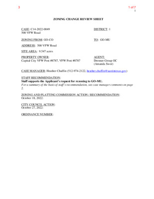
1 ZONING CHANGE REVIEW SHEET CASE: C14-2022-0049 500 VFW Road ZONING FROM: GO-CO ADDRESS: 500 VFW Road SITE AREA: 9.547 acres PROPERTY OWNER: Capital City VFW Post #8787, VFW Post #8787 DISTRICT: 1 TO: GO-MU AGENT: Drenner Group OC (Amanda Swor) CASE MANAGER: Heather Chaffin (512-974-2122, heather.chaffin@austintexas.gov) STAFF RECOMMENDATION: Staff supports the Applicant’s request for rezoning to GO-MU. For a summary of the basis of staff’s recommendation, see case manager comments on page 2. ZONING AND PLATTING COMMISSION ACTION / RECOMMENDATION: October 18, 2022: CITY COUNCIL ACTION: October 27, 2022: ORDINANCE NUMBER: 1 of 73 2 ISSUES: No issues at this time. CASE MANAGER COMMENTS: The subject property is located east of IH 35 on the north side of VFW Drive. The GO-CO property is currently developed with club or lodge and outdoor recreation land uses. The existing conditional overlay limits the site to 2,000 vehicular trips per day (vpd). North of the subject property are two multifamily developments that are zoned MF-3-CO. East of the property is land zoned SF-6-CO, LO and MF-3 that include single family residential, religious assembly and undeveloped uses. Across VFW Road to the south is an undeveloped tract that is currently under review to be rezoned from GR-CO to MF-4. Across IH 35 to the west are commercial properties zoned LI, including headquarter offices of the Texas Council on Environmental Quality (TCEQ). Please see Exhibits A and B- Zoning Map and Aerial Exhibit. Staff supports the requested GO-MU rezoning. The property has access to IH 35 via VFW Road and is in an area that includes multifamily, single family and undeveloped properties. The addition of multifamily units at this location will increase housing opportunities and be consistent with nearby residential properties. BASIS FOR RECOMMENDATION 1. The proposed zoning should be consistent with the goals and objectives of the City Council. 2. Zoning should be consistent with approved and existing residential densities. 3. Granting of the request should result in an equal treatment of similarly situated properties. EXISTING ZONING AND LAND USES: Site North South East LAND USES Club/lodge, Outdoor recreation Multifamily residential Undeveloped Single family residential, Religious assembly, Undeveloped Administrative/business office GO-CO MF-3-CO GR-CO SF-6-CO, LO, MF-3 ZONING West LI TIA: Deferred to time of site plan, if triggered. WATERSHED: Walnut Creek (suburban) NEIGHBORHOOD ORGANIZATIONS: Friends of Copperfield Nature Trails Yager Community Homeless Neighborhood Association North Growth Corridor Alliance Friends of Austin Neighborhoods Neighborhood Empowerment Foundation TechRidge Neighbors Sierra Club Pflugerville ISD Bike Austin Austin Neighborhoods Council Austin Lost and Found Pets 2 of 73 3 COMMISSION To grant MF-4 as recommended CITY COUNCIL 11/15/2022: SELTexas AREA CASE HISTORIES: NUMBER REQUEST C14-2020-0143 12121 N. IH 35 GR-CO to MF-4 EXISTING STREET CHARACTERISTICS: ADDITIONAL STAFF COMMENTS: Name ASMP Classification Existing ROW Existing Pavement Sidewalks Bicycle Route Capital Metro (within ¼ mile) ASMP Required ROW 50’ 60’ 16’ None None No Level 1 VFW Road Comprehensive Planning Yes Imagine Austin Decision Guidelines Compact and Connected Measures Imagine Austin Growth Concept Map: Located close to, within or adjacent to an Imagine Austin Activity Center, Imagine Austin Activity Corridor, or Imagine Austin Job Center as identified on the Growth Concept Map. Name(s) of Activity Center/Activity Corridor/Job Center: Mobility and Public Transit: Located within 0.25 miles of public transit stop and/or light rail station. Mobility and Bike/Ped Access: Adjoins a public sidewalk, shared path, and/or bike lane. Connectivity, Good and Services, Employment: Provides or is located within 0.50 miles to goods and services, and/or employment center. Connectivity and Food Access: Provides or is located within 0.50 miles of a grocery store/farmers market. Connectivity and Education: Is located within 0.50 miles from a public school or university. Connectivity and Healthy Living: Provides or is located within 0.50 miles from a recreational area, park and/or walking trail. Connectivity and Health: Provides or is located within 0.50 miles of health facility (ex: hospital, urgent care, doctor’s office, drugstore clinic, specialized outpatient care.) Housing Affordability: Provides a minimum of 10% of units for workforce housing (80% MFI or less) and/or fee in lieu for affordable house. Y Housing Choice: Expands the number of units and housing choice that suits a variety of household sizes, incomes, and lifestyle needs of a diverse population (ex: apartments, triplex, granny flat, live/work units, cottage homes, and townhomes) in support of Imagine Austin and the Strategic Housing Blueprint. Mixed Use: Provides mixed use development (minimum 10% residential and 10% non-residential floor area). Culture and Creative Economy: Provides or is located within 0.50 miles of a cultural resource (ex: library, theater, museum, cultural center). 1 Total Number of “Yes’s” Environmental 3 of 73 4 1. The site is not located over the Edwards Aquifer Recharge Zone. The site is in the Walnut Creek Watershed of the Colorado River Basin, which is classified as a Suburban Watershed by Chapter 25-8 of the City's Land Development Code. 2. Under current watershed regulations, development or redevelopment on this site will be subject to the following impervious cover limits: Development Classification % of Gross Site Area % of Gross Site Area Single-Family (minimum lot size 5750 sq. ft.) Other Single-Family or Duplex Multifamily Commercial 50% 55% 60% 80% with Transfers 60% 60% 70% 90% 3. According to floodplain maps there is a floodplain within or adjacent to the project location. Based upon the location of the floodplain, offsite drainage should be calculated to determine whether a Critical Water Quality Zone exists within the project location. 4. Standard landscaping and tree protection will be required in accordance with LDC 25-2 and 25-8 for all development and/or redevelopment. 5. At this time, site specific information is unavailable regarding vegetation, areas of steep slope, or other environmental features such as bluffs, springs, canyon rimrock, caves, sinkholes, and wetlands. 6. Under current watershed regulations, development or redevelopment requires water quality control with increased capture volume and control of the 2 year storm on site. Parkland PR1: Parkland dedication will be required for the new applicable uses proposed by this development, multifamily with GO-MU zoning, at the time of subdivision or site plan, per City Code § 25-1-601. Whether the requirement shall be met with fees in-lieu or dedicated land will be determined using the criteria in City Code Title 25, Article 14, as amended. Currently, the site is park deficient, and lacks sufficient access to nearby parkland, namely Northern Walnut Creek Greenbelt. PARD would consider improved connectivity solutions for park access toward the satisfaction of the parkland dedication requirement. Should any fees in-lieu be required, those fees shall be used toward park investments in the form of land acquisition and/or park amenities within the surrounding area, per the Parkland Dedication Operating Procedures § 14.3.11 and City Code § 25-1-607 (B)(1) & (2). If the applicant wishes to discuss parkland dedication requirements in advance of site plan or subdivision applications, please contact this reviewer: thomas.rowlinson@austintexas.gov. At the applicant’s request, PARD can provide an early determination of whether fees in-lieu of land will be allowed. Site Plan SP 1. Site plans will be required for any new development other than single-family, two-family or duplex residential. SP 2. Any development which occurs in an SF-6 or less restrictive zoning district which is located 540-feet or less from property in an SF-5 or more restrictive zoning district will be subject to compatibility development regulations. The site is subject to compatibility standards due to the adjacent SF-2 district to the west. 4 of 73 5 SP 3. Any new development is subject to Subchapter E. Design Standards and Mixed Use. Additional comments will be made when the site plan is submitted. SP 4. This tract is already developed and the proposed zoning change is a footprint within the existing development. The applicant is responsible for requesting relocation and demolition permits once the site plan is approved. The City Historic Preservation Officer will review all proposed building demolitions and relocations prior to site plan approval. If a building meets city historic criteria, the Historic Landmark Commission may initiate a historic zoning case on the property. Transportation Assessment of required transportation mitigation, including the potential dedication of right of way and easements and participation in roadway and other multi-modal improvements, will occur at the time of site plan application. A traffic impact analysis shall be required at the time of site plan if triggered per LDC 25-6-113. Water Utility AW1. The landowner intends to serve the site with City of Austin water and wastewater utilities. The landowner, at own expense, will be responsible for providing any water and wastewater utility improvements, offsite main extensions, utility relocations and or abandonments required by the land use. The water and wastewater utility plan must be reviewed and approved by Austin Water for compliance with City criteria and suitability for operation and maintenance. Based on current public infrastructure configurations, it appears that service extension requests (SER) will be required to provide adequate service to this site. For more information pertaining to the Service Extension Request process and submittal requirements contact the Austin Water SER team at ser@austintexas.gov. The landowner must pay the City inspection fee with the utility construction. The landowner must pay the tap and impact fee once the landowner makes an application for a City of Austin water and wastewater utility tap permit. AW2. 30 TAC §285, §15-5, §15-9: City records indicate the site is served by an On-Site Sewage Facility (OSSF). The owner must connect the site to city wastewater service through the cutover process. For more information pertaining to the wastewater cutover process, contact the AW OSSF team at OSSF@austintexas.gov or call (512)-972-0050. The cutover process may also initiate a required review by the Industrial Waste Division depending on building usage. EXHIBITS: A – Zoning Map B – Aerial Map 5 of 73 SP-05-1663D GR CS-CO C14-2018-0063 LR 98-0 0 67 98-0067 P MF-2 SF-6 E Y A G E R L N 00-2150 D N S B E R U AT N UNDEV LR 85-339RC RR N 3 5 S B T O P A R K V F W T O I H 3 5 N B R A M P N I H 3 5 N B T N H I I R H T 3 Y 5 F I S B R A M P LO MF-4 C14-2019-0010 99-0018 89-0064 UNDEV EQUIPMENT SALES IP GR 91-0069C OFFICE 85-069 90-008C C14-92-0150(RCT) SP94-0316C APARTMENTS 92-0150 94-0316C SPC96-0353A ! ! ! ! ! SF-2 ! ! ! MF-3-CO 00-2150 C14-00-2150 85-339 ! ! ! ! ! ! ! ! ! ! UNDEV ! ! LO UNDEV MF-2 SP-06-0437C 00-2133 85-168 85-149 GO PARK THIRTY FIVE CIR DETENTION\POND 84-385 INDUSTRIAL BILLBOARD GO ! BASEBALL FIELD ! ! ! ! VF ! W R ! ! D ! ! ! GO-CO 00-2084 ! ! ! ! ! ! ! ! ! ! ! ! ! ! ! 85-312 ! ! ! ! ! ! ! ! ! ! ! ! ! ! ! ! ! ! ! ! ! ! ! ! ! ! ! ! ! ! ! ! V. F. W. CELL\TOWER ! ! ! ! ! ! ! ! ! ! ! 85-339 ! ! ! ! O F FIC E LI OFFICE B S D R V S 5 3 H I N GR-CO C14-03-0151 03-0151 SP-05-0766C ! ! ! GO ! ! ! ! ! ! ! ! B N D R V S 5 3 H I N 85-312 GO ! ! ! SF-6-CO ! ! 03-0151 ! ! ! ! ! C14-85-339(RCA) BOWERY TRL UNDEV L P Y R E W O B SF-6-CO SF-6 T E C D A N E M O R E P G TA T O C SF-6-CO 2008-0193 DR SF-6-CO Y A L W L FA R E T A W 85-339 C14-2008-0193 CLE A R S T R E A M XIN G 2008-0193 PARK THIRTY FIVE CIR SP-95-0412C SP-95-0411C 83-336 GO SF-1 ( ( NO 00-2134 RR LI ( ± 85-339 SF-6-CO 85-339 SF-2 SF-2 PYEGRAVE PL SF-2 R D D O O W T O R T SF-2 PEGGOTTY PL SF-2 P LO SF-2 ( ( ( ( ( WA L N U T C R E E K D R SF-2 SF-2 R D S O M L O ( ( ( SF-2 ( ( ZONING ZONING CASE#: C14-2022-0049 SUBJECT TRACT ! ! ! ! ! ! PENDING CASE ZONING BOUNDARY This product is for informational purposes and may not have been prepared for or be suitable for legal, engineering, or surveying purposes. It does not represent an on-the-ground survey and represents only the approximate relative location of property boundaries. 1 " = 400 ' This product has been produced by the Housing and Planning Department for the sole purpose of geographic reference. No warranty is made by the City of Austin regarding specific accuracy or Created: 4/5/2022 6 of 73 !!!!!!!!!!!!!!!!!!!!!!!!!!!!!!!!!!!!!!!!!!!!!!!!!!!!!!!!!!!!!!!!!!!!!!!!!!!!!!!!!!!!!!!!!!!!!!!!!!!!!!!!!!!!!!!!!!M33M32N33N32C14-2022-0049C14-2008-0193C14-03-0151C14-85-339(RCA)C14-00-2150C14-92-0150(RCT)NATURES BNDVFW RDN IH 35 SVRD NBBOWERY TRLWATERFALL WAYCLEAR STREAM XINGWATERFALL WAYMF-3-COLOGR-COGO-COGOSF-6-COSF-6-COLRSF-6-COSF-6-COSF-6-COSF-6-COGOSF-2GO500 VFW Road±This product has been produced by the Housing and Planning Department for the sole purpose of geographicreference. No warranty is made by the City of Austin regarding specific accuracy or completeness.ZONING CASE#:LOCATION:SUBJECT AREA:GRID:MANAGER:C14-2022-0049500 VFW Road9.55 AcresM33Heather ChaffinCreated: 10/5/2022SUBJECT TRACTZONING BOUNDARY!!!!!!PENDING CASECREEK BUFFER0200400100Feet7 of 73