B-06 C14-2022-0016 - 2301 Oak Valley Rd; District 5.pdf — original pdf
Backup
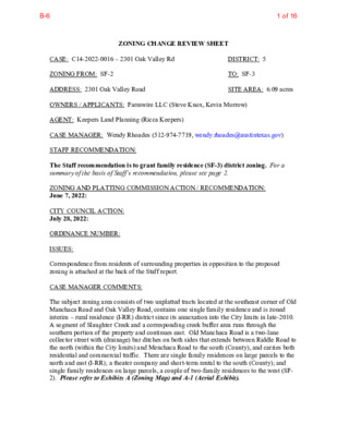
ZONING CHANGE REVIEW SHEET DISTRICT: 5 TO: SF-3 SITE AREA: 6.09 acres CASE: C14-2022-0016 – 2301 Oak Valley Rd ZONING FROM: SF-2 ADDRESS: 2301 Oak Valley Road OWNERS / APPLICANTS: Farmwire LLC (Steve Knox, Kevin Morrow) AGENT: Keepers Land Planning (Ricca Keepers) CASE MANAGER: Wendy Rhoades (512-974-7719, wendy.rhoades@austintexas.gov) STAFF RECOMMENDATION: The Staff recommendation is to grant family residence (SF-3) district zoning. For a summary of the basis of Staff’s recommendation, please see page 2. ZONING AND PLATTING COMMISSION ACTION / RECOMMENDATION: June 7, 2022: CITY COUNCIL ACTION: July 28, 2022: ORDINANCE NUMBER: ISSUES: Correspondence from residents of surrounding properties in opposition to the proposed zoning is attached at the back of the Staff report. CASE MANAGER COMMENTS: The subject zoning area consists of two unplatted tracts located at the southeast corner of Old Manchaca Road and Oak Valley Road, contains one single family residence and is zoned interim – rural residence (I-RR) district since its annexation into the City limits in late-2010. A segment of Slaughter Creek and a corresponding creek buffer area runs through the southern portion of the property and continues east. Old Manchaca Road is a two-lane collector street with (drainage) bar ditches on both sides that extends between Riddle Road to the north (within the City limits) and Menchaca Road to the south (County), and carries both residential and commercial traffic. There are single family residences on large parcels to the north and east (I-RR); a theater company and short-term rental to the south (County); and single family residences on large parcels, a couple of two-family residences to the west (SF- 2). Please refer to Exhibits A (Zoning Map) and A-1 (Aerial Exhibit). 1 of 16B-6 C14-2022-0016 Page 2 The Applicant has requested family residence (SF-3) district zoning in order to build residential units on the property. The Applicant does not have specific development plans at this time, and SF-3 zoning allows for single family residences, single family residences with accessory dwelling units (two-family residences), or duplexes. BASIS OF RECOMMENDATION: 1. The proposed zoning should be consistent with the purpose statement of the district sought. Zoning changes should promote compatibility with adjacent and nearby uses. The family residence (SF-3) district is the designation for a moderate density single-family residential use and a duplex use on a lot that is a minimum of 5,750 square feet. An SF-3 district designation may be applied to a use in an existing single-family neighborhood with moderate sized lots or to new development of family housing on lots that are 5,750 square feet or more. A two-family residence allows for one single family residence, plus a second detached unit not to exceed 1,100 square feet or a floor-to-area ratio of 0.15 : 1, whichever is smaller on each lot. The detached unit is limited to 2 stories or 30 feet in height, and 550 square feet on the second story, if any. A duplex use that is designated in an SF-3 district is subject to development standards that maintain single-family neighborhood characteristics. 2. The extension of Slaughter Creek through the southern portion of the property and its adjacent buffer area will limit the number of dwelling units that can be developed on the property. Although the residences on Oak Valley Road are single family on large lots, there is SF-3 base district zoning across Old Manchaca Road and on Drew Lane to the west. The requested SF-3 zoning would allow for up to two residential units on each newly created lot. Staff recommends the Applicant’s request because the property meets the intent of the SF-3 district as it has frontage on a residential street and a collector street, and is located within an existing residential neighborhood. EXISTING ZONING AND LAND USES: ZONING LAND USES I-RR I-RR Site North South County East West I-RR I-SF-2; SF-3; SF-3- CO One single family residence Single family residences on large parcels Theater company; Short-term rental Single family residences on large parcels Single family residences on large lots; A couple of two- family residences NEIGHBORHOOD PLANNING AREA: Not Applicable WATERSHED: Slaughter Creek – Suburban CAPITOL VIEW CORRIDOR: No TIA: Is not required SCENIC ROADWAY: No 2 of 16B-6 C14-2022-0016 Page 3 Akns High School Bailey Middle School SCHOOLS: Kocurek Elementary School COMMUNITY REGISTRY LIST: 242 – Slaughter Lane Neighborhood Association 627 – Onion Creek Homeowners Association 742 – Austin Independent School District 1214 – Bauerle Ranch Owners Association, Inc. 1228 – Sierra Club, Austin Regional Group 1343 – Oak Hill Trails Association 1530 – Friends of Austin Neighborhoods 1531 – South Austin Neighborhood Alliance (SANA) 1596 – TNR BCP – Travis County Natural Resources 1616 – Neighborhood Empowerment Foundation 1624 – Southwest Gate Addition Neighborhood Association 1774 – Austin Lost and Found Pets AREA CASE HISTORIES: 1559 – Palomino Park HOA 1363 – SEL Texas COMMISSION To Grant CITY COUNCIL Apvd (8-26-2021). NUMBER C14-2021-0089 – Drew Lane Residential – 2414 Drew LN C14-2019-0134 – 10302 Old Manchaca Rd C14-2014-0007 – Drew Lane Zoning – 2507 Mitchell Ln C14-2011-0070 – Bergstrom Duplex Rezoning – 2508 Mitchell Ln REQUEST DR to SF-3 on 2.40 acres SF-2 to SF-3 To Grant SF-3, w/conds of a r-o-w dedication on Old Manchaca Rd SF-2-CO to SF- 2, as amended To Grant SF-2-CO, w/CO for max 16 units DR; SF-2 to SF- 3-CO To Grant SF-3-CO w/CO limiting development of Lot 27 to 1 duplex use and all SF-2 uses (east lot), and Lot 26 to 1 two- family residence use and all SF-2 uses (west lot). Apvd SF-3, w/Street Deed for r-o-w as Commission recommended (1-23-2020). Apvd SF-2 (4-17-2014). Apvd SF-3-CO as Commission recommended (8-25-2011). C14-02-0171 – Page Rezoning – 10318 Old Manchaca Rd C14-01-0122 – SF-2 to SF-3-CO To Deny SF-3-CO Apvd SF-3-CO w/CO prohibiting duplex use (2-13-2003). DR to SF-2 To Grant SF-2-CO Apvd SF-2-CO 3 of 16B-6 C14-2022-0016 Page 4 Hidden Forest – 2507 Mitchell Ln C14-99-2059 – Bauerle Development – 2700-3300 Squirrel Hollow I-RR to SF-2 w/CO for a minimum 1 acre lot size To Grant RR for Tract 1 and SF-2 for Tract 2 with conditions of the TIA (10-25-2001). Apvd RR-CO for Tract 1 and SF-2-CO for Tract 2 with the CO for the conditions of the TIA and restricting access to Squirrel Hollow to emergency access (2-1-2001). RELATED CASES: The property was annexed into the City’s full-purpose jurisdiction on December 30, 2010 (C7a-10-006). A Land Status Determination was made on June 28, 2004 and states that the three acre tract (located at the corner of Old Manchaca Road and Oak Valley Road) is a legal tract and eligible to receive utility service as provided in Texas Local Government Code Section 212 (C8I-04-0220 – M. C. & NINA GRAHAM). Please refer to Exhibit B. There are no subdivision or site plan applications in process. EXISTING STREET CHARACTERISTICS: Name ASMP Classification ASMP Required ROW Existing ROW Existing Pavement Sidewalks Bicycle Route Old Manchaca Road Oak Valley Road ASMP Level 2 ASMP Level 1 68’ 50’ 48’ – 56’ 20’ 53’ 15’ No No None None Yes OTHER STAFF COMMENTS: Inclusive Planning Project Name and Proposed Use: 6.09 acres from I-RR to SF-3. Demolish existing house, rezone to SF-3, and sell two parcels for single family development Capital Metro (within ¼ mile) Yes Yes Y Imagine Austin Decision Guidelines Compact and Connected Measures Imagine Austin Growth Concept Map: Located close to, within or adjacent to an Imagine Austin Activity Center, Imagine Austin Activity Corridor, or Imagine Austin Job Center as identified on the Growth Concept Map. Name(s) of Activity Center/Activity 4 of 16B-6 C14-2022-0016 Page 5 Corridor/Job Center: 60 feet west of Slaughter Lane Station Neighborhood Center Mobility and Public Transit: Located within 0.25 miles of public transit stop and/or light rail station. Mobility and Bike/Ped Access: Adjoins a public sidewalk, shared path, and/or bike lane. Y Connectivity, Good and Services, Employment: Provides or is located within 0.50 miles to goods and services, and/or employment center. Y Connectivity and Food Access: Provides or is located within 0.50 miles of a grocery Connectivity and Education: Is located within 0.50 miles from a public school or store/farmers market. university. Connectivity and Healthy Living: Provides or is located within 0.50 miles from a recreational area, park and/or walking trail. Connectivity and Health: Provides or is located within 0.50 miles of health facility (ex: hospital, urgent care, doctor’s office, drugstore clinic, specialized outpatient care.) Housing Affordability: Provides a minimum of 10% of units for workforce housing (80% MFI or less) and/or fee in lieu for affordable house. Housing Choice: Expands the number of units and housing choice that suits a variety of household sizes, incomes, and lifestyle needs of a diverse population (ex: apartments, triplex, granny flat, live/work units, cottage homes, and townhomes) in support of Imagine Austin and the Strategic Housing Blueprint. Mixed Use: Provides mixed use development (minimum 10% residential and 10% non- residential floor area). Culture and Creative Economy: Provides or is located within 0.50 miles of a cultural resource (ex: library, theater, museum, cultural center). 3 Total Number of “Yes’s” Drainage The developer is required to submit a pre- and post-development drainage analysis at the subdivision and site plan stage of the development process. The City’s Land Development Code and Drainage Criteria Manual require that the Applicant demonstrate through engineering analysis that the proposed development will have no identifiable adverse impact on surrounding properties. Environmental The site is not located over the Edwards Aquifer Recharge Zone. The site is in the Slaughter Creek Watershed of the Colorado River Basin, which is classified as a Suburban Watershed by Chapter 25-8 of the City's Land Development Code. The site is in the Desired Development Zone. Under current watershed regulations, development or redevelopment on this site will be subject to the following impervious cover limits: 5 of 16B-6 C14-2022-0016 Page 6 Development Classification % of Gross Site Area % of Gross Site Area Single-Family (minimum lot size 5750 sq. ft.) Other Single-Family or Duplex Multifamily Commercial 50% 55% 60% 80% with Transfers 60% 60% 70% 90% According to floodplain maps there is a floodplain within or adjacent to the project location. Based upon the location of the floodplain, offsite drainage should be calculated to determine whether a Critical Water Quality Zone exists within the project location. Standard landscaping and tree protection will be required in accordance with LDC 25-2 and 25-8 for all development and/or redevelopment. At this time, site specific information is unavailable regarding vegetation, areas of steep slope, or other environmental features such as bluffs, springs, canyon rimrock, caves, sinkholes, and wetlands. Under current watershed regulations, development or redevelopment requires water quality control with increased capture volume and control of the 2-year storm on site. At this time, no information has been provided as to whether this property has any preexisting approvals that preempt current water quality or Code requirements. Impervious Cover The maximum impervious cover allowed by the SF-3 zoning district would be 45%, which is based on the more restrictive zoning regulations. PARD – Planning & Design Review Parkland dedication will be required for the new residential units proposed by this development, single-family with SF-3 zoning, at the time of subdivision or site plan, per City Code § 25-1-601. Whether the requirement shall be met with fees in-lieu or dedicated land will be determined using the criteria in City Code Title 25, Article 14, as amended. Should fees in-lieu be required, those fees shall be used toward park investments in the form of land acquisition and/or park amenities within the surrounding area, per the Parkland Dedication Operating Procedures § 14.3.11 and City Code § 25-1-607 (B)(1) & (2). If the applicant wishes to discuss parkland dedication requirements in advance of site plan or subdivision applications, please contact this reviewer: thomas.rowlinson@austintexas.gov. At the applicant’s request, PARD can provide an early determination of whether fees in-lieu of land will be allowed. 6 of 16B-6 C14-2022-0016 Page 7 Site Plan and Compatibility Standards Site plans will be required for any new development other than single family, two-family, or duplex residential. Any new development is subject to Subchapter E. Design Standards and Mixed Use. Additional comments will be made when the site plan is submitted. Rezoning from I-RR to SF-3 does not trigger the application of compatibility standards. The applicable building standards are outlined below: Breakdown by square footage for living area / garage / patio / porch is required on duplex residential site plans. Setbacks for duplex residential: • Anything that juts more than 5 feet into a setback must be fireproofed. Standard side setback is 5 feet with a maximum allowable 2-foot overhang. The overhang cannot have any openings, soffit vents, windows, etc. • Setbacks between buildings is 10 feet (5 feet on each side). Any encroachment into this setback must be fireproofed. • Nothing can encroach into a 2-foot setback. Austin Transportation Department – Engineering Review ASMP Assessment The Austin Strategic Mobility Plan (ASMP) calls for 68 feet of right-of-way for Old Manchaca Rd. It is recommended that 34 feet of right-of-way from the existing centerline should be dedicated for Old Manchaca Rd. according to the Transportation Plan with the first subdivision or site plan application. [LDC 25-6-51 and 25-6-55]. Transportation Assessment Assessment of required transportation mitigation, including the potential dedication of right of way and easements and participation in roadway and other multi-modal improvements, will occur at the time of site plan application. A traffic impact analysis shall be required at the time of site plan if triggered per LDC 25-6-113. Austin Water Utility The landowner intends to serve the site with City of Austin water and wastewater utilities. The landowner, at own expense, will be responsible for providing any water and wastewater utility improvements, offsite main extensions, utility relocations and or abandonments required by the land use. The water and wastewater utility plan must be reviewed and approved by Austin Water for compliance with City criteria and suitability for operation and maintenance. 7 of 16B-6 C14-2022-0016 Page 8 Depending on the development plans submitted, water and or wastewater service extension requests may be required. All water and wastewater construction must be inspected by the City of Austin. The landowner must pay the City inspection fee with the utility construction. The landowner must pay the tap and impact fee once the landowner makes an application for a City of Austin water and wastewater utility tap permit. INDEX OF EXHIBITS AND ATTACHMENTS TO FOLLOW: A: Zoning Map A-1: Aerial Map B: Land Status Determination Correspondence Received 8 of 16B-6 980326-L ( ( ( ( ( SF-1 SF-3 ( ( > > > > > 980326-L > > SF-1 980326-L RR ( ( SF-3 ( ( = = = > > 980326-L SF-3 980326-L G A R R E T T S O N D R Y A ( ( ( ( D W O O LW L E W O H ( ( ( ( ( ( ( ( SF-2 SF-3 SF-3 ( 980326-L ( ( ( ( SF-3 SF-2 ( D AIL R G ( ( SF-2 = = = = = = = = ( = = = = = = = = RIDDLE RD = = = C14-02-0083 = = 02-0083 = = = SF-3 = = = POND = = = = = = = ( SF-3 ( 98-0040 CS-1-CO SF-1 R O X A N N A D R SF-1 980326-L I-SF-2 SP90-40C TIRE STORE DR UNDEV SF-2 SHOPPING CENTER C14-98-0141 98-0040 GR-CO FASTFOOD GR 85-132 RETAIL CENTER W SLAU GHTER LN OFFICE WHSE ( 89-23 ARCHERY ( ( FIRE STATION LO C14-2012-0162 SP90-80A ( ( ( ( ( DRIVEWAY C14-2008-0114 C14-2008-0114 C14-2011-0136 C14-2017-0146 ( ( C14-97-0120 NO 97-0120 GO-MU-CO C14-02-0061 C14-2011-0168 ( C14-2014-0087 C14-2009-0149 LR-MU-CO ( ( SF-2 ( ALLRED DR MH ( MH ( BAR M H SF-2 ( UNDEV ( ( ( ( ( ( ( ( ( ( ( M H ( ( ( D R K C A M M O W ( ( ( ( ( SF-2 G A I L R D M H ( ( ( SF-3 ( C14-2019-0134 ( ( ( SF-2 ( ( ( ! ! ! ( ( AUTO\TRAN S.\CO. ! ! ! ( ( ( ( ( ( ( ( SF-3-CO C14-02-0171 ( ( ( ( ( ( SF-3 C14-2021-0089 M H DREW LN ( ( ( ( ( ( M A R G R A L N COSMIC CT SIREN ST GAMMA WAY ( ( ( ( C14-2011-0070 SF-2 DR MITCHELL LN SF-2-CO ( ( C14-01-0122 ( C14-2014-0007 SF-2 DR ( ( ( ( ( ( ( ( ( ( ( ( ( ( ( ( ( ( ( ( ( ( ( ( ( ( SAND ER S ST ( ( ( ( ( ( ( ( ( WHSE ( ! ! ! ! OAK VALLEY RD ! ! ! ! ! ! ! ! ! ! ( ! ! ! ! ! ! ! I-SF-2 ( ! ! ! ! ! ( ( ( I-RR I-RR ! ! ! ! ! ! ! ( ( ! ! ! ! ! ! ( ( ( ( ( ( SCREEN\PRINTING USED CONSTRUCTION\EQUIPMENT YARD MH SP-03-0290D C14-2013-0093 I-SF-4A ± WHSE CELL\TOWER ( ( SUBJECT TRACT ! ! ! ! ! ! PENDING CASE ZONING BOUNDARY O L D M A N C H A C A R D C O N S T R U C T I O N \ S A L E S $ S V R C CONSTRUCTION SALES & SVRC I-RR SP-02-0361D I-RR AUTO REPAIR CONSTRUCTION\SALES $ SVRC WHSE A U T O \ S A L E S ZONING ZONING CASE#: C14-2022-0016 Exhibit A This product is for informational purposes and may not have been prepared for or be suitable for legal, engineering, or surveying purposes. It does not represent an on-the-ground survey and represents only the approximate relative location of property boundaries. 1 " = 400 ' This product has been produced by the Housing and Planning Department for the sole purpose of geographic reference. No warranty is made by the City of Austin regarding specific accuracy or Created: 2/16/2022 86-126 BANK GR SP07-0030C SP94-178C GR-CO 92-0114 ( ( GR C14-2015-0096 CS-CO C14-2008-0147 AUTO RENTAL AUTO PARTS AUTO REPAIR RETAIL ( D A R C A H C N E M I-RR K E M A H D R R NA D OZO I-RR RED W ATER D R I-RR R O D D E R A L I-RR R O C K L A N D D R M A Y D E LLE D R I-RR I-RR SP-05-1249D I-RR 9 of 16B-6 Exhibit A - 1 410-B513129-A15-B29111030529-B262113-A13-B810-A636-AA6-B2A3272111-B11-A9-A47-A10-A28211B2B89-B11112537-B10-BC14-2022-0016SF-3-COI-RRSF-2LOSF-3I-SF-2SF-3SF-2SF-2I-RRSF-2SIREN STGAMMA WAYOLD MANCHACA RDDREW LNGAILRDOLD MANCHACA RDALLRED DROAK VALLEY RDE14E13Copyright nearmap 2015±This map has been produced by the Communications Technology Management Dept. on behalf of thePlanning Development Review Dept. for the sole purpose of geographic reference. No warranty is madeby the City of Austin regarding specific accuracy or completeness.ZONING CASE#:LOCATION:SUBJECT AREA:GRID:MANAGER:C14-2022-00162301 Oak Valley Road6.09 AcresE14WENDY RHOADES1'' = 200'CREEK BUFFERPENDING CASE!!!!!!ZONING BOUNDARYSUBJECT TRACT2301 Oak Valley Rd10 of 16B-6 Exhibit B 11 of 16B-6 March 21, 2022 Wendy Rhoades City of Austin Housing and Planning Department 404 Barton Springs Rd. Austin, TX 78704 RE: Protest of Neighboring Property Owners of Application to Rezone 2301 Oak Valley Rd., Austin, TX 78748, (“Subject Property”), in Case No. C14-2022-0016. Dear Ms. Rhoades, We, the undersigned neighboring property owners affected by the requested zoning change of the Subject Property in the above-referenced Case Number, in reply to the Notice of Filing of Application for Rezoning mailed on February 23, 2022, do hereby protest and oppose the Keepers Land Planning’s, (“Applicant”), proposed application, on behalf of Farmwire, LLC., (“Owner”), to rezone the Subject Property to SF-3. The majority interest holders of Farmwire, LLC., are Steve Knox and Kevin Morrow. Mr. Knox and Mr. Marrow are out-of-state investors and, to date, nothing has indicated that either of them has a vested interest in the Austin community or in the neighborhood surrounding the Subject Property. Instead, it appears that this is a case of opportunistic investors that are only interested in upzoning the property to maximize personal profit without regard to how it impacts the community. In fact, the Applicant’s Drenner memorandum submitted to the Housing and Planning Department makes it quite clear that the intent of the property owners is to sell the Subject Property once it has been successfully rezoned. We oppose the zoning change on the Subject Property for several reasons that we hereby state. Substantial recent and on-going development all along Old Manchaca Road has led to more vehicle, bicycle, and foot traffic. Changing the zoning code of the Subject Property will obviously result in added traffic to our streets which will then further agitate the existing issues. One such issue is that Old Manchaca Road is very narrow with no demarcated dividing line between the lanes, and it has no bicycle lanes or sidewalks. In fact, drainage ditches run parallel to and on either side of the street for most of its length. There is no way to widen Old Manchaca Street without a takings of frontage owners’ properties. In addition, multiple consumer businesses operate on this road including, but not limited to, the following: Action Academy, Eskew Electric, ABC Austin Service Express, ATX Remodeling and Repair, Atomic Picnic, Green Cremation & Burial Texas, Go Green Heating and Cooling, Third Coast Coffee, A Team Disposal and Commercial 1 12 of 16B-6 Services, Taurus Detailing, PPF & Ceramic Coating, IXRF, Inc., and others in the Manchac and Stinson business parks. The Southwest Christian Church operates off of this road as well and it occasionally converts the use of its parking lot as a pay to park for drivers to then be shuttled to various bars in the surrounding area. Additionally, a 60-unit tiny home rental development has begun to rent out units on this road and a commercial bar is in the process of being developed on the southwest corner of Old Manchaca Road and Sanders. A new gas station is also in development on the corner of Old Manchaca Road and Manchaca Road. Therefore, between the residential development, the consumer businesses and the new bar this road already generates significantly more traffic than an ordinary residential street. Couple that with the fact that vehicles often exceed the speed limit of this residential road—as many commonly treat this road as a shortcut between Slaughter Lane and Manchaca Road or as a cut-through to Bauerle Ranch homes— and it is then simple to conclude that rezoning the Subject Property to an SF-3 classification will add to the traffic safety concerns and, as such, stands to further endanger current residential homeowners. Furthermore, Oak Valley Road is also very narrow with no demarcated dividing line between the lanes, it too lacks a bicycle lane, or sidewalks, and the road ends in a dead end. Two vehicles cannot traverse the road in opposite directions, at the same time, without one vehicle needing to stop or slow down to let the other vehicle go around first. There is also a commercial bar named Sam’s Town Point on this road with an entrance to the bar for overflow and event parking, which results in heavier traffic than an ordinary residential road. Aside from the bar, there are five single-family residential homes on this road. The end of that road and some of the neighboring properties are also within 25- and 100-year floodplains. Moreover, the only current ingress/egress point for the Subject Property is via this road and it does not appear that any ingress/egress point can be made from the Subject Property directly onto Old Manchaca Road. Rezoning the Subject Property to SF-3 will undoubtedly amplify this problem and generate untenable health, safety, and traffic issues for all the residents of this community. Additionally, emergency vehicles that have come into our neighborhood on various occasions have blocked our streets on Old Manchaca Road and Oak Valley Road as there is no appropriate place for them to park while they render help to the various residents that live on our streets. There have also been serious accidents on these roads in the last few years. An SF-3 rezoning would only serve to exacerbate all of the present safety concerns that already exist, and, that will only increase given that an SF-3 rezoning on the Subject Property translates to up to potentially 46 new home residences. Although not all the homes on our street are within 200 feet of the Subject Property, we will all be directly affected by the additional number of vehicles traversing our streets and the significant increase to the density of people per 2 13 of 16B-6 square foot along Oak Valley Road. Simply put, these streets cannot sustain a development under an SF-3 application. Rezoning the Subject Property to SF-3 increases the danger to the community from traffic accidents, to the inability of emergency services being capable of rendering prompt aid to any in need, to the potential fire hazards, and it will patently impact the normal use and enjoyment of neighboring property owners’ own property. Zoning ordinances exist to prevent a single property owner from committing his property to a use which would be unduly imposed on the adjoining landowners in the use and enjoyment of their property. The Applicant’s request for SF-3 rezoning would clearly unduly burden the neighboring owners of the Subject Property for all of the aforementioned reasons. We call upon the Planning Commission and Austin City Council to reject this Applicant’s rezoning request of the Subject Property to SF-3 in the name of safety, public health and community interests; and, we instead request that no rezoning classification be issued to the Subject Property other than to an SF-1 designation, as per the City of Austin’s Municipal Code. All individuals listed on Schedule A, attached to this letter, submit this letter of protest as the hereby undersigned residents and home owners of properties surrounding 2301 Oak Valley Road both within the City of Austin and the Extraterritorial Jurisdiction, which directly borders the south side of the property in question, and, others within Travis County that are near to the Subject Property. Respectfully, Signatories of Schedule A 3 14 of 16B-6 15 of 16B-6 16 of 16B-6