B-06 C14-2021-0141 - Agave Annex; District 1.pdf — original pdf
Backup
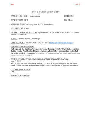
1 ZONING CHANGE REVIEW SHEET TO: SF-4A DISTRICT: 1 CASE: C14-2021-0141 – Agave Annex ZONING FROM: SF-2 ADDRESS: 7902 West Rogers Lane & 4708 Rogers Lane SITE AREA: 17.28 acres PROPERTY OWNER/APPLICANT: Agave Brown, Ltd. (by 1500 Oliver GP, LLC, its General Partner) (David Foor) AGENT: Drenner Group PC (Leah Bojo) CASE MANAGER: Heather Chaffin (512-974-2122, heather.chaffin@austintexas.gov) STAFF RECOMMENDATION: Staff supports the Applicant’s request to rezone the property to SF-4A, with the condition that the related Neighborhood Transportation Analysis (NTA) memorandum is attached via public restrictive covenant. For a summary of the basis of staff’s recommendation, see case manager comments on page 2. ZONING AND PLATTING COMMISSION ACTION/ RECOMMENDATION: May 17, 2022: April 5, 2022: To grant postponement to May 17, 2022, as requested by applicant, on consent. March 1, 2022: To grant postponement to April 5, 2022, as requested by applicant, on consent. CITY COUNCIL ACTION: TBD ORDINANCE NUMBER: 1 of 12B-6 C14-2021-0141 2 ISSUES: The proposed rezoning is for a property that will take vehicular access to Annette Cove and West Rogers Lane. A Neighborhood Traffic Analysis (NTA) has been prepared in conjunction with the rezoning request. Please see Exhibit C- NTA Memorandum. CASE MANAGER COMMENTS: The proposed rezoning is for a 17.28 acre property located west of Rogers Lane and adjacent to West Rogers Lane. The SF-2 property includes one single family residence and is otherwise undeveloped. Properties across Rogers Lane to the east and across West Rogers Lane to the south are mostly zoned SF-2 and primarily developed with single family residences and related structures. In addition to the SF-2 zoned properties along Rogers Lane are SF-3 and SF-5 zoned tracts. Also south of the rezoning tract is undeveloped property zoned SF-6-CO; further south are properties zoned SF-2, LR, and LR-MU that have frontage on FM 969. The LR zoned property is developed with food sales, limited restaurant and personal services land uses; the other properties are undeveloped. North of the rezoning tract is MH zoned land developed with mobile home residences. Northeast of the rezoning tract is unzoned land in the ETJ that is also developed with mobile home residences. West of the rezoning tract is property zoned SF-3 that is developed with single family residences. Please see Exhibits A and B—Zoning Map and Aerial Exhibit. As stated in the Issues section, a NTA has been prepared with the rezoning request. The NTA states that development of the property with approximately 107 single family residences will not exceed1,200 vehicles per day on Rogers Lane and Annette Cove, maintaining a desirable level and will continue to do so with the addition of the proposed site generated traffic. Development of the property will require dedication of additional right-of-way (ROW) along Rogers Lane. Please see Exhibit C- NTA Memorandum. Staff supports the rezoning request of SF-4A. Small-lot single family residential land use is compatible with the SF-2, SF-3, SF-6 and MH zoned areas surrounding the subject property. The proposed rezoning would provide an additional housing type in the area, consistent with the Strategic Housing Blueprint adopted by City Council. BASIS OF RECOMMENDATION: 1. The proposed zoning should be consistent with the goals and objectives of the City Council. 2. The rezoning should be consistent with the policies and principles adopted by the City Council or Planning Commission. The addition of a residential units on this site would be consistent with the goals of the City Council as outlined in the Strategic Housing Blueprint and other Council-approved actions. EXISTING ZONING AND LAND USES: ZONING LAND USES Site SF-2 Single family residential, Undeveloped North MH, Undeveloped Mobile home residential 2 of 12B-6 C14-2021-0141 South East SF-6-CO, SF-2, LR, LR-MU SF-2, SF-5, SF-3 West SF-3 Single family residential STREET CHARACTERISTICS: Undeveloped, Food sales, Restaurant-limited, Personal services Single family residential, Undeveloped 3 Friends of Northeast Austin SELTexas Sierra Club Neighbors United for Progress Claim Your Destiny Foundation TIA/NTA: – Please see Exhibit C- NTA Memorandum. WATERSHED: Walnut Creek (Suburban) NEIGHBORHOOD ORGANIZATIONS: Homeless Neighborhood Association Neighborhood Empowerment Foundation Del Valle Community Coalition Agave Neighborhood Association Friends of Austin Neighborhoods Austin Neighborhoods Council AREA CASE HISTORIES: NUMBER C14-2021-0145 Rogers ADU REQUEST SF-2 to SF-3 C14-2021-0127 Roger Lane Residential SF-2 to SF-6; amended to SF-5 COMMISSION January 4, 2022: To grant SF-3 zoning as rec by staff. [Acosta- 1st; Smith – 2nd] (7-3) Denkler; B. Greenberg; J. Kiolbassa – Nay; T. Bray – Off the Dais November 9, 2021: To grant SF- 6-CO, max. 3 units (6-3) COUNCIL February 17, 2022: To grant SF-3, on consent. November 18, 2021: To grant SF-5 (as amended 11/12/2021) on 1st reading only (11-0) December 3, 2020: To grant SF-3, on consent C14-2020-0108 Rogers Lane Project Rezoning SF-2 to SF-3 November 3, 2020: To grant SF- 3, on consent. OTHER STAFF COMMENTS: COMPREHENSIVE PLANNING The subject property of this zoning case is located along the entire eastern side and terminus of West Rogers Lane, on a 17.28 acre property, which contains three residential units. The property 3 of 12B-6 C14-2021-0141 4 is located approximately 0.39 miles from the FM 969 Road Activity Corridor and is not located within the boundaries of a neighborhood planning area. Surrounding land uses include a manufactured housing subdivision to the north; to the south are single family houses and vacant land; to the west is a single-family subdivision; and to the east is a single-family house and vacant land. Request: Upzone property from SF-2 to SF-4A, demolish existing residential units, and construct 107 houses under SF-4A zoning requirements. Per the Agent: The purpose of this rezoning is to allow for development of the Property as small lot single family homes, similar to what is currently under construction in the neighboring Agave development. This rezoning to SF-4A would also match the zoning of the majority of that neighboring development. Connectivity West Rogers Lane is a narrow road, with a substandard paving surface, which is in need of resurfacing/repair, which cuts into Rogers Lane, which is in the same condition. There are no existing public sidewalks, walking trails or public transit stops located along this portion of Rogers or West Rogers Lane. There are also no public transit stops located along this portion of FM 969/East Martin Luther King Boulevard, which is located more than a quarter of a mile away, and intersects with Rogers Lane. Mobility and connectivity options in the area are below average and necessitate the use of a car to access goods, services and civic uses, including the school. The public school is located over a mile away driving distance. Imagine Austin The following Imagine Austin policy is applicable to this case: LUT P3 Promote development in compact centers, communities or along corridors that are connected by roads and transit, are designed to encourage walking and bicycling, and reduce healthcare, housing and transportation costs. HN P10. Create complete neighborhoods across Austin that have a mix of housing types and land uses, affordable housing and transportation options, and access to schools, retail, employment, community services, and parks and recreation options. Based upon: other residential uses being in the area; being located over a quarter of a mile from an Activity Corridor; providing 107 housing units; but below average mobility and connectivity options in the area, this project partially supports policies in the Imagine Austin Comprehensive Plan. ENVIRONMENTAL 1. The site is not located over the Edwards Aquifer Recharge Zone. The site is in the Walnut Creek Watershed of the Colorado River Basin, which is classified as a Suburban Watershed by Chapter 25-8 of the City's Land Development Code. 2. Under current watershed regulations, development or redevelopment on this site will be subject to the following impervious cover limits: 4 of 12B-6 5 C14-2021-0141 3. Standard landscaping and tree protection will be required in accordance with LDC 25-2 and 25-8 for all development and/or redevelopment. 5. At this time, site specific information is unavailable regarding vegetation, areas of steep slope, or other environmental features such as bluffs, springs, canyon rimrock, caves, sinkholes, and wetlands. 6. Under current watershed regulations, development or redevelopment requires water quality control with increased capture volume and control of the 2 year storm on site. TRANSPORTATION Transportation Assessment Assessment of required transportation mitigation, including the potential dedication of right of way and easements and participation in roadway and other multi-modal improvements, will occur at the time of site plan application. A traffic impact analysis shall be required at the time of site plan if triggered per LDC 25-6- 113. A Neighborhood Traffic Analysis is required and will be performed for this project by ATD staff. Results will be provided in a separate memo. LDC 25-6-114. NTA requires three (3) consecutive 24-hour tube counts, preferably on Tuesday, Wednesday, and Thursday, during a non-holiday week when school is in session. Staff will contact the applicant to discuss the location of the tube counts. Results will be provided in a separate memo. LDC 25-6-114. NTA fees will be added in AMANDA. This comment will be cleared once the Memo is approved, and the fees are paid. The adjacent street characteristics table is provided below: SITE PLAN SP1. This site will be reviewed by the Residential Review team. Comments will be provided at time of permit application submittal. PARKLAND PR1: Parkland dedication will be required for the new residential units proposed by this development, small lot single family with SF-4A zoning, at the time of subdivision or site plan, per City Code § 25-1-601. Whether the requirement shall be met with fees in-lieu or dedicated land will be determined using the criteria in City Code Title 25, Article 14, as amended. Should fees in-lieu be required, those fees shall be used toward park investments in the form of land acquisition and/or park amenities within the surrounding area, 5 of 12B-6 C14-2021-0141 6 per the Parkland Dedication Operating Procedures § 14.3.11 and City Code § 25-1-607 (B)(1) & (2). If the applicant wishes to discuss parkland dedication requirements in advance of site plan or subdivision applications, please contact this reviewer: thomas.rowlinson@austintexas.gov. At the applicant’s request, PARD can provide an early determination of whether fees in-lieu of land will be allowed. WATER UTILITY AW1. The landowner intends to serve the site with City of Austin water and wastewater utilities. The landowner, at own expense, will be responsible for providing any water and wastewater utility improvements, offsite main extensions, utility relocations and or abandonments required by the land use. The water and wastewater utility plan must be reviewed and approved by Austin Water for compliance with City criteria and suitability for operation and maintenance. Based on current public infrastructure configurations, it appears that service extension requests (SER) will be required to provide service to this lot. For more information pertaining to the Service Extension Request process and submittal requirements contact the Austin Water SER team at ser@austintexas.gov. The landowner must pay the City inspection fee with the utility construction. The landowner must pay the tap and impact fee once the landowner makes an application for a City of Austin water and wastewater utility tap permit. INDEX OF EXHIBITS TO FOLLOW A: Zoning Map B. Aerial Exhibit C. NTA Memorandum 6 of 12B-6 R D D O O LW E M MH MH M E D R A N O PAT H Y NT Y LIMIT LINE TRAVIS C O U C.O.A. CIT MH R Y D O TIC A S TAZA TRL MH C A N O G A AV E MH TA P O LN T O PA N G A LN TO N O PA LN SF-4A L R E T C A S L A SF-4A SF-4A SF-4A SF-3 A L O N D R A L N T L P A N S I G SF-4A R A D T N V I S O P I N KE Y VIE W D R HID D E N W MH E S T BLV D V W C Y VIE E K H T DI PA R A N A Z MH C14-2016-0016 PLAT O PATH 6 3 0 5 - 0 8 SPC-03-0011C 83-060 E V A A N A C S O T SF-3 85-0036 SF-4A SF-3 A C I R H T A A G T E C V A N N E T SPC-03-0009C AVA LN 85-0036 ! ! SF-3 85-0036 ! ! ! ! ! SF-3 SF-3 S E N D E R O H I L L S P K W Y 85-036 SF-3 JUNK C14-2018-0077 SF-3 85-0036 SF-6-CO SF-3 LR 85-0036 LR SF-2 88-0134 5 9 -0 7 7 5 9 77-0 ( LR CONV. STORE 4 5 1 0-2 0 LR SF-2 FM 969 RD LR-MU GR-MU C14-2020-0057 C14-2011-0080 82-165 ± SUBJECT TRACT ! ! ! ! ! ! PENDING CASE ZONING BOUNDARY SP96-0442C P O O E L K A LILY L MH 95-0178C SF-3 85-0036 ! ! ! ! ! ! ! ! ! ! ! ! N E L K A M L A E R D MH ! ! ! ! N E L K A F L L E H S C H A S M LA K E LN MH ! ! ! HID D E N VIE W CIR ! ! ! ! ! ! ! ! ! ! ! ! ! ! ! ! ! ! ! ! ! ! ! ! ! ! ! W R ! O G ! E R ( ! S L N ( ! ! 83-060 MH ! ! ! ! ! ! ! ! ! ! ! ! ! ! ! ! ! ! ! ! !! ! ( ( ( ( ( ( ( ( ( ! ! ! ! ! ! ! ! ! ! ! ! ! ! ! ! ! ! ! !! SF-2 GERS LN ( ( O R ( STORAGE ( ( P O O L S R E G O R ZONING ( ( C14-2020-0108 SF-3 ( SF-2 ( ( SF-2 ( ZONING CASE#: C14-2021-0141 This product is for informational purposes and may not have been prepared for or be suitable for legal, engineering, or surveying purposes. It does not represent an on-the-ground survey and represents only the approximate relative location of property boundaries. 1 " = 400 ' This product has been produced by the Housing and Planning Department for the sole purpose of geographic reference. No warranty is made by the City of Austin regarding specific accuracy or Created: 9/8/2021 7 of 12B-6 Legend Zoning Review Cases- IN REVIEW Zoning Text 0.2 0 0.08 0.2 Miles NAD_1983_StatePlane_Texas_Central_FIPS_4203_Feet Date Printed: This product is for informational purposes and may not have been prepared for or be suitable for legal, engineering, or surveying purposes. It does not represent an on-the-ground survey. This product has been produced by the City of Austin for the sole purpose of geographic reference. No warranty is made by the City of Austin regarding specific accuracy or completeness. 1: 4,800 Notes 8 of 12B-6 MEMORANDUM To: CC: FROM: DATE: SUBJECT: Heather Chaffin, Case Manager Jayesh Dongre, Bryan Golden, ATD Nazlie Saeedi, P.E. February 14, 2022 Neighborhood Traffic Analysis for Agave Annex Zoning Case C14-2021-0141 The Transportation Development Services (TDS) Division has performed a Neighborhood Traffic Analysis (NTA) for the above-referenced case and offers the following comments. The 17.28 acres tract is located in east Austin at 7806 W Rogers Lane. The zoning is proposing to rezone from Single Family Residence – Standard Lot (SF-2) to Single Family Residence – Small Lot (SF-4A). Exhibit A shows the site location. Roadways The tract proposes two access points onto the site via two roadways: Rogers Lane and Annette Cove. Rogers Lane and Annette Cove are classified as local streets (Level 1) and currently have about 17 and 27 feet, respectively, of pavement width. The roadway has two unstriped lanes, with curb and gutter, and no sidewalk on either side. The average daily traffic (ADT) on Rogers Lane north of FM 969 and Annette Cove east of Sendero Hills Parkway is 198 and 71 vehicles per day, respectively, based on 24-hour tube counts collected on June 8, 2021. Trip Generation and Traffic Analysis Based on the Institute of Transportation Engineer’s Trip Generation Manual, 10 the proposed residential development will generate 1,107 vehicle trips per day. See for a trip generation summary. th Table 1 Edition, Unadjusted Trip Generation Land Use Single-Family Detached Housing TOTAL (ITE 210) Table 1 Size 107 Dwelling Units 1,107 1,107 Page 1 of 4 9 of 12B-6 Table 2 Table 3 1. 2. 3. represents the expected distribution of the 1,107 trips: Table 2 Access Points (Street) Traffic Distribution by Percent Rogers Lane TOTAL Annette Cove 50% 50% 100% represents a breakdown of existing traffic, proposed site traffic, total traffic after development, and percentage increase in traffic on the existing network. Existing Traffic (vpd) Table 3 Proposed New Site Traffic Overall Traffic Percentage Increase in Traffic Street Rogers Lane Annette Cove 198 71 554 554 752 625 279.8% 780.3% According to Section 25-6-116 of the Land Development Code, streets which have pavement width less than 30 feet are considered to be operating at an undesirable traffic level if the average daily traffic volume for such roadways exceeds 1,200 vehicles per day. Both Rogers Lane and Annette Cove are currently operating at a desirable level and will continue to do so with the addition of the proposed site generated traffic. Recommendations/Conclusions As a condition of approval for the site plan application, the applicant shall adhere to the following requirements: The applicant shall dedicate a total of 25 feet of right-of-way from the existing centerline of Rogers Lane in accordance with the Transportation Criteria Manual. If the land uses or intensities proposed in Table 1 are modified, the TDS division may reassess the NTA. The City Council may deny an application if the NTA demonstrates that the traffic generated by the project combined with existing traffic exceeds the desirable operating level established on a residential local or collector street in the NTA study area. Page 2 of 4 10 of 12B-6 If you have any questions or require additional information, please contact me at (512) 974- 4073. Nazlie Saeedi, P.E. Transportation Development Engineer – Central Lead Austin Transportation Department Page 3 of 4 11 of 12B-6 EXHIBIT A Page 4 of 4 12 of 12B-6