B-05 (C14-2022-0012 - 7001 Circle S Road; District 2).pdf — original pdf
Backup
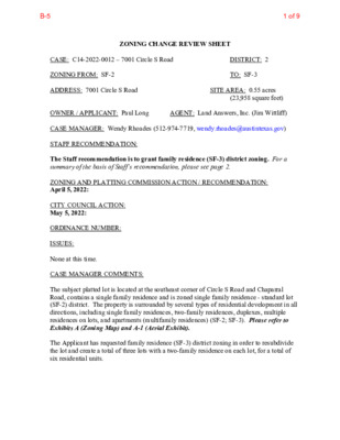
ZONING CHANGE REVIEW SHEET (23,958 square feet) AGENT: Land Answers, Inc. (Jim Wittliff) DISTRICT: 2 TO: SF-3 SITE AREA: 0.55 acres CASE: C14-2022-0012 – 7001 Circle S Road ZONING FROM: SF-2 ADDRESS: 7001 Circle S Road OWNER / APPLICANT: Paul Long CASE MANAGER: Wendy Rhoades (512-974-7719, wendy.rhoades@austintexas.gov) STAFF RECOMMENDATION: The Staff recommendation is to grant family residence (SF-3) district zoning. For a summary of the basis of Staff’s recommendation, please see page 2. ZONING AND PLATTING COMMISSION ACTION / RECOMMENDATION: April 5, 2022: CITY COUNCIL ACTION: May 5, 2022: ORDINANCE NUMBER: ISSUES: None at this time. CASE MANAGER COMMENTS: The subject platted lot is located at the southeast corner of Circle S Road and Chaparral Road, contains a single family residence and is zoned single family residence - standard lot (SF-2) district. The property is surrounded by several types of residential development in all directions, including single family residences, two-family residences, duplexes, multiple residences on lots, and apartments (multifamily residences) (SF-2; SF-3). Please refer to Exhibits A (Zoning Map) and A-1 (Aerial Exhibit). The Applicant has requested family residence (SF-3) district zoning in order to resubdivide the lot and create a total of three lots with a two-family residence on each lot, for a total of six residential units. 1 of 9B-5 C14-2022-0012 Page 2 BASIS OF RECOMMENDATION: 1. The proposed zoning should be consistent with the purpose statement of the district sought. The family residence (SF-3) district is the designation for a moderate density single-family residential use and a duplex use on a lot that is a minimum of 5,750 square feet. An SF-3 district designation may be applied to a use in an existing single-family neighborhood with moderate sized lots or to new development of family housing on lots that are 5,750 square feet or more. A two-family residence allows for one single family residence, plus a second detached unit not to exceed 1,100 square feet or a floor-to-area ratio of 0.15 : 1, whichever is smaller on each lot. The detached unit is limited to 2 stories or 30 feet in height, and 550 square feet on the second story, if any. A duplex use that is designated in an SF-3 district is subject to development standards that maintain single-family neighborhood characteristics. 2. The requested SF-3 zoning would allow for up to two residential units on each lot. Staff recommends the Applicant’s request because the property meets the intent of the SF-3 district as it fronts on residential streets and is located within an existing residential neighborhood. EXISTING ZONING AND LAND USES: Zoning changes should promote compatibility with adjacent and nearby uses. ZONING Site North SF-2 SF-2 South SF-2 East SF-2 West SF-3 LAND USES One single family residence Residential, including single family residences, two-family residence, and multifamily residences Residential, including single family residences and multifamily residential Residential, including single family residences, multifamily residential, manufactured home park and auto repair Residential, including single family residences, duplexes and multifamily residential NEIGHBORHOOD PLANNING AREA: Not Applicable WATERSHED: South Boggy Creek – Suburban CAPITOL VIEW CORRIDOR: No SCHOOLS: Pleasant Hill Elementary School COMMUNITY REGISTRY LIST: 511 – Austin Neighborhoods Council Bedichek Middle School Crockett High School 627 – Onion Creek Homeowners Assoc. TIA: Is not required SCENIC ROADWAY: No 2 of 9B-5 C14-2022-0012 Page 3 1424 – Preservation Austin 742 – Austin Independent School District 1228 – Sierra Group, Austin Regional Group 1363 – SEL Texas 1429 – Go Austin Vamos Austin (GAVA) – 78745 1494 – South Boggy Creek Neighborhood Association 1530 – Friends of Austin Neighborhoods 1531 – South Austin Neighborhood Alliance (SANA) 1550 – Homeless Neighborhood Association 1616 – Neighborhood Empowerment Foundation 1787 – Circle S. Ridge Neighborhood Association AREA CASE HISTORIES: 1774 – Austin Lost and Found Pets REQUEST SF-2 to MH on 1.5 acres COMMISSION To Grant CITY COUNCIL Apvd (6-6-2019). SF-2 to SF-3 To Grant Apvd (6-16-2016). SF-2 to SF-3 To Grant Apvd (11-12-2015). NUMBER C14-2019-0044 – Templeton Mobile Home Park – 305 and 401 Chaparral Rd C14-2016-0033 – 300 Corral Ln C14-2015-0123 – Langan Rezoning – 7016 Circle S Rd C14-2010-0199 – C G & S Corral – 402 Corral Ln SF-2 to CS-MU- CP To Grant CS-MU-CO w/construction sales & services as the only permitted CS use, administrative/business office, the existing residences, existing building coverage and impervious cover. R-O- W is not req’d. To Grant “A” Residence, First Height and Area Apvd CS-MU-CO as Commission recommended, w/public Restrictive Covenant to limit the size of a trash receptacle on the property and prohibit 18-wheel trucks from accessing the site (6- 23-2011). Apvd “A” Residence, First Height and Area (11-15-1984). Note: “A” converted to SF-3 on 1-1-1985). Apvd “A” Residence, First Height and Area (12-20-1979). C14-84-232 – 304 and 308 Corral Ln C14-79-243 – 6910 -7004 Circle S Rd Interim “AA” First Height and Area to “A” Residence, First Height and Area, as amended Interim “A” Residence, First Height and Area to “A” Residence, First Height and Area 3 of 9B-5 Capital Metro (within ¼ mile) Shared Lane None Yes Yes C14-2022-0012 Page 4 RELATED CASES: The area east of Circle S Road was annexed into the Full Purpose City limits on December 31, 1975 (C7a-75-012). The rezoning area is platted as Lot 1, Tamayo Subdivision recorded in December 1979 (C8s-79-208). EXISTING STREET CHARACTERISTICS: Name ROW Pavement Classification Sidewalks Bicycle Route Circle S Road 70 feet 20 feet ASMP Level 2 No No ASMP Level 1 Chaparral Road 50 feet 20 feet OTHER STAFF COMMENTS: Comprehensive Planning Project Name and Proposed Use: 7001 Circle S Road. 1 lot to 3 lots. 0.55 acres. SF-2 to SF-3 Yes Imagine Austin Decision Guidelines Compact and Connected Measures Imagine Austin Growth Concept Map: Located close to, within or adjacent to an Imagine Austin Activity Center, Imagine Austin Activity Corridor, or Imagine Austin Job Center as identified on the Growth Concept Map. Mobility and Public Transit: Located within 0.25 miles of public transit stop and/or Mobility and Bike/Ped Access: Adjoins a public sidewalk, shared path, and/or bike light rail station. lane. Y Connectivity, Good and Services, Employment: Provides or is located within 0.50 miles to goods and services, and/or employment center. Connectivity and Food Access: Provides or is located within 0.50 miles of a grocery store/farmers market. Connectivity and Education: Is located within 0.50 miles from a public school or university. Connectivity and Healthy Living: Provides or is located within 0.50 miles from a recreational area, park and/or walking trail. Connectivity and Health: Provides or is located within 0.50 miles of health facility (ex: hospital, urgent care, doctor’s office, drugstore clinic, specialized outpatient care.) Housing Affordability: Provides a minimum of 10% of units for workforce housing 4 of 9B-5 C14-2022-0012 Page 5 (80% MFI or less) and/or fee in lieu for affordable house. Housing Choice: Expands the number of units and housing choice that suits a variety of household sizes, incomes, and lifestyle needs of a diverse population (ex: apartments, triplex, granny flat, live/work units, cottage homes, and townhomes) in support of Imagine Austin and the Strategic Housing Blueprint. Mixed Use: Provides mixed use development (minimum 10% residential and 10% non- residential floor area). Y Culture and Creative Economy: Provides or is located within 0.50 miles of a cultural resource (ex: library, theater, museum, cultural center). 2 Total Number of “Yes’s” Drainage The developer is required to submit a pre- and post-development drainage analysis at the subdivision and site plan stage of the development process. The City’s Land Development Code and Drainage Criteria Manual require that the Applicant demonstrate through engineering analysis that the proposed development will have no identifiable adverse impact on surrounding properties. Environmental The site is not located over the Edwards Aquifer Recharge Zone. The site is in the South Boggy Creek Watershed of the Colorado River Basin, which is classified as a Suburban Watershed by Chapter 25-8 of the City's Land Development Code. The site is in the Desired Development Zone. Under current watershed regulations, development or redevelopment on this site will be subject to the following impervious cover limits: Development Classification % of Gross Site Area % of Gross Site Area Single-Family (minimum lot size 5750 sq. ft.) Other Single-Family or Duplex Multifamily Commercial 50% 55% 60% 80% with Transfers 60% 60% 70% 90% According to floodplain maps there is no floodplain within or adjacent to the project location. Standard landscaping and tree protection will be required in accordance with LDC 25-2 and 25-8 for all development and/or redevelopment. At this time, site specific information is unavailable regarding vegetation, areas of steep slope, or other environmental features such as bluffs, springs, canyon rimrock, caves, sinkholes, and wetlands. 5 of 9B-5 C14-2022-0012 Page 6 Under current watershed regulations, development or redevelopment requires water quality control with increased capture volume and control of the 2-year storm on site. Impervious Cover The maximum impervious cover allowed by the SF-3 zoning district would be 45%, which is based on the more restrictive zoning regulations. PARD – Planning & Design Review Parkland dedication will be required for the new residential units proposed by this development, single family with SF-3 zoning, at the time of subdivision or site plan, per City Code § 25-1-601. Fees in-lieu of land and park development may be required, as determined using the criteria in City Code Title 25, Article 14, as amended. Fees shall be used toward park investments in the form of land acquisition and/or park amenities within the surrounding area, per the Parkland Dedication Operating Procedures § 14.3.11 and City Code § 25-1-607 (B)(1) & (2). If the applicant wishes to discuss parkland dedication requirements in advance of site plan or subdivision applications, please contact this reviewer: thomas.rowlinson@austintexas.gov. At the Applicant’s request, PARD can provide an early determination of whether fees in-lieu of land will be allowed. Site Plan and Compatibility Standards Site plans will be required for any new development other than single-family or duplex residential. Any new development is subject to Subchapter E. Design Standards and Mixed Use. Additional comments will be made when the site plan is submitted. Rezoning from SF-2 to SF-3 does not trigger the application of compatibility standards. The applicable building standards are outlined below: Breakdown by square footage for living area / garage / patio / porch is required on duplex residential site plans. Setbacks for duplex residential: • Anything that juts more than 5 feet into a setback must be fireproofed. Standard side setback is 5 feet with a maximum allowable 2-foot overhang. The overhang cannot have any openings, soffit vents, windows, etc. • Setbacks between buildings is 10 feet (5 feet on each side). Any encroachment into this setback must be fireproofed. • Nothing can encroach into a 2-foot setback. 6 of 9B-5 C14-2022-0012 Page 7 Transportation ASMP Assessment The Austin Strategic Mobility Plan (ASMP) adopted 04/11/2019, calls for 78 feet of right-of- way for Circle S Road. It is recommended that 39 feet of right-of-way from the existing centerline should be dedicated for Circle S Road according to the Transportation with the first subdivision or site plan application [LDC 25-6-51 and 25-6-55]. Transportation Assessment Assessment of required transportation mitigation, including the potential dedication of right- of-way and easements and participation in roadway and other multi-modal improvements, will occur at the time of site plan application. A Traffic Impact Analysis shall be required at the time of site plan if triggered per LDC 25-6-113. Austin Water Utility The landowner intends to serve the site with City of Austin water and wastewater utilities. The landowner, at own expense, will be responsible for providing any water and wastewater utility improvements, offsite main extensions, utility relocations and or abandonments required by the land use. The water and wastewater utility plan must be reviewed and approved by Austin Water for compliance with City criteria and suitability for operation and maintenance. Depending on the development plans submitted, water and or wastewater service extension requests may be required. All water and wastewater construction must be inspected by the City of Austin. The landowner must pay the City inspection fee with the utility construction. The landowner must pay the tap and impact fee once the landowner makes an application for a City of Austin water and wastewater utility tap permit. INDEX OF EXHIBITS TO FOLLOW: A: Zoning Map A-1: Aerial Map 7 of 9B-5 SF-3 ( ( ( ( ( ( ( ( ( SF-3 ( ( ( APARTMENTS 73-221 AUTO\REPAIR SP90-0182T SP-92-0114BS FAST\FOOD GR RETAIL CENTER RESTAURANT GR-MU-CO-NP GR-MU-CO-NP E WILLIAM CANNON DR MF-2-NP C14-05-0105 83-022RC 80-216 LO-NP ( ( ( ( ( ( ( ( ( SF-3 ( ( R K D O O N Y K S ( ( ( ( ( ( ( ( ( ( ( ( ( ( ( ( ( ( ( ( ( ( SF-2 ( R L D L E ( G W HIN WIS ( SF-2 ( ( ( ( ( ( DR DR MEADO R D D R A G G A H W LEA DR T T S N A L P THELONIOUS DR ( ( ( ( ( ( ( ( ( ( ( ( ( ( ( ( ( ( SF-3 ( ( ( ( ( ( R T D N O M N O O M ( ( ( ( ( ( ( ( R R D A T S = = = = = ( ( ( ( RZ-85-073 02-0087 C14-02-0087 CS-1-CO FAST\FOOD APARTMENTS MF-2 CLEAR = DAY D R 73-221 APA RT M E NTS MF-2 73-221 ( ( ( ( ( ( ( ( ( ( = SF-3 = ( ( = = METEO = = ( SF-3 C L O ( ( U D VIE ( ( W D R ( ( SF-3 ( ( ( ( ( ( ( R D R ( ( ( ( = = = ( = = 01-0179 CHUR CH LO C14-01-0179 DR MINI W A REH O US ES O LG UIN S T DR R G D DIN D E R SF-6 C14-2017-0007 UNDEV (N O T O N G R O U N D) M H C14-2013-0157 ( LO-MU ( E V A S S E R G N O C S S T N E M T R A P A LO = SF-3 = = = = ( ( ( ( = APARTMENTS P82-63 = = 79-243 = = ! ! ( ! ! ! ! ( ! ! ! ( ! ! ! APTS ( ( SF-3 C14-2015-0123 ( ( ( ( ( ( ( ( GR-NP FOOD STORE 78-011 78-011 APTS. P83-60 TRUCK 76-004 PHARMACY RZ86-056RC SP-02-0336C CAR WASH GR 79-080 78-211 APTS. 81-12RC APTS. LR 75-096 LO ( = = = = = = = = = ( ( ( ( ( SP-96-0241C SERVICE\STATION GR-MU-CO-NP RZ013 C14-81-013(RCT) NP-05-0020 NP-05-0020 SPC-99-0192C P 98-0102 GR-MU-CO C14-98-0102 C14-2016-0047 80-118 98-0102 86-114 LIBRARY 86-200 83-182 CHURCH DAY CARE 84-319 86-114 80-118 APARTMENTS MF-3 SP-2007-0331C UNDEV 77-185 SF-3 84-319 SF-3 GR ( ( ( ( SF-2 ( ( SF-2 ( ( ( ( ( ( ( ( C14-2019-0014 MH MH\PARK CS Y D O O B T U G KIN R A P E/\A S U O H E R A W ( ( C H APA ( ( R R AL R D MH ( ( MF-1-CO ( LO-MU-CO 91 0 03-0 C14-2015-0003 C14-03-0091 GR-MU-CO 4 8 0 4-0 9 ( C F O CS-MU-CO 95-0184 C14-95-0184 AUTO SALES MH ( 7 11 99-0 ( 79-061 24 1 99-0 SF-2 GR-MU-CO ( C14-2015-0003 8 8 79-2 CS-CO ( ( ( ( ( ( CS 0 3 78-2 SF-3 REST B D S R V 5 S S IH 3 B 5 S S IH 3 S E S H W SF-3 B 5 N S IH 3 B D N R V 5 S S IH 3 CS-CO SP97-0289C I-RR 86-327 C14-2018-0069 C14-2008-0123 CS-MU-CO C14-2018-0069 MF-4-CO C14-2016-0033 SF-3 2 3 84-2 ( ( ( ( C2-66-001D CLASS RING CO. SF-2 ( W H SE APT. CS-MU-CO C14-2010-0199 E FIC F O ( ( ( C O R R PA R KIN G AL LN GENERAL CONTRACTOR LI ! ! ! ! ! ! ! ! MF-3 C14-2019-0085 96-0057 ( MF-3-CO ! ! ! ! ! ! ! ! ! ! MF-2-CO C14-96-0057 ! ! ! ! ! APARTMENTS ! ! ! SF-2 UNDEV GR ! ! ! ! ! ! ! ! ! ! ! ! ! ! 84-456 ! ! ! ! ! ! ! ! DR ! ! ! ! ! ! PIPELINE EASEMENT B R ID G E F O R D D R T C D R A Y K IC R B MF-2-CO 94-0097 UNDEV SF-2 CEMETERY SP-01-0207C ( 99-2065 D R S E L C IR C ( SF-2 V E D N U 98 -0 0 33 84-262 CS SUBJECT TRACT ! ! ! ! ! ! PENDING CASE ZONING BOUNDARY RR ± ZONING Exhibit A ZONING CASE#: C14-2022-0012 This product is for informational purposes and may not have been prepared for or be suitable for legal, engineering, or surveying purposes. It does not represent an on-the-ground survey and represents only the approximate relative location of property boundaries. 1 " = 400 ' This product has been produced by the Housing and Planning Department for the sole purpose of geographic reference. No warranty is made by the City of Austin regarding specific accuracy or Created: 1/28/2022 8 of 9B-5 Exhibit A - 1 44181523562332101112769210677C14-2022-0012SF-3SF-2LOSF-2CHAPARRALRDCIRCLE S RDG15Copyright nearmap 2015±This map has been produced by the Communications Technology Management Dept. on behalf of thePlanning Development Review Dept. for the sole purpose of geographic reference. No warranty is madeby the City of Austin regarding specific accuracy or completeness.ZONING CASE#:LOCATION:SUBJECT AREA:GRID:MANAGER:C14-2022-0012 7001 Circle S Rd. 0.55 AcresG15WENDY RHOADES1'' = 75'CREEK BUFFERPENDING CASE!!!!!!ZONING BOUNDARYSUBJECT TRACT7001 Circle S Road9 of 9B-5