C-01 - Backup Submitted by Commissioner Greenberg.pdf — original pdf
Backup
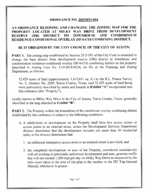
ORDINANCE NO. 20191031-044 AN ORDINANCE REZONING AND CHANGING THE ZONING MAP FOR THE PROPERTY LOCATED AT MILKY WAY DRIVE FROM DEVELOPMENT RESERVE (DR) DISTRICT TO TOWNHOUSE AND CONDIMINIUM RESIDENCE-CONDITIONAL OVERLAY (SF-6-CO) COMB N NG DISTIC-. BE IT ORDAINED BY THE CITY COUNCIL OF THE CITY OF AUSTIN: PART 1. The zoning map established by Section 25-2-191 of the City Code is amended to to townhouse and change the base district condominium residence-conditional overlay (SF-6-CO) combining district on the property the Planning and Zoning described in Zoning Case No. C 14-2018-0124, on file at Department, as follows: reserve (DR) district from development 32.429 acres of land (approximately 1,412,611 sq. ft.) in the R.L. Preece Survey No. 2, Abstract No. 2269, Travis County, Texas, said 32.429 acres of land being more particularly described by metes and bounds in Exhibit "A" incorporated into this ordinance (the "Property"l locally known as Milky Way Drive in the City of Austin, Travis County, Texas, generally identified in the map attached as Exhibit "B". PART 2. The Property within the boundaries of the conditional overlay combining district established by this ordinance is subject to the following conditions: A. A subdivision or development on the Property shall have two access streets or access points to an external street, unless the Development Services Department director determines that the development includes not more than 30 residential units, or the director determines that: 1. an additional emergency access point to an external street is provided; and 2. the completed development or uses of the Property, considered cumulatively with all existing or previously authorized development and uses, generate traffic that will not exceed 1,200 trips per day on Milky Way Drive as measured by the tube count taken at the time of site plan or the number in the ITE Trip General Manual, whichever is greater. Page 1 of 2 B. Access streets on the Property shall: 1. have a minimum width of 20 feet and a clear height of 13 feet 6 inches; 2. be designed to accommodate the loads and turning radii for fire apparatus; 3. have a gradient negotiable by the fire apparatus as required by the adopted fire code; and 4. include a surface material acceptable to the Fire Marshal that would allow for the passage of emergency service vehicles and fire apparatus. C. Access streets and other public or private streets within the Property shall be reviewed and approved by the Fire Marshal for the appropriate travel lane width of both the arrival of emergency vehicles and the evacuation of residential vehicles. the Property may be PART 3. Except as specifically restricted under this ordinance, developed and used in accordance with the regulations established for the townhouse and condominium residence (SF-6) base district and other applicable requirements of the City Code. PART 4. This ordinance takes effect on November 11, 2019. PASSED AND APPROVED October 31 ,2019 APPROVED: GL_ Anne L. Morgan City Attorney § § § (\\1 f'A fL ? ? St*e ANer V Mayoll ATTEST:?f-7rl'll# 1 ft€ A J60.-U Jannette S. Goodall City Clerk Page 2 of 2 Professional Land Surveying, Inc. Surveying and Mapping Office: 512-443-1724 Fax. 512-389-0943 3500 McCall Lane Austin, Texas 78744 rral //P Cha 32.429 ACRES R.L. PREECE SURVEY NO. 2 TRAVIS COUNTY, TEXAS A DESCRIPTION OF 32.429 ACRES (APPROXIMATELY 1,412,611 SQ. FT.) IN THE R.L. PREECE SURVEY NO. 2, ABSTRACT NO. 2269, TRAVIS COUNTY, TEXAS, BEING A PORTION OF A 79.9 ACRE TRACT CONVEYED TO BERTA BRADLEY BY EXECUTOR'S DEED DATED DECEMBER 31, 1990 AND RECORDED IN VOLUME 11345, PAGE 325, REAL PROPERTY RECORDS, TRAVIS COUNTY, TEXAS (RPRTCT); FURTHER BEING A PORTION OF THAT 40 ACRE TRACT DESCRIBED IN A DEED OF RECORD IN VOLUME 5094, PAGE 2176, DEED RECORDS, TRAVIS COUNTY, TEXAS (DRTCT), AND A PORTION OF A 119.32 ACRE TRACT DESCRIBED IN A DEED TO LANDRUM HICKMAN OF RECORD IN VOLUME 1869 PAGE 319, DRTCT; SAID 32.429 ACRES BEING MORE PARTICULARLY DESCRIBED BY METES AND BOUNDS AS FOLLOWS: COMMENCING for reference at a cotton spindle found for the south corner of said 119.32 acre tract, being the called south corner of said 40 acre tract, same being the south corner of said 79.9 acre tract, also being in the west line of a 467.5 acre tract described in a deed to City of Austin Nature Conservancy, recorded in Volume 11848, Page 1718, RPRTCT, and also being an angle point in the east line of a 91.585 acre tract, described in a deed to RP Preserve, Ud. in Document No. 1999062334, of the Official Public Records of Travis County, Texas, from which a Mag nail in rock found bears North 25°57'17" East, a distance of 2.60 feet; THENCE with the common line of said 119.32 acre tract, the 40 acre tract, the 79.9 acre tract, and the 91.585 acre tract, the following two (2) courses and distances: 1. North 04°58'46" West, at a distance of 1337.94 feet passing 0.13 feet right of a 1/2" rebar found for the called southeast corner of Lot 13, Block B, The Preserve at River Place Section 2, a subdivision of record in Document No. 200000178, OPRTCT, and continuing with the common line of the 119.32 acre tract, the 40 acre tract, the 79.9 acre tract and said Lot 13, for a total distance of 1662.93 feet to a calculated southerly west corner and POINT OF BEGINNING herein; and 2. North 04 58' 46" West, at a distance of 211.54 feet passing 0.11 feet left of a 1 /2" rebar with "TJ Dodd 1882" cap found for the called northeast corner of Lot 13, same being the southeast corner of Milky Way Drive (501 right-of-way width), and continuing with the common line of the 119.32 acre tract, the 40 acre tract, the 79.9 acre tract and the east terminus of Milky Way Drive, at a distance of 268.35 feet passing 0.11 feet left of a 1 /2" rebar found for the called northeast corner of Milky Way Drive, same being the southeast corner of Lot 12, Block B, The Preserve at River Place Section 2, and continuing with the common line of the 119.32 acre 759-011-ZO3 docx EXHIBIT "A" Page 2 of 3 tract, the 40 acre tract, the 79.9 acre tract and said Lot 12, for a total distance of 480.00 feet to a calculated point, from which a concrete monument found for an angle point in the common west line of the 119.32 acre tract, the 79.9 acre tract, and the 40 acre tract, for a corner of Lot 3, Block A, Austin Christian Fellowship Phase Two Subdivision, a subdivision of record in Document No. 200700102, OPRTCT, same being in the south line of a 3.75 acre tract described in a deed to Eugene Marcus Bar'?es, 111 and Emily Puckett Barnes, recorded in Volume 3909, Page 1174, DRTCT, bears North 04°58'46" West, a distance of 526.94 feet; THENCE crossing the 119.32 acre tract, the 40 acre tract, and the 79.9 acre tract, the following four (4) courses and distances: 1. North 85°01'14" East, a distance of 50.00 feet to a calculated point; 2. North 04°58'46" West, a distance of 497.80 feet to a calculated point; 3. North 55°29'35" East, a distance of 15.70 feet to a calculated point; and 4. North 20°03'33" West, a distance of 181.74 feet to a calculated point in north line of the 40 acre tract, same being the south line of a 40 acre tract described in Volume 2475, Page 123, DRTCT; and from which point the calculated northwest corner of said 40 acre tract described in Volume 5094, Page 2176, DRTCT, for the southwest corner of said 40 acre tract described in Volume 2475, Page 123, DRTCT, bears North 61° 46' 22" West, 75.14 feet; THENCE South 61°46'22" East, continuing across the 79.9 acre tract and the 119.32 acre tract, with the north line of the 40 acre tract described in Volume 5094, Page 2176, DRTCT, being the south line of the 40 acre tract described in Volume 2475, Page 123, found at a distance of 1522.07 feet and DRTCT, passing a concrete monument continuing, for a total distance of 1522.80 feet to a calculated point in the east line of the 79.9 acre tract, being the east line of the 119.32 acre tract, for the northeast corner of the 40 acre tract described in Volume 5094, Page 2176, DRTCT, same being the southeast corner of the 40 acre tract described in Volume 2475, Page 123, DRTCT, also being in the west line of said 467.5 acre tract, from which a 1/2" rebar with "Chaparral" cap set for the northeast corner of the 79.9 acre tract, being the northeast corner of the 40 acre tract described in Volume 2475, Page 123, DRTCT, same being a corner of said Lot 3, also being an angle point in the west line of the 467.5 acre tract, bears North 27° 59' 03" East, 923.50 feet; THENCE South 27°59'03" West, with the common line of the 79.9 acre tract, the 119.32 acre tract, the 40 acre tract described in Volume 5094, Page 2176, DRTCT, and the west line of the 467.5 acre tract, at a distance of 1087.06 feet passing 0.40 feet right of a 1/2 11 iron pipe found, and continuing for a total distance of 1888.43 feet to the calculated south corner herein; and from which point, said cotton spindle found for the south corner of said bears South 27° 59' 03" West, at a distance of 340.55 feet passing 1.32 feet left of a 1/2" iron pipe found and continuing for a total distance of 483.37 feet; 759-011-ZC)3.docx Page 3 of 3 THENCE leaving the west line of said 467.5 acre tract and again crossing said 79.9 acre tract, the 119.32 acre tract, and the 40 acre tract described in Volume 5094, Page 2176, DRTCT, the following two (2) courses and distances: 1. North 04°58'46" West, a distance of 1257.38 feet to a calculated point; and 2. South 85°01'14" West, a distance of 263.00 feet to the POINT OF BEGINNING and containing 32.429 acres of land. Surveyed on the ground on April 28, 2015. Bearing Basis: The Texas Coordinate System of 1983 (NA[)83), Central Zone (4203), US Survey Feet, based on GPS solutions from The National Geodetic Survey (NGS) on-line positioning user service (OPUS) for Chaparral control point"P765". Attachments: Survey Drawing No. 759-011-ZO3. 4.-4- - 01 /?9? 3 1 U. 2019 Bryan D. Newsome Registered Professional Land Surveyor State of Texas No. 5657 TBPLS Firm No. 10124500 Date ...................... /4 e.·»ls,Ea€dp & ¢j BRYAN D. NEWSOME ..tz?ss,0151* J 759-011-ZO3 docx SKETCH TO ACCOMPANY A DESCRIPTION OF 34.508 ACRES (APPROXIMATELY 1,503,176 SQ. FT.) IN THE R.L PREECE SURVEY NO. 2, ABSTRACT NO. 2269, TRAVIS COUNTY, TEXAS, BEING A PORTION OF A 79.9 ACRE TRACT CONVEYED TO BERTA BRADLEY BY EXECUTOR'S DEED DATED DECEMBER 31, 1990 AND RECORDED IN VOLUME 11345, PAGE 325, REAL PROPERTY RECORDS, TRAVIS COUNTY, TEXAS (RPRTCT); FURTHER BEING A PORTION OF THAT 40 ACRE TRACT DESCRIBED IN A DEED OF RECORD IN VOLUME 5094, PAGE 2176, DEED RECORDS, TRAVIS COUNTY, TOAS (DRTCT), AND A PORTION OF A 119.32 ACRE TRACT DESCRIBED IN A DEED TO LANDRUM HICKMAN OF RECORD IN VOLUME 1869, PAGE 319, DRTCT. LINE TABLE BEARING DISTANCE N04'58'46"W 1 662.93' N04'58'46"W 480.00 N04'58'46"W 526.94' N8501'14"E 50.00' N04'58'46"W 464.64' N55'29'35"E 15.70' N20'03'33"W 181.74' N61'46'22"W 75.14' 1 522.80' S61'46'22"IE S2T59'03"W 1888.43 N04'58'46"W 1 257.38 S85'01'14"W 263.00 LINE Ll L2 L3 L4 L5 L6 L7 L8 L9 L10 Ll 1 L12 LEGEND ICH 1/2" REBAR WITH "CHAPARRAL" CAP FOUND 1/2" REBAR FOUND (OR AS NOTED) 0 CONCRETE MONUMENT FOUND 60D NAIL FOUND (OR AS NOTED) 1/2" IRON PIPE FOUND Il A ® * COTTON SPINDLE FOUND CALCULATED POINT ( ) RECORDINFORMAnON DATE OF SURVEY: 4/28/15 PLOT DATE: 8/07/19 DRAWING NO.: 759-011 -Z03 PROJECT NO.: 759-011 T.B.P.L.S. FIRM NO. 10124500 DRAWN BY: BDN SHEET 1 OF 5 . i ,(T<* ?1 E OF PL-¥X ' 'er»....... e \19.01 Av %,ir :*·0661$45,/<4-P 9 . u. ¢I BRYA ... .. ...... 1/ .... N D. NEWSOME .9·3434,>.4? ' tb . 8/FQ24O ZO,9 ...... Chaparil BEARING BASIS: THE TEXAS COORDINATE SYSTEM OF 1983 (NAD83), CENTRAL ZONE, BASED ON GPS SOLUTIONS FROM THE NATIONAL GEODETIC SURVEY (NGS) ON-LINE POSITIONING USER SERVICE (OPUS) ATTACHMENTS: METES AND BOUNDS DESCRIPTION 759-01 1-Z03 DETAIL "B" NOT TO SCALE BERTA BRADLEY (11345/325) TRACT 19 - 79.9 AC. PART OF (1869/3619) APPROX. 40 AC. DESCRIBED IN VETERANS LAND BOARD DEED (2475/123) \ N61'46'22"W \ 0.92' N61'46'22?W 75.14' BERTA BRADLEY - (11345/325) \ TRACT 19 79.9 AC. 3.75 AC. ? EUGENE MARCUS \ APPROX. 40 AC. BARNES 111 EMILY PUCKETT BARNES (3909/1174) \.(5094/2176) DETAIL "A" NOT TO SCALE MAC; NAIL IN ROCK,? -\% N g ?4 PORTION OF 91.585 ACRE TRACT \ RP PRESERVE, LTD. \ (1999062334) E P.O.C. 0-* 467.5 ACRES CITY OF AUSTIN NATURE CONSERVANCY (11848/1718) DETAIL *C" NOT TO SCALE 0 CH Ld - to g Fi . ™ 467.5 ACRES h CD CITY OF AUSTIN N Z NATURE CONSERVANCY (11848/1718) S56-51'00"E 2.47' BERTA BRADLEY (11345/325) TRACT 19 - 79.9 AC. APPROX. 40 AC. DESCRIBED IN VETERANS LAND BOARD DEED (2475/123) 0.73' 1522.07 L9 BERTA BRADLEY (11345/325) TRACT 19 - 79.9 AC. APPROX. 40 AC. (5094/2176) SHEET 2 OF 5 Chae@[Il , PAGE 5 PNGE 3 .4 13' 16, 19. P.O.B. BERTA BRADLEY (11345/325) TRACT 19 - 79.9 AC. 7 APPROX. 40 AC. (5094/2176) 0 A. N 0 -CD 51 U) PORTION OF 119.32 AC. LANDRUM HICKMAN (1869/319) 34.508 ACRES APPROX. 1,503,176 SQ. FT. LOT 13 BLOCK B THE PRESERVE AT RIVER PLACE SECTION 2 (200000178) 0 U. 1" = 200' PORnON OF 91.585 ACRE TRACT RP PRESERVE, LTD. (1999062334) 7 €1 .,9 467.5 ACRES CITY OF AUSTIN NATURE CONSERVANCY (11848/1718) 10 2 Ch 19 . R SOUTH CORNER OF 119.32 AC. LANDRUM HICKMAN (1869/319) CALLED SOUTH CORNER OF 40 AC. (5094/2176) SEE N 9 DETAIL "An P.O.C. SHEET 3 OF 5 00VA 1-3 r? .L, FR'FECE j r' v NO p BERTA BRADLEY (11345/325) TRACT 19 - 79.9 AC. APPROX. 40 AC. DESCRIBED IN VETERANS LAND BOARD DEED (2475/123) PORTION OF 119.32 AC. LANDRUM HICKMAN (1869/319) LOT 3 BLOCK A AUSTIN CHRIS11AN FEUOWSHIP PHASE TWO SUBDIVISION (200700102) SEE DETAIL "B" L8 (b 3.75 AC. EUGENE MARCUS BARNES, 111 EMILY PUCKETT BARNES (3909/1174) BOUNDARY UNE AND ACCESS AGREEMENT (13189/248) LOT 3 BLOCK A ?40 0 AUSLN CHRISTIAN d. C FELLOWSHIP PHASE TWO SUBDMSION (200700102) 0 e .. <r SAM e lb. LOT 12 LOT 10 LOT 11 BLOCK B THE PRESERVE AT PLACE SECTION (20 000178) IVER 0 6 d· e Miller WAY DR (50' R.O.W. WIDTH) SHEET 4 OF 5 04 1? = 200' P to 44A.Q. L9 BERTA BRADLEY (11345/325) TRACT 19 - 79.9 AC. APPROX. 40 AC. (5094/2176) PORTION OF 119.32 AC. LANDRUM HICKMAN (1869/319) 34.508 ACRES APPROX. 1,503,176 SQ. FE 0,1, P.O.B. 0 e 5. 3 . e (11345/325) BERTA BRADLEY 1" = 200' TRACT 19 - 79.9 AC. APPROX. 40 AC. DESCRIBED ]N VETERANS LAND BOARD DEED (2475/123) PORTION OF 119.32 AC. LANDRUM HICKMAN (1869/319) SEE DETAIL '0 CH W g FS k 61N Z . '1 10 4W L9 BERTA BRADLEY (11345/325) TRACT 19 - 79.9 AC. APPROX. 40 AC. (5094/2176) PORTION OF 119.32 AC. LANDRUM HICKMAN (1869/319) 34.508 ACRES APPROX. 1,503,176 SQ. FT. 467.5 ACRES CFTY OF AU5nN NATURE CONSERVANCY (11848/1718) 19' P.O.B. % 3, 0 e 1 RVE \ ACE SHEET 5 OF 5 0 r. CN V A# m 0 'if) C) • BERTA BRADLEY (11345/325) TRACT 19 79.9 AC. APPROX. 40 AC. (5094/2176) 0 PORTION OF 119.32 AC. LANDRUM HICKMAN (1869/319) PAGE 5 PAGE 3 00/4 NO-CO C14-01-0121 DR SP-06-0045C SP-01-0289C NO-CO C 14-99-2130 C7A- 0-002 S 1 40 06-0 C14-06- 4 SF-1-C C14-06-0184 06-018 14-06-00 F-1-CO O 0095 1-R 9 98- 68 -1-C C7A-00-0 C7A-00-002 SF-1-CO C7A-00-002 1-RR C7A-00-002 ?A /09»X Created: 8/7/2019 N ? SUBJECT TRACT r-7; PENDING CASE ZONING BOUNDARY ZONING ZONING CASE#: C14-2018-0124 1 " = 400' Exhibit B This product is for informational purposes and may not have been prepared for or be suitable for legal , engineering, or surveying purposes. approximate relaflve location of property boundaries. It does not represent an on-the-ground survey and represents only the This product has been produced by CTM for the sole purpose of geographic reference. No warranty is made by the City of Austin regarding specific accuracy or completeness.