B-06 (C14-2021-0182 - Burleson Rd. 78744; District 2).pdf — original pdf
Backup
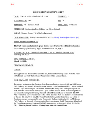
ZONING CHANGE REVIEW SHEET DISTRICT: 2 TO: LI SITE AREA: 55.41 acres CASE: C14-2021-0182 – Burleson Rd. 78744 ZONING FROM: I-RR ADDRESS: 7051 Burleson Road APPLICANT: Southeastern Freight Lines Inc. (Ryan Smigiel) AGENT: Drenner Group, P.C. (Charley Dorsaneo) CASE MANAGER: Wendy Rhoades (512-974-7719, wendy.rhoades@austintexas.gov) STAFF RECOMMENDATION: The Staff recommendation is to grant limited industrial services (LI) district zoning. For a summary of the basis of Staff’s recommendation, see page 2. ZONING AND PLATTING COMMISSION ACTION / RECOMMENDATION: February 15, 2022: CITY COUNCIL ACTION: March 24, 2022: ORDINANCE NUMBER: ISSUES: The Applicant has discussed the intended use, traffic and driveway access with Del Valle ISD officials and with the Southeast Neighborhood Plan Contact Team. CASE MANAGER COMMENTS: The subject zoning tract has frontage along Burleson Road on its north side and McKinney Falls Parkway on its south side and is zoned interim – rural residence (I-RR). It was annexed into the City limits in August 2020 and is undeveloped except for a small parking area on McKinney Falls that serves the adjacent Ojeda Middle School. There is undeveloped land and a manufacturing facility along the north side of Burleson Road to the north (LI-PDA- NP), commercial and industrial uses in the Travis Business Park and Burleson Industrial Park to the east (LI-CO; CS-1-CO; LI); Ojeda Middle School, undeveloped land and a City of Austin emergency services and Austin Community College training facility on McKinney Falls Parkway to the south (County); and office / warehouses, Smith Elementary School and the Texas Department of Parks and Wildlife headquarters to the west (LI-CO; W/LO-CO; DR). Please refer to Exhibits A (Zoning Map) and A-1 (Aerial View). 1 of 11B-6 C14-2021-0182 Page 2 The Applicant proposes to zone the property to the limited industrial services (LI) district so that it may be developed with a limited warehousing and distribution use. Access is proposed to be taken from both Burleson Road and McKinney Falls Parkway. The Applicant and Del Valle ISD officials have discussed improvements to the subject site and improvements to Ojeda Middle School as it pertains to shared vehicular access to McKinney Falls Parkway. Both parties agreed to work through these two items as the Applicant moves forward with the site planning process. BASIS FOR RECOMMENDATION 1. The proposed zoning should be consistent with the purpose statement of the district sought. The proposed zoning should allow for a reasonable use of the property. The limited industrial services (LI) district designation is for a commercial service use or limited manufacturing use generally located on a medium or large sized site. 2. Staff recommends the Applicant’s request based on the following considerations: 1) adjacency to heavy commercial and industrial uses and zoning to the north, east and west, and 2) access is taken to Burleson Road and McKinney Falls Parkway, both arterial roadways. EXISTING ZONING AND LAND USES: Site I-RR ZONING North LI-PDA-NP South County LAND USES Undeveloped; Parking area along McKinney Falls Parkway for adjacent Middle School Office / Warehouse / Manufacturing Del Valle ISD Middle School; Undeveloped; COA Police, Fire and Austin Community College training facility East LI-CO; CS-1-CO; LI Auto repair, Adult-oriented business, Night club, Building West LI-PDA; LI-CO; W/LO-CO; DR supply stores within the Travis Business Park; Office / warehouses, Building supply companies, Equipment rentals within the Burleson Industrial Park Industrial; Office / Warehouses; Del Valle ISD Elementary School; Texas Parks and Wildlife Headquarters AREA STUDY: Not Applicable WATERSHED: Onion Creek – Suburban CAPITOL VIEW CORRIDOR: No SCHOOLS: This property is located within the Del Valle Independent School District boundaries. SCENIC ROADWAY: No TIA: Is not required 2 of 11B-6 C14-2021-0182 Page 3 627 – Onion Creek Homeowners Association COMMUNITY REGISTRY LIST: 511 – Austin Neighborhoods Council 774 – Del Valle Independent School District 1228 – Sierra Club, Austin Regional Group 1258 – Del Valle Community Coalition 1316 – Southeast Combined Neighborhood Plan Contact Team 1363 – SEL Texas 1441 – Dove Springs Proud 1550 – Homeless Neighborhood Association 1616 – Neighborhood Empowerment Foundation 1774 – Austin Lost and Found Pets AREA CASE HISTORIES: 1408 – Go Austin Vamos Austin 78744 1530 – Friends of Austin Neighborhoods 1614 – Caracol Southeast CITY COUNCIL Apvd as Commission recommended (7-30-2020). Apvd as Commission recommended (6-11-2015). Apvd as Commission recommended (11-6-2014). Apvd as ZAP recommended (1-17-2013). Apvd as ZAP Commission recommended (9-27-2012). Apvd as Commission recommended (5-24-2012). NUMBER C14-2020-0058 – 4201 Felter Lane C14-2015-0042 – Burleson Industrial – 7005 Burleson Rd C14-2014-0131 – Burleson Industrial Park – 7103 Burleson Rd C14-2012-0143 – 7303 Burleson Rd C14-2012-0051 – Felter Lane Hot Bodies – 4134 Felter Ln C14-2012-0027 – Felter Lane Road Rezoning – Felter Ln. at Burleson Rd. C14-02-0198 – Telecom Office Park – 7001 Burleson Rd REQUEST COMMISSION I-RR to LI To Grant I-RR to LI I-RR to LI To Grant LI-CO w/CO for 2,000 trips per day To Grant I-RR to LI I-RR to CS-1 I-RR; I-SF-2 to LI To Grant LI-CO w/CO for 2,000 trips To Grant CS-1-CO w/CO for 2,000 trips per day over the existing land uses To Grant LI-CO w/CO for 2,000 trips per day over the existing land uses LI-PDA w/PDA for add’l permitted uses, prohibits certain uses, 2,000 trips, subj. to LI stds unless developed with multi-family in which case MF-2 stds apply, 25’ buffer between residential and commercial / I-RR to LI-PDA To Grant Staff rec. of Apvd LI-PDA (8-7-2003). 3 of 11B-6 C14-2021-0182 Page 4 C14-02-0117 – Telecom Office Park – 4101 Smith School Rd I-RR to LI-PDA To Grant Staff rec. of industrial uses Apvd LI-PDA (3-20-2003). LI-PDA w/PDA for 2,000 trips, add’l permitted uses, restricted uses with multi-family devt, subj. to LI stds unless developed with multi- family in which case MF-2 stds apply, 25’ buffer between residential and commercial/ industrial uses, and prohibits certain uses To Grant Rezoning of 24 tracts of land Apvd as Commission recommended (10-10-2002). C14-02-0128.03 – Southeast Combined Neighborhood Plan (Southeast) Rezonings – Ben White/SH 71 on the north, U.S. 183 on the east, Burleson Rd. on the south, and Montopolis Dr. on the west C14-02-0078 – Smith School Road – 4207 Smith School Rd C14-00-2041 – Lockheed Tract – 6800 Burleson Rd I-RR to CS DR to LI To Grant W/LO-CO w/CO for 2,000 trips / day Apvd. Staff rec. of LI with conditions Apvd as Commission recommended (7-18-2002). Apvd LI-PDA, LI-CO and RR-CO for area in the floodplain (3-8-2001). RELATED CASES: The property was annexed into the full purpose City limits on August 10, 2020 and assigned I-RR zoning (C7a-2020-0002). There are no subdivision or site plan applications on the property. 4 of 11B-6 C14-2021-0182 Page 5 EXISTING STREET CHARACTERISTICS: Name ROW Pavement Classification Sidewalks Bicycle Route Capital Metro (within ¼ mile) Burleson Road 125 feet 64 feet No Bike Lane Yes Level 3 (Minor Arterial) McKinney Falls Parkway 105 feet Level 3 (Minor Arterial) Yes Shared Lane No 27 feet on each side of an 18-foot median OTHER STAFF COMMENTS: Comprehensive Planning This zoning case has dual street frontage and is located on the west side of Burleson Road and the north side of McKinney Falls Parkway. It is not located within the boundaries of a neighborhood planning area. The property is 55.41 acres in size, mostly undeveloped, and is located just outside the boundaries of the McKinney Job Center, which is to the north. Surrounding land uses include undeveloped land, a business / warehouse office park, and single-family subdivisions to the north; to the south is undeveloped land and the John Ojeda Middle School; to the east are business/warehouse office parks; and to the west are two business / warehouse office parks, Smith Elementary School, and Texas Parks and Wildlife Department. The proposal per the agent: zone the property from I-RR to LI (Limited Industrial Services) to allow for a limited warehousing and distribution use, which is consistent with the zoning adjacent to the Property. Connectivity Imagine Austin A bus stop is located directly in front of the subject property on Burleson Road. There appear to be unprotected bike lanes but no public sidewalks along this portion of Burleson Road. On McKinney Falls Parkway, there are no public transit stops or bike lanes but there is a public sidewalk along this section of the road. Mobility and connectivity options are fair in the area. The property is located immediately adjacent to a Job Center and abuts several office / warehouse parks. Like many Imagine Austin Centers, they are represented by a circles or globular shapes that reflects the general location where the center should be located in the future. The center’s actual boundaries would need to be clarified through a small area planning process. From Imagine Austin: Job centers will mostly contain office parks, 5 of 11B-6 C14-2021-0182 Page 6 manufacturing, warehouses, logistics, and other businesses with similar demands and operating characteristics. They should nevertheless become more pedestrian and bicycle friendly, in part by better accommodating services for the people who work in those centers. While many of these centers are currently best served by car, the Growth Concept Map offers transportation choices such as light rail and bus rapid transit to increase mobility options. The following Imagine Austin policies are applicable to this case: • LUT P4. Protect neighborhood character by directing growth to areas of change that includes designated redevelopment areas, corridors and infill sites. Recognize that different neighborhoods have different characteristics and infill development should be sensitive to the predominant character of these communities. • LUT P20. Locate industry, warehousing, logistics, manufacturing, and other freight- intensive uses in proximity to adequate transportation and utility infrastructure. Based on this property having a large number of other light industrial and office / warehouse parks located within a half a mile radius of this site; the Imagine Austin policies above that recognize that different neighborhoods have different characteristics; but fair mobility and connectivity options, this request partially supports the Imagine Austin Comprehensive Plan. Drainage The developer is required to submit a pre- and post-development drainage analysis at the subdivision and site plan stage of the development process. The City’s Land Development Code and Drainage Criteria Manual require that the Applicant demonstrate through engineering analysis that the proposed development will have no identifiable adverse impact on surrounding properties. There is a regional water quality / detention facility that will serve this site, therefore onsite drainage facilities will not be provided. Environmental The site is not located over the Edwards Aquifer Recharge Zone. The site is in the Onion Creek Watershed of the Colorado River Basin, which is classified as a Suburban Watershed by Chapter 25-8 of the City's Land Development Code. The site is in the Desired Development Zone. Under current watershed regulations, development or redevelopment on this site will be subject to the following impervious cover limits: Development Classification % of Gross Site Area % of Gross Site Area Single-Family (minimum lot size 5750 sq. ft.) Other Single-Family or Duplex Multifamily 50% 55% 60% with Transfers 60% 60% 70% 6 of 11B-6 C14-2021-0182 Commercial 80% Page 7 90% According to floodplain maps there is no floodplain within or adjacent to the project location. Standard landscaping and tree protection will be required in accordance with LDC 25-2 and 25-8 for all development and/or redevelopment. At this time, site specific information is unavailable regarding vegetation, areas of steep slope, or other environmental features such as bluffs, springs, canyon rimrock, caves, sinkholes, and wetlands. Under current watershed regulations, development or redevelopment requires water quality control with increased capture volume and control of the 2-year storm on site. At this time, no information has been provided as to whether this property has any preexisting approvals that preempt current water quality or Code requirements. Impervious Cover Within the Onion Creek watershed, the maximum impervious cover allowed by the LI zoning district is 80% (90% with transfers), which is based on the more restrictive watershed regulations. PARD – Planning & Design Review There are currently no parkland requirements for uses other than residential and hotel. Given that the application is for LI zoning, with a proposed use of warehousing and distribution, there would not be parkland dedication requirements or parkland impacts at the time of site plan or subdivision. Site Plan Site plans will be required for any new development other than single-family or duplex residential. Any development which occurs in an SF-6 or less restrictive zoning district which is located 540-feet or less from property in an SF-5 or more restrictive zoning district will be subject to compatibility development regulations. Any new development is subject to Subchapter E (Suburban roadway). Design Standards and Mixed Use. Additional comments will be made when the site plan is submitted. Austin Transportation Department ASMP Assessment The Austin Strategic Mobility Plan (ASMP) calls for 120 feet of right-of-way for McKinney Falls Parkway. It is recommended that 60 feet of right-of-way from the existing centerline 7 of 11B-6 C14-2021-0182 Page 8 should be dedicated for McKinney Falls Parkway according to the Transportation Plan at the time of subdivision and/or site plan application, whichever comes first [LDC 25-6-51 and 25- 6-55]. Transportation Assessment Assessment of required transportation mitigation, including the potential dedication of right of way and easements and participation in roadway and other multi-modal improvements, will occur at the time of site plan application. A traffic impact analysis shall be required at the time of site plan if triggered per LDC 25-6-113. Water / Wastewater The landowner intends to serve the site with City of Austin water and wastewater utilities. The landowner, at own expense, will be responsible for providing any water and wastewater utility improvements, offsite main extensions, utility relocations and or abandonments required by the land use. The water and wastewater utility plan must be reviewed and approved by Austin Water for compliance with City criteria and suitability for operation and maintenance. Depending on the development plans submitted, water and or wastewater service extension requests may be required. All water and wastewater construction must be inspected by the City of Austin. The landowner must pay the City inspection fee with the utility construction. The landowner must pay the tap and impact fee once the landowner makes an application for a City of Austin water and wastewater utility tap permit. INDEX OF EXHIBITS AND ATTACHMENT TO FOLLOW: A: Zoning Map A-1: Aerial Map Applicant’s correspondence 8 of 11B-6 UNDEV LI-PDA-NP C14-03-0037 C14-2015-0135 O L R D S MIT H S C H O PRIMARY\SCHOOL DR TEXAS PARKS &\WILDLIFE OFFICE C14-2015-0066 W/LO-CO 02-0078 C14-02-0078 ! ! ! ! ! ! ! ! ! ! ! ! ! ! ! ! ! 02-0117 OFFICE/ WAREHOUSE/ MANUFACTURING ! ! ! ! ! ! ! ! ! ! B U ! R ! L E ! S ! O N R ! D ! ! ! ! ! ! ! LI-PDA-NP C14-03-0116 ! ! ! ! AUTO REPAIR ! ! ! ! ! ! CS-1-CO ! C14-2012-0051 ! C14-2020-0058 M PANY O R C O D O ! ! ! ! F E LT E R L N ! ! ! ! C7A-11-001 LI S U P P LY C T C14-2014-0131 LI LI-CO C14-2012-0143 UNDEV LI-PDA C14-02-0117 02-0117 LI-CO C14-2015-0042 ! ! ! ! ! C7a-01-021 ! ! ! ! ! ! ! ! ! ! ! ! ! ! ! ! ! ! ! ! ! ! ! ! ! ! ! ! ! ! ! ! ! ! ! ! ! ! ! ! ! ! ! ! ! ! ! ! ! ! ! ! ! COUNTY ! ! ! ! ! ! C14-2012-0027 2012-0027 I-RR OFFICE\WAREHOUSE ! ! ! ! ! ! ! ! ! ! ! ! ! ! ! ! ! ! ! ! ! ! COUNTY ! ! ! ! ! ! ! ! ! ! ! ! ! ! ! ! ! ! ! ! ! OJEDA MIDDLE SCHOOL ! ! ! ! ! ! ! ! ! ! ! ! ! UNDEVELOPED MC KINNEY FALLS PKWY MC KINNEY FALLS PKWY ± SUBJECT TRACT ! ! ! ! ! ! PENDING CASE ZONING BOUNDARY ZONING Exhibit A ZONING CASE#: C14-2021-0182 This product is for informational purposes and may not have been prepared for or be suitable for legal, engineering, or surveying purposes. It does not represent an on-the-ground survey and represents only the approximate relative location of property boundaries. 1 " = 400 ' This product has been produced by the Housing and Planning Department for the sole purpose of geographic reference. No warranty is made by the City of Austin regarding specific accuracy or Created: 12/2/2021 9 of 11B-6 3 4B 4 5 LI-PDA-NP 1 LI-CO-NP 1 1 3 2 4 S MIT H S C H O O L R D LI-PDA 2 4 B U R L E S O N R D 3 2 LI-CO 1 3 4 LI-PDA-NP 2 113 111 112 106 105 114 116 122 102 119 120 123 124 141 25 26 24 22 21 38 27 39 28 40 42 30 37 31 35 33 36 34 17 18 CRESTONE CREEDE DR 2 56 59 60 55 79 63 65 64 67 66 62 69 43 45 48 3 49 51 52 53 54 1 W/LO-CO K16 I-RR 2 8 1 0 - 1 2 0 2 - 4 1 C DR 1 2 CS-1-CO 5 L16 1 LI 2 S U P PLY C T 6 LI 5 4 F ELT E R L N 2 3 LI-CO 1 K15 P MF-4 M C KIN N E Y FALLS P K W Y 1 MC KINNEY FALLS PKWY L15 3 4 5 SUBJECT TRACT ZONING BOUNDARY ! ! ! ! ! ! PENDING CASE CREEK BUFFER BURLESON RD. 78744 Exhibit A - 1 ZONING CASE#: LOCATION: SUBJECT AREA: GRID: MANAGER: C14-2021-0182 7021-7053 Burleson Rd 55.41 ACRES K15, K16, L15, L16 WENDY RHOADES 1'' = 600' This map has been produced by the Communications Technology Management Dept. on behalf of the Planning Development Review Dept. for the sole purpose of geographic reference. No warranty is made by the City of Austin regarding specific accuracy or completeness. B U 4 R L E S O N R D 7 LI-PDA-NP 2 I-RR 1 2 1 2 3 3 4 1 2 3 12 11 9 4 6 5 7 8 6 7 8 4 9 2 3 5 3 14 15 17 16 I V C N L R A M 5 2 8A 7A 2A N L W A H S 3A 7 6 Copyright nearmap 2015 10 of 11B-6 Charley Dorsaneo 512-807-2949 Ms. Rosie Truelove Housing and Planning Department City of Austin 1000 E 11th Street Austin, TX 78702 November 22, 2021 Via Electronic Delivery Re: Burleson Rd. 78744 – Rezoning application for the approximately 55.41-acre property located between 7021 - 7053 Burleson Road, Austin, Texas in Austin, Travis County, Texas known as TCAD parcel no. 0320130101 (the “Property”) Dear Ms. Truelove: As representatives of the owner of the Property, we respectfully submit the enclosed rezoning application package. The project is titled Burleson Rd. 78744 and is approximately 55.41 acres of land, located on the southwest side of Burleson Road, southeast of Smith School Road, and northwest of Felter Lane. The Property was annexed into the full purpose jurisdiction of the City of Austin via Ordinance No. 20200730-006 on August 7, 2020. The Property is currently zoned I-RR (Interim - Rural Residence). The requested rezoning is from I-RR to LI (Limited Industrial Services). The Property is currently undeveloped. The purpose of the rezoning is to allow for a limited warehousing and distribution use. This rezoning request is consistent with the zoning adjacent to the Property. The Property is not located within a neighborhood planning area, and therefore, a neighborhood plan amendment application is not required with this request. The attached Traffic Impact Analysis ("TIA") determination was provided on November 26, 2021, by Justin Good, not requiring a TIA at this time. Please let me know if you or your team members require additional information or have any questions. Thank you for your time and attention to this project. Sincerely, Charley Dorsaneo cc: Jerry Rusthoven, Housing and Planning Department (via electronic delivery) Joi Harden, Housing and Planning Department (via electronic delivery) Wendy Rhoades, Housing and Planning Department (via electronic delivery) 200 Lee Barton Drive, Suite 100 | Austin, Texas 78704 | 512-807-2900 | 11 of 11B-6