B-07 (C14-2021-0195 - Howard Lane Residences Two, District 7).pdf — original pdf
Backup
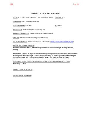
ZONING CHANGE REVIEW SHEET TO: MF-4 CASE: C14-2021-0195 (Howard Lane Residences Two) DISTRICT: 7 ADDRESS: 1421 East Howard Lane ZONING FROM: GR-MU SITE AREA: 8.382 acres (365,119.92 sq. ft.) PROPERTY OWNER: John Colbert Fish & Oana H Fish AGENT: Alice Glasco Consulting (Alice Glasco) CASE MANAGER: Sherri Sirwaitis (512-974-3057, sherri.sirwaitis@austintexas.gov) STAFF RECOMMEDATION: Staff recommends MF-4, Multifamily Residence-Moderate-High Density District, zoning. In addition, 39 feet of right-of-way from the existing centerline should be dedicated for Harrisglenn Drive through a street deed to the City of Austin prior to 3rd reading in accordance with the Transportation Plan. [LDC, Sec. 25-6-51 and 25-6-55]. ZONING AND PLATTING COMMISSION ACTION / RECOMMENDATION: February 1, 2022 CITY COUNCIL ACTION: ORDINANCE NUMBER: 1 of 13B-7 C14-2021-0195 2 ISSUES: N/A CASE MANAGER COMMENTS: The property in question is a 8.382 acre area located at the northwest corner of Harris Glenn Drive and East Howard Lane. The site is undeveloped and contains part of the Harris Branch tributary/floodplain. The lots to the north are zoned MF-3 and are developed with single family residences and a detention pond. To the south, across East Howard Lane, there is an undeveloped tract zoned GR and a single family residential subdivision zoned SF-4A-CO. To the east, across Harris Glenn Drive, there is undeveloped land that is zoned GR-MU. The property to the west is undeveloped, unzoned and has an interim-rural residence (I-RR) designation. The staff is currently processing a zoning application for MF-4 (case C14-2021- 0186) on this tract of land. These properties were annexed by the City of Austin on December 31, 2003 through case: C7A-03-013. The applicant is requesting MF-4 zoning on the property in this case to construct a new 140-unit multifamily use at this location. The staff recommends the applicant’s request to rezone this tract of land to the Multifamily Residence-Moderate-High Density District because the property in question meets the intent of the MF-4 district. The proposed rezoning area is located adjacent to MF-3 zoning and a residential development to the north. MF-4 zoning will provide for additional housing options in this area of the city with access to East Howard Lane, a major arterial roadway and a designated Activity Corridor by the Imagine Austin Comprehensive Plan. The applicant agrees with staff’s recommendation. BASIS OF RECOMMENDATION: 1. The proposed zoning is consistent with the purpose statement of the district sought. Multifamily Residence (Moderate-High Density) district is intended to accommodate multifamily and group residential use with a maximum density of 36 to 54 units per acre, depending on unit size. This district is appropriate for moderate-high density housing in centrally located areas near supporting transportation and commercial facilities, in areas adjoining downtown Austin and major institutional or employment centers, and in other selected areas where moderate-high density multifamily use is desirable. The site under consideration is located on an arterial roadway and designated Activity Corridor near major employers, such as Dell Technologies. 2. The proposed zoning promotes consistency and orderly planning. The proposed zoning is consistent with surrounding land use patterns as there is residential zoning to the north and south. MF-4 zoning will provide a transition in the intensity of residential uses from a higher density along E. Howard Lane to the single family residential development to the north. 2 of 13B-7 C14-2021-0195 3 3. The proposed zoning should allow for a reasonable use of the property. The proposed zoning will provide for additional housing options in this area of the city with access to East Howard Lane, a major arterial roadway and Activity Corridor on a property that abuts the Dessau/Parmer Neighborhood Center as designated by the Imagine Austin Comprehensive Plan. EXISTING ZONING AND LAND USES: ZONING MF-3, GR-MU Site North MF-3 South GR, SF-4A-CO East GR-MU West I-RR LAND USES Undeveloped Area, Floodplain Detention Pond, Single Family Residences Undeveloped, Single Family Residences Undeveloped Undeveloped NEIGHBORHOOD PLANNING AREA: N/A TIA: Deferred to the time of Site Plan WATERSHED: Harris Branch SCHOOLS: Pflugerville I.S.D. Barron Elementary School Dessau Middle School Pflugerville High School NEIGHBORHOOD ORGANIZATIONS: Austin Lost and Found Pets Friends of Austin Neighborhoods Harris Ridge Owner’s Association Homeless Neighborhood Association Neighborhood Empowerment Foundation North Growth Corridor Alliance Pflugerville Independent School District SELTEXAS Sierra Club, Austin Regional Group Techridge Neighbors Yager Community 3 of 13B-7 C14-2021-0195 4 REQUEST I-RR to MF-4 AREA CASE HISTORIES: NUMBER C14-2021-0186 (Howard Lane Residences: 1208 East Howard Lane) C14-2018-0099 (Howard Lane Commercial: 1208 East Howard Lane) C14-2018-0098 (Howard Lane Residential: 1208 East Howard Lane) I-RR to SF-6 SF-2* I-RR to LR LO-CO to SF-4A LO-CO to SF-4A C14-2017-0056 (Howard Lane Tract, Part 2: 13000 Block of E. Howard Lane and 13414 Harris Glenn Drive) C14-2016-0126 (Howard Lane Tract: 13000 Block of E. Howard Lane and 13414 Harris Glenn Drive) LI-PDA to LI-PDA C14-2016-0124 (Parmer Business Park: E. Howard Lane at Harris Ridge Blvd.) COMMISSION CITY COUNCIL 2/17/22: Pending 1/18/22: Approved staff recommendation of MF-4 zoning by consent (10-0, R. Woody-off dais); H. Smith-1st, C. Acosta-2nd. 1/15/19: Approved staff’s recommendation of SF-2-CO zoning, with a CO to limit the development intensity on the site to less than 2,000 vehicle trips per day, by consent (10-0, N. Barrera- Ramirez-absent); S. Lavani-1st, J. Duncan-2nd. 5/16/17: Approved staff’s recommendation of SF-4A zoning by consent (11-0); A. Denkler-1st, J. Duncan-2nd. 2/07/17: Approved staff’s recommendation of SF-4A-CO zoning, with a conditional overlay to prohibit driveway access to East Howard Lane and to limit the development intensity on the site to less than 2,000 vehicle trips per day, on consent. The Commission proposed an additional condition to limit the development intensity on the to require a roadway connection to Scranton Drive (9-0, B. Greenberg and J. Kiolbassa- absent); G. Rojas-1st, B. Evans-2nd. 3/07/17: Approved staff recommendation of LI-PDA zoning, with additional conditions for no outdoor amplified sound and to require a TIA at the time of Site Plan (10-0); B. Greenberg-1st, B. Evans-2nd. 12/17/18: The case was withdrawn by the applicant 1/31/19: Approved SF-2-CO zoning was approved on Council Member Kitchen’s motion, Council Member Pool’s second on a 10-0 vote. Council Member Flannigan was absent. 6/15/17: The public hearing was conducted and a motion to close the public hearing and approve Ordinance No. 20170615-096 for SF-4A district zoning was approved on Council Member Kitchen’s motion, Council Member Alter’s second on an 11- 0 vote. 3/02/17: Approved the ZAP Commission’s recommendation of SF-4A-CO zoning on all 3 readings (10-0, A. Kitchen-off dais); J. Flannigan-2nd. Troxclair-1st, E. 4/20/17: Approved the ZAP Commission’s recommendation for LI-PDA zoning on consent on 1st reading, with additional conditions that a multifamily use be limited to 900 residential dwelling units and that a TIA be conducted at the time of site plan 4 of 13B-7 C14-2021-0195 5 review if a multifamily use is proposed to be built on the property (11-0); L. Pool-1st, G. Casar-2nd. 5/18/17: Ordinance No. 20170518-056 was approved for limited industrial services-planned development area (LI-PDA) combining district zoning, to change a condition of zoning on Council Member Garza’s motion, Council Member Alter’s second on a 9-0 vote. Council Members Casar and Troxclair were off the dais. 9/26/13: Approved MF-3 zoning on first reading on consent (7-0); B. Spelman-1st, S. Cole-2nd. 10/17/13: Approved MF-3 zoning on consent on 2nd/3rd readings (6-0, M. Martinez-off dais); B. Spelman-1st, S. Cole-2nd. 9/27/07: Approved MF-3 zoning by consent (5-0); all 3 readings 12/07/06: Approved SF-6-CO zoning for Tract 1 and LI-CO zoning for Tract 2 (7-0); 1st reading 6/29/07: Approved SF-6-CO zoning for Tract 1 and LI-CO zoning for Tract 2, with conditions (7-0); 2nd/3rd readings C14-2013-0041 (Fort Dessau- GR: 1602 Fish Lane) SF-2-CO to MF-3 6/18/13: Approved staff’s recommendation of MF-3 zoning by consent (6-0, C. Banks-absent); P. Seeger-1st, R. McDaniel-2nd. C14-2007-0103 (Del Cerro: 13700 Dessau Road) C14-06-0098 (Harris Ridge: 13809 Harris Ridge Boulevard) GR-MU, GR, SF-2-CO to MF-3 LI-CO to Tract 1: SF- 6 and Tract 2: LI 8/21/07: Approved staff’s recommendation of MF-3 zoning by consent (7-0, K. Jackson-absent); J. Martinez-1st, J. Gohil-2nd. 11/21/06: Approved staff’s recommendation of SF-6-CO zoning for Tract 1, with following conditions: 1) Changed setback requirement to a 45-foot building setback from the southern property line along proposed Tract 2; 2) Added requirement for an 8-foot masonry fence along the southern property line along proposed Tract 2; 3) Included a 25-foot vegetative buffer along the western property line bordering single family development in the County; 4) Approved staff’s recommendation for LI zoning for Tract 2, adding a conditional overlay for the following: Establish a 78-foot building setback from the northern property line along proposed Tract 1; 5) Include the TIA recommendations for Tracts 1 and 2 as provided in Attachment D 5 of 13B-7 C14-2021-0195 6 C14-04-0139 (Howard Lane Industrial Park: 1100 East Howard Lane) C14-04-0127 (Wright Subdivision Dessau Road Zoning Change: 1624 East Howard Lane) C14-04-0056 (Fish Tract: 13600- 14224 Dessau Road) I-RR to LI GR-CO to GR I-RR to SF-2, SF-6, MF-3 and CS 12/02/04: Approved LI-CO, with a CO for 2,000 vtpd limit and prohibiting Adult Oriented Businesses, (7-0); all 3 readings 11/18/04: Granted GR-CO (7-0); all 3 readings 12/16/04: Granted SF-2-CO, SF-6, MF-3, LR-MU, GR and GR-MU on all 3 readings (7-0) in a public restrictive covenant. Vote: (9-0); K. Jackson-1st, B. Baker-2nd. 11/2/04: Approved staff’s recommendation of LI-CO zoning with added condition of no Adult Oriented Businesses, by consent (9-0) 10/19/04: Approved staff’s recommendation of GR-CO zoning, with CO to prohibit Adult Oriented Businesses and a public RC encompassing the TIA recommendations, by consent (9-0) 11/02/04: Approved staff’s recommendation of : Tract 1, Block A: GR-MU Tract 2, Block A: GR Tract 3, Block A: GR Tract 4, Block A: GR Tract 5, Block A: GR Tract 6, Block A: SF-2-CO (The conditional overlay includes a 100- foot vegetative buffer with a sound barrier fence along the western boundary of this tract to create a physical separation from the commercial/mixed use development proposed on Tract 1, Block A.) Tract 7, Block A: LR-MU Tract 8, Block A: MF-3 Tract 9, Block A: SF-6 Tract 10, Block A: LR Tract 1, Block B: GR-MU Tract 2, Block B: GR-MU In addition, require a public restrictive covenant to encompass the Transportation Impact Analysis Recommendations, by consent (9-0) 8/1/00: Approved staff rec. w/ condition of no Adult Oriented Businesses (8-0) 9/28/00: Approved GR-CO w/ conditions on TR 1 & 2 (7-0); all 3 readings DR to CS C14-00-2101 (Harris Ridge Rezoning: Harris Glenn Drive At Howard Lane) RELATED CASES: C7A-03-013 Annexation Case 6 of 13B-7 C14-2021-0195 7 EXISTING STREET CHARACTERISTICS: Name ROW Pavement Classification Sidewalks Bicycle Harrisglenn Dr. 50’ – 76’ 30’ – 46’ ASMP Level 2 Yes Route None Capital Metro (within ¼ mile) No OTHER STAFF COMMENTS: Comprehensive Planning This zoning case is located on the northwest corner of East Howard Lane and Harrisglenn Drive, on a vacant parcel that is approximately 8.38 acres in size. This property is located along the Howard Lane Activity Corridor, within the Dessau/Parmer Neighborhood Center, and outside the boundaries of a small area plan. Surrounding land uses includes a large single family subdivision to the north; to the south is an apartment complex and a single family subdivision; to the east is vacant land and a senior living complex; and to the west is vacant land. The proposed use is a 140 unit midrise multi-family apartment complex. Connectivity: Public sidewalks are located along both sides of this portion of E. Howard Lane. There are no urban trails or public transit stops located within a quarter mile of this site. When looking at mobility and connectivity options in the area, they appear to be limited. Imagine Austin The Imagine Austin Growth Concept Map, found in the Imagine Austin Comprehensive Plan (IACP) identifies this project as being located along an Activity Corridor (E. Howard Lane). The property also located within the boundaries of a Neighborhood Center (Dessau/Parmer Neighborhood Center). Activity Corridors are characterized by a variety of activities and types of buildings located along the roadway — shopping, restaurants and cafés, parks, schools, single-family houses, apartments, public buildings, houses of worship, mixed-use buildings, and offices. A Neighborhood Center is the smallest and least intense of the three types of activity centers outlined in the Growth Concept Map, with a focus on creating local businesses and services—including doctors and dentists, shops, branch libraries, dry cleaners, hair salons, coffee shops, restaurants, and other small and local businesses that generally serve the center and surrounding neighborhoods. Like many Imagine Austin Centers, this center is represented by a circle or globular shape that reflects the general location where the center should be located in the future. The center’s actual boundaries would need to be clarified through a small area planning process. Regional, town, and neighborhood centers are supposed to be walkable, bikeable, and supported by transit. The following Imagine Austin policies are applicable to this case: • LUT P3. Promote development in compact centers, communities, or along corridors that are connected by roads and transit that are designed to encourage walking and bicycling, and reduce health care, housing and transportation costs. • LUT P4. Protect neighborhood character by directing growth to areas of change that include designated redevelopment areas, corridors and infill sites. Recognize that 7 of 13B-7 C14-2021-0195 8 different neighborhoods have different characteristics and new and infill development should be sensitive to the predominant character of these communities. • HN P10. Create complete neighborhoods across Austin that have a mix of housing types and land uses, affordable housing and transportation options, and access to schools, retail, employment, community services, and parks and recreation options. Analysis and Conclusion Howard Lane is transitioning away from a rural road to one that is quickly filling up with large single-family subdivisions and apartment complexes but contains little in the way of goods and services to serve people living along this major corridor and nascent neighborhood Center. Based upon: (1) this project being located along an Activity Corridor and within a Neighborhood Center, which supports residential uses, including multifamily; and (2) some civic options available in the area (three public schools within a mile of this property); but (3) limited mobility and connectivity options in this area, this project appears to partially support the Imagine Austin Comprehensive Plan. Environmental The site is not located over the Edwards Aquifer Recharge Zone. The site is in the Harris Branch Creek Watershed of the Colorado River Basin, which is classified as a Suburban Watershed by Chapter 25-8 of the City's Land Development Code. The site is in the Desired Development Zone. Under current watershed regulations, development or redevelopment on this site will be subject to the following impervious cover limits: Development Classification % of Gross Site Area % of Gross Site Area Single-Family (minimum lot size 5750 sq. ft.) Other Single-Family or Duplex Multifamily Commercial 50% 55% 60% 80% with Transfers 60% 60% 70% 90% According to floodplain maps there is a floodplain within or adjacent to the project location. Based upon the location of the floodplain, offsite drainage should be calculated to determine whether a Critical Water Quality Zone exists within the project location. Standard landscaping and tree protection will be required in accordance with LDC 25-2 and 25-8 for all development and/or redevelopment. At this time, site specific information is unavailable regarding vegetation, areas of steep slope, or other environmental features such as bluffs, springs, canyon rimrock, caves, sinkholes, and wetlands. 8 of 13B-7 C14-2021-0195 9 Under current watershed regulations, development or redevelopment requires water quality control with increased capture volume and control of the 2 year storm on site. At this time, no information has been provided as to whether this property has any at preempt current water quality or Code requirements. Fire No comments. Parks and Recreation Parkland dedication will be required for the new residential units proposed by this development, multifamily with MF-4 zoning, at the time of subdivision or site plan, per City Code § 25-1-601. The requirement shall be met with fees in-lieu, determined using the criteria in City Code Title 25, Article 14, as amended. Those fees shall be used toward park investments in the form of land acquisition and/or park amenities within the surrounding area, per the Parkland Dedication Operating Procedures § 14.3.11 and City Code § 25-1-607 (B)(1) & (2). If the applicant wishes to discuss parkland dedication requirements in advance of site plan or subdivision applications, please contact this reviewer: thomas.rowlinson@austintexas.gov. Site Plan Site plans will be required for any new development other than single-family or duplex residential. Any development which occurs in an SF-6 or less restrictive zoning district which is located 540 feet or less from property in an SF-5 or more restrictive zoning district will be subject to compatibility development regulations. Any new development is subject to Subchapter E. Design Standards and Mixed Use. Additional comments will be made when the site plan is submitted. Compatibility Standards The site is subject to compatibility standards due to the SF-2-CO lot being roughly 25 feet from north/northwest property line. Wildland Urban Interface This site is located within 150 feet of a wildland area, in the Wildland Urban Interface (WUI). Please see this website for more information about construction in the WUI: http://www.austintexas.gov/department/wildland-urban-interface-code 9 of 13B-7 C14-2021-0195 10 Transportation ASMP Assessment: The Austin Strategic Mobility Plan (ASMP) calls for 78 feet of right-of-way for Harrisglenn Dr. It is recommended that 39 feet of right-of-way from the existing centerline should be dedicated for Harrisglenn Dr. according to the Transportation Plan prior to 3rd reading of City Council. [LDC 25-6-51 and 25-6-55]. Transportation Assessment: Assessment of required transportation mitigation, including the potential dedication of right of way and easements and participation in roadway and other multi-modal improvements, will occur at the time of site plan application. A traffic impact analysis shall be required at the time of site plan if triggered per LDC 25-6-113. Water Utility The landowner intends to serve the site with City of Austin water and wastewater utilities. The landowner, at own expense, will be responsible for providing any water and wastewater utility improvements, offsite main extensions, utility relocations and or abandonments required by the land use. The water and wastewater utility plan must be reviewed and approved by Austin Water for compliance with City criteria and suitability for operation and maintenance. Depending on the development plans submitted, water and or wastewater service extension requests may be required. All water and wastewater construction must be inspected by the City of Austin. The landowner must pay the City inspection fee with the utility construction. The landowner must pay the tap and impact fee once the landowner makes an application for a City of Austin water and wastewater utility tap permit. INDEX OF EXHIBITS TO FOLLOW A: Zoning Map B. Aerial Map C. Correspondence from Interested Parties 10 of 13B-7 ! ! ! ! ! ! ! ! ! ! ! ! ! ! ! ! ! ! ! ! ! ! ! ! ! ! ! ! ! ! ! ! ! ! ! ! ! ! ! ! ! ! ! ! ! ! ! ! ! ! ! ! ! ! ! ! ! ! ! ! ! ! ! ! ! ! ! ! ! ! ! ! ! ! ! ! ! ! ! ! ! ! ! ! ! ! ! ! ! ! ! ! ! ! ! ! ! ! ! ! ! ! ! ! ! ! ! ! ! ! ! ! ! ! ! ! ! ! ! ! ! ! ! ! ! ! ! ! ! ! ! !! ! ! ! ! ! ! ! ! ! ! ! ! ! ! ! ! ! ! ! ! ! ! ! ! ! ! ! ! ! ! ! ! ! ! ! ! ! ! ! ! ! ! ! ! ! ! ! ! ! ! ! ! ! ! ! ! ! ! ! ! ! ! ! ! ! ! ! ! ! ! ! ! ! ! ! ! ! ! ! ! ! ! ! ! ! ! ! ! ! ! ! ! ! ! ! ! ! ! ! ! ! ! ! ! ! ! ! ! ! ! ! ! ! ! ! ! ! ! ! ! ! ! ! ! ! ! ! ! ! ! ! ! ! ! ! ! ! ! ! ! ! ! ! ! ! ! ! ! ! ! ! ! ! ! ! ! ! ! ! ! ! ! ! ! ! ! ! ! ! ! ! ! ! ! ! ! ! ! ! ! ! ! ! ! ! ! ! ! ! ! ! ! ! ! ! ! ! ! ! ! ! ! ! ! ! ! ! ! ! ! ! ! ! ! ! ! ! ! ! ! ! ! ! ! ! ! ! ! ! ! ! ! ! ! ! ! ! ! ! ! ! ! ! ! ! ! ! ! ! ! ! ! ! ! ! ! ! ! ! ! ! ! ! ! ! ! ! ! ! ! ! ! ! ! ! ! ! ! ! ! ! ! ! ! ! ! ! ! ! ! ! ! ! ! ! ! ! ! ! ! ! ! ! ! ! ! ! ! ! ! ! ! ! ! ! ! ! ! ! ! ! ! ! ! ! ! ! ! ! ! ! ! ! ! ! ! ! ! ! ! ! ! ! ! ! ! ! ! ! ! ! ! ! ! ! ! ! ! ! ! ! ! ! ! ! ! ! ! ! ! ! ! ! ! ! ! ! ! ! ! ! ! ! ! ! ! ! ! ! ! ! ! ! ! ! ! ! ! ! ! ! ! ! ! ! ! ! ! ! ! ! ! ! ! ! ! ! ! ! ! ! ! ! ! ! ! ! ! ! ! ! ! ! ! ! ! ! ! ! ! ! ! ! ! ! ! ! ! ! ! ! ! ! ! ! ! ! ! ! ! ! ! ! ! ! ! ! ! ! ! ! ! ! ! ! ! ! ! ! ! ! ! ! ! ! ! ! ! ! ! ! ! ! ! ! ! ! ! ! ! ! ! ! ! ! ! ! ! ! ! ! ! ! ! ! ! ! ! ! ! ! ! ! ! ! ! ! ! ! ! ! ! ! ! ! ! ! ! ! ! ! ! ! ! ! ! ! ! ! ! ! ! ! ! ! ! ! ! ! ! ! ! ! ! !! !! ! ! ! !! ! ! ! ! ! ! ! ! ! ! ! ! ! ! ! ! ! ! ! ! ! ! ! ! ! ! ! ! ! ! ! ! ! ! ! ! ! ! ! ! ! ! ! ! ! ! ! ! ! ! ! ! ! ! ! ! ! ! ! ! ! ! ! ! ! ! ! ! ! ! ! ! ! ! ! ! ! ! ! ! ! ! ! ! ! ! ! ! ! ! ! ! ! ! ! ! ! ! ! ! ! ! ! ! ! ! ! ! ! ! ! ! ! ! ! ! ! ! ! ! ! ! ! ! ! ! ! ! ! ! ! ! ! ! ! ! ! ! ! ! ! ! ! ! ! ! ! ! ! ! ! ! ! ! ! ! ! ! ! ! ! ! ! ! ! ! ! ! ! ! ! ! ! ! ! ! ! ! ! ! ! ! ! ! !! ! ! ! ! ! ! ! ! ! ! ! ! ! ! ! ! ! ! ! ! ! ! ! ! ! ! ! ! ! ! ! ! ! ! ! ! ! ! ! ! ! ! ! ! ! ! ! ! ! ! ! ! ! ! ! ! ! ! ! ! ! ! ! ! ! ! ! ! ! ! ! ! ! ! ! ! ! ! ! ! ! ! ! ! ! ! ! ! ! ! ! ! ! ! ! ! ! ! ! ! ! ! ! ! ! ! ! ! ! ! ! ! ! ! ! ! ! ! ! ! ! ! ! ! ! ! ! ! ! ! ! ! ! ! ! ! ! ! ! ! ! ! ! ! ! ! ! ! ! ! ! ! ! ! ! ! ! ! ! ! ! ! ! ! ! ! ! ! ! C12M-00-0005.09 ! ! ! ! ! ! ! ! ! ! ! ! ! ! ! ! ! ! ! ! ! ! !! ! ! ! ! ! ! ! ! ! ! ! ! ! ! ! ! ! ! ! ! ! ! ! ! ! ! ! ! ! ! ! ! ! ! ! ! ! ! ! ! ! ! ! ! !! ! ! ! ! ! ! ! ! ! ! ! ! LI-CO ! ! ! ! ! ! ! SF-2-CO EXHIBIT A MF-3 P C14-2013-0042 04-0139 SF-2-CO C7A-03-013 C14-2018-0098 SF-2-CO R E D S U A H U Z R T D S E R O N F RIA A V A B SF-2-CO MF-3 SF-2-CO 04-0056 MAIER DR C14-2013-0041 SF-6-CO C14-04-0139 C14-06-0098 R K D C E B U L KLE E ST SF-2-CO MF-3 ELBE ST MF-3 C14-04-0056 2007-0103 F O R T D E S S A U R D BAUH AU S BND 04-0056 MF-3 ! ! ! ! ! ! ! ! ! ! MF-3 GR ! ! ! ! ! ! ! ! ! ! ! ! ! ! ! MF-3 ! ! ! ! ! ! ! ! ! ! GR-MU ! ! ! ! ! ! ! ! ! ! ! ! ! ! ! ! ! ! ! ! ! ! ! DR ! ! ! ! ! ! ! ! ! ! ! ! ! ! ! ! ! ! ! ! ! I-RR ! ! ! ! ! ! ! ! E H O W A R D LN ! ! ! ! ! ! ! ! ! ! ! ! ! SF-4A-CO SF-4A-CO SF-4A A M C14-2016-0126 98-0257 H A Z L E T O N C V B L E R D R 9 8 - 0 2 5 7 ( ( ( ( ( ( ( GR 98-0257 R E D B O R T A L SF-4A-CO R N D N E L G R I S R A H SP-01-0269C 98-0258 MF-2-CO UNDEV GR 98-0257 LO-CO SF-4A SF-2 ( ( W E A T H E ( ( ( ( ( ( D D R ( R F O R ( ( ( ( SF-2 ( V ALE C D S N LA C14-2017-0056 ( ( ( ( ( ( ( ( ( SF-2 ( ( ( ( ( ( SF-2 ( ( F I E L D G A T E D R ( ( ( ( ( ( ( ( SF-2 ( ( ( ( ( ( ( N R L E T S ( ( E H ( ( C O R ( ( ( ( ( SF-2 ( ( ( ( ( ( ( ( ( ( ( ( ( SF-2 R K D WIC S N KE SF-2 SF-2 SF-6-CO C14-06-0011 SUBJECT TRACT ! ! ! ! ! ! PENDING CASE ZONING BOUNDARY SF-2 ± LO-CO C14-03-0001 C14H-00-0005 03-0001 ZONING ZONING CASE#: C14-2021-0195 04-0056 UNDEV GR-MU 00-2101 GR-CO C14-00-2101 FIS H LN D U R A S S E D SP-04-0010DS P WATER PLANT C14-2021-0106 GR-CO C14-04-0127 GR-CO C14-2012-0157 I-SF-2 CS-1-CO I-RR GR-MU C14-2013-0099 UNDEV MF-4 This product is for informational purposes and may not have been prepared for or be suitable for legal, engineering, or surveying purposes. It does not represent an on-the-ground survey and represents only the approximate relative location of property boundaries. 1 " = 400 ' This product has been produced by the Housing and Planning Department for the sole purpose of geographic reference. No warranty is made by the City of Austin regarding specific accuracy or Created: 1/3/2022 11 of 13B-7 EXHIBIT B 61429103214733397852722361187131430161911132910171627322629723618151526134845431982807985183686739388232153115610991110131414122229892751281564632203128262534396A107574406252422279214929177134203212824175874615311543212223356B81738644437122225172210251664181211229203130243422811823163027363547174429248704516281918111758321212348121326451716163172447121333163419127223774134272634782674681917312916131071918252253181823638401768488421212532021231124288141415111011613252120191121130374878969285242052627101537363518151112152361436C14-2021-0195SF-4A-COI-RRMF-3MF-2-COPPSF-2-COSF-2-COSF-2GRGR-MUSF-2-COGR-COGRSF-4A-COSF-2SF-4A-COSF-2-COSF-2-COSF-2DRGR-MUSF-2SF-2SF-4AMF-3LI-COGR-COLANSDALECVWEATHERFORDDRLATROBE DRMAIER DRKLEE STHARRISGLENN DRFORTDESSAU RDHAZLETON CVLUBECKDRELBE STAMBLERDRZUHAUSE DRHARRISGLENN DRBAVARIAN FORESTDRBAUHAUS BNDFISH LNE HOWARDLNE HOWARD LNP34Copyright nearmap 2015±This map has been produced by the Communications Technology Management Dept. on behalf of thePlanning Development Review Dept. for the sole purpose of geographic reference. No warranty is madeby the City of Austin regarding specific accuracy or completeness.ZONING CASE#:LOCATION:SUBJECT AREA:GRID:MANAGER:C14-2021-01951421 East Howard Lane8.382 AcresP34SHERRI SIRWAITIS1'' = 300'CREEK BUFFERPENDING CASE!!!!!!ZONING BOUNDARYSUBJECT TRACT Howard Lane Residences Two12 of 13B-7 EXHIBIT C From: To: Subject: Date: Attachments: Fla Mingo Sirwaitis, Sherri Case C14-2021-0186 and Case C14-2021-0195 Monday, January 17, 2022 5:45:42 PM HowardHarrisglennSignalRequest011722.pdf *** External Email - Exercise Caution *** I recently received notices associated with the subject rezoning applications. Given the ongoing level of development in my area, I submitted the attached traffic signal request to the City. I am sending it to you as well because, as an area homeowner, safety (traffic volumes and speeds) at the Howard Lane/Harrisglenn Drive is my primary concern associated with the two cited applications. Can you please include my input with the relevant commission packets? Thank you! Kelly Blume 1312 Hazleton Cv Austin, TX 78753 407-721-6673 CAUTION: This email was received at the City of Austin, from an EXTERNAL source. Please use caution when clicking links or opening attachments. If you believe this to be a malicious and/or phishing email, please forward this email to cybersecurity@austintexas.gov. 13 of 13B-7