B-03 (C14-2021-0186 - Howard Lane Residences, District 7).pdf — original pdf
Backup
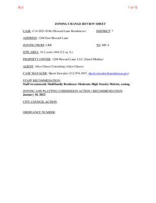
ZONING CHANGE REVIEW SHEET TO: MF-4 DISTRICT: 7 CASE: C14-2021-0186 (Howard Lane Residences) ADDRESS: 1208 East Howard Lane ZONING FROM: I-RR SITE AREA: 10.2 acres (444,312 sq. ft.) PROPERTY OWNER: 1208 Howard Lane, LLC (Saeed Minhas) AGENT: Alice Glasco Consulting (Alice Glasco) CASE MANAGER: Sherri Sirwaitis (512-974-3057, sherri.sirwaitis@austintexas.gov) STAFF RECOMMEDATION: Staff recommends Multifamily Residence-Moderate-High Density District, zoning. ZONING AND PLATTING COMMISSION ACTION / RECOMMENDATION: January 18, 2022 CITY COUNCIL ACTION: ORDINANCE NUMBER: 1 of 12B-3 C14-2021-0186 2 ISSUES: N/A CASE MANAGER COMMENTS: The property in question contains part of the Harris Branch tributary/floodplain and undeveloped land. The tract to the north is a developing single family residential neighborhood zoned SF-2-CO. To the south, across East Howard Lane, there is an undeveloped tract zoned GR and a single family residential subdivision zoned SF-4A-CO. To the east, there is undeveloped land that is zoned SF-2-CO and GR-MU. The property to the west contains a wet detention pond for the office-warehouse uses to the northwest zoned LI- CO. The site under consideration was annexed by the City of Austin on December 31, 2003 through annexation case: C7A-03-013. The applicant is requesting permanent zoning on this property to construct a new 160-unit multifamily apartment complex. The staff recommends the applicant’s request to zone this tract of land to the Multifamily Residence-Moderate-High Density District because the property in question meets the intent of the MF-4 district. The proposed rezoning area is located adjacent to SF-2-CO zoning and a platted single family residential subdivision to the north and east. MF-4 zoning will provide for additional housing options in this area of the city with access to East Howard Lane, a major arterial roadway and a designated Activity Corridor. The property abuts the Dessau/Parmer Neighborhood Center as designated by the Imagine Austin Comprehensive Plan. The applicant agrees with staff’s recommendation. BASIS OF RECOMMENDATION: 1. The proposed zoning is consistent with the purpose statement of the district sought. Multifamily Residence (Moderate-High Density) district is intended to accommodate multifamily and group residential use with a maximum density of 36 to 54 units per acre, depending on unit size. This district is appropriate for moderate-high density housing in centrally located areas near supporting transportation and commercial facilities, in areas adjoining downtown Austin and major institutional or employment centers, and in other selected areas where moderate-high density multifamily use is desirable. The site under consideration is located on an arterial roadway and designated Activity Corridor near major employers, such as Dell Technologies. 2. The proposed zoning promotes consistency and orderly planning. The proposed zoning is consistent with surrounding land use patterns as there is residential zoning to the north and south. MF-4 zoning will provide a transition in the intensity of residential uses from a higher density along E. Howard Lane to the single family residential development to the north. 2 of 12B-3 C14-2021-0186 3 3. The proposed zoning should allow for a reasonable use of the property. The proposed zoning will provide for additional housing options in this area of the city with access to East Howard Lane, a major arterial roadway and Activity Corridor on a property that abuts the Dessau/Parmer Neighborhood Center as designated by the Imagine Austin Comprehensive Plan. EXISTING ZONING AND LAND USES: ZONING I-RR SF-2-CO Site North South GR, SF-4A-CO East West SF-2-CO, GR-MU LI-CO LAND USES Undeveloped Area, Floodplain Single Family Residences Single Family Residences Detention Pond, Undeveloped Wet Pond, Office/Warehouse use (Harris Ridge Business Center) NEIGHBORHOOD PLANNING AREA: N/A TIA: Deferred to the time of Site Plan WATERSHED: Harris Branch SCHOOLS: Pflugerville I.S.D. Barron Elementary School Dessau Middle School Pflugerville High School NEIGHBORHOOD ORGANIZATIONS: Austin Lost and Found Pets Friends of Austin Neighborhoods Harris Ridge Owner’s Association Harris Ridge Phase IV Homeless Neighborhood Association Neighborhood Empowerment Foundation North Growth Corridor Alliance Pflugerville Independent School District SELTEXAS Sierra Club, Austin Regional Group Techridge Neighbors Yager Community 3 of 12B-3 C14-2021-0186 4 REQUEST I-RR to LR AREA CASE HISTORIES: NUMBER C14-2018-0099 (Howard Lane Commercial: 1208 East Howard Lane) C14-2018-0098 (Howard Lane Residential: 1208 East Howard Lane) I-RR to SF-6 SF-2* LO-CO to SF-4A LO-CO to SF-4A C14-2017-0056 (Howard Lane Tract, Part 2: 13000 Block of E. Howard Lane and 13414 Harris Glenn Drive) C14-2016-0126 (Howard Lane Tract: 13000 Block of E. Howard Lane and 13414 Harris Glenn Drive) LI-PDA to LI-PDA C14-2016-0124 (Parmer Business Park: E. Howard Lane at Harris Ridge Blvd.) COMMISSION 1/15/19: Approved staff’s recommendation of SF-2-CO zoning, with a CO to limit the development intensity on the site to less than 2,000 vehicle trips per day, by consent (10-0, N. Barrera- Ramirez-absent); S. Lavani-1st, J. Duncan-2nd. 5/16/17: Approved staff’s recommendation of SF-4A zoning by consent (11-0); A. Denkler-1st, J. Duncan-2nd. 2/07/17: Approved staff’s recommendation of SF-4A-CO zoning, with a conditional overlay to prohibit driveway access to East Howard Lane and to limit the development intensity on the site to less than 2,000 vehicle trips per day, on consent. The Commission proposed an additional condition to limit the development intensity on the to require a roadway connection to Scranton Drive (9-0, B. Greenberg and J. Kiolbassa- absent); G. Rojas-1st, B. Evans-2nd. 3/07/17: Approved staff recommendation of LI-PDA zoning, with additional conditions for no outdoor amplified sound and to require a TIA at the time of Site Plan (10-0); B. Greenberg-1st, B. Evans-2nd. CITY COUNCIL 12/17/18: The case was withdrawn by the applicant 1/31/19: Approved SF-2-CO zoning was approved on Council Member Kitchen’s motion, Council Member Pool’s second on a 10-0 vote. Council Member Flannigan was absent. 6/15/17: The public hearing was conducted and a motion to close the public hearing and approve Ordinance No. 20170615-096 for SF-4A district zoning was approved on Council Member Kitchen’s motion, Council Member Alter’s second on an 11- 0 vote. 3/02/17: Approved the ZAP Commission’s recommendation of SF-4A-CO zoning on all 3 readings (10-0, A. Kitchen-off dais); J. Flannigan-2nd. Troxclair-1st, E. 4/20/17: Approved the ZAP Commission’s recommendation for LI-PDA zoning on consent on 1st reading, with additional conditions that a multifamily use be limited to 900 residential dwelling units and that a TIA be conducted at the time of site plan review if a multifamily use is proposed to be built on the property (11-0); L. Pool-1st, G. Casar-2nd. 4 of 12B-3 C14-2021-0186 5 5/18/17: Ordinance No. 20170518-056 was approved for limited industrial services-planned development area (LI-PDA) combining district zoning, to change a condition of zoning on Council Member Garza’s motion, Council Member Alter’s second on a 9-0 vote. Council Members Casar and Troxclair were off the dais. 9/26/13: Approved MF-3 zoning on first reading on consent (7-0); B. Spelman-1st, S. Cole-2nd. 10/17/13: Approved MF-3 zoning on consent on 2nd/3rd readings (6-0, M. Martinez-off dais); B. Spelman-1st, S. Cole-2nd. 9/27/07: Approved MF-3 zoning by consent (5-0); all 3 readings 12/07/06: Approved SF-6-CO zoning for Tract 1 and LI-CO zoning for Tract 2 (7-0); 1st reading 6/29/07: Approved SF-6-CO zoning for Tract 1 and LI-CO zoning for Tract 2, with conditions (7-0); 2nd/3rd readings C14-2013-0041 (Fort Dessau- GR: 1602 Fish Lane) SF-2-CO to MF-3 6/18/13: Approved staff’s recommendation of MF-3 zoning by consent (6-0, C. Banks-absent); P. Seeger-1st, R. McDaniel-2nd. C14-2007-0103 (Del Cerro: 13700 Dessau Road) C14-06-0098 (Harris Ridge: 13809 Harris Ridge Boulevard) GR-MU, GR, SF-2-CO to MF-3 LI-CO to Tract 1: SF- 6 and Tract 2: LI 8/21/07: Approved staff’s recommendation of MF-3 zoning by consent (7-0, K. Jackson-absent); J. Martinez-1st, J. Gohil-2nd. 11/21/06: Approved staff’s recommendation of SF-6-CO zoning for Tract 1, with following conditions: 1) Changed setback requirement to a 45-foot building setback from the southern property line along proposed Tract 2; 2) Added requirement for an 8-foot masonry fence along the southern property line along proposed Tract 2; 3) Included a 25-foot vegetative buffer along the western property line bordering single family development in the County; 4) Approved staff’s recommendation for LI zoning for Tract 2, adding a conditional overlay for the following: Establish a 78-foot building setback from the northern property line along proposed Tract 1; 5) Include the TIA recommendations for Tracts 1 and 2 as provided in Attachment D in a public restrictive covenant. Vote: (9-0); K. Jackson-1st, B. Baker-2nd. 5 of 12B-3 C14-2021-0186 6 C14-04-0139 (Howard Lane Industrial Park: 1100 East Howard Lane) C14-04-0127 (Wright Subdivision Dessau Road Zoning Change: 1624 East Howard Lane) C14-04-0056 (Fish Tract: 13600- 14224 Dessau Road) I-RR to LI GR-CO to GR I-RR to SF-2, SF-6, MF-3 and CS 12/02/04: Approved LI-CO, with a CO for 2,000 vtpd limit and prohibiting Adult Oriented Businesses, (7-0); all 3 readings 11/18/04: Granted GR-CO (7-0); all 3 readings 12/16/04: Granted SF-2-CO, SF-6, MF-3, LR-MU, GR and GR-MU on all 3 readings (7-0) 11/2/04: Approved staff’s recommendation of LI-CO zoning with added condition of no Adult Oriented Businesses, by consent (9-0) 10/19/04: Approved staff’s recommendation of GR-CO zoning, with CO to prohibit Adult Oriented Businesses and a public RC encompassing the TIA recommendations, by consent (9-0) 11/02/04: Approved staff’s recommendation of : Tract 1, Block A: GR-MU Tract 2, Block A: GR Tract 3, Block A: GR Tract 4, Block A: GR Tract 5, Block A: GR Tract 6, Block A: SF-2-CO (The conditional overlay includes a 100- foot vegetative buffer with a sound barrier fence along the western boundary of this tract to create a physical separation from the commercial/mixed use development proposed on Tract 1, Block A.) Tract 7, Block A: LR-MU Tract 8, Block A: MF-3 Tract 9, Block A: SF-6 Tract 10, Block A: LR Tract 1, Block B: GR-MU Tract 2, Block B: GR-MU In addition, require a public restrictive covenant to encompass the Transportation Impact Analysis Recommendations, by consent (9-0) 8/1/00: Approved staff rec. w/ condition of no Adult Oriented Businesses (8-0) 9/28/00: Approved GR-CO w/ conditions on TR 1 & 2 (7-0); all 3 readings DR to CS C14-00-2101 (Harris Ridge Rezoning: Harris Glenn Drive At Howard Lane) RELATED CASES: C7A-03-013 Annexation Case C14-2018-0099 Previous Zoning Case 6 of 12B-3 C14-2021-0186 7 EXISTING STREET CHARACTERISTICS: Name Pavement ROW Classification Sidewalks Bicycle E Howard Lane 210’ ASMP Level 3 Yes 99’ (including median) Capital Metro (within ¼ mile) No Route Off-Street Trail - Paved OTHER STAFF COMMENTS: Comprehensive Planning Please note: An LR Zoning application on this same property was submitted in August 2018 This zoning case is located on the north side of East Howard Lane, on a vacant parcel that is approximately 10.2 acres in size. This property is located along the Howard Lane Activity Corridor and abuts the Dessau/Parmer Neighborhood Center. The area is not located within the boundaries of a Neighborhood Plan Area. Surrounding land uses includes vacant land, a light industrial park, and single-family housing to the north; to the south is vacant land and a single-family housing, to the west is a gas station/convenience store; and to the east is single-family housing and the Dessau Wastewater Treatment Plant. There is a park, a performing arts center and three public schools located within a mile of this site. The proposed use is a 160 unit multi-family apartment complex. Connectivity: Public sidewalks are located along both sides of this portion of E. Howard Lane, which is quickly filling up with large single-family subdivisions. There are no urban trails or public transit stops located within a quarter mile of this site. When looking at mobility and connectivity options in the area, they appear to be limited (there are no public transit stations, urban trails, or bike lanes, and the only retail use within walking distance is a gas station/convenience store.) Imagine Austin The Imagine Austin Growth Concept Map, found in the Imagine Austin Comprehensive Plan (IACP) identifies this project as being located along an Activity Corridor (E. Howard Lane). The property also abuts the Neighborhood Center (Dessau/Parmer Neighborhood Center. Activity Corridors are characterized by a variety of activities and types of buildings located along the roadway — shopping, restaurants and cafés, parks, schools, single-family houses, apartments, public buildings, houses of worship, mixed-use buildings, and offices. A Neighborhood Center is the smallest and least intense of the three types of activity centers outlined in the Growth Concept Map, with a focus on creating local businesses and services—including doctors and dentists, shops, branch libraries, dry cleaners, hair salons, coffee shops, restaurants, and other small and local businesses that generally serve the center and surrounding neighborhoods. Like many Imagine Austin Centers, this center is represented by a circle or globular shape that reflects the general location where 7 of 12B-3 C14-2021-0186 8 the center should be located in the future. The center’s actual boundaries would need to be clarified through a small area planning process. Regional, town, and neighborhood centers are supposed to be walkable, bikeable, and supported by transit. The following Imagine Austin policies are applicable to this case: • LUT P3. Promote development in compact centers, communities, or along corridors that are connected by roads and transit that are designed to encourage walking and bicycling, and reduce health care, housing and transportation costs. • LUT P4. Protect neighborhood character by directing growth to areas of change that include designated redevelopment areas, corridors and infill sites. Recognize that different neighborhoods have different characteristics and new and infill development should be sensitive to the predominant character of these communities. • HN P10. Create complete neighborhoods across Austin that have a mix of housing types and land uses, affordable housing and transportation options, and access to schools, retail, employment, community services, and parks and recreation options. Analysis and Conclusion Howard Lane is transitioning away from a rural road to one that is quickly filling up with large single-family subdivisions but contains little in the way of goods and services to serve people living next to this major corridor. Based upon: (1) this project being located along an Activity Corridor and adjoining Neighborhood Center, which supports residential uses, including multifamily; and (2) some connectivity options available in the area (public schools and a park); but (3) a lack of goods and services in this area and only fair mobility options, this project appears to partially support the Imagine Austin Comprehensive Plan. Environmental The site is not located over the Edwards Aquifer Recharge Zone. The site is in the Harris Branch Creek Watershed of the Colorado River Basin, which is classified as a Suburban Watershed by Chapter 25-8 of the City's Land Development Code. The site is in the Desired Development Zone. Under current watershed regulations, development or redevelopment on this site will be subject to the following impervious cover limits: Development Classification % of Gross Site Area % of Gross Site Area Single-Family (minimum lot size 5750 sq. ft.) Other Single-Family or Duplex Multifamily Commercial 50% 55% 60% 80% with Transfers 60% 60% 70% 90% According to floodplain maps there is no floodplain within or adjacent to the project location. Standard landscaping and tree protection will be required in accordance with LDC 25-2 and 25-8 for all development and/or redevelopment. 8 of 12B-3 C14-2021-0186 9 At this time, site specific information is unavailable regarding vegetation, areas of steep slope, or other environmental features such as bluffs, springs, canyon rimrock, caves, sinkholes, and wetlands. Under current watershed regulations, development or redevelopment requires water quality control with increased capture volume and control of the 2 year storm on site. At this time, no information has been provided as to whether this property has any preexisting approvals that preempt current water quality or Code requirements. Fire No comments. Parks and Recreation Parkland dedication will be required for the new residential units proposed by this development, multifamily with MF-4 zoning, at the time of subdivision or site plan, per City Code § 25-1-601. Whether the requirement shall be met with fees in-lieu or dedicated land will be determined using the criteria in City Code Title 25, Article 14, as amended. Should fees in-lieu be required, those fees shall be used toward park investments in the form of land acquisition and/or park amenities within the surrounding area, per the Parkland Dedication Operating Procedures § 14.3.11 and City Code § 25-1-607 (B)(1) & (2). If the applicant wishes to discuss parkland dedication requirements in advance of site plan or subdivision applications, please contact this reviewer: thomas.rowlinson@austintexas.gov. Site Plan Site plans will be required for any new development other than single-family or duplex residential. Any development which occurs in an SF-6 or less restrictive zoning district which is located 540-feet or less from property in an SF-5 or more restrictive zoning district will be subject to compatibility development regulations. Any new development is subject to Subchapter E. Design Standards and Mixed-Use. Additional comments will be made when the site plan is submitted. Compatibility Standards: The site is subject to compatibility standards due to SF-2-CO lot located immediately adjacent to the north and SF-4A-CO and SF-2 lots located across Howard Lane to the south. 9 of 12B-3 C14-2021-0186 10 Transportation A Traffic Impact Analysis shall be required at the time of site plan if triggered, when land uses and intensities will be known per LDC 25-6-113. The adjacent street characteristics table is provided below: Water Utility The landowner intends to serve the site with City of Austin water and wastewater utilities. The landowner, at own expense, will be responsible for providing any water and wastewater utility improvements, offsite main extensions, utility relocations and or abandonments required by the land use. The water and wastewater utility plan must be reviewed and approved by Austin Water for compliance with City criteria and suitability for operation and maintenance. Depending on the development plans submitted, water and or wastewater service extension requests may be required. All water and wastewater construction must be inspected by the City of Austin. The landowner must pay the City inspection fee with the utility construction. The landowner must pay the tap and impact fee once the landowner makes an application for a City of Austin water and wastewater utility tap permit. INDEX OF EXHIBITS TO FOLLOW A: Zoning Map B. Aerial Map C. Correspondence from Interested Parties 10 of 12B-3 ! ! ! ! ! ! ! ! ! ! ! ! ! ! ! ! ! ! ! ! ! ! ! ! ! ! ! ! ! ! ! ! ! ! ! ! ! ! ! ! ! ! ! ! ! ! ! ! ! ! ! ! ! ! ! ! ! ! ! ! ! ! ! ! ! ! ! ! ! ! ! ! ! ! ! ! ! ! ! ! ! ! ! ! ! ! ! ! ! ! ! ! ! ! ! ! ! ! ! ! ! ! ! ! ! ! ! ! ! ! ! ! ! ! ! ! ! ! ! ! ! ! ! ! ! ! ! ! ! ! ! ! ! ! ! ! ! ! ! ! ! ! ! ! ! ! ! ! ! ! ! ! ! ! ! ! ! ! ! ! ! ! ! ! ! ! ! ! ! ! ! ! ! ! ! ! ! ! ! ! ! ! ! ! !! ! ! ! ! ! ! ! ! ! ! ! ! ! ! ! ! ! ! ! ! ! ! ! ! ! ! ! ! ! ! ! ! ! ! ! ! ! ! ! ! ! ! ! ! ! ! ! ! ! ! ! ! ! ! ! ! ! ! ! ! ! ! ! ! ! ! ! ! ! ! ! ! ! ! ! ! ! ! ! ! ! ! ! ! ! ! ! ! ! ! ! ! ! ! ! ! ! ! ! ! ! ! ! ! ! ! ! ! ! ! ! ! ! ! ! ! ! ! ! ! ! ! ! ! ! ! ! ! ! ! ! ! ! ! ! ! ! ! ! ! ! ! ! ! ! ! ! ! ! ! ! ! ! ! ! ! ! ! ! ! ! ! ! ! ! ! ! ! ! ! ! ! ! ! ! ! ! ! ! ! ! ! ! ! ! ! ! ! ! ! ! ! ! ! ! ! ! ! ! ! ! ! ! ! ! ! ! ! ! ! ! ! ! ! ! ! ! ! ! ! ! ! ! ! ! ! ! ! ! ! ! ! ! ! ! ! ! ! ! ! !! ! ! ! ! ! ! !! !! ! ! ! ! ! ! ! ! ! ! ! ! ! ! ! ! ! ! ! ! ! ! ! ! ! ! ! ! ! ! ! ! ! ! ! ! ! ! ! ! ! ! ! ! ! ! ! ! ! ! ! ! ! ! ! ! ! ! ! ! ! ! ! ! ! ! ! ! ! ! ! ! ! ! ! ! ! ! ! ! ! ! ! ! ! ! ! ! ! ! ! ! ! ! ! ! ! ! ! ! ! ! ! ! ! ! ! ! ! ! ! ! ! ! ! ! ! ! ! ! ! ! ! ! ! ! ! ! ! ! ! ! ! ! ! ! ! ! ! ! ! ! ! ! ! ! ! ! ! ! ! ! ! ! ! ! ! ! ! ! ! ! ! ! ! ! ! ! ! ! ! ! ! ! ! ! ! ! ! ! ! ! ! ! ! ! ! ! ! ! ! ! ! ! ! ! ! ! ! ! ! ! ! ! ! ! ! ! ! ! ! ! ! ! ! ! ! ! ! ! ! ! ! ! ! ! ! ! ! ! ! ! ! ! ! ! ! ! ! ! ! ! ! ! ! ! ! ! ! ! ! ! ! ! ! ! ! ! ! ! ! ! ! ! ! ! ! ! ! ! ! ! ! ! ! ! ! ! ! ! ! ! ! ! ! ! ! ! ! ! ! ! ! ! ! ! ! ! ! ! ! ! ! ! ! ! ! ! ! ! ! ! ! ! ! ! ! ! ! ! ! ! ! ! ! ! ! ! ! ! ! ! ! ! ! ! ! ! ! ! ! ! ! ! ! ! ! ! ! ! ! ! ! ! ! ! ! ! ! ! ! ! ! ! ! ! ! ! ! ! ! ! ! ! ! ! ! ! ! ! ! ! ! ! ! ! ! ! ! ! ! ! ! ! ! ! ! ! ! ! !! ! ! ! ! ! ! ! ! ! ! ! ! ! ! ! ! ! ! ! ! ! ! ! ! ! ! ! ! ! ! ! ! ! ! ! ! ! ! ! ! ! ! ! ! ! ! ! ! ! ! ! ! ! ! ! ! ! ! ! ! ! ! ! ! ! ! ! ! ! ! ! ! ! ! ! ! ! ! ! ! ! ! ! ! ! ! ! ! ! ! ! ! ! ! ! ! ! ! ! ! ! ! ! ! ! ! ! ! ! ! ! ! ! ! ! ! ! ! ! ! ! ! ! ! ! ! ! ! ! ! ! ! ! ! ! ! ! ! ! ! ! ! ! ! ! ! ! ! ! ! ! ! ! ! ! ! ! ! ! ! ! ! ! ! ! ! ! ! ! ! ! ! ! ! ! ! ! ! ! ! ! ! ! ! ! ! ! ! ! ! ! ! ! ! ! ! ! ! ! ! ! ! ! ! ! ! ! ! ! ! ! ! ! ! ! ! ! ! ! ! ! ! ! ! ! ! ! ! ! ! ! ! ! ! ! ! ! ! ! ! ! ! ! ! ! ! ! ! ! ! ! ! ! ! ! ! ! ! ! ! ! ! ! ! ! ! ! ! ! ! ! ! ! ! ! ! ! ! ! ! ! ! ! ! ! ! ! ! ! ! ! ! ! ! ! ! ! ! ! ! ! ! SP-03-0385D ! ! ! ! ! ! ! ! 04-0139 LI-CO ! ! ! ! ! ! ! ! ! ! ! ! ! ! ! ! ! ! ! ! ! ! ! ! ! ! ! ! ! ! ! ! ! ! ! ! C12M-00-0005.09 ! ! ! ! ! ! ! ! N TI L T LE ! ! ! ! ! ! ! ! ! ! ! ! ! ! ! ! ! ! ! ! ! ! ! ! ! ! ! ! ! ! ! ! ! D LV E B G ! ! RIS RID R A H ! ! ! ! ! ! ! ! ! ! ! ! ! ! ! ! ! ! ! !! ! ! ! ! ! ! ! ! ! ! ! ! ! ! ! ! LI-PDA ! ! ! ! ! ! !! ! ! ! ! ! ! ! ! SF-6-CO C14-06-0098 C14-04-0139 EXHIBIT A SF-2-CO P C14-2013-0042 R K D C E B U L SF-2-CO C7A-03-013 C14-2018-0098 R E D S U A H U Z SF-2-CO R T D S E R O N F RIA A V A B SF-2-CO KLE E ST SF-2-CO MAIER DR MF-3 SF-2-CO MF-3 C14-2013-0041 FO RT DESSAU R D MF-3 C14-04-0056 ELBE ST MF-3 BAUH AU S BND MF-3 GR-MU UNDEV FIS H LN 00-2101 GR-CO C14-00-2101 SP-04-0010DS P C14-2021-0106 C14-04-0127 ! C14-97-0141 C14-97-0141 ! ! ! LI-PDA ! C14-2016-0124 ! ! ! ! ! ! ! ! ! ! ! C7A-03-013 ! ! ! ! ! ! ! ! ! ! ! ! ! ! ! ! ! ! ! ! ! ! ! ! ! ! ! ! ! ! ! ! ! I-RR ! ! ! ! ! E H O W A R D LN ! ! ! ! ! ! ! ! ! V ALE C D S N LA C14-2017-0056 SF-4A-CO C14-2016-0126 98-0257 H A Z L E T O N C V SF-4A-CO SF-4A A M ( ( ( ( ( ( ( ( ( SF-2 ( ( B L E R D R 9 8 - 0 2 5 7 ( ( GR 98-0257 R E D B O R T A L SF-4A-CO R N D N E L G R I S R A H MF-3 GR-MU DR ( ( ( ( ( ( ( ( ( ( ( ( ( ( ( ( ( ( ( ( ( ( ( E T S E H N R L ( ( C O R ( ( ( W E A T H E ( ( R F O R D D R R K D SF-2 SF-2 S W I C N E K SF-2 SP-01-0269C MF-2-CO 98-0258 UNDEV LO-CO C14-03-0001 ZONING ZONING CASE#: C14-2021-0186 98-0257 GR LO-CO 98-0257 SF-2 ( ( ( ( ( 98-0257 ( ( ( ( ( ( ( ( ( ( ( SF-2 ( ( ( ( ( ( ( SF-4A ( ( R N D O T N A R C S ( ( ( ( ( ( ( ( ( ( ( ( ( ( ( ( ( ( ( ( ( ( ( ( ( ( ( ( FAIR ( ( SF-2 ( ( ( ( C R E S ( ( T D R ( ( ( ( ( ( ( ( ( ( ( ( ( ( SF-2 ( ( H AV E ( R F O R ( ( D D R ( ( ( ( B L U E F O ( X D R ( ( ( ( ( ( SF-2 ( ( ( ( ( ( ( ( SF-2 ( ( ( ( ( HATTERAS DR ( ( ( SF-2 ( ( ( ( ( ( FIE L D R G A T E D ( ( ( ( ( ( ( SF-2 ( ( ( ( ( ( ( ( ( ( ( ( ( ( ( ( ( ( ( ( SUBJECT TRACT ! ! ! ! ! ! PENDING CASE ( ( SF-2 ( ( ZONING BOUNDARY ± This product is for informational purposes and may not have been prepared for or be suitable for legal, engineering, or surveying purposes. It does not represent an on-the-ground survey and represents only the approximate relative location of property boundaries. 1 " = 400 ' This product has been produced by the Housing and Planning Department for the sole purpose of geographic reference. No warranty is made by the City of Austin regarding specific accuracy or Created: 12/8/2021 11 of 12B-3 D LV E B G RIS RID R A H LI-CO R K D C E B U L SF-2-CO R E D S U A H U Z SF-2-CO SF-2-CO EXHIBIT B R T D S E R O N F RIA A V A B SF-2-CO M AIER D R D N S B U A H U A B MF-3 KLEE ST ELBE ST N34 GR LO-CO SF-4A SF-2 N O T N A R C S R D SF-2 FAIR C R E ST D R SF-2 H A V E R F O D R R D SF-2 C14-2021-0186 I-RR P34 E H O W A R D LN LANSDALE CV SF-4A SF-4A-CO A M B L E R D R SF-2 SF-4A-CO W E A T H E R F O R D D R F I E L D G A T E D R SF-2 R E T N E S L H C O R SF-2 N N E R I S L R G D R A H H A Z L E T O N C V R E D B O R T A L SF-4A-CO GR GR-MU DR R N D N E L G RIS R A H GR-MU FIS H LN GR-CO MF-2-CO Copyright nearmap 2015 SUBJECT TRACT ZONING BOUNDARY ! ! ! ! ! ! PENDING CASE CREEK BUFFER Howard Lane Residences ZONING CASE#: LOCATION: SUBJECT AREA: GRID: MANAGER: C14-2021-0186 1208 East Howard Lane 10.2 Acres P34 Sherri Sirwaitis 1'' = 300' This map has been produced by the Communications Technology Management Dept. on behalf of the Planning Development Review Dept. for the sole purpose of geographic reference. No warranty is made by the City of Austin regarding specific accuracy or completeness. 12 of 12B-3