B-02 (C8-2020-0255.0A - Avery Lakeline; District 6).pdf — original pdf
Backup
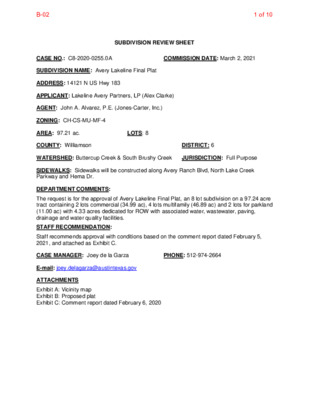
SUBDIVISION REVIEW SHEET CASE NO.: C8-2020-0255.0A COMMISSION DATE: March 2, 2021 SUBDIVISION NAME: Avery Lakeline Final Plat ADDRESS: 14121 N US Hwy 183 APPLICANT: Lakeline Avery Partners, LP (Alex Clarke) AGENT: John A. Alvarez, P.E. (Jones-Carter, Inc.) ZONING: CH-CS-MU-MF-4 AREA: 97.21 ac. LOTS: 8 COUNTY: Williamson DISTRICT: 6 WATERSHED: Buttercup Creek & South Brushy Creek JURISDICTION: Full Purpose SIDEWALKS: Sidewalks will be constructed along Avery Ranch Blvd, North Lake Creek Parkway and Hema Dr. DEPARTMENT COMMENTS: The request is for the approval of Avery Lakeline Final Plat, an 8 lot subdivision on a 97.24 acre tract containing 2 lots commercial (34.99 ac), 4 lots multifamily (46.89 ac) and 2 lots for parkland (11.00 ac) with 4.33 acres dedicated for ROW with associated water, wastewater, paving, drainage and water quality facilities. STAFF RECOMMENDATION: Staff recommends approval with conditions based on the comment report dated February 5, 2021, and attached as Exhibit C. CASE MANAGER: Joey de la Garza PHONE: 512-974-2664 E-mail: joey.delagarza@austintexas.gov ATTACHMENTS Exhibit A: Vicinity map Exhibit B: Proposed plat Exhibit C: Comment report dated February 6, 2020 B-021 of 10 B-022 of 10 S 2 0 ° 4 5 ' 0 2 " E 9 0 6 . 5 6 ' 30 BLOCK 1 29 28 C A N N O N M A R K W A Y 27 26 TEXAS PARKS AND WILDLIFE DEPARTMENT (6.177 ACRES) DOC. NO. 2012082085 O.P.R.W.C.T. Y E 1 V 5 R U O . 5 L S U T N A C L S A R E T A S A R H B C A 3 C LOT 3 BLOCK D MULTIFAMILY 11.13 AC. 6 ' 5 ' 0 1 . 3 3 ° E " 4 1 8 1 N 6 25 BLOCK 1 24 S 2 0 ° 4 5 ' 4 3 " E 8 1 5 . 0 5 ' LOT 4 BLOCK D MULTIFAMILY 12.00 AC. S87°38'10"W 435.52' L1 S88°04'17"W 534.02' STATE OF TEXAS STATE DEPARTMENT OF HIGHWAYS AND PUBLIC TRANSPORTATION (REMAINDER 789.508 ACRES) VOL. 1723, PAGE 855 D.R.W.C.T. 23 22 BLOCK 1 21 20 19 AVERY STATION SECTION 1A, PHASE 1 DOC. NO. 2011052951 O.P.R.W.C.T. 18 17 C A N N O N M A R K W A Y M O N T O U R D R I V E 14 15 16 BLOCK 1 AVERY STATION SECTION 1A, PHASE 1 DOC. NO. 2011052951 O.P.R.W.C.T. 3 BLOCK 1 2 4 6 8 7 S A X E T , L L I H Y T R E B I L , 9 2 Y A W H G H W 0 9 0 0 1 I 0 0 8 1 0 0 0 1 . O N M R I F S L E P B T 1 0 9 7 - 8 3 2 - 2 1 5 M P 6 0 : 1 1 2 0 2 / 5 2 / 2 : E T A D T O L P M P 5 0 : 1 1 2 0 2 / 5 2 / 2 : D E V A S T S A L ) S E H C N I 0 0 . 4 2 X 0 0 . 8 1 ( C D E E L B L L U F H C R A : I E Z S T O L P T E E H S I . \ G W D E N L E K A L Y R E V A T A L P E R S G W D D A C H C N A R Y R E V A C A 7 9 - \ \ 2 0 0 9 1 \ : L : H T A P G N W A R D I Y R E V A C A 7 9 - 2 0 0 9 1 \ : L . G W D E N I L E K A L Y R E V A T A L P E R S G W D D A C H C N A R \ \ \ B-023 of 10 Y W A H 3 8 S 1 N U Y E V 0 R 7 U N S O . 1 O T N M C A A L D R T E S A S M U B A STATE OF TEXAS STATE DEPARTMENT OF HIGHWAYS AND PUBLIC TRANSPORTATION (REMAINDER 789.508 ACRES) VOL. 1723, PAGE 855 D.R.W.C.T. LOT 1, BLOCK A TURNBERRY CONDOMINIUMS DOC. NO. 2015039061 O.P.R.W.C.T. 25 24 23 22 BLOCK G 21 20 19 18 D R A V E L U O H B C N A Y R R E V A 4' 1.0 6 3"E 1 4'0 7°0 2 N LOT 1, BLOCK A S 2 1 ° 3 0 ' 4 0 " E 3 0 5 . 3 2 ' LOT 1 BLOCK A E " 0 9 ' 9 N 6 5 ' 2 9 . 0 1 3 ° 6 17 9 ' 9 . 0 3 6 E " ° 1 0 9 N 6 5 ' 2 L O W E R C O L O R A D O R I V E R A U T H O R I T Y 2 A C R E 5 9 . 8 0 8 9 3 ( N O . O . P . R . W . C . T . E M E N T W I T H I N T H E D O C . 2 . 6 S T R A C T 8 A C R E S 5 ) 7 S 2 9 - L C R A E A S 4 A C R E 7 . 2 9 H A R P S T E R B E N D A I L R O W T L L O Y H E K R U T 11 12 13 BLOCK G 1A 14 15 16 2 4 6 8 7 S A X E T , L L I H Y T R E B I L , 9 2 Y A W H G H W 0 9 0 0 1 I 0 0 8 1 0 0 0 1 . O N M R I F S L E P B T 1 0 9 7 - 8 3 2 - 2 1 5 N T Y U O N C M S O (4.0 0 9 1 A C R E S) O . 2 0 0 5 1 0 2 6 8 0 O .P.R. W .C.T. W IL LI A C. N O D C 2 I N E L Y E S U R V E P R O X I M A T A P C4 C25 LOT 1 BLOCK D MULTIFAMILY 12.69 AC. E R Y R A N C H B O U L V A 3 E " 2 7 ' 0 4 ° 7 N 6 A R D V E 4 ' 6 . 5 3 N33°47'46"E 155.14' Y W H A 3 8 1 S U N ' 9 5 . 1 0 3 E " 2 4 1 0 ° 2 N ' Y E 1 V 5 R U O . 5 L S U T N A C L S A R E T A S A R H B C A LOT 1 BLOCK A COMMERCIAL 26.74 AC. N O R T H S 3 L 3 N ° 3 A 0 3 K ° 4 ' 2 0 E 4 4 ' 2 " E C 4 " R 5 W 5 E 4 . 5 E 4 5 4 K 5 ' . 4 P 4 ' A R K W A Y S 2 0 ° 4 5 ' 0 2 " E 9 0 6 . 5 6 ' M P 6 0 : 1 1 2 0 2 / 5 2 / 2 : E T A D T O L P M P 5 0 : 1 1 2 0 2 / 5 2 / 2 : D E V A S T S A L ) S E H C N I 0 0 . 4 2 X 0 0 . 8 1 ( C D E E L B L L U F H C R A : I E Z S T O L P T E E H S . I \ G W D E N L E K A L Y R E V A T A L P E R S G W D D A C H C N A R Y R E V A C A 7 9 - \ \ 2 0 0 9 1 \ : L : H T A P G N W A R D I Y R E V A C A 7 9 - 2 0 0 9 1 \ : L . G W D E N I L E K A L Y R E V A T A L P E R S G W D D A C H C N A R \ \ \ CRITICAL KARST ENVIRONMENTAL FEATURE CRITICAL ENVIRONMENTAL FEATURE LOT 3 BLOCK D MULTIFAMILY 11.13 AC. LOT 2 BLOCK D PARKLAND DEDICATED TO THE CITY OF AUSTIN 3.95 AC. C 5 C 2 4 LOT 4 BLOCK D MULTIFAMILY 12.00 AC. N O L15 RTH LAKE CREEK PARK S62°42'46"E 276.39' W AY B-024 of 10 C 2 4 LOT 4 BLOCK D MULTIFAMILY 12.00 AC. N O 2 C L15 RTH LAKE CREEK PARK S62°42'46"E 276.39' N62°42'46"W 144.19' 3 4 L1 C 1 2 W L8 AY LOT 3 BLOCK D 2 2 C 3 1 C C6 C7 C 1 1 C 8 L6 C10 C 9 L7 S87°38'10"W 435.52' 2 4 6 8 7 S A X E T , L L I H Y T R E B I L , 9 2 Y A W H G H W 0 9 0 0 1 I 0 0 8 1 0 0 0 1 . O N M R I F S L E P B T 1 0 9 7 - 8 3 2 - 2 1 5 LOT 2 BLOCK B MULTIFAMILY 11.07 AC. ' S 2 ° 1 0 2 4 " E 1 0 7 6 . 6 8 ' STATE OF TEXAS STATE DEPARTMENT OF HIGHWAYS AND PUBLIC TRANSPORTATION (REMAINDER 789.508 ACRES) VOL. 1723, PAGE 855 D.R.W.C.T. LOT 1 BLOCK A COMMERCIAL 26.74 AC. CRITICAL KARST ENVIRONMENTAL FEATURE 3 1 L 9 L 1 2 C 4 1 C LOT 2 BLOCK A PARKLAND DEDICATED TO THE CITY OF AUSTIN 7.05 AC. CRITICAL ENVIRONMENTAL FEATURE CRITICAL KARST ENVIRONMENTAL FEATURE CRITICAL ENVIRONMENTAL FEATURE C 1 N U S 1 8 3 A H W Y STATE OF TEXAS STATE DEPARTMENT OF HIGHWAYS AND PUBLIC TRANSPORTATION (REMAINDER 789.508 ACRES) VOL. 1723, PAGE 855 D.R.W.C.T. 0 2 C 5 1 C LOT 1 BLOCK B COMMERCIAL 8.25 AC. H E M A D R I V E 1 C 9 C 6 1 C18 2 1 L 1 1 L C17 N 2 7 ° 5 5 ' 5 7 " W 4 0 3 . 8 2 ' Y E 1 V 5 R U O . 5 L S U T N A C L S A R E T A S A R H B C A S88°53'13"W 204.04' S88°53'52"W 970.10' L2 WALTER R. HOPKINS AND MARY E. HOPKINS, HUSBAND AND WIFE (1.308 ACRES) DOC. NO. 2006014551 O.P.R.W.C.T. DAVID ALEXANDER HARTMAN AND CLAUDETTE LUCILLE HARTMAN, TRUSTEES OF THE HARTMAN FAMILY REVOCABLE TRUST. (6.00 ACRE TRACT SAVE AND EXCEPT 0.053 ACRE) DOC. NO. 2013015091 O.P.R.W.C.T. DAVID ALEXANDER HARTMAN AND CLAUDETTE LUCILLE HARTMAN, TRUSTEES OF THE HARTMAN FAMILY REVOCABLE TRUST. (4.2692 ACRES) DOC. NO. 2013015092 O.P.R.W.C.T. Y R E V A C A 7 9 - 2 0 0 9 1 \ : L . G W D E N I L E K A L Y R E V A T A L P E R S G W D D A C H C N A R \ \ \ 1B RESUBDIVISION OF LOT 1, PARKLINE SECTION I DOC. NO. 2008061675 O.P.R.W.C.T. M P 6 0 : 1 1 2 0 2 / 5 2 / 2 : E T A D T O L P M P 5 0 : 1 1 2 0 2 / 5 2 / 2 : D E V A S T S A L ) S E H C N I 0 0 . 4 2 X 0 0 . 8 1 ( C D E E L B L L U F H C R A : I E Z S T O L P T E E H S . I \ G W D E N L E K A L Y R E V A T A L P E R S G W D D A C H C N A R Y R E V A C A 7 9 - \ \ 2 0 0 9 1 \ : L : H T A P G N W A R D I B-025 of 10 2/25/21B-026 of 10 CITY OF AUSTIN –DEVELOPMENT SERVICES DEPARTMENT SUBDIVISION APPLICATION – MASTER COMMENT REPORT PHONE #: 512-974-2664 CASE NUMBER: UPDATE: CASE MANAGER: C8-2020-0255.0A U0 Joey de la Garza PROJECT NAME: LOCATION: Avery Lakeline 14121 N US 183 HWY SUBMITTAL DATE: January 11, 2021 FINAL REPORT DATE: February 5, 2021 STAFF REPORT: This report includes all staff comments received to date concerning your most recent subdivision application submittal. The comments may include requirements, recommendations, or information. The requirements in this report must be addressed by an updated submittal. The subdivision application will be approved when all requirements from each review discipline have been addressed. If you have any questions, concerns or if you require additional information about this report, please contact your case manager at the phone number listed above or by using the contact information listed for each reviewer in this report. Any change to the plan/plat shall not cause noncompliance with any applicable code or criteria. In addition, any change to the plat may trigger new comments. UPDATE DEADLINE INFORMATION (LDC 25-4-56; 25-4-82): All comments must be addressed by filing an updated submittal prior to the update deadline of April 12, 2021. Otherwise, the application will expire. If this date falls on a weekend or City of Austin holiday, the next City of Austin workday will be the deadline. Extension of Review Period, Extension of Update Deadline and Tolling of Application Period do not apply to applications for preliminary plan, plat or subdivision construction plans (LDC 25-1-88; 25-1-89; 25-1-90). UPDATE SUBMITTAL INSTRUCTIONS (LDC 25-1-83): 1. Applicants must make an appointment with Intake Staff (974-1770) in order to submit an update. 2. Your update must include the following items: a. This report b. The revised plat/plan in pdf format c. A letter that addresses each comment in the master comment report 3. Updates must be submitted on an approved submittal date, between the hours of 8:30 am and 4:00 pm. Refer to the submittal calendar for a list of approved submittal dates. REVIEWERS: Site Plan Plumbing : Cory Harmon ATD Engineering : Sangeeta Jain Drainage Engineering : Kyle Virr Environmental : Kristy Nguyen Subdivision : Joey de la Garza Transportation Planning : Adam Fiss B-027 of 10 Electric Review - Andrea Katz - 512-322-6957 No Review Required. Out of Austin Energy service area, served by Pedernales Electric Cooperative, Inc. 911 Addressing Review - Jorge Perdomo - 512-974-1620 AD 1 This plat review is cleared; however, any changes to street names, street name labels, or street layouts will require a new review. §25-4-155 City Arborist Review - Taylor Horton - 512-974-1218 Tree mitigation review is deferred to Subdivision Construction Plan Review. Note: an approved status does not eliminate a proposed development’s requirements to meet the intent of the tree preservation ordinances. Drainage Engineering Review - Kyle Virr - 512-974-2538 Release of this application does not constitute a verification of all data, information, and calculations supplied by the applicant. The engineer of record is solely responsible for the completeness, accuracy, and adequacy of his/her submittal, whether or not the application is reviewed for code compliance by city engineers. DE 1 Engineer's seal, signature and date required [LDC 25-7-62]. DE 2 Add the following Floodplain Note: "No portion of this tract is within the boundaries of the 100 year floodplain according to data from the Federal Insurance Administration FIRM panel # _______________, dated ________ for ______________ (name of city or county)." Environmental Review - Kristy Nguyen - 512-974-3035 Administrative – Transfer of Development Intensity EV 1 The Transfer of Development restrictive covenants are in review. The applicant shall file in the deed records a restrictive covenant, approved by the City Attorney, that runs with the transferring tract and describes the development intensity transfer. [LDC 25-8, Subchapter A, Article 9] ESC FISCAL SURETY [LDC 25-1, Article 5; ECM Appendix S-1] EV 2 Provide a conceptual erosion & sedimentation control plan along with the fiscal estimate for erosion/sedimentation controls and revegetation based on ECM Appendix S-1. A conceptual ESC plan is necessary to assess the accuracy of the ESC fiscal estimate. The amount of fiscal must be approved prior to plat approval. Fiscal must be posted within 90 days of plat approval. Additional fiscal posting might be required at the time of subdivision construction plan ESC review. Sites with a limit of construction greater than one acre must include a $3000 per acre LOC clean-up fee in the fiscal estimate. [LDC 25-8, Subchapter A, Article 5; ECM Appendix S-1] Sites with a limit of construction greater than 25 acres are required to show phasing of disturbance tailored to the specific site conditions. A phased ESC plan and phased fiscal estimate are required. [LDC 25-8, Subchapter A, Article 7, Division 4; ECM 1.4.4] B-028 of 10 The revegetation line item quantity must equal the entire LOC area less any existing impervious cover proposed to remain and less proposed public streets and sidewalks. This is necessary in the event that construction ceases after vegetation has been removed from within the LOC. [LDC 25-8, Subchapter A, Article 5; ECM Appendix S-1] Subdivision Review - Joey de la Garza - 512-974-2664 SR 1. Add the Case # C8-2020-0255.0A in the bottom right hand corner of each sheet. 25-1-83 SR 2. Add the following note 25-1-83; TXLCG 212.016; 2122.014: “All restrictions and notes from the previous existing subdivision, Avery Lakeline, recorded in Doc. No. 2020023739 of the plat records of Williamson County, shall apply to this plat.” SR 3. There are two owners of the property which comprise this plat, Lakeline Avery Partners, LP and Ascension Seton. Please revise the Owner’s dedication statement as follows to reflect this: 25-1-83 That Lakeline Avery Partners, LP, a Texas limited partnership, acting by and through Sam Kumar, and being owner of Avery Lakeline, a subdivision of record in document No. 2020023739 of the official public records of Williamson County, Texas, and Ascension Seton, a Texas non-profit corporation, acting by and through ___________________ and being owner of Lot 1, Block A; Lot 1, Block B and Lot 1, Block C of the aforementioned Avery Lakeline Subdivision, conveyed by deed of record in Doc. No. 2020029508 of the real property records of Williamson County, Texas, and said subdivision having been approved for resubdivision pursuant to the public notification and hearing provisions of Chapter 212.014 of the Local Government Code, do hereby resubdivide 97.21 acres of land in accordance with the map or plat attached hereto, to be known as: REPLAT OF AVERY LAKELINE And do hereby dedicate to the public the use of all streets and easement shown hereon, subject to any and all easements or restrictions heretofore granted and not released. SR 4. Provide documentation that <name>, <title>, has the authority to sign the plat as owner on behalf of Ascension Seton. 25-1-83 SR 5. Add an owner signature block for Ascension Seton under the Owner’s Statement. Show signatures of owner(s), notary public(s) with appropriate, legible seals and dates. Print names under signatures with addresses. 25-1-83 SR 6. Please amend the following administrative approval block: 25-1-83 APPROVED, ACCEPTED AND AUTHORIZED FOR RECORD BY THE DIRECTOR, DEVELOPMENT SERVICES DEPARTMENT, CITY OF AUSTIN, COUNTY OF TRAVIS, THIS THE ____ DAY OF _____________, 20__, AD. _________________________________________________ Joey de la Garza, for: Denise Lucas, Director Development Services Department SR 7. Remove the existing Zoning and Platting Commission approval block on the plat and replace it with the Land Use Commission approval block as follows 25-1-83: Accepted and authorized for record by the Land Use Commission of the City of Austin, Texas, on this, the ______day of _____________20__. B-029 of 10 AW Utility Development Services - Bradley Barron - 512-972-0078 AW 1. Per Utility Criteria Manual Section 2, §15-9, §25-4, §25-5, §25-9, and the Uniform Plumbing Code: The landowner intends to serve each lot with City of Austin water and wastewater utilities. Each lot must have a separate water and wastewater utility connection and no existing or proposed plumbing may cross lot lines. The landowner, at own expense, will be responsible for providing the water and wastewater utility improvements, offsite main extensions, system upgrades, utility relocations and or abandonments to serve each lot. FYI. The landowner must pay the tap and impact fee once the landowner makes an application for a City of Austin water and wastewater utility tap permit. END OF REPORT B-0210 of 10