B-08 (SP-2012-0370C(XT3) - Riata Corporate Park Building 1).pdf — original pdf
Backup

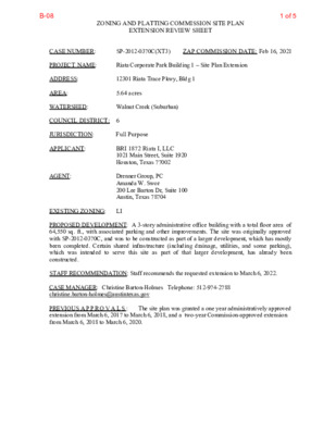
ZONING AND PLATTING COMMISSION SITE PLAN EXTENSION REVIEW SHEET CASE NUMBER: SP-2012-0370C(XT3) ZAP COMMISSION DATE: Feb 16, 2021 PROJECT NAME: Riata Corporate Park Building 1 – Site Plan Extension ADDRESS: 12301 Riata Trace Pkwy, Bldg 1 AREA: 5.64 acres WATERSHED: Walnut Creek (Suburban) COUNCIL DISTRICT: 6 JURISDICTION: Full Purpose APPLICANT: AGENT: BRI 1872 Riata I, LLC 1021 Main Street, Suite 1920 Houston, Texas 77002 Drenner Group, PC Amanda W. Swor 200 Lee Barton Dr, Suite 100 Austin, Texas 78704 EXISTING ZONING: LI PROPOSED DEVELOPMENT: A 3-story administrative office building with a total floor area of 64,550 sq. ft., with associated parking and other improvements. The site was originally approved with SP-2012-0370C, and was to be constructed as part of a larger development, which has mostly been completed. Certain shared infrastructure (including drainage, utilities, and some parking), which was intended to serve this site as part of that larger development, has already been constructed. STAFF RECOMMENDATION: Staff recommends the requested extension to March 6, 2022. CASE MANAGER: Christine Barton-Holmes Telephone: 512-974-2788 christine.barton-holmes@austintexas.gov PREVIOUS A P P R O V A L S : extension from March 6, 2017 to March 6, 2018, and a two-year Commission-approved extension from March 6, 2018 to March 6, 2020. The site plan was granted a one year administratively approved 1 of 5B-08 PROJECT INFORMATION: 5.64 acres EXIST. ZONING: LI MAX. BLDG. COVERAGE: 75% MAX. IMPERV. CVRG: 80% PROP. BLDG CVRG: 22,080 sq. ft. (8.99%) PROP. IMP. CVRG: 3.5 acres (62.1%) A COMPARISON OF THE APPROVED PROJECT WITH CURRENT REGULATIONS WATERSHED ORDINANCE: This project complies with current watershed regulations. LAND USE: The site plan complies with all zoning regulations. ENVIRONMENTAL: All environmental comments have been cleared. TRANSPORTATION: All transportation comments have been cleared. SURROUNDING CONDITIONS: Zoning/ Land Use North: GR-MU-CO and MF-2-CO (Riata Trace Pkwy, then multi-family) South: SF-2 (single-family) East: LI (office) West: LI (restaurant) STREET: Riata Trace Pkwy R.O.W. varies (+/- 90’) SURFACING varies (+/- 60’) CLASSIFICATION Suburban Roadway NEIGHBORHOOD ORGANIZATIONS: Angus Valley Area Neighborhood Association Bike Austin Friends of Angus Valley Friends of Austin Neighborhoods Homeless Neighborhood Association Neighborhood Empowerment Foundation Northwest Austin Coalition NW Austin Working Group SELTexas Sierra Club, Austin Regional Group Summit Oaks Neigh. Assn. TNR BCP – Travis County Natural Resources 2 of 5B-08 3 of 5B-08 4 of 5B-08 5 of 5B-08