B-02 (C14-2020-0131 - FPT Apartments; District 5).pdf — original pdf
Backup
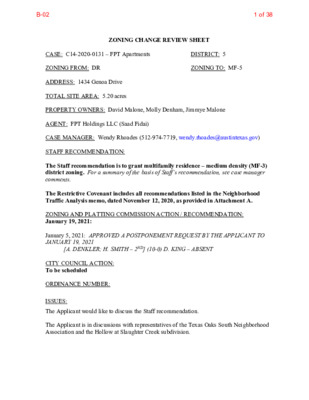
DISTRICT: 5 ZONING TO: MF-5 ZONING CHANGE REVIEW SHEET CASE: C14-2020-0131 – FPT Apartments ZONING FROM: DR ADDRESS: 1434 Genoa Drive TOTAL SITE AREA: 5.20 acres PROPERTY OWNERS: David Malone, Molly Denham, Jimmye Malone AGENT: FPT Holdings LLC (Saad Fidai) CASE MANAGER: Wendy Rhoades (512-974-7719, wendy.rhoades@austintexas.gov) STAFF RECOMMENDATION: The Staff recommendation is to grant multifamily residence – medium density (MF-3) district zoning. For a summary of the basis of Staff’s recommendation, see case manager comments. The Restrictive Covenant includes all recommendations listed in the Neighborhood Traffic Analysis memo, dated November 12, 2020, as provided in Attachment A. ZONING AND PLATTING COMMISSION ACTION / RECOMMENDATION: January 19, 2021: January 5, 2021: APPROVED A POSTPONEMENT REQUEST BY THE APPLICANT TO JANUARY 19, 2021 CITY COUNCIL ACTION: To be scheduled ORDINANCE NUMBER: [A. DENKLER; H. SMITH – 2ND] (10-0) D. KING – ABSENT ISSUES: The Applicant would like to discuss the Staff recommendation. The Applicant is in discussions with representatives of the Texas Oaks South Neighborhood Association and the Hollow at Slaughter Creek subdivision. 1 of 38B-02 C14-2020-0131 Page 2 CASE MANAGER COMMENTS: The subject undeveloped 5.2 acre tract is located on Genoa Drive, a two-lane roadway and west of its intersection with Bilbrook Place. Billbrook is a signalized intersection at West Slaughter Lane which is an above-grade roadway abutting the tract to the north. It is a primary conduit for vehicular traffic from the existing Hollow at Slaughter Creek and the Texas Oaks South subdivisions, the Malone subdivision under construction, and the proposed condominium development on the Messinger Tract, all to the south. The property is used for agricultural purposes and contains groupings of trees along its boundaries, with a 100-foot wide drainage easement along the west side of the property. It has been zoned development reserve (DR) district since annexation into the City limits in 1984. To the east is an oil and lube shop (LR; CS-1), to the south is the Hollow at Slaughter Creek single family subdivision (SF-4A), and to the west is Slaughter Creek Drive which provides access to mini-warehouses and terminates below the Slaughter Drive bridge structure (CS-CO). Railroad tracks are further west. Please refer to Exhibits A and A-1 – Zoning Map and Aerial Exhibit. The Applicant proposes to rezone the property to the multi-family residence – high density (MF-5) district so that it may be developed with approximately 265 apartment units. BASIS OF RECOMMENDATION: The proposed zoning should be consistent with the purpose statement of the district sought. Applicant’s request: The multifamily residence – high density (MF-5) district is intended to accommodate multifamily and group residential use with a maximum density of up to 54 units per acre, depending on unit size. This district is appropriate for high density housing in centrally located areas near supporting transportation and commercial facilities, in areas adjoining downtown Austin and major institutional or employment centers, and in other selected areas where high density multifamily use is desirable. Also: The multi-family residence – moderate-high density (MF-4) district is intended for residential and multi-family use with a maximum density of up to 54 units per acre, depending on unit size and mix. This district is appropriate for multi-family residential areas located near supporting transportation and commercial facilities, generally in more centrally located areas. Staff recommendation: The MF-3, multifamily residence – medium density district is intended for multifamily developments with a maximum density of up to 36 units per acres located near supporting transportation and commercial facilities. 1. 2 of 38B-02 C14-2020-0131 Page 3 2. Zoning changes should promote compatibility with adjacent and nearby uses. 3. Zoning should be consistent with approved and existing densities. Staff has an alternate recommendation of MF-3 zoning given its access to two Level 1 streets and compatibility with the adjacent single family residential subdivision to the south. Direct access to West Slaughter Lane from this site is not possible because of the bridge structure that passes over the railroad tracks. The maximum height allowed by the MF-3 zoning district is 40 feet which can be achieved on the property. The Applicant’s request for MF-5 zoning would allow for up to a 60-foot height limit that could be achieved at a distance of approximately 300 feet from the closest single family residences in the Hollow at Slaughter Creek subdivision. (MF-4 zoning also has a 60- foot height limit). A 50-foot height limit could be achieved on the property approximately 200 feet from the closes residences in the Hollow at Slaughter Creek subdivision. The Neighborhood Traffic Analysis memo includes a transportation assessment and recommends a fee-in-lieu payment towards protected bike lanes on both sides of Slaughter Lane from Menchaca Road to Texas Oaks Drive, a fee-in-lieu payment towards relocating two existing bus stops at the Slaughter Lane / Bilbrook Place intersection, and a 5-foot wide sidewalk on the property’s frontage on Genoa and extending across the adjacent property to the east, to its intersection with Billbrook Place. Please refer to Attachment A. EXISTING ZONING AND LAND USES: ZONING Site North MF-2-CO; LR-CO DR South East West (across Slaughter Lane) SF-4A LR; CS-1 CS-CO LAND USES Agricultural Sage Meadow condominium community; Undeveloped Hollow at Slaughter Creek single family subdivision Service station; Undeveloped Convenience storage; Railroad tracks NEIGHBORHOOD PLANNING AREA: Not Applicable NEIGHORHOOD TRAFFIC ANALYSIS: Please refer to Attachment A WATERSHED: Slaughter Creek – Suburban CAPITOL VIEW CORRIDOR: No SCENIC ROADWAY: Yes, West Slaughter Lane SCHOOLS: An Educational Impact Statement is required. Please refer to Attachment A. Casey Elementary School Paredes Middle School Akins High School 3 of 38B-02 C14-2020-0131 Page 4 COMMUNITY REGISTRY LIST: 242 – Slaughter Lane Neighborhood Association 360 – Texas Oaks South Neighborhood Association 511 – Austin Neighborhoods Council 742 – Austin Independent School District 1363 – SEL Texas 1528 – Bike Austin 1531 – South Austin Neighborhood Alliance 1550 – Homeless Neighborhood Association 1596 – TNR BCP – Travis County Natural Resources 1616 – Neighborhood Empowerment Foundation 1774 – Austin Lost and Found Pets AREA CASE HISTORIES: 627 – Onion Creek Homeowners Association 1228 – Sierra Club, Austin Regional Group 1424 – Preservation Austin 1530 – Friends of Austin Neighborhoods REQUEST SF-2 to CS-CO as amended COMMISSION CITY COUNCIL To Grant CS-CO w/CO for broad list of prohibited uses Apvd CS-CO as Commission recommended (6-20-2019). SF-1 to NO-MU To Grant Apvd (12-17-2009). NUMBER C14-2019-0048 – The Avalon N Holdings, LLC – 9606 Swansons Ranch Rd C14-2009-0098 – Apogee Workshop – 9704 Swansons Ranch Rd C14-2008-0052 – TJG – Swansons Ranch Road – 9609 Swansons Ranch Rd SF-2 to CS To Grant GO-CO w/CO for personal services use and all NO uses and dev’t regs, parking to be located offsite, 150 trips per day and conditions of NTA. Encourage Applicant to petition City for no parking signs on David Moore Rd To Grant SF-6 as Staff recommended Apvd GO-CO w/ Restrictive Covenant for the NTA, as Commission recommended (1-15-2009). Apvd SF-6-CO w/CO for 2,000 trips (9-7-2000). Apvd MF-1-CO and LR-CO, with CO for Traffic Impact Analysis; 13.24 u.p.a. (300 units); 15’ vegetative buffer along I-RR to LO C14-00-2027 – Texas Oaks Baptist Church – 9910 Blk of Bilbrook Pl C14-00-2098 – Blackhawk Apartments – 1200 W Slaughter Ln SF-1 to MF-1- CO and LR-CO To Grant MF-1-CO and LR-CO, w/conditions 4 of 38B-02 C14-2020-0131 Page 5 DR to MF-3 To Grant MF-2-CO w/conditions DR to W/LO To Grant W/LO-CO w/conditions DR to LR To Grant LR-CO w/conditions SF-2 to LO To Grant LO-CO, w/conditions DR; SF-2 to LI C14-00-2111 – Solera – 1200 Block of West Slaughter Ln C14-00-2189 – Wattinger Acres – 1218 W Slaughter Ln C14-00-2242 – Swanson’s Crossing Retail – 1216-1400 W Slaughter Ln C14-99-0063 – Shirell and Lois Hipp Zoning Change – 1303 W Slaughter Ln C14-94-0129 – Slaughter Lane Development – Slaughter Creek Dr David Moore Rd; list of prohibited uses (1-25-2001). Apvd MF-2-CO w/ CO for 12.18 u.p.a. and conditions of Traffic Impact Analysis (10-26-2000). Apvd W/LO-CO w/ CO for 2,000 trips (1-18-2001). Apvd LR-CO w/CO for 2,000 trips (2-15-2001). Apvd LO-CO w/CO prohibiting access to Slaughter Lane (8-19-1999). Apvd CS-CO, w/r-o-w dedication as Commission recommended (2-9-1995). To Grant CS-CO w/ CO prohibiting the following uses on Tracts 1 and 2: adult- oriented businesses, financial services, food sales, general retail sales (convenience), medical offices, restaurant uses (all types), and vehicle storage on Tract 2, and 2,000 trips, a r-o-w dedication on Slaughter Creek Dr RELATED CASES: The subject property was annexed into the City limits on November 15, 1984 (C7A-83-017 A). 5 of 38B-02 Capital Metro (within ¼ mile) Yes Yes Yes C14-2020-0131 Page 6 EXISTING STREET CHARACTERISTICS: Name ROW Pavement Classification Sidewalks Bicycle Route No 80 feet No No Level 4 120 feet Bike Lane N / A N / A 42 feet 23 feet 70 feet 46 feet Level 1 Level 1 West Slaughter Lane Genoa Drive Slaughter Creek Drive OTHER STAFF COMMENTS: Comprehensive Planning This rezoning case is located on the northeast corner of Slaughter Creek Drive and Genoa Drive on an undeveloped 5.23 acre tract. The property is located within the Slaughter Creek Station Neighborhood Center and along the Slaughter Lane Activity Corridor but is not located within the boundaries of a small area plan. Surrounding uses includes the West Slaughter Lane Bridge and a single family subdivision to the north; to the south is a single family subdivision; to the east is undeveloped land and oil change shop; and to the west is a convenience storage facility. The request is to construct a 265 unit apartment development. Connectivity There is a public sidewalk located along one side of Genoa Road and Bilbrook Plaza. Bilbrook Plaza road also has bike lanes on both sides of the street, as does West Slaughter Lane. A CapMetro transit stop is located 1,100 linear feet away on West Slaughter Lane. Imagine Austin The property is located by the Slaughter Lane Station Neighborhood and the Slaughter Lane Activity Corridor. A Neighborhood Center is intended to have a more local focus, businesses and services and will generally serve the center and surrounding neighborhoods. A Neighborhood Center and Activity Corridors supports additional housing, including apartment buildings. Like many Imagine Austin Centers, they are represented by a circle or globular shape that reflects the general location where the center should be located in the future. The center’s actual boundaries would need to be clarified through a small area planning process. Regional, town, and neighborhood centers are supposed to be walkable, bikable, and supported by transit. The following Imagine Austin policies are applicable to this case: • LUT P3 Promote development in compact centers, communities or along corridors that are connected by roads and transit, are designed to encourage walking and bicycling, and reduce healthcare, housing and transportation costs. 6 of 38B-02 C14-2020-0131 Page 7 • LUT P4. Protect neighborhood character by directing growth to areas of change that includes designated redevelopment areas, corridors and infill sites. Recognize that different neighborhoods have different characteristics and new and infill development should be sensitive to the predominant character of these communities. • LUT P7. Encourage infill and redevelopment opportunities that place residential, work, and retail land uses in proximity to each other to maximize walking, bicycling, and transit opportunities. • HN P1. Distribute a variety of housing types throughout the City to expand the choices able to meet the financial and lifestyle needs of Austin’s diverse population. Based on mobility strengths in the area, the policies above that support multifamily within Neighborhood Centers and along Activity Corridors, the proposed project appears to support the policies of the Imagine Austin Comprehensive Plan. 7 of 38B-02 C14-2020-0131 Page 8 8 of 38B-02 C14-2020-0131 Page 9 Drainage The developer is required to submit a pre- and post-development drainage analysis at the subdivision and site plan stage of the development process. The City’s Land Development Code and Drainage Criteria Manual require that the Applicant demonstrate through engineering analysis that the proposed development will have no identifiable adverse impact on surrounding properties. Environmental The site is not located over the Edwards Aquifer Recharge Zone. The site is in the Slaughter Creek Watershed of the Colorado River Basin, which is classified as a Suburban Watershed by Chapter 25-8 of the City's Land Development Code. The site is in the Desired Development Zone. Under current watershed regulations, development or redevelopment on this site will be subject to the following impervious cover limits: Development Classification % of Gross Site Area % of Gross Site Area Single-Family (minimum lot size 5750 sq. ft.) Other Single-Family or Duplex Multifamily Commercial 50% 55% 60% 80% with Transfers 60% 60% 70% 90% According to City of Austin GIS, a Critical Water Quality Zone exists along the western property boundary. Development is limited within the Critical Water Quality Zone. Standard landscaping and tree protection will be required in accordance with LDC 25-2 and 25-8 for all development and/or redevelopment. At this time, site specific information is unavailable regarding vegetation, areas of steep slope, or other environmental features such as bluffs, springs, canyon rimrock, caves, sinkholes, and wetlands. Under current watershed regulations, development or redevelopment requires water quality control with increased capture volume and control of the 2-year storm on site. At this time, no information has been provided as to whether this property has any preexisting approvals that preempt current water quality or Code requirements. 9 of 38B-02 C14-2020-0131 Page 10 Impervious Cover Within the Slaughter Creek watershed, the maximum impervious cover allowed by the MF-5 and MF-4 zoning districts is 70%, which is a consistent figure between the zoning and watershed regulations. Within the Slaughter Creek watershed, the maximum impervious cover allowed by the MF-3 zoning district is 65%, which is based on the more restrictive zoning regulations. Site Plan and Compatibility Standards Site plans will be required for any new development other than single-family or duplex residential. Any development which occurs in an SF-6 or less restrictive zoning district which is located 540 feet or less from property in an SF-5 or more restrictive zoning district will be subject to compatibility development regulations. Any new development is subject to Subchapter E. Design Standards and Mixed Use. Additional comments will be made when the site plan is submitted. Compatibility Standards The site is subject to compatibility standards as a result of being located within 540 feet of the SF-4A zoned property to the south, across Genoa Drive. Along the southerly and easterly property lines, the following standards apply: • No structure in excess of three stories or 40 feet in height may be constructed within 100 feet of the property line of the SF 4A zoned property to the south. • For a structure more than 100 feet but not more than 300 feet from property zoned SF-5 or more restrictive, height limitation is 40 feet plus one foot for each 10 feet of distance in excess of 100 feet from the property line. Scenic Roadways This site is within the Scenic Roadway Sign District. All signs must comply with Scenic Roadway Sign District regulations. Contact Cierra Flores at 512-974-2612 for more information. PARD – Planning & Design Review Parkland dedication will be required for the new residential units proposed by this development, multifamily with MF-5 zoning, at the time of subdivision or site plan, per City Code § 25-1-601. Whether the requirement shall be met with fees in-lieu or dedicated land will be determined using the criteria in City Code Title 25, Article 14, as amended. Should fees in-lieu be required, those fees shall be used toward park investments in the form of land acquisition and/or park amenities within the surrounding area, per the Parkland Dedication Operating Procedures § 14.3.11 and City Code § 25-1-607 (B)(1) & (2). 10 of 38B-02 C14-2020-0131 Page 11 If the applicant wishes to discuss parkland dedication requirements in advance of site plan or subdivision applications, please contact this reviewer: thomas.rowlinson@austintexas.gov. At the applicant’s request, PARD can provide an early determination of whether fees in-lieu of land will be allowed. Transportation ASMP Assessment The Austin Strategic Mobility Plan (ASMP) adopted April 11, 2019, calls for 120 feet of right-of-way for Slaughter Lane. It is recommended that 60 feet of right-of-way from the existing centerline should be dedicated for Slaughter Lane according to the Transportation with the first subdivision or site plan application [LDC 25-6-51 and 25-6-55]. Transportation Assessment Assessment of required transportation mitigation, including the potential dedication of right of way and easements and participation in roadway and other multi-modal improvements, will occur at the time of site plan application. A Traffic Impact Analysis shall be required at the time of site plan if triggered per LDC 25-6-113. A Neighborhood Traffic Analysis has been performed for this project by the Transportation Review staff [LDC 25-6-114]. Results have been provided in Attachment A. Austin Water Utility The landowner intends to serve the site with City of Austin water and wastewater utilities. The landowner, at own expense, will be responsible for providing any water and wastewater utility improvements, offsite main extensions, utility relocations and or abandonments required by the land use. The water and wastewater utility plan must be reviewed and approved by Austin Water for compliance with City criteria and suitability for operation and maintenance. Depending on the development plans submitted, water and or wastewater service extension requests may be required. All water and wastewater construction must be inspected by the City of Austin. Based on current public infrastructure configurations, it appears that service extension requests (SER) will be required to provide wastewater service to this lot. For more information pertaining to the Service Extension Request process and submittal requirements contact Alberto Ramirez with Austin Water, Utility Development Services at 625 E. 10th St., 7th Floor. Ph: 512-972-0211. The landowner must pay the City inspection fee with the utility construction. The landowner must pay the tap and impact fee once the landowner makes an application for a City of Austin water and wastewater utility tap permit. 11 of 38B-02 C14-2020-0131 Page 12 INDEX OF EXHIBITS, ATTACHMENT AND CORRESPONDENCE TO FOLLOW A: Zoning Map A-1: Aerial Map Site Photos and Conceptual Renderings Attachment A: Neighborhood Traffic Analysis memo Correspondence Received 12 of 38B-02 ELEMENTARY SCHOOL DR ( ( ( ( ( ( SF-2 ( ( ( ( R D S K A O S A X E T ( ( ( ( ( ( ( ( ( SF-2 ( ( ( SF-2 ( ( ( ( ( SF-2 > > > > = SF-2 ( R R D E L P M E K > SF-1 > > > SF-2 > > > > SF-1 CAR WASH APTS. MF-2-CO C14-97-0066 ( AUTO\PARTS\STORES GR-CO SP-01-0426C INDO OR SPO RTS A ND REC REATI ON SP- 06 -0 1 85 C SP-06-0065C LR-CO AUTO\PARTS\STORES SP-98-0463C SP-03-0056D FAST\FOOD CS-CO C14-2014-0168 C14-2014-0119 UNDEV 98-0139 SF-1 M O N A R C H D R C14-98-0213 LO-CO LR-CO C14-2017-0040 W/LO C14-98-0141 GR-CO C14-2007-0194 I-SF-2 GR-CO D A R C A H C N E M ELECTRONICS STORE 96-0422C GR PHARMACY SP96-0361C FAST\FOOD GR-CO 85-22 SP-01-0342CS 00-2192 C14-00-2192 R T D U N H C E E B BEEBRUSH LN 00-2111 WAXBERRY LN SP-06-0704C MF-2-CO HUCKLEBERRY LN FAST FOOD SP-01-0450CR SERVICE STATION SP-98-0356C SP96-0210C Y A W E IV R D SP-05-0823C 01-0115 C14-2013-0063 CS-CO UNDEV GR R85-056 PARKING SP-01-0451D UNDEV SELF-\STORAGE SP96-0086C ! ! ! ! ! ! CS-CO SP-00-2094C ! ! ! ! UNDEV CS-1 DR ! ! ! ! ! ! ! ! ! ! L P K O O R B L B I LR 85-154 UNDEV 94-0129 ! ! ! ! ! ! ! ! ! GENOA DR UNDEV UNDEV SUGARBERRY LN CONDOMINIUMS SWEETGUM CT W/LO-CO C14-00-2189 00-2189 R D M U G T E E W S RETAIL LR-CO C14-00-2242 00-2242 02-0046 C14-02-0046 LR-CO LO-MU-CO C14-2014-0164 LO-CO LO C14-05-0217 ( UNDEV ( OFFICE ! ! ! W SLAUGHTER LN ! ! ! ! ! LUBE CENTER ( SF-2 LO-CO UNDE V LR-CO C14-2015-0106 00-2098 UNDE V LR-CO C14-2015-0105 R D E R O O M D V A D I 3 6 0 0 - 9 9 M/H ( SF-2 CUSTOM M FG C14-2008-0052 GO-CO ( ( SHED SF-2 ( ( M/H 95-0122 CS-CO C14-2019-0048 ( SF-2 ( SF-1 NO-MU C14-2009-0098 ( 2009-0098 SF-1 ( 95-0121 S W A N S O N S R A N C H R D PLUMBING CO RR T R A N S M I S S I O N R E P A I R V E D N U APARTMENTS 00-2098 C14-00-2098 MF-1-CO 00-2027 SP-00-2216C CHURCH SF-6-CO E G A R O T S E C N E I N E V N O C Y T N U O C R D K E E R C R E T H G U A L S SF-4A C14-2011-0007 TILLERFIELD TRL SF-4A H T A P L O O P G N I D A W R D Y A M Y L A SF-4A C14-2011-0008 MEADOWSOUTH LN SF-4A C14-2011-0008 SF-4A SF-6 C14-2019-0109 ( ( 96-0073 SF-3 = C14-96-0073 = = ZONING Exhibit A ZONING CASE#: C14-2020-0131 C14-2012-0074 RETAIL CENTER LI-CO C14-2010-0190 2010-0190 CS-1 R86-023 UNDEV C14-2015-0096 CS-CO 2008-0147 C14-2008-0147 CONVENIENCE STORAGE I-RR ± SUBJECT TRACT ! ! ! ! ! ! PENDING CASE ZONING BOUNDARY This product is for informational purposes and may not have been prepared for or be suitable for legal, engineering, or surveying purposes. It does not represent an on-the-ground survey and represents only the approximate relative location of property boundaries. 1 " = 400 ' This product has been produced by CTM for the sole purpose of geographic reference. No warranty is made by the City of Austin regarding specific accuracy or completeness. Created: 11/17/2020 13 of 38B-02 3 CS-CO 3 GR-CO 1 T U N H C E E B R D HUCKLEBERRY LN SWEETGUM CT SUGARBERRY LN MF-2-CO 1 R M D U G T E E W S W/LO-CO 1 2 LR-CO W SLAUGHTER LN 1 CS-CO 1 CS-1 C14-2020-0131 DR E14 A LR B 2 2 LO-CO 4A A SF-2 SF-2 4B CS-CO B S W A N S O N S R A N C H R D SF-2 1 2 4 NO-MU 5 SF-1 CS-CO 2 1 1A GR 1 32 1 31 30 29 28 27 R D K E E R C R E T H G U A L S 57 33 34 35 36 37 38 39 40 41 42 H T A P L O O P G N I D A W 20 26 24 23 22 21 19 25 SF-4A A L Y M A Y D R 8 SF-4A 1 80 2 3 4 5 6 7 9 10 11 12 13 14 15 2 3 4 5 6 7 8 9 10 11 12 13 14 16 GENOA DR 3 SF-1 B I L B R O O K P L SF-6-CO 1 1 SF-6 18 17 15 16 FPT Apartments Exhibit A - 1 Copyright nearmap 2015 ± 1'' = 200' SUBJECT TRACT ZONING BOUNDARY ! ! ! ! ! ! PENDING CASE CREEK BUFFER ZONING CASE#: LOCATION: SUBJECT AREA: GRID: MANAGER: C14-2020-0131 1407 W. Slaughter Lane 5.234Total Acres E14 Wendy Rhoades This map has been produced by the Communications Technology Management Dept. on behalf of the Planning Development Review Dept. for the sole purpose of geographic reference. No warranty is made by the City of Austin regarding specific accuracy or completeness. 14 of 38B-02 15 of 38B-02 16 of 38B-02 17 of 38B-02 18 of 38B-02 19 of 38B-02 20 of 38B-02 21 of 38B-02 MEMORAN DUM To: CC: FROM: DATE: SUBJECT: Amer Gilani, P.E., PTOE (Carlson, Brigance & Doering, Inc.) Curtis Beaty, P.E. (ATD); Joan Minyard EIT (ATD) Justin Good, P.E. (ATD) November 12, 2020 Neighborhood Traffic Analysis for FTP Development Zoning Case Number The Transportation Development Services (TDS) division has performed a Neighborhood Traffic Analysis (NTA) for the above referenced case and offers the following comments. C14-2020-0131 The 5.2-acre tract is located in south Austin at 1407 West Slaughter Lane (see Figure 1). In Figure 2 it is shown that the surrounding area south of Slaughter Lane is bounded on the west by an existing railroad track (red), the south by Slaughter Creek (blue), and the east by Mary Moore Searight Metropolitan Park (green). The site is currently zoned DR and the zoning request is for MF-5. Figure 1: Local Map Attachment A Page 1 of 5 22 of 38B-02 Figure 2: Regional Map Roadways The tract proposes access to Genoa Drive, which is classified as a residential local street and currently has 70 feet of right-of-way and 40 feet of pavement width. Genoa Drive has four travel lanes with curb and gutter and sidewalk on the south side of the street. There are no bicycle facilities present on Genoa Drive. Bilbrook Place is the primary access point to Slaughter Lane both for the proposed development and the existing neighborhoods to the south. It is classified as a residential collector with 70 feet of right-of-way and 40 feet of pavement width. North of Genoa Drive, Bilbrook Place has two travel lanes, two bicycle lanes, and sidewalk on the west side of the street. The 24-hour traffic volumes on Genoa Drive and Bilbrook Place were 2,316 vehicles per day and 6,664 vehicles per day, respectively, based on traffic counts collected August 18, 2020. Previously, daily traffic count data was collected on Bilbrook Place between August 27 and August 29, 2019, and showed an average 24-hour traffic volume of 8,022 vehicles per day. In order to account for reduced daily traffic volumes due to the ongoing COVID-19 pandemic, an adjustment factor of 1.20 was calculated based on the difference in traffic on Bilbrook Place between 2019 and 2020. Applying the adjustment factor to the August 18, 2020 daily traffic volume on Genoa Drive results in an adjusted daily traffic volume of 2,788 vehicles per day. Page 2 of 5 23 of 38B-02 Trip Generation and Traffic Analysis This zoning case assumes 265 low-rise multifamily dwelling units (ITE Code 220). Based on the Institute of Transportation Engineer’s Trip Generation Manual, 10th Edition, the proposed development will generate 1,963 vehicle trips per day. See Table 1 for a detailed breakdown of the trip generation. Table 1 – Trip Generation Land Use Residential (Low-Rise Multifamily Housing) TOTAL Size 265 DU Unadjusted Trip Generation 1,963 1,963 Table 2 provides the expected distribution of site trips to/from Slaughter Lane. Street Genoa Drive Bilbrook Place Table 2 – Trip Distribution Traffic Distribution by Percent 100% 100% Table 3 represents a breakdown of traffic on Genoa Drive and Bilbrook Place: existing traffic, proposed site traffic, total traffic after development, and percentage increase in traffic. Street Table 3 – Traffic Summary Proposed New Site Traffic to Existing Traffic (vpd) Genoa Drive Bilbrook Place 2,788 (adjusted) 8,022 (2019) Roadway 1,963 1,963 Overall Traffic 4,751 9,985 Percentage Increase in Traffic 70.4% 24.5% According to Section 25-6-116 of the Land Development Code, streets which have pavement width of 40 feet or wider are considered to be operating at an undesirable traffic level if the average daily traffic volume for such roadway exceeds 4,000 vehicles per day. Genoa Drive is currently operating at a desirable level, however with the addition of daily site trips the overall traffic level becomes undesirable. Bilbrook Place is currently operating at undesirable levels and will continue to do so with the addition of site traffic. Additional Transportation Assessment An additional level of transportation assessment was requested from the applicant due to the fact that 1) Bilbrook Place is the sole access point to and from Slaughter Lane for this development and a number of residential areas farther south, 2) with the addition of site traffic both Genoa Drive and Bilbrook Place will operate at undesirable levels, and 3) there are two background projects that would not be considered through the typical NTA process that will contribute additional traffic to Bilbrook Place. Through coordination with ATD, the Page 3 of 5 24 of 38B-02 applicant agreed to provide intersection analysis for the Slaughter Lane / Bilbrook Place and Bilbrook Place / Genoa Drive intersections to better understand the impacts of this development’s traffic on the surrounding road network. The transportation assessment provided analysis for the two identified intersections in the existing, no-build, and build scenario for both the AM and PM peak hours. The no-build scenario includes traffic from two background projects farther south along Bilbrook Place; the build scenario is simply the no-build scenario with this site’s traffic included. To assess a development’s impact on traffic, the delay for each movement at an intersection in the no- build scenario is compared to the delay experienced in the build scenario. Delay is defined as the average amount of time in seconds that a vehicle must wait at an intersection to perform a specific movement (right-turn, left-turn, or going through the intersection). The Slaughter Lane / Bilbrook Place intersection currently experiences significant amounts of delay for vehicles turning left on the northbound and westbound approaches. This delay is expected to increase with the addition of site traffic. For the Bilbrook Place / Genoa Drive intersection, vehicles turning left on the eastbound approach currently experience minor delay. The introduction of site traffic is not expected to significantly increase delay. The Slaughter Lane / Bilbrook Place intersection is already at capacity from a vehicular improvement standpoint, meaning that there is no room to add additional lanes and the intersection is already signalized. Because of this, ATD decided to explore improvements related to pedestrian, bicycle, and transit infrastructure in the area to encourage residents to opt for alternate modes of transportation. Recommendations/Conclusions Based on the results of the NTA and the transportation assessment, ATD has the following recommendations and conclusions. 1. At time of subdivision or site plan, contribute a fee-in-lieu payment of $92,000 towards protected bike lanes on both sides of Slaughter Lane from Menchaca Road to Texas Oaks Drive as identified in the Slaughter Lane Corridor Mobility Plan. 2. At time of subdivision or site plan, contribute a fee-in-lieu payment of $30,000 towards relocating and upgrading the two existing bus stops at the Slaughter Lane and Bilbrook Place intersection as shown in the Slaughter Lane Corridor Mobility Plan. 3. At time of subdivision or site plan, construct a 5’-wide sidewalk on the north side of Genoa Drive from the property to Bilbrook Place. 4. If the number of units proposed in Table 1 is exceeded, the TDS division may be required to reassess the NTA. If at time of subdivision or site plan a TIA is required per LDC 25-6-113, the recommendations identified in this NTA memo may be revised and the final decision on mitigation recommendations shall defer to the TIA. 5. The City Council may deny an application if the neighborhood traffic analysis demonstrates that the traffic generated by the project combined with existing traffic exceeds the desirable operating level established on a residential local or collector street in the neighborhood traffic analysis study area. Page 4 of 5 25 of 38B-02 If you have any questions or require additional information, please contact me at 974-1449. Justin Good, P.E. Transportation Development Engineer – Lead: South Austin Transportation Department Page 5 of 5 26 of 38B-02 Attachment B 27 of 38B-02 28 of 38B-02 29 of 38B-02 30 of 38B-02 31 of 38B-02 32 of 38B-02 33 of 38B-02 34 of 38B-02 35 of 38B-02 36 of 38B-02 37 of 38B-02 38 of 38B-02