B-01 (C14-2020-0121 - Holland Stone; District 5).pdf — original pdf
Backup
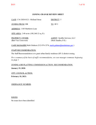
ZONING CHANGE REVIEW SHEET CASE: C14-2020-0121– Holland Stone DISTRICT: 5 ZONING FROM: DR ADDRESS: 1105 Matthews Lane SITE AREA: 2.49 acres (108,360.32 sq. ft.) TO: SF-5 PROPERTY OWNER: (Bart Van Cromvoirt) AGENT: Sandlin Services, LLC (Nick Sandlin, P.E.) CASE MANAGER Mark Graham (512-974-3574, mark.graham@austintexas.gov ) STAFF RECOMMENDATION: The Staff Recommendation is to grant urban family residence (SF-5) district zoning. For a summary of the basis of staff’s recommendation, see case manager comments beginning on page 2. ZONING AND PLATTING COMMISSION ACTION / RECOMMENDATION: January 19, 2020: CITY COUNCIL ACTION: February 18, 2021: ORDINANCE NUMBER: ISSUES No issues have been identified. 1 of 15B-01 C14-2020-0121 2 CASE MANAGER COMMENTS: Location The subject tract, addressed as 1105 Matthews Lane, is located south of West William Cannon Drive, north of West Dittmar Road, east of Menchaca Road and west of Cooper Lane. Access to the Site is from Matthews Lane. The property was annexed to the full purpose jurisdiction on 11/15/1984 and assigned development reserve (DR) zoning. A Demolition permit for a one family home was issued January 21, 2016 for a residence established in about 1935. Request The applicant requests urban family residence (SF-5) zoning for the tract. SF-5 zoning requires 10,500 sq. ft. minimum site area and 3,500 sq. ft. area per unit. The subject tract is 2.4876 acres (108,360.32 square feet). There is a “creek buffer” crossing the tract which may reduce the total number of units that can be built, encourage clustering or both. The portions of the tract that are unbuildable will be determined during site planning. Applicant intends to build 10 townhouse style residences. Context The subject tract is one of five contiguous (DR) zoned tracts but the only undeveloped tract. Property Profile shows a Creek Buffer/Waterway Setback on a significant portion of the subject tract, and shows the waterway continuing beyond the south property line along the rear (west) property lines of the residential lots fronting on Cooper Lane and reaching Boggy Creek and FEMA Floodplain south of Dittmar Road. The five (DR) zoned tracts (including the subject tract) are surrounded by single-family residence - standard lot (SF-2) zoning. Lots to the west are generally 0.5 acre to over 2.0 acres though minimum required lot area for SF-2 is 5,750 sq. ft., Maximum building height in SF-2 is 35 feet, and lots are limited to one dwelling. There are five SF-2 zoned lots bordering the subject tract on the east. Those lots range from 0.25 to 1.0 acres each. Most of the land south of Matthews Lane, north of Sherwood Road, west of the railroad tracks and east of Cooper Lane, is zoned either SF-2 or DR. Land on the north side of Matthews Lane from the railroad tracks on the west, to Cooper Lane on the east, is primarily SF-3 zoned. There is a flag of general commercial services (CS) zoning extending north from Matthews Lane to William Cannon Drive along the railroad tracks and linking the self-storage and retail uses along William Cannon Drive. There is also SF-6-CO zoning west of Woodhue Drive, and developed with a church, educational and residential campus of El Buen Samaritano Episcopal Mission and the San Francisco De Asis Church. The SF-3 zoned lots on the north side of Matthews are smaller than the lots to the south. Compatibility If the property is rezoned to SF-5 and developed with any of the by-right land uses, then the Article 10 Compatibility Standards, do not apply. Development regulations for the requested SF- 5 are the same as for SF-2 and SF-3 zoned land in many cases, such as: 2 of 15B-01 C14-2020-0121 3 1. Minimum lot width 2. Maximum height 3. Front yard 4. Street side yard 5. Interior side yard 6. Rear yard 7. Maximum building coverage Maximum impervious cover permitted in SF-5 is 10% higher than in SF-2 or SF-3. SF-3 DR SF-5 MINIMUM LOT SIZE (square feet): 5,750 10 acres 5,750 MINIMUM CORNER LOT AREA (square feet): MINIMUM LOT WIDTH: MINIMUM CORNER LOT WIDTH: MAXIMUM DWELLING UNITS PER LOT: MAXIMUM HEIGHT: MINIMUM SETBACKS: FRONT YARD: STREET SIDE YARD: INTERIOR SIDE YARD: REAR YARD: SF-2 5,750 50 1 35 25 15 5 10 100 1 35 25 25 10 10 — 50 50 — 35 25 15 5 10 50 2 35 25 15 5 10 MAXIMUM BUILDING COVERAGE: MAXIMUM IMPERVIOUS COVER: 40% 45% 40% 45% 12,000 15,000 40% 55% MAXIMUM FLOOR AREA RATIO — There are eleven permitted residential uses and one conditional use in the urban family residence (SF-5) zone district: Bed and Breakfast (group 1) Bed and Breakfast Group 2 Condominium Residential Duplex Residential Retirement Housing (small site) Retirement Housing (large site) [Conditional] Single-Family Attached Residential Single-Family Residential Small Lot Single-Family Residential Townhouse Residential Two-Family Residential Short-term Rental BASIS OF RECOMMENDATION: The proposed rezoning from DR to SF-5 on the nearly 2.5 acre site would change the number of permitted residences from 1 to 10 in the subject infill site. The resulting development with an average of 4 units per acre would be very similar to the surrounding SF-2 density. Staff is recommending the requested SF-5 district zoning for the following reasons: 1. The proposed zoning should be consistent with the purpose statement of the district sought. 3 of 15B-01 C14-2020-0121 4 Urban family residence (SF-5) district is the designation for a moderate density single-family residential use on a lot that is a minimum of 5,750 square feet. A duplex, two-family, townhouse, or condominium residential use is permitted in an SF-5 district under development standards that maintain single family neighborhood characteristics. An SF-5 district designation may be applied to a use in an existing family residential neighborhood in a centrally located area of the City. An SF-5 district may be used as a transition between a single family and multifamily residential use or to facilitate the implementation of City affordable housing programs. (25-2-60) The subject property exceeds the minimum lot area for an SF-5 lot and for 10 residential units. The proposed development would maintain single family neighborhood characteristics with an average density of about 4 dwelling units to the acre. 2. Zoning changes should promote compatibility with adjacent and nearby uses Development regulations, including building height, setback, yards and units per acre in SF-5 are the same as for the adjacent SF-2 zoned lots in most instances. The exception is the limit on impervious coverage where SF-5 allows 10% more. The city requires on-site detention for the two year storm and may require additional stormwater volume controls. Zoning should allow for reasonable use of the property. 3. The “Creek Buffer” appears to cover about a third of the subject property. With the proposed SF- 5 zoning the residential units can be clustered on the buildable part of the lot and served by a common driveway to make reasonable use of the property. 4. Zoning should promote clearly identified community goals, such as creating employment opportunities or providing for affordable housing. The proposed zoning and development could provide ten units of infill housing close to 3 Imagine Austin Corridors: William Cannon, Manchaca and Slaughter Lane. Austin’s Housing Blueprint calls for at least 75 percent of new housing to be located within a half-mile of Imagine Austin Corridors and Centers. Living close to Corridors translates to more affordable access to shopping, services, education, entertainment and employment. It is also expected to reduce vehicle miles traveled, reduce greenhouse emissions and enhance recreation options. The subject site is within a third of a mile of William Cannon Corridor and just beyond a half- mile of the Manchaca Corridor. Both Corridors are identified in the Affordable Housing Blueprint with housing goals: The ten-year goal for the William Cannon Corridor is 1,884 dwelling units. Austin voters approved $720 million in the 2016 Mobility Bond to build pedestrian connections along nine Imagine Austin Corridors. City Council authorized staff to move forward with design and construction of projects on April 25, 2019. About $482 million is targeted at Corridors. Some projects were initiated in 2019 but the bulk of the construction is expected between 2021 4 of 15B-01 C14-2020-0121 5 and 2024 (2020 Mobility Annual Plan, p10). Eight of the projects are identified as improvements to William Cannon. EXISTING ZONING AND LAND USES: Zoning Land Uses Site North South East West DR SF-3 DR SF-2 DR, SF NEIGHBORHOOD PLANNING AREA: No FLUM, No Regulating Plan Undeveloped Detached residential Detached residential Detached residential Detached residential TIA: The determination is deferred to site plan application when land use and intensity will be finalized. WATERSHED: South Boggy Creek – Suburban Watershed - Maximum impervious coverage 50 to 70% based on development type Williams Elementary Bedichek Middle Crockett High OVERLAYS: None SCHOOLS: NEIGHBORHOOD ORGANIZATIONS Armadillo Park Neighborhood Association Austin Independent School District Austin Lost and Found Pets Austin Neighborhoods Council Bike Austin Friends of Austin Neighborhoods Go Austin Vamos Austin 78745 Homeless Neighborhood Association Matthews Lane Neighborhood Assn. Neighborhood Empowerment Foundation Onion Creek Homeowners Assoc. Preservation Austin SEL Texas Sierra Club Austin Regional Group South Austin Neighborhood Alliance (SANA) 5 of 15B-01 C14-2020-0121 6 AREA CASE HISTORIES: C14-2015-0140 Latta Rezoning 7505 Wynne Lane C14-2009-0157 7201-7207 Albert Road & 1305-1407 Matthews Lane Number Request Commission City Council Rezone from MH to SF-2 To grant Apvd.12/10/2015 Ord.# 20151210-071 Apvd. 05/13/2010 Ord.#20100513-050 To grant Rezone 2.239 acres from SF-1 to SF-2- CO. Conditions: A. All vehicular access to property from Matthews Lane shall be as follows: 1 maximum 3 driveways; 2. One driveway for drainage facility access; 3. Two driveways shall be for single family residence use and may be joint-use driveways that serve more than one single family residence use. B. Unless a joint-use driveway is used as an alternative access for single family residence use, the minimum lot width at the street frontage on Matthews Lane or Albert Road is 20 feet. C14-2009-0158 7211 Albert Road C14-2007-0184 Soule Residence 7406 Forest Wood Rd. C14-2019-0139 7708 Forest Wood Rd. C14-2011-0056 Najar 7503 Wynne Lane Rezone 2.0016 acres from DR to SF-1 To grant Rezone 1.28 acres from DR to SF-2 To grant Rezone 0.571from SF-2 to SF-3. To grant Rezone 0.32 acres from MH to SF-3. To grant Apvd. 02/25/2010 Ord.#20100225-075 Apvd. 11/29/2007 Ord.#20071129-073 Apvd. 01/23/2020 Ord.#20200123-103 Apvd. 07/28/2011 Ord.# 20110728-134 6 of 15B-01 C14-2020-0121 7 Number Request Commission City Council C14-2013-0118 Cooper Commercial 7200 Cooper Lane To grant Apvd. 09/25/2014 Ord.#20140925-113 Rezone 0.3306 acres SF-2 to GR-CO. Conditional Overlay includes: A. drive- in service as accessory use to commercial is a conditional use. B. List of prohibited uses: Automotive repair svcs., Automotive rentals, automotive sales, automotive washing (of any type), bail bond svcs., business or trade school, business support services, commercial off-street parking, communication services, drop-off recycling collection facility, exterminating services, funeral svcs., hospital svcs.,(general), hotel-motel, indoor entertainment, indoor sports and recreation, outdoor entertainment, off- site accessory parking, outdoor sports and recreation, pawn shop svcs., research svcs., services station, theater. C. Conditional uses of the property: alternative financial services, community recreation (private), community recreation (public), congregate living, group home (Class II), hospital svcs.,(limited), medical offices exceeding 5,000 sq. ft. gross floor area, residential treatment. D. The following uses are subject to City Code 25-2-587(D) (Requirements for Certain Uses in a Neighborhood Commercial (LR) District): general retail sales (general), personal improvement svcs., restaurant (general). C14-2017-0110 7505 Wynne Lane C14-2013-0082 Ellis Oaks 7208 Cooper Lane C14-2019-0090 7410 Cooper Lane Rezone 0.32 acres from SF-2 to SF-3 To grant Rezone 3.212 acres from DR to SF-3- CO To grant Rezone 5.001 acres from DR to SF-6 To grant Apvd. 11/02/2017 Ord.# 20171102-019 Apvd. 09/26/2015 Ord.# 20130926-125 Apvd. 11/14/2019 Ord.# 20191114-075 7 of 15B-01 C14-2020-0121 8 RELATED CASES: None LEGAL DESCRIPTION: Lot 11, Block E Elmwood Estates OTHER STAFF COMMENTS: Inclusive Planning Imagine Austin Comprehensive Plan Compact/Connected/Complete Community (IACP p88) The community around the subject site meets the Imagine Austin Comprehensive Plan test for good access to essential goods, services, recreation, education and public transportation. Many of those destinations are within walking or biking distance. A key concept in the Imagine Austin Comprehensive Plan is that Austin becomes more “green” as it moves towards Activity Centers that are accessible by Corridors that have improved transportation networks including bike trails and paths, bus and other transit and pedestrian facilities that reduce reliance on cars. Groceries are available within a mile of the subject site at the intersection of Manchaca Road and William Cannon Drive (Sprouts). The Post office is 0.8 miles also on Manchaca about 500 feet south of Matthews Lane. The Austin Public Library, Manchaca Branch is 2.2 miles to the north and along the way is banking, restaurants and auto repair and Austin Community College, South Austin Campus. Garrison Pool/Park is at the 1.7-mile mark on the way to the library. K-12 facilities serving this community include Williams Elementary, which is over a mile away and Bedichek Middle School, which is 1.0 miles because the street grid is incomplete to the east. Crockett High School is about 2 miles, a 40-minute walk. Going south, Ditmar Park/Recreation Center is about 1 mile via Forest Wood Road, though there are no sidewalks on Forest Wood. There is a sidewalk along the north side of Matthews Lane from the site to about a block before Forest Wood Road. The Dittmar Park/Recreation Center is about 1.3 miles via Cooper Lane and Dittmar Road. Neither Matthews Lane east of the subject property nor Cooper Lane south of Matthews Lane, have sidewalks. Dittmar Road has sidewalks along both sides. While the community is connected to the north and west with sidewalks, the connections to the east and south are less pedestrian friendly. The rezoning site is near three Imagine Austin Comprehensive Plan (IACP) Corridors: William Cannon (0.3 miles), South 1st Street (0.4 miles), and West Slaughter Lane (1.3 miles). There are three IACP Centers near the subject site: South Austin Civic Center, William Cannon & MoPac and Slaughter Lane Station. Corridors have been the focus of transportation investments such as the 2016 Mobility Bonds and over the next decade, Project Connect. The Corridors link Communities with Activity and Employment Centers. 8 of 15B-01 C14-2020-0121 9 To the north, the closest IACP Center is South Austin Civic Center, which is a 16-minute bike ride away. Google estimates 7 minutes to drive to the Manchaca Road Branch of Austin Library which is across the Street from Austin Community College, South Campus in the South Austin Center. The 23 minute bus trip to this library includes a 7 minute walk to the stop. To the west, is William Cannon & MoPac Center. The westbound 333 bus stops at the Mount Carrell bus stop, a 7-minute walk from the subject site. The 333 stops every 15 minutes from 7a.m. to 8 p.m. along William Cannon. A commute to the William Cannon & MoPac activity center takes about 36 minutes including walking to William Cannon, 11 minutes riding on the bus, and 16 minutes walking to the activity center intersection per the CapMetro Trip Planner. Going to the South IACP Center, Slaughter Lane, at Slaughter and Manchaca is about 35 minutes by bus, including 16 minutes of walking and bus layover between the 333 and the 3. While the local street grid and pedestrian facilities could be improved to make walking safer and more convenient, the site is generally well located for residential access to goods, services, recreation, entertainment and employment. The proposed zoning with a density of 4 dwelling units per acre is recommended in this case because the SF-5 allows clustering the residential units which may offset an unbuildable portion of the site. Environmental 1. The site is not located over the Edwards Aquifer Recharge Zone. The site is in the South Boggy Creek Watershed of the Colorado River Basin, which is classified as a Suburban Watershed by Chapter 25-8 of the City's Land Development Code. The site is in the Desired Development Zone. 2. Under current watershed regulations, development or redevelopment on this site will be subject to the following impervious cover limits: Development Classification % of Gross Site Area % of Gross Site Area with Transfers Single-Family 50% (minimum lot size 5750 sq. ft.) Other Single-Family or Duplex 55% Multifamily Commercial 60% 80% 60% 60% 70% 90% 3. According to floodplain maps there is no floodplain within or adjacent to the project location. However, there is a calculated minimum 64 acres of drainage to a point on the property, resulting in a classified waterway and a critical water quality zone as defined in 9 of 15B-01 C14-2020-0121 10 LDC 25-8-91 and 25-8-92 (see diagonally hatched polygon in below image). Likewise, development within a critical water quality zone is limited to that allowed under LDC 25- 8-261 and 25-8-262. Approximate centerline of waterway and associated critical water quality zone 4. Standard landscaping and tree protection will be required in accordance with LDC 25-2 and 25-8 for all development and/or redevelopment that proposes a minimum of three living units. 5. At this time, site specific information is unavailable regarding vegetation, areas of steep slope, or other environmental features such as bluffs, springs, canyon rimrock, caves, sinkholes, and wetlands. 6. Under current watershed regulations, development or redevelopment requires water quality control with increased capture volume and control of the 2 year storm on site. 7. At this time, no information has been provided as to whether this property has any preexisting approvals that preempt current water quality or Code requirements. Parks & Recreation PR1: Parkland dedication will be required at the time of subdivision or site plan application for new residential units proposed by this rezoning, SF-5, per City Code § 25-1-601, as amended. The proposed development meets the criteria for land dedication in City Code Title 25, Article 14. As such, a partial land dedication may be required, as well as any remaining fees in-lieu. 10 of 15B-01 C14-2020-0121 11 The surrounding neighborhood area is currently park deficient, defined as being outside walking distance to existing parks. The Parks and Recreation Department (PARD) would consider a greenbelt connection along the South Boggy Creek tributary toward satisfying the requirement at the time of permitting (whether subdivision or site plan). Such a connection would satisfy an acquisition need for South Boggy Creek, a recommendation identified in the Parks and Recreation Department’s Long Range Plan. To meet the parkland dedication standards, access from ROW would need to be provided to the creek area, as well. Should there be any remaining fees in-lieu, those fees shall be used toward park investments in the form of land acquisition and/or park amenities within the surrounding area, per the Parkland Dedication Operating Procedures § 14.3.11 and City Code § 25-1-607 (B)(1) & (2). Should the applicant wish to discuss parkland dedication requirements in advance of site plan or subdivision applications, please contact this reviewer: thomas.rowlinson@austintexas.gov. At the applicant’s request, PARD can provide an early determination letter of the requirements as stated in this review. Site Plan SP1. Site plans will be required for any new development other than single-family or duplex residential. SP2. Any development which occurs in an SF-6 or less restrictive zoning district which is located 540-feet or less from property in an SF-5 or more restrictive zoning district will be subject to compatibility development regulations. SP3. Any new development is subject to Subchapter E. Design Standards and Mixed Use. Additional comments will be made when the site plan is submitted. SP4. With the proposed SF-5 zoning, the site is not subject to compatibility standards. Additional design regulations will be enforced at the time a site plan is submitted. Transportation ASMP Assessment The Austin Strategic Mobility Plan (ASMP) adopted 04/11/2019, calls for 64 feet of right-of- way for Matthews Lane. It is recommended that 32 feet of right-of-way from the existing centerline should be dedicated for Matthews Lane with the first subdivision or site plan application [LDC 25-6-51 and 25-6-55]. Transportation Assessment A traffic impact analysis was not required for this case because the traffic generated by the proposed zoning does not exceed the threshold of 2,000 vehicle trips per day [LDC 25-6-113]. The adjacent street characteristics table is provided below: 11 of 15B-01 C14-2020-0121 Name ROW Pavement Classification Sidewalks Bicycle Route Matthews Lane 60’ 25’ Level 2 No Wide Curb 12 Capital Metro (within ¼ mile) Yes Austin Water Utility AW1. The landowner intends to serve the site with City of Austin water and wastewater utilities. The landowner, at own expense, will be responsible for providing any water and wastewater utility improvements, offsite main extensions, utility relocations and or abandonments required by the land use. The water and wastewater utility plan must be reviewed and approved by Austin Water for compliance with City criteria and suitability for operation and maintenance. Depending on the development plans submitted, water and or wastewater service extension requests may be required. All water and wastewater construction must be inspected by the City of Austin. The landowner must pay the City inspection fee with the utility construction. The landowner must pay the tap and impact fee once the landowner makes an application for a City of Austin water and wastewater utility tap permit. INDEX OF EXHIBITS TO FOLLOW Exhibit A: Zoning Map Exhibit B: Aerial Map Correspondence 12 of 15B-01 ( ( ( ( ( ( ( ( ( ( ( S V C S GR TATIO N ( 84-337R ( C ( ( ( ( ( SF-3 ( ( ( ( SF-3 ( ( ( ( ( ( ( ( ( ( ( ( ( ( ( ( ( ( ( ( ( ( ( ( CS 98-0228 SF-6-CO C14-96-0117 = = = = = = = = = = T C Y E K Y R O V I = = = = = = V E C R U S A E R T = = SF-3 = = = = = M AT T H E W = = S L N = = = ( WOODHUE DR = = = = = = = = = ( = W O O D H U E C T = = = = = = ( SF-2 ( D T R R E B AL ( ( ( ( 2009-0157 SF-2-CO C14-2009-0157 98-0008 SF-1 C14-2009-0158 ( 2009-0158 = = ( ( ( ( ( ( ( ( ( = = = ( ( ( ( ( ( AY T W RIF D WIN ( ( ( ( ( ( ( ( ( ( ( ( ( ( ( O D A E M ( ( ( ( ( ( ( = = ( ( ( ( = = = = = ( ( ( ( ( ( ( ( ( ( ( ( ( ( ( ( ( SF-3 ( HID D E ( ( ( ( ( ( ( ( N HILL CIR ( ( ( ( ( ( ( ( C ULLE R S C V ( ( ( ( ( ( ( N U W R ( ( ( ( ( ( ( ( ( ( ( SF-3 ( ( ( R D D O O W S S O R C ( ( ( ( ( ( ( ( ( ( ( ( ( D D R O O T W S E R O F ( ( ( ( ( ( SF-2 ( ( ( DR ( ( SF-2 ( ( ( ( D T R S E R O M F EL ( ( ( 87-085 ( 87-085 ( ( SF-2 ( ( ( ( ( ( ( ( ( R ELL D ( ( ( SF-3 ( ( ( ( R R A T C N U O ( M ( ( ( ( ( ( ( ( ( ! ! ! ! ! ! ! ! ! ( ( ! ! ! ! ! ! ! ! ! ! ! ! ! ( ! ! ! SHED ! ! ! ! ! ( ( ( ( SF-2 ( 00-2171 SF-2 C14-2007-0184 ( LANDSCAPE\DESIGN SF-3 C14-2013-0082 ( ( ( ( ( ( WHSE ( ( ( SH ERWOOD RD ( ( ( ( ( ( ( ( ( ( ( ( ( ( ( ( ( ( ( ( ( ( SF-2 ( ( ( ( ( ( ( ( ( ( ( ( ( ( ( ( ( SF-2 ( ( ( ( MH C14-2011-0056 C14-2017-0110 SF-3 C14-2019-0060 M/H MH M/H SF-3 C14-2016-0076 M/H M/H MH ( W Y N N E L N SF-3 ( C14-2019-0139 M/H SF-2 MH SF-3 C14-03-0095 SF-2 ( ± ( ( ( ( ( ( ( ( SF-2 W O O D C L I F F D R M/H ( ( ( ( ( ( ( M/H ( M/H W WILLIAM CANNON DR C14-2014-0019 CARWASH ( ( 79-233 GR 84-33RC ( ( ( APARTMENTS MF-2-CO C14-2013-0077.SH C14-2007-0038.SH ( ( ( ( ( ( ( ( ( ( ( ( ( ( ( ( ( ( ( ( ( ( SF-3 ( ( ( ( ( ( ( ( K L N ST O N E O A ( ( ( ( ( ( SF-3 ( ( ( ( ( ( ( ( ( ( ( ( ( ( ( ( ( ( ( ( ( ( ( ( ( ( ( ( ( ( ( ( ( ( SF-3 ( ( ( ( ( HILLSID ( ( ( E O A K ( ( ( SF-3 ( ( S D R ( ( ( ( ( ( ( ( ( ( ( ( ( ( ( ( ( ( ( ( B O D A R K LN ( ( ( ( ( ( ( SF-3 ( ( ( ( ( A C O R ( ( ( SF-3 ( ( N O A K S D R ( ( ( ( ( ( ( ( ( ( ( ( ( ( ( ( ( ( ( ( ( ( ( ( ( ( ( ( ( ( ( ( ( ( N O L H C E ( ( ( SF-3 ( ( ( SF-3 ( ( ( ( ( ( ( ( ( ( T S E E D ( ( ( L E N O R A S T SF-2 ( ( ( COGB ILL S T ( ( ( ( ( ( ( ( ( C14-2013-0118 ( GR-CO SF-2 ( ( ( ( ( ( SF-2 ( ( ( ( DR ( ( WHSE ( ( ( ( ( ( ( ( ( ( ( ( ( ( Y A W E L A D S N R A B ( ( SF-2 ( ( ( ( ( ( ( PR INC E VALIANT DR ( ( ( ( ( ( ( ( ( ( ( ( ( ( ( ( C O O P E R L N SF-2 ( ( ( SF-2 ( ( ( AL E T H A L N ( ( ( ( ( BERN STEIN ST SF-6-CO C14-96-0078 C14-2014-0052 COBURN ST ( B R Y N N E R S T MC QUEEN ST ( ( ( ( ( OAK H ED GE PL ( ( ( ( ( ( SF-6 C14-2019-0090 ZONING Exhibit A ZONING CASE#: C14-2020-0121 SUBJECT TRACT ! ! ! ! ! ! PENDING CASE ZONING BOUNDARY This product is for informational purposes and may not have been prepared for or be suitable for legal, engineering, or surveying purposes. It does not represent an on-the-ground survey and represents only the approximate relative location of property boundaries. 1 " = 400 ' This product has been produced by CTM for the sole purpose of geographic reference. No warranty is made by the City of Austin regarding specific accuracy or completeness. Created: 11/3/2020 13 of 15B-01 WIN D RIFTW AY W O D A E M N U R SF-3 MATTHE W S LN SF-3 R D D O O W S S O R C SF-3 R ELL D R R A T C N U O M SF-3 SF-2 D T R S E R O ELM F SF-2 C14-2020-0121 F16 DR SF-2 SF-3 K LN R A D O B SF-3 A C O R N O A K S D R SF-3 M AT T H E W S L N SF-2 L E N O R A S T COGBILL ST SF-2 SF-3 SHERWOOD RD W O O D C L I F F D R SF-2 SF-2 Holland Stone Exhibit B Copyright nearmap 2015 ± 1'' = 200' SUBJECT TRACT ZONING BOUNDARY ! ! ! ! ! ! PENDING CASE CREEK BUFFER ZONING CASE#: LOCATION: SUBJECT AREA: GRID: MANAGER: C14-2020-0121 1105 Matthews Ln 2.49 Acres F16 MARK GRAHAM This map has been produced by the Communications Technology Management Dept. on behalf of the Planning Development Review Dept. for the sole purpose of geographic reference. No warranty is made by the City of Austin regarding specific accuracy or completeness. 14 of 15B-01 From: To: Subject: Date: Graham, Mark Eugene Sutton RE: C14-2020-0121 Friday, December 18, 2020 10:12:00 AM Eugene, Thanks for your comments. The proposal is to build 10 residences on about 2.5 acres with the SF-5 zoning or about 4 dwellings per acre. I will pass along your comments to the Zoning and Platting Commission with my staff report. Regards, Mark Graham, Case Manager Housing and Planning Dept. Mark.graham@austintexas.gov 512-974-3574 From: Eugene Sutton <eesutton@sbcglobal.net> Sent: Friday, December 18, 2020 9:58 AM To: Graham, Mark <Mark.Graham@austintexas.gov> Subject: C14-2020-0121 *** External Email - Exercise Caution *** Review of proposed zoning change for 1105 Matthews Lane from DR to SF-5 would be an over reach. Current zoning is predominantly SF-1 and SF-2 within the Matthew's Lane Neighborhood Association and as such this rezoning to SF-5 would not be welcome. Thank you Eugene Sutton 1505 Damon President Matthew's Lane Neighborhood Association CAUTION: This email was received at the City of Austin, from an EXTERNAL source. Please use caution when clicking links or opening attachments. If you believe this to be a malicious and/or phishing email, please forward this email to cybersecurity@austintexas.gov. 15 of 15B-01