B-04 (C14-2020-0126 - Gemini Tract C; District 6).pdf — original pdf
Backup
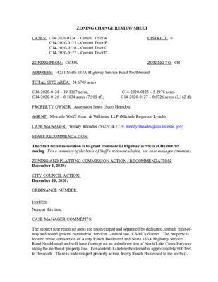
DISTRICT: 6 ZONING TO: CH ZONING CHANGE REVIEW SHEET CASES: C14-2020-0124 – Gemini Tract A C14-2020-0125 – Gemini Tract B C14-2020-0126 – Gemini Tract C C14-2020-0127 – Gemini Tract D ZONING FROM: CS-MU ADDRESS: 14231 North 183A Highway Service Road Northbound TOTAL SITE AREA: 24.6705 acres C14-2020-0124 – 19.1167 acres; C14-2020-0126 – 0.1834 acres (7,989 sf); PROPERTY OWNER: Ascension Seton (Scott Herndon) AGENT: Metcalfe Wolff Stuart & Williams, LLP (Michele Rogerson Lynch) C14-2020-0125 – 5.2978 acres C14-2020-0127 – 0.0726 acres (3,162 sf) CASE MANAGER: Wendy Rhoades (512-974-7719, wendy.rhoades@austintexas.gov) STAFF RECOMMENDATION: The Staff recommendation is to grant commercial highway services (CH) district zoning. For a summary of the basis of Staff’s recommendation, see case manager comments. ZONING AND PLATTING COMMISSION ACTION / RECOMMENDATION: December 1, 2020: CITY COUNCIL ACTION: December 10, 2020: ORDINANCE NUMBER: ISSUES: None at this time. CASE MANAGER COMMENTS: The subject four rezoning areas are undeveloped and separated by dedicated, unbuilt right-of- way and zoned general commercial services – mixed use (CS-MU) district. The property is located at the intersection of Avery Ranch Boulevard and North 183A Highway Service Road Northbound and will have frontage on an unbuilt section of North Lake Creek Parkway along the northeast property line. For context, Lakeline Boulevard is approximately 900 feet to the south. There is undeveloped property across Avery Ranch Boulevard to the north (I- C14-2020-0124_0127 Page 2 RR, MF-4), undeveloped property across the unbuilt North Lake Creek Parkway right-of- way to the east (MF-4), undeveloped property to the south (MF-4, CS-MU), and the North 183A Service Road Northbound and main lanes to the west. Please refer to Exhibits A and A-1 – Zoning Map and Aerial Exhibit. The Applicant proposes to rezone the property to the commercial highway services (CH) district so that it may be developed with a hospital (general) use, and related driveways, parking areas and open space. Please refer to Exhibit B for the Master Site Plan showing the campus layout and location of each rezoning case. BASIS OF RECOMMENDATION: The proposed zoning should be consistent with the purpose statement of the district sought. Commercial highway services (CH) district is the designation for a use that has operating and traffic generation characteristics that require that the use be located at the intersection of State maintained highways other than scenic arterial roadways. A CH district designation may be applied to a single major mixed use development of a service nature that includes any combination of office, retail, commercial, and residential uses. A CH district may include a high density residential use. Site development regulations and performance standards applicable to a CH district are designed to ensure adequate access to and from all uses. Zoning should promote the policy of locating retail and more intensive zoning near the intersections of arterial roadways or at the intersections of arterials and major collectors. Staff recommends CH zoning because the property meets the purpose statement of the district. These parcels of land are located at the intersection of a highway, Highway 183A North and an arterial roadway, Avery Ranch Boulevard. The CH zoning district is compatible with the surrounding uses because there is moderate-high density multifamily zoned property to the east (MF-4) and higher intensity commercial zoned (CS-MU) to the south of the site, respectively. The property is within the vicinity of the Northwest Park & Ride Town Center Transit Oriented Development District (TOD) and by the Lakeline Station Regional Center as identified on the Growth Concept Map in the Image Austin Comprehensive Plan. The proposed CH zoning is appropriate for this location because it will permit the proposed hospital use along a highway and will provide medical services at a regional scale. 1. 2. C14-2020-0124_0127 Page 3 EXISTING ZONING AND LAND USES: Site North ZONING CS-MU I-RR; MF-4; PUD South CS-MU; GR-MU East MF-4; I-RR West Not Applicable LAND USES Undeveloped Undeveloped; Single family residences in the Avery Ranch subdivision Undeveloped Undeveloped; State offices (TXDoT - Cedar Park campus) North 183A Highway main lanes and service road TIA: Is not required SCENIC ROADWAY: No Elsa England Elementary School McNeil High School 1228 – Sierra Club, Austin Regional Group 1363 – SEL Texas 1530 – Friends of Austin Neighborhoods NEIGHBORHOOD PLANNING AREA: Not Applicable WATERSHED: Buttercup Creek – Suburban CAPITOL VIEW CORRIDOR: No SCHOOLS: This site is located within the Round Rock ISD. Sommer Elementary School Pearson Ranch Middle School COMMUNITY REGISTRY LIST: 604 – Davis Spring HOA 1239 – Leander ISD Population and Survey Analysts 1528 – Bike Austin 1616 – Neighborhood Empowerment Foundation AREA CASE HISTORIES: NUMBER REQUEST COMMISSION CITY COUNCIL To Grant MF-4 for Tract 1 and CS-MU for Tract 2 (4-16-2019). Apvd MF-4 for Tract 1 and CS- MU for Tract 2 as Commission recommended (5-23-2019). To Grant MF-4 (2-5-2019). Apvd MF-4 as Commission recommended (3-7-2019). CH, GO, GR to GR-MU To Grant GR-MU-CO w/CO prohibiting Alternative Financial Svcs, Bail Bond Apvd GR-MU as Commission recommended (2-07-2019). I-RR to Tract 1: MF-4, Tract 2: CS-MU I-RR to MF-4 C14-2019-0035 – Lakeline Mixed Use – 9500 North Lake Creek Pkwy C14-2018-0134 – Avery Ranch at 183A – US Hwy 183A Toll Rd and Avery Ranch Blvd C14-2018-0133 – Lakeline at 183A – 14115 N US C14-2020-0124_0127 Page 4 DR to GR Apvd GR-CO (7-26-2007). Hwy 183A NB Service Rd C14-2007-0046 – Wolf Hester Tract – 14000 US Hwy 183 N C14-04-0166 – Lake Creek – Lakeline Blvd and N Lake Creek Pkwy C14-04-0165 – Lakeline Blvd at Lake Creek Pkwy GO to CS GR to CS Svcs and Pawn Shop Svcs (1-15-2019). To Grant GR-CO w/CO to prohibit Pawn Shop Svcs (6-5-2007). To Grant CS-CO w/CO to prohibit Pawn Shop Svcs, Exterminating Svcs, and Adult-Oriented Businesses (6-21-2005). To Grant CS-MU-CO w/CO to prohibit Pawn Shop Svcs, Exterminating Svcs, and Adult-Oriented Businesses (6-21-2005). Apvd CS-CO as Commission recommended (7-28-2005). Apvd CS-MU-CO as Commission recommended (7-28-2005). RELATED CASES: On August 27, 2020, Council approved CS-MU zoning for all four tracts (C14-2020-0060 – Avery Lakeline). Prior to that rezoning case, Council approved MF-4 and CS-MU zonings for the property on May 23, 2019 (C14-2019-0035 – Lakeline Mixed Use). The property is platted as portions of Lot 1, Block A, and Lot 1, Block B, Avery Lakeline recorded on January 20, 2020 (C8-2019-0041.1A). There is a resubdivision in process that includes the rezoning areas and with a purpose to realign Hema Drive and revise Linnaea Lane so the two lots designated for hospital use are more contiguous. EXISTING STREET CHARACTERISTICS: Name Pavement Classification Existing ROW ASMP Required ROW Sidewalks Bicycle Route Capital Metro (within ¼ mile) 135 feet 52 feet Level 3 Yes Yes Yes Avery Ranch Boulevard 183A Highway Service Road NB 120 feet Defer to TxDOT 437 feet 41 feet Level 4 No Yes Yes C14-2020-0124_0127 Page 5 North Lake Creek Parkway Future roadway 78 feet Not Applicable Level 2 No Yes No OTHER STAFF COMMENTS: Comprehensive Planning This rezoning case is located on the southeast corner of the 183A service road and Avery Ranch Boulevard, on an undeveloped lot that is approximately 19.116 acres in size. The property is located just north of Imagine Austin’s Lakeline Regional Center. Surrounding land uses includes undeveloped land and a large single family subdivision to the north; to the south is an office building and the Parkline Shopping Center; to the east is undeveloped land, a TXDOT office building and a large single family subdivision; and to the west is the 183A toll road, an auto dealership, and an apartment complex. The proposed use is a hospital. Connectivity There are public sidewalks and bike lanes located along Avery Ranch Blvd., but none along the frontage road of US 183A, which this property abuts. Public sidewalks, public transit and bike lanes are located partially along both sides of Lakeline Boulevard, approximately 0.40 miles away. There are no urban trails or parks located within a half of a mile from this property. The 183A Shared Use Path Trailhead and Bushy Creek Trailhead are located over a mile away to the north but there is no access available via a public sidewalk or a connecting trail. The connectivity and mobility options in this area are fair but expanding. Imagine Austin The property is located near the Lakeline Station Regional Center as identified on the Imagine Austin’s Growth Concept Map. A Regional Center is the most urban of the three activity centers outlined in the growth concept map. These centers are the places where the greatest density of people and jobs and the tallest buildings in the region will be located. Like many Imagine Austin Centers, they are represented by a circle or globular shape that reflects the general location where the center should be located in the future. The center’s actual boundaries would need to be clarified through a small area planning process. Regional, town, and neighborhood centers are supposed to be walkable, bikable, and supported by transit. The following Imagine Austin policies are applicable to this case: • LUT P3 Promote development in compact centers, communities or along corridors that are connected by roads and transit, are designed to encourage walking and bicycling, and reduce healthcare, housing and transportation costs. • LUT P4. Protect neighborhood character by directing growth to areas of change that includes designated redevelopment areas, corridors and infill sites. Recognize that different neighborhoods have different characteristics and new and infill development should be sensitive to the predominant character of these communities. C14-2020-0124_0127 Page 6 • LUT P7. Encourage infill and redevelopment opportunities that place residential, work, and retail land uses in proximity to each other to maximize walking, bicycling, and transit opportunities. Analyzing this specific site, there seems to be some mobility options available in the area (bike lanes and public sidewalks along Avery Ranch Blvd. and bike lanes, public sidewalks and transit stops along South Lakeline Boulevard). The proposed hospital also will provide much needed civic/medical use to serve the nearby Regional Center. However, due to the lack of connectivity and mobility options within walking distance (no public sidewalks along the service road to access nearby goods and services), this request appears to only partially support policies in the Imagine Austin Comprehensive Plan. C14-2020-0124_0127 Page 7 C14-2020-0124_0127 Page 8 Drainage The developer is required to submit a pre- and post-development drainage analysis at the subdivision and site plan stage of the development process. The City’s Land Development Code and Drainage Criteria Manual require that the Applicant demonstrate through engineering analysis that the proposed development will have no identifiable adverse impact on surrounding properties. Environmental The site is located over the North Edwards Aquifer Recharge Zone. The site is in the Buttercup Creek Watershed, which is classified as a Suburban Watershed by Chapter 25-8 of the City's Land Development Code. It is in the Desired Development Zone. Under current watershed regulations, development or redevelopment on this site will be subject to the following impervious cover limits: Development Classification % of Gross Site Area % of Gross Site Area with Single-Family Residential (min. lot size 5750 sq. ft.) One or Two Family Residential (lot size < 5750 sq. ft.) Multifamily Residential Commercial 45% 55% 60% 65% Transfers 50% 60% 65% 70% According to floodplain maps there is no floodplain within or adjacent to the project location. Standard landscaping and tree protection will be required in accordance with LDC 25-2 and 25-8 for all development and/or redevelopment. At this time, site specific information is unavailable regarding vegetation, areas of steep slope, or other environmental features such as bluffs, springs, canyon rimrock, caves, sinkholes, and wetlands. Under current watershed regulations, development or redevelopment requires water quality control with increased capture volume and control of the 2-year storm on site. Impervious Cover The proposed amount of impervious cover shown on the Master Site Plan is 52.8% which is within the allowable limits for the CH zoning district and the applicable watershed regulations. C14-2020-0124_0127 Page 9 Site Plan and Compatibility Standards There are active site plan applications in review for this site, SPC-2020-0261A and SP-2020- 0268B. Any new development is subject to Subchapter E. Design Standards and Mixed Use. Additional comments will be made when the site plan is submitted. Site plans will be required for any new development other than single-family or duplex residential. PARD – Planning & Design Review The application for CH zoning indicates that the land use is hospital and related parking / driveway and open space uses. There are currently no parkland requirements for non- residential or non-hotel developments at the time of subdivision or site plan. Should there later be new residential units proposed by this development, parkland dedication will be required per City Code § 25-1-601. Please note that there are future parks nearby that will be dedicated as part of the Avery Lakeline subdivision. Transportation The Austin Strategic Mobility Plan (ASMP), adopted April 11, 2019, identifies existing right-of-way as sufficient for Avery Ranch Boulevard, North Lake Creek is a new roadway and does not identify any existing ROW, and 183A Highway Service Road NB will defer to TxDOT ROW requirements. The traffic impact analysis is waived, this site is subject to SB 1396; a TIA cannot be required for any development within this area; right-of-way dedication may still be required. Austin Water Utility The landowner intends to serve the site with City of Austin water and wastewater utilities in accordance with the Service Extension Requests approved for this tract. The landowner, at own expense, will be responsible for providing any water and wastewater utility improvements, offsite main extensions, utility relocations and or abandonments required by the land use. The water and wastewater utility plan must be reviewed and approved by Austin Water for compliance with City criteria and suitability for operation and maintenance. Depending on the development plans submitted, water and or wastewater Service Extension Request revisions may be required. All water and wastewater construction must be inspected by the City of Austin. The landowner must pay the City inspection fee with the utility construction. The landowner must pay the tap and impact fee once the landowner makes an application for a City of Austin water and wastewater utility tap permit. C14-2020-0124_0127 Page 10 INDEX OF EXHIBITS TO FOLLOW A: Zoning Map A-1: Aerial Map B: Master Site Plan 18 17 16 14 15 PUD 1 3 8 P B Y M A S R A E H R V O A N 1 C N A R T I-RR MF-4 1 B N Y W A H 3 8 1 N Y R E V A O T D V L B H C N A R P M A R B N A 3 8 1 8 3 A S B A T A V E R Y N 1 R A N C H T R N A V E R Y R A N C H B L V D B A N R E V H T C Y R N 3 8 T A N A N 1 A R N 1 8 3 A H W Y S B N 1 8 3 A H W Y S V R D N B 1 N O R T H L A K E C F41 R E E K P K W Y 1 CS-MU C14-2020-0124 C14-2020-0127 R HEMA D C14-2020-0126 2 2 MF-4 3 H C N A R Y R E V A O T D V L B P M A R L L E B N 1 8 3 A H W Y N B L A K E N T O L I B N 1 R 8 E A 3 B M A P L V D A V E I-RR R T S O Y B R 1 R 8 A A 3 N A C M P H R A T 1 N O 8 3 C A A V H N E R R B A Y M P C14-2020-0125 L I N N A E A L N F40 1 3 I-RR 1 N 1 S 8 V 3 R A D H N W B Y 1 GR-MU CS-CO 1B SUBJECT TRACT ZONING BOUNDARY ! ! ! ! ! ! PENDING CASE CREEK BUFFER Gemini Tract A, B, C, D Exhibit A ZONING CASE#: LOCATION: SUBJECT AREA: GRID: MANAGER: C14-2020-0124, 0125, 0126, 0127 14231 N 183A Highway Service Rd NB 24.6705 Total Acres F40 & F41 Wendy Rhoades This map has been produced by the Communications Technology Management Dept. on behalf of the Planning Development Review Dept. for the sole purpose of geographic reference. No warranty is made by the City of Austin regarding specific accuracy or completeness. S B E L L B 348B L V D TRACT-B 351B 352B 353B 347B 346B 5 R I V I E R A D R TRACT-A ± 1'' = 300' 18 17 16 14 15 PUD 1 3 8 P B Y M A S R A E H R V O A N 1 C N A R T I-RR MF-4 1 B N Y W A H 3 8 1 N Y R E V A O T D V L B H C N A R P M A R B N A 3 8 1 8 3 A S B A T A V E R Y N 1 R A N C H T R N A V E R Y R A N C H B L V D B A N R E V H T C Y R N 3 8 T A N A N 1 A R N 1 8 3 A H W Y S B N 1 8 3 A H W Y S V R D N B 1 N O R T H L A K E C F41 R E E K P K W Y 1 CS-MU C14-2020-0124 C14-2020-0127 R HEMA D C14-2020-0126 2 2 MF-4 3 H C N A R Y R E V A O T D V L B P M A R L L E B N 1 8 3 A H W Y N B L A K E N T O L I B N 1 R 8 E A 3 B M A P L V D A V E I-RR R T S O Y B R 1 R 8 A A 3 N A C M P H R A T 1 N O 8 3 C A A V H N E R R B A Y M P C14-2020-0125 L I N N A E A L N F40 1 3 I-RR 1 N 1 S 8 V 3 R A D H N W B Y 1 GR-MU CS-CO Copyright nearmap 2015 1B SUBJECT TRACT ZONING BOUNDARY ! ! ! ! ! ! PENDING CASE CREEK BUFFER Gemini Tract A, B, C, D Exhibit A - 1 ZONING CASE#: LOCATION: SUBJECT AREA: GRID: MANAGER: C14-2020-0124, 0125, 0126, 0127 14231 N 183A Highway Service Rd NB 24.6705 Total Acres F40 & F41 Wendy Rhoades This map has been produced by the Communications Technology Management Dept. on behalf of the Planning Development Review Dept. for the sole purpose of geographic reference. No warranty is made by the City of Austin regarding specific accuracy or completeness. S B E L L B 348B L V D TRACT-B 351B 352B 353B 347B 346B 5 R I V I E R A D R TRACT-A ± 1'' = 300' SITE INFORMATION SITE AREA 23.73 AC. (1,033,679 SF) ZONING CS - COMMERCIAL GROSS FLOOR AREA 202,600 SF FLOOR TO AREA RATIO 0.20:1 IMPERVIOUS COVER 12.53 AC. (52.8%) BUILDING COVERAGE 91,392 SF (8.8%) OPEN SPACE 148,239 SF (14.3%) BUILDING #1 INFORMATION PROPOSED USE HOSPITAL NUMBER OF STORIES BUILDING TYPE HEIGHT ALLOWED HEIGHT ACTUAL FOUNDATION TYPE SLAB ON GRADE SPRINKLERED YES BUILDING COVERAGE 70.034 SF GROSS FLOOR AREA 142,600 SF FINISH FLOOR ELEV. 935.0 AMENITIES HELIPAD BEDS/ROOMS STAFF BUILDING #2 INFORMATION 3 IB 60 FT 60 FT 36 144 MOB 2 IIB 60 FT 42 FT FOUNDATION TYPE SLAB ON GRADE SPRINKLERED YES BUILDING COVERAGE 21,358 SF GROSS FLOOR AREA 60,000 SF FINISH FLOOR ELEV. 933.0 AMENITIES STAFF - 75 PROPOSED USE NUMBER OF STORIES 3201.8205 BUILDING TYPE HEIGHT ALLOWED HEIGHT ACTUAL Y A W S) H RIE A A HIG (R.O.W. V 3 8 S 1 N U A 3 8 Y 1 A W H S HIG E T A T D S E NIT U STATE OF TEXAS STATE DEPARTMENT OF HIGHWAYS AND PUBLIC TRANSPORTATION (REMAINDER 789.508 ACRES) VOL. 1723, PAGE 855 D.R.W.C.T. D.R.W.C.T. ZONING: MF-4 USE: MULTIFAMILY WILLIAMSON COUNTY (4.0091 ACRES) DOC. NO. 2005102680 O.P.R.T.C.T. AVERY RANCH BOULEVARD AVERY RANCH WATER RESERVOIR SUBDIVISION DOC. NO. 2008019232 O.P.R.T.C.T. EAST LINE OF 97.24 ACRE TRACT - REMAINING PORTION OF 789.508 ACRE TRACT. B O U N D A R Y L I N E O V E R L A P L O T 1, B K A, L O C W E S T B O U N D A R Y APPROXIMATE SURVEY LINE LEGEND EXISTING PROPOSED DESCRIPTION LCRA EASEMENT WITHIN THE 97.24 ACRES TRACT - 2.68 ACRES LOWER COLORADO RIVER AUTHORITY (39.852 ACRES) DOC. NO. 9805729 O.P.R.T.C.T. UNITED STATES HIGHWAY 183A AVERY RANCH BOULEVARD EXISTING POND PERMITTED WITH C8-2019-0041.1B RACHAEL SAUL SURVEY ABSTRACT NO. 551 LOT 1 BLOCK A COMMERCIAL 19.12 AC. ZONING: MF-4 USE: MULTIFAMILY N O R T H L A K E C R E E K P K W Y PARKLAND DEDICATED TO THE CITY OF AUSTIN 3.95 AC. T D ZONING: CS USE: COMMERCIAL T T X PARKLAND DEDICATED TO THE CITY OF AUSTIN 7.03 AC. SITE NOTES: SITE PLAN RELEASE NOTES: ZONING: MF-4 USE: MULTIFAMILY BUTTERCUP CREEK SOUTH BRUSHY CREEK WATERSHED WATERSHED HEMA DR ZONING: CS USE: COMMERCIAL ZONING: MF-4 USE: MULTIFAMILY FOR CITY USE ONLY: 2 9 5 2 - 8 9 2 ) 2 1 5 ( x a F 4 8 2 3 - 8 9 2 ) 2 1 5 ( . l e T 0 2 0 2 t h g i r y p o C © C L L , C M E a z r a G 9 2 6 4 1 - F # E P B T 5 2 1 e t i u S l , . d v B o t l a R 8 0 7 7 i 5 3 7 8 7 s a x e T , n i t s u A I N O S V E R I . O N E T A D I E T S R E T S A M - 2 F N A L P 1 B O M D N A L A T P S O H I - I H T R O N R E T N E C L A C D E M S N E R D L I H C L L E D ' Y W K P K E E R C E K A L H T R O N 0 1 0 9 N O T E S N O S N E C S A I 3 1 0 0 0 - 9 4 6 1 0 1 : . O N T C E J O R P : Y B D E N G S E D I : Y B N W A R D : C Q / A Q SHEET 16 OF 54 M A 8 2 1 1 0 2 : , 5 v o N n o i a g a c r u b m y b d e i f i l . - d o m g w d a m e H d O P S M - 3 1 0 0 0 - 9 4 6 1 0 1 \ S T B H X E D A C - 0 0 I \ I \ l i i \ v C 3 1 0 0 0 - 9 4 6 1 0 1 \ : V SP-2020-0268B.F2