B-04 (C14-2019-0159 - Arboretum Lot 9; District 10).pdf — original pdf
Backup
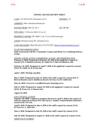
ZONING CHANGE REVIEW SHEET CASE: C14-2019-0159 (Arboretum Lot 9) DISTRICT: 10 ADDRESS: 9401 Arboretum Boulevard ZONING FROM: GR, CS, CS-1 TO: GR-MU SITE AREA: 15.20 acres (662,112 sq. ft.) PROPERTY OWNER: GF-ARB C, Ltd. % Live Oak Gottesman AGENT: Drenner Group, PC (Amanda Swor) CASE MANAGER: Sherri Sirwaitis (512-974-3057, sherri.sirwaitis@austintexas.gov) STAFF RECOMMENDATION: Staff recommends GR-MU, Community Commercial-Mixed Use Combining District, zoning. ZONING AND PLATTING COMMISSION ACTION / RECOMMENDATION: February 4, 2020: Postponed to February 18, 2020 at the applicant's request by consent (9-0, J. Kiolbassa-absent); H. Smith-1st, N. Barrera-Ramirez-2nd. February 18, 2020: Postponed to April 7, 2020 at the applicant's request by consent (10-0); H. Smith-1st, B. Evans-2nd. April 7, 2020: Meeting cancelled. May 5, 2020: Postponed to June 16, 2020 at the staff's request by consent (8-0, N. Barrera-Ramirez and J. Kiolbassa-absent); B. Evans-1st, H. Smith-2nd. June 16, 2020: Case to be re-notified because of posting error. July 21, 2020: Postponed to August 18, 2020 at the applicant's request by consent (10-0); B. Evans-1st, J. Duncan-2nd. August 18, 2020 CITY COUNCIL ACTION: February 20, 2020: A motion to postpone this item to April 9, 2020 at the request of staff was approved on Mayor Pro Tem Garza's motion, Council Member Renteria's second on an 11-0 vote. April 9, 2020: Postponed to June 4, 2020 at the staff's request by consent (11-0); K. Tovo-1st, A. Alter-2nd. June 4, 2020: Postponed to July 30, 2020 at the staff's request by consent (11-0) July 30, 2020: Postponed to August 27, 2020 at the staff's request by consent (11-0) ORDINANCE NUMBER: 1 of 35B-041 of 35 C14-2019-0159 ISSUES: There is a restrictive covenant covenant on this property,C14r-83-280 (Please see the Restrictive Covenant - Exhibit D). In the covenant,,note 2. reads,, "The area on the site that is reserved for a Conservation Area will be rezoned to an appropriate zoning category that will preclude its use for commercial or residential facilities. Then the Principal Roadway Area site plan as required by Zoning Ordinance is approved. The site of the area is approximately 30 acres,and is shown on the attached site plan attached hereto as Exhibit B."” The conservation area was zoned GR and has never been rezoned to preclude the use for commercial or residential facilities. The Environmental Officer has provided an synopsis of the issues concerning the restrictive covenant conditions and impervious cover for this property (Please see Exhibit E). In this rezoning request,,the applicant is asking to rezone a 15+ acre area that does include part of the designated conservation area. CASE MANAGER COMMENTS: The site under consideration is a 15.20 acre property located at the northwest corner of North Capital of Texas Highway and Arboretum Boulevard. The property is currently an undeveloped parcel within a retail center, adjacent to a detention pond and a parking garage. The applicant is requesting a rezoning of the property from GR, CS and CS-1 zoning to GR- MU zoning to allow for mixed use development. The staff recommends GR-MU zoning for the property in question as it meets the intent of the Community Commercial-Mixed Use Combining District. This tract of land is surrounded by commercial uses/zoning to the north, east, and west. The property fronts and takes access to an arterial roadway, Arboretum Boulevard and a state highway, North Capital of Texas Highway. Site is located on an Activity Corridor, the Arboretum Boulevard Activity Corridor, as designated in the Imagine Austin Comprehensive Plan. The applicant agrees with the staff’s recommendation. BASIS OF RECOMMENDATION: 1. The proposed zoning should be consistent with the purpose statement of the district sought. Community Commercial district is intended for office and commercial uses serving neighborhood and community needs, including both unified shopping centers and individually developed commercial sites, and typically requiring locations accessible from major traffic ways. The purpose of a mixed use (MU) combining district is to allow office, retail, commercial, and residential uses to be combined in a single development. 2. The proposed zoning should promote consistency and orderly planning. The proposed GR-MU zoning would be compatible and consistent with the adjacent uses because this tract of land is surrounded by office and commercial uses/zoning to the north, south, east, and west. The property in question is located on an Activity Corridor, the Arboretum Boulevard Activity Corridor, as designated in the Imagine Austin Comprehensive Plan. 3. The proposed zoning should allow for a reasonable use of the property. The Community Commercial district would allow for a fair and reasonable use of the site. GR zoning is appropriate for this location because of the commercial character of the area. 2 of 35B-042 of 35 The proposed Mixed Use Combining District will permit the applicant to develop a mixture of commercial and high density residential uses at this location with access to an arterial roadway and a highway. EXISTING ZONING AND LAND USES: ZONING GR, CS, CS-1 Site North GR. CS, CS-1 South ROW/Highway East West GR. CH, CS GR, CS LAND USES Undeveloped Area, Pond Office, Hotel/Motel Use (Renaissance Hotel), Arboretum at Great Hills Retail Center North Capital of Texas Highway/ Loop 360 Restaurants (Z-Tejas, Eddie V’s), Office Office, Parking Garage, Restaurant (Cheesecake Factory), Arboretum at Great Hills Retail Center NEIGHBORHOOD PLANNING AREA: N/A TIA: Not Required WATERSHED: Bull Creek SCHOOLS: Austin I.S.D. Hill Elementary School Murchison Middle School Anderson High School NEIGHBORHOOD ORGANIZATIONS: Austin Independent School District Austin Neighborhoods Council Bull Creek Foundation Bike Austin Friends of Austin Neighborhoods Great Hills VII HOA Long Canyon Homeowners Association Mountain Neighborhood Association (MNA) Neighborhood Empowerment Foundation North Oaks Neighborhood Association Northwest Austin Civic Association NW Austin Neighbors SELTEXAS Sierra Club, Austin Regional Group TNR BCP – Travis County Natural Resources 3 of 35B-043 of 35 AREA CASE HISTORIES: NUMBER REQUEST COMMISSION CITY COUNCIL GR, LO to CS-MU-V C14-2017-0028 (Great Hills Mixed Use: 9828 Great Hills Trail and 10224 Research Boulevard) 10/17/17: Approved the staff’s recommendation for CS-MU-V zoning, with TIA conditions (8-0, D. Breithaupt, Y. Flores and S. Trinh-absent); S. Lavani-1st, B. Evans-2nd. 12/14/17: Approved CS-MU-V- CO zoning on 1st reading, with a conditional overlay to prohibit the following uses: Adult-Oriented Business, Alternative Financial Services, Automotive Rentals, Automotive Repair Services, Automotive Sales Automotive Washing (of any type), Commercial Off-Street Parking, Exterminating Services, Funeral Services, Guidance Services, Pawn Shop Services, Pedicab Storage and Dispatch, Residential Treatment, Service Station, Short- Term Rental, Urban Farm, Veterinary Services, Monument Retail Sales, Vehicle Storage, Kennels, Convenience Storage, Campground, Limited Warehousing and Distribution and Drive-in service as an accessory use to Restaurants (general) and Restaurants (limited) is prohibited within 200 feet of Jollyville Road and a public restrictive covenant for the TIA conditions/ recommendations. (9-1-1, J. Flannigan-No, E. Troxclair-off the dais); A. Alter-1st, L. Pool- 2nd. 2/01/18: Ordinance No. 20180201-083 for general commercial services-mixed use- vertical mixed use building (CS- MU-V-CO) combining district zoning, with conditions was approved on Council Member Alter’s motion, Council Member Pool’s second on an 8-2 vote. Those voting aye were: Mayor 4 of 35B-044 of 35 Adler, Mayor Pro Tem Tovo, Council Members Alter, Garza, Houston, Kitchen, Pool and Renteria. Those voting nay were: Council Members Flannigan and Troxclair. Council Member Casar was off the dais. 10/16/08: Approved NBG-NP or NBG-H-NP (7-0); 1st reading 3/12/09: Approved NBG-NP or NBG-H-NP (6-0); 2nd/3rd readings 12/15/05: Approved CS-CO, with CO to limit the site to 2,000 vtpd and prohibiting Pawn Shop Services and Adult Oriented Businesses, zoning by consent (7-0); all 3 readings 11/29/01: Approved LR-CO with conditions on 1st reading (7-0) 11/29/02: Case Expired 8/30/01: Approve GO-CO with conditions (7-0); all 3 readings Add NP designation to existing zoning 9/09/08: Approved rezoning of certain tracts to NBG-NP or NBG-H-NP, with conditions (8-0) SF-2 to CS C14-2008-0182 (North Burnet /Gateway NP Rezoning: Metric Boulevard) C14-05-0182 (Cox Office Supply: 10938 Research Boulevard) C14-01-0127 LO-CO to GR GO-CO to GO- CO C14-01-0092 (Grace Covenant Church: 9310 Jollyville Road) 11/15/05: Approved staff’s recommendation for CS-CO zoning with additional conditions prohibiting Pawn Shop Services and Adult Oriented Businesses (7-0, J. Martinez, J. Gohil- absent); K. Jackson-1st, M. Hawthorne-2nd. 10/30/01: Approved LR-CO zoning with the condition of a 30-foot setback for structures from the property line along Jollyville Road (7-1, D. Castaneda-Nay, N. Spelman- absent) 7/31/01: Approved staff rec. of GO-CO, with CO to limit the property to 1) LO site development regulations, 2) limit trips to 2,000 per day, 3) limit FAR to a max of 0.15 to 1, 4) prohibit all GO uses except those permitted in the LO district, off- site accessory parking and secondary educational facilities and 5) provide landscape buffer of 50’ along southwest property line and 10’ along western and southern property line (8-0). 5 of 35B-045 of 35 RELATED CASES: C14-78-054 - Previous Zoning Case C8-78-89.01.2(85) - Subdivision Case C14r-83-280 – Site Plan Case EXISTING STREET CHARACTERISTICS: Name ROW Pavement Classification Sidewalks Bike Route Capital Research Blvd (US 183) Jollyville Road 364 ft. 340 ft. Highway 100 ft. 75 ft. Arterial Great Hills Trails 100 ft. 75 ft. Arterial No Yes Yes OTHER STAFF COMMENTS: Comprehensive Planning Metro (within ¼ mile) Yes Yes, shared lane Yes, bike lane, Yes, shared lane Yes Yes The subject tract for this zoning case is located along the Arboretum Boulevard Activity Corridor and just outside the boundaries of the North Burnet/Gateway Station Regional Center, and outside the boundaries of a small area plan. This zoning case is located on the northeast corner of Arboretum Boulevard and just north of Highway 360 (Capital of Texas Highway), on a 15.2 acre parcel that is undeveloped and also contains a large detention pond. Surrounding uses includes a hotel and a shopping center to the north; to the south is Highway 360 and office and residential uses; to the east is a shopping center and office uses; and to the west are retail and office uses. The proposed use is multifamily project. Connectivity: The property abuts Arboretum Boulevard to the west and south. The western boundary of the subject property has no public sidewalks, bike lanes or public transit stops, while the southern portion only has public sidewalks on one side of the street. Commercial and retail uses are close by but are not readily accessible by foot or bicycle because of the intermittent and incomplete public sidewalk system and the lack of bike lanes. The mobility options in the area are below average even though there are nearby neighborhood serving uses. Imagine Austin This project is located by the North Burnet/Gateway Station Regional Center to the east and abuts the Arboretum Boulevard Activity Corridor. Like many Imagine Austin Centers, this center is represented by a circle or globular shape that reflects the general location where the center should be located in the future. The center’s actual boundaries would need to be clarified through a small area planning process. Page 106 of Imagine Austin states: “(Activity) Corridors are characterized by a variety of activities and types of buildings located along the roadway — shopping, restaurants and 6 of 35B-046 of 35 cafés, parks, schools, single-family houses, apartments, public buildings, houses of worship, mixed-use buildings, and offices. Regional Centers are intended for retail, cultural, recreational, and entertainment destinations for Central Texas and are the places where the greatest density of people and jobs and the tallest buildings in the region will be located. The following Imagine Austin policies are applicable to this project: LUT P1. Align land use and transportation planning and decision-making to achieve a compact and connected city in line with the growth concept map. LUT P3. Promote development in compact centers, communities, or along corridors that are connected by roads and transit that are designed to encourage walking and bicycling, and reduce health care, housing and transportation costs. HN P10. Create complete neighborhoods across Austin that have a mix of housing types and land uses, affordable housing and transportation options, and access to schools, retail, employment, community services, and parks and recreation options. Based upon this property being situated along an Activity Corridor, which supports multifamily and mixed use; and the Imagine Austin policies referenced above that supports a variety of development that is designed to encourage walking and bicycling, this project appears to partially support the policies of Imagine Austin. Environmental The site is located over the Edwards Aquifer Recharge Zone. The site is in the Bull Creek Watershed of the Colorado River Basin, which is classified as a Water Supply Suburban Watershed by Chapter 25-8 of the City's Land Development Code. It is in the Drinking Water Protection Zone. Under the current Ordinance No. 84-0202-K regulations, development or redevelopment on this site is subject to that approved with the original zoning site plan (C14R-83-280). According to floodplain maps there is no floodplain within or adjacent to the project location. Standard landscaping and tree protection will be required in accordance with the Ordinance requirements for all development and/or redevelopment. At this time, site specific information is unavailable regarding vegetation, areas of steep slope, or other environmental features such as bluffs, springs, canyon rimrock, caves, sinkholes, and wetlands. Site Plan Site plans will be required for any new development other than single-family or duplex residential. Any development which occurs in an SF-6 or less restrictive zoning district which is located 540 feet or less from property in an SF-5 or more restrictive zoning district will be subject to compatibility development regulations. 7 of 35B-047 of 35 Any new development is subject to Subchapter E. Design Standards and Mixed Use. Additional comments will be made when the site plan is submitted. FYI: Additional design regulations will be enforced at the time a site plan is submitted. COMPATIBILITY STANDARDS The site is subject to compatibility standards due to proximity of SF-3 zoning to the south. The following standards apply: • No structure in excess of two stories or 30 feet in height may be constructed • No structure in excess of three stories or 40 feet in height may be constructed within 50 feet of the property line. within 100 feet of the property line. • For a structure more than 100 feet but not more than 300 feet from property zoned SF-5 or more restrictive, height limitation is 40 feet plus one foot for each 10 feet of distance in excess of 100 feet from the property zoned SF-5 or more restrictive. • For a structure more than 300 feet but not more than 540 feet from property zoned SF-5 or more restrictive, 60 feet plus one foot for each four feet of distance in excess of 300 feet from the property zoned SF-5 or more restrictive. • An intensive recreational use, including a swimming pool, tennis court, ball court, or playground, may not be constructed 50 feet or less from property in an SF-5 or more restrictive zoning district. SCENIC ROADWAYS This site is within the Scenic Roadway Sign District. All signs must comply with Scenic Roadway Sign District regulations. Contact Viktor Auzenne at (512) 974-2941 for more information. HILL COUNTRY ROADWAY A large portion of the site is located within 1,000 feet of Loop 360 and within a Hill Country Roadway Corridor. The site is located within the moderate intensity zone of Loop 360. The site may be developed with the following maximum floor-to-area ratio (FAR): Slope 0-15% 15-25% 25-35% Maximum FAR 0.25 0.10 0.05 Except for clearing necessary to provide utilities or site access, a 100-foot vegetative buffer will be required along Loop 360. At least 40% of the site (excluding dedicated right-of-way) must be left in a natural state. The allowable height is as follows: Within 200 feet of Loop 360 the maximum height is 28 feet, and beyond 200 feet the maximum height is 40 feet. Prior to the issuance of a building permit for the proposed use, a site plan must be approved by the Land Use Commission. 8 of 35B-048 of 35 DEMOLITION AND HISTORIC RESOURCES The applicant is responsible for requesting relocation and demolition permits once the site plan is approved. The City Historic Preservation Officer will review all proposed building demolitions and relocations prior to site plan approval. If a building meets city historic criteria, the Historic Landmark Commission may initiate a historic zoning case on the property. FYI: This site is in the Edwards Aquifer Recharge Zone and the Edwards Aquifer Recharge verification zone. Transportation The ASMP calls for 94 feet of right-of-way for ARBORETUM BLVD. Additional right-of- way dedication will be required at the time of site plan. A traffic impact analysis was not required for this case because the traffic generated by the proposed zoning does not exceed the threshold of 2,000 vehicle trips per day. The adjacent street characteristics table is provided below: Name ROW Pavement Classification Sidewalks Bicycle 90’ 65’ ASMP level 3 No 375’ Multiple lane divided TxDOT Roadway No ARBORETUM BLVD N CAPITAL OF TEXAS HWY Austin Water Utility The landowner intends to serve the site with City of Austin water and wastewater utilities. The landowner, at own expense, will be responsible for providing any water and wastewater utility improvements, offsite main extensions, utility relocations and or abandonments required by the land use. The water and wastewater utility plan must be reviewed and approved by Austin Water for compliance with City criteria and suitability for operation and maintenance. Depending on the development plans submitted, water and or wastewater service extension requests may be required. All water and wastewater construction must be inspected by the City of Austin. The landowner must pay the City inspection fee with the utility construction. The landowner must pay the tap and impact fee once the landowner makes an application for a City of Austin water and wastewater utility tap permit. Route Yes Yes Capital Metro (within ¼ mile) No No 9 of 35B-049 of 35 C14-2019-0159 INDEX OF ATTACHMENTS TO FOLLOW: A. Zoning Case Map B. Aerial Map C. Applicant's Request Letter D. Restrictive Covenant C14r-83-280 E. Environmental Officer Synopsis 10 of 35B-0410 of 35 SF-2 SF-3 LO CS GREAT HILLS TRL GR SAVINGS & LOAN SP91-0039C REAL ESTATE CS-MU-V-CO C14-2017-0028 OFFICE PARKING EXHIBIT A CENTER C14-2008-0182 NBG-NP APARTMENTS LO P79-36 83-280 D LV M B U T E R O B R A GR CS CH CS R85-155 ! ! ! ! ! 90-001 LR 78-54 LO GO R E ST. PARKING I D R E L L V Y L L O J SP-93-0077B SP93-0319C R83-280 CS-1 SP-93-0319C RETAIL RESTAURANTS GR HOTEL CS ! ! ! ! CS-1 R83-280 ! ! ! ! ! ! ! ! ! ! ! ! ! ! ! ! RETAIL (ARBORETUM) R86-185 CS-1 ! ! ! ! MOVIE THEATRE R83-280 CS RETAIL OFFICE PARKING I E C F F O ! ! ! ! ! ! ! ! ! ! ! ! ! ! ! ! ! ! ! ! ! N C A P I TA L O F T E X A S H W Y S B N C A P I TA L O F T E X A S H W Y N B JOLLYVILLE RD B N D R V S D V L B H C R A E S E R R E S E A R C H B L V D N B C14-2008-0182 NBG-NP 91-0061 R84-038 G R E A T H I L L S T O R E S E A R C S B R A M P R E S E A R C H B L V D S B R E S E A R C H B L V 78-054 D S V R D S B P82-9 LO 79-236 MF-2 4 -P L EXES MF-3 D U P L E X E S S M O O T H O A K D R 78-143 P ( ( S E X E L P U D SF-3 ( ( ( SF-3 ( ( ( ( ( ( MOUNTAIN RIDGE CIR SF-3 ( ( ( SF-3 ( ( SUBJECT TRACT ! ! ! ! ! ! PENDING CASE ZONING BOUNDARY ± ( SF-3 ( LO ( ( L U F F ( RID G ( ( E D R ( ( R81-114 MF-2-CO 91-0014 SP93-0265C 69-165 M.H. M.H. ( M.H. ( 81-170 IRON PIPES A.C. M.H. GR 76-88 GR GO OFFICE LR APARTMENTS ( ( ( ( ( SF-3 ( ( ( ( ( ( ( R B E D ( ( G RID ( WILD ( LIF C ( ( SF-3 ( ( ( V D C ( F W ( O O ( ( ( ( ( ( ( ZONING SF-3 ( ( ( ( ( ( ( ( ( ( ( ( ( ( ( ( ( T CIR ( ( S E R C ( K C O R ( ( ( SF-3 ( ( ( ( 77-72 MF-2 01-0092 C14-01-0092 GO-CO ( SP-00-2121C ZONING CASE#: C14-2019-0159 This product is for informational purposes and may not have been prepared for or be suitable for legal, engineering, or surveying purposes. It does not represent an on-the-ground survey and represents only the approximate relative location of property boundaries. 1 " = 400 ' This product has been produced by CTM for the sole purpose of geographic reference. No warranty is made by the City of Austin regarding specific accuracy or completeness. Created: 12/3/2019 11 of 35B-0411 of 35 H C R A E S E R B S D V L B NBG-NP GREAT HILLS TRL R E S E A R C H A T H I L L S G R E A T T R N N B H C R A E S E R B S D R V S D V L B R E S E A S V R C R D N H B R B E S E L V D G T R O E S B R A E T R S H A E I L M A P R L A S R C S R E T B X R S T O E A A M P C R C A P H C H B L V R D E B S N L V E B A D R S C B H H C R A E S E R P A C O T B S P M A R B S X T LO CS SF-2 SF-3 A T R E HIL L S T R L G GR CS-MU-V-CO GO J O L L Y V I L L E R D GREAT HILLS TRL LO CS-1 H33 GR J33 GR A R B O R E T U M B L V D CS CH CS CS CS-1 CS-1 CS C14-2019-0159 LR LO SF-3 ± 1'' = 400' N C A P I TA L O F TE X A S H W Y S B R I D G E M O U N T A D R I N H32 LO N CAPITAL OF TEXAS HWY NB MF-2 MF-3 P SMOOTH OAK DR SF-3 M O R U I D N C T I G R A E I N SF-3 R D E G D R D L I W I SF-3 LO B L U F F R ID CLIFF CIR W O O D G E D R SF-3 SF-3 C LIF SF-3 F W O O D C V N C A P I TA L O F T E X A S H W Y S B J32 N CAP TX SB TO RESEARC SB RAMP N C A P I T A L O F T E X A S H W Y N B JO LLY VILLE R D GR LR GO GR MF-2 GO-CO MF-2-CO T S E R C CIR K C O R SF-3 SUBJECT TRACT ZONING BOUNDARY ! ! ! ! ! ! PENDING CASE CREEK BUFFER Arboretum Lot 9 ZONING CASE#: LOCATION: SUBJECT AREA: GRID: MANAGER: C14-2019-0159 9401 Arboretum Blvd 15.2 ACRES H32 Sherri Sirwaitis This map has been produced by the Communications Technology Management Dept. on behalf of the Planning Development Review Dept. for the sole purpose of geographic reference. No warranty is made by the City of Austin regarding specific accuracy or completeness. 12 of 35B-0412 of 35 EXHIBIT B H C R A E S E R B S D V L B NBG-NP GREAT HILLS TRL R E S E A R C H A T H I L L S G R E A T T R N N B H C R A E S E R B S D R V S D V L B R E S E A S V R C R D N H B R B E S E L V D G T R O E S B R A E T R S H A E I L M A P R L A S R C S R E T B X R S T O E A A M P C R C A P H C H B L V R D E B S N L V E B A D R S C B H H C R A E S E R P A C O T B S P M A R B S X T VILLE R D GR LR GO GR LO CS SF-2 SF-3 A T R E HIL L S T R L G GR CS-MU-V-CO GO J O L L Y V I L L E R D GREAT HILLS TRL LO CS-1 H33 GR J33 GR A R B O R E T U M B L V D CS CH CS CS CS-1 CS-1 CS C14-2019-0159 LR LO SF-3 ± 1'' = 400' N C A P I TA L O F T E X A S H W Y S B J32 N CAP TX SB TO RESEARC SB RAMP N C A P I T A L O F T E X A S H W Y N B JO LLY N C A P I TA L O F TE X A S H W Y S B R I D G E M O U N T A D R I N H32 LO N CAPITAL OF TEXAS HWY NB MF-2 MF-3 P SMOOTH OAK DR SF-3 M O R U I D N C T I G R A E I N SF-3 R D E G D R D L I W I SF-3 LO B L U F F R ID CLIFF CIR W O O D G E D R SF-3 SF-3 C LIF SF-3 F W O O D C V MF-2-CO T S E R C CIR K C O R SUBJECT TRACT ZONING BOUNDARY ! ! ! ! ! ! PENDING CASE CREEK BUFFER Arboretum Lot 9 ZONING CASE#: LOCATION: SUBJECT AREA: GRID: MANAGER: C14-2019-0159 9401 Arboretum Blvd 15.2 ACRES H32 Sherri Sirwaitis This map has been produced by the Communications Technology Management Dept. on behalf of the Planning Development Review Dept. for the sole purpose of geographic reference. No warranty is made by the City of Austin regarding specific accuracy or completeness. MF-2 GO-CO SF-3 Copyright nearmap 2015 13 of 35B-0413 of 35 EXHIBIT C 14 of 35B-0414 of 35 15 of 35B-0415 of 35 EXHIBIT D 16 of 35B-0416 of 35 17 of 35B-0417 of 35 18 of 35B-0418 of 35 19 of 35B-0419 of 35 20 of 35B-0420 of 35 21 of 35B-0421 of 35 22 of 35B-0422 of 35 23 of 35B-0423 of 35 24 of 35B-0424 of 35 25 of 35B-0425 of 35 26 of 35B-0426 of 35 27 of 35B-0427 of 35 28 of 35B-0428 of 35 29 of 35B-0429 of 35 30 of 35B-0430 of 35 31 of 35B-0431 of 35 32 of 35B-0432 of 35 33 of 35B-0433 of 35 EXHIBIT E Project Name: Arboretum Lot 9 Case Number: C14-2019-0159 Applicant is requesting that Lot 9 (15.2 acres) be rezoned from GR, CS, and CS-1 to GR-MU. Issue #1-Conservation area of 30 acres. 1. The restrictive covenant C14r-83-280, note 2. reads, “The area on the site that is reserved for a Conservation Area will be rezoned to an appropriate zoning category that will preclude its use for commercial or residential facilities, when the Principal Roadway Area site plan as required by Zoning Ordinance is approved. The site of the area is approximately 30 acres, and is shown on the attached site plan attached hereto as Exhibit B.” 2. The requirements outlined in #1 above were never realized and are outstanding at this time. 3. The applicant has sent an exhibit with possible areas that add up to 30+ acres. The problem is that some of the areas shown are on existing commercial lots, disturbed by current uses, have water quality ponds, or satellite dishes. There is a requirement in the RC to rezone the conservation areas, how would this work on existing commercial lot? Are you proposing to re-plat the adjacent lots and then rezone conservation lot per RC requirements? Issue #2-Impervious Cover 1. Note # 8 on site plan sheet 13 states that this project is subject to a maximum of 50% unless more is allowed under the LA ordinance 80-0103-N. 2. The impervious cover table states that the development is currently at 50.75% GSA, putting the existing development over the impervious cover limit by .75% or 32,670sf. 3. The impervious cover for the site was based on gross site area and therefore the slopes do not come into play in determining the impervious cover unless the project seeks to get more impervious cover based on the LA ordinance. 4. The ordinance as we read it would only allow a maximum of 24.471 acres. 30% allowed on slopes 0-15% = 65.73 x .30 = 19.719 ac 20% allowed on slopes 15-25% = 18.03 x .20 = 3.606 ac 10% allowed on slopes 25-35% = 11.46 x .10 = 1.146 ac 34 of 35B-0434 of 35 Total = 24.471 acres (higher slope areas can be transferred to lower as long as 0-15 does not go over 80%) But this site is already over the allowable impervious cover per the LA ordinance. We do not see a way to increase impervious cover, previous corrections have reinforced this idea since impervious cover has been removed in minute increments on this site plan to increase development on other lots. 35 of 35B-0435 of 35