B-01 (C14-2019-0129 - 10801 Wayne Riddell Loop; District 5) — original pdf
Backup
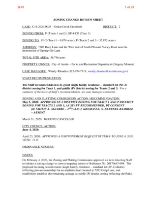
ZONING CHANGE REVIEW SHEET CASE: C14-2020-0025 – Onion Creek Greenbelt DISTRICT: 2 ZONING FROM: P (Tracts 1 and 2); SF-4-CO (Tract 3) ZONING TO: SF-2 (Tract 1 – 0.874 acres); P (Tracts 2 and 3 – 35.872 acres) ADDRESS: 7203 Deep Lane and the West side of South Pleasant Valley Road near the intersection of Springville Lane TOTAL SITE AREA: 36.746 acres PROPERTY OWNER: City of Austin – Parks and Recreation Department (Gregory Montes) CASE MANAGER: Wendy Rhoades (512-974-7719, wendy.rhoades@austintexas.gov) STAFF RECOMMENDATION: The Staff recommendation is to grant single family residence – standard lot (SF-2) district zoning for Tract 1, and public (P) district zoning for Tracts 2 and 3. For a summary of the basis of Staff’s recommendation, see case manager comments. ZONING AND PLATTING COMMISSION ACTION / RECOMMENDATION: May 5, 2020: APPROVED SF-2 DISTRICT ZONING FOR TRACT 1 AND P DISTRICT ZONING FOR TRACTS 2 AND 3, AS STAFF RECOMMENDED, BY CONSENT [H. SMITH; A. AGUIRRE – 2ND] (8-0) J. KIOLBASSA, N. BARRERA-RAMIREZ – ABSENT March 31, 2020: MEETING CANCELLED CITY COUNCIL ACTION: June 4, 2020: ORDINANCE NUMBER: ISSUES: April 23, 2020: APPROVED A POSTPONEMENT REQUEST BY STAFF TO JUNE 4, 2020. VOTE: 11-0. On February 4, 2020, the Zoning and Platting Commission approved an item directing Staff to initiate a zoning change to correct mapping errors in Ordinance No. 20170615-094. The proposed rezoning would restore single family residence – standard lot (SF-2) district reflecting private ownership for an unplatted tract located at 7203 Deep Lane, and establish/re-establish the remaining acreage as public (P) district zoning reflecting the Parks B-011 of 23 C14-2020-0025 Page 2 and Recreation Department’s (PARD) ownership. Please refer to Exhibit B – Staff memo to ZAP and background material. CASE MANAGER COMMENTS: The subject rezoning area consists of undeveloped land, including an unplatted tract previously zoned for single family residence use, and the remainder known as the Onion Creek Greenbelt. The majority of the property has P, public district zoning and a triangular area on the north side has single family residence – small lot – conditional overlay (SF-4A- CO) combining district zoning by a 2000-01 case. Onion Creek flows through the property which is surrounded by single family residences, undeveloped land and a church to the north (SF-4A-CO; SF-6; SF-2), undeveloped land to the east (MH; SF-2; SF-3), single family residences to the south and west (SF-2, SF-3). Please refer to Exhibits A (Zoning Map) and A-1 (Aerial View). BASIS OF RECOMMENDATION (LAND USE CRITERIA): 1. The proposed zoning should be consistent with the purpose statement of the district sought. Tract 1: The single family residence standard lot (SF-2) district is intended for a moderate density single-family residential use on a lot that is a minimum of 5,750 square feet. This district is appropriate for existing single-family neighborhoods having moderate sized lots or to new development of single-family housing areas with minimum land requirements. Tracts 2 and 3: P, Public district zoning is intended to accommodate uses of a governmental, civic, public service, or public institutional nature, including major public facilities. This district is intended for properties, used, reserved, or intended to be used for a civic or public institutional purpose or for major public facilities. 2. The proposed zoning should be consistent with the goals and objectives of the City Council. For Tract 1, Staff recommends restoring SF-2 zoning to the property at 7203 Deep Lane, thereby reflecting its intent for single family residence use. For Tracts 2 and 3, Staff recommends P zoning, given: 1) P zoning is consistent with its greenbelt use and facilitates development of a portion of the property with trails, 2) parkland is considered a civic use, and the project will comply with City of Austin development regulations, 3) it is City Council’s general policy that all City owned or leased land be zoned public (P) district, and 4) the subject property as well as the Onion Creek Metro Park – Greenbelt and additional property across South Pleasant Valley Road to the east known as the Lower Onion Creek Flood Mitigation Project Area are proposed for recreational amenity improvements. B-012 of 23 C14-2020-0025 Page 3 EXISTING ZONING AND LAND USES: Site North ZONING P; SF-4A-CO SF-4A-CO; PUD; SF-3 South SF-2; SF-3 East West P SF-2 LAND USES Undeveloped; Greenbelt Single family residences within the Meadow Lake subdivision; Attached single family residences in the Greenslopes Phase 1 Subdivision (PUD); Religious assembly Single family residences in the Silverstone Phase 1 subdivision Onion Creek Metro Park – Greenbelt Single family residences in the Silverstone Phase 2 subdivision NEIGHBORHOOD PLANNING AREA: Not Applicable TIA: Is not required WATERSHED: Slaughter Creek – Suburban CAPITOL VIEW CORRIDOR: No SCENIC ROADWAY: No SCHOOLS: This property is within the Austin Independent School District. Perez Elementary School Paredes Middle School Akins High School NEIGHBORHOOD ORGANIZATIONS: 511 – Austin Neighborhoods Council 742 – Austin Independent School District 951 – Indian Hills / Langford Elementary Neighborhood Association 1258 – Del Valle Community Coalition 1289 – Onion Creek Park Neighborhood Alliance 1408 – Go Austin/Vamos Austin (GAVA) – Dove Springs 1431 – Indian Hills Neighborhood Watch 1441 – Dove Springs Proud 1528 – Bike Austin 1550 – Homeless Neighborhood Association 1616 – Neighborhood Empowerment Foundation 627 – Onion Creek Homeowners Association 1228 – Sierra Club, Austin Regional Group 1363 – SEL Texas 1530 – Friends of Austin Neighborhoods AREA CASE HISTORIES: NUMBER C14-00-2199.SH – Meadowlake Subdivision – Stoneleigh Pl south of Blue Meadow Dr C14-99-2090 – REQUEST SF-4A-CO to SF-4A-CO, to change a condition of zoning I-RR to SF-4A COMMISSION To Grant SF-4A-CO w/CO for 235 residential units CITY COUNCIL Apvd SF-4A-CO as Commission recommended (1-18-2001). To Grant SF-4A-CO Apvd SF-4A-CO B-013 of 23 C14-2020-0025 Page 4 Ritchie 35 Acres – Stoneleigh Pl south of Blue Meadow Dr w/CO for 2,000 trips/day (3-23-2000). RELATED CASES: On June 15, 2017, Council approved P zoning for City-owned property comprising the Onion Creek Greenbelt to P, Public district zoning. The rezoning area mistakenly changed the zoning of an adjacent privately-owned unplatted tract (C14-2017-0043). There are no site plan applications approved or in process on the subject property. Council also approved P zoning for a 575 acre tract east of South Pleasant Valley Road and southwest of East William Cannon Drive on June 15, 2017 (C14-2017-0044 – Onion Creek Metro Park - Greenbelt). ADJACENT STREET CHARACTERISTICS: Name Pavement Classification Sidewalks ROW Bike Facility Capital Metro Yes (within ¼ mile) No Yes Yes Yes None None None 65 feet 50 feet 74 feet 55 feet 42 feet 30 feet Arterial, Divided Yes; shared lane Level 1 (Local) Level 1 Deep Lane Meadow Lake Boulevard South Pleasant Valley Road OTHER STAFF COMMENTS: Comprehensive Planning The original rezoning case was initiated by the City of Austin and approved in the spring of 2017 for the creation of the Onion Creek Greenbelt by rezoning numerous parcels. This case concerns a corrective action initiated by staff to rezone two parcels from P to SF-2 and from SF-4A-CO to P because the original zoning map inadvertently included a privately owned property on Deep Lane, which was zoned to ‘P’, (a public district); and did not include a parcel at the terminus of Deep Lane. Imagine Austin These two parcels are not located within an Activity Center or along an Activity Corridor. However, sustainability is the basis of the Imagine Austin vision statement and dozens of policies and actions developed through the input of thousands of community members. These policies and actions express six core principles for action to make our imagined Austin a reality, and one in particular appears to support this project: 2.) Integrate nature into the city. A beautiful, world-class system of outdoor places for recreation and environmental B-014 of 23 C14-2020-0025 Page 5 protection will define Austin as a world-class city. We need to develop our natural assets into a network of connected greenways and waterways. By strengthening our "green infrastructure" - parks, the urban forest, trails and greenbelts, rivers, creeks, lakes, gardens, urban agriculture, open spaces, and wildlife habitat - Austin can protect the natural environment and enhance recreational opportunities. The following Imagine Austin policies are also applicable to this case: • LUT P23. Integrate citywide and regional green infrastructure, to including such elements as preserves and parks, trails, stream corridors, green streets, greenways, agricultural lands, and the trail system, into the urban environment and the transportation network. • CFS P42. Increase connectivity between neighborhoods and from neighborhoods to parks and greenways through the use of sidewalks, bicycle lanes, multi-use paths, and trails • CFS P47. Extend existing trail and greenway projects to create an interconnected green infrastructure network that includes such elements as preserves and parks, trails, stream corridors, green streets, greenways, agricultural lands linking all parts of Austin and connecting Austin to nearby cities. Based on the Imagine Austin policies and text above, which supports the expansion of parks, trails, greenways, and the need to correct an administrative rezoning error, this case supports the Imagine Austin Comprehensive Plan. B-015 of 23 C14-2020-0025 Page 6 B-016 of 23 C14-2020-0025 Page 7 60% % of Gross Site Area % of Gross Site Area with Transfers 50% Drainage The developer is required to submit a pre- and post-development drainage analysis at the subdivision and site plan stage of the development process. The City’s Land Development Code and Drainage Criteria Manual require that the Applicant demonstrate through engineering analysis that the proposed development will have no identifiable adverse impact on surrounding properties. Environmental The site is not located over the Edwards Aquifer Recharge Zone. The site is in the Slaughter Creek Watershed of the Colorado River Basin, which is classified as a Suburban Watershed by Chapter 25-8 of the City's Land Development Code. The site is in the Desired Development Zone. Under current watershed regulations, development or redevelopment on this site will be subject to the following impervious cover limits: Development Classification Single-Family (minimum lot size 5750 sq. ft.) Other Single-Family or Duplex 55% 60% Multifamily Commercial 80% According to floodplain maps there is a floodplain within or adjacent to the project location. Based upon the location of the floodplain, offsite drainage should be calculated to determine whether a Critical Water Quality Zone exists within the project location. Standard landscaping and tree protection will be required in accordance with LDC 25-2 and 25-8 for all development and/or redevelopment. At this time, site specific information is unavailable regarding vegetation, areas of steep slope, or other environmental features such as bluffs, springs, canyon rimrock, caves, sinkholes, and wetlands. Under current watershed regulations, development or redevelopment requires water quality control with increased capture volume and control of the 2 year storm on site. At this time, no information has been provided as to whether this property has any preexisting approvals that preempt current water quality or Code requirements. Impervious Cover The maximum impervious cover allowed by the P zoning district is established by a conditional use site plan. 60% 70% 90% B-017 of 23 C14-2020-0025 Page 8 Site Plan and Compatibility Standards This site is subject to the Hazardous Pipeline Ordinance. Review by the Fire Department is required [LDC, 25-2-516]. Development in a restricted pipeline area is regulated by Sec. 25-2-516. At the time of site plan, please identify the actual location of the pipeline itself. Before a person may place a road, surface parking lot, or utility line in a restricted pipeline area, the person must deliver to the Director a certification by a registered engineer stating that the proposed construction activity and structure are designed to prevent disturbing the pipeline or impeding its operation [LDC, 25-2-516(D)(2)]. Transportation A traffic impact analysis was not required for this case because the traffic generated by the proposed zoning does not exceed the threshold of 2,000 vehicle trips per day [LDC 25-6- 113]. In addition, the site is for a City-owned project. A neighborhood traffic analysis was not required for this case because the site is for a City- owned project. Austin Water Utility No comments. INDEX OF EXHIBITS TO FOLLOW A: Zoning Map A-1: Aerial Map B: Staff memo to ZAP and background material B-018 of 23 = = ( ( SF-3 = ( D CIR = = = = N A L Y H = ( = = = SF-3 = = ( ( ( ( SF-4A-CO ( ( ( ( = ( = P LN E E D MAGIN MEADO ( ( ( ( SF-3 ( ( ( = = = = = ( = = = R R D E G N A R G ( = = P CIR E E D = = = = SF-3 = = = = ( ( G LA D = = = ( ( ( ( E LIN E D R = SF-3 = = = = = BL U E M ( ( ( ( ( SF-3 ( ( ( ( ( ( ( B U C K S R U N ( ( SF-3 ( ( ( ( ( ( ( ( ( ( ( ( ( ( ( 00-2199SH W DR SF-4A-CO E A D O W D R SF-4A-CO = = = = ( ( ( ( ( ( ( ( SF-3 ( ( ( ( ( ( ( SF-3 ( ( ( ( SF-3 ( ( ( ( V G C R U O B AVALON AVE ( ( ( ( R U E L E F L E U R L A K E B L V D M E A D O W T O U R N U S T R L SF-3 SF-3 F O N T E N A Y D R Y U C C A HILL D R SF-3 E CT LOIR L A M B S L N P O O T L S O D P L O N Y L L E V O L MISTY SLOPE LN PUD T H A N N A S W A Y ! ! ! ! ! ! ! ! ! ! ! ! ! ! ! ! ! TRACT 3 ! ! ! ! ! ! ! ! ! ! ! ! ! ! ! ! ! ! ! ! ! ! ! ! ! ! ! ! ! ! ! ! ! ! ! ! ! ! ! ! ! UNDEV SF-6 TRACT 2 ! ( ! ! ! ( ( SF-2 ! ! ( ( ! ( ! ( ! ( ( ( ( BORAGE DR ( SF-2 ( ( ( ! ! ( ( ! ! ( ( ! ! ( ( ( ( ( ( ! ! ! ! ! ! ! ! ! ! ! ! ! ! ! ! ! ! ! ! ! ( ! ! ! ! ! ! SF-2 ! ! ! ! ! ! 99-2090 SF-4A-CO TRACT 1 ( ( ( ( SF-2 ( LENDALL LN ( ( SF-2 ( N L P E E D PATSY PKWY ( ! ! ! ! ! ! ! ! ! ! SF-4A-CO ! ! ! ! ! ! ! ! ! ! ! ! ! ! ! ! ! ! ! ! ! ! ! ! ! ! ! ( ! ! ! ( ( ( ( ! ! ! SF-2 ! ! ( ( ( ( ! ! ! ! ! ! ! ! ! ! ! ! ! ! ! ( ! ! ! ! ! ! ( ( ( ( ( ( ! ! ! ( ( ! ( ! ( ( ( ( ( ( ( SF-2 S I L V E R S ( T O N ( E D R Q U I C K S I L V E R C I R SF-2 T E N O A K S C I R SF-2 C L I F F R I D G E R D ! ! ! ! ! ! ! ! ! ! ! ! ! P C14-2017-0043 ! ! ! ! ! ! ! ! ! ! ! ! ! ! ( MH ! ! ! ( ( ( ( ( MH ( MH ( C14-2017-0091 ( MH C14-2017-0091 MH P MH ! D Y R ! ! T VALLE P ( ! ! ! N A S A E L S P ( ( ! ! ! ! ! ! ! SP RIN G VILLE LN QUICKSILVER BLVD ! ! SF-3 ! ! ! ! ! ! ! ! P C14-2017-0091 SF-2 SF-3 S A G U A R O R D SF-2 MH-CO V I L L A G E C R E E K C I R MH-CO MH-CO T K C O O R B N E D HID SUBJECT TRACT ! ! ! ! ! ! PENDING CASE ZONING BOUNDARY K C I R Y O A L H O L MH-CO P C14-2017-0044 ± SF-2 L R L T A E T SAVOREY LN SF-2 R H D S U B N O T T U B SF-2 R LLA D E N A C SF-2 P C14-2017-0091 R G D SIN S O R N C NIO O SF-3 P C14-2017-0044 SP-05-1275CX E D G E C R E E K D R P C14-2017-0044 SF-3 ZONING Exhibit A ZONING CASE#: C14-2020-0025 P C14-2017-0091 P C14-2017-0091 R N D NIO D O WIL SF-3 T G S U B Y D LA P C14-2017-0091 SF-3 This product is for informational purposes and may not have been prepared for or be suitable for legal, engineering, or surveying purposes. It does not represent an on-the-ground survey and represents only the approximate relative location of property boundaries. 1 " = 400 ' This product has been produced by CTM for the sole purpose of geographic reference. No warranty is made by the City of Austin regarding specific accuracy or completeness. Created: 3/4/2020 B-019 of 23 20 22 21 SF-2 24 23 N L P E E D 27 26 25 17 SF-2 LENDALL 25 LN 26 SF-2 1 29 28 SF-2 70 1 2 3 4 5 21 17 16 3 4 S I L 18 V E 15 14 13 R S T 19 17 O 12 N E 16 SF-2 D 11 R 5 10 9 6 QUICK SILVER 16 BLVD 20 19 17 18 1 23 22 21 20 21 19 18 24 23 D N A CIR L Y H 22 30 31 37 36 35 34 33 29 38 39 3 2 51 R E G N R A D R G 17 16 18 4 5 40 SF-3 42 50 49 48 19 12 11 G 28 15 13 14 20 27 LA M BS LN 11 10 12 21 22 23 P CIR E E D 43 44 45 18 SF-3 22 SF-4A-CO 4 5 6 23 24 25 3 2 1 18 27 26 33A 34A 44 43 42 15 16 24 25 23 22 37A 36A 40 39 38 TRACT 1 41 37 36 79 19 20 19 18 17 21 20 SF-4A-CO 14 45A THANNAS W 42A 35 34 32 33 31 SF-3 26 25 E D 5 4 R 3 SF-3 5 4 3 2 1 2 1 47 46 11 LA 8 D 24 E LIN 7 6 10 10 13 9 12 11 17 16 20 21 14 13 12 23 24 22 13 16 M BLU E E A D 10 M A 8 25 27 GIN M 11 47A E 9 28 7 6 29 30 O W D 5 4 31 32 A D O R 1 33 34 12 49A 8 7 51A AY 30 29 26A 28 27A 6 5 53A 54A 4 W D 3 2 1 R 56A 24A 55A 57A 25A 23A 20 21A 11A 22A 15 16 17 18 19A 8 9 6 7 12 13 10 TRACT 3 14 7 8 6 11 14 12 13 15 16 17 B U K C 8 S R 9 11 18 19 7 U N 6 5 27 28 29 4 3 30 12 13 14 H15 7 10 9 SF-3 20 21 22 23 2 1 29 15 16 17 30 31 SF-3 18 19 6 5 4 20 24 3 2 1 M E A D O W L A K E B L V D 40 41 42 T O U R N U S T R L 35 34 39 38 37 36 U C Y HIL L D 1 3 4 C A R 6 2 8 7 N Y L 1 L 4 E V 1 O 2 1 L 2 3 6 5 6 1 4 3 2 1 SF-3 32 31 30 6 5 8 1 2 3 1 3 8 O L D P O S T L O O P 1 1 3 4 MISTY SLOPE LN 8 7 11 1 32 23 22 21 11 13 14 15 16 17 19 18 L 33 E R F U 21 22 34 35 L E E U R 23 22 21 20 1 35 2 3 4 36 37 34 33 27 5 6 7 26 25 32 31 28 1 2 3 J15 SF-3 2 3 8 9 7 6 10 11 12 5 16 4 SF-3 18 13 19 FONTENAY DR 8 15 14 9 13 12 17 14 15 16 10 11 SF-3 19 30 29 LOIR 23 E CT 24 22 18 21 20 L A M B S L N 15 16 17 19 18 20 24 26 25 23 21 22 28 27 SF-4A-CO TRACT 2 P C14-2020-0025 M E A D O W L A K E B L V D 4 3 7 8 PUD O A 11 12 11 9 K S T E N 12 C I R 3 6 5 2 1 1 4 3 1 CLIFFRIDGE RD 1 2 10 2 3 4 5 7 8 12 2 3 8 9 H14 SF-6 1 6 7 8 9 22 23 24 25 10 9 26 27 8 SF-2 15 14 11 12 13 17 18 19 13 12 10 11 BORAGE DR 14 16 15 29 5 30 31 4 28 7 6 32 33 34 3 2 1 20 21 25 24 22 23 15 14 SF-2 3 2 13 12 10 9 11 5 6 7 8 4 S A G U A R O R D 10 9 8 12 11 SF-2 MH-CO MH-CO C V R I L E L E A K G C E I R T N E D HID K C O O R B SF-2 2 3 6 5 4 14 5 6 7 11 12 13 9 8 10 SF-2 4 3 22 23 21 20 18 19 16 15 17 2 1 7 6 5 4 3 2 17 18 20 21 22 16 14 15 19 11 10 13 12 SF-2 9 8 7 6 1 L A E T 9 8 10 L R T SAVOREY LN EDGE CREEK DR SF-2 7 P SF-3 8 9 10 11 12 CANELLA DR 1 2 3 13 11 12 4 5 SF-3 9 10 6 7 24 23 3 4 5 1 8 2 1 13 QUICKSILVER BLVD R H D S U B N O 10 T 9 T U 8 B 12 SF-2 5 9 8 7 3 4 10 2 6 7 4 3 2 1 6 5 4 2 1 3 2 13 14 15 16 17 1 1A 19 18 20 4A 5A 2A 3A 3 4 9 11 P 8 5 6 7 R G D SIN S O 13 R N C NIO O 19 15 17 P 18 20 21 6A 7A 8A 9 10 11 12 13 9A 10A 11A 12A 11 2 12 13 14 SPRINGVILLE LN 1 15 3 5 7 8 10 12 2 4 6 R N D NIO WILD O 5 4 6 P 8 7 1 2 3 4 5 2 3 6 7 11 10 9 T G S U B Y D LA 9 10 11 14 16 8 9 10 22 24 SF-3 19 14A 18 17 23 25 27 SF-3 4 26 5 12 11 13 SF-3 16 15 30 12 Copyright nearmap 2015 13 24 SF-3 13 P Onion Creek Greenbelt Exhibit A - 1 SUBJECT TRACT ZONING BOUNDARY ! ! ! ! ! ! PENDING CASE CREEK BUFFER ZONING CASE#: LOCATION: SUBJECT AREA: GRID: MANAGER: C14-2020-0025 7201 DEEP LN. 35.872 Acres H14 WENDY RHOADES This map has been produced by the Communications Technology Management Dept. on behalf of the Planning Development Review Dept. for the sole purpose of geographic reference. No warranty is made by the City of Austin regarding specific accuracy or completeness. V I L L C H A T E A U A G E W A Y ± 1'' = 400' 1A SF-2 2A J14 1 1 26 3 4 3 2 P 23 3 4 D Y R E L L A T V N A S A E L S P 19 17 20 18 P 21 8 16 9 25 24 23 22 5 6 7 1 15 14 10 11 13 12 2 1 10 B-0110 of 23 ************************************************************************ MEMORANDUM TO: Ms. Jolene Kiolbassa, Chair Members of the Zoning and Platting Commission FROM: Wendy Rhoades, Principal Planner, Zoning Case Management Planning and Zoning Department DATE: February 12, 2020 RE: Request initiation of a zoning change for the property located at the west side of South Pleasant Valley Road near the intersection of Springville Lane ************************************************************************ The item under discussion is a request to consider directing Staff to initiate a rezoning case from P to SF-2, and from SF-4A-CO to P, associated with C14-2017-0043 – Onion Creek Greenbelt. The rezoning case would correct mapping errors in Ordinance No. 20170615-094 for the property located at the west side of South Pleasant Valley Road near the intersection of Springville Lane. In March 2017, a rezoning case was initiated by Council and filed by the Parks and Recreation Department requesting public (P) district zoning consistent with its greenbelt use and to facilitate development of a portion of the property with trails. The rezoning application included an accurate metes and bounds description, however, the rezoning map inadvertently included 7203 Deep Lane and rezoned this privately owned SF-2 zoned property to the P, Public district. In addition, the map did not include a SF-4A-CO zoned triangular area at the terminus of Deep Lane and extending east to unbuilt Meadow Lake Boulevard right-of-way that is also under the stewardship of PARD. In late-January 2020, the owner of 7203 Deep Lane inquired with Staff about the P district zoning assigned to her property. In response, Staff re-mapped the 2017 metes and bounds description and concluded that it correctly captured the City-owned property, but incorrectly mapped 7203 Deep Lane to the P district. The zoning map also incorrectly Exhibit B B-0111 of 23 excluded the SF-4A-CO zoned triangular area. A City-initiated rezoning application would correct both errors. Attachments: Illustration of Proposed Mapping Errors to be Corrected 2017 Rezoning Ordinance B-0112 of 23 ( ( ( ( (( (( ( LA ( ( M B ( ( S L N ( ( ( ( ( ( ( ( ( ( ( ( SF-3 ( ( F ( ( ( ( ( ( ( ( ( SF-3 ( (( ( ( ( SF-3 AVALO (( ( ( N AVE ( ( O N T E N A Y D R E CT LOIR SF-3 SF-3 SF-3 ( ( A D O W L M E L V D E B A K T O U R N U S T R L Y U C C A HILL D R SF-3 E T R L G R ID MISTY SLOPE LN B K R A B PUD C L I F F R I D G E R D SF-6 = = ( SF-3 ( = = = ( == = D CIR = = = = = ( ( ( Proposed Rezoning: = = = = = = = = P CIR N A L Y From SF-4A to P H = = = = = = SF-3 = From P to SF-2 ( ( = ( ( ( SF-4A-CO ( ( ( = = E E D = ( = = = = = = = SF-3 = = ( R R D ( E G N A R = G = = ( G LA = = = = = ( ( ( 00-2199SH MAGIN MEAD SF-4A-CO BL U O W D R E M E A D O W D R THANNAS W SF-4A-CO AY ( ( ( ( ( SF-3 ((( ( ( ( ( ( ( ( ( SF-3 ( ( ( ( ( B U C K ( ( D ( SF-3 ( ( ( ( ( E LIN = E D = = = = SF-3 R ( ( = = SF-4A-CO = S R ( ( U N ( ( ( ( ( ( SF-4A-CO ( ( ( ( (( SF-2 ( ( ( ( ( ( SF-2 ( ( ( ( ( ( N L P E E D ( ( ( ( ( ( SF-2 ( ( ( ( ( ( ( ( ( ( ( ( ( ( ( ( ( ( S I L ( R V E ( ( ( ( S T O N SF-2 E D R C14-2017-0043 UNDEV ( ( ( (( ( ( BORAGE DR ( ( ( ( ( SF-2 ( ( ( ( ( ( ( ( (( ( ( QUICKSILVER BLVD SF-3 SF-2 SF-2 MH-CO SF-2 SF-3 SF-2 SAVOREY LN R H D S U B N O T T U B SF-2 R A D L L E N A C SF-2 SF-2 ED GE C REEK D R MH-CO C14-2017-0044 P ZONING Zoning Case: C14-2017-0043 MH-CO MH-CO C14-2017-0044 ± SUBJECT TRACT ! ! ! ! ! ! PENDING CASE ZONING BOUNDARY This product is for informational purposes and may not have been prepared for or be suitable for legal, engineering, or surveying purposes. It does not represent an on-the-ground survey and represents only the approximate relative location of property boundaries. 1 " = 417 ' This product has been produced by CTM for the sole purpose of geographic reference. No warranty is made by the City of Austin regarding specific accuracy or completeness. ( ( MH ( ( ( MH MH MH D Y R ( E L ( L A ( T V ( N A ( S A ( E L ( S P MH SF-2 SPRIN SF-3 GVILLE LN SF-3 R G D SIN S O R N C NIO O SF-3 R N D NIO D O WIL SF-3 T G S U B Y D A L SF-3 B-0113 of 23 ORDINANCE NO. 20170615-094 AN ORDINANCE REZONING AND CHANGING THE ZONING MAP FOR THE PROPERTY LOCATED AT THE WEST SIDE OF SOUTH PLEASANT VALLEY ROAD NEAR THE INTERSECTION OF SPRINGVILLE LANE FROM SINGLE- FAMILY RESIDENCE STANDARD LOT (SF-2) DISTRICT TO PUBLIC (P) DISTRICT. BE IT ORDAINED BY THE CITY COUNCIL OF THE CITY OF AUSTIN: PART I. The zoning map established by Section 25-2-191 of the City Code is amended to change the base district from single-family residence standard lot (SF-2) district to public (P) district on the property described in Zoning Case No. CI4-2017-0043, on file at the Planning and Zoning Department, as follows: Being all that certain tract or parcel of land out of and a part of the Santiago Del Valle Grant, situated in Travis County, Texas, more particularly described as being out of and a part of that certain tract of land conveyed to Gaston Development Company of record in Volume 8236, Page 613, Travis County, Texas, Deed Records, said tract being 24.694 acres of land, and; Being all that certain tract or parcel of land out of and part of the Santiago Del Valle Grant, situated in Travis County, Texas, more particularly described as being of and a part of that certain tract of land conveyed to Gaston Development Company of record in Volume 8236, Page 613, Travis County, Texas, Deed Records, said tract being 11.178 acres of land, both 24.694 and 11.178 acres being more particularly described by metes and bounds in Exhibit "A" incorporated into this ordinance (the "Property"), locally known as the west side of South Pleasant Valley Road near the intersection of Springville Lane in the City of Austin, Travis County, Texas, generally identified in the map attached as Exhibit "B". Page I of 2 B-0114 of 23 PART 2. This ordinance takes effect on June 26, 2017 PASSED AND APPROVED June 15 ., 2017 APPROVED: ATTES Anne L. Morgan City Attorney Jannette S. Goodall City Clerk Page 2 of 2 B-0115 of 23 LI J IF.I.WC ALL TlUt CEkTAIV TWCT OR FftPCfl. tir L^^J^ Ol'T A-jp A PART OF H IE K A N T I « ;O OEL i'M.i.E LPAVT. IM TOAVIS CQUM\, TEXAS, KORt P A B T I C I L A J LV DESCFIEED AS ECINC OUT A.>.D A F A 'T Or THAI CEKTAIH TPACt Or tA.'Ja cosvuYED ro CASTON nEVELornCKT to.fp.u:!- OF R£eo:t) :H VOLLUE B i : t, tECORDS. SAID TIUACT SEIKO 24.69* ACRES OF L/^'l'J r.^Ki. PACE 6 1 J, T R A V IS CCL'^TY, TEXAS, i i i U A i tn r em PARTICULAALT FOLLtWS: DESCRIBEO BV HETES A'.D SOUhSS AS i hi " o it n a t t h e r ly J p o i nt In FKASl ONF aCCCVNlKC It a SILVEBSTONE, m b d l u n l on o£ In F l »t Rook 76, Pagpn 331 nnJ 381, T r i a ti County, T » m, Flat Hucord«, Ccoa v hl Ch trncc h r a tt S t ^• 71'S3'fcS" E. 1 J 9 . II th» Kouchca^c c o r n tr o( l o u i h t i ic cotnar of [ • • t. inLd CmCon f or ( I ). SECTION OUt l i ne of i«coril ( 1 ). 1. [h» f i ve t r * C t, ih« B o it f o l l o J l uE i i o u l h » i ly Hoc al through f i ve i Z S . Si f e e t, e!ie h t r e tn [5) courees and niEhCC, u l ih d . i c r l b «d ( S ), d l » C i n c « », nunbpTcd on« (1) M 7 1 ' 1 ' ' 4 S" U. to *n i t : :i m i l k *, b«In« ehn r . e c t h u » st cocrcr af s a id GI1.VE115T0KE, PHASE CUE (1>, <l»i> b « I n( SlUVEBSTOSE, niASe ONE (21, Tfl, T < i J «, P1*C Ricorda, H a t u b d l v l i l on ai c t z o ti F i l l ** 383 nnd In Flat Soak ] a t, Tra"!.! Cuunty. ih« norch»ii«t cornet W, 155.08 ( I ), SECTION TJQ ( 1 ). SECTION OSE I ren I t i ti an to 2, ], i, S, f c c c, 360.00 narEhwiaCrrly n 72'19'30" V, bl.91! I t c t, to on I rnn • t4U, H T3**8'll" V. 7tl.!.l (»cc. to En Ircr, •t>V>, r.hP aali M*C SlLVtaSTONI, PHASE 0N£ t^JO [ 2 ), alko b t l ng of SILVERSTONE, PHASE T^.0 In F l ai ONE C D. • Book B4. F«g«a HHC-UTA, T m v lu Counly, ror-c T i M », Plot KOuclwaattrl)' h«r« In d a i c r l b td l u b d l v l i i l o .i ol r i c o td In the moot e o » t c r ly c c r n ui ( L ). ( 2 ), SECTlCIl b«lng of R*carii», iECTIQll t TBCt, e o r n rf l i re f or the the of rnWCE, d - f c r l b td ind d l » t » n e « t. i h« n u v i b t ni - Uh ih« «>o«t v e i t r r ly l i ne of t r » e t. (ollt)«Lr|[ f o u r t e en em ( I) througli the h e t t ln (1*) ccuraes f o u r t e en ( IM in to I t on f e e t, f r , » r, n>aoc h » l ng I J 3 . ll to an FllASE TVO 7B,l6 th« 60ck 04, P-ige" s Bubdlvlslcn of trcr. ;f>uthean[#rly (.21. r e c o nl l*7B-3. T r : i v i5 K 0J*JS'13" E, I t J h *, jl M ' I b ' l J" (Cakt, cotnar of SlLVmSTONt. SECIIOK T^'O ( 2 ). In PUe County. T«iia*, F l at Becotds, c a r n i c. N I 8 ' 7 6' E. f J I . it f p e t, In tha eorv.'nii H.O.-- t o l l f l v l r ft a.-ild B . O , -. e i u j lK CU t r t i, »i •lie ..'loL.nce of arJ el.orJ b c j r. H Sl-SS'lS"' F., 19-53 I r n v l n it 33. II f e e t, ro nn S 1 9 ' : 6' u, SJ.fiC f e e t. I" an Iran et-ll'Q. S l l ' J l' E, 1S2.JS f ; t c, to an Iron cciite ;.; to -in Iron stake Ilcfp I j n e, th -i cufJc lO.'J.T f e j r, I ' . r c. S 0 ' . * I 9 ' 3 0" W. l i ne of I Inr . r a J l J- (!ie S c s l r r l nc i * IJ R.O.W. ; r : ii Jt.iVe, f ni nn cU ' curve. : a . i ' .. i-lionf the i-f 10759 0(^89 £ - £ I : - 1 2 - 2 J 33 lO^iV EXHIBIT A B-0116 of 23 : ^ " 3 :J J; « n o w> a CS . S I . !! O • S 2 :i n v4 r. 2 ^ ^ 1 D n r- " ^ c - • 3 T > * i "; •35 c > 5= 5? > r . LJ CT n H .-; r . oh ^ ^ 2 S "I o CJ -1 >3 u ' o. a. • Ft o an I • a. 3 • - o- ff. _ • » S o J ' ^ 1. °= a. - E S - S ^ l_ 3 :: ., s° t:- r=3o ^ 3 D r fl t* i ia " S o i . S S' B-0117 of 23 05 . i l o ng DIKrrCE, F l e . i s a nt V a l l ey K o x d, Cha ond d l s t j i n c r o. n u n b r r ed 1. 2. ( he B.Tid u * B t e r l )j R . O . U. l i ne of S3uc:i f al l o v| nj c "o ( 1) a nj L .o l e ft t he ( J) ( 2 ). u l i a ^c ; n - j r c i ;c an a t- d ' . s t a r . ce u l i a se c h = rd r a i l u .s t il S c n rE F f e e t. g, 8 7 i , 02 •-, i n . 23 ] I " 2 3 ' 4 $" :o l e c t, and w i th A c u r ue o q u n is b t - h . il 1 3 3 . 41 l e e r, ] 6 ' 5 1' S s t a Vp SII.UF.HSIO.fC, ( 1 ), » ( U b d i v l o l on of 7 8, C o u n t y, g c ^ l t ^ « ^ l at t r a c t, and P l at at 361 T e i : a », e o t n »t P3B*« t in ar n o t c h e a f i c e r ly f e e t, ;o an l r : i: . if c o r n jr PHASE ONE ( 1 ), SECTION 0^= ol 3 B 2, r e c o rd in P l j; £col-. t l ie T r a v is t he i \ it h e r e in d e E c r t b :i R e c o r d a, f or along THEWCE. due point dascrlhed n bed for Irvirt. the Lcact, eoutharly 7Z'57'<S" the S aouthueit line of U, corner 4j9.11 of the f e e t, the here ta In a Serein !. of ( 1) l l ie I t ia « i «c n l o ng c r n c t, " e n t er iy l o l l o u l n jt t h r t* f e e t, l i ne t h r ee l h r o u | ; li Z. 2 0 3 . 34 THEUCE, d e a c r l b ad d i a t a n c e i, n u n b a i ed o n* H U ' a j ' l S" • t a k e, N 1 0 * 4 / , ' 3 O- E. 2 4 2 . G4 C e e t, a t a b .. H 0 7 * 5 6' t, B t a k i, b e i ng B a a u d f ul A i l d l t l o n, h t r a ln d a a c r l b ed t he n o u c h u n it S a v i o ur t he n o r t h u e tc 3 3 8 . 36 t r a c e, f e e t, f or 3. 3. ( 3) c o u r s er h e r e in .nnd t he ( 3 ), . in [ t on to on I t o .i to . in I r on r o r n rr sf E AU L u t h i r an C h i i r c\ c o m et of t h; THEKCE, v; th d a i c r l b ed d l a t a n c t a, n u e b e i ed o n« t he n o at t r a c t, t ^* l l c I ^ ^ e r ly l i re fo H a v i ng g lx of t he h e t e lr ( 6) Couc&ps 3 nl I. !. 1. i, ). 6. ( 1) t h r o u gh e l i. ( 6 ), to t » e t, an L r c .i l r :Q f e e t, 1 2 1 . 94 1 3 1 . 65 to an S 7 3 ' 4 3 ' 1 5 '' E. S l . ?2 • t a k a, S 7 4 * 2 Q' E, B t a b a, 5 7 4 * 5 0 ' 3 O" E, a t i k i. S a c a k a, S 7 6 - 0 2 ' : 5" E, • t a k r, t he ? 0 I N7 S 7 S ' J 3 ' 3 0 '' E. 1 4 4 . 7S OF BKClN.s'tiir: c e n c a l . i l n^ 1 1 . 1 73 A c r ee E[ f e s c, Co 1 0 9 . 57 1 0 9 . 23 7 5 " ; 4' to an f c e C. f p e r. ( e e t, I r on I r cn I r on : r. an E, ro to " " r - ' - ' i ' r! ftttentlrn M r. T oo S ' i t l . c rn i)o /icy //'/^ Aim '^^'^7 REAL :7 L . ' i l - 'i ,'>'i;-J?.i)S ui::\' -: - :L-f.s 10759 Oh^\ DEC-ia-2^o: B-0118 of 23 r.-.x :a 4 /c 1 /'Jo ' OOD77G"^9 PARK LAKD DEEH 0000!:-30599L; THE .STATE OT TEXAS S cct;:jTY oy T f i A v is s THAT T D HIIALTY, I N C ., of l l a r r ic C o u . i t y, T e x a s, h o r e i n a f t er of t he t ho T o x f l o, c o n o l d c e a t l o n, r e c e i pt » ni c o n f e e f l c d, to do G r a n i o r, w n c t h cc one or I ' . c r n, [SIC.OO] In h j nd p a id by eum of TEN DOLUIRS to G r a n t o rs re f e r t oa c r a t i on v a l u d b la A u s t i n, a c k n o v l c d q ed I c i p l i c d. by C i ty or A u m t l n, a K u n l c l p f tl c o r p o r a t i on s i t u a t ed T r a w l a, H I l U a i a B an and H a y a, whoae n a i l i ng a d d r e ss l O S a, A a a t l n, T o x a a, 7 8 7 6 1 - 1 0 3 8, A t t n: f o U o v l ng d e s c r i b ed p r o p e r ty 3 u r f i c i c r . :y f or w h i ch r o t a l n c d, have l . i r .d p u r p o s e s, t h e >o p r o o e n ta do h o r e ty G r a n t, S e ll arid C o n v e y, u n tc of u J i i ch f or p a rk /tr.a J nd l l o r. ro in la t he C i ty is h e - e by cxprcaEos"^ or ar.-' s a id t he C o u n t i e -, o' t he K o al E a t a tc D i v i s i o n, Is P. o Ho* t nc f or and xn c o n . s i d- and o t h er g o u d ' a nd t h ja d,»y G r a n t e d, S o ld and C o n v e y e d, t o - w i t: 3S,EI72 Dsing Bcren DEL VM.LZ G r a n t, d o E c r i b od h a r o ot In E x h i b it f or a ll p u r p o s e s. mere land, of T r a v la C o u n : : y, " A ', a t t a c h ed or less tfiO SM:Tzr,GO T e x a s, h e r e -o ar.d p a r t i c u l a r ly r r j do a p a rt o'Jt of r.orc; a b o v o - d c s c r l b ed p r c n i s c s, t c q i i t h er TO HAVE MID TO MOLD a ll t he t hn c l ^ h te a nd s i n g u l ar in I ts E u c c e a s o r ;; and f o r p v e rj and C r a n t o r a, w h e t h er o r .r or m o r e, do h e r e by b i nd f c r e w or d e f e nd d ll and i ts w i th a r r / u i cc b a l o n q l n q, u n to zY.a o a ld C i ty of A u o l i n, A B s l g nn I to o u c c e i n o rc a l n g u l ar s u c c c a a or c l a l o i nq oi s a id C i ty c<>rDon w h e n s o e v er to w a r r a nt t he n v c ry t he a aw or a ny p a rt a p p u r t e n a n c es a nd a s o l r j ns of A-jst i n, p r e n i B CR a a s l g n o, to c l a in t h e r e o f, a g a i n st t h e r e to u n to a n id l a w f u l ly a nd and and t he , • « f f C U t cd Oft t h ia IN WITNESS iniEBEOr, G r am or h as c a u s ed , 193 8. 3rd d ay of Au^uat t h is I n s t r i i . i J ^ nt to be ATTESTi r. A S f l l f t i f nt S e c r e t a ry THE STATE or TEXAS COUMTV OF HAflPIS $ 5 ~ D REALTY, inc. " D i c k s cn RogcrR Vi'ce P r e s i d e nt Thi,»^!t^tril«ent wja acVnouli.dged before r-i? C.T i 19B0 by'^^,tt±,:yv?n,fiogerB, Vice rrcaideiit of 7 D Bciltv, :r.~. o a id c o r p o r a t i o n. -•Jotary.-HV-bllc cKe S t i t= of i r. ar.d t or r E X ?! S RIAL :.'/.3 1 0753 OiiSB Z£.c.-:z-i p.02 B-0119 of 23 ZONING EXHIBIT B Zoning Case: C14-2017-0043 \ / / /\ SUBJECT TRACT PENDING CASE ZONING BOUNDARY N A L - 1 " = 417' This product is for informational purposes and may not have been prepared (or of be suitable for legal, engineering, or surveying purposes. It does not represent an on-the-ground survey and represents only the approximate relative location of property boundaries. This product has been produced by CTM for the sole purpose of geographic reference. No warranty is made by the City of Austin regarding specific accuracy or completeness. B-0120 of 23 B-0121 of 23 B-0122 of 23 B-0123 of 23