B-10 (C8-2019-0063.0A - Allegro Parmer Final Plat; District 7) — original pdf
Backup

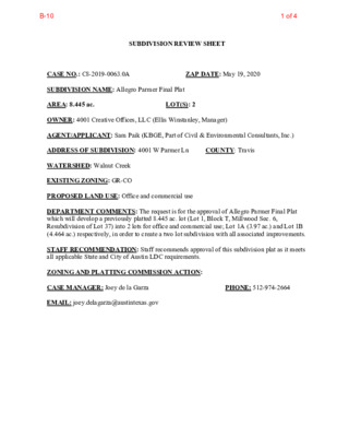
SUBDIVISION REVIEW SHEET LOT(S): 2 ZAP DATE: May 19, 2020 COUNTY: Travis CASE NO.: C8-2019-0063.0A SUBDIVISION NAME: Allegro Parmer Final Plat AREA: 8.445 ac. OWNER: 4001 Creative Offices, LLC (Ellis Winstanley, Manager) AGENT/APPLICANT: Sam Paik (KBGE, Part of Civil & Environmental Consultants, Inc.) ADDRESS OF SUBDIVISION: 4001 W Parmer Ln WATERSHED: Walnut Creek EXISTING ZONING: GR-CO PROPOSED LAND USE: Office and commercial use DEPARTMENT COMMENTS: The request is for the approval of Allegro Parmer Final Plat which will develop a previously platted 8.445 ac. lot (Lot 1, Block T, Millwood Sec. 6, Resubdivision of Lot 37) into 2 lots for office and commercial use; Lot 1A (3.97 ac.) and Lot 1B (4.464 ac.) respectively, in order to create a two lot subdivision with all associated improvements. STAFF RECOMMENDATION: Staff recommends approval of this subdivision plat as it meets all applicable State and City of Austin LDC requirements. ZONING AND PLATTING COMMISSION ACTION: CASE MANAGER: Joey de la Garza EMAIL: joey.delagarza@austintexas.gov PHONE: 512-974-2664 1 of 4B-10 Part of Civil & Environmental Consultants, Inc. 3711 S. Mopac Expy Bldg I, Suite 550, Austin, Tx 78746 T (512) 439-0400 www.cecinc.com TBPE Firm No: F-38 & TBPLS Firm No:10194419 2 of 4B-10 Part of Civil & Environmental Consultants, Inc. 3711 S. Mopac Expy Bldg I, Suite 550, Austin, Tx 78746 T (512) 439-0400 www.cecinc.com TBPE Firm No: F-38 & TBPLS Firm No:10194419 · · · 3 of 4B-10 C O LU M BIN E R A W N O S O U Q O P P A R M E R B U R R O A K P A L O M A R B E A C O N S D A L E E D E M Y N A G S K RIC R A B K C A R A M A T REEK SILVER C T S R E H M A N E T O R O C A D E L P H I C A S S A D Y Subject Tract ± This product is for informational purposes and may not have been prepared for or be suitable for legal, engineering, or surveying CASE NO: C8-2019-0063.0A ADDRESS: 4001 W PARMER LANE purposes. It does not represent an on-the-ground survey and represents only the approximate relative location of property boundaries. Base Map This product has been produced by the Planning and Development Review Department for the sole purpose of geographic reference. 4 of 4B-10