B-04 (C14-2020-0037 - 10400 Research Blvd VMU; District 10) — original pdf
Backup
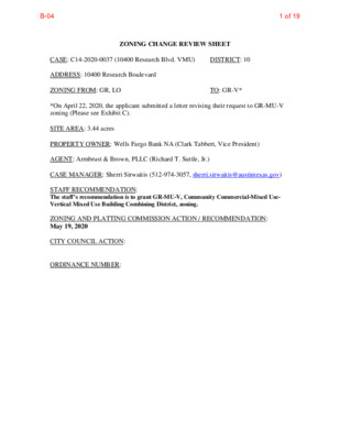
ZONING CHANGE REVIEW SHEET CASE: C14-2020-0037 (10400 Research Blvd. VMU) DISTRICT: 10 ADDRESS: 10400 Research Boulevard ZONING FROM: GR, LO TO: GR-V* *On April 22, 2020, the applicant submitted a letter revising their request to GR-MU-V zoning (Please see Exhibit C). SITE AREA: 3.44 acres PROPERTY OWNER: Wells Fargo Bank NA (Clark Tabbert, Vice President) AGENT: Armbrust & Brown, PLLC (Richard T. Suttle, Jr.) CASE MANAGER: Sherri Sirwaitis (512-974-3057, sherri.sirwaitis@austintexas.gov) STAFF RECOMMENDATION: The staff’s recommendation is to grant GR-MU-V, Community Commercial-Mixed Use- Vertical Mixed Use Building Combining District, zoning. ZONING AND PLATTING COMMISSION ACTION / RECOMMENDATION: May 19, 2020 CITY COUNCIL ACTION: ORDINANCE NUMBER: 1 of 19B-04 2 ISSUES: N/A CASE MANAGER COMMENTS: The property in question is a 3+ acre parcel of land located between the U.S. Highway 183 (Research Boulevard) frontage road to the east and Jollyville Road to the west. The site is currently developed with a financial services use. The applicant is requesting a rezoning from GR and LO zoning to GR-MU-V zoning to redevelop the property with a mixed use project with multifamily and retail uses (please see Applicant’s Request Letter – Exhibit C). The staff recommends GR-MU-V, Community Commercial-Mixed Use-Vertical Mixed Use Building Combining District, zoning as the property meets the intent of the zoning district purpose statement as described by the Code. The site under consideration is surrounded by multifamily, office and commercial uses/zoning to the north, south, east, and west. This tract of land fronts and takes access to an arterial roadway, Jollyville Road, and to the northbound service road for U.S. Highway 183 North. The property is located within a Future Core Transit Corridor, is on the Jollyville Activity Corridor and is within the North Burnet/ Gateway Regional Center as designated in the Imagine Austin Comprehensive Plan. The applicant agrees with the staff’s recommendation. BASIS OF RECOMMENDATION: 1. The proposed zoning should be consistent with the purpose statement of the district sought. Community Commercial district is intended for office and commercial uses serving neighborhood and community needs, including both unified shopping centers and individually developed commercial sites, and typically requiring locations accessible from major traffic ways. The purpose of a mixed use (MU) combining district is to allow office, retail, commercial, and residential uses to be combined in a single development. The purpose of a vertical mixed use (VMU) overlay district is to allow the development of vertical mixed use (VMU) buildings, subject to compliance with the standards in Section 4.3. 2. The proposed zoning should promote consistency and orderly planning. The proposed GR-MU-V zoning would be compatible and consistent with the adjacent uses because this tract of land is surrounded by multifamily, office and commercial uses/ zoning to the north, south, east, and west. The property in question is located within a Future Core Transit Corridor, on an Activity Corridor, and is within a Regional Center as a designated in the Imagine Austin Comprehensive Plan. 2 of 19B-04 3 3. The proposed zoning should allow for a reasonable use of the property. The GR-MU-V combining district would allow for a fair and reasonable use of the site. GR-MU-V zoning is appropriate for this location because of the commercial character of the area. The tract of land to the south, located at the intersection of Great Hills Trail, Jollyville Road and U.S. Highway 183, was rezoned to the CS-MU-V zoning district in 2017 through case C14-2017-0028. The proposed rezoning will allow the applicant to develop a mixture of commercial and high-density residential uses at this location with access to a highway and an arterial roadway. EXISTING ZONING AND LAND USES: ZONING Site North GR, LO LO-CO, GR-CO South CS-MU-V East NBG-NP West MF-3-CO LAND USES Financial Services (Wells Fargo Bank) Automotive Washing (Arbor Car Wash), Personal Improvement Services (24 Hour Fitness) Retail Center (Modern Market, Petco, Sleep Experts, T J Maxx, Pier 1, Hallmark, etc.), Restaurant Uses (Firebowl Café, Macaroni Grill, Manuel’s, La Madeline), Indoor Entertainment (Arbor Movie Theater) U.S. Highway 183/ Research Boulevard Hardrock Canyon Apartments PLANNING AREA: U.S. 183/Jollyville Road Area Study TIA: Deferred to the time of Site Plan WATERSHED: Walnut Creek, Bull Creek SCHOOLS: Austin I.S.D. Davis Elementary School Murchison Middle School Anderson High School NEIGHBORHOOD ORGANIZATIONS: Austin Heritage Tree Foundation Austin Independent School District Bull Creek Foundation Bike Austin Friends of Austin Neighborhoods 3 of 19B-04 4 Homeless Neighborhood Association Long Canyon Homeowners Association Mountain Neighborhood Association (MNA) Neighborhoods of North Austin (NONA) North Oaks Neighborhood Association Northwest Austin Coalition North Burnet/Gateway Neighborhood Plan NW Austin Working Group SELTEXAS Sierra Club, Austin Regional Group TNR BCP – Travis County Natural Resources AREA CASE HISTORIES: NUMBER REQUEST COMMISSION CITY COUNCIL GR, LO to CS-MU-V C14-2017-0028 (Great Hills Mixed Use: 9828 Great Hills Trail and 10224 Research Boulevard) 10/17/17: Approved the staff’s recommendation for CS-MU-V zoning, with TIA conditions (8-0, D. Beithaupt, Y. Flores and S. Trinh- absent); S. Lavani-1st, B. Evans-2nd. 12/14/17: Approved CS-MU-V-CO zoning on 1st reading, with a conditional overlay to prohibit the following uses: Adult-Oriented Business, Alternative Financial Services, Automotive Rentals, Automotive Repair Services, Automotive Sales Automotive Washing (of any type), Commercial Off-Street Parking, Exterminating Services, Funeral Services, Guidance Services, Pawn Shop Services, Pedicab Storage and Dispatch, Residential Treatment, Service Station, Short-Term Rental, Urban Farm, Veterinary Services, Monument Retail Sales, Vehicle Storage, Kennels, Convenience Storage, Campground, Limited Warehousing and Distribution and Drive-in service as an accessory use to Restaurants (general) and Restaurants (limited) is prohibited within 200 feet of Jollyville Road and a public restrictive covenant for the TIA conditions (9-1-1, J. Flannigan-No, E. Troxclair-off the dais); A. Alter-1st, L. Pool-2nd. 2/01/18: Ordinance No. 20180201- 083 for CS-MU-V-CO zoning, with conditions was approved on Council Member Alter’s motion, Council Member Pool’s second on an 8-2 4 of 19B-04 5 SF-2 to CS C14-05-0182 (Cox Office Supply: 10938 Research Boulevard) C14-01-0127 LO-CO to GR C14-96-0107 MF-2 to GO-CU C14-94-0040 GO to GR 11/15/05: Approved staff’s recommendation for CS-CO zoning with additional conditions prohibiting Pawn Shop Services and Adult Oriented Businesses (7-0, J. Martinez, J. Gohil-absent); K. Jackson-1st, M. Hawthorne-2nd. 10/30/01: Approved LR-CO zoning with the condition of a 30-foot setback for structures from the property line along Jollyville Road (7-1, D. Castaneda-Nay, N. Spelman-Absent) 7/09/96: Directed staff to initiate rezoning from MF-2 to GO-CO (8-0) 9/24/96: Approved staff recommendation of GO-CO (7-0) 4/26/94: Approved staff alternate rec. of GR-CO (5-0) with adjusted FAR for restaurant (general) C14-93-077 GO to GR 7/27/93: Approved staff alternate rec. of GR-CO by consent (7-0) C14-91-0040 GR to CS-1 6/11/91: Approved CS-1 C14-90-0038 GR to CO C14-88-022 LO to GR 8/07/90: Approved GR-CO (6-0-2, HG/ CV-abstain) 11/08/99: Grant w/ conditional overlay C14-82-068 I-AA to C To grant “O” Office (TR:1) and “C” Commercial (TR:2), 1st H&A, as amended (5-0) consent vote. Those voting aye were: Mayor Adler, Mayor Pro Tem Tovo, Council Members Alter, Garza, Houston, Kitchen, Pool and Renteria. Those voting nay were: Council Members Flannigan and Troxclair. Council Member Casar was off the dais. 12/15/05: Approved CS-CO, with CO to limit the site to 2,000 vtpd and prohibiting Pawn Shop Services and Adult Oriented Businesses, zoning by consent (7-0); all 3 readings 11/29/01: Approved LR-CO with conditions on 1st reading (7-0) 11/29/02: Case Expired 10/24/96: Approved PC recommendation of GO-CO (6-0), all 3 readings 5/26/94: Approved GR-CO (4-0-1), 1st reading 6/08/94: Approved GR-CO (4-0-1, GG-abstain); 2nd reading 6/09/94: Approved GR-CO (4-0-1, GG-abstain); 3rd reading 8/05/93: Approved GR-CO w/ conditions (5-0-1, GG-abstain), all 3 readings 7/11/91: Approved CS-1, all 3 readings 9/06/90: Approved GR-CO w/ conditions (6-0), all 3 readings 12/08/88: Approved LO-CO, GR-CO (5-0), 1st reading 5/25/89: Approved LO-CO, GR-CO (5-0), 2nd/ 3rd readings 8/05/82: Approved O (TR:1) & C (TR:2), 1st H&A, 1st reading 5 of 19B-04 6 8/26/82: Approve O (TR:1) & C (TR:2), 1st H&A, 3rd reading RELATED CASES: C8S-79-214 (Subdivision Case) EXISTING STREET CHARACTERISTICS: Name Existing ROW ASMP Required Pavement ASMP ROW Classification Sidewalks Bicycle Route Capital Metro (within ¼ mile) Jollyville Road ~99 104’ 27’ US HWY 183 N/A Defer to TxDOT N/A 3 4 Yes No Yes Yes Yes Yes OTHER STAFF COMMENTS: Comprehensive Planning This zoning case is located along the Jollyville Road Activity Corridor and within the North Burnet/Gateway Regional Center. The property is 3.44 acres in size, has street frontage on both Jollyville Road and the Research Boulevard Service Road. The site currently has a bank on it. This case is not located within the boundaries of an area that has a neighborhood plan. Surrounding uses includes retail/commercial uses to the north and south; to the west is a restaurant and a large apartment complex; and to the east is SH 183. The proposed use is mid-rise mixed use building with 220 units of multi-family and 2,425 square feet for office use. Connectivity: Two CapMetro Transit stops are located 500 feet from the subject property, along Jollyville Road. Public sidewalks are located along both sides to the street. Mobility and connectivity options in the area are above average. Imagine Austin The Imagine Austin Growth Concept Map, found in the Imagine Austin Comprehensive Plan (IACP) identifies this project as being located along an Activity Corridor and within the North Burnet/Gateway Regional Center. Activity Corridors are intended to allow people to reside, work, shop, access services, people watch, recreate, and hang out without traveling far distances. Regional Centers are intended for retail, cultural, recreational, and entertainment destinations for Central Texas and are the places where the greatest density of people and jobs and the tallest buildings in the region will be located. The center’s actual boundaries would need to be clarified through a small area planning process. The following Imagine Austin policies are applicable to this project: 6 of 19B-04 7 • LUT P1. Align land use and transportation planning and decision-making to achieve a compact and connected city in line with the growth concept map. • LUT P3. Promote development in compact centers, communities, or along corridors that are connected by roads and transit that are designed to encourage walking and bicycling, and reduce health care, housing and transportation costs. • HN P10. Create complete neighborhoods across Austin that have a mix of housing types and land uses, affordable housing and transportation options, and access to schools, retail, employment, community services, and parks and recreation options. Based upon this property being situated within a Regional Center and along an Activity Corridor, which supports mixed use; and the Imagine Austin policies referenced above that supports a variety of development, including mixed use, this project supports the Imagine Austin Comprehensive Plan. Environmental This location is located within two different watershed classifications; Suburban and Water Supply Suburban. Below are the notes for both of those watersheds. Water Supply Suburban: The site is located over the Edwards Aquifer Recharge Zone. The site is in the Bull Creek Watershed of the Colorado River Basin, which is classified as a Water Supply Suburban Watershed by Chapter 25-8 of the City's Land Development Code. It is in the Drinking Water Protection Zone. Under the current watershed regulations, development or redevelopment on this site will be subject to the following impervious cover limits: Development Classification One or Two Family Residential 30% 40% Multifamily Residential Commercial 40% 40% 55% 55% % of Net Site Area % NSA with Transfers Development within a Water Quality Transition Zone is limited to 18%. According to floodplain maps there is no floodplain within or adjacent to the project location. Standard landscaping and tree protection will be required in accordance with LDC 25-2 and 25-8 for all development and/or redevelopment. 7 of 19B-04 8 At this time, site specific information is unavailable regarding vegetation, areas of steep slope, or other environmental features such as bluffs, springs, canyon rimrock, caves, sinkholes, and wetlands. Under current watershed regulations, development or redevelopment requires water quality control with increased capture volume and control of the 2-year storm on site. At this time, no information has been provided as to whether this property has any preexisting approvals that preempt current water quality or Code requirements. Suburban: The site is in the Walnut Creek Watershed of the Colorado River Basin, which is classified as a Suburban Watershed by Chapter 25-8 of the City's Land Development Code. The site is in the Desired Development Zone. Under current watershed regulations, development or redevelopment on this site will be subject to the following impervious cover limits: Development Classification Single-Family (minimum lot size 5750 sq. ft.) Other Single-Family or Duplex 55% 60% Multifamily Commercial 80% 60% 70% 90% % of Gross Site Area % of Gross Site Area with Transfers 50% 60% According to floodplain maps there is no floodplain within or adjacent to the project location. Standard landscaping and tree protection will be required in accordance with LDC 25-2 and 25-8 for all development and/or redevelopment. At this time, site specific information is unavailable regarding vegetation, areas of steep slope, or other environmental features such as bluffs, springs, canyon rimrock, caves, sinkholes, and wetlands. Under current watershed regulations, development or redevelopment requires water quality control with increased capture volume and control of the 2-year storm on site. At this time, no information has been provided as to whether this property has any preexisting approvals that preempt current water quality or Code requirements. Site Plan Site plans will be required for any new development other than single-family or duplex residential. 8 of 19B-04 9 Any new development is subject to Subchapter E. Design Standards and Mixed Use. Additional comments will be made when the site plan is submitted. Development regulations for zoning GR are as follows: • Maximum Height: 60 ft. • Maximum Building Coverage: 75% • Maximum Impervious Coverage: 90% • Maximum FAR: 1:1 Transportation The Austin Strategic Mobility Plan (ASMP) adopted 04/11/2019, calls for 104 feet of right-of- way for Jollyville Road. It is recommended that 52 feet of right-of-way from the existing centerline should be dedicated for Jollyville Road at the time of subdivision or site plan. A traffic impact analysis determination should be deferred to the time of site plan when land uses and intensities are finalized. Water Utility The landowner intends to serve the site with City of Austin water and wastewater utilities. The landowner, at own expense, will be responsible for providing any water and wastewater utility improvements, offsite main extensions, utility relocations and or abandonments required by the land use. The water and wastewater utility plan must be reviewed and approved by Austin Water for compliance with City criteria and suitability for operation and maintenance. Wastewater service for this tract is dependent on approval of Service Extension Request 4655. This SER must be approved prior to development plan approval. Depending on the development plans submitted, further water and or wastewater service extension requests may be required. All water and wastewater construction must be inspected by the City of Austin. The landowner must pay the City inspection fee with the utility construction. The landowner must pay the tap and impact fee one the landowner makes an application for a City of Austin water and wastewater utility tap permit. INDEX OF EXHIBITS TO FOLLOW A: Zoning Map B. Aerial Map C. Applicant’s Request Letter D. Educational Impact Statement 9 of 19B-04 SP-94-0217CS 95-0042 83-194RC MF-2 O CV D A R O M MF-2 APARTMENTS LO-CO SP95-0467C 79-13 SP93-0556C GR 78-151 SP90-0017C SERVICE STATION GO OFFICE 86-320RC MORADO CIR 90-0065 GR LO OFFICE W BRAKER LN 88-022 N TIO SP92-0408C A T S CS C14-88-0022 GR-CO LO-CO C14-2019-0145 ( 80-94 D E R L IL V Y L L O J CHURCH LR-CO RETAIL SALES 91-0040 CS-1 SP88-0339C SHOPPING CENTER GR 79-32 GROCERY STORE C14-2019-0145 814-84-029 88-051 93-77 SP94- 0253C SP93-0444A GO 88-051 SP88-0339O SP94-0179C R83-136RC 91-0025 94-0040 LO-CO C14-95-0150 95-0150 GR-CO 90-0038 ! ! ! ! ! ! ! ! GR ! ! ! ! ! ! ! ! ! LO ! ! ! ! ! ! ! ! ! ! ! ! ! ! PARKING REST. 80-86 79-196 ! ! ! ! ! ! SP90-0176O SPORTS GYM BANK ( GR ! ! ! ! ! ! ! 78-181 ! ! ! ! ! P M A R B S H C R A E S E R O T R E K A R B W MF-1-CO C14-90-0065 90-0065 96-0107 90-0065 96-0107 GO-CO CHURCH SCHOOL GO ( MF-2-CO 77-144 RZ87-029 85 -284 SP-02-0251C ( SF-2 LO CS 88-0065 SPC92-0021C APARTMENTS MF-3-CO 84-318 83-302 91-0059 94-0013 A PA R T M E N TS GR-CO GO SP97-134C PAR KING THEATRE CS-MU-V-CO C14-2017-0028 SPC88-0138C SP94-0365C S P 9 7 - 1 3 4 C R E S T. PARKING SP91-0039C REAL ESTATE SHOPPING CENTER OFFICE PARKING SHOPPING CENTER GR SAVINGS & LOAN LO CS-1 SP93-0319C R83-280 SP-93-0077B SP-93-0319C RETAIL GR 83-280 A R B O R E T U M B L V D RESTAURANTS GR B S D R V S D V L B H C R A E S E R B S D V L B H C R A E S E R B N D R V S D V L B H C R A E S E R B N D V L B H C R A E S E R BOAT SALES BAR FAST FOOD H A MILTO CS N LN SP-99-0148C 80-34 EXHIBIT A CS-CO LO ELEC. S UBSTATION 93-0009 GR-CO R86-266 P SP94-0258C 94-0106 77-001 W H S F U R E. C NIT U R O M E,C A R PLE X P E T P AUTO SHOP MH MH MH MH 77-11 MH CELETA LN MH LUMBER P M A R R E K A R B O T B N H C R A E S E R SP97-0276C NBG-NP C14-2008-0182 C14-01-0055 FENCE CO. SP95-0472C 85-244.7RC SP93-0399C SP93-0399C FIR E W O O D S ALE S FRUIT & PRODUCE GARDEN LANDSCAPING CENTER SP94-0099C G R EAT HILLS TRL G R E A T H I L L S T O R E S E A R C S B R A M P SP-2007-0216C NBG-NP C14-2008-0182 91-0061 SP91-0040C R84-038 84-256 BOAT SHOP ELECTRONIC SALES P M A R X T P A C O T B S H C R A E S E R N C A P T X T O R E S E A R C H N B R A M P 91-0061 99-0009 UNDEV CS HOTEL CS-1 ± SUBJECT TRACT ! ! ! ! ! ! PENDING CASE ZONING BOUNDARY RETAIL (ARBORETUM) ZONING ZONING CASE#: C14-2020-0037 This product is for informational purposes and may not have been prepared for or be suitable for legal, engineering, or surveying purposes. It does not represent an on-the-ground survey and represents only the approximate relative location of property boundaries. 1 " = 400 ' This product has been produced by CTM for the sole purpose of geographic reference. No warranty is made by the City of Austin regarding specific accuracy or completeness. Created: 3/19/2020 10 of 19B-04 GR GO J33 C14-2020-0037 GR LO-CO GR GR-CO LO CS-MU-V-CO GO-CO MF-2-CO GO J O L L Y V I L L E R D MF-3-CO GR-CO GO GR B S D V L B H C R A E S E R B N D V L B H C R A E S E R B S D R V S D V L B H C R A E S E R R E K A R B W H C R A E S E R O T P M A R B S O T B N H C R A E S E R P M A R R E K A R B B N D R V S D V L B H C R A E S E R NBG-NP GREAT HILLS TRL RESEARCH SB AT GREAT HILL TRN ± 1'' = 200' SUBJECT TRACT ZONING BOUNDARY ! ! ! ! ! ! PENDING CASE CREEK BUFFER 10400 Research Blvd. VMU ZONING CASE#: LOCATION: SUBJECT AREA: GRID: MANAGER: C14-2020-0037 10400 RESEARCH BLVD. 3.4449 ACRES J33 Sherri Sirwaitis This map has been produced by the Communications Technology Management Dept. on behalf of the Planning Development Review Dept. for the sole purpose of geographic reference. No warranty is made by the City of Austin regarding specific accuracy or completeness. 11 of 19B-04 GO-CO MF-2-CO GO J O L L Y V I L L E R D MF-3-CO GR-CO GO GR EXHIBIT B GR GO LO-CO GR GR-CO LO J33 C14-2020-0037 GR CS-MU-V-CO B S D V L B H C R A E S E R B N D V L B H C R A E S E R B S D R V S D V L B H C R A E S E R R E K A R B W H C R A E S E R O T P M A R B S O T B N H C R A E S E R P M A R R E K A R B B N D R V S D V L B H C R A E S E R NBG-NP GREAT HILLS TRL RESEARCH SB AT GREAT HILL TRN Copyright nearmap 2015 ± 1'' = 200' SUBJECT TRACT ZONING BOUNDARY ! ! ! ! ! ! PENDING CASE CREEK BUFFER 10400 Research Blvd. VMU ZONING CASE#: LOCATION: SUBJECT AREA: GRID: MANAGER: C14-2020-0037 10400 RESEARCH BLVD. 3.4449 ACRES J33 Sherri Sirwaitis This map has been produced by the Communications Technology Management Dept. on behalf of the Planning Development Review Dept. for the sole purpose of geographic reference. No warranty is made by the City of Austin regarding specific accuracy or completeness. 12 of 19B-04 EXHIBIT C 13 of 19B-04 14 of 19B-04 15 of 19B-04 ARMBRUST & BROWN, PLLC A T T O R N E Y S A N D C O U N S E L O R S 100 CONGRESS AVENUE, SUITE 1300 AUSTIN, TEXAS 78701-2744 512-435-2300 FACSIMILE 512-435-2360 RICHARD T. SUTTLE, JR. (512) 435-2310 rsuttle@abaustin.com April 22, 2020 Sherri Sirwaitis Planning and Zoning Department City of Austin 505 Barton Springs Road, 5th Floor Austin, Texas 78704 Re: 10400 Research Blvd. VMU Zoning Application (C14-2020-0037); Amendment to rezoning request (the “Application”) Dear Sherri: This firm represents the applicant in the above referenced zoning case. The applicant hereby amends its request to GR-MU-V. Very Truly Yours, Richard T. Suttle, Jr. ARMBRUST & BROWN, PLLC cc: Jeff Lahr, Slate Real Estate Partners Jewels Cain, Armbrust & Brown, PLLC {W0971152.2} 16 of 19B-04 EDUCATIONAL IMPACT STATEMENT Prepared for the City of Austin Austin Independent School District EXHIBIT D PROJECT NAME: 10400 Research Blvd. VMU ADDRESS/LOCATION: 10400 Research Blvd., 78759 CASE #: C14-2020-0037 NEW SINGLE FAMILY NEW MULTIFAMILY DEMOLITION OF MULTIFAMILY TAX CREDIT # SF UNITS: STUDENTS PER UNIT ASSUMPTION Elementary School: Middle School: High School: # MF UNITS: 220 STUDENTS PER UNIT ASSUMPTION Elementary School: 0.012 Middle School: .004 High School: .008 IMPACT ON SCHOOLS The student yield factor of 0.024 (across all grade levels) for apartment homes was used to determine the number of projected students. This factor was provided by the district’s demographer and is based on other multi-family complexes built in the last ten years within close proximity to the proposed location. The low yields are subject to change if the proposed development became a tax-credit complex with below market-rate rents. Research indicates market rate apartment complexes of similar size that were constructed within the last five years within a few mile radius of the proposed development do not yield many students. The 220-unit multifamily development is projected to add approximately 6 students across all grade levels to the projected student population. It is estimated that of the 6 students, 3 will be assigned to Davis Elementary School, 1 to Murchison Middle School, and 2 to Anderson High School. The percent of permanent capacity by enrollment for SY 2024-25, including the additional students projected with this development, would within the target range of 75-115% at Davis ES (100%), Murchison MS (83%) and Anderson HS (83%). All of these schools will be able to accommodate the projected additional student population from the proposed development. TRANSPORTATION IMPACT Students within the proposed development attending Davis ES, Murchison MS, or Anderson HS will qualify for transportation due to the distance of the schools from the proposed development. SAFETY IMPACT There are no known safety impacts at this time. Date Prepared: 27 April 2020 Executive Director: [1] 17 of 19B-04 EDUCATIONAL IMPACT STATEMENT Prepared for the City of Austin Austin Independent School District DATA ANALYSIS WORKSHEET ELEMENTARY SCHOOL: Davis ADDRESS: 5214 Duval Road % QUALIFIED FOR FREE/REDUCED LUNCH: 27.59% RATING: Met Standard PERMANENT CAPACITY: MOBILITY RATE: +0.7% 731 POPULATION (without mobility rate) ELEMENTARY SCHOOL STUDENTS Population 2019-20 5- Year Projected Population (without proposed development) 5-Year Projected Population (with proposed development) ENROLLMENT (with mobility rate) ELEMENTARY SCHOOL STUDENTS 2019-20 Enrollment 5- Year Projected Enrollment (without proposed development) 5-Year Projected Enrollment (with proposed development) MIDDLE SCHOOL: Murchison ADDRESS: 3700 N Hills Drive % QUALIFIED FOR FREE/REDUCED LUNCH: 21.27% RATING: Met Standard PERMANENT CAPACITY: MOBILITY RATE: -2.4% 1,392 (SY2020-21) POPULATION (without mobility rate) MIDDLE SCHOOL STUDENTS Population 2019-20 5- Year Projected Population (without proposed development) 5-Year Projected Population (with proposed development) ENROLLMENT (with mobility rate) MIDDLE SCHOOL STUDENTS 2019-20 Enrollment 5- Year Projected Enrollment (without proposed development) 5-Year Projected Enrollment (with proposed development) Number % of Permanent Capacity Number % of Permanent Capacity Number % of Permanent Capacity Number % of Permanent Capacity 744 102% 749 102% 1,386 100% 1,353 97% 740 101% 730 100% 1,221 88% 1,162 83% 737 101% 727 99% 1,220 88% 1,161 83% [2] 18 of 19B-04 EDUCATIONAL IMPACT STATEMENT Prepared for the City of Austin Austin Independent School District HIGH SCHOOL: Anderson ADDRESS: 8403 Mesa Drive % QUALIFIED FOR FREE/REDUCED LUNCH: 21.75% RATING: Met Standard PERMANENT CAPACITY: MOBILITY RATE: +1.9% 2,478 POPULATION (without mobility rate) HIGH SCHOOL STUDENTS Population 2019-20 5- Year Projected Population (without proposed development) 5-Year Projected Population (with proposed development) Number % of Permanent Capacity Number % of Permanent Capacity 2,175 88% 2,216 89% ENROLLMENT (with mobility rate) HIGH SCHOOL STUDENTS 2019-20 Enrollment 5- Year Projected Enrollment (without proposed development) 5-Year Projected Enrollment (with proposed development) 2,065 83% 2,069 83% 2,063 83% 2,067 83% [3] 19 of 19B-04